Bandera Mountain Photos


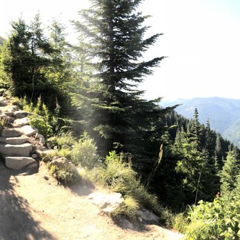
You might also consider


More like Bandera Mountain
Recommended Reviews - Bandera Mountain
Start your review...


Reviews With Photos


Wonderful, somewhat challenging hike with a beautiful view! One of the many mountain hikes off of the I-90 interstate. I really enjoyed this hike. The Ira Spring trail was nicely maintained with lots of different aspect versus the typical endless switchbacks. Distance: 7.6 miles round trip Elevation gain: 3400 ft Time: 2.5 hours up, 2 hours down Difficulty: Moderate to Intense Hike Drive: Located off I-90 at Exit 45 on Forest Road 9031. For the last mile, the road is all gravel and dirt but still accessible. No big potholes of any kind. Parking: Decent size parking lot. Can fit around 30-40 cars or so. Trail: This is a very popular hike sharing most of its trail with the Ira Spring Trail. Mason Lake is another destination. The trail starts off fairly easy with a mild grade incline for the first 1.5 miles through the forest. You will pass a log bridge that was newly built. The pathway is wide but a little rocky. This part is nicely shaded. The trail then starts to get a little steeper for the next 1.5 miles with some moderate grade long switchbacks (I counted 3-4). This part is partly exposed. Then the trail comes to a junction splitting off to Bandera Mountain and Mason Lake. The way to the lake is on the left, the way to the mountain is to the right and it's all upwards from there. The elevation really picks up here. This is the steepest and hardest part of the trail. The trail zig-zags through a very narrow and rocky pathway with a intense grade incline. Lots of wild flowers blooming. This part is exposed. After reaching the ridge line, you will catch a glimpse of all the surrounding mountains. You will then re-enter the forest for about 5-10 minutes before reaching the minor rock field. The section was my favorite part of the hike. The many large boulders and rocks made it fun to climb over. To the left, you will get a birds-eye view of the beautiful Mason Lake. With no clear pathway, you will be climbing over boulders to the summit. This part is not bad at all but a little hard to navigate. At the summit, there is a very distinct view of McClellan Butte and all the surrounding valleys. The clouds covered up the view of Mt. Rainier. This part is also all exposed. Bugs: A few annoying bugs at the summit. Overall, I didn't wear any bug spray and I didn't get bit at all. Tips: Becareful going down at the ridgeline. I slipped a few times. Bring lots of sunblock and water as most of the trail is exposed to the sun! *Northwest Forest Pass required*


7.6 miles of fun with only a 3K elevation gain. What more can one ask for? You get an amazing view of Mason Lake and a VERY clear and up-close view of Mt. (Not sure which one it is) on a good day. A moderate to intense hike. Most hikers will probably do fine before the fork, but the intensity quickly builds up once you get to the rocks as you gain more than 1K of elevation in less than a mile? When you get to the rock scrambles, that's False Summit. The False Summit View is definitely better than the Real Summit View. At Real Summit, all you can see is the view of the mountain in the distance vs. False Summit, where you can see the mountain and the lake! False Summit is also super windy, which means little to NO bugs! Perfect lunch spot. =] Some tips: 1) Arrive early. The parking lot gets pretty full by 8AM. It's also a one lane dirt/gravel road all the way to the parking lot from the fork that splits off to the Talapus Lake trail head. My group had fun playing tetris with some cars on the way back home. =] 2) Bring bugspray. The mosquitoes and whatever flies they have here are no joke. My group and I had to reapply several layers of bugspray and they still wouldn't leave us aslone. They will even bite through your long sleeves! 3) Sunblock. There's barely any shade for most of the hike and practically none towards the top unless you get there early to avoid the sun. 4) If it's your first time doing this, I would recommend just going up to Bandera Mt. versus going to Mason Lake at the fork since you'll get an aerial view of it at False Summit anyway. No reason to waste energy...unless you want to of course. =] Last but not least, have fun!


Surprisingly this hike was harder than expected. It gets pretty steep as you head to the top, probably the last half mile or so. This trail is called Ira Spring Trail, there are 3 options: Bandera Mountain, Mason Lake, or Point Defiance. I only went to Bandera Mountain, there weren't many people going that day too so it was perfect!! From the top of Bandera you can see Mt. Rainer, Mason Lake, I-90 and so much more. It's a wonderful fun hike, I'd love to go again. If you do decide to take the way to Mason Lake you can hike a little further to reach Point Defiance, i heard the view is better than Bandera Mountain so i guess my next review will be of Point Defiance. I loved Bandera Mountain, can't wait to go again. I believe they also required a northwest forest pass!


This is a tough hike but really beautiful. There are great views all along the way, with rainier imposing and other snowy ridges. The first 1.5 hours up are a nice, uphill but manageable climb. Then come the crazy boulders. Up up up for half an hour. Then you think you're at the top and done. But no! A little break through the woods and then more boulders!!! But it's so lovely at the top. Views of Mason lake below, mt rainier, you can see bellevue, Seattle and the Olympics. Took 5 hours roundtrip with a half hour break. I think its tougher but more beautiful than mt si. Get there early. Parking is a pain.


This year I'll be hiking Mt Fuji. So, I've been stepping up my game with PNW hikes that are a little more challenging. My Krav Maga friends suggested giving Bandera Mountain a try if I'm looking for a challenge. I liked the elevation change and lengthiness this hike promised. Additionally, it still seemed rather doable for our dogs, which was a huge plus. And how can you beat just 45ish miles from Seattle?! Suggestions: - You'll need a parking pass which you can buy and print online before you go - Check the WA Trails Association page for condition reports prior to going. We read the bugs were TERRIBLE, so we brought bug spray. So glad we did because the bugs were, in fact, very aggressive! - Get there EARLY! We snagged one of the last parking spaces at our 7:30AM arrival time! Arrival: Anticipate driving down a single lane, terrifying and long dirt road to get to parking. It's terrifying because there are numerous blind turns. The dirt is kicked up badly by other cars making general visibility an additional issue. Lastly, there is no barrier on the cliff side of the road. So that's scary. The actual trail is called the Ira Spring Trail. And it leads to/splits off to take you to three different locations: Bandera Mountain, Mason Lake, or Point Defiance. We opted for Bandera Mountain, which was beautiful and challenging. However, after seeing photos of Mason Lake, I'm a little salty we didn't take that route. Next time! Like many others have mentioned, the beginning part of this trail is very chill. The path is wide and has just a slight incline. As you move along the trail, incline gets steeper and steeper. Many areas are sandy and dry, which can be slippery. And as you get closer to the summit, the trail turned to giant rocks you actually climb to get up. Nothing too bad--our dogs both did great with these parts of the trails. You'll eventually get to the part of the Ira Spring Trail where you can either go to Mason Lake, or continue upwards to Bandera Mountain. We chose to continue upwards for a while until we reached what I consider the "false summit". It's right when the climb gets really steep and rocky, and is only about 100 ft in elevation short of the actual summit. At this point we decided to turn around based on two facts: 1) WTA info said the views at the false summit are better than the actual summit. And being only 100ft in elevation difference... meh. 2) Our dogs would not have been safe hiking the remainder of the trail. So we turned around at that point and headed back. However, please note this was the area with the horrid bug situation. I'm talking about in your nose, mouth, ears--bugs all up in your shiz. Lastly, our decent down the trail did NOT take us as long as I'm reading it took other Yelpers. It took us about 45mins to an hour to get back to parking. DOGS: Dogs are allowed on leash. Please leash your dogs. I saw at least three off leash. If you don't care about your dog's safety, that's your problem. But don't put other dogs at risk because you don't care. Also, I have a 25lb terrier (8yrs old) and a 17lb mutt (1 yr) that did really well on this long and strenuous hike! Both dogs made it all the way, except our 17lb baby gave up .5 from the finish and we carried her the rest of the way. Haha. Bring water and poop bags. However, there is no waste receptacles for poops. So you'll have to hike with poop bags up and back down the mountain. read more


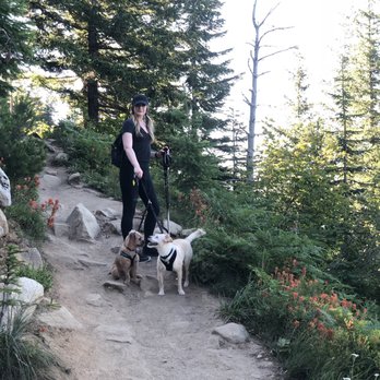


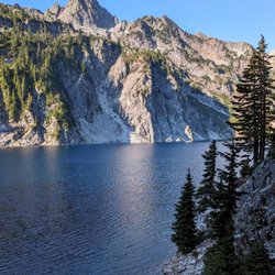
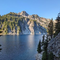
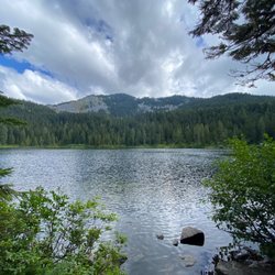
ATTN: I didn't go all the way to Bandera's summit! I only did Mason Lake, which is on Bandera Mt. Mason Lake is .4 miles inferior in distance and takes you to an opposite part of the mountain at a junction. I'm reading some reviews here that say Mason Lake is "very popular" but we showed up at almost 10 a.m. and the parking lot wasn't even close to half full! When we came out at the end of our hike, I did notice that it was completely packed. So maybe go in the morning and beat the rush! We hardly encountered anybody on the way up, just the way down. The hike to Mason Lake on the Ira Spring Trail is GORGEOUS. So pretty, especially during fall when all the colors are changing. Even in the thicket of all the trees, you can't help but notice how pretty all the sunshine is beaming in on all the trees. Along the way, you get so many views of surrounding peaks and you even get a good amount of views of Mt. Rainier! The higher you go, the more visible it is (obviously) and pictures don't do it justice. It's amazing in person. The first half of the hike is fairly easy, with a wide trail and not too much incline. You come to a junction about 1.5 miles in, and it's unmarked, but you can tell that you need to go UP. This is where your workout starts. It's a hefty climb to the second junction, which you come to at about 2.9 miles. Here is where you can decide to go right to Bandera Summit, or Mason Lake. We took the path to Mason Lake, and expected it to be pretty close to the junction. Noooope. You scale up some rocks, up some more rocks, and then you're welcomed by the forest again. Here, you go DOWN a trail for about 10 minutes... Don't worry though, it's not too steep of a climb later. The lake itself is very pretty and very clear! There's a lot of places to sit and relax - the ideal spot is on all the lake logs piled up high enough that there are plenty of dry spots, but some girls already had claimed that location. We sat on some flat rocks adjacent to the logs, and got just as great of a view and a perfect resting place for my dog. Overall, I would say the hike on the way to the lake was a lot prettier than the lake itself. The mountain views just blew me away. I would definitely come back and do the hike to Bandera Summit, and I'm sure that'll be in the very near future for me! Note: you do have to have a day pass to hike here, you can get it online at the Washington Trail Association website for $5! And know that it takes about 1.5 hours to get up (with breaks) and about 45 minutes to get down. read more
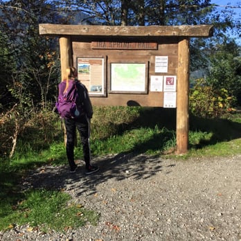

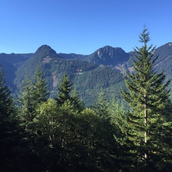
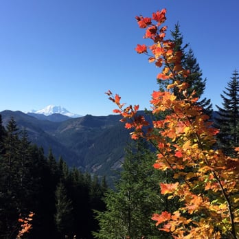


Amazing views of Mount Rainier on a clear day...but the rocky hill climb will have you winded and on all fours. After a gradual climb up Bandera, you'll find yourself tasked with climbing a near straight up hill with rocks. It's definitely one that you have to use your hands for. The rocks can be slippery and even more difficult to navigate on your way down. If you're up for a challenge and something different, this is for you. read more




11 years ago
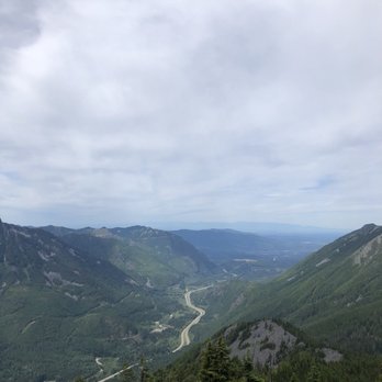
Wonderful, somewhat challenging hike with a beautiful view! One of the many mountain hikes off of the I-90 interstate. I really enjoyed this hike. The Ira Spring trail was nicely maintained with lots of different aspect versus the typical endless switchbacks. Distance: 7.6 miles round trip Elevation gain: 3400 ft Time: 2.5 hours up, 2 hours down Difficulty: Moderate to Intense Hike Drive: Located off I-90 at Exit 45 on Forest Road 9031. For the last mile, the road is all gravel and dirt but still accessible. No big potholes of any kind. Parking: Decent size parking lot. Can fit around 30-40 cars or so. Trail: This is a very popular hike sharing most of its trail with the Ira Spring Trail. Mason Lake is another destination. The trail starts off fairly easy with a mild grade incline for the first 1.5 miles through the forest. You will pass a log bridge that was newly built. The pathway is wide but a little rocky. This part is nicely shaded. The trail then starts to get a little steeper for the next 1.5 miles with some moderate grade long switchbacks (I counted 3-4). This part is partly exposed. Then the trail comes to a junction splitting off to Bandera Mountain and Mason Lake. The way to the lake is on the left, the way to the mountain is to the right and it's all upwards from there. The elevation really picks up here. This is the steepest and hardest part of the trail. The trail zig-zags through a very narrow and rocky pathway with a intense grade incline. Lots of wild flowers blooming. This part is exposed. After reaching the ridge line, you will catch a glimpse of all the surrounding mountains. You will then re-enter the forest for about 5-10 minutes before reaching the minor rock field. The section was my favorite part of the hike. The many large boulders and rocks made it fun to climb over. To the left, you will get a birds-eye view of the beautiful Mason Lake. With no clear pathway, you will be climbing over boulders to the summit. This part is not bad at all but a little hard to navigate. At the summit, there is a very distinct view of McClellan Butte and all the surrounding valleys. The clouds covered up the view of Mt. Rainier. This part is also all exposed. Bugs: A few annoying bugs at the summit. Overall, I didn't wear any bug spray and I didn't get bit at all. Tips: Becareful going down at the ridgeline. I slipped a few times. Bring lots of sunblock and water as most of the trail is exposed to the sun! *Northwest Forest Pass required* read more

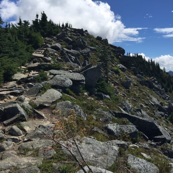
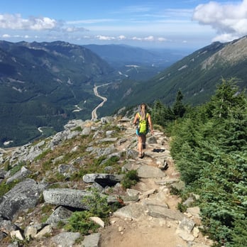


7.6 miles of fun with only a 3K elevation gain. What more can one ask for? You get an amazing view of Mason Lake and a VERY clear and up-close view of Mt. (Not sure which one it is) on a good day. A moderate to intense hike. Most hikers will probably do fine before the fork, but the intensity quickly builds up once you get to the rocks as you gain more than 1K of elevation in less than a mile? When you get to the rock scrambles, that's False Summit. The False Summit View is definitely better than the Real Summit View. At Real Summit, all you can see is the view of the mountain in the distance vs. False Summit, where you can see the mountain and the lake! False Summit is also super windy, which means little to NO bugs! Perfect lunch spot. =] Some tips: 1) Arrive early. The parking lot gets pretty full by 8AM. It's also a one lane dirt/gravel road all the way to the parking lot from the fork that splits off to the Talapus Lake trail head. My group had fun playing tetris with some cars on the way back home. =] 2) Bring bugspray. The mosquitoes and whatever flies they have here are no joke. My group and I had to reapply several layers of bugspray and they still wouldn't leave us aslone. They will even bite through your long sleeves! 3) Sunblock. There's barely any shade for most of the hike and practically none towards the top unless you get there early to avoid the sun. 4) If it's your first time doing this, I would recommend just going up to Bandera Mt. versus going to Mason Lake at the fork since you'll get an aerial view of it at False Summit anyway. No reason to waste energy...unless you want to of course. =] Last but not least, have fun! read more
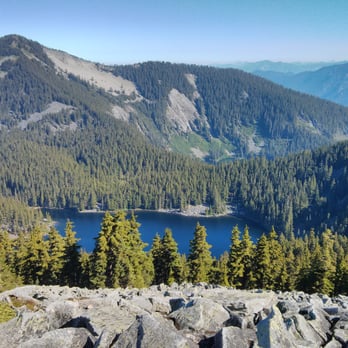
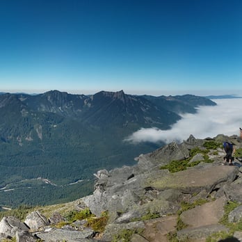
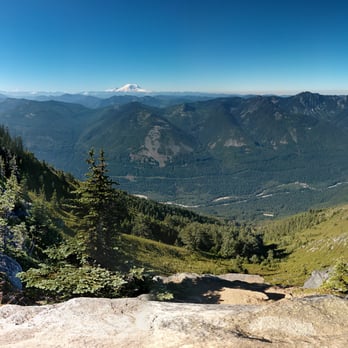


Surprisingly this hike was harder than expected. It gets pretty steep as you head to the top, probably the last half mile or so. This trail is called Ira Spring Trail, there are 3 options: Bandera Mountain, Mason Lake, or Point Defiance. I only went to Bandera Mountain, there weren't many people going that day too so it was perfect!! From the top of Bandera you can see Mt. Rainer, Mason Lake, I-90 and so much more. It's a wonderful fun hike, I'd love to go again. If you do decide to take the way to Mason Lake you can hike a little further to reach Point Defiance, i heard the view is better than Bandera Mountain so i guess my next review will be of Point Defiance. I loved Bandera Mountain, can't wait to go again. I believe they also required a northwest forest pass! read more
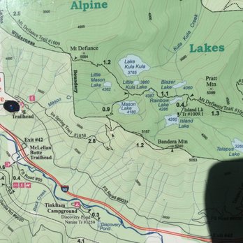
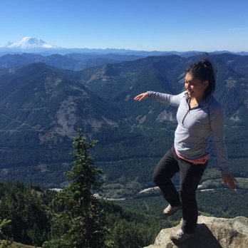


This is a tough hike but really beautiful. There are great views all along the way, with rainier imposing and other snowy ridges. The first 1.5 hours up are a nice, uphill but manageable climb. Then come the crazy boulders. Up up up for half an hour. Then you think you're at the top and done. But no! A little break through the woods and then more boulders!!! But it's so lovely at the top. Views of Mason lake below, mt rainier, you can see bellevue, Seattle and the Olympics. Took 5 hours roundtrip with a half hour break. I think its tougher but more beautiful than mt si. Get there early. Parking is a pain. read more


10 years ago
The two hikes that seem to be in public consciousness the most are Rattlesnake and Mt Si due to their close proximity to Seattle in North Bend. However, there's an unheralded hike in Bandera Mountain which is nearby and offers even better views than Si. The trail is off of Exit 42 and be prepared to park on the road, the parking lot isn't very big. The first 1.5 miles are through a leafy forest. It's pretty gradual uphill so it's not too difficult. The next 1.5 miles, it's full of switchbacks. This is a pretty scenic area of the trail as all the wildflowers grow on the side. Then you arrive at the junction. One section goes off to Mason Lake and the other one goes up to Bandera. Be warned, the last jaunt to Bandera is hard. The incline is pretty steep and the trail is all rocks so you're basically bouldering. After 40 minutes, you reach a forest that takes about 10 minutes to navigate. You then arrive at another sea of boulders. After 10 minutes, you'll have arrived at the summit of Bandera. All of the painstaking bouldering is worth as you get breathtaking views of Mason lake, Mt Si and the entire north bend Valley. On the way down, be careful bouldering down. Then it's just a quick hike back down after the bouldering fields. Bandera stats 8 MI round trip, 4000 ft elevation, 5 hours read more


12 years ago

11 years ago

11 years ago
More info about Bandera Mountain
Bandera Mountain
Bandera Mountain, WA 98045
Directions
Hours
Indoor Amenities
Outdoor Amenities
Ask the Community - Bandera Mountain
Review Highlights - Bandera Mountain




















Why does Yelp recommend reviews?
1 review that is not currently recommended
The reviews below are not factored into the business's overall star rating.

11 years ago
Bandera Mountain - hiking - Updated September 2026
Best of Bandera Mountain
People found Bandera Mountain by searching for…
Scenic Spots in Bandera Mountain, WA
Photo Spots in Bandera Mountain, WA
Hiking Trails With Waterfalls in Bandera Mountain, WA
View Points in Bandera Mountain, WA
Dog Friendly Hiking Trails in Bandera Mountain, WA
Fall Colors in Bandera Mountain, WA
Scenic Drive in Bandera Mountain, WA
Scenic View in Bandera Mountain, WA
Easy Hiking Trails in Bandera Mountain, WA
Off Leash Dog Hikes in Bandera Mountain, WA
Dog Friendly Parks in Bandera Mountain, WA
Dog Friendly Things to Do in Bandera Mountain, WA
Cliff Diving in Bandera Mountain, WA
Hikes With Dogs in Bandera Mountain, WA
Off Road Trails in Bandera Mountain, WA
Scenic Overlook in Bandera Mountain, WA
Wildflowers in Bandera Mountain, WA
Walking Trails in Bandera Mountain, WA
Hiking Groups in Bandera Mountain, WA


