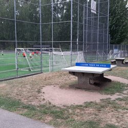
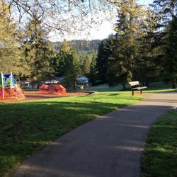
Bert Flinn Park Photos


You might also consider
More like Bert Flinn Park
Recommended Reviews - Bert Flinn Park
Start your review...

2 years ago
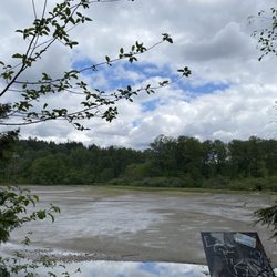
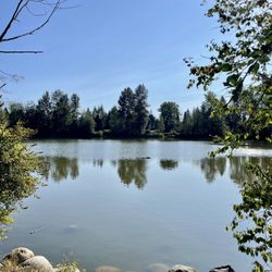
Last month, a friend and I decided to explore Bert Flinn Park in Port Moody. There are numerous trails within the park, so you can spend hours walking in the park (we spent about 2.5 hours at a leisurely pace, exploring various trails). The trails are flat with little to no elevation, so you won't be hiking, but it's still a lovely park for walking. There are several biking trails, so be careful if walking along a biking trail. The park is transit accessible and we took the #183 bus from Moody Center Station and got off at Heritage Mountain Boulevard @1200 block and walked a few minutes to the entrance at Heritage Mountain and David Avenue. Overall, a lovely park for a walk, but not for hiking. As it takes me over an hour by transit to get there and there is no elevation for hiking, it's unlikely I will make the trip again. But it is a nice park for a walk, and if I lived in the area or if I find myself nearby again, I would go for a walk. Note: there did not appear to be any washrooms/outhouses, so we had to pee in the woods. [Yelp collections: Parks and Gardens; Hiking] read more


More info about Bert Flinn Park
David Avenue
Port Moody, BC V3H 4Z7
Canada
Directions
(604) 469-4676
Call Now
Hours
Outdoor Amenities


Bert Flinn Park - parks - Updated June 2026
People found Bert Flinn Park by searching for…
Hiking in Port Moody, British Columbia
Picnic Areas in Port Moody, British Columbia
Hiking Trails in Port Moody, British Columbia
Walking Trails in Port Moody, British Columbia
Places to Take Pictures in Port Moody, British Columbia
Views in Port Moody, British Columbia
Things to Do in Port Moody, British Columbia
Picnic Spots in Port Moody, British Columbia
Romantic Views in Port Moody, British Columbia
Playgrounds in Port Moody, British Columbia
Open Gym Basketball Court in Port Moody, British Columbia
Feed Ducks in Port Moody, British Columbia
Fun Things to Do at Night in Port Moody, British Columbia
Photo Spots in Port Moody, British Columbia
Picnic Areas BBQ Pits in Port Moody, British Columbia
Dog Friendly Beaches in Port Moody, British Columbia
Romantic Picnic in Port Moody, British Columbia
Running Trails in Port Moody, British Columbia
Sunset in Port Moody, British Columbia
Kite Flying in Port Moody, British Columbia
View Points in Port Moody, British Columbia
Sunset Views in Port Moody, British Columbia
Browse Articles
Browse Brands
Related Searches in Port Moody, BC
Best Fun Things to Do in Port Moody, British Columbia
Best Off Leash Dog Parks in Port Moody, British Columbia
Best Water Parks for Kids in Port Moody, British Columbia
Check Out Great Playgrounds in Port Moody, British Columbia
Discover Baseball Fields Around Port Moody, British Columbia
Discover Beautiful Garden Spots in Port Moody, British Columbia
Discover Free Parking Options in Port Moody, British Columbia
Discover Fun Toddler Parks in Port Moody, British Columbia for Your Little One
Discover Lakes & Ponds to Explore in Port Moody, British Columbia
Discover Popular Photo Spots in Port Moody, British Columbia
Discover Soccer Fields in Port Moody, British Columbia Near You
Discover the Best Beaches in Port Moody, British Columbia
Discover the Best Kids Park Spots in Port Moody, British Columbia
Enjoy the Best Picnic Spots and Ideas in Port Moody, British Columbia
Enjoy the Best Walking Trails in Port Moody, British Columbia
Explore Beautiful Botanical Gardens in Port Moody, British Columbia
Explore Family-Friendly Zoos and Wildlife in Port Moody, British Columbia
Explore Free Picnic Areas Around Port Moody, British Columbia
Explore Free Things to Do Around Port Moody, British Columbia
Explore Fun Activities to Do in Port Moody, British Columbia
Explore Parks With Pull Up Bars in Port Moody, British Columbia
Explore Popular Campgrounds Near Port Moody, British Columbia
Explore Popular Picnic Areas Around Port Moody, British Columbia
Explore Popular RV Parks Around Port Moody, British Columbia
Explore Popular Recreation Centers Around Port Moody, British Columbia
Explore Scenic Lakes to Visit in Port Moody, British Columbia
Explore Top Dog Parks in Port Moody, British Columbia Near You
Explore Top Water Parks in Port Moody, British Columbia Today
Find Fun Things to Do With Kids in Port Moody, British Columbia
Find Parks and Recreation Activities in Port Moody, British Columbia
Find Top Skate Parks in Port Moody, British Columbia for All Skill Levels
Find Top-Rated Waterfalls in Port Moody, British Columbia Now
Find the Best Swimming Pools in Port Moody, British Columbia Today
Fun Things for Kids in Port Moody, British Columbia
Have Fun at a Splash Pad in Port Moody, British Columbia
Indoor Playgrounds to Explore in Port Moody, British Columbia
Locate Tennis Courts Around Port Moody, British Columbia
Must-See Tourist Attractions Around Port Moody, British Columbia
Picnic Areas With BBQ Pits Available in Port Moody, British Columbia
Popular Children Playgrounds to Visit in Port Moody, British Columbia
Popular Fishing Spots to Explore in Port Moody, British Columbia
Popular Outdoor Activities to Try in Port Moody, British Columbia
Popular Things to Do in Port Moody, British Columbia
Popular Things to See in Port Moody, British Columbia
Top Hiking Trails to Explore in Port Moody, British Columbia
Top Places to Visit in Port Moody, British Columbia for Sightseeing
Top Swimming Lakes to Enjoy in Port Moody, British Columbia
Top Things to Do With Kids in Port Moody, British Columbia
People who viewed Bert Flinn Park also viewed
Deas Island Regional Park
11 reviews
Green Timbers Urban Forest
7 reviews
Kloochman Park
2 reviews
Tynehead Regional Park
11 reviews
Lynn Canyon Park
71 reviews
Lynn Valley
Rocky Point Park
32 reviews
Pitt-Addington marsh Wildlife Management Area
2 reviews
West Dyke Trail
2 reviews
Boundary Bay Dyke Trail
5 reviews
Stanley Park
1207 reviews
Coal Harbour