
Black Mountain Trail Photos


You might also consider


More like Black Mountain Trail
Recommended Reviews - Black Mountain Trail
Start your review...




This was my first time on the Black Mountain Trail in my new off-road capable vehicle, and I had a blast! The trail was pretty easy, with many of the sharp curves being paved to reduce erosion. Went up on a Sunday and not a lot of people there. Stayed at the campground at the top with only one other guest present. Awesome views when you get up high looking for miles and miles down to Southern California. A lovely little drive into nature that could be done with most cars, but not if they have low clearance. Highly recommend the campground at the top, very peaceful and quiet when I was there. read more


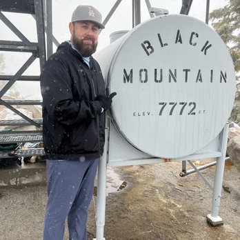
I hiked this for the first time on 3/20/22. I had never heard about it or seen anyone post this hike on Instagram and I follow a lot of hikers. I had a fellow hiker suggest this hike for a group hike and researched it a bit and got excited to try it. Location/Parking- it is a long drive for most people...nearly 2 hours for me coming from the SE part of LA county and pretty much everyone in our group had anywhere from about an hour to 2 hours just getting to this place (people coming from Rancho Cucamonga, Oceanside, and San Diego). It is easy to miss the small dirt road off HWY 243 that leads to the trailhead (especially in the dark since we were trying to start the hike at 5 AM). The narrow dirt road will take you about 400ft away from the road to a small parking lot that will allow for about 10-15 cars to park at the trailhead Trail- it is just under 4 miles to the top and almost 8 miles RT with every mile being at least 500ft of elevation gain which makes it pretty steep for a hike. The first mile or so is also hard because the trail has a big rut in the middle and you are not able to walk on a flat surface and your feet are always at an angle. The hike starts at just over 5K ft elevation and we didn't see any snow during th first mile, but in the 2nd mile we saw some clumps of snow off the trail from a recent storm, and during the 3rd mile we began seeing more snow that was on the trail, and during the last mile we got lucky to experience snow falling as we reached the 7K ft elevation. It was cold, a bit windy, and the snow was coming down pretty good at the top but we still spent about 30 mins at the top. On the way down we were able to find a few spots to take shortcuts by sliding down the snow on our butts...lots of fun! This was my first experience hiking while it was snowing. We saw no one on our way up or our way done. I think this hike is not on people's radar and I love hikes that are not crowded. Peak- There is a fire lookout tower at the top and stairs that you can go up but the top is closed off; there is a tank with the peak name and elevation and large rocks that allow you to spread out a bit at the top while you are eating a snack and taking pictures read more



8 years ago
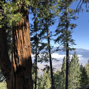
A beautiful trail with varying landscapes and, ultimately, excellent views. I was glad that about 70% of the trail was shaded forest (in the early morning - not so shaded by late morning) as it is a gain of about 2,600 feet over 3.9 miles (so about 7.8 miles round trip). Not one person on the trail other than myself on a recent weekday. One can take the stairs almost to the top of the fire lookout station at the peak. I chose to get to the peak via a use trail (on the right) a bit before one hits the dirt road near the top. It is an unmarked and not crystal clear use trail (but was on both of my hiking/trails oriented apps). read more


More info about Black Mountain Trail
You might also consider


Black Mountain Trail - hiking - Updated September 2026
Best of Idyllwild
People found Black Mountain Trail by searching for…
Hiking Trails in Idyllwild, CA
Places to Take Pictures in Idyllwild, CA
Waterfall Hike in Idyllwild, CA
Off Road Trails in Idyllwild, CA
Fishing Spots in Idyllwild, CA
Walking Trails in Idyllwild, CA
Running Trails in Idyllwild, CA
Scenic Overlook in Idyllwild, CA
Beautiful Views in Idyllwild, CA
Fun Places to Go in Idyllwild, CA


