Black Rock Mountain State Park Photos


More like Black Rock Mountain State Park
Recommended Reviews - Black Rock Mountain State Park
Start your review...


Reviews With Photos


I can't give this less than 3 starts due to our beautiful sunrise this morning prior to our small hike we did but this morning was definitely not what I expected. My fiancé and I came here for the sunrise, we're staying at Tallulah Gorge campground, well it was close to 8am for the visitor center to open at Black Rock Mtn., next thing you know, this park manager comes flying into the parking lot (assuming he was running late for his shift) and my fiancé and I weren't even standing close to the door, he rudely asks "what do you need/want?!" I was thinking "whoa!!, that's kinda rude and uncalled for!" So my fiancé then says well we came up here to see the sunrise and maybe check out the visitor center, then the guy was like, well.. umm.. give me a couple minutes. Didn't even come out to let us know if we can come inside yet. There was another lady who was going inside with him and she told us we can finally come inside. Finally went inside, he wasn't very friendly at all, I didn't have my passport book to stamp in so I asked him and all he did was took a sticky note and put a stamp on it, wasn't very helpful with going over the map in case we had any questions or anything, he was not friendly at all. We don't understand what his deal was, all the other GSP's we've stayed at, we've never encountered any issues or problems. They all have been friendly/nice for the most of our trips we've taken in Ga. My fiancé finally got a call back from the regional manager and they are going to address the issue and hopefully something will be done. The views from the park were spectacular for sure but the customer service from the park manager could use some improving.


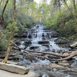
This is a neat Georgia State Park. Black Rock Mountain State Park is the highest state park in Georgia. Our visit centered around several days of camping and hiking. FIrst, the visitor center is located at the top of a long twisty road. Very helpful personnel here. Incredible views from the visitor center. Camping. We had a group of 10 folks that camped at the "pioneer campground". It was nicely setup with a cabin, shelters, fire pit, water, primitive toilets. Fine for a couple of nights in the woods. Hiking. We hiked the 2.2 mile "Tenessee Rock Trail" and the 7.2 mile "James Edmonds Trail". Both were great. My picture of the waterfall is along the James Edmonds trail. Also did the short walk around the lake. Small parking fee ($5) but it is worth it. Enjoy!

We ended up doing the Tennessee Rock Trail which was 2.3 miles. Beautiful walk, not too hard. The top was beautiful. We also walked the Springhouse/ Ada-hi falls trail to the main Ada-hi falls trail which there and back was 1.3 miles. Cute little waterfall, going back was a little tough because it was all uphill. We also went to the visitor center to enjoy the views of the overlook. Breathtaking.


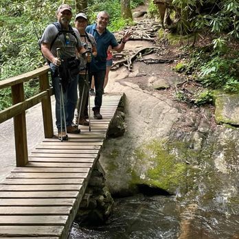
I really enjoyed hiking in this State Park. Fyi, five dollars to park. Hemlock Falls trail was my kind of hike, moderate, with the rushing river all along the way to the Falls, with a large pool of water. We also did Ada-hi Falls and the Lake trail as well. Ada-hi was short, easy, and pretty. The Lake trail, flat, picturesque, and easy. Everything was soooo GREEN!
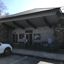

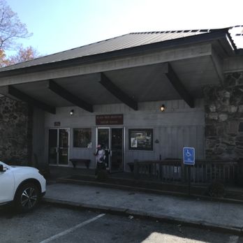
A very nice place to see the mountains. We were visiting the mountains looking for a riot of colors that defines the change of seasons and this is where we found them. You have to drive up the mountain which can be a real drive up as the Visitors center is near the top. It is worth the drive as the view is excellent. There are several parking spots in a long parking area with a covered viewing area near the end of the lot for people to appreciate the view. The area between that area and the gift shop/visitor's center building is an open area of about 200 feet that provides an excellent view of the trees below. There is a nice outdoor viewing area with a solid railing looking out over the mountain. If you want to be inside, the visitors' center offers the same spectacular views. If you are into hiking, several trails have trailheads in the local area. You can obtain a map from the very pleasant people in the center. I would recommend this as a good place for fellow travelers to see the mountain. There is the bonus that if you want to see the Foxfire area it is on the way to or from this site.


Beautiful state park. We visited while staying for the weekend less than 5 miles away. The drive up is a long and winding road, but I loved it. My wife, not so much. The views from the top are spectacular, even with a partially cloudy day. The visitor center was open for business, but limiting capacity, so be courteous of others who wish to enter and don't dilly dally. Highest state park in GA at almost 4,000 feet. There's an overlook a few hundred feet down too as you descend the mountain. Worth a stop if there's parking. If no parking is available, don't be that guy ... move along.


This is a great hike! The drive up to the trail is steep and winding. Once you get there it is awesome. I did the shorter 2.5 mile loop which was pretty rugged. I am going for the 7 mile loop next time. The visitor center at the top is well stocked with gifts and has some nature displays. Plenty of warnings about bears but I did not see one. I need to get a bear bell.


Black Rock Mountain state park has a lot of nice views especially during the peak fall season when you can see color transitioning of the tree leaves. It's cost about $5 to get in. It's not too difficult of trail for most people. Definitely bring supplies and dress properly for the occasion. The right shoes here will guarantee you not accidentally rolling an ankle. You get really nice scenic views as you trek up the mountain. The change in elevation can be a bit for some people. The point itself is only about 3000+ feet. Getting up to the summit isn't that difficult. It will probably take you about an hour and half or more depending on the route you take or your pace. They have several trails to choose from with different views, distances, and levels of difficulty. This park is popular with novices and those who are more experienced as well. It can suck though when the weather is not in you favor. Keep that in mind and check the forecast ahead of time. Other than that it's a good a trail for beginners with nice views, definitely worth checking out if you can.


Our four-person family stayed in Cottage 1 for a long weekend. Black Rock Mtn is absolutely stunning and we would highly recommend it for any active, outdoorsy family. The cottages are snug, but comfortable. They have a kitchen with some amenities, and the bathrooms are utilitarian. The showers are hot and there are plenty of towels provided. There is a strong emphasis on being environmentally conscious, with signage posted throughout the cottage. The views from the back deck are stunning, especially at night. The cottages are more expensive per night than other Georgia state parks, but you do get a 10% discount for all Friends of Georgia members. There are many walking and hiking trails throughout the park. The trails are well maintained, however visitors should be very mindful of the trail ratings. We did a 7.2 mile loop that was very, very strenuous. It was marked as very difficult, and we thought that was very accurate, even for experienced hikers. The other trails were also accurately marked. This is a great state park, and we would highly recommend it.


Wonderful used with a super friendly staff. We went on a few of the nature trails and had a great time. Definitely worth the trip just to see the incredible views. Luckily we didn't see any bears but there are several signs warning visitors to be aware. There are some cabins at the end of the road that seem to have incredible views, and we may stay there in the future.


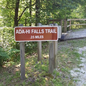
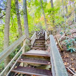
This was our 3rd stay at Black Rock. We LOVE the cabins and highly recommend booking one, especially as the pet-friendly options have been expanded. Cabin 10, where we've stayed all 3 trips, is very well outfitted. It even has an electric fry pan and a hand mixer! There are only 2 downers for this particular site, which aren't true for most of the other sites---the fire pit is on a slope and difficult to sit around and the view is obstructed due to the positioning of the cabin. Cabins 1-6 seem to have significantly better views. Black Rock is the kind of park if you are looking to unwind and relax. It doesn't have a swimming beach, boat rentals, archery, or most of the bells and whistles of other state parks. What it does have is gorgeous mountain views, a peaceful easy lake trail, and some of the best state park cabins I've ever stayed in. It is also now open year round! There is no lodge and few amenities, with the visitors center closing at 5 and the trading post having limited hours, but the drive into town for essentials is very reasonable and the town is just darling. The cabins have solid wifi and cable tv. We were able to hook up a Fire Stick with no trouble. You can bring your own boat or may be able to rent one in the nearby town. One caution---the Ada-Hi Falls trail appeals because it is short, .25miles. Don't fall for it. It is incredibly steep, stairs most of the way except for the third that is a very tricky narrow walk (or, in my case, slip) down. The view at the end isn't worth the hike at all. If you are very fit and hike just to hike, you'll enjoy it; but, if seeing falls or having a relaxing hike are important to you, skip this one. Do the lake trail instead. Make sure to visit the visitors center. It has one of the most spectacular overlooks right outside AND has two viewing porches from inside. Absolutely the best views of the trip. Honestly, the views are better than Tallulah Gorge. We're already planning our next trip!
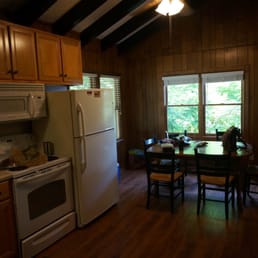

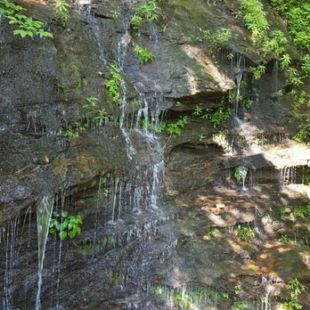
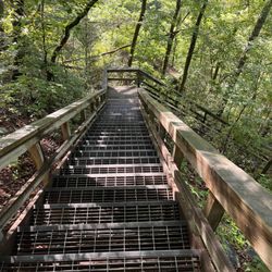
Nice park. Not one of the larger state parks, but it has two outstanding hiking trails and some relatively well-secluded cottages that offer a great getaway experience. We stayed in cottage #5, a two bedroom cabin, which was plenty for the two of us. #5 is not the best of the ten available - the view off the porch is completely obscured by trees - but it had everything else we wanted and then some. Except wi-fi - but hey, we're roughing it, right? If we do this again, we'll try for cottages 1, 2 or 3. They have better views, it seems. Pick up the keys at the ranger station if checking in before 5 PM (somewhere else if after that). Drop off by 11 AM the morning you leave. Hiking is the name of the game here: Tennessee Rock Overlook trail - relatively short at 2.2 miles, but still one of the best trails in the state. Plenty of variation in the terrain, plenty of elevation change and just a very nice hike. I could do this one many times. It will take you to the top of Black Rock Mountain and the Tennessee Rock overlook, which is at a slightly lower elevation. The trailhead is at a large parking lot on the main park road. The lot serves both the Tennessee Rock and Edmonds trails. James Edmonds trail - at over 7 miles, this one is quite a hike. We didn't finish it, doing a couple miles from the main trailhead lot and part of the trail upslope from the lake. Lots of elevation changes. Great hiking. I recall hiking this one years ago and seeing a large, awesome expanse of fern forest. Didn't find that this time (although there's plenty of fern everywhere) but it's there somewhere. As with the Tennessee Rock Overlook trail, the Edmonds trail is one of the most enjoyable hikes in the state. Black Rock Lake trail - just under a mile long, this easy trail loops a very scenic lake. The trailhead has a dirt parking lot which you'll see as you come down the lake access road. The lot is unfriendly to low clearance vehicles (such as ours). However, if you continue past that lot, you'll shortly come to the lake itself with some boardwalks/docks that you can fish from. You can park there with no trouble. Really nice walk around the lake. Doesn't look like much of a fishing lake, but I have no idea, really. James Edmonds trail (northern part) - you'll find the trailhead for the steep northern portion of the Edmonds trail just up the road from the lake parking lot. There isn't a separate lot, so park at the lake. We only went up this trail a quarter mile or so before turning back. Ada Falls trail - this is a very short but steep trail that takes you down to the 'falls', which really are nothing more than some water sorta falling over a rock face. Along with some elevation change on the short dirt trail, there are about a hundred wooden steps. It's a nice walk to get your heart pumping but not too spectacular. After a day of hiking, we whipped up some strong margaritas (tequila, cointreau and fresh-squeezed lime juice) and had a blast playing Scrabble and Yahtzee . Both games were in the cottage - along with some dumb ones - but I wouldn't count on that. So if you like games, maybe bring your own. Nice park. I'll be back.


I've both hiked and camped at Black Rock Mountain State Park. This is one of my favorite for camping but be warned, depending on the year you may find yourself in the clouds with everything wet. I attended an Isuzu Vehicross meet here during the fall where we had 13 camping and several who showed up just for the day. That first night was fairly cold and the cloud layer descended soaking anyone who wasn't prepared for it. The campgrounds spiral down a road that's really meant more for cars than RVs. We had a blast. For day hikes, you really can't beat Black Rock. There's everything from a 1 mile easy hike (Lake Trail) to an intermediate (Tennessee Rock Overlook) at about 2.2 miles and a longish 7 mile James Edmond trail that will get your heart racing - you get some change in altitude and variation of scenery or vegetation with any of these. There's an Ada Falls trail that's mostly dirt and wooden stairs to see water falling over some rocks - not much to that last one. In all this is a great place to camp up in Clayton. When you get tired of it hit the Dillard House for some homestyle southern food.
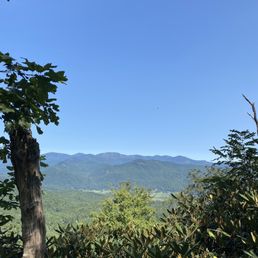

Run to Black Rock Mountain State Park! From the moment we arrived at the visitor center, we enjoyed breathtaking views. The views throughout the park are epic and the hiking is superb. Jack the gentleman at the entrance was beyond helpful and likely saved us from our own demise. As we were wandering about, he kindly interjected and offered us a map along with some detailed instructions regarding the various trails. We then explored a few trails to include the Ada-Hi Falls Trail and the Tennessee Rock Trail. We enjoyed all the views but would recommend a walking stick. The guide shop at the visitor center has some great merchandise including many items from local businesses. Furthermore, the prices were fair. read more

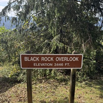

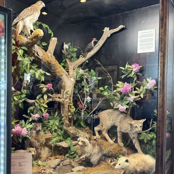


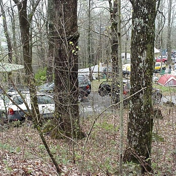
What a beautiful campground, especially in October when the leaves are changing. Each reserved lot has access to electricity, a picnic table, and a nice fire pit. Dogs are more than welcome. In fact, most of the people there brought one or two dogs. The lots vary in size from canvas tent and car all the way to travel bus. It's great for a weekend trip away from the city noise! read more


4 years ago
This is my second review of the park. We came here for Fathers Day weekend actually intending to camp near Highlands, NC but then the call of GA's highest park just beckoned us in. We drove up the road not expecting to even find any spots. Highlands was still another 40 min drive North. But low and behold there were 3 spots remaining. It turned out to be the right decision. Unpacked. Set up the tent and hiked the Ada-Hi Falls Trail then back up to Springhouse. All told about 2 miles with 500 ft of gains on a dry evening. We purchased a couple of bundles of wood which was moist so it required a lot of local wood to heat up before it would actually take fire. Two bundles was enough for a couple of hours of fun. We dined on cold cuts, fruit, cheese and shared a bottle of wine. At 9:30pm we noticed Daddy had not packed blankets or sleeping bags. Doh! Thankfully, only 15 minutes away was a Walmart Super Center open till 11pm. 30-45 mins later I discovered the State Park gates had closed at 10pm! The gates were still another 1.2 miles from Camp. Nicole went to the Camp Host and who gave me the code over the phone to unlock the automatic gate. Phew! (Always an adventure) The night was perfect for sleeping. Temps got into the 50s. However, my foam roll was just too hard on me. I'll have to figure out something else. It's only the second time this year I've camped and it's been years since then. Still working out the kinks. The camp neighbors were great. We had a fantastic time. The next morning we packed up and hiked around Black Rock Mt Lake before heading to Sky Land to summit Rabun Bald. read more


2 years ago
I can't give this less than 3 starts due to our beautiful sunrise this morning prior to our small hike we did but this morning was definitely not what I expected. My fiancé and I came here for the sunrise, we're staying at Tallulah Gorge campground, well it was close to 8am for the visitor center to open at Black Rock Mtn., next thing you know, this park manager comes flying into the parking lot (assuming he was running late for his shift) and my fiancé and I weren't even standing close to the door, he rudely asks "what do you need/want?!" I was thinking "whoa!!, that's kinda rude and uncalled for!" So my fiancé then says well we came up here to see the sunrise and maybe check out the visitor center, then the guy was like, well.. umm.. give me a couple minutes. Didn't even come out to let us know if we can come inside yet. There was another lady who was going inside with him and she told us we can finally come inside. Finally went inside, he wasn't very friendly at all, I didn't have my passport book to stamp in so I asked him and all he did was took a sticky note and put a stamp on it, wasn't very helpful with going over the map in case we had any questions or anything, he was not friendly at all. We don't understand what his deal was, all the other GSP's we've stayed at, we've never encountered any issues or problems. They all have been friendly/nice for the most of our trips we've taken in Ga. My fiancé finally got a call back from the regional manager and they are going to address the issue and hopefully something will be done. The views from the park were spectacular for sure but the customer service from the park manager could use some improving. read more


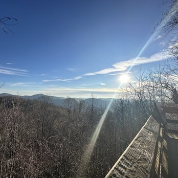

This is a neat Georgia State Park. Black Rock Mountain State Park is the highest state park in Georgia. Our visit centered around several days of camping and hiking. FIrst, the visitor center is located at the top of a long twisty road. Very helpful personnel here. Incredible views from the visitor center. Camping. We had a group of 10 folks that camped at the "pioneer campground". It was nicely setup with a cabin, shelters, fire pit, water, primitive toilets. Fine for a couple of nights in the woods. Hiking. We hiked the 2.2 mile "Tenessee Rock Trail" and the 7.2 mile "James Edmonds Trail". Both were great. My picture of the waterfall is along the James Edmonds trail. Also did the short walk around the lake. Small parking fee ($5) but it is worth it. Enjoy! read more


1 year ago
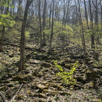
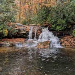
We ended up doing the Tennessee Rock Trail which was 2.3 miles. Beautiful walk, not too hard. The top was beautiful. We also walked the Springhouse/ Ada-hi falls trail to the main Ada-hi falls trail which there and back was 1.3 miles. Cute little waterfall, going back was a little tough because it was all uphill. We also went to the visitor center to enjoy the views of the overlook. Breathtaking. read more


10 months ago


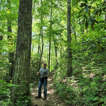
I really enjoyed hiking in this State Park. Fyi, five dollars to park. Hemlock Falls trail was my kind of hike, moderate, with the rushing river all along the way to the Falls, with a large pool of water. We also did Ada-hi Falls and the Lake trail as well. Ada-hi was short, easy, and pretty. The Lake trail, flat, picturesque, and easy. Everything was soooo GREEN! read more





3 years ago
A very nice place to see the mountains. We were visiting the mountains looking for a riot of colors that defines the change of seasons and this is where we found them. You have to drive up the mountain which can be a real drive up as the Visitors center is near the top. It is worth the drive as the view is excellent. There are several parking spots in a long parking area with a covered viewing area near the end of the lot for people to appreciate the view. The area between that area and the gift shop/visitor's center building is an open area of about 200 feet that provides an excellent view of the trees below. There is a nice outdoor viewing area with a solid railing looking out over the mountain. If you want to be inside, the visitors' center offers the same spectacular views. If you are into hiking, several trails have trailheads in the local area. You can obtain a map from the very pleasant people in the center. I would recommend this as a good place for fellow travelers to see the mountain. There is the bonus that if you want to see the Foxfire area it is on the way to or from this site. read more


5 years ago
Beautiful state park. We visited while staying for the weekend less than 5 miles away. The drive up is a long and winding road, but I loved it. My wife, not so much. The views from the top are spectacular, even with a partially cloudy day. The visitor center was open for business, but limiting capacity, so be courteous of others who wish to enter and don't dilly dally. Highest state park in GA at almost 4,000 feet. There's an overlook a few hundred feet down too as you descend the mountain. Worth a stop if there's parking. If no parking is available, don't be that guy ... move along. read more


This is a great hike! The drive up to the trail is steep and winding. Once you get there it is awesome. I did the shorter 2.5 mile loop which was pretty rugged. I am going for the 7 mile loop next time. The visitor center at the top is well stocked with gifts and has some nature displays. Plenty of warnings about bears but I did not see one. I need to get a bear bell. read more


3 years ago

Black Rock Mountain state park has a lot of nice views especially during the peak fall season when you can see color transitioning of the tree leaves. It's cost about $5 to get in. It's not too difficult of trail for most people. Definitely bring supplies and dress properly for the occasion. The right shoes here will guarantee you not accidentally rolling an ankle. You get really nice scenic views as you trek up the mountain. The change in elevation can be a bit for some people. The point itself is only about 3000+ feet. Getting up to the summit isn't that difficult. It will probably take you about an hour and half or more depending on the route you take or your pace. They have several trails to choose from with different views, distances, and levels of difficulty. This park is popular with novices and those who are more experienced as well. It can suck though when the weather is not in you favor. Keep that in mind and check the forecast ahead of time. Other than that it's a good a trail for beginners with nice views, definitely worth checking out if you can. read more

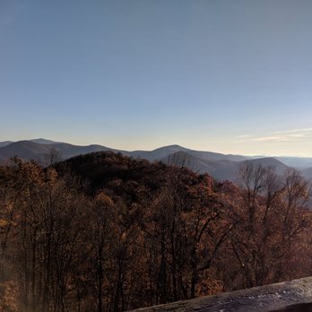
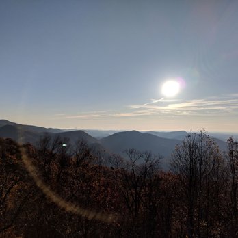


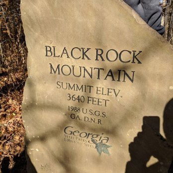


Our four-person family stayed in Cottage 1 for a long weekend. Black Rock Mtn is absolutely stunning and we would highly recommend it for any active, outdoorsy family. The cottages are snug, but comfortable. They have a kitchen with some amenities, and the bathrooms are utilitarian. The showers are hot and there are plenty of towels provided. There is a strong emphasis on being environmentally conscious, with signage posted throughout the cottage. The views from the back deck are stunning, especially at night. The cottages are more expensive per night than other Georgia state parks, but you do get a 10% discount for all Friends of Georgia members. There are many walking and hiking trails throughout the park. The trails are well maintained, however visitors should be very mindful of the trail ratings. We did a 7.2 mile loop that was very, very strenuous. It was marked as very difficult, and we thought that was very accurate, even for experienced hikers. The other trails were also accurately marked. This is a great state park, and we would highly recommend it. read more


5 years ago
Wonderful used with a super friendly staff. We went on a few of the nature trails and had a great time. Definitely worth the trip just to see the incredible views. Luckily we didn't see any bears but there are several signs warning visitors to be aware. There are some cabins at the end of the road that seem to have incredible views, and we may stay there in the future. read more


7 years ago
This was our 3rd stay at Black Rock. We LOVE the cabins and highly recommend booking one, especially as the pet-friendly options have been expanded. Cabin 10, where we've stayed all 3 trips, is very well outfitted. It even has an electric fry pan and a hand mixer! There are only 2 downers for this particular site, which aren't true for most of the other sites---the fire pit is on a slope and difficult to sit around and the view is obstructed due to the positioning of the cabin. Cabins 1-6 seem to have significantly better views. Black Rock is the kind of park if you are looking to unwind and relax. It doesn't have a swimming beach, boat rentals, archery, or most of the bells and whistles of other state parks. What it does have is gorgeous mountain views, a peaceful easy lake trail, and some of the best state park cabins I've ever stayed in. It is also now open year round! There is no lodge and few amenities, with the visitors center closing at 5 and the trading post having limited hours, but the drive into town for essentials is very reasonable and the town is just darling. The cabins have solid wifi and cable tv. We were able to hook up a Fire Stick with no trouble. You can bring your own boat or may be able to rent one in the nearby town. One caution---the Ada-Hi Falls trail appeals because it is short, .25miles. Don't fall for it. It is incredibly steep, stairs most of the way except for the third that is a very tricky narrow walk (or, in my case, slip) down. The view at the end isn't worth the hike at all. If you are very fit and hike just to hike, you'll enjoy it; but, if seeing falls or having a relaxing hike are important to you, skip this one. Do the lake trail instead. Make sure to visit the visitors center. It has one of the most spectacular overlooks right outside AND has two viewing porches from inside. Absolutely the best views of the trip. Honestly, the views are better than Tallulah Gorge. We're already planning our next trip! read more


Nice park. Not one of the larger state parks, but it has two outstanding hiking trails and some relatively well-secluded cottages that offer a great getaway experience. We stayed in cottage #5, a two bedroom cabin, which was plenty for the two of us. #5 is not the best of the ten available - the view off the porch is completely obscured by trees - but it had everything else we wanted and then some. Except wi-fi - but hey, we're roughing it, right? If we do this again, we'll try for cottages 1, 2 or 3. They have better views, it seems. Pick up the keys at the ranger station if checking in before 5 PM (somewhere else if after that). Drop off by 11 AM the morning you leave. Hiking is the name of the game here: Tennessee Rock Overlook trail - relatively short at 2.2 miles, but still one of the best trails in the state. Plenty of variation in the terrain, plenty of elevation change and just a very nice hike. I could do this one many times. It will take you to the top of Black Rock Mountain and the Tennessee Rock overlook, which is at a slightly lower elevation. The trailhead is at a large parking lot on the main park road. The lot serves both the Tennessee Rock and Edmonds trails. James Edmonds trail - at over 7 miles, this one is quite a hike. We didn't finish it, doing a couple miles from the main trailhead lot and part of the trail upslope from the lake. Lots of elevation changes. Great hiking. I recall hiking this one years ago and seeing a large, awesome expanse of fern forest. Didn't find that this time (although there's plenty of fern everywhere) but it's there somewhere. As with the Tennessee Rock Overlook trail, the Edmonds trail is one of the most enjoyable hikes in the state. Black Rock Lake trail - just under a mile long, this easy trail loops a very scenic lake. The trailhead has a dirt parking lot which you'll see as you come down the lake access road. The lot is unfriendly to low clearance vehicles (such as ours). However, if you continue past that lot, you'll shortly come to the lake itself with some boardwalks/docks that you can fish from. You can park there with no trouble. Really nice walk around the lake. Doesn't look like much of a fishing lake, but I have no idea, really. James Edmonds trail (northern part) - you'll find the trailhead for the steep northern portion of the Edmonds trail just up the road from the lake parking lot. There isn't a separate lot, so park at the lake. We only went up this trail a quarter mile or so before turning back. Ada Falls trail - this is a very short but steep trail that takes you down to the 'falls', which really are nothing more than some water sorta falling over a rock face. Along with some elevation change on the short dirt trail, there are about a hundred wooden steps. It's a nice walk to get your heart pumping but not too spectacular. After a day of hiking, we whipped up some strong margaritas (tequila, cointreau and fresh-squeezed lime juice) and had a blast playing Scrabble and Yahtzee . Both games were in the cottage - along with some dumb ones - but I wouldn't count on that. So if you like games, maybe bring your own. Nice park. I'll be back. read more
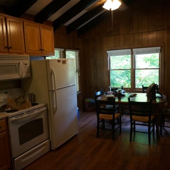
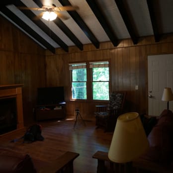
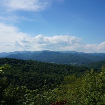






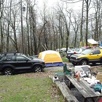
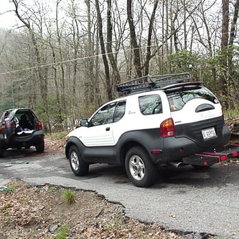
I've both hiked and camped at Black Rock Mountain State Park. This is one of my favorite for camping but be warned, depending on the year you may find yourself in the clouds with everything wet. I attended an Isuzu Vehicross meet here during the fall where we had 13 camping and several who showed up just for the day. That first night was fairly cold and the cloud layer descended soaking anyone who wasn't prepared for it. The campgrounds spiral down a road that's really meant more for cars than RVs. We had a blast. For day hikes, you really can't beat Black Rock. There's everything from a 1 mile easy hike (Lake Trail) to an intermediate (Tennessee Rock Overlook) at about 2.2 miles and a longish 7 mile James Edmond trail that will get your heart racing - you get some change in altitude and variation of scenery or vegetation with any of these. There's an Ada Falls trail that's mostly dirt and wooden stairs to see water falling over some rocks - not much to that last one. In all this is a great place to camp up in Clayton. When you get tired of it hit the Dillard House for some homestyle southern food. read more






6 years ago
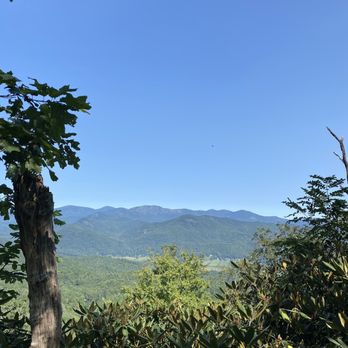
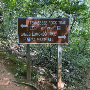
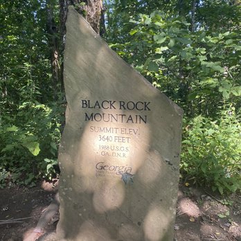
Tennessee Rock Trail was challenging and rewarding. Go left at the start of the loop if you're just hiking for a view. read more

8 years ago
What a great place to spend a few hours watching the sunrise or sunset. Spectacular panoramic views from the top of mountain coupled with numerous hiking trails. We have spent many hours here sometimes late into the night star watching after the sun sets. Being a Georgia State Park as always the facility's and amenities are second to none. Well worth the time to drive to the top of mountain when visiting the area. read more


7 years ago

8 years ago
The highest point in the state and a wonderful way to see it!! I went here thinking I was going to find just a scenic lookout but instead found numerous hiking trails, a great campground and some amazing view points. I started off with the ada hi waterfall trail which was a great hike because of the stairs if you like a challenge it's only 1/2 a mile but stairs at 8% grade make for just that. You will fill your legs burning by the end if you try taking this at a bit of a rapid pace :) I toured the campground and was really impressed with the layout and amenities but mostly of the camp host who was very friendly and welcoming. He made some other suggestions for my travels which turned out to be awesome stops. read more


6 years ago
Loved it here!! Such a great camp site!! Cant wait to go back! A couple of great trails right by the campsite as well! Its up a steep mountain but its conveniently close to the dollar general and grocery store for last minute camping needs! read more


9 years ago
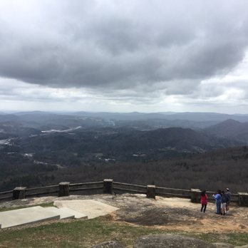
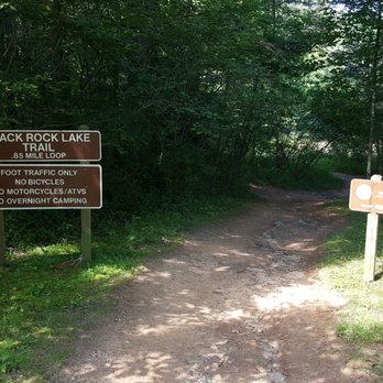
I wanted my 1000th review to be on a place I genuinely loved, so what better review than of one of my more favorite state parks just for the views alone? Black Rock Mountain State Park holds the distinction of being the highest (in elevation) state park in Georgia, resting at 3640 feet. One could argue that someone not intending on hiking at all could get a great deal out of Black Rock Mountain just by going to the visitor's center. I don't use the word amazing often, to hold onto the weight of that word, but it fits the views at the visitor's center quite well. All the way down the trail you'll come across two blueridge mountain overlooks where you can park on the side of the winding road, and sit for a bit. There's really not an ugly spot here. If hiking IS why you're here, Black Rock Mountain has a few trails for you. All are round trip distances and include: The tennessee rock trail: 2.2 mi The James E. Edmonds Trail: 7.2 mi The Ada-Hi Falls Trail: 0.5 mi The Black rock Lake Trail: 0.85 mi. The "hidden falls" trail off of the black rock Lake trail: 0.9 mi Sadly because I got to Black rock Mountain a little too late, I did not attempt the James E. Edmonds Trail, which staff mentioned you should allow 4 to 5 hours to complete the strenuous trail. James E. Edmonds can be picked up either just below the visitor's center, or near the Black rock lake Trail. Staff mentioned that before you even try to challenge the 7.2 mile James E. Edmonds trail, that you should first give the Tennessee Rock trail a shot, and if you found it easy, you were probably ready for James. Again, due to my timing, I decided to not hike the Tennessee Rock trail, so I can't really speak on it, outside of it being accessible just below the Visitor's center as well. Before reaching the first stop sign from the center. The Ada-Hi Falls Trail, if coming from the visitor's center, is reached by coming to the first stop sign below the visitor's center and taking a right. You'll see Ada-Hi marked. Partially wooden stairs, partially steep natural soil/root trail, the elevation changes over 200 feet in 0.25 miles. I must admit, the waterfalls were severely underwhelming when I visited, but I have seen photos of Ada-Hi after rains, and it was worth that hike. Is Ada-Hi tough? Well that depends on you. If you've tackled the likes of Amicalola falls, Cloudland canyon or Tallulah Gorge state parks and their respective staircase trails without difficulty, you're likely not going to be bothered by Ada-Hi (I didn't stop in either direction). But it will set a fire to your thighs. The black rock lake trail was one that I wasn't going to do. It's actually accessed outside of the actual park grounds gate. See the continental divide sign before you enter into the park? Turn down that road and follow the dirt road until you see a lake and parking lot to the left. Black rock lake trail is very serene, flat, and able to be taken by little kids, dogs, and likely bikes (though I didn't see any bikes on my time here). Wildlife are all over the place, from fish, to frogs (which you'll constantly hear), to yes, bugs. Take every opportunity to go down the stringer trails off of black rock lake trail that lead you to the lake on your right, to get a closer view. It's worth it! Less than a mile, it's down right easy, but several mountain and lake views make this much more impressive a trail than I thought it would be. The "Hidden" waterfall trail access via the Black Rock Lake trail actually is a portion of the James E. Edmonds trail. As you take on the Black Rock lake trail from the parking lot, when you come to the first wooden walkway (assuming you took a left from the parking lot away from the lake), follow the natural path that's to the left of the wooden walkway and follow it. You'll immediately come upon two rickety wooden walkways and a series of orange worn out blaze markers. This trail is about 0.9 mi round trip, and you'll pass a total of 4 wooden walkways before walking up a slight hill and hearing/seeing the smaller waterfall. It's a nice find, and not a difficult trail, although this trail has you wondering if you're going the right way at times, as I passed a few people who had turned around and gave up their search. Beautiful park that offers a little bit of everything. Both strenuous and long trails for experienced hikers, to meandering and short trails for the family. If you're close to Black Rock Mountain State park, take a little time and visit this park! read more




6 years ago
We stayed in cottage 9 for three days and two nights. They had everything we could ever need for the stay, except for food, spices, soaps, and cleaning supplies. The queen beds were only on frames and had very little back support. Causing two people to dip to the center of the bed. We found it more comfortable when we each had our own bed. The outside of the cottage had so many spiders and spider webs. I know we are in nature, but it would have been nice to be able to look out through clean windows. We did see spiders in the bathroom, but didn't see any the bedrooms. Other than that, we enjoyed our stay and hikes. Will come back again. read more
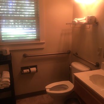

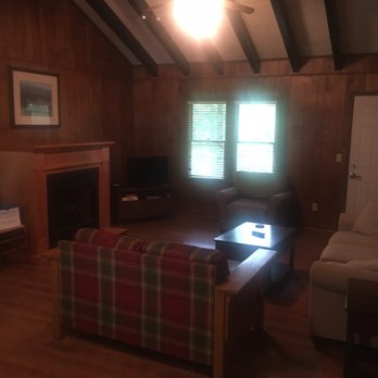


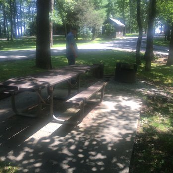


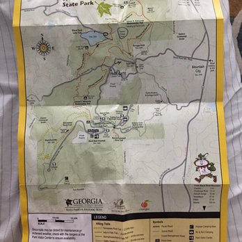
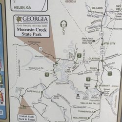
Black Rock Mountain State Park is the highest state park in terms of elevation. That was enough for me to want to come here. I checked out online which trails to take and I opted for the shorter ones cause of time before heading off to other hiking destinations in the area. It cost $5 to get in because of it's a state park but if you want to get the annual pass, it is $50. Stopping for a bathroom break at the visitor's center is a great idea. Little did I know that the overlook next to the visitor's center is sooo gorgeous and wide. This is the view I wanted. I went to Blood Mountain a few weeks prior and the view wasn't as gorgeous there as it is at Black Rock Mountain. Plus there is no hiking required to get this view! I am a fan! I loved it! The view is so wide that you cannot capture it all in a photo. Yeah, seriously. The map to the trail is confusing. I got lost trying to find Ada-Hi Falls trail and couldn't find it. I kept going north so I went back to the visitor's center to ask for directions. Apparently, a lot of people get confused with the map directions too. The map actually shows the visitor's center north instead of south like how it has so I would have to go out and go south pass the visitor's center to get to Ada-Hi trail. The parking lot there is very small. I got there and there were cars that did not know how to park and took up 2, even 3 parking space! How rude! Regardless, I parked and got out to hike. Ada-Hi Falls trail is only .25 miles but it is considered strenuous because of the stairs and incline coming back up. Just think, Tallulah or Amiacola Falls. What got me was the "waterfall" as you would call it was very disappointing haha. I mean, given that there was very little rain the prior days. I felt that I did that hike to see that view? Hmm okay haha but I did have a great workout :) There's a little visitor's center across the Ada-Hi Falls and met with this sweet lady who often comes to Black Rock Mountain who suggested to go on the lake trails since it's a nice view and can do it in an hour or less. It is a drive there too, away from the main entrance which confused me too. She said to go down south and will hit Taylor Gap Road and will be on a gravel road there with a parking lot. Found it! The trail is only .85 mile and it is flat all the way, no elevation gains but beautiful view of the lake, definitely completed it in less than an hour for sure. It was a gorgeous day! I am glad I came to check out this trail too. Black Rock Mountain State Park definitely is gorgeous but can be confusing cause of the map and many places are away from the main gate and visitor's center. Maybe next time will camp there or take the longer trails. 76/2017 read more





7 years ago
4 years ago
Visited here just as winter was about to wrap up for the year. For a state park, it is a bit touristy and over-developed for its size. For those who want an easily accessible view of the mountains and simple trails, this is a great place. What stood out to me is the Black Rock Lake- it is absolutely beautiful and the water is crystal clear. Personally, I prefer to be away from groups of people and enjoy the calm of nature, and it was a bit too crowded there for me. Overall, it is a well-kept park and a nice spot to spend a few hours. read more


10 years ago
Standing at the crest of Black Rock Mountain felt like standing in an amphitheater for angels watching God perform! There isn't a bad seat in the house and the world is laid before you like a giant stage. I've been to a lot of mountain peaks. I can tell you most any of them will give you a sense of awe and majesty. But usually there are other mountains in the close distance which makes the scale of where you may be standing difficult to comprehend. But when you stand on a mountainside where there seems to be nothing but open lands before you as far as the eye can see, well, scale becomes magnified! Suddenly everything about where you are standing seems grand. Black Rock Mountain feels like that! Black Rock Mountain sits at an altitude of 3,640 feet. Not very tall compared to mountains out West, but it is said on a clear day you can see upwards of 80 miles. Several hiking trails are available including the 7.2-mile James E. Edmonds Trail, the 2.2-mile Tennessee Rock Trail, the .85-mile Black Rock Lake Trail and the strenuous Ada-Hi Falls Trail. That particular trail is less than a quarter of a mile, but the elevation change is a brutal 220 feet over that short distance. Other points of interest here include the beautiful Summit Visitors Center, a wooden overlook along the drive up the mountain, 17-acre Black Rock Lake, a waterfall, 44 tent/RV/trailer sites, campsites, 10 cottages, multiple picnic areas (2 w/covered shelters) and a children's playground. FINAL THOUGHTS As I mentioned in recent reviews, I've been feeling a little overwhelmed with the busyness of life and decided to do a solo trip to the mountains just to re-center myself. Black Rock was the first stop of many mountain vistas on this day, but it was probably the most special. The enormity of the views oddly seemed to bring life into perspective. I was especially pleased because it was not a place I'd previously planned to visit, but while driving I noticed a directional sign for the mountain and decided on a whim to follow it. My decision to make the detour after seeing the sign took all of 1.57896 seconds and I questioned that decision all the way up the mountain. Would it throw me too far off course? Would it somehow hamper my ability to get where I was going on time? My structured nature often times comes with anxiety to stay on task, perform as expected and get as much completed with the time I'm given as humanly possible. Black Rock was just what I needed, because after seeing the views, I suddenly felt inspired to relax and just enjoy the moment. We as humans struggle in the valleys of life, surrounded by so many large obstacles and challenges that it truly is sometimes hard to see the forest for the trees. Our internal navigation can occasionally get stuck "recalculating" and for brief moments we feel lost. But every now and then we reach a higher place where not only can we see just how far we've come, but also clearly where we are going. It is not your final destination, but instead one of those critical reminder points meant to encourage you to continue pressing forward. The rush I felt to hit all of my goals faded as I sat looking out over the vast valley before me and for the remainder of my day, all I wanted to do was just be. No rules, no structure, no anxiety... just freedom to be me. 2016/130 read more


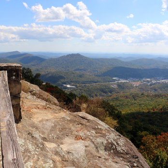


What not to like about national parks? Nothing. After hiking at numerous parks in Georgia, I have not encountered a bad trail or park. I first hiked through Black Rock Mountain in 2015 and fell in love with the rigorous trail and breathtaking view that the Edmonds trail offered. After 2 years, I decided to come back and conquer the Edmonds trail once again, and I discovered that nothing has changed---the trail is as intense I remembered it---with steep inclines and declines--but the view at the top is the same---Just simply beautiful. For this time, we decided to hike the Edmonds trail, going up the East Fork first and head down on the West Fork and do a loop around the quaint Black Rock Trail (highly recommend this, it was a very short and easy trail, and the beautiful view made it that much more enjoyable). PARK FEE: Please go to the visitor center or pay in cash at the entrance when you come here. The fee is only $5 and it helps maintain the park and trails so that we can continue to enjoy hiking it. Overall, another awesome trail and park in GA. Highly recommend. Just remember to bring plenty of water, or bring water bottles since there is a refill station at the visitor center. Bring snacks or lunch too! read more

4 years ago

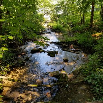
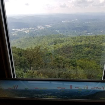
Our family attempted to head to the summit for #Eclipse2017, but ended up at Black Rock Lake/Dam instead. We turned off of 23 just before 7am to get in the line. We were about 1.8 miles from the entrance when we joined the line. After about 45 minutes of that, when we'd made it maybe .3 miles, my dad and I decided to check out the situation. 170 cars in front of us, after passing the park sign saying the summit was 1 mile away and the Continental Divide sign, we talked with the ranger. He informed us that car was #75, and they expected to be able to fit about 150 in the park that day. They'd closed a lane of traffic and they were having people park on the side, not in designated spaces. After finding a slightly secluded spot in the woods (the ranger recommended that since we were still a ways away from the restrooms), we headed back to our car. By now, a lot of the cars were getting out of the queue and pulling onto the wider parts of the shoulder or paying the nearby homeowners to park in their driveways. We attempted to get into the park anyway, since we had our kids and my parents and lots of stuff that was not packed in a way to hike long distances. We tried parking on the side ourselves when the ranger came through on his golf cart saying the park was full, but I'd heard from Georgia B about Black Rock Dam, so I cut through the woods and ran down the hill to find it. Black Rock Lake, created by Black Rock Dam, has a small paved parking lot with a honor system paybox and a port-a-potty. Success! We found a spot on paved road and in the shade. The Lake has a .85 mile trail around it with a few wooden bridges, benches, a dock, and wooden walkway on the northeast shore, and some nature signs along the way. The dam is an earthen dam with a concrete inlet valve out in the water. No swimming, but fishing is allowed (with proper permits) and more than one person had a kayak. People set up viewing spots all around the lake, with the majority on the embankment of the dam. We contemplated hiking up to the summit, but decided that seeing it over the water would be interesting. We walked all the way around the lake trail, which was well maintained and relatively flat. My oldest got stung by 3 yellow jackets, so do be aware that they are in the area, particularly between the embankment and the parking area. There was a DNR officer keeping an eye on things (and the eclipse of course). There were Friends of Ga State Parks selling water and snacks in the parking lot for $1 as a fundraiser. Several people had extra eclipse glasses that they were offering for free or a small fee to recoup their cost. When totality had ended, everyone packed up as soon as they could. The DNR officer encouraged us to continue down the road, instead of back up towards the summit. It made for a slightly longer loop back to 23, but I think we ended up beating some of the cars that were headed down from the summit, as that line was still quite long when we passed it. I look forward to returning to see the summit. read more






8 years ago
Great park! Loved the trails and overlooks and will be back for a cottage or to camp that's for sure!! read more


8 years ago

8 years ago
Page 1 of 2
More info about Black Rock Mountain State Park
3085 Black Rock Mountain Pkwy
Mountain City, GA 30562
Directions
(706) 746-2141
Call Now
Visit Website
http://www.gastateparks.org/BlackRockMountain
Hours
Indoor Amenities
Outdoor Amenities
Ask the Community - Black Rock Mountain State Park
Review Highlights - Black Rock Mountain State Park

















Why does Yelp recommend reviews?
2 reviews that are not currently recommended
The reviews below are not factored into the business's overall star rating.
14 years ago

4 years ago
Black Rock Mountain State Park - parks - Updated August 2026
Best of Mountain City
People found Black Rock Mountain State Park by searching for…
Campgrounds in Mountain City, GA
Watch Sunset in Mountain City, GA
Playgrounds in Mountain City, GA
Hiking Trails With Waterfalls in Mountain City, GA
Things to Do in Mountain City, GA
Scenic Overlook in Mountain City, GA
Dog Parks in Mountain City, GA
Places to Take Pictures in Mountain City, GA
Swimming Holes in Mountain City, GA
Sunset View in Mountain City, GA
Photo Spots in Mountain City, GA
Water Parks in Mountain City, GA
Off Road Trails in Mountain City, GA
Things to Do on a Rainy Day in Mountain City, GA
Scenic Drive in Mountain City, GA
What to Do in Mountain City, GA
Regional Parks in Mountain City, GA
Trending Searches in Mountain City, GA
Antiques near Black Rock Mountain State Park
Barbershop For Men near Black Rock Mountain State Park
Bike Shop near Black Rock Mountain State Park
Cliff Jumping near Black Rock Mountain State Park
Consignment Shops near Black Rock Mountain State Park
Ear Piercing near Black Rock Mountain State Park
Fishing Spots near Black Rock Mountain State Park
Hair Braiding near Black Rock Mountain State Park
Kids Haircut near Black Rock Mountain State Park
Lakes near Black Rock Mountain State Park
Mini Golf near Black Rock Mountain State Park
Peach Picking near Black Rock Mountain State Park
Pedicure near Black Rock Mountain State Park
Permanent Makeup near Black Rock Mountain State Park
Picnic Areas near Black Rock Mountain State Park
Playgrounds near Black Rock Mountain State Park
Preschools near Black Rock Mountain State Park
Public Golf Courses near Black Rock Mountain State Park
Rock Quarry near Black Rock Mountain State Park
Swimming Holes near Black Rock Mountain State Park
Teen Clothing Stores near Black Rock Mountain State Park
Things To Do With Kids near Black Rock Mountain State Park
Used Furniture Stores near Black Rock Mountain State Park
Browse Articles
Browse Nearby
BEST of Mountain City, Georgia Restaurants near Black Rock Mountain State Park
BEST of Mountain City, Georgia Things to Do near Black Rock Mountain State Park
BEST of Mountain City, Georgia Coffee near Black Rock Mountain State Park
BEST of Mountain City, Georgia Breakfast near Black Rock Mountain State Park
BEST of Mountain City, Georgia Wineries near Black Rock Mountain State Park
BEST of Mountain City, Georgia Shopping near Black Rock Mountain State Park
Browse Brands
Related Searches in Mountain City, GA
Best Parks for Parties and Events in Mountain City, Georgia
Best Water Parks for Kids in Mountain City, Georgia
Check Out Great Playgrounds in Mountain City, Georgia
Discover Baseball Fields Around Mountain City, Georgia
Discover Popular Bike Trails in Mountain City, Georgia
Discover Popular Photo Spots in Mountain City, Georgia
Discover Top Nature Parks to Visit in Mountain City, Georgia
Discover the Best Beaches in Mountain City, Georgia
Enjoy Hiking Adventures in Mountain City, Georgia
Enjoy the Best Picnic Spots and Ideas in Mountain City, Georgia
Enjoy the Best Walking Trails in Mountain City, Georgia
Explore Easy Hikes Perfect for All in Mountain City, Georgia
Explore Family-Friendly Zoos and Wildlife in Mountain City, Georgia
Explore Free Picnic Areas Around Mountain City, Georgia
Explore Fun Activities to Do in Mountain City, Georgia
Explore Parks With Pull Up Bars in Mountain City, Georgia
Explore Picnic Parks Near Mountain City, Georgia
Explore Popular Campgrounds Near Mountain City, Georgia
Explore Popular Picnic Areas Around Mountain City, Georgia
Explore Popular RV Parks Around Mountain City, Georgia
Explore Popular Scenic Views Near Mountain City, Georgia
Explore Scenic Lakes to Visit in Mountain City, Georgia
Explore Top Dog Parks in Mountain City, Georgia Near You
Explore Top Trampoline Parks in Mountain City, Georgia
Explore Top Water Parks in Mountain City, Georgia Today
Explore the Best Swimming Holes Around Mountain City, Georgia
Find Beautiful Views in Mountain City, Georgia
Find Great Places to Feed Ducks in Mountain City, Georgia
Find Parks and Recreation Activities in Mountain City, Georgia
Find Top Dog Friendly Parks to Visit in Mountain City, Georgia
Find Top Skate Parks in Mountain City, Georgia for All Skill Levels
Find Top-Rated Waterfalls in Mountain City, Georgia Now
Find a Park With BBQ Pits in Mountain City, Georgia
Find the Best Parks BBQ Grills in Mountain City, Georgia
Find the Best Parks for Picnics in Mountain City, Georgia
Find the Best Playgrounds to Visit in Mountain City, Georgia
Great Places to Swim in Mountain City, Georgia
Have Fun at a Splash Pad in Mountain City, Georgia
Hiking Trails With Waterfalls in Mountain City, Georgia
Locate Tennis Courts Around Mountain City, Georgia
Picnic Areas With BBQ Pits Available in Mountain City, Georgia
Popular Fishing Spots to Explore in Mountain City, Georgia
Popular Picnic Spots to Visit in Mountain City, Georgia
Safe and Fun Parks for Kids in Mountain City, Georgia
Top Amusement Parks to Visit in Mountain City, Georgia
Top Hiking Trails to Explore in Mountain City, Georgia
Top Playgrounds for Kids to Enjoy in Mountain City, Georgia
Top Swimming Lakes to Enjoy in Mountain City, Georgia


