
Coyote Creek Trail Photos


You might also consider


More like Coyote Creek Trail
Recommended Reviews - Coyote Creek Trail
Start your review...


Reviews With Photos


I am indifferent to this trail. I started by the 237 freeway and didn't go more than 3 miles north. So I more likely missed out on some good scenery. I would say this trail would be more for bikers, as they could explore the trail along its vast stretch. The south portion is more industrial. If walking or running, stay on trail. There are many homeless people living by the river or by the interior dirt trails. Be careful. I would prefer starting by the north end to experience more of a wooded or pasture style setting. South end has homeless camps. If they clean up the area, I could give it a better score. Big warehouses like Amazon are set up in this area. More trees or bushes would help to block out the industry feel.


Did you know that a famous Pirate Captain is buried right near the Coyote Creek Trail? Here is my experience with "Captain Elvira" https://youtu.be/j9ONR3G93Sc This is a pretty well-maintained very flat Trail perfect for beginner Riders. There's also a lot of Walkers and joggers along the trail. The bad news is that some of the trailheads are disgraceful. The one in Milp off McCarthy is just completely full of trash and 2 shopping carts full of junk. I wouldn't want to come here at night. So all in all a mixed experience. Nicely maintained trail, poorly-maintained Trailhead area.


Nice trail ... calm and quite . Enjoyed long walk on the trail . Beautiful views and more enjoyable and beautiful in little sunshine as without it its pretty cold .


1 year ago

When it rains as hard and long as it has been, I have limited options for taking my daily constitutional when I'm out and about because like Adele, I'm always chasing pavements. Even if it leads nowhere. Like this trail. I walked only the northern half near McCarthy Ranch where a fence prevented me from walking underneath Hwy 237. Not a problem for me since it smelled of fecal matter. Northbound it is. I headed north alongside the mostly hidden Coyote Creek to Dixon Landing Road. There was a series of homeless encampments and even an open campfire. I kept walking. Sights along the way included landfill and the back of an Amazon distribution center. It was only five miles to go back and forth, but hey, I did get a lot of my steps in without getting mud on my shoes. No small feat between atmospheric rivers. Up for a hike? Here's a collection of trails I've walked and reviewed: http://bit.ly/2OrC8nU read more


5 years ago
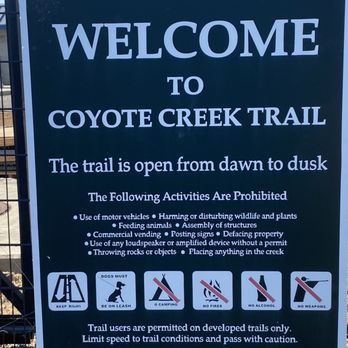
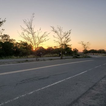
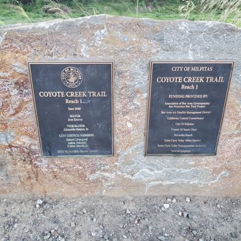
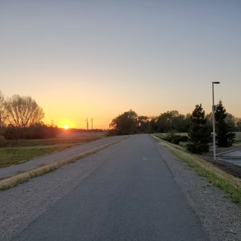
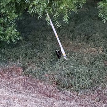
Coyote Creek Trail is basically flat and short-distanced, my favorite kind of trail for a nice and easy run. If looking for more of an "adventure," go in the other direction starting from the parking lot, toward Alviso along highway 237, where you'll find moderate slopes and a slightly more challenging terrain (this is beyond the sign that says Coyote Creek Trail ends). I also think it's more scenic by the water, and the trail widens, plus you don't get that stink that permeates the air in parts of Milpitas. I don't recommend going after dark (in either direction) as there are no lights and can be scary, especially if you're by yourself. But otherwise, Coyote Creek Trail is a peaceful paved path for walking, jogging, or biking, surrounded by nature (I even saw a tiny snake while running), but still close enough to businesses that you could easily fit it into a day of errands or grab food nearby. There is limited 4-hour parking at the entrance, and of course McCarthy Ranch parking lots across the street. read more





4 years ago
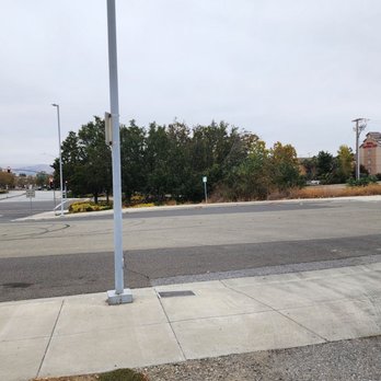
I am indifferent to this trail. I started by the 237 freeway and didn't go more than 3 miles north. So I more likely missed out on some good scenery. I would say this trail would be more for bikers, as they could explore the trail along its vast stretch. The south portion is more industrial. If walking or running, stay on trail. There are many homeless people living by the river or by the interior dirt trails. Be careful. I would prefer starting by the north end to experience more of a wooded or pasture style setting. South end has homeless camps. If they clean up the area, I could give it a better score. Big warehouses like Amazon are set up in this area. More trees or bushes would help to block out the industry feel. read more




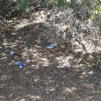
Did you know that a famous Pirate Captain is buried right near the Coyote Creek Trail? Here is my experience with "Captain Elvira" https://youtu.be/j9ONR3G93Sc This is a pretty well-maintained very flat Trail perfect for beginner Riders. There's also a lot of Walkers and joggers along the trail. The bad news is that some of the trailheads are disgraceful. The one in Milp off McCarthy is just completely full of trash and 2 shopping carts full of junk. I wouldn't want to come here at night. So all in all a mixed experience. Nicely maintained trail, poorly-maintained Trailhead area. read more




8 years ago
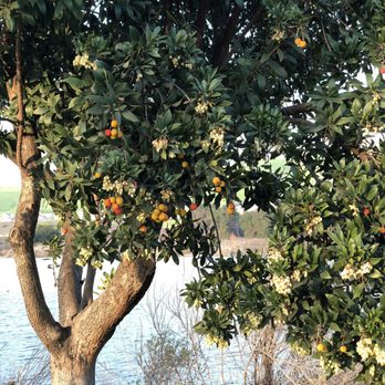
Nice trail ... calm and quite . Enjoyed long walk on the trail . Beautiful views and more enjoyable and beautiful in little sunshine as without it its pretty cold . read more




11 years ago
Coyote Creek Trail runs parallel to McCarthy Blvd between Montague Expressway and Dixon Landing Road along the Coyote Creek. It also links up to the Bay Trail. The northern part of CCT is paved and the rest is dirt/gravel. So, it doesn't matter which you prefer to stomp on, you got it. The scenery is not too exciting as you encounter office buildings, apartment complex, and a little farming compound on the way. Occasionally, you'll have to share the trail with cyclists. People walk their dogs here as well, some without leashes which is clearly against city regulation, so beware. When it's migration season, you are likely to run into paunchy geese and the countless droppings they leave behind. It becomes an obstacle course. Watch where you step! Despite the minuses, I still enjoy coming here mainly because of its convenient location and easy access. Skip the rush hour traffic and spend some time outside after work. The drive home is a breeze then. read more


11 years ago


17 years ago

7 years ago


7 years ago


13 years ago
More info about Coyote Creek Trail
2 Ranch Dr
Milpitas, CA 95035
Directions
Hours
Outdoor Amenities
Ask the Community - Coyote Creek Trail
Review Highlights - Coyote Creek Trail
You might also consider















Why does Yelp recommend reviews?

Coyote Creek Trail - hiking - Updated September 2026
Best of Milpitas
People found Coyote Creek Trail by searching for…
Trending Searches in Milpitas, CA
Antiques near Coyote Creek Trail
Apple Orchards near Coyote Creek Trail
Apple Picking near Coyote Creek Trail
Barbershop near Coyote Creek Trail
Bike Shop near Coyote Creek Trail
Bird Sanctuary near Coyote Creek Trail
Casinos near Coyote Creek Trail
Cliff Jumping near Coyote Creek Trail
Consignment Shops near Coyote Creek Trail
Cruising Spots near Coyote Creek Trail
Dog Friendly Things To Do near Coyote Creek Trail
Dog Swimming near Coyote Creek Trail
Ear Piercing near Coyote Creek Trail
Eyebrow Threading near Coyote Creek Trail
Eyelash Extensions near Coyote Creek Trail
Furniture Stores near Coyote Creek Trail
Hiking near Coyote Creek Trail
Kids Haircut near Coyote Creek Trail
Mattresses near Coyote Creek Trail
Picnic Areas near Coyote Creek Trail
Private Schools near Coyote Creek Trail
Public Shower near Coyote Creek Trail
Rock Quarry near Coyote Creek Trail
Scenic Night View near Coyote Creek Trail
Scenic Overlook near Coyote Creek Trail
Star Gazing near Coyote Creek Trail
Sunrise View near Coyote Creek Trail
Browse Articles
Browse Nearby
BEST of Milpitas, California Coffee near Coyote Creek Trail
BEST of Milpitas, California Restaurants near Coyote Creek Trail
BEST of Milpitas, California Things to Do near Coyote Creek Trail
BEST of Milpitas, California Walking Trails near Coyote Creek Trail
BEST of Milpitas, California Parks near Coyote Creek Trail
BEST of Milpitas, California Breakfast near Coyote Creek Trail
BEST of Milpitas, California Campgrounds near Coyote Creek Trail
BEST of Milpitas, California Sightseeing near Coyote Creek Trail
BEST of Milpitas, California Glamping near Coyote Creek Trail
Browse Brands
Related Searches in Milpitas, CA
Best Dog Hiking Trails Around Milpitas, California
Best Fishing Locations and Guides in Milpitas, California
Best Nature Trails for Hiking in Milpitas, California
Best Places for Horseback Riding in Milpitas, California
Check Out Off Road Trails in Milpitas, California
Discover Dog Friendly Trails to Explore in Milpitas, California
Discover Easy Hiking Trails Near Milpitas, California
Discover Kid Friendly Hiking Trails in Milpitas, California
Discover Popular Bike Trails in Milpitas, California
Discover Scenic Mountain Bike Trails Near Milpitas, California
Discover Walking Parks in Milpitas, California Near You
Discover a Hiking Trail in Milpitas, California
Discover the Best Night Hike Trails in Milpitas, California
Dog-Friendly Hikes With Dogs in Milpitas, California
Enjoy Camping Adventures Around Milpitas, California
Enjoy Kayaking Adventures in Milpitas, California
Enjoy Off Leash Dog Hikes in Milpitas, California
Enjoy Scenic Places to Walk in Milpitas, California
Enjoy Tent Camping Spots Around Milpitas, California
Enjoy a Beautiful Waterfall Hike in Milpitas, California
Enjoy the Best Walking Path in Milpitas, California
Enjoy the Best Walking Trails in Milpitas, California
Explore Beautiful Parks and Green Spaces in Milpitas, California
Explore Easy Hikes Perfect for All in Milpitas, California
Explore Fun Activities to Do in Milpitas, California
Explore Popular Campgrounds Near Milpitas, California
Explore Popular Dog Walking Trails in Milpitas, California
Explore Top Dog Parks in Milpitas, California Near You
Explore the Best Beach Spots in Milpitas, California
Family Friendly Hiking With Kids in Milpitas, California
Find Parks and Recreation Activities in Milpitas, California
Find Top Dog Friendly Parks to Visit in Milpitas, California
Find Top-Rated Waterfalls in Milpitas, California Now
Find the Best Parks for Picnics in Milpitas, California
Hiking Trails With Waterfalls in Milpitas, California
Off Leash Dog Hiking Trails in Milpitas, California
Popular Outdoor Activities to Try in Milpitas, California
Popular Picnic Spots to Visit in Milpitas, California
Popular Waterfall Hiking Trails in Milpitas, California
Safe River Swimming Areas in Milpitas, California
Safe and Fun Parks for Kids in Milpitas, California
Top Hiking Trails to Explore in Milpitas, California
Top Playgrounds for Kids to Enjoy in Milpitas, California
Top Running Trails to Explore in Milpitas, California
Top Swimming Lakes to Enjoy in Milpitas, California
Top Swimming Spots and Pools in Milpitas, California
Top-Rated Camping Sites in Milpitas, California


