Cancel

    Open app

    Search

    Eask Tower Path

    5.0 (1 review)

    Eask Tower Path Photos

    Recommended Reviews - Eask Tower Path

    Your trust is our priority, so businesses can't pay to alter or remove their reviews. Learn more about reviews.
    Yelp app icon
    Browse more easily on the app
    Review Feed Illustration

    2 years ago

    Helpful 2
    Thanks 0
    Love this 3
    Oh no 0

    Verify this business for free

    Get access to customer & competitor insights.

    Verify this business

    Conor Pass - Waterfall near the top

    Conor Pass

    4.7(15 reviews)
    2.8 km

    Conor Pass, situated on the Dingle Peninsula, is a twisty and narrow mountain passage that connects…read moreDingle with Brandon Bay and Castlegregory. This 3.5 mile drive is considered as one of Ireland's prettiest drives. The scenic road leading to the pass weaves around the edges of coastal cliffs and past blue glacial lakes. Prior to our visit we heard the horror stories of how dangerous this drive was. The drive really isn't that bad; although this was our third day of driving on the left side of the road! There were a few spots that were too narrow for two cars to pass at once, but we would just pull off the road in a passable spot and there were no issues. We approached several sheep in the middle of the road so be cautious as you make each turn. There is only one spot to pull off the road and take photos. It was very foggy on the morning that we were on Conor Pass, but I think the fog adds an eerie and romantic touch to the photos we took!

    We got lucky with clear skies and were rewarded with majestic views as we traversed the cliff side…read moreroad to a summit that allowed us to see as far as the eye would allow! Just. Beautiful. We had a driver. Truthfully, I'd be scared out of my wits if myself or a family member tried driving this. The lanes are super narrow and literally one lane in places. Plan to take your time and enjoy the views. Unless you're the driver... then, just plan to take your time, please. You need to keep your eyes on the road! ;) P.S. The ice cream bordered on custard and was the perfect treat!

    Photos
    Conor Pass - Sheehys Ice Cream Truck!

    Sheehys Ice Cream Truck!

    Conor Pass - Conor Pass (September 2014)

    Conor Pass (September 2014)

    Conor Pass - Conor Pass (September 2014)

    See all

    Conor Pass (September 2014)

    Irish Famine Cottages - Inside Kavanagh house

    Irish Famine Cottages

    4.5(2 reviews)
    9.4 km

    I loved the history behind the Famine Cottages and can not believe that they are still in such good…read moreshape considering they were built in the mid nineteenth century. The cottages has been preserved so that when you step inside you get a good idea of how people had to live in this difficult time. I do think that they took things a little far when they placed mannequins in the bed and by the fireplace. It is creepy and I don't think added anything to the site. You have to walk up a step hill to view the cottages. Once you arrive at the top the view will take your breath away. On a clear day you can see as far as Skellig Rocks. There is a large farmer's cottage and three smaller cottages, The large one has outhouses attached for the horse and cow. These cottages were made from mud and stone and any wood used was washed up from shipwrecks. There are burials on the property that are sectioned off and protected. The last person to live in the cottages moved out in the 1950's.

    The Irish Famine Cottages are a neat piece of history: as close as one can come to understanding…read moresome of the living conditions of the Irish in the early 19th century. FYI, admission is listed in travel books as €4, but we were quoted €3 at the entrance. Ask for feed to feed the donkeys, sheep, and ponies in the Animal Park on your ascent. (Though the greedy buggers only want your food: no pets after you oblige!) The first cottage is "Pat's House": a peasant laborer. The second is the Kavanaghs. The cottages were built using mud and stone, and had thatched roofs (though no longer). The latter has multiple rooms with furniture and information. It also has an adjoining cow house/outhouse and stable. Finally, there is a beehive hut that was used to house the pig. There is also a path that leads you to an old (non-Catholic) burial ground, though it's not accessible and can only be viewed from the fence. Still very neat! Overall the Irish Famine Cottages was an interesting historical look into one of the most trying times for the Irish! It's worth a visit if you're in the area seeing the other ancient attractions!

    Photos
    Irish Famine Cottages - Another creepy mannequin

    Another creepy mannequin

    Irish Famine Cottages - This mannequin scared the bejeezus out of me!

    This mannequin scared the bejeezus out of me!

    Irish Famine Cottages - Creepy mannequin with a giant mole on her face

    See all

    Creepy mannequin with a giant mole on her face

    Rahinnane Castle

    Rahinnane Castle

    5.0(1 review)
    7.3 km

    Rahinnane Castle was one of my favorite places we visited while driving the Dingle Peninsula. We…read morefollowed our GPS to get to the general area (the roads are unnamed but Google Maps recognizes the name) and then saw it in the distance across a field. We followed some homemade signs that directed you to park next to a barn. As we tried to figure out what to do next, a lady came out and told us it was 2 EUR each to see the castle. We paid and then she told us to walk through her yard, through the fence, and across the field. The field was extremely muddy and is home to livestock so watch your step (unfortunately I discovered that part the hard way...not my proudest moment). I don't think the castle actually resides on this family's land but they seem to have a monopoly on the access. Even after walking over, we didn't see a better way to have arrived. If you are using a GPS to navigate, the GPS coordinates are 52.143510, -10.382297. The castle itself is breathtaking and it looked pretty sturdy for being in ruins. We were the only ones there at that time. It was so peaceful as we were free to explore the castle without anyone else to disturb us. There is an information board sitting outside that gives you a brief history. I really didn't want to leave but we wanted to explore more of the peninsula before sunset so we only spent about 15 minutes looking around. This was probably the sketchiest place we visited but it was worth it. The 2 EUR admission was pretty standard for other more established looking destinations. 5 stars.

    Photos
    Rahinnane Castle
    Rahinnane Castle - Nooks and crannies

    Nooks and crannies

    Rahinnane Castle

    See all

    Dunbeg Fort - Cliffs (and a boat!) near Dunbeg Fort

    Dunbeg Fort

    3.0(7 reviews)
    10.2 km

    Another ancient site along Slea Head Drive (R 559) in Dingle, County Kerry, is Dunbeg Fort. It was…read morebuilt in the Iron Age - wood excavated from the site was dated at 580 BCE. There is a ~16m defense wall and ditches still intact. The fort was built close to Dingle Bay and, as a result, has suffered damage when the cliff has eroded and parts have fallen into the sea. Visitors will see the steep, precarious drop near the fence line. Unfortunately at the time of this review, Dunbeg Fort is closed due to seasonal storms having again caused damage. Links to more information: https://www.irishtimes.com/news/environment/future-of-precarious-kerry-fort-dunbeg-hangs-in-the-balance-1.3346234 http://www.thejournal.ie/kerry-fort-ancient-3781702-Jan2018/ Hopefully what is left will be preserved and made safe so visitors can continue to enjoy this ancient, impressive piece of history.

    We visited Dunbeg Fort as part of the Slea Head Drive. The fort is well marked with a spacious…read moreparking area. You pay a small fee to enter and then walk down a narrow path to the fort. The fort is falling off the cliff so there are areas that are blocked off and you can see the reinforcement to try and preserve what is remaining. Needless to say, don't ignore the signs or disregard the fences. We had already seen Dun Aengus on the largest of the Aran Islands - Inishmore. Dunbeg Fort simply didn't compare. Dun Aengus is also on a cliff and falling into the ocean but is MUCH larger and the area is more scenic. The next day we visited the Staigue Stone Fort along the Ring of Kerry and it was also much more impressive. If you've seen Dun Aengus, you can probably skip this. 2 stars.

    Photos
    Dunbeg Fort - Mom near Dingle Bay and the cliffs

    Mom near Dingle Bay and the cliffs

    Dunbeg Fort - Dunbeg Fort

    Dunbeg Fort

    Dunbeg Fort - Dunbeg Fort

    See all

    Dunbeg Fort

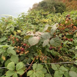
    Cliff Walk - Wild Blackberries

    Cliff Walk

    4.6(5 reviews)
    28.2 km

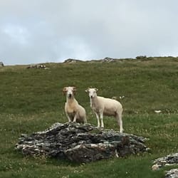
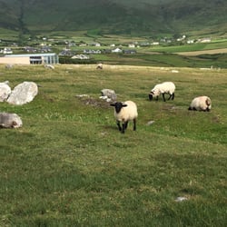
    I love hiking. And in San Francisco Bay Area, people hike every weekend. So initially I really…read moredon't want to do a hike. However, the hike in Ireland totally blew my mind. This is an easy trail and takes about 90 minutes to finish if you don't stop. I stop to take gazillions of pictures, so it takes about two hours to complete. You will see a rock mountain and can hike over it. There is a beautiful costal view when you get to the tops. Many local wild flowers and cute house are along the road too. I was surprised to see an old castle style a banded house there. My favorite part of the hike is to see those sheep. They are so cute and running around everywhere. There is no fence to separate the hiking trail and the sheep. So I got to stand very closely and say hi to them. You can ask Dingle visitor center about this hike. We part our car at the Blasket Island Experience center. And walked outside, turned left, and followed the green arrow. I mean, it's Ireland. You can't go wrong by choosing a green hiking trail. Overall, I had a fantastic fun and relax evening hiking this route. Highly recommended if you are looking for a true Ireland hiking experience without tons of tourists.

    If you fancy getting away from Dublin city for a day then jump on a DART headed south and get off…read morein Bray. Walk the length of the promenade to the foot of Bray Head 'mountain' and there you will find the beginning of the 'Cliff Walk' to Greystones. The cliff walk winds around base of Bray Head and offers beautifully clear views of the sea to your left and the wildlife of Bray Head to your right. It is not called the 'cliff walk' for nothing. Walkers are literally overlooking the tide as it crashes against the shoreline below and it's not advisable on a blustery or windy day. It takes less than two hours at a leisurely pace. You will notice the occasional DART zooming by below as you walk and you can jump on one of these to get back to town once you reach Greystones. Stop for a coffee (or something stronger) in one of Greystones' many pubs/cafes first though! Basically, tis a great way to get some fresh, sea air into your lungs while you take in some stunning coastal views! Captain Birdseye would approve!

    Photos
    Cliff Walk
    Cliff Walk
    Cliff Walk

    See all

    Eask Tower Path - farms - Updated May 2026

    Loading...
    Loading...
    Loading...