Feather Falls Trail Photos




You might also consider


More like Feather Falls Trail
Recommended Reviews - Feather Falls Trail
Start your review...


Reviews With Photos


Me, my boyfriend, and our dog started and ended with the lower loop trail, which is about a little over 7 miles total. The lower loop trail is pretty tough, especially during hot weather because it is steep going to and back. My butt is so sore! Don't bring the dog unless he is trained for strenuous exercise! There are also way too many mosquitoes-I got bitten at least 23 times! I would recommend putting some anti-mosquito repellent on, snacks, and if it's a super hot day bring a gallon of water for the dog with ice, plus at least 2 bottles of water for each person. There are no water fountains or sinks either-only bathrooms so make sure to bring lots of water (with ice preferably), otherwise the dog and/or person can get dehydrated really quickly. There are also tons of poison oak everywhere, so be aware of how those look like, and don't touch any plants. Unfortunately, you don't get close enough to the waterfalls to touch it, only to look at it from afar. The hike took us about 4 hours, including stops. Overall, the trail was a really great workout and the fall was spectacular. I most likely won't be coming back because of all the poison oak and mosquito bites I got but it is still a nice fall to see at least once-just make sure you're prepared!


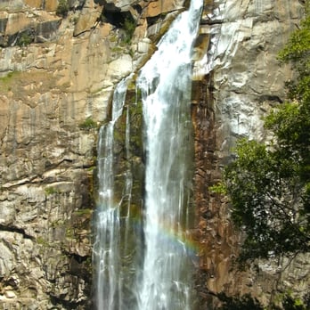
I was really impressed by the powerful falls. Even during the drought (2015 April), I saw a good amount of water. The loop is 9-10 miles total. It is not strenuous, not much elevation gain and shady. However, there are a lot of poison oak. I am very sensitive to them, and I washed my body with tecnue but still got horrible rash. I recommend to wash both body and tools after a hike. Parking lot is big and there is a restroom. Trail is very popular, so you will see some people on a hike, and loop is simple, so unlikely to get lost, however, always better to have a map.


Intermediate trail, with a few obstacles that will have to be climbed over or under. Lower loop is level with lots of gentle declines. Do that one first. Coming back that way, those declined turn into muscle burning inclines! There are fabulous cool / cold swimming holes above the falls to cool off in. Lay out on the flat rocks to dry off, before taking the upper loop back to base. Upper loop is about a mile longer, but mostly declining slope. Please take at least 4 bottles of water per person.


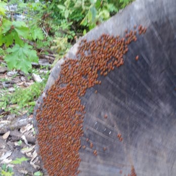
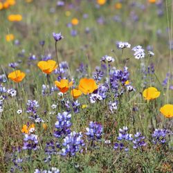
Short: The Feather Falls Trail is a moderately challenging hike to a spectacular ~400 foot waterfall. The tree-covered trail starts at a large/free parking lot (with toilets!) and is about 8 miles long if you do the full loop, which is descends on the way to the falls and is uphill on the return to the parking lot. The upper, flatter portion of the loop is longer (4.5 miles). The lower, steeper portion of the loop is shorter (3.3 miles). The lower portion also has a lot of plant overgrowth and erosion, so hikers are constantly forced to duck under branches, climb over sharp vines, and balance on the eroded/flooded trail. There are also a lot of bugs so bring repellent! The hike took us about four hours total, including a good break at the falls. Long: I drove up to the Feather Falls Trailhead to do this hike a few days ago. Overall, it was a pretty easy drive, although the road eventually becomes thin and windy. The roads that take you to the trailhead have little cell phone service, but the turns to the trailhead were well signed for the last ~11 miles starting on Forbestown Road. The parking lot at the trailhead is large and has free parking. On the Saturday I went, there were probably 7 cars in the lot. The lot had two toilets/restrooms but no running water. We started off on the trail around 10 am. After about 0.25 miles, we met the fork and chose to take the long/upper route to the falls and the short/lower route back. The upper trail was lovely and rolling: a mix of short uphills and downhills with frequent flat portions. The trail was mostly 3-4 feet wide and was only overgrown in a few places towards the falls end of the trail. I really enjoyed this part of the loop, and even though it was longer, I would have hiked it both directions if I had known the disrepair of the lower trail. The upper and lower trails meet at a junction, where a short trail to the falls is also well-signed. This short trail is the most challenging part of the hike because it climbs a steep, sunny, bouldery hill. It then descends the hill's opposite side to the fall's observation deck. The uncovered deck looks directly at the falls on one side and the valley below on the other side. The waterfall is particularly beautiful this year because of the increased rainfall. After returning to the junction, we took the lower part of the loop to get back to the parking lot. This was a mistake. The lower loop trail, especially close to the falls, was in significant disrepair. We climbed through bushes with spiky thorns for a large portion of the relatively flat first mile, so my legs became scratched. This section was also partially eroded out in the center, so we had to straddle the valley in the middle of the trail or jump from side to side when the trail was too narrow on one side. Later on, the trail also had fallen out one side and and had a small creek running down it. The last couple miles back to the parking lot were pretty uphill. As someone who doesn't really exercise much, this section were pretty challenging for me, especially on a 95 degree day. One of the best features of this hike is that it is almost completely covered by trees. With the exception of the deck and a portion of the of trail after the junction of the upper and lower loops, only about 10% of the trail had portions of direct sun exposure. This trail was also great because it had lots of benches, where I could sit and take a break. The benches would also be good if you just wanted a quiet place to read or meditate. The trail also has a lot of informative plaques with descriptions of things you might see: Bald Rock Dome, poison oak, ticks/bugs, and creeks. We saw many different plants and animals. I really enjoyed the canopy of trees because it is really beautiful to look up to see the light coming through and reflecting off the leaves. There were also plenty of cute little wildflowers. The thorny bushes that we climbed through on the lower trail and the poison oak on the upper trail were less cute. As for animals, we saw tons of lizards and two snakes (1 garter and 1 other). Sadly, we also saw a dead baby deer. Mosquitoes were a problem on this hike. Although I covered myself in insect repellent before the hike, I ended up with 5 mosquito bites. There were also a lot of bugs that enjoy buzzing around ears (but they don't really hurt you). There were also ladybugs in one particular area: we crossed some stream on the lower loop, and there were hundreds on the ground below us. I had never seen something like that, and it was very cool. Overall, I really enjoyed the hike: the upper loop was pretty easy, and the falls were really beautiful. If I went back, I would probably change three things: 1) I would probably hike the upper portion of the loop both ways since I don't enjoy climbing through a mile of bushes, 2) I would choose a cooler day, and 3) I would re-apply insect repellent and apply it to my clothing.


Just finished this hike this morning and boy, what a day. Initially, I was very excited but noticed a very vacant parking lot. The last challenging hike that I experienced was Muir Woods and it was packed! I was surprised to see this one nearly empty... so be extra alert and careful!! There is no signal, if something happens, it is mostly likely GG. Start sending invites for your funeral... jk. Haha Anyways, my first note is to AVOID making a pit stop at the restrooms that are provided in the parking lot. It is literally like a porta potty in a tiny garage. The smell was extremely rancid and my friend who checked the toilets said it was splattered with feces. NO THANKS. Luckily, we had a backup plan which was to bring wipes/toilet paper in case we needed to release in the bushes.. which we did instead. (Shhh, don't tell nobody of our savagery) Before the entrance sign, there was a memorial for some Caucasian male... it was not very welcoming to see that someone had passed on this trail but the scenery after that was quite nice. Second, YES, please bring insect repellent. My group bought the "DEEP FOREST" OFF BRAND, I made sure that I sprayed a generous amount on my skin and clothes. None of my group ended up with bug bites but you will encounter many gnats coming at you, especially in big groups like they're having some sort of orgy in your face. DO NOT wear shorts on this hike btw!! Third, there are two routes! We started off with the shorter 3.3 MI route to the waterfall and 4.4 MI back. Yes, 3.3 MI does have obstacles of narrow, eroded roads and plants stabbing at you. However, I would say it has the most shade for those who find the heat unbearable. This will be where you will encounter the most bugs coming at your face, but nothing too life endangering besides losing your balance trying to pass all the erosion. The 4.4 MI is easier but the alternating uphill/downhill was killing my legs. It also did not help that my group did not bring enough water so we were just forcing ourselves to finish half way towards the end. So bring at least 3-5 waters each!! This place is also super humid as it was about 100 degrees; it was more of 40 percent shade and 60 sun exposure. We also encountered a rattle snake that was clearly in offense mode a quarter way in; so be warned! We had to stop and try to lead it further away from us so we can continue our hike. I wish I could say I saw other fascinating wild life but I did not besides spiders, gnats and an angry snake. Overall, I felt pretty accomplished and relieved when it was finally finished. The environment was pretty serene and quiet. The waterfall was beautiful but you are better off seeing pictures or videos at home because you cannot even be near it. Also the balcony was directly in the suns' view so the heat was not worth it. I wish they would put up a giant umbrella or something so people can have shade when they are enjoying the view of the falls. Would I do this again??? Hell nah... I would go to the BAY for hikes for the cooler breeze. Maybe if we were more prepared with abundance of water and nicer weather it would've been a breeze. 4 stars for the potential. If you're up for adventure, hate crowds and don't mind whatever I stated. Go for it!!


We have been progressively getting more and more into hiking as a family. This past Sunday was Superbowl weekend, and as I am not a fan of football (hold the boos), we decided to take advantage of the nice weather and what was most likely going to be an empty trail. This was my biggest hike yet. We went to Alamere Falls (8.5 mile hike) about a moth prior and I was exhausted all the next day. Since then I have been training (spin 3x per week, strength training) and felt like I was ready for this longer hike (~10 miles). Man am I glad I went to those spin classes! This place is GORGEOUS! Especially with all of the recent rain. But that trail definitely makes you work for it. On the way in we did the 4.5 mile slight grade trail, and on the way back did the steeper 3.3 mile section of the loop. WOO! Those last couple miles of uphill were KILLER! But the level of personal accomplishment I feel is totally worth it! All that aside, the trail and the falls are just breathtaking. The pictures of the falls really do not do it justice. Sitting on the overlook and peering over the edge, you really feel very small in the universe. It is truly awe-inspiring. And along the way all of the mini waterfalls and creeks are so picturesque. And the ladybugs! Ladybugs everywhere by the bridge! Final verdict - DO IT! Just know that if you are not in peak physical condition it will be challenging. Bring plenty of water, snacks, and sunscreen, and make sure your foam roller and Epsom salts are ready for the next day! Happy hiking!


You can watch our hike to Feather Fall YouTube video here - Go to link: https://youtu.be/LPyNEkOa6Wo Feather Falls is one of the most beautiful water falls and tallest fall in the United Stats located in Northern California. It's a 9 mile hike round trip, but it can be challenging for some. Overall it's a beautiful hike and one that you should add on your hiking bucket list.


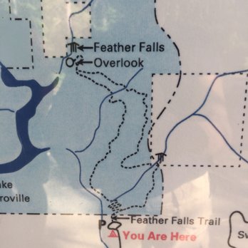
Awesome dog-friendly hike, totally worth the 10 miles to see the breathtaking waterfall! I was surprised to see it's in full force right now (January). Came on Friday and was the only one in the large parking lot at start and finish. A couple picnic areas, bear proof trash bins, and a building housing 2 pit toilets with lots of TP are at the trail head. No sinks or water. You'll hike about 1/2 mi in before you see the split-off for the Upper and Lower trail. Map is deceiving- it looks like it starts from the beginning. I took the Upper trail at start (almost all downhill) which was very easy but long, and the lower trail back. Lower trail back was mostly downhill and then uphill the last 1.5mi or so. It was tiring but not as strenuous as I expected. Following the loop this way will yield the least overall uphill hiking because if you take the lower loop to the falls, towards the end it has a lot of steep uphill. Although the Upper is more gradual, it's a lot of uphill back and longer. The Upper trail also has views of Bald Rock Dome (lower trail was too foggy to see), a few nice bridges and a mini "falls" where you cross a bridge and see the Frey Creek sign. You'll hike down into the valley and then up a bit to the top where there are views of the valley and tree line. You will come to an unmarked split in the trail, down is the Lower trail and if you continue up you'll reach an outlook of Middle Fork Feather River and then you'll hike down onto the Falls viewing platform. Great place to take a break with incredible views. If you hike back up where the "viewing area" sign is, you can take the trail behind if to the actual top of the falls (it's about an extra mile there and back). It's a little tricky to find the top because most of the trails take you to pools at the top. You need to go left where it splits to get to the top. There are newts and frogs here and lots of algae which makes it very slippery. You have to cross the top of the stream that feeds into the falls to get to the edge and it's very dangerous. It's nearly impossible to get to the "cage" at the very edge so I wouldn't recommend it. I don't think it's meant to get to. You're only a few feet from the drop on slippery, highly sloped 5ft boulders so it's dangerous and tricky to get there. Stick to the top of the boulders to get your pics-still a great view. Hiking back along the lower loop was not as scenic as the upper, but I was happy to shave off a mile and just get back. There's a nice bridge, some streams along the trails, and lots of newts, so watch your step. The end is uphill, but not too bad. Entire hike was 10.5 miles and took us almost 5 hours (but we took a lunch break and stopped for a lot of pictures). Overall, highly recommended! The Falls were probably the most incredible thing I've seen in my life so far.


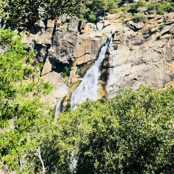
A lot of beautiful sights and sounds to take in! I didn't thoroughly read the reviews so I did not know that there was a way to the top of the Falls so I missed out on that part. Nevertheless, you will enjoy this trail in all of it's mossy glory! It is easy to miss the trail that leads up to the falls overlook but look for pink ribbon wrapped around tree branches and it will lead you up the rocky path (check pics). We took the Lower Falls Trail going back and it had A LOT of incline. Be careful not to step on newts (or salamanders?) and slugs! Also, we had 0 reception as our drive got closer to the trailhead so we definitely had none during the hike. Print out driving directions just in case.


Great outdoor cardio session! Dog friendly !We got here around 11 am and finished around 3:30 pm . Started up the hill on the shorter lower loop and took the longer upper loop back down . We stopped at the waterfalls look out and ate lunch and took photos for about 30 minutes. Truly a decent moderately challenging hike . The lower loop has more stepper inclines then the upper loop . Tons of poison oak !! Be aware ! LOts of shade along the trails , less shade at the top of course .Make sure you are prepared water !! You will need it ! Two toilets in the parking lot , but they are not kept up , no toilet paper and not that clean. Had a great time here . Kind of a long and winding drive up the the trails but worth it . Over 9 miles around trip on foot . I feel accomplished :)


Absolutely stunning views of a very active waterfall in the month of April! The longer route is less strenuous and the shorter hike gets a bit narrow but all worth the climb! You will have the choice of either route at the beginning and on the way back from the overlook platform! The platform has a long bench perfect for lunch with a view of the falls and river! This hike is mostly shaded by trees and stayed at a comfortable temperature in April. The parking is free and spacious which is a plus!


This is a beautiful hike that isn't as crowded as a lot of other waterfall hikes such as alamere falls in Marin. Take the upper route as it's the easiest compared to the lower route which is shorter yet steeper. Go past the lookout view and you can get all the way to the falls. The view from the top of the falls is even more amazing!


Go now! The falls are raging and beautiful. Take the lower trail there (even though it's a little washed out) and upper trail to return. It's beautiful.


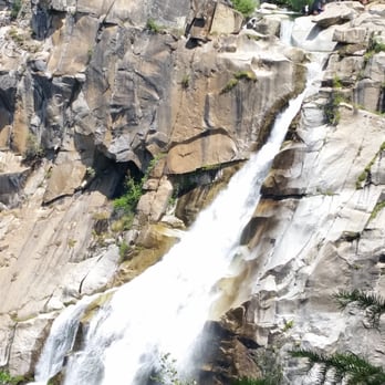
This hike was a blessing and a curse combined; stunningly beautiful views and an amazing waterfall mixed with treacherous inclines, a mass amount of poison oak, and very aggressive bugs. I hiked this trail with my group in early June, and needless to say, this was one of the most beautiful and also one of the most challenging hikes that I've done. The entire loop measures about 8 miles, but you should add another mile if you plan to hike to the top of the falls. We started on the Upper Trail which is about 4.5 miles long. We took this trail to the top of the falls, then to the falls Overlook, and then to the Lower Falls trail which looped us back to the beginning of the trailhead. But be forewarned; if you take the Lower Falls trail back, the hike is very strenuous and not very well maintained. Right from the gate, you can see that this trail was filled with tons and tons of poison oak. If you don't know what poison oak looks like, you should look it up before you decide to come here. It's a beautiful plant, but you definitely don't want it touching you. And trust me, it's everywhere. All over the trails! I would recommend that you wear long pants and sleeves, especially if you're allergic. Also, there are tons of bugs! Lots of mosquitos and even ticks. Spray yourself with bug spray before you hit the trail. We sprayed and we still got bitten up pretty badly. Luckily, I didn't find any ticks on myself though. We also spotted a rattlesnake on the trail and you should also note that there have been bear sightings in the past. Just be aware of your surroundings. Okay, so now that I've gotten the scary stuff out of the way, let's focus on the actual hike. The hike through the Upper Trail is really pretty! It starts out flat and inclines gradually. It's full of greenery and mostly shaded. You'll pass over a small bridge that overlooks a baby waterfall that flows into a beautiful creek. There are ferns and flowers all throughout the trail. You'll see giant ants crawling on the ground. You'll also get a wonderful view of Bald Rock Dome which looks likes a mini Half Dome (Yosemite), and a sweeping view of the Middle Fork Feather River. The Overlook point to Feather Falls will be down some stairs and to the left. There are signs that will help to guide you. The view of Feather Falls is just simply breathtaking! The images are stunning but even they can't do it justice. You will truly have to just experience it for yourself. If you're up for some fun, I would highly recommend hiking to the top of the falls. It's seriously unbelievable up there. Storybook views, crystal clear water, and vivid greenery. It'll make you feel like you just walked into an enchanted forest. Like, is this really real? On the way back from the falls, we took the Lower Falls Trail back. This trail is a mile shorter than the Upper Falls Trail, but 10 times more strenuous. If you're looking for a less strenuous hike, either take the Lower to Upper Trail Loop or take the Upper Falls Trail there and back. Otherwise, you'll be in for a steep climb. Not only is this trail all uphill until the very end, it's also not well maintained. It's super rocky with lots of trees blocking the trail that you'll have to climb under and over. Parts of the trail are narrow and slippery. You should also make sure that you bring waaay more water than you think that you'll need because you WILL need it. After 9 miles of hiking, we were tired but felt extremely accomplished. The restrooms aren't the cleanest and the parking lot is pretty small, so I'd advise that you get there early. Would I do this hike again? Definitely! I would just take a different route and bring a stronger bug repellent. In the end, this hike is worth it for the views of one of the tallest waterfalls in California. read more
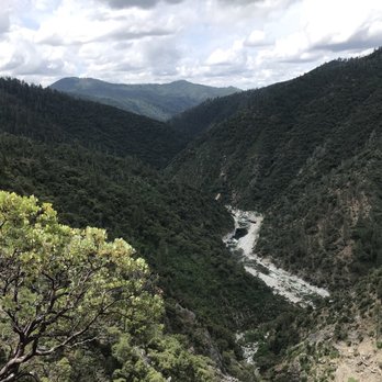
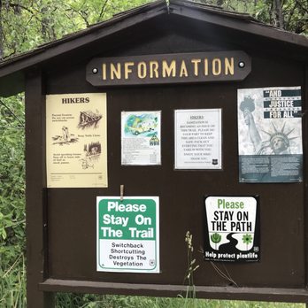


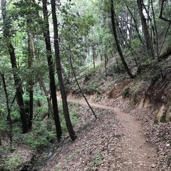


6 years ago
First off, if you cannot have the decency to carry out your trash, don't hike. People leave trash EVERYWHERE on this trail. Literally, the most trash I've ever seen on a trail. People were leaving trash within hours of places we passed earlier. Unbelievable. Snack wrapper, water bottles and I even saw a dirty diaper. WTF?! Falls are awesome. Totally blew passed the turn for the loop on the way down so it was more of an out and back for us. Approximately 3.41 miles to the falls. Didn't have a problem with bugs but bring bug spray. read more


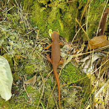

For those of y'all who know me well, you're probably aware of my extreme risk-aversion. If there's any chance of danger, no matter how big or small, my anxiety alarm will flash and I'll be like NOPE! So you may find it surprising that there have been a couple instances where the stupid region of my frontal cortex has taken over and put me in precarious situations. Not coincidentally, most have involved hiking. Most recently, my friends and I made plans to visit Feather Falls in the Plumas National Forest. If you haven't been living under a rock, you'll know that the tragic Carr and Mendocino Complex Fires have been ravaging NorCal - pretty much ~100-200 miles from where our trail was. Despite guaranteed exposure to ash and thick air, we went anyway; because this was considered one of the tallest and most beautiful waterfalls in the U.S., we weren't about to pass. Getting to the parking lot wasn't all that bad for us. The trailhead was about an hour or so from where we stayed in Marysville, and all we pretty much had to do was drive dead east and follow signs for Feather Falls. Since most people stayed indoors due to the fires, we encountered very minimal traffic on the way there. Once we arrived at the gigantic parking lot, we braced ourselves for the arduous adventure that was about to come. Oh yea, and we made sure to avoid the vault toilets. Looked and SMELLED like they hadn't been cleaned for months. The trail(s) to Feather Falls consisted of about 4.5 miles of diverse scenery and wildlife. One moment we were crawling through thick brush and another we found ourselves amongst a field of massive trees. There were deer, lots of squirrels, and butterflies as well! About 10 minutes into the hike, our main path split into two trails: Upper (right) and lower (left) trails. We ended up taking the upper one, and overall it was pretty chill. I would say 90 percent of it was flat, and we also saw some pretty cool stuff such as a mini waterfall (not Feather Falls) and Bald Rock Down - essentially Butte County's version of Half Dome! Around 2 hours later, we came across it. I can't even describe in words how magnificent Feather Falls was. I've chased waterfalls all along the Pacific Northwest, seeing beasts such as Multnomah and Metlako Falls, but few have come close to what we encountered. In short, Feather Falls was spectacular. It was taller than anything I've ever seen, the crashing of water on water was deafening, and I felt so spellbound watching the rainbow form at the bottom of the falls. It was awesome that the trail included a walkway and an overlook that was safe, yet provided an amazing view of the waterfall. But it didn't end there. Thanks to some advice from a couple of chill bros, we took a 10-minute detour uphill and reached the actual TOP OF THE WATERFALL. Who knew this was possible? Apparently, lots of hikers come to Feather Falls not knowing that you could be literally NEXT to Feather Falls. All we had to do was head left instead of going back the way we came after leaving the walkway. This path took us to a watering hole which would lead to the start of the waterfall. We probably spent around 1-2 hours here swimming in cold water, eating, and chilling. It was bliss; we pretty much forgot about the hike and the fires during these peaceful moments. As all things must come to an end, so we eventually took the lower trail back. Though it was the same distance, the return journey was DIFFICULT. Kind of regretted going this way because it was mostly uphill. There was more sunlight and plenty of rocks to climb over. So if you're looking for an easier time getting to and from Feather Falls, I suggest taking the upper trail there and back. Or at least, take the upper trail back. Nevertheless, we persevered and eventually made it back to the car. So how much did the fires and the ashen-filled air hinder our trip? Looking back, it was a STUPID mistake. Regardless of how amazing the experience was, I'm pretty sure we lost a few years off of our lives. Though we encountered many hikers along the way, it was pretty difficult to breathe - especially on the way back. Poor air quality or not, if you are planning on checking out this experience I HIGHLY RECOMMEND keeping in mind a few things: First off, bring bug spray and first aid. Lots of inspects bit us, and we tried SO HARD to avoid the poison ivy. "Leaves of 3, let it be." Secondly, bring double the water you need cause you WILL need it. Third, COME EARLY because it got SO HOT later on. Fourth, be very careful in the water at the top of the waterfall, as the current WILL push you off. Since Yelp limits my character count, I'll just end by saying this. If you get the chance, please check out Feather Falls. It's truly one of the coolest things I have ever done. Pictures can only do so much justice; you have to go yourself. I give it an "Omg, I'd travel 2 hours for this" rating. Have fun and prosper, read more





16 years ago
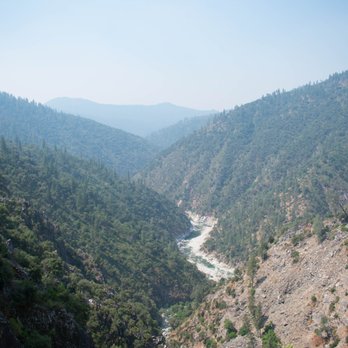
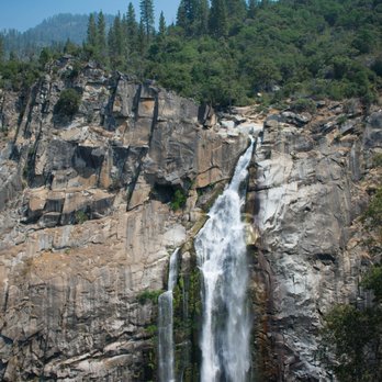
Me, my boyfriend, and our dog started and ended with the lower loop trail, which is about a little over 7 miles total. The lower loop trail is pretty tough, especially during hot weather because it is steep going to and back. My butt is so sore! Don't bring the dog unless he is trained for strenuous exercise! There are also way too many mosquitoes-I got bitten at least 23 times! I would recommend putting some anti-mosquito repellent on, snacks, and if it's a super hot day bring a gallon of water for the dog with ice, plus at least 2 bottles of water for each person. There are no water fountains or sinks either-only bathrooms so make sure to bring lots of water (with ice preferably), otherwise the dog and/or person can get dehydrated really quickly. There are also tons of poison oak everywhere, so be aware of how those look like, and don't touch any plants. Unfortunately, you don't get close enough to the waterfalls to touch it, only to look at it from afar. The hike took us about 4 hours, including stops. Overall, the trail was a really great workout and the fall was spectacular. I most likely won't be coming back because of all the poison oak and mosquito bites I got but it is still a nice fall to see at least once-just make sure you're prepared! read more


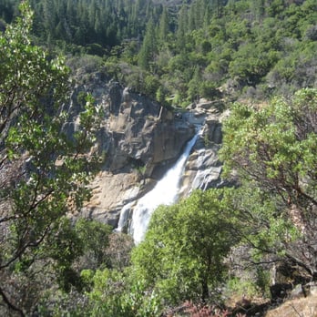
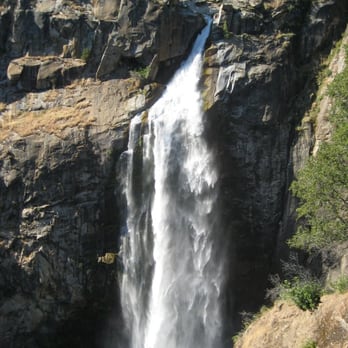

I was really impressed by the powerful falls. Even during the drought (2015 April), I saw a good amount of water. The loop is 9-10 miles total. It is not strenuous, not much elevation gain and shady. However, there are a lot of poison oak. I am very sensitive to them, and I washed my body with tecnue but still got horrible rash. I recommend to wash both body and tools after a hike. Parking lot is big and there is a restroom. Trail is very popular, so you will see some people on a hike, and loop is simple, so unlikely to get lost, however, always better to have a map. read more



8 years ago
Intermediate trail, with a few obstacles that will have to be climbed over or under. Lower loop is level with lots of gentle declines. Do that one first. Coming back that way, those declined turn into muscle burning inclines! There are fabulous cool / cold swimming holes above the falls to cool off in. Lay out on the flat rocks to dry off, before taking the upper loop back to base. Upper loop is about a mile longer, but mostly declining slope. Please take at least 4 bottles of water per person. read more




9 years ago
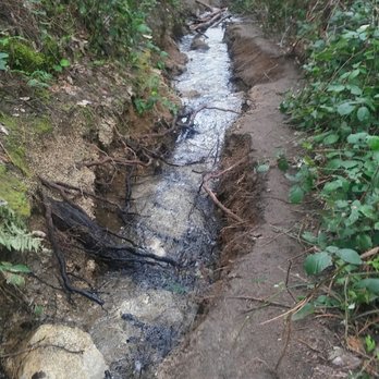
Short: The Feather Falls Trail is a moderately challenging hike to a spectacular ~400 foot waterfall. The tree-covered trail starts at a large/free parking lot (with toilets!) and is about 8 miles long if you do the full loop, which is descends on the way to the falls and is uphill on the return to the parking lot. The upper, flatter portion of the loop is longer (4.5 miles). The lower, steeper portion of the loop is shorter (3.3 miles). The lower portion also has a lot of plant overgrowth and erosion, so hikers are constantly forced to duck under branches, climb over sharp vines, and balance on the eroded/flooded trail. There are also a lot of bugs so bring repellent! The hike took us about four hours total, including a good break at the falls. Long: I drove up to the Feather Falls Trailhead to do this hike a few days ago. Overall, it was a pretty easy drive, although the road eventually becomes thin and windy. The roads that take you to the trailhead have little cell phone service, but the turns to the trailhead were well signed for the last ~11 miles starting on Forbestown Road. The parking lot at the trailhead is large and has free parking. On the Saturday I went, there were probably 7 cars in the lot. The lot had two toilets/restrooms but no running water. We started off on the trail around 10 am. After about 0.25 miles, we met the fork and chose to take the long/upper route to the falls and the short/lower route back. The upper trail was lovely and rolling: a mix of short uphills and downhills with frequent flat portions. The trail was mostly 3-4 feet wide and was only overgrown in a few places towards the falls end of the trail. I really enjoyed this part of the loop, and even though it was longer, I would have hiked it both directions if I had known the disrepair of the lower trail. The upper and lower trails meet at a junction, where a short trail to the falls is also well-signed. This short trail is the most challenging part of the hike because it climbs a steep, sunny, bouldery hill. It then descends the hill's opposite side to the fall's observation deck. The uncovered deck looks directly at the falls on one side and the valley below on the other side. The waterfall is particularly beautiful this year because of the increased rainfall. After returning to the junction, we took the lower part of the loop to get back to the parking lot. This was a mistake. The lower loop trail, especially close to the falls, was in significant disrepair. We climbed through bushes with spiky thorns for a large portion of the relatively flat first mile, so my legs became scratched. This section was also partially eroded out in the center, so we had to straddle the valley in the middle of the trail or jump from side to side when the trail was too narrow on one side. Later on, the trail also had fallen out one side and and had a small creek running down it. The last couple miles back to the parking lot were pretty uphill. As someone who doesn't really exercise much, this section were pretty challenging for me, especially on a 95 degree day. One of the best features of this hike is that it is almost completely covered by trees. With the exception of the deck and a portion of the of trail after the junction of the upper and lower loops, only about 10% of the trail had portions of direct sun exposure. This trail was also great because it had lots of benches, where I could sit and take a break. The benches would also be good if you just wanted a quiet place to read or meditate. The trail also has a lot of informative plaques with descriptions of things you might see: Bald Rock Dome, poison oak, ticks/bugs, and creeks. We saw many different plants and animals. I really enjoyed the canopy of trees because it is really beautiful to look up to see the light coming through and reflecting off the leaves. There were also plenty of cute little wildflowers. The thorny bushes that we climbed through on the lower trail and the poison oak on the upper trail were less cute. As for animals, we saw tons of lizards and two snakes (1 garter and 1 other). Sadly, we also saw a dead baby deer. Mosquitoes were a problem on this hike. Although I covered myself in insect repellent before the hike, I ended up with 5 mosquito bites. There were also a lot of bugs that enjoy buzzing around ears (but they don't really hurt you). There were also ladybugs in one particular area: we crossed some stream on the lower loop, and there were hundreds on the ground below us. I had never seen something like that, and it was very cool. Overall, I really enjoyed the hike: the upper loop was pretty easy, and the falls were really beautiful. If I went back, I would probably change three things: 1) I would probably hike the upper portion of the loop both ways since I don't enjoy climbing through a mile of bushes, 2) I would choose a cooler day, and 3) I would re-apply insect repellent and apply it to my clothing. read more

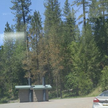
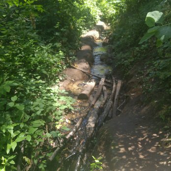

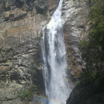

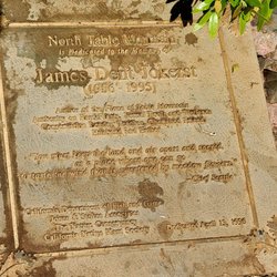
Just finished this hike this morning and boy, what a day. Initially, I was very excited but noticed a very vacant parking lot. The last challenging hike that I experienced was Muir Woods and it was packed! I was surprised to see this one nearly empty... so be extra alert and careful!! There is no signal, if something happens, it is mostly likely GG. Start sending invites for your funeral... jk. Haha Anyways, my first note is to AVOID making a pit stop at the restrooms that are provided in the parking lot. It is literally like a porta potty in a tiny garage. The smell was extremely rancid and my friend who checked the toilets said it was splattered with feces. NO THANKS. Luckily, we had a backup plan which was to bring wipes/toilet paper in case we needed to release in the bushes.. which we did instead. (Shhh, don't tell nobody of our savagery) Before the entrance sign, there was a memorial for some Caucasian male... it was not very welcoming to see that someone had passed on this trail but the scenery after that was quite nice. Second, YES, please bring insect repellent. My group bought the "DEEP FOREST" OFF BRAND, I made sure that I sprayed a generous amount on my skin and clothes. None of my group ended up with bug bites but you will encounter many gnats coming at you, especially in big groups like they're having some sort of orgy in your face. DO NOT wear shorts on this hike btw!! Third, there are two routes! We started off with the shorter 3.3 MI route to the waterfall and 4.4 MI back. Yes, 3.3 MI does have obstacles of narrow, eroded roads and plants stabbing at you. However, I would say it has the most shade for those who find the heat unbearable. This will be where you will encounter the most bugs coming at your face, but nothing too life endangering besides losing your balance trying to pass all the erosion. The 4.4 MI is easier but the alternating uphill/downhill was killing my legs. It also did not help that my group did not bring enough water so we were just forcing ourselves to finish half way towards the end. So bring at least 3-5 waters each!! This place is also super humid as it was about 100 degrees; it was more of 40 percent shade and 60 sun exposure. We also encountered a rattle snake that was clearly in offense mode a quarter way in; so be warned! We had to stop and try to lead it further away from us so we can continue our hike. I wish I could say I saw other fascinating wild life but I did not besides spiders, gnats and an angry snake. Overall, I felt pretty accomplished and relieved when it was finally finished. The environment was pretty serene and quiet. The waterfall was beautiful but you are better off seeing pictures or videos at home because you cannot even be near it. Also the balcony was directly in the suns' view so the heat was not worth it. I wish they would put up a giant umbrella or something so people can have shade when they are enjoying the view of the falls. Would I do this again??? Hell nah... I would go to the BAY for hikes for the cooler breeze. Maybe if we were more prepared with abundance of water and nicer weather it would've been a breeze. 4 stars for the potential. If you're up for adventure, hate crowds and don't mind whatever I stated. Go for it!! read more


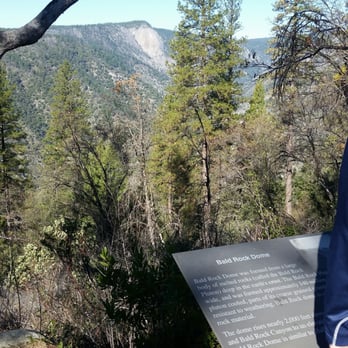
We have been progressively getting more and more into hiking as a family. This past Sunday was Superbowl weekend, and as I am not a fan of football (hold the boos), we decided to take advantage of the nice weather and what was most likely going to be an empty trail. This was my biggest hike yet. We went to Alamere Falls (8.5 mile hike) about a moth prior and I was exhausted all the next day. Since then I have been training (spin 3x per week, strength training) and felt like I was ready for this longer hike (~10 miles). Man am I glad I went to those spin classes! This place is GORGEOUS! Especially with all of the recent rain. But that trail definitely makes you work for it. On the way in we did the 4.5 mile slight grade trail, and on the way back did the steeper 3.3 mile section of the loop. WOO! Those last couple miles of uphill were KILLER! But the level of personal accomplishment I feel is totally worth it! All that aside, the trail and the falls are just breathtaking. The pictures of the falls really do not do it justice. Sitting on the overlook and peering over the edge, you really feel very small in the universe. It is truly awe-inspiring. And along the way all of the mini waterfalls and creeks are so picturesque. And the ladybugs! Ladybugs everywhere by the bridge! Final verdict - DO IT! Just know that if you are not in peak physical condition it will be challenging. Bring plenty of water, snacks, and sunscreen, and make sure your foam roller and Epsom salts are ready for the next day! Happy hiking! read more




9 years ago
You can watch our hike to Feather Fall YouTube video here - Go to link: https://youtu.be/LPyNEkOa6Wo Feather Falls is one of the most beautiful water falls and tallest fall in the United Stats located in Northern California. It's a 9 mile hike round trip, but it can be challenging for some. Overall it's a beautiful hike and one that you should add on your hiking bucket list. read more

12 years ago
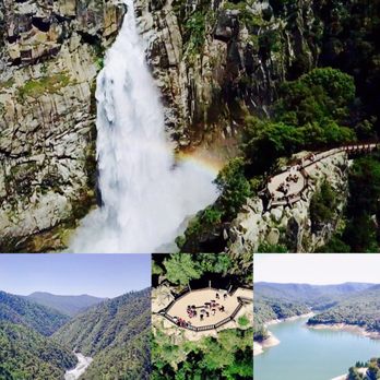
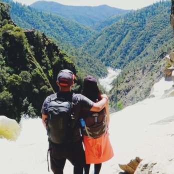
Awesome dog-friendly hike, totally worth the 10 miles to see the breathtaking waterfall! I was surprised to see it's in full force right now (January). Came on Friday and was the only one in the large parking lot at start and finish. A couple picnic areas, bear proof trash bins, and a building housing 2 pit toilets with lots of TP are at the trail head. No sinks or water. You'll hike about 1/2 mi in before you see the split-off for the Upper and Lower trail. Map is deceiving- it looks like it starts from the beginning. I took the Upper trail at start (almost all downhill) which was very easy but long, and the lower trail back. Lower trail back was mostly downhill and then uphill the last 1.5mi or so. It was tiring but not as strenuous as I expected. Following the loop this way will yield the least overall uphill hiking because if you take the lower loop to the falls, towards the end it has a lot of steep uphill. Although the Upper is more gradual, it's a lot of uphill back and longer. The Upper trail also has views of Bald Rock Dome (lower trail was too foggy to see), a few nice bridges and a mini "falls" where you cross a bridge and see the Frey Creek sign. You'll hike down into the valley and then up a bit to the top where there are views of the valley and tree line. You will come to an unmarked split in the trail, down is the Lower trail and if you continue up you'll reach an outlook of Middle Fork Feather River and then you'll hike down onto the Falls viewing platform. Great place to take a break with incredible views. If you hike back up where the "viewing area" sign is, you can take the trail behind if to the actual top of the falls (it's about an extra mile there and back). It's a little tricky to find the top because most of the trails take you to pools at the top. You need to go left where it splits to get to the top. There are newts and frogs here and lots of algae which makes it very slippery. You have to cross the top of the stream that feeds into the falls to get to the edge and it's very dangerous. It's nearly impossible to get to the "cage" at the very edge so I wouldn't recommend it. I don't think it's meant to get to. You're only a few feet from the drop on slippery, highly sloped 5ft boulders so it's dangerous and tricky to get there. Stick to the top of the boulders to get your pics-still a great view. Hiking back along the lower loop was not as scenic as the upper, but I was happy to shave off a mile and just get back. There's a nice bridge, some streams along the trails, and lots of newts, so watch your step. The end is uphill, but not too bad. Entire hike was 10.5 miles and took us almost 5 hours (but we took a lunch break and stopped for a lot of pictures). Overall, highly recommended! The Falls were probably the most incredible thing I've seen in my life so far. read more



9 years ago
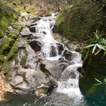
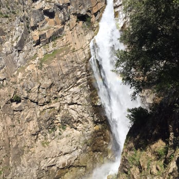
A lot of beautiful sights and sounds to take in! I didn't thoroughly read the reviews so I did not know that there was a way to the top of the Falls so I missed out on that part. Nevertheless, you will enjoy this trail in all of it's mossy glory! It is easy to miss the trail that leads up to the falls overlook but look for pink ribbon wrapped around tree branches and it will lead you up the rocky path (check pics). We took the Lower Falls Trail going back and it had A LOT of incline. Be careful not to step on newts (or salamanders?) and slugs! Also, we had 0 reception as our drive got closer to the trailhead so we definitely had none during the hike. Print out driving directions just in case. read more




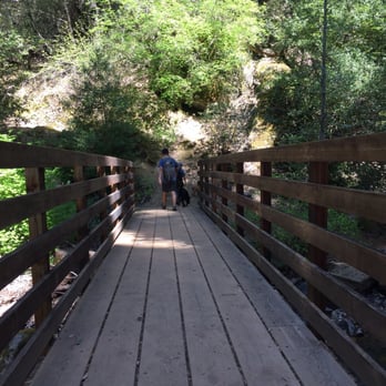
Great outdoor cardio session! Dog friendly !We got here around 11 am and finished around 3:30 pm . Started up the hill on the shorter lower loop and took the longer upper loop back down . We stopped at the waterfalls look out and ate lunch and took photos for about 30 minutes. Truly a decent moderately challenging hike . The lower loop has more stepper inclines then the upper loop . Tons of poison oak !! Be aware ! LOts of shade along the trails , less shade at the top of course .Make sure you are prepared water !! You will need it ! Two toilets in the parking lot , but they are not kept up , no toilet paper and not that clean. Had a great time here . Kind of a long and winding drive up the the trails but worth it . Over 9 miles around trip on foot . I feel accomplished :) read more








7 years ago
Absolutely stunning views of a very active waterfall in the month of April! The longer route is less strenuous and the shorter hike gets a bit narrow but all worth the climb! You will have the choice of either route at the beginning and on the way back from the overlook platform! The platform has a long bench perfect for lunch with a view of the falls and river! This hike is mostly shaded by trees and stayed at a comfortable temperature in April. The parking is free and spacious which is a plus! read more


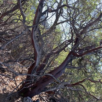


This is a beautiful hike that isn't as crowded as a lot of other waterfall hikes such as alamere falls in Marin. Take the upper route as it's the easiest compared to the lower route which is shorter yet steeper. Go past the lookout view and you can get all the way to the falls. The view from the top of the falls is even more amazing! read more


7 years ago
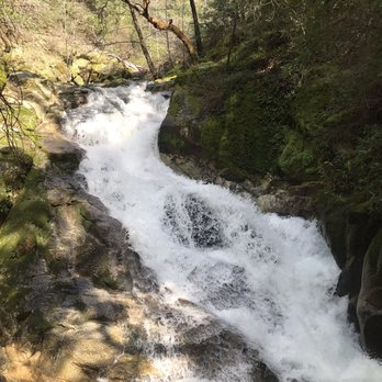
Go now! The falls are raging and beautiful. Take the lower trail there (even though it's a little washed out) and upper trail to return. It's beautiful. read more


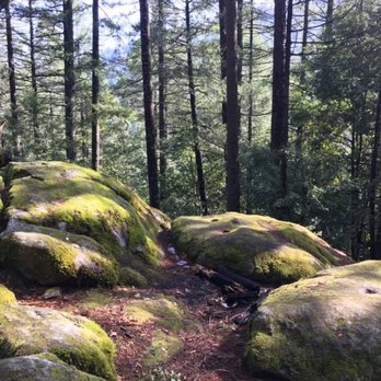

5 years ago

So beautiful! Really glad we did it. It was an awesome hike, however travelers be wary because the hike back is much more strenuous than the hike there! Most of the way back is uphill, and pretty steep uphills too. There are a lot of benches along the way for you to stop and rest which is nice. Also, there are no places to stop on your drive there for snacks or water so make sure to pack plenty! 4/5 rating simply for the tough hike back. read more


Surprisingly well maintained trail! The main attraction on this trail is of course Feather Falls, the sixth highest waterfall in America. There's a strenuous 3.3 mile trail to the falls or a more gradual 4.5 mile trail. I'd recommend taking the 4.5 mile trail to the falls because it's a bit more scenic, and the 3.3 mile out when you "just want to get home." The 3.3 mile trail has some spots where you can dip into the creek and play around in the water (look for red salamanders!) and watch out for snakes on the trail! (we saw an imposter coral snake; remember: red touches yellow, you're a dead fellow -- red touches black, you're OK jack). This trail does not have water or bathrooms along the way so plan accordingly. You are rewarded with a fantastic observation deck directly in front of the falls though! Follow Lumpkin Road out and you can't miss the trailhead. Check http://fs.usda.gov/Internet/FSE_DOCUMENTS/fsm9_034836.pdf for more information about this fantastic trail! read more


9 years ago
Camped at Lake Oroville SRA, 8/10-8/13, and took the 23 mile drive up to the trail head, first thing in the morning on 8/11 (after brekky of course). If you leave the SRA campground and turn right onto the main road, take the first left and you'll see the Feather Falls signage. Keep going and Follow the street signs and pay attention because it's easy to miss the turnoffs. Ask the park rangers for sights feather falls info page and it gives you the info you need to find the trailhead. Anyways, Got up to the trailhead by 6:40am and we were the first ones in the parking lot. FYI: There are bathrooms, but I wouldn't recommend using it. Based off Yelp reviews and all trail reviews, opted to take the upper trail back and forth, instead of the complete loop. It was a 4.5 mile trek each way, pretty moderate hike, with inclines and dips, and fallen trees across the path. Most of the trail is shaded by trees, but on sunny and warm days, like when I went last Friday, the spots where the sun came through warmed us all up very quick! Some parts of the trail are overgrown, and these sections are mostly thickened by blackberry bushes. But...still be careful, there's tons of poison oak! We were able to make it to the overlook within 2 hours and the view was amazing! I'm not afraid of heights, but you have to climb down wooden steps and across a wooden path to get to the overlook. It is a little nerve wrecking, but the views are worth it. At the overlook, There are squirrels that appear to have no fear of humans, or they are used to human interaction or used to being fed, because they kept approaching us. Don't feed the wildlife!! We opted to not do the additional trail up to the top of the falls, as we had to prep for lunch. But if you do, look out for the pink ribbons, that's the indicator that you are heading the right way and I hear there are some spectacular swimming holes!! The hike back seemed to be quicker, and by the time we got back to the parking lot, people were just pulling into the lot. Go early and you'll miss the summer heat, you won't have to share the trail either. The overlook is yours for all your photo capture desires. Enjoy it. Bring Water, snacks, sunblock and big repellant and a hat! Also, let folks know where you're heading...there's NO cell reception on the trail. read more


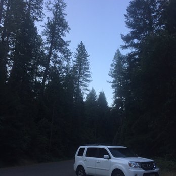


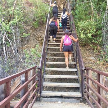

9 years ago

15 years ago

11 years ago

12 years ago
This was truly a fun trail to hike. Make sure you go for a run a day or two before this hike if you haven't done much exercise before this trail hike. Trust me, you will need that bit of endurance strengthening. It's not too hard of a trail, however it's a lot of up and down. Going to the falls it's mostly going down, with some walking up the hills closer to the falls. Make sure you save enough strength for your return trip because it's mostly hiking upwards :-O. It burned going back, but it felt good after we arrived back to our car. I would recommend bringing water, food for a small picnic, duck tape because it always comes handy, flash light, sharp knife, good hiking shoes as they will see lots of rocks, and your game on. Have fun! P.S. Driving directions: It's going to seem like you're driving forever to the turn for the falls off of Lepkin Rd. Just keep looking to your left for a sign that says Father Falls Scenic Area, or something very close to that if my memory serves me right. Look left if you are coming from Forbestown Road. If you're coming from the other direction, then it will be on your right. Cheers! read more


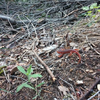

9 years ago
Hiked on May 28th. Great hike. Took right hand side of loop in and came out from left side(steeper side). Hike was Beautiful. Lots of flowers on the upper trail on way out to falls. Trail is about 70% shady for whole loop but it got pretty hot even though it was only around 90 that day. The water is absolutely crashing over the top of the cliff!! and The observation deck is fabulous . Also we added in the extra jaunt up to the top of the waterfall which is maybe an extra half mile in total. And if you do go up there I would stay away from the water and be careful. (Someone just went over the edge last week) - my app picked up 9.75 miles and about 1400 feet elev gain and loss. We were gone about 4.5hours with a short lunch stop. Great hike for Sacramento folks to get to. About 2 hours to trail head. read more


12 years ago
It was the perfect day to hike! The trail was not crowded, like I'd imagine summer would be! I totally suggest you take the trail that leads to the top of the waterfall! The view from the top is breathtaking! The lower trail is easy on the way up, but strenuous on the way back! I def recommend this hike on a fall day :) read more


12 years ago
Good hike!! I recommend taking the 3.3 hike down and the 4.5 mile up. You should be in moderate shape as it is a challenge but very doable. Took about 3.5 hrs for us but we walk fast. Must bring OFF and H2O. read more


8 years ago
Definitely recommend doing this hike around this time of year! There are two signs when you reach the top of the loop pointing the direction of the falls. You can't miss it unless you're literally not looking up the entire time you're walking. We took the upper trail the way there, and the lower the way back. The lower trail is absolutely not flat and is mostly all uphill incline on the walk back to the parking lot. Seeing the falls was absolutely worth the hike. No bugs, but a lot of ticks on our dog. read more


11 years ago
What a great hike!!! Both ways have their ups and downs but at the end you must go up to see the beautiful waterfall! This hike never gets old, between the people you meet, the ladybugs, and the salamanders, it's always great! The views are amazing as you get close to the end capped off by the gorgeous view of the valley and Feather Falls. read more


11 years ago

8 years ago

10 years ago
Great hike, with breathtaking waterfall at end. Lots of poison oak, bring plenty of water. read more




9 years ago

16 years ago

14 years ago

13 years ago

9 years ago

13 years ago

11 years ago
Page 1 of 2
More info about Feather Falls Trail
Oroville, CA 95966
Directions
(530) 534-6500
Call Now
Visit Website
https://www.fs.usda.gov/r05/plumas/recreation/feather-falls-trailhead-campground
Hours
Indoor Amenities
Outdoor Amenities
Ask the Community - Feather Falls Trail
Review Highlights - Feather Falls Trail


















Why does Yelp recommend reviews?
2 reviews that are not currently recommended
The reviews below are not factored into the business's overall star rating.

13 years ago

11 years ago
Feather Falls Trail - hiking - Updated August 2026
Best of Oroville
People found Feather Falls Trail by searching for…
Swimming Holes in Oroville, CA
Hiking Trails With Waterfalls in Oroville, CA
River Swimming in Oroville, CA
Walking Trails in Oroville, CA
Mountain Bike Trails in Oroville, CA
Off Road Trails in Oroville, CA
Dog Friendly Hiking Trails in Oroville, CA
Parks for Kids in Oroville, CA
Scenic Overlook in Oroville, CA
Swimming Lakes in Oroville, CA
Trending Searches in Oroville, CA
Barbershop For Men near Feather Falls Trail
Bike Shop near Feather Falls Trail
Casinos near Feather Falls Trail
Cliff Jumping near Feather Falls Trail
Consignment Shops near Feather Falls Trail
Dog Friendly Things To Do near Feather Falls Trail
Ear Piercing near Feather Falls Trail
Elementary Schools near Feather Falls Trail
Eyebrow Threading near Feather Falls Trail
Flower Fields near Feather Falls Trail
Hair Braiding near Feather Falls Trail
Kids Haircut near Feather Falls Trail
Lakes near Feather Falls Trail
Parks near Feather Falls Trail
Pedicure near Feather Falls Trail
Picnic Areas near Feather Falls Trail
Public Golf Courses near Feather Falls Trail
Public Pools near Feather Falls Trail
Rock Quarry near Feather Falls Trail
Running Trails near Feather Falls Trail
Scenic Overlook near Feather Falls Trail
Sunrise View near Feather Falls Trail
Swimming Holes near Feather Falls Trail
Trading Card Shops near Feather Falls Trail
Browse Articles
Browse Brands
Related Searches in Oroville, CA
Affordable Kayak Rental Services in Oroville, California
Best Dog Hiking Trails Around Oroville, California
Best Fishing Locations and Guides in Oroville, California
Best Nature Trails for Hiking in Oroville, California
Best Places for Horseback Riding in Oroville, California
Best Waterfalls and Swimming Holes in Oroville, California
Check Out Off Road Trails in Oroville, California
Discover Dog Friendly Trails to Explore in Oroville, California
Discover Kid Friendly Hiking Trails in Oroville, California
Discover Popular Bike Trails in Oroville, California
Discover Scenic Mountain Bike Trails Near Oroville, California
Discover a Hiking Trail in Oroville, California
Discover the Best Night Hike Trails in Oroville, California
Dog-Friendly Hikes With Dogs in Oroville, California
Enjoy Camping Adventures Around Oroville, California
Enjoy Off Leash Dog Hikes in Oroville, California
Enjoy Tent Camping Spots Around Oroville, California
Enjoy the Best Walking Trails in Oroville, California
Explore Beautiful Parks and Green Spaces in Oroville, California
Explore Easy Hikes Perfect for All in Oroville, California
Explore Fun Activities to Do in Oroville, California
Explore Popular Campgrounds Near Oroville, California
Explore Top Dog Parks in Oroville, California Near You
Explore Top Water Parks in Oroville, California Today
Explore the Best Beach Spots in Oroville, California
Explore the Best Swimming Holes Around Oroville, California
Family Friendly Hiking With Kids in Oroville, California
Find Popular Ziplining Spots Around Oroville, California
Find Top Dog Friendly Parks to Visit in Oroville, California
Find the Best Playgrounds to Visit in Oroville, California
Hiking Trails With Waterfalls in Oroville, California
Off Leash Dog Hiking Trails in Oroville, California
Picnic Areas With BBQ Pits Available in Oroville, California
Plan a Scenic Drive Route Near Oroville, California
Popular Fishing Spots to Explore in Oroville, California
Popular Outdoor Activities to Try in Oroville, California
Popular Picnic Spots to Visit in Oroville, California
Safe River Swimming Areas in Oroville, California
Safe and Fun Parks for Kids in Oroville, California
Top Dog Friendly Things to Do in Oroville, California
Top Hiking Trails to Explore in Oroville, California
Top Playgrounds for Kids to Enjoy in Oroville, California
Top Running Trails to Explore in Oroville, California
Top Swimming Lakes to Enjoy in Oroville, California
Top Swimming Spots and Pools in Oroville, California




