Four Mile Trail Photos


More like Four Mile Trail
Recommended Reviews - Four Mile Trail
Start your review...


Reviews With Photos
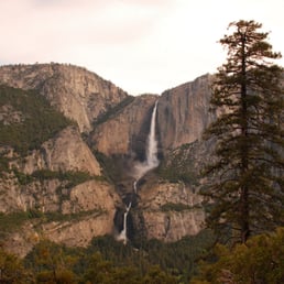

Date of hike: 5.31.2011 If the whole trail up to Glacier Point was open I'd give it 4 stars but sadly it was not. The sign said the trail was closed at 3.5 miles (http://www.yelp.com/biz_photos/whtFIcY-4aK890kB-DSMdA?select=Jn8hS_R6YgmlCPqa9p-kBA) but that was a lie! My Garmin had it around 2.5 miles. We were very bummed because it was a waste of a morning. We could have hiked somewhere else. The trail isn't as strenuous as the Yosemite Falls hike (http://www.yelp.com/biz/yosemite-falls-mariposa#hrid:TF67bHthxnOGyFw1bK2VsA/src:self) but you are still constantly at an incline. However the trail is just never ending switchbacks so the scenery around you gets monotonous. Don't bother hiking this trail if it's not open all the way to Glacier Point.


This trail is not easy!! Bring lots of water, good hiking shoes and some snacks. There is no shuttle at the top or bottom, of you go to the top you will have to hike all the way back down or maybe get a ride. The trail has lots of great views but it is very steep in places and can be very challenging in places.


A 5-star hike if you're able to go one way from the Valley floor to Glacier Point. I don't think I'd ever want to weather several hours going down switchbacks - my knees hate me enough as it is. 4-Mile doesn't get as much lip service as the Mist Trail, Half Dome, or Yosemite Falls, but it offers an escape from the swarms of campers and is full of gorgeous 270-degree views of the Valley, from El Cap to the Falls to Half Dome. It's closer to 5 miles if you're going all the way from parking to the top, and you'll be greeted with water fountains, restrooms, and a shop with food. If you don't get up there too late, shuttles can take you back down to the Valley. The trail still has snow into May, but you'll be so sweaty after hours of climbing that the temperature change will have no effect - I wouldn't even bother dressing in layers if you're going straight up, as you'll have your heart pumping the whole time. WATER and snacks, however, are a must. A 3,000-ft. elevation gain is no time to go on a diet. Also, leave the kids at the site - this is not a training hike for your Jr. Ranger. You'll want a camera and shoes that have good traction - slippery pebbles will exhaust you if you're sloshing up the trail in running shoes or sneakers. Sunscreen and sunglasses are also primo. Have fun and enjoy the view - you're in the best park in the world! :-)


This is a difficult hike even by Yosemite standards. The difficulty lies not in the mileage (which is really like 4.6) but in the steep uphill. If you attempt this trail from the valley, and I highly recommend it, be prepared. Bring plenty of water. There are several ways to hike the Four Mile Trail: 1. Start in the Valley and hike all the way up to the Glacier Point, be prepared to have your breath taken away by the surreal and stunning beauty. Have your picnic with a view then descend the same way that you ascended. 2. Start in the Valley and reach the Glacier Point. Arrange to meet someone at the Glacier Point so that you can give you a ride to come down. I prefer this version in the afternoon/evening because watching the sunset at Glacier Point is the best thing in the world. When you stay up until the stars come out and crowds disperse you will realize that life is worth living. If you do this, bring very warm clothes and preferably a blanket. Once the sun sets, temperature goes down significantly. 3. Get to Glacier Point by a car via Tioga Road. Arrange for someone to take the car back, and you hike down the Four Mile Trail. You get all the benefit of the views but not much of the struggle to attain those views. Preferred for someone who has difficulty hiking uphill or for people who want to brag that they hiked Four Mile Trail but don't want to put in the work. I once overheard someone say that this is how the trail was meant to be hiked, but I vehemently disagree, and I concluded that this person had no idea what they were talking about. Unlike some of the more difficult hikes in Yosemite, the Four Mile Trail is very easy to navigate. The trail itself (mostly switchbacks) is clearly defined. You will not get lost. Great to hike solo. During the busy season the trail can get crowded in places.


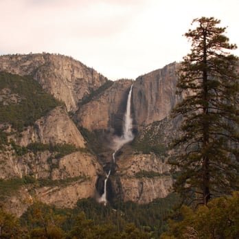
The Four Mile Trail is kind of misleading because it's more like the 4.7 Mile Trail (or 9.4 miles round-trip). I originally thought about parking my car at the Visitors' Center and then taking the shuttle to the trailhead, but the El Capitan shuttle didn't start until 9AM. I didn't want to sit around the Visitors' Center for an hour so I went off on my own. I started from the trail at 8:30, so the temperature was still cool. A series of switchbacks slowly took me above the treeline and lo and behold the great Yosemite Falls was in the distance. It was a pretty sight - too bad I only had my wide angle lens with me so I couldn't zoom in on it. I seared it into my memory instead. Continuing up I eventually reached the trail gate, where the view opened up even more. Now the Half Dome and North Dome, as well as Tenaya Canyon and the Royal Arches were all visible. By then I started to feel a slight fatigue to my calves from the Half Dome hike the day before. But as I was already ~2.7 miles in, it would have been silly to turn back. Onward I went. The last fifth or so of the trail flattens out and leads into the forest before opening back out onto Glacier Point. The crowd factor suddenly jumped from zero to a hundred. Since Glacier Point is accessible by car, a lot of people just drive there. There was also a crew there filming an ad for the state of California. So it was a party up at Glacier Point. There's a shuttle that goes from Glacier Point back to the Four Mile trailhead, but that's $25 a head. Heck no.


I went here on Saturday, 7/28/12. The hike is about 4.6 mi up. It was a nice day to hike. I love the scenic views it offered as my friends and I hiked up. A lot of switch backs though and it's a bit gravelly, so wear comfortable shoes. The hike up took 4.5 hours. It took us longer than expected because we took several stops (resting, eating, taking pictures, etc.). If we didn't stop so much, it would probably take about 3.5-4 hours which is how long it's supposed to be. We started at 1:30 pm (pretty late) and we reached Glacier Point at 6pm. The higher you hike, the harder it will be. There's a point where you'll see an awesome view of Half Dome and the path becomes narrow, so be careful! Once you reach the top, the view is absolutely breathtaking. & there's ice cream when you reach Glacier Point =) Take lots of pictures!! We were planning to hike down on Yosemite Valley Trail (8.0 mi), but we decided not to because we probably wouldn't be back until 12am. We weren't as prepared to hike at night either. The hike down was faster since it was a decline. It took us 1 1/2 hour by speed walking. Be extra careful as you hike down because there's a chance you can slip and fall. This hike was a bit more strenuous compared to other trails (Mission Peak & Castle Rock). Bring lots of water (Camelback preferably) & snacks!


To start, this trail is actually 4.6 - 4.8 miles (there are a couple of smaller side paths to vista points) plus another little bit to the actual Glacier Point Overlook, so it should really be called the Five Mile Trail! In 2010, my wife and I saw someone coming up from this trail and commented on how crazy you would have to be to hike to the top of Glacier Point. That was before we realized how much we love hiking! There is an awesome satisfaction to look down from the top, surrounded by gobs of people who drove, and know that you climbed up this impressive 3200 feet from the Valley floor. There is parking right at the trail head, which along the right side of the road driving east through the valley, just before the Swinging Bridge. The trail itself is entirely uphill, and mostly composed of switchbacks. But there is still plenty to see along the way as a lot of it is on the edge of the mountain and not enclosed by trees. There are a few awesome "reverse Tunnel View" shots, as well as a full view of Upper Yosemite Falls staring right at you from across the Valley, that is, if the there is any water flowing. There is a very good chance you will have to cross some snow/ice patches near the top, so be careful not to slip and go flying over the edge. It is not as steep as the Upper Yosemite Trail, but it goes 1000 feet higher to Glacier Point. A lot of people will take the shuttle to the top and just hike down this trail, (or do the opposite, which seems pointless to me) But you could also come up this trail and then go back down to the Valley on one of the other trails departing from Glacier Point such as the Panorama Trail (8.2 miles down to the valley floor, plus 3 miles back to the 4 Mile trail head. - connects to the John Muir Trail after 4 miles near Nevada Falls and comes out near Happy Isles.) for a full day adventure which covers most every major landmark in Yosemite. We will definitely do this again, but only in the Spring when the waterfalls are flowing.


I love love love this hike. Actually I love all of the Yosemite hikes, but this one has a great effort/reward ratio. Others have described the 4.8-ish mile trail length and the 3200-ft elevation gain. It took our group of 4 about 2.25 hours to walk up from the trail head to Glacier Point at a chatting pace. I would rate this as a pretty hard hike in that you are walking up for about 5 miles. But the trail itself is smooth and easy--you don't find the tricky footing (gravel-over-granite) that defines the Upper Yosemite Falls Trail, for example. This is way (way) easier than, say, the hike up to Half Dome (which is steeper and wetter, at least in parts). I have hiked this both ways, but my preference is to hike up, have someone else drive up, and then all drive down. Or two people can drive up, you exchange hugs and keys, then they walk down. It's not a loop, so the scenery is the same both ways :-) And oh my goodness, the views are just spectacular. You start out across the valley from Yosemite Falls, so as you climb you see Lower Yosemite Falls, then both Upper and Lower. In a wet year like this one (2016), the falls are amazing. Then you get to Glacier Point and see the whole valley. If you are reasonably physically fit (our age range was 15 yo to 62 yo; I think my kids did this at 11 yo), you should really hike this trail. Start early for cool shade up most of the way. Bring water (but know that snacks await above). It was a fleece on/fleece off hike for us (sun/sheltered + cool breezes) and even mid-June I wore light gloves at the start (but I hate cold fingers; gloves are not needed).


This should be called a 10 mile trail !!!! we took trail from Glacier point down, then up back (no cheating like some people who takes bus from top and climbs down), the hike is more like 5 mile down, 5 mile up ... excellent views of the surrounding valley, half dome, and others - took us about 5 hours round-trip with plenty of photo shoots and selfies (probably 3.5 hours if we didn't do so many stops for photos) Semi Advanced Hiker but for some reason out of excitement I didn't verify when my wife told me it was a 4.6 mile hike (we ate only little fruits for breakfast), I though it was 4.6 round-trip!!! lol I only brought a e-Gel, couple of chocolates, dried ice cream and 40 oz of water for 2 (my personal normal intake for H2O for hikes like this are 50-80 oz - my bad though)...we made it but barely (thanks to e-gel I didn't cramp up) if you sweat much, you might need less water some parts of the trail are windy/cold (so bring light sweater or jacket if you're the cold type person) People are friendly on this trail, everyone are joyful, even the tired ones!!! felt bad an old guy was almost out of water, i usually offer (well i usually take over 150-200 oz of water just in case someone needs it, but like i said i was excited wasn't paying attention - hey hope you made it though!)


Overall, the hike has stunning views of Yosemite's finest elements including half dome and Yosemite falls. The trail itself is very strenuous with a lot of switch backs to ascend. Some portions have loose gravel and can make for an uneasy climb at times. In more detail, we began our climb at 8am at the base of the four mile trail. The weather was very mild with temps in the mid 80s and a slight breeze. We made a few stops on our way up for much needed water breaks. We got to the top of glacier point around 1030am. Here you are met with an onslaught of tourists. The views were spectacular but I was not fond of all the people. We had the option to take a shuttle back down to the valley for 25$ a person which at the time sounded crazy. We decided to descend the trial which proved very difficult. The sometime steep sloops combined with loose gravel made for a very slippery path in some parts. We descended in the same amount of time due to how careful we had to be. If I was to do it again I'd get the shuttle to bring me back down into the valley from a pure safety perspective


I LOVE THIS HIKE! IT is challenging for the kids and the view is amazing almost every step of the way. Granted you can also take a shuttle, but where is the adventure in that?! This is my favorite hike in Yosemite if we are just going up for the day with the kids. The last time I did this hike was April 13th, 2013. We left SSF early in the morning, and got into Yosemite Valley just after 7:30am. Just to give you an idea of who "we" are: It was my husband, our two girls age 3.5yo and 1.5yo, my brother, and his daughter, age 8, and ME of course! and to give you an idea of out mindset: we are some what of weekend warriors, meaning we don't get to exercise all that often, but aren't intimidated by a challenge. if you look at the other reviews I believe that the trail is about 4.6 miles long, and the elevation is about 3000 feet. the hike had a lot of back twitches so it's good for setting goals (ie lets walk "x" more switchbacks and then take a break) We had a good bite to eat on the valley floor, and then packed sandwiches, trail-mix and drinks for the trip. With kids you can never have too much food :o) My brother and his daughter went on ahead and set a good pace early. my niece is age 8, not terribly active, but kids have energy to burn. They made it quite a way before taking their first break. The first section of the hike is in the shade of the trees, where as the top is more exposed to the elements. so bring hats, and plenty of water. My husband and our girls took a much slower start to the morning. We let our girls walk the first half mile or so at their toddler pace, stopping to say hi to EVERY dog on the path. Then I took my littlest (1.5yo) into the backpack carrier and started walking. Our 3.5 year old walked most of the way up to the 3.5 mile point holding hands with her daddy helped her pace a bit. We stopped for a good bite to eat at about 3.5 miles and then both our girls went into the back packs for a nap. By this time we had caught up to the rest of our group and we walked to the top together. Such a great hike. For some reason it was relatively quiet at the top, which was nice. It can often be very busy up there with shuttles running up and down. I hope you don't feel cheated by this. You should be proud of the accomplishment, and save the shuttle for when you are no longer able to make the hike. The view is sensational any way you get there. We headed back down after about an hour at the top of relaxing in the shade. As mentioned in another review the trail can be slippy going down. There are a few places where the footing is loose. The kids slipped a bit, so we put them back into the carriers and they napped again. win-win. I don't want to give the wrong impression about the trail. It is plenty wide throughout, and if you watch your footing on the few steeper parts you will be fine. ENJOY!!


This hike was soooooo hard!!!lol my knees locked on my way down we hiked all day and all night it was hard!!!! hahah but an experience for sure!!! 12miles later...


8 years ago

12 years ago

12 years ago

9 years ago

11 years ago

10 years ago
This hike is for those who want your calves, quads, and butt on fire the next day. I started at 12pm and was surprised by how much shade we had on the trail. I have to say, it was a tough hike. Lots of switchbacks and you're going up constantly. It was a very warm day so my boyfriend and I brought a gallon of water and it was perfect for the round trip. For moderately fit people in our 20s, It took us 2.75 hours to reach Glacier Point going at a slow and steady pace. Along the trail was beautiful. You get multiple glances of Yosemite falls, half dome, and reverse tunnel view. I enjoyed the last mile before reaching glacier point, the view was absolutely amazing and the trail was relatively flat lol. Going down was not the business. Someone with bad knees will have to take it slow. By 4pm the sun was hitting down the trail so if you plan on hiking this up around this time, be prepared for the heat. If I were to do this hike again, I'd bring a long more friends and have them drive up to glacier point and pick me up! read more


11 years ago
This was a great hike. I did it on 11/09/15 and it snowed almost the entire time, which, being from Southern California, I thought was awesome. The trail is closer to 5 miles than 4 and you'll really feel it the following day unless you're a triathlete. It's not impossible, but the change in elevation does wear on you so bring plenty of water and a snack. Also dress for the weather / season you're in. The temperature can change quickly. The trail is hard to see in the snow so walk carefully. As I said I loved hiking in the snow but I did lose the ability to see some of the scenic views due to the weather. So if the views are a must for you be sure to go on a clear day. Oh, and protect your phone if you take it. On the top at Glacier Point you actually get a very strong cell signal. I decided to call my wife to tell her I was on top of a mountain. She thought that was cool but the amount of snow that fell on and into my phone did damage it. That's on me though. All in all with the snow and taking my time the whole hike took me about 6 hours. It may take you less but count on at least that so you have time to enjoy the trail. I've been on easier hikes but this was one of the most fun hikes I've been on anywhere. Also you burn so many calories you can eat all the desert you want at dinner that night. read more


11 years ago


16 years ago

12 years ago
7 years ago
11 years ago
12 years ago
16 years ago
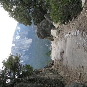
A buddy and I had only a day off from work and came down to Yosemite for the day. We hadn't planned on doing any hiking, but when we stopped to take some photos we saw the sign for Four Mile Trail and decided to hike it. What a blast!!! I want to go back and do it again, especially since we weren't able to make it all the way to Glacier Point due to snow. The hike was a little challenging, especially since we didn't have any food or water, but the views were spectacular. And, if you can believe it, it is paved all the way with asphalt. If you're in OK shape it's well worth the effort and much more rewarding than driving up. There is a sign near the base that gives a brief history of the trail and explains how the trail was originally 4 miles but was modified to reduce some of the steeper parts and is now 4.7 miles. I can't wait to come back and do it again, as well as some of the other trails like upper falls and half dome. read more



Page 2 of 2
More info about Four Mile Trail
Ask the Community - Four Mile Trail
Review Highlights - Four Mile Trail














Why does Yelp recommend reviews?
1 review that is not currently recommended
The reviews below are not factored into the business's overall star rating.

12 years ago
Four Mile Trail - hiking - Updated September 2026
Best of Yosemite
People found Four Mile Trail by searching for…
Hiking Trails With Waterfalls in Yosemite, CA
Dog Friendly Hiking Trails in Yosemite, CA
National Parks in Yosemite, CA
Running Trails in Yosemite, CA
Stairs Workout in Yosemite, CA
Off Road Trails in Yosemite, CA
Natural Hot Springs in Yosemite, CA
Hikes With Dogs in Yosemite, CA
Scenic Overlook in Yosemite, CA
Visitor Centers in Yosemite, CA


