Glacier Point Road Photos


More like Glacier Point Road
Recommended Reviews - Glacier Point Road
Start your review...



4 years ago
i hiked from badger pass ski area to glacier point on 3/28 and posted a vlog on yoütübe including tips and info so you can be prepared! search "Nikko Gandia Travels." wilderness permit issued at badger pass ranger station (200 ft. to the right of main ski lodge) or a-frame. self registration on porch when open. make sure to keep up with the road closure/construction updates! fresh powder so the snowshoes were needed. camped near ostrander rocks. read more
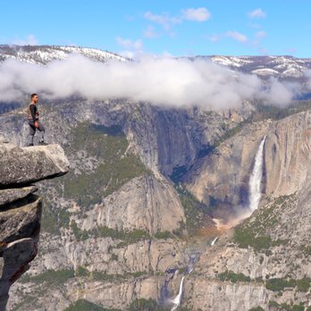


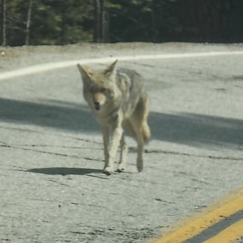
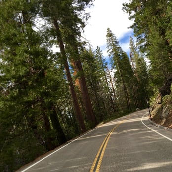
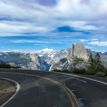
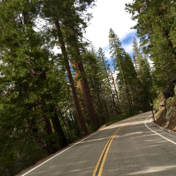
This is the road to some of the most popular attractions in Yosemite Park, but only open half the year, closed in the winter due to snow. We were driving from the Bay Area to Yosemite, 4 hours including a potty break in Mariposa, to Yosemite Valley, and then another hour going by dried up Bridalveil falls, and then the tunnel view, to Glacier Point. Glacier Point Road is some 22 miles long, and intersects Highway 41 between Yosemite Valley and Wawona, on the way to Fresno. It's not only a winding mountain road, but takes you from the 4500 foot elevation of the Yosemite Valley, to 7700 foot Glacier Point. As we go up the road, we pass a sign saying 'road closed 7pm', on Sunday November 1, 2015. No overnight parking allowed after October 15. The first part of the road is relatively straight roadway with 35 mph speed limits, through dense forests on both sides of the road, going up the mountain. Last April when the road opened, we saw a heavy duty construction grader, with chains on all four giant tires, each taller than a man, towing snow removal equipment. Badger Pass skiing resort is here, and once the road is covered with snow, cross country skiers will be able to ski on the road. There are very short turn outs on the sides of the road, for pulling over for faster cars to pass. Inevitably if I drive at the 35 mph speed limit, some guy in a hurry comes on my tail. This time its somebody in a pickup, probably local, as he is the only occupant. I speed up to 50 mph, but he clings right up to me, even when I slow down for a car in front of me. Long distances of solid double lines -no passing. The recently paved smooth asphalt road going uphill reaches a peak, and degrades into cracked surface with potholes and jagged edges. At the 16 mile mark, I pull over to the small parking lot at Sentinel Dome, the tallest location on the road, where we do both the Sentinel Dome and Taft Point hikes in 3 hours. At 4:30 pm we drive down the remaining 6 miles to Glacier Point, to enjoy the sunset. Speed limit drops to 15mph as we go down through some hairpin loops in a darkened forest, when all of a sudden, Half Dome rises on the horizon, prior to Glacier Point. We leave at 5:15 for the 1 hour trip back to Yosemite Valley. This part of the Glacier Point road has a 15mph speed limit, with hairpin 180 degree turns, and steep cross traverse roadways in a deep forest. One guy going way too fast approaches us, going way over the center line on the hairpin turn. We were going real slow, and just missed a head on collision. The road becomes dark, and there is nothing like driving on a dark winding mountain road. Amazingly enough cars are still driving up the road to Glacier Point in the darkness! Full moon at Glacier Point? I'm going the speed limit, when some joker comes up right behind me, lights in my rear view mirror, saying go faster. I'm not about to go 50 mph in a 35 mph zone in the dark. Last April I saw a coyote on the road, and the last thing I want to do is hit a bear or deer at dusk, and damage my car. I pull over at the Sentinel dome parking lot, to let the speedster past. Inevitably another car comes onto my tail, and actually passes me on the road in one of the few straight aways, only to pull over at the next turn out to enjoy the setting sun on the horizon, emitting a purple glow. About half way down the road, another car comes onto my tail,.I find a turnout, and let him pass, and then comes a whole series of cars, all going 10-15 mph over the 35 mph speed limit, like it is the Indianapolis 500! Dusk becomes complete darkness. Fortunately the road has a newly painted center line, and two bike lane solid white lines on the edges of the road. Another car comes onto my tail. but this time, I can't utilize the turn outs, as it is too dark, and I have no way to estimate the length of the turnouts. And there are snow poles on the side of the road, to delineate the roadway when covered with snow. The guy follows me at the speed limit for what seems like half an hour, down to the end of Glacier point road, past the tunnel view, onto the Valley loop, where the road becomes two lanes in one direction. At least he never blew his horn. It's 6:15 pm, on this first day of standard time, and is completely dark, when we arrive at Yosemite Lodge at the Falls, after the hour drive from Glacier Point. The following day, it rains hard the entire day. Glacier Point is closed with snow and ice, at least temporarily, and perhaps for the season, until next April, or June if El Nino materializes. read more



Oh, GPR how I wish I could give you 5 stars. A 17 mile road that takes you to one of the most breathtaking spots on earth. I don't even mind that you close for half the year because of snow! The one star that I must be fair and take away is for the shear fact that driving this road by yourself is AMAZING. With ANYONE else on it, chances are it's going to take you 45 minutes to get 17 miles. I spend MUCH of my time in Yosemite. Last month I was there 4 times because of water levels and the opening of this very road. The road closes every fall after the first significant snow fall. You can check out if the road is open and historical dates it and the 120 over the Tioga Pass has opened here at the official Yosemite Page: https://www.nps.gov/yose/planyourvisit/tiogaopen.htm Since this is specifically my second favorite spot in Yosemite, (Sierra Point is my first)...let me give you a few pro tips for driving up here. If you are coming from the Yosemite Valley floor they say 45 minutes but give yourself an hour. Glacier Point doesn't close ever (unless the road is closed) so this is a great spot for moonless nights when you want to star watch or take pictures of the Milky Way. You are more than welcome to try and drive up the road during the day just keep a couple things in mind. One: EVERYONE wants to go to Glacier Point. This includes people like me who know the road all the way to the people from other countries who have no idea how to drive. Two: It's a pretty big climb in elevation. The Yosemite Valley floor is just over 3000 feet, up at Glacier Point it is 7200 feet...just know it might be a little colder up there then it is down on the Valley floor. Three: DRIVE VERY CAREFULLY. I say this not because YOU are a bad driver, I tell you this because people are stupid. Let me say this one more time. PEOPLE ARE STUPID. There will be a traffic jam for a mile because one car has decided to stop in the middle of the road to take pictures of the cute little bear on the side of the road, all the time while there is 30 cars behind them. Please dont be that person. Pull off the road if you need to. Last but not least, take some food and drinks with you. They have vault toilets at Glacier Point, but the store has limited hours, and this is a SUPURB spot to watch sunrise or sunset from. Just if you stay till when it gets dark, take your time driving down the road. There are cute little animals all around. Don't be that person who kills a bear... In all seriousness its a pretty awesome road and it has one of the best views in the WORLD at the end of it. Now...go out and drive... :0) read more




More info about Glacier Point Road
Yosemite, CA 95389
Directions
Hours
Outdoor Amenities


















Glacier Point Road - parks - Updated August 2026
Best of Yosemite
Browse Nearby
BEST of Yosemite, California Playgrounds near Glacier Point Road
BEST of Yosemite, California Picnic Areas near Glacier Point Road
BEST of Yosemite, California Restaurants near Glacier Point Road
BEST of Yosemite, California Things to Do near Glacier Point Road
BEST of Yosemite, California Coffee near Glacier Point Road
BEST of Yosemite, California Breakfast near Glacier Point Road
BEST of Yosemite, California Campgrounds near Glacier Point Road
BEST of Yosemite, California Gold Panning near Glacier Point Road
BEST of Yosemite, California Sledding near Glacier Point Road


