Goldstrike Hot Springs Photos
You might also consider


More like Goldstrike Hot Springs
Recommended Reviews - Goldstrike Hot Springs
Start your review...


Reviews With Photos


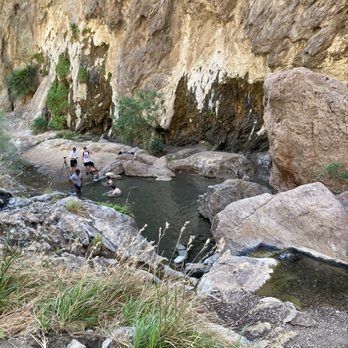
Fun hike with a variety of obstacles and views. You can walk on sand, climb on boulders, get wet in warm water, see the Hoover Dam, and taste the Colorado river all in a 5-6 mile round trip that takes about 3-4 hours of trekking. There are several pools of warm water to dip in. You can also walk out to the river to take advantage of privacy. There's a couple puddles you can chill in while checking out the beautiful mountain view.


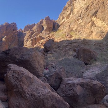
I shouldn't have done this hike, probably. I'm in no shape, and mostly was motivated by the promise of a nice soak in a hot spring. Uh, it's hard. If you're in shape, and hike all the time, ignore this- you'll have a blast and breeze up and down. If you're not- prepare to slide down rocks, get some rope burn, use every single muscle in your body, and maybe get some bruises. We mis-timed it. We left the trailhead at 1:30pm and spent only 20 min in the hot springs at the bottom and still ended up hiking the last couple miles uphill in the dark, which was a scary experience and we almost got lost when we got off the trail. Canyons at night are black pits that look entirely different! Bring headlamps!! Start early!! It was also a TON of fun. I fell and yelped and crawled and slid and laughed my butt off and I have no regrets, just make sure you're in hiking boots and have multiple liters of water. Good luck!


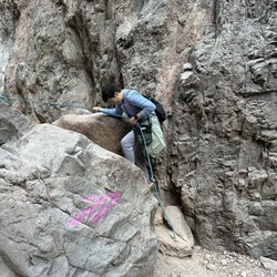
Incredible hike in spectacular terrain! Not for small kids, dogs, elderly. There are a number of spots where you need to use a rope to climb up/down. Start your hike in the morning or early afternoon. You don't want to get caught out there when it gets dark. There's three main hot spring pools at the end of the hike. Trust me when I say this....BRING WATER SHOES to change into for the rocks in the pools and streams. The 1st pool is the warmest, the 3rd at the river is the coldest. Pack lunch and about 32oz of water per person. Good luck!


I came here with a group of 9 and it was an absolute blast. We started with a good pace. I'm afraid of heights so the rappelling was first challenging but then I got used to it. It's really fun and we worked together as a team. Whoever write here it's easy is whether a trained climber or very athletic because this is not a walk in the park for an average person. Once we made it down, which took exactly 2 hours, the pools were awesome. Some groups are naked. People come out here at night to camp too. It gets busy. If you continue down there's another pool with a little bath. The warm waterfalls are great. Also go down to the river. On the left there's a really hot waterfall. River water is cold. Little hike through the water will get you to a hole in the wall in your left which you can easily go up and you will find a gem: dark tunnel with knee deep water. We called it the sauna tunnel. We walked to the end with a flash light in our phones and back. Two of our group came later and missed the hole, not sure how that was even possible it's obvious. Back up it took is hours solely because one of the group was just point blank a pain in the ass: only talk and laugh and complain and acting like she was gonna die climbing back up. If you haven't hiked in decades then don't burden others and don't come on this hike. We also saw a family with 2 toddlers and a new born on flip flops, this is so irresponsible especially none were wearing helmets. Water shoes are recommended. I walked in my sneakers. But for getting to the pools I recommend shoes with grip as it's often slippery and my sneakers didn't do well with that. Also don't bring your dog if you can't carry him on your back or handle the narrow rappelling, we also had to help idiots of that kind. Bring enough water and snack. Lovely way to spend the day especially fall when there's excellent weather and you can enjoy hot pools. Small parking lot and no bathrooms so you rely on the wild:)


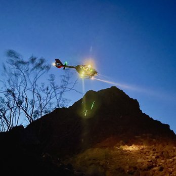
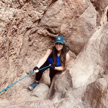
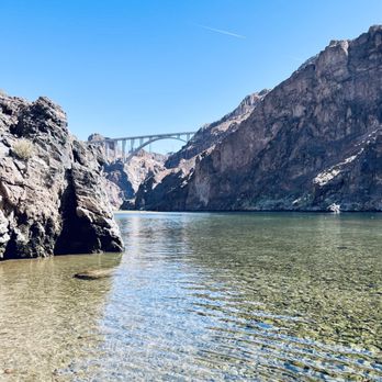
What a beautiful, challenging and rewarding hike this was! I did this hike for the first time this Saturday early am with my cousin. We got there around 7am to start the hike. Thankfully for the hike into the Hot-springs and the Colorado river we had shade. So that made the hike enjoyable. We had to Rappel down 8-9 ropes to get there. You definitely need gloves. I forgot to put my gloves back on to descend one of them and I burned my finger tips. The Rocks are very steep & slippery to rappel down so wear good hiking shoes with a good grip. Also pack water shoes for the Hot-springs and Colorado river. Also bring a bag for your wet shoes and wet cloths for the hike back. We didn't see any garbage cans along this hike so make sure to bring your own bag to dispose your garbage instead of leaving it behind. This canyon is too beautiful to litter. Be kind! Now for the hike back the first hour was fine, but then the rest of the hike back out became full sun and it was in the mid 90's. That heat definitely drained me and made the hike back difficult. Climbing back up those Rocks on the way back with the heat was very exhausting. Please packs lots of water. I went through 4 1/2 water bottles round trip. Toward the end of our hike when we were getting closer to the parking lot the rescue team was there with a canopy set up. When they saw us approaching a women headed down to us and handed us cold water and helped me carry my book bag the rest of the way. I can not say enough how thankful I was too her. If I can give any advice it would be to stay hydrated, be prepared, make sure you have a lots of water, and take your time. I would definitely recommend this hike, but during the cooler temps. I wouldn't do this hike again unless the high is only 75 degrees, but we did it and I'm very proud of both my cousin and I!!!

Pros: Beautiful and varying canyon formations that are very up close and personal, colors and the shadows and glowing sun light against the ridges , very enclosed canyon that has lots of shaded areas creating cooler temps. Hot springs water run down the trail so need to jump or walk throw the warm water. The bouldering was super fun and thank goodness some professionals installed the knots and ropes are very difficult sections, peaceful on non busy weekends. Cons: young punks bringing their portable speakers and thumping their music at the hot pools, worried about seeing some people not prepared for the challenges of the full hike (saw some people entering the trail at 3pm, no backpack of food or water but just a camera bag, bringing dogs) Visited in the fall and the pools are natural and the earlier pools are the hottest and the longest one at the very end isn't too hot , just like warm. If you're thinking of soaking tired feet , it's better to do it at one of the earlier pools like 3rd or 4th. You won't be able to submerge past your hips in the earlier pools but the final one is usually more crowded AND it maybe just warm temp. Without bringing gloves, it would be 40% harder to scale the ledges and control the rope climbs. The best hike I've been on in the Vegas Nevada area. 6 & 7 year old girls were there, they been there before with their very experienced parents (locals) and had good shoes. If you have the will , skill, strength and endurance to return, you'll be fine. Many women had issues and delays on the rocks and rope climbs due to lack of arm, shoulder, and muscle strength. Lots of gym ladies in their yoga pants were extra slow because lack of coordination with hands and grappling experience. Kids and teens should do fine as long as they are positive and done hikes before. You will be on your belly crawling through dusty sharp rocks.


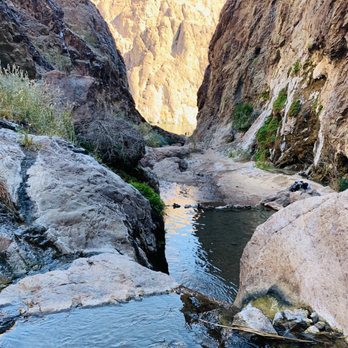
Lovely views. Steaming hot water in three separate locations. 10-20ft. rope climbs with ropes left in place by others. Variety in wildflowers & geological views. A couple hours hike, some sand & sight elevation gain. 15-30 minutes from Vegas!


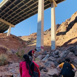
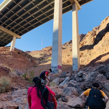
Wait we have hot springs this close to Vegas!? Yes we do! This hike is easily my most favorite in the valley. Obviously because of the hot springs but also because how beautiful it get the closer and closer you get to the Colorado River. For most parts the hike is flat and very easy. The difficult parts are those obstacles along the hike which if you can't complete you'll never get to the hot springs or even the Colorado River. It includes beings able to go up and down boulders though nothing too tall like all under 10 ft. There are ropes which are helpful but you need to be able to at least pull or hold your body weight. It's a nice and easy hike for at least a mile until where there's warnings and helpful items. While on the hike you're walking through a valley so it does get kind of cold. I would use a light jacket at least until there's Sun or you warm up. You'll pass under a bridge which gets a little loud as cars pass. You'll see various things like steel cables, abandon cars, caves, maybe some wild animals, and of course the water. Bring a towel, extra clothes and footwear so you can relax and take a dip in the water or just dry off before you head back. Slippery footing makes it just a little more difficult than it should. Bring some food and drinks since it's not a short hike. Enjoy it and have fun. By the way the trail is closed usually for a few months every year from about May to September. It's open now! Since it's October. Go!


Today we finally visited and hiked this beautiful canyon and trail. Very strenuous, so be prepared to use your upper body a lot. One of the best hikes I've ever done! It was little challenging, but manageable. If you're semi good shape. Climbing up and down huge boulders using the ropes definitely required some skill. Pools were filled with warm water. The sounds of running water is so serene and I felt like I could just stay there all day just to listen to it. At certain points there was complete dead silence and I loved it. The views at the end of the trail is totally worth it. Plenty of people came, though as we were leaving the trail. "Gold Strike Hot Springs Trail is a 6 mile heavily trafficked out and back trail located near Boulder City, Nevada that features Hot Springs and is rated as difficult. The trail is primarily used for hiking and nature trips and is best used from October until May."


Seriously love this hike! As others have mentioned, do yourself a favor and prepare yourself! I'm going to iterate a couple key points because I believe they make this hot spring hike more enjoyable for you (and others)! -Make sure you have plenty of water. I suggest at LEAST 2 liters per person to be safe, especially in the warmer months. -Bring lunch/snacks. You're looking at 4 total hours on average in the canyon if you start from the parking area and hike to the Colorado river and back. -This should go without saying but please, take your trash out with YOU! It's the responsible thing to do. *Also, the cooler near the beginning of the hike is NOT for trash, it is designated for full bottles of water for other hikers that weren't prepared. -Wear shoes with good traction because the rocks are sllliiipppeery even when they're not wet. -Pack water shoes or sandals unless you are already wearing shoes you don't mind getting wet. The end of the hike is at the Colorado river and those rocks aren't fun to walk on barefoot. Tips for hot springs: -Don't get the water in nose/eyes/ears. -Please don't pee in the hot springs! It's gross. -Please don't blast your music. For some of us that appreciate tranquility and silence found in nature, your music comes off as obnoxious and inconsiderate. This is a fun but dangerous hike. Take your time, be cautious, and be patient with yourself and others!


I did this hike with my hubby months ago. Can't wait to do this hike again! This hiking trail is absolutely wonderful ! Definitely Not for beginners. Get ready to climb up and down ropes, squeeze into tying spaces, and feel the warm pool waters. I loved this hike just as much as turtle head trail at red rock. Be sure to bring Gatorade, water, healthy snacks like fig bars, granola, trail mix, and some good music. Good shoes highly suggested ! The river will be super cold so be prepared! The view along the journey will be so worth your wild!


This hike is not for beginners! And actually this home should be done with caution. You definitely need upper body strength and or may need some help getting over some of the climbs. The hike starts out with a few light scrambles and a downhill walk in soft sand. After a while you get to the first rope climb. Thank goodness for the ropes negated there's no way I would be able to get over some of those rocks without the rope. Even with the rope some are pretty scary. I would say only 1 or 2 of them are considered extremely difficult the rest would be moderate. However once you get over and down all the ropes the beautiful river is waiting for you. It's awesome. If the day could end here it would be awesome. Hiking back up and out of the Canyon is brutal! I absolutely love that some amazing people set up a first aid type station for extra water, salt, sugar and etc. This last time that station probably saved my life. I'm very appreciative of the thoughtfulness that went into it. I meant to get a photo, but I was completely out of it. Note to self never hike GS when it's over 100 degrees. I do have to say that I'm completely disappointed in many of the hikers that think it is ok to leave or drop trash along the trail. What is wrong with you? If you bring it in - take it out. It's so incredibly selfish and rude.
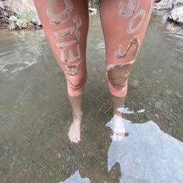

This is one of my absolute favorite places to go it's definitely an intermediate course approximately 6 miles total to the river and back with intense rock climbing and ropes. There is Ameba which is a single celled living organism that is brain eating if water goes up your nose it is fatal out of 140 something people that got it only 4 survived but it's 1 in 70 million chances of getting it


1 year ago
This hike is not for dogs, and I wouldn't recommend small kids under 10. You have to go up and own ropes, climb a lot of rocks. It is a part of willow beach. So I would recommend maybe meeting at the end of the trail if you HAVE to bring small kids or dogs. You would have to kayak or canoe from willow beach to the end of the trail. At willow beach they do have the equipment available for rent. This hike is long. It took me 4 hours to get to the end and back. There are 7 ropes you will have to go down and climb up to get back. We had to have young men help us up some of the rocks. Boost were needed, and assistance getting down the rocks. read more



3 years ago
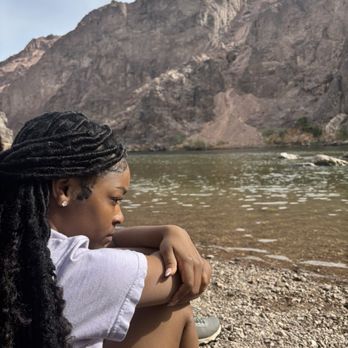
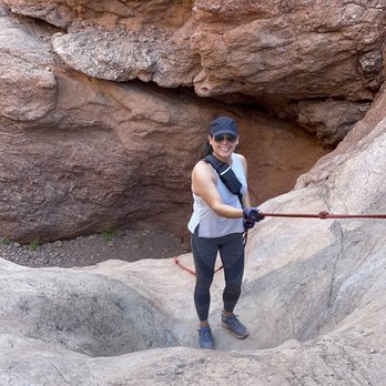
This was an incredible hike! 6 miles round trip, took us about 5 hours to complete! The ropes were helpful throughout (climbing up was much easier then climbing down) however on some, the rocks were very slippery so I think metal stairs in place would be helpful and likely lead to less people getting injured or trapped! Also, it would be great if some trash bins could be placed throughout, this would go a long way in helping to keep this beautiful spot clean. I will definitely revisit again in the fall, recommend starting this hike at sunrise and when temps are 80 or below! Search and rescue teams were set up in the parking lot at around 12pm while we were making our way out, it was around 90 degrees and getting brutal so friendly word of caution, the temps can get extreme and also this is not a hike for children or dogs!! read more


2 years ago
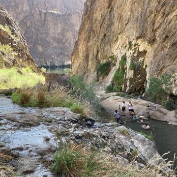
Great hike. Pretty intense and not recommended for kids or elderly in my opinion. Also leave your dogs at home. There are 5 (?) spots with ropes or ladders that you have to climb up / down. The hike is all downhill on the way to the springs and uphill on the way out so remember that. Definitely pack snacks! It's a long hike, our round trip ended up being 7 miles but we did a lot of walking once we got down to the Colorado River. Don't forget to keep ur head above the hot springs water! There are signs for brain eating amoebas that live in the springs (only attack humans if they can travel up the nasal passage) read more


2 years ago
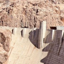
Fun hike with a variety of obstacles and views. You can walk on sand, climb on boulders, get wet in warm water, see the Hoover Dam, and taste the Colorado river all in a 5-6 mile round trip that takes about 3-4 hours of trekking. There are several pools of warm water to dip in. You can also walk out to the river to take advantage of privacy. There's a couple puddles you can chill in while checking out the beautiful mountain view. read more

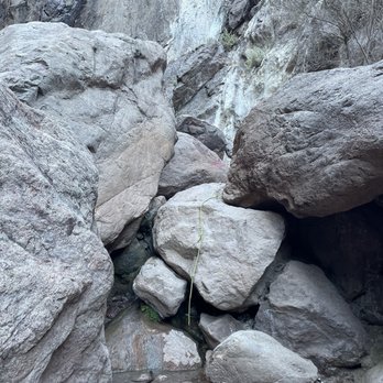

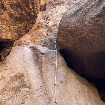


I shouldn't have done this hike, probably. I'm in no shape, and mostly was motivated by the promise of a nice soak in a hot spring. Uh, it's hard. If you're in shape, and hike all the time, ignore this- you'll have a blast and breeze up and down. If you're not- prepare to slide down rocks, get some rope burn, use every single muscle in your body, and maybe get some bruises. We mis-timed it. We left the trailhead at 1:30pm and spent only 20 min in the hot springs at the bottom and still ended up hiking the last couple miles uphill in the dark, which was a scary experience and we almost got lost when we got off the trail. Canyons at night are black pits that look entirely different! Bring headlamps!! Start early!! It was also a TON of fun. I fell and yelped and crawled and slid and laughed my butt off and I have no regrets, just make sure you're in hiking boots and have multiple liters of water. Good luck! read more

1 year ago

4 years ago
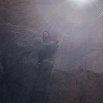
Incredible hike in spectacular terrain! Not for small kids, dogs, elderly. There are a number of spots where you need to use a rope to climb up/down. Start your hike in the morning or early afternoon. You don't want to get caught out there when it gets dark. There's three main hot spring pools at the end of the hike. Trust me when I say this....BRING WATER SHOES to change into for the rocks in the pools and streams. The 1st pool is the warmest, the 3rd at the river is the coldest. Pack lunch and about 32oz of water per person. Good luck! read more
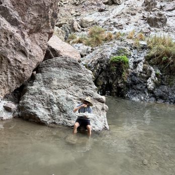
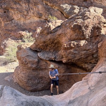
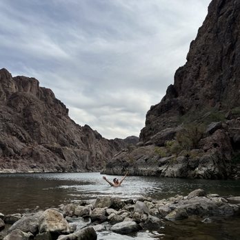

I came here with a group of 9 and it was an absolute blast. We started with a good pace. I'm afraid of heights so the rappelling was first challenging but then I got used to it. It's really fun and we worked together as a team. Whoever write here it's easy is whether a trained climber or very athletic because this is not a walk in the park for an average person. Once we made it down, which took exactly 2 hours, the pools were awesome. Some groups are naked. People come out here at night to camp too. It gets busy. If you continue down there's another pool with a little bath. The warm waterfalls are great. Also go down to the river. On the left there's a really hot waterfall. River water is cold. Little hike through the water will get you to a hole in the wall in your left which you can easily go up and you will find a gem: dark tunnel with knee deep water. We called it the sauna tunnel. We walked to the end with a flash light in our phones and back. Two of our group came later and missed the hole, not sure how that was even possible it's obvious. Back up it took is hours solely because one of the group was just point blank a pain in the ass: only talk and laugh and complain and acting like she was gonna die climbing back up. If you haven't hiked in decades then don't burden others and don't come on this hike. We also saw a family with 2 toddlers and a new born on flip flops, this is so irresponsible especially none were wearing helmets. Water shoes are recommended. I walked in my sneakers. But for getting to the pools I recommend shoes with grip as it's often slippery and my sneakers didn't do well with that. Also don't bring your dog if you can't carry him on your back or handle the narrow rappelling, we also had to help idiots of that kind. Bring enough water and snack. Lovely way to spend the day especially fall when there's excellent weather and you can enjoy hot pools. Small parking lot and no bathrooms so you rely on the wild:) read more


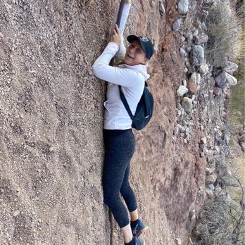


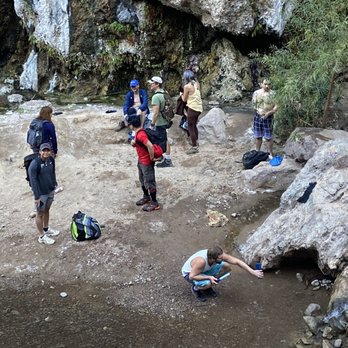

What a beautiful, challenging and rewarding hike this was! I did this hike for the first time this Saturday early am with my cousin. We got there around 7am to start the hike. Thankfully for the hike into the Hot-springs and the Colorado river we had shade. So that made the hike enjoyable. We had to Rappel down 8-9 ropes to get there. You definitely need gloves. I forgot to put my gloves back on to descend one of them and I burned my finger tips. The Rocks are very steep & slippery to rappel down so wear good hiking shoes with a good grip. Also pack water shoes for the Hot-springs and Colorado river. Also bring a bag for your wet shoes and wet cloths for the hike back. We didn't see any garbage cans along this hike so make sure to bring your own bag to dispose your garbage instead of leaving it behind. This canyon is too beautiful to litter. Be kind! Now for the hike back the first hour was fine, but then the rest of the hike back out became full sun and it was in the mid 90's. That heat definitely drained me and made the hike back difficult. Climbing back up those Rocks on the way back with the heat was very exhausting. Please packs lots of water. I went through 4 1/2 water bottles round trip. Toward the end of our hike when we were getting closer to the parking lot the rescue team was there with a canopy set up. When they saw us approaching a women headed down to us and handed us cold water and helped me carry my book bag the rest of the way. I can not say enough how thankful I was too her. If I can give any advice it would be to stay hydrated, be prepared, make sure you have a lots of water, and take your time. I would definitely recommend this hike, but during the cooler temps. I wouldn't do this hike again unless the high is only 75 degrees, but we did it and I'm very proud of both my cousin and I!!! read more


5 years ago
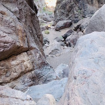
Pros: Beautiful and varying canyon formations that are very up close and personal, colors and the shadows and glowing sun light against the ridges , very enclosed canyon that has lots of shaded areas creating cooler temps. Hot springs water run down the trail so need to jump or walk throw the warm water. The bouldering was super fun and thank goodness some professionals installed the knots and ropes are very difficult sections, peaceful on non busy weekends. Cons: young punks bringing their portable speakers and thumping their music at the hot pools, worried about seeing some people not prepared for the challenges of the full hike (saw some people entering the trail at 3pm, no backpack of food or water but just a camera bag, bringing dogs) Visited in the fall and the pools are natural and the earlier pools are the hottest and the longest one at the very end isn't too hot , just like warm. If you're thinking of soaking tired feet , it's better to do it at one of the earlier pools like 3rd or 4th. You won't be able to submerge past your hips in the earlier pools but the final one is usually more crowded AND it maybe just warm temp. Without bringing gloves, it would be 40% harder to scale the ledges and control the rope climbs. The best hike I've been on in the Vegas Nevada area. 6 & 7 year old girls were there, they been there before with their very experienced parents (locals) and had good shoes. If you have the will , skill, strength and endurance to return, you'll be fine. Many women had issues and delays on the rocks and rope climbs due to lack of arm, shoulder, and muscle strength. Lots of gym ladies in their yoga pants were extra slow because lack of coordination with hands and grappling experience. Kids and teens should do fine as long as they are positive and done hikes before. You will be on your belly crawling through dusty sharp rocks. read more




3 years ago
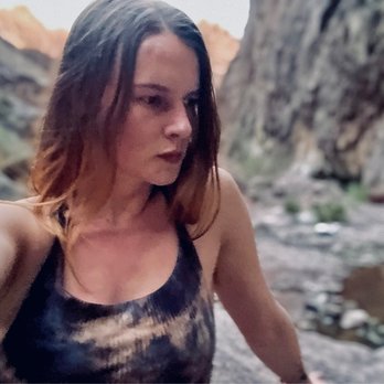
Lovely views. Steaming hot water in three separate locations. 10-20ft. rope climbs with ropes left in place by others. Variety in wildflowers & geological views. A couple hours hike, some sand & sight elevation gain. 15-30 minutes from Vegas! read more

3 years ago

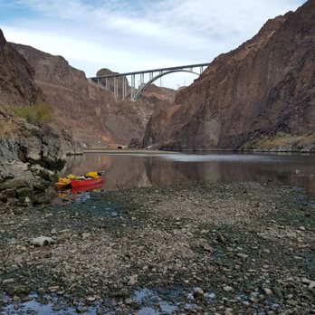
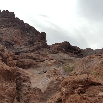
Wait we have hot springs this close to Vegas!? Yes we do! This hike is easily my most favorite in the valley. Obviously because of the hot springs but also because how beautiful it get the closer and closer you get to the Colorado River. For most parts the hike is flat and very easy. The difficult parts are those obstacles along the hike which if you can't complete you'll never get to the hot springs or even the Colorado River. It includes beings able to go up and down boulders though nothing too tall like all under 10 ft. There are ropes which are helpful but you need to be able to at least pull or hold your body weight. It's a nice and easy hike for at least a mile until where there's warnings and helpful items. While on the hike you're walking through a valley so it does get kind of cold. I would use a light jacket at least until there's Sun or you warm up. You'll pass under a bridge which gets a little loud as cars pass. You'll see various things like steel cables, abandon cars, caves, maybe some wild animals, and of course the water. Bring a towel, extra clothes and footwear so you can relax and take a dip in the water or just dry off before you head back. Slippery footing makes it just a little more difficult than it should. Bring some food and drinks since it's not a short hike. Enjoy it and have fun. By the way the trail is closed usually for a few months every year from about May to September. It's open now! Since it's October. Go! read more



7 years ago
Today we finally visited and hiked this beautiful canyon and trail. Very strenuous, so be prepared to use your upper body a lot. One of the best hikes I've ever done! It was little challenging, but manageable. If you're semi good shape. Climbing up and down huge boulders using the ropes definitely required some skill. Pools were filled with warm water. The sounds of running water is so serene and I felt like I could just stay there all day just to listen to it. At certain points there was complete dead silence and I loved it. The views at the end of the trail is totally worth it. Plenty of people came, though as we were leaving the trail. "Gold Strike Hot Springs Trail is a 6 mile heavily trafficked out and back trail located near Boulder City, Nevada that features Hot Springs and is rated as difficult. The trail is primarily used for hiking and nature trips and is best used from October until May." read more


Seriously love this hike! As others have mentioned, do yourself a favor and prepare yourself! I'm going to iterate a couple key points because I believe they make this hot spring hike more enjoyable for you (and others)! -Make sure you have plenty of water. I suggest at LEAST 2 liters per person to be safe, especially in the warmer months. -Bring lunch/snacks. You're looking at 4 total hours on average in the canyon if you start from the parking area and hike to the Colorado river and back. -This should go without saying but please, take your trash out with YOU! It's the responsible thing to do. *Also, the cooler near the beginning of the hike is NOT for trash, it is designated for full bottles of water for other hikers that weren't prepared. -Wear shoes with good traction because the rocks are sllliiipppeery even when they're not wet. -Pack water shoes or sandals unless you are already wearing shoes you don't mind getting wet. The end of the hike is at the Colorado river and those rocks aren't fun to walk on barefoot. Tips for hot springs: -Don't get the water in nose/eyes/ears. -Please don't pee in the hot springs! It's gross. -Please don't blast your music. For some of us that appreciate tranquility and silence found in nature, your music comes off as obnoxious and inconsiderate. This is a fun but dangerous hike. Take your time, be cautious, and be patient with yourself and others! read more


I did this hike with my hubby months ago. Can't wait to do this hike again! This hiking trail is absolutely wonderful ! Definitely Not for beginners. Get ready to climb up and down ropes, squeeze into tying spaces, and feel the warm pool waters. I loved this hike just as much as turtle head trail at red rock. Be sure to bring Gatorade, water, healthy snacks like fig bars, granola, trail mix, and some good music. Good shoes highly suggested ! The river will be super cold so be prepared! The view along the journey will be so worth your wild! read more





10 years ago
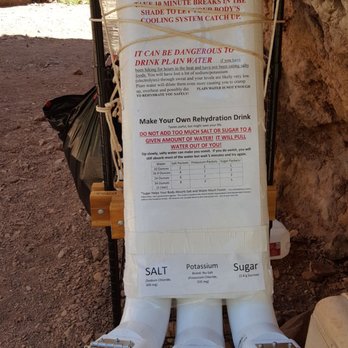
This hike is not for beginners! And actually this home should be done with caution. You definitely need upper body strength and or may need some help getting over some of the climbs. The hike starts out with a few light scrambles and a downhill walk in soft sand. After a while you get to the first rope climb. Thank goodness for the ropes negated there's no way I would be able to get over some of those rocks without the rope. Even with the rope some are pretty scary. I would say only 1 or 2 of them are considered extremely difficult the rest would be moderate. However once you get over and down all the ropes the beautiful river is waiting for you. It's awesome. If the day could end here it would be awesome. Hiking back up and out of the Canyon is brutal! I absolutely love that some amazing people set up a first aid type station for extra water, salt, sugar and etc. This last time that station probably saved my life. I'm very appreciative of the thoughtfulness that went into it. I meant to get a photo, but I was completely out of it. Note to self never hike GS when it's over 100 degrees. I do have to say that I'm completely disappointed in many of the hikers that think it is ok to leave or drop trash along the trail. What is wrong with you? If you bring it in - take it out. It's so incredibly selfish and rude. read more


6 years ago
This is one of my absolute favorite places to go it's definitely an intermediate course approximately 6 miles total to the river and back with intense rock climbing and ropes. There is Ameba which is a single celled living organism that is brain eating if water goes up your nose it is fatal out of 140 something people that got it only 4 survived but it's 1 in 70 million chances of getting it read more



Lily and Christie have written excellent reviews. I only have a few things to add. I have done this hike four times and I swear the last time was the LAST time I'd do it. Hiking to the Colorado is a physically demanding hike. Coming back up is even harder. Your boots will be wet and they will be very slippery against the boulders. You will bang your knees and other parts of your body. About halfway, you get to this boulder as shown in Lily's photo. http://www.yelp.com/biz_photos/RF7-W3Dc2B3FXW07Y-ZOVw?select=2D9p1_SUaOZIjQrORjnXEw#OO5O1CD1DWjAFEXi9S3gtQ Do not go down this boulder unless you're sure you can get back up. This will be a point at which you use great care before proceeding. The large hot spring pools are beyond this boulder. The ones before this have all dried up. The caution Christie gave about the nettle should be heeded. This stuff is nasty especially when it's brown and dead. The small spines along the edges of living and dead nettle can get easily caught in your fingers and they are very irritating and difficult to get out. One way to remove them even when you can't see them is to spread some Elmer's glue on your hand. Let it completely dry and then peel off the glue. That should get the last ones out. This is a cold weather hike. It's best not attempted during the warmer months no matter how early you start. Finally, if you hike to the Colorado, the last section has been filled with river water and it has been impossible to get to the river without swimming or wading in a couple of feet of very cold water. Use caution. If you do this hike, you will most likely enjoy it, but hike it sensibly and know your limitations. Since you're coming back uphill all the way, the hardest part is the way back when you're very tired and more prone to doing stupid things. read more


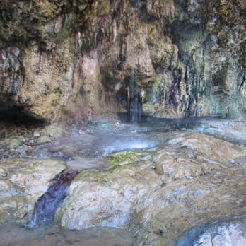


This is a great hike to do in the spring or fall. If you do it in the summer I would recommend hiking at night to avoid the heat. The hot springs are warm, not hot, and have gotten bigger over the years as hikers damn them up. You will have to traverse up and over many boulders. Gloves to grip the ropes are helpful but not necessary. I wouldn't recommend brining your dog unless you can carry it in a backpack over the boulders. 3 miles in 3 miles out. You can swim in the colorado river at the end as well. It's a lovely hike! read more


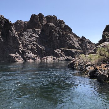
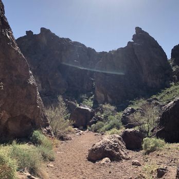
What a nice enjoyable hike this is. Came here on a Tuesday morning around 10 am. Took us a little while to figure out where to go once we got off the freeway but we finally figured it out that you make a left once you pull off the freeway, one you make a left a drive down and park, you will see other cars there. The hike there is pretty easy cause it's all pretty much going down hill but you won't realize it it you hike back out, the hike back that is a little harder cause you got to climb up rocks and pull yourself up ropes and figure out which way is the safest to get back up in some parts. Over all it's a Beautiful hike and if I lived in Vegas I would do it a lot on the cooler months. Like everyone else said make sure you bring lots of water cause your gong need it for the hike out. read more




5 years ago
Holy $#!+ we had no idea what we were getting ourselves into! In the beginning there's sign that mentions strenuous hike but clearly we did not heed to this. It's all soft sand in the begging mostly downhill. Then you start with having to hike the boulders and ropes! Luckily for others on the hike that helped us down the first one otherwise we would've turned around! It's such a beautiful canyon and the hot springs would've been nice hot tub spot if we had prepared to get wet. It's 3 miles to the Colorado river one way. So beautiful but not for the faint of heart! read more


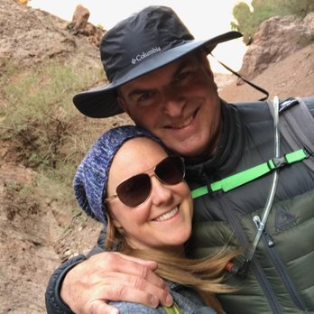
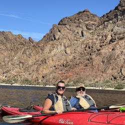
Not for beginners or pets! This is a hike that has been on my list for quite a while and im happy to say its finally been checked off! Make sure you prepare for this hike by researching it so you know what to expect to insure an enjoyable hike. Example - Do not hike between May and October due to excessive heat. This time of year, we saw an incredible amount of blooming green throughout the canyon! The best way to describe this trail is telling my party of 5 that it is basically boot camp. Alot of negotiating very sizable obstacles. And when you do, working together as a team to figure out which way is the most efficient. The hike has about 6 steep places where you must rappel down or pull yourself up by rope. The day we went ( Saturday - St. Patricks day ) the trail was heavily populated with teams of hikers. I found myself pulling total strangers up through the crevices or across bodies of water. That being said, the scenary was absolutely breathtaking as the trail basically is a wash that is at the bottom of towering canyon walls on both sides. Bring lots of water. A hydration pack was optimal for my needs. Todays weather was a perfect 65 degrees. It was windy outside when we left the house, but deep in the canyon, it was non existent. Toward the end of the hike begins a series of natural warm springs that bleed off towards the colorado river. Once you reach the river, we were greeted by people in kayaks and canoes who took the hike in the opposite direction ( complete with life jackets still on ). We also brought our water shoes - sandals to wade through the water at the mouth of the river. I have hiked many trails all over the western parts of the U.S. and this one should be on your list as well. AAA +++ read more


8 years ago
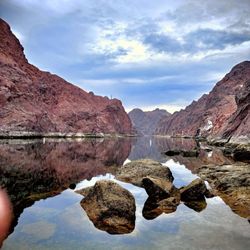
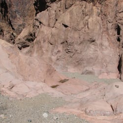
This is one of the best hikes I've ever done (because of the hot springs). We did this stunning day hike on October 28, 2018, when temps were in the mid-80s (i.e. perfect). I wore a soft long sleeve sun shirt and long leggings over a tank top and bathing suit, hike-y tennis shoes, a hat, and I brought water sandals. I'd wear the same thing again. (My leggings got wet during the hike, but dried in the arid environment--they really protected my legs from getting scratched up on the rocks.) Others have described the hike in detail; basically, once you park by the freeway, the trail is pretty grim for the first couple of miles: closed in, a bit claustrophobic, next to a huge retaining wall, freeway traffic overhead to your left. Keep going. Def. a challenge to get down some of the larger drops. Take your time, scout around (sometimes there is more than one rope), and make the tallest person go first so they can guide you from below. The hike gets prettier and prettier (see my photo), and then you see a stream, and it's warm (!! wow--I never saw that before!) The stream forms (with the aid of some man-made walls) a few little pools that you can soak your feet in. There were even a few warm waterfalls! How cool is that?! The best part was at the end of the hike where the stream met the cold Colorado river. When we went, the river water was low (according to local hikers), and there was a deep-enough-to-submerse-yourself hot pool right by the river. You can warm up, plunge into the cold river, swim around, and then warm back up. Heaven on earth. After playing and swimming and eating, we walked along the shore and in shallow water to the left of the stream (i.e. towards the dam). There is an uninviting hole in the hill after about 7 minutes--look up to your left, you may see it with water pouring out. If you hike up the small hill in front of it, this is a tunnel with a small wall at the entrance that creates 3-or-so foot deep stream. Pretty creepy, pretty cool; worth a look if you're the curious sort (I am). TL/DR: Best done with someone else so you can help each other; bring your sense of adventure and bathing suit; go early so you have plenty of time to splash around; bring plenty of water and sunscreen! read more


6 years ago
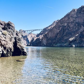
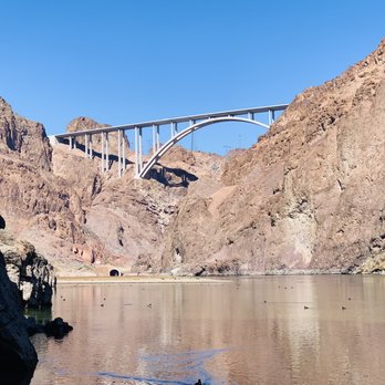
Hiked it today. Great weather. The trailhead is easy to find. Don't bring dogs or kids. There is 6 ropes to climb down and you have to come back the same way. Takes teamwork and some strength. Lot of boulder climbing as well. Don't hike after April. Will get hot. Bring water and pack a lunch to eat at the river. The end at the river is worth it. Great view of the new bridge. read more


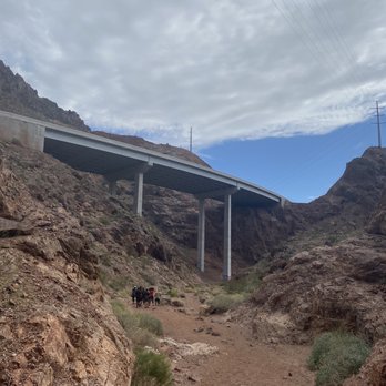


One of the most gorgeous hikes within the Las Vegas area, hidden just ten minutes outside of Henderson. It's a gem, and an unexpected one. A must is a walk across the Colorado river (once you reach the bottom of the hike at the river mouth) to the Sauna Cave. Used by the dam builders during its build, this cave is a warm sauna hide away with a brilliant overlook of the river. Just don't get stuck when the water levels rise in the late afternoon. Enjoy! read more
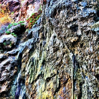

6 years ago
This was our first visit to the hot springs we went with friends who visited before and it's a journey but one we enjoyed and experienced and we did it with my son who is on the spectrum and he loved it so I highly recommend to anyone else to go. read more


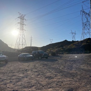
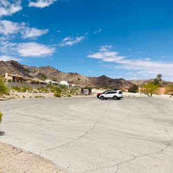
I had the hardest time finding this place but it was definitely worth the search! Google maps will tell you to drive over the bridge and tell you that you've arrived when you're driving through it. Take the exit right before the bridge and turn right. Yup will see a dirt road to park and start your hike. This hike is not appropriate for children, pets or the weak. There are a few difficult spots where you climb down a flat, smooth rock and tell only guidance you have is a repelling rope. I did not go into the actual hot springs but I know it's safe. Just don't drink the water! The hike takes about 3 hour ls and it take you down to the Colorado River. Notes: No shade so bring lots of water Wear hiking boots for gripping Be prepared to climb Full body hike Parking is on a dirt road Be aware of long horn sheep read more


9 years ago
Such an awesome experience! I would definitely recommend this hike to anyone. Its a 4.5 mile hike so take plenty of water i recommended hats and light clothes and of course be prepared for the water ! We took snacks and relaxed by the water once we finished. There is boulders to climb so make sure you take your good shoes. Ill be back once its not so hot outside if you go i recommend going as early as you can so you dont get to much of the heat i went at 7am and seemed perfect timing! It does seem like a family friendly activity i saw a couple of families with kids :) read more

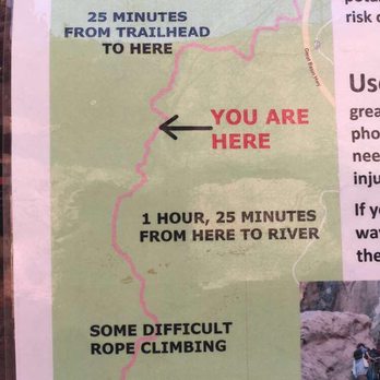


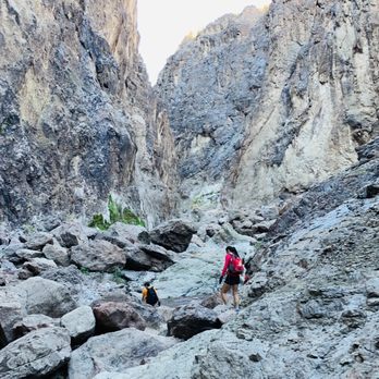
Ok everyone needs to simmer down, seriously. You guys are acting as if you went through some SEAL Team 6 training. It's not that difficult of a hike. In fact, the first part I would call a walk, I carried my Starbucks Valencia Orange Refresher the entire way, and also down the first set of ropes. Yes there are 5-8 series of ropes (depending on how far down you go) but if you're able to grab onto a rope and walk yourself down, it's fine. It's not like you're repelling down a 100 foot cliff face. Once you hit the ropes, I think this hike gets to be more fun. There is some scrambling involved, nothing more than a little up and over (class 3 if you want to be technical) I brought my gloves, which were helpful, but not needed. I enjoyed the hike through the canyon. The canyons walls span a few hundred feet up, and they're beautiful. I can sit and admire what time has created, you can see in the walls the different paths the water takes in the rain. The blackened walls from the desert varnish, the different variations in color of the rock walls are amazing. The water levels have changed over time, and most of the soaking pools are now closer to the river. You can still see where the old pools were. The day we went, the water level of the river was so low we were able to walk over to the sauna cave which usually requires you to wade through knee deep water. Be careful though, if you do check out the sauna cave, they have been known to release water from the dam without warning and the water level can rise 10 feet in seconds. Better be a good swimmer. I don't partake in soaking myself. I am not fond of warm public pools of water, as well as the brain eating amoeba found in hot springs (this is why you're not supposed to put your head under the water, it can make its way up your nostrils, into your brain). And I'm thinking, if that thing can make its way up that hole, who's to say if I'm sitting in the pool, why couldn't it makes its way up other holes, you know what I'm saying? No thanks, not in my holes. We did see a rattlesnake while at the sauna cave, so be on the lookout. Common sense, you should not be attempting this hike during the summer months. Temps can reach 120+. Not only are you putting yourself in danger, but you're also putting the first responders in danger as well. Side Note: there is a saying, pack it in, pack it out. It you don't understand what that means, take your trash back out with you, you don't throw your trash on the trail. Also, the piles of toilet paper and human excrement were disgusting. It's beyond me how people can do this without regard to the environment. Dirt bags. read more


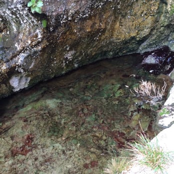


This has to be my all time favorite hike! Kind of difficult to park here and even find because it's one of those side of the road hikes. When you start it's mostly loose dirt but once you get farther it's basically every terrain you can think of. You have to climb down ropes (and up to get back to your car) walk through water, climb over boulders and really go through a pretty hard hike. I consider myself a good hiker and I even had trouble with it. The water makes some of the rocks super slick so I would recommend probably some water hiking shoes. Once you get to the hot springs it's an amazing time. Super warm and when you get to the river the view is spectacular! Super fun hike! Make sure you bring water and food! Took us around 3-5 hours to complete the trail from start to getting back to our car read more


First and last time I hike this. It was a fun first experience, but I think the first time is good enough for me and my legs. I saw a couple of people do this so my friend and I decided to hike this instead of red rock because it would be different. The first 1.5 miles is pretty flat. It kind of tricked us into thinking it would just be a long flat hike with a couple of obstacles. Definitely not the case! It was a fun hike, but it also painful on the way back. The first rope is pretty easy. It's pretty interesting because once you think there's no way to get down some rocks, you look down and there's the rope! Sometimes they're kind of hidden in the cracks. Everytime we wanted to stop, we would come across people coming back and they would say "you have to keep going and reach the river!" A couple of tips: 1) Bring more than 1 bottle of water! 2)The first hot spring is not the destination, keep going! 3) if you're a girl, bring some strong guys to help you up some rocks! 4) slippers or water shoes help when you reach the lake because getting your shoes and socks are not pleasant. read more


This hike is one of my favorite hikes ever! This hike is about 6 miles round trip it will take you about 5-6 hours depending how fast you walk and get through all the rock climbing and rope obstacles.. I'm not much in shape but i did it! During the hike you will encounter a few hot springs you can relax in, and all the beautiful sites of rock formation and nature itself.. I highly suggest you stretch before going on this hike, my friends and I was so sore the following day . I friend she even got bruises all over her legs and chest.. It look like someone beat her up! hahaha! If your a hiker and you love climbing rocks, and love the site of nature this is a really good hike to go on... If you keep hiking all the way down to the river the view is breathless.. and you will be proud of yourself that you did it! warning: I heard sightings of rattle snakes are present during the summer time.. did not see any while i was there! I did see a tarantula looking spider! Thanks Elnino F. for recomending this hike! read more

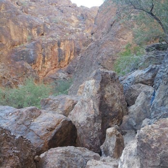


11 years ago
"I gotta leave this town and run to you "curse these nights that speak your name "I gotta leave this town and come to you" ------------------------------------------------------------ This is not the Baatan Death March and you are not a Filipino, American or Filipino-American G.I. on an impossible, forced, road march in the twentieth century. Unless you are visiting from the past in a DeLorean. If so: apologies for Trump. ------------------------------------------------------------ Quick Review™ + Nature. + Someone considerate placed ropes. Some other considerate fellow put a cooler and yet another one left a hoodie for anyone who gets cold. - Trash. Apparently closed for a quarter of the fucking year. Thoreau is turning and turning and turning in his grave. Shit-eating bureaucrat morons who order it closed have never heard of Thoreau. ------------------------------------------------------------ This hike is not hard. I saw a diminutive toddler at the end of it (river) and I don't think he swam there. I saw several nine, ten or eleven year olds. I saw tiny sub-couple kilo dogs*. *Not sure how they climbed the ropes; they probably don't need them. Hardcore. If you want hard: go summit Charleston (http://www.yelp.com/biz/charleston-peak-mt-charleston). That is fucking hard! Goddamnit. This is a stroll. This may be hard for those that think that Diamondhead is a "hike." Spoilers: It's not a fucking hike. Charleston beats you down; this is a stroll. One can talk the whole way. Even argue politics. Even shout at the top of your lungs. No hard hike allows for that. This is not hard. The federal government needs to get a life. Closing it down for several months a year? Pathetic. Do you close Death Valley? No. It's hotter there, assholes. Pencil-dicked dweebs. ------------------------------------------------------------ Pro Tip: write, call, visit and wave your middle finger at individuals -- paid by taxdollars to trample on our rights -- here: www.usbr.gov/lc/region/g1000/contacts.html. ------------------------------------------------------------ Rating: Four-stars, "Yay! I'm a fan." read more

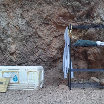


12 years ago
This hike is my home away from home. It's so beautiful and tranquil to do after a stressful week. Just trek, boulder, and rappel your way down to several relaxing hot springs. As much as people boast this trail is not for beginners, the reality is, anyone can do it. I have no prior experience hiking, and I went back in 2011 when there weren't as many ropes assisting you down. Also, I see children and teens doing this hike all the time, so just believe in yourself. The first time I went I just hiked past the hot springs to the Colorado river. It was covered in moss, and looked like a green wonderland. I went inside every single hot spring on my last hike with my friends. The best hot springs are those closest to the river, those are the hottest ones. There is one hotspring, you can swim underneath, under some rocks, and it brings you to an underwater cave. I won't tell you which one though, that's where the adventure lies. Cheers. read more


10 years ago
Let me just start off that my experience on this trail was like no other that I've been on! My group and I literally encountered all the 4 elements on this hike! We ended up spending the last hour of the hike running through a flash flood thunderstorm! At one point, it was hailing so hard that we could barely see where we were going. I know this is common sense, but please check the weather before you go on any hike! It was our mistake on that matter, but hey, it called for a fun adventure. Haha. So a couple of friends and I decided to do this hike around the same time last year. None of us had done this hike besides one other person, so this IS doable if your spirits are high, have an open mind, and have a supportive group with ya ! When we got to the destination, the parking lot was a basic dirt road. I highly think they should upgrade this 'ish because it gets a bit packed. Also, on our way back during the thunderstorm, our car was nearly tire deep in water (once again, our mistake lol). But anyways, we started the hike and there is a cooler that provides water and salt. You can also put whatever you want inside it too. A group ahead of us put in a couple of beers haha. The first mile of the hike is pretty much flat gravel so it wasn't bad at all. The middle of the hike is when all the fun begins! There is a lot of rope climbing, and just climbing in general. If anything, most of the hike is climbing. I suggest bringing gloves to protect your hands because I left with quite a few cuts! Also, be patient. At this time of the year, expect a lot of people hiking alongside with ya. Since there is only one rope and people coming from both ends, you gotta wait. This poor boy was so frightened that it took him about 30 minutes to finally reach the bottom of the rope. By then, there was about 10 people waiting on both ends. BTW, that same boy ended up spraining his ankle later on the hike. A rescue team had to come get him. :/ Thus, I do NOT recommend this hike for children! I seriously saw some families bringing their babies...like WHY?! When you get towards the end of the hike, expect to get your shoes wet! You'll be walking in streams of hot spring water. Mind you, theres still a lot of climbing... so bring shoes that have a pretty good grip! You'll also come across hot spring pools here and there along the way so if you need a breather, just take a dip and chillaxx. The end of the hike opens up to the river and the iconic bridge to your left. BUT WAIT! If that ain't enough for ya, there is another hot spring if you climb over a little more to the left side of the mountain trail. However, It is pretty steep, very slippery, and involve a little bit of swimming. If you're up for the extra challenge, hike with caution! Maybe even bring extra clothes with you too. Overall, this hike was the bees knees! read more
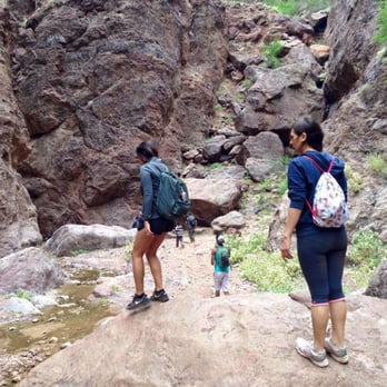


11 years ago
This hike is awesome and it is now my favorite hike in Nevada so far! The boulders were both challenging but definitely do-able for people in decent shape. Some of the ropes were cut but we were able to make it to the river which was beautiful. There were 1-2 ropes left that we did use... Please check the ropes before you use them as some are frayed quite a bit. This is a good hike for a small group but not the best small children or dogs... My own personal opinion. It took us about 4 hours and we spent some time at the river and hot spring. Happy (and safe) hiking to all! read more


10 years ago
Highly recommend! If you live in Vegas you definitely need to check it out. Make sure to bring plenty of WATER!! Snacks are a must as well to keep you energized it was a great workout! Will be coming back very soon. read more

Page 1 of 4
More info about Goldstrike Hot Springs
US 93 Hoover Dam Exit
Boulder City, NV 89005
Directions
Hours
Outdoor Amenities
Ask the Community - Goldstrike Hot Springs
Do you need to pay like national parks to get into this trail?
Nope, its free, parking is also free & no check point
Can dogs come here?
Can, but due to large boulders and some rappelling, you will have to carry them w/ you
Are there any other trails like goldstrike?
There are at least 2 other hikes similar distance from Vegas, in the same area close to the dam, ending in a piping hot spring, Colorado river kayak/boat access, with lots of beautiful geological views & lots of wildflower varieties: "Arizona hot…
Can you camp here overnight?
There were campers but didn't see any camp sites. Saw some hikers with lots of pro camping gear (no ice cooler, so it's likely prepared meal or nuts) that were hiking in at 4pm. They were likely going to get picked up down at the Colorado river by…
Review Highlights - Goldstrike Hot Springs





















Why does Yelp recommend reviews?
9 reviews that are not currently recommended
The reviews below are not factored into the business's overall star rating.

3 months ago

11 years ago

8 years ago
10 years ago

12 years ago
8 years ago

8 years ago
6 years ago
4 years ago
Goldstrike Hot Springs - hiking - Updated August 2026
Best of Boulder City
People found Goldstrike Hot Springs by searching for…
Things to Do in Boulder City, NV
Abandoned Places in Boulder City, NV
Swimming Lakes in Boulder City, NV
River Swimming in Boulder City, NV
Campgrounds in Boulder City, NV
Scenic Views in Boulder City, NV
Public Shower in Boulder City, NV
Lookout Points in Boulder City, NV
Rock Climbing in Boulder City, NV
Easy Hikes in Boulder City, NV
Night Hike in Boulder City, NV
Off Road Trails in Boulder City, NV
Scenic Overlook in Boulder City, NV
Scenic Drive in Boulder City, NV
Hot Springs in Boulder City, NV
Hiking Trails With Waterfalls in Boulder City, NV
Waterfalls and Swimming Holes in Boulder City, NV
Waterfalls in Boulder City, NV
Cliff Diving in Boulder City, NV
Trending Searches in Boulder City, NV
Antiques near Goldstrike Hot Springs
Barbershop For Men near Goldstrike Hot Springs
Bike Shop near Goldstrike Hot Springs
Bird Sanctuary near Goldstrike Hot Springs
Cliff Jumping near Goldstrike Hot Springs
Consignment Shops near Goldstrike Hot Springs
Cruising Spots near Goldstrike Hot Springs
Dog Friendly Things To Do near Goldstrike Hot Springs
Ear Piercing near Goldstrike Hot Springs
Eyebrow Threading near Goldstrike Hot Springs
Flower Fields near Goldstrike Hot Springs
Hair Braiding near Goldstrike Hot Springs
Kids Haircut near Goldstrike Hot Springs
Lakes near Goldstrike Hot Springs
Mini Golf near Goldstrike Hot Springs
Parks near Goldstrike Hot Springs
Pedicure near Goldstrike Hot Springs
Permanent Makeup near Goldstrike Hot Springs
Picnic Areas near Goldstrike Hot Springs
Public Golf Courses near Goldstrike Hot Springs
Public Pools near Goldstrike Hot Springs
Rock Quarry near Goldstrike Hot Springs
Scenic Night View near Goldstrike Hot Springs
Scenic Overlook near Goldstrike Hot Springs
Sunrise View near Goldstrike Hot Springs
Swimming Holes near Goldstrike Hot Springs
Trading Card Shops near Goldstrike Hot Springs
Used Furniture Stores near Goldstrike Hot Springs
Browse Articles
Browse Nearby
BEST of Boulder City, Nevada Restaurants near Goldstrike Hot Springs
BEST of Boulder City, Nevada Things to Do near Goldstrike Hot Springs
BEST of Boulder City, Nevada Coffee near Goldstrike Hot Springs
BEST of Boulder City, Nevada Beaches near Goldstrike Hot Springs
BEST of Boulder City, Nevada Shopping near Goldstrike Hot Springs
BEST of Boulder City, Nevada Breakfast near Goldstrike Hot Springs
Browse Brands
Related Searches in Boulder City, NV
Affordable Kayak Rental Services in Boulder City, Nevada
Best Dog Hiking Trails Around Boulder City, Nevada
Best Fishing Locations and Guides in Boulder City, Nevada
Best Nature Trails for Hiking in Boulder City, Nevada
Best Places for Horseback Riding in Boulder City, Nevada
Best Sightseeing Experiences Available in Boulder City, Nevada
Check Out Off Road Trails in Boulder City, Nevada
Discover Dog Friendly Trails to Explore in Boulder City, Nevada
Discover Popular Bike Trails in Boulder City, Nevada
Discover Scenic Mountain Bike Trails Near Boulder City, Nevada
Discover Walking Parks in Boulder City, Nevada Near You
Discover a Hiking Trail in Boulder City, Nevada
Discover the Best Night Hike Trails in Boulder City, Nevada
Dog-Friendly Hikes With Dogs in Boulder City, Nevada
Enjoy Camping Adventures Around Boulder City, Nevada
Enjoy Kayaking Adventures in Boulder City, Nevada
Enjoy Off Leash Dog Hikes in Boulder City, Nevada
Enjoy Scenic Places to Walk in Boulder City, Nevada
Enjoy Tent Camping Spots Around Boulder City, Nevada
Enjoy a Beautiful Waterfall Hike in Boulder City, Nevada
Enjoy the Best Walking Path in Boulder City, Nevada
Enjoy the Best Walking Trails in Boulder City, Nevada
Explore Beautiful Parks and Green Spaces in Boulder City, Nevada
Explore Easy Hikes Perfect for All in Boulder City, Nevada
Explore Fun Activities to Do in Boulder City, Nevada
Explore Popular Campgrounds Near Boulder City, Nevada
Explore Popular Dog Walking Trails in Boulder City, Nevada
Explore Top Dog Parks in Boulder City, Nevada Near You
Family Friendly Hiking With Kids in Boulder City, Nevada
Find Parks and Recreation Activities in Boulder City, Nevada
Find Popular Ziplining Spots Around Boulder City, Nevada
Find Top-Rated Waterfalls in Boulder City, Nevada Now
Find the Best Parks for Picnics in Boulder City, Nevada
Hiking Trails With Waterfalls in Boulder City, Nevada
Off Leash Dog Hiking Trails in Boulder City, Nevada
Picnic Areas With BBQ Pits Available in Boulder City, Nevada
Plan a Scenic Drive Route Near Boulder City, Nevada
Play at a Splash Pad Park in Boulder City, Nevada
Popular Outdoor Activities to Try in Boulder City, Nevada
Popular Picnic Spots to Visit in Boulder City, Nevada
Safe and Fun Parks for Kids in Boulder City, Nevada
Top Hiking Trails to Explore in Boulder City, Nevada
Top Playgrounds for Kids to Enjoy in Boulder City, Nevada
Top Running Trails to Explore in Boulder City, Nevada
Top Swimming Lakes to Enjoy in Boulder City, Nevada
Top Swimming Spots and Pools in Boulder City, Nevada
Top Things to Do With Kids in Boulder City, Nevada
Top-Rated Camping Sites in Boulder City, Nevada


