Guadalupe Mountains National Park Photos


More like Guadalupe Mountains National Park
Recommended Reviews - Guadalupe Mountains National Park
Start your review...


Reviews With Photos


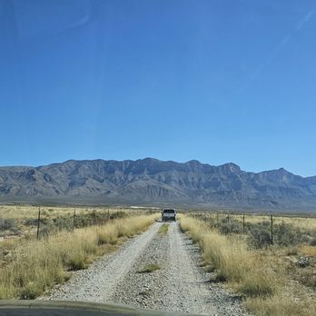
Really no way to check in when you this far out...This entire area is just gorgeous with so much to see...took a hike on the Salt Basin Dunes Trailhead which takes you to very remote spot...Bring Water, hat and glasses...its windy with blowing sand. From there we traveled around the Mountains to see other sites...Highlight was El Capitain View spot. Take your time and look around...So much to see in Texas.
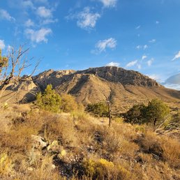

This review is for Guadalupe Peak Trail which was a ~8.1 miles round trip that took ~6 hours to complete. Guadalupe Peak Trail was a very strenuous and popular hike in Guadalupe Mountains National Park. It tests your limits physically and mentally! The trail was narrow and extremely rocky. Majority of the trail was an incline towards the top. Easy to slip on the loose rocks during the decline. Highly recommend using hiking poles! Stunning views of the surrounding mountains and desert terrain! There was a Border Patrol Checkpoint on the road to Guadalupe Mountains NP from El Paso direction. They will ask you a few questions before letting you go. Short video of the hike for those interested! https://youtu.be/DW2z1Vnatvw


This is a smaller national park, but has some pretty mountain views. We didn't hike the popular Guadalupe Peak trail as it was fairly hot out so we hiked Devil's Hall trail instead. It's only a 4 mile trail, but half of that is walking through a wash and maneuvering rocks so the hike took longer than I expected.


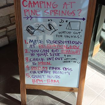
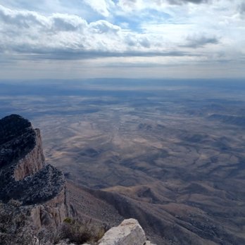
I had been wanting to climb the highest peak in Texas for a long time, so I finally took the opportunity to go during one of the hottest months of the year. Guadalupe Mountains is one of the least visited national parks for a reason. It is remote, and the dusty mountains are not very impressive. However, they have a rugged beauty to them. We camped at Pine Springs Campground (site 18), which has a nice view of the mountains. It is located very close to Pine Springs Visitor Center and the trailhead for Guadalupe Peak. The visitor center is a decent size with an educational exhibit and a gift ship. There are bathrooms with sinks and flush toilets close to the campsite. There appeared to be water fountains at each campsite, but they were not functional. There is also a dishwashing sink and a water bottle refill station (cool water!) by the bathroom. The campsites have picnic tables. We started our Guadalupe Peak hike around 3am to beat the heat. It took us around 7 hours in total to go up and back down, including a nice rest at the top. The ascent took us a total of 2 hours 45 minutes. We had the whole peak to ourselves when we reached it just after sunrise. The peak was surprisingly very windy and chilly. We met quite a few hikers going up as we descended, and they were suffering in the heat.


Nice drive, one of the smallest National parks we been to. But glad we came, not smart to go in the summer lol way hot... in my experience being from California:) My youngest really enjoyed it!!


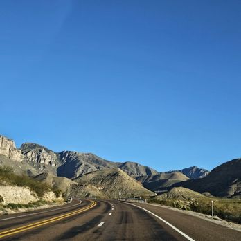
Guadalupe Mountains, the beautiful! This isn't the largest national park and it's also not as popular as nearby Carlsbad Caverns and White Sands National Parks. However, it's still an absolute beauty and you can find quite a bit to do here if you're active. The highest point in Texas can be found right here in this park. You can even hike up to it if you're up for the challenge. It's called Guadalupe Peak and its' range is over 8,700 feet tall. As you can imagine, this is one of the most strenuous hikes in the park. So if you don't want to take that trek, you can still enjoy the beautiful views of the peak along the drive to and from El Paso into the park. There's a neat vista point where you can see the peak and the mountain range right off of the road. There are plenty of other hikes to choose from while you're at the park as well. Be forewarned; the majority of the hikes are difficult. I'd chalk Guadalupe Mountains up to be more a hiker's type of national park. If you're not hiking here, there's not much else to see unless you're planning to camp. And even then, you'd still want to do some kind of hiking to enjoy the beautiful views and to get the most out of what the park has to offer. Also, it's haaaawwwt out here! This is one of those spots where you really need to carry way more water than you think that you'll need because you will most likely end up drinking it. There is little to no shade and a whole lotta sun. There's a cute little visitor center with park maps and souvenirs. It isn't huge but still worth a visit. As I mentioned before, this isn't a super large national park. You'll be able to cover a lot of ground in just one day, and a day hike will do you wonders. Some people like to combine Carlsbad Caverns and Guadalupe Mountains in one day since they're pretty close in driving distance from each other. It's doable but I'd advise dedicating at least a day to each park if you have it. This will allow for a non-rushed experience. The major attraction here of course is the breathtaking mountain range. The views of the Guadalupe Mountains are so scenic. The desert vegetation is pretty damn charming too. I hiked one of the "shorter" trails in the park known as Devil's Hall. I emphasize "shorter" because although it's a shorter hike in length compared to some of the other trails nearby, it ain't easy! The Devil's Hall trail gains 600 feet of elevation within the first 2 miles and requires lots of rock scrambling and a map to stay on track of the trail. There's also some gnarly sections like having to navigate around a natural staircase. But making it to Devil's Hall and being able to take in amazing views on the way up made this difficult hike so worth the trek. I'd recommend it if you're not looking to go hard and tackle the peak. Also, the bugs can be pretty aggressive in spots. Bring but repellant and also sun protection of course. All in all, Guadalupe Mountains National Park has a lot to offer. If you're planning a trip to El Paso or Carlsbad Caverns, make sure to add a visit to this park to your itinerary.
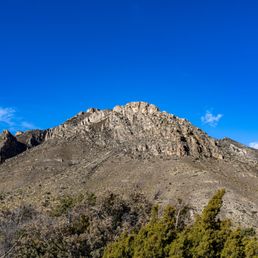

Attitude Adjustment Located in the northern part of the Chihuahuan Desert, this ±86k-acre National Park's (NP) claim-to-fame is its massive mountain range that includes the infamous El Capitan. This mountain range is so large that it even extends 25 miles northerly to include the mountains where Carlsbad Caverns is located. This was a totally impromptu stop as, quite frankly, we didn't even realize this was even a place until we drove thru it. The Good: *Easy on-and-off the freeway *Nice visitors center (VC) with clean restrooms and park info *$10 entrance fee makes this one of the cheaper NPs to visit. *The views of the mountains are pretty spectacular, even just from the VC. *The Headquarters VC Trailhead is about ± 1/2-mile roundtrip and worth the time if you're just stopping thru like we did. The Meh: *Fairly large parking lot that was chock-full and hard to find a spot when we arrived. The Ugly: *Gusts of up-to 60mph winds at the time of our visit, which is why we only did the VC Trail. Evidently, this is fairly common in these here parts, so please hike safely and don't be stupid. TLDR: Spectacular park that we'd love to explore more one day, but until then, I'd still recommend this as a must-stop if you're en route to Carlsbad or El Paso.
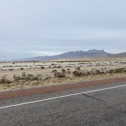

*** 2022 marks 50 years as a national park for GMNP *** Late last fall I drove through Guadalupe Mountains National Park as I have on numerous occasions throughout my near 40 years on Earth. It brought to mind the first time I climbed the highest peak in Texas at 8,751 feet. It was such a fun day trip. I served as a chaperone for a backpacking and camping course through New Mexico Junior College where I was employed for several years. I lived in Colorado for a short while. I'm from New Mexico. The peaks are far superior in those states... go ahead and laugh. I am too. Lol. The hikes are not too strenuous, however, I preface this statement with the fact that I have always been in shape and on the athletic spectrum. As I write, it is March 2022. This is the time of year that I would personally return to hike this area again. Why? It gets unexpectedly hot even early in the morning in the summer time. Late winter will allow you to see the buds growing, birds returning, and perhaps some other wildlife. Use the usual precautions... Bring water, hiking boots, a light jacket, sunscreen, snacks, etc. Pack it in, pack it out. TIPS + Make time to visit Carlsbad Caverns National Park which is not too far away from here. + although you're in Texas when visiting the Guadalupe mountains, you're not on Texas time. You're in the mountain time zone. SOURCE https://www.nps.gov/gumo/


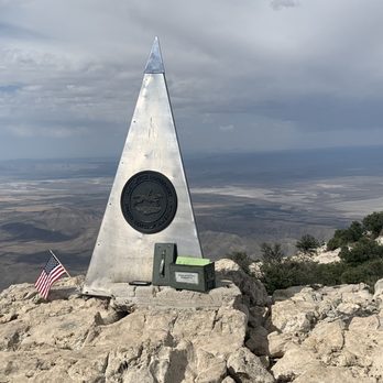
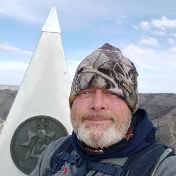
Calling all Peak-Baggers! Wow - what an accomplishment Guadeloupe Mountains NP offers! In this park is the highest speak in Texas at over 8,700 feet. It was a windy journey up to the summit, but it all was worth it to see the peak marker and to sign our names into the peak journal. Additionally, the rangers here are so kind with great advice. They took the time to answer all of my questions in detail and patiently help visitors who are not from the area and are not used to the climate. They seem more in tune with the area than the rangers at the semi-neighboring NP Big Bend. The visitor center is lovely, with an informative museum and separate gender-neutral bathroom. I would absolutely recommend this park to anyone who comes through the area.


Amazing mountains, clean fresh air, not alot of tourists. This park is definitely one that is underrated. We were crazy enough to still check out thr park when reports said winds were from 35-65mph. There were moments when there were snow patches on the trail. The waterfall was more like a stream at most. It was a good day. I would love to come back to check out Devil's hall trail and the peak trail next time.


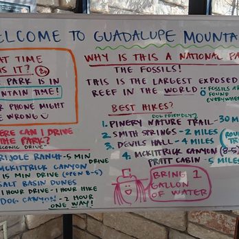
Very close to Carlsbad Caverns NP. We stayed in White's City and visited both parks over 3 days. CCNP is in New Mexico, and GMNP is in Texas, only 30 min apart. There is no road that travels through the park, only Hwy 62 that skirts along the SE border. Therefore, there is no entrance gate. You pay the park fee by stopping at one of the four visitor centers. The Pine Springs visitor center has a nature trail, very small gift shop, exhibits, restrooms, water, picnicking and a covered seating area with information plaques outside. There is a ranger on duty here for questions or first aid. Several of the trails can be reached out the back of the center. We decided to take the trail that led from the visitor center to the Butterfield Stage Station Ruins. This was an easy, paved, and accessible 0.7 mile path with some information along the way. We also traveled to the Frijole Ranch, which includes an 1800s schoolhouse, bunkhouse, barn and springhouse, and from there hiked the 2.3 mile loop Smith Spring Trail. We were told this trail would take us about an hour and be pretty easy. I would not call this trail easy, it is more moderate. We did the trail counter-clockwise and I think it may have been easier clockwise. The biggest problem was that the spring wasn't reached until more than half way through the trail. We didn't realize that, so it seemed like it was taking forever. It's like "where is this spring at?!!" And the map shows that there is another spring at the beginning of the trail called Manzanita Spring, but there is no sign there and it just looks like a small backyard pond. We had no idea that's what it was until later. If you decide to hike the Smith Spring trail, pick up a trail guide at the visitor center first. It includes information for 7 stops along the trail (starting at the Frijole Ranch and ending at the foothills). There is plenty of trail guide information at the visitor center. We not only picked up a nps map and the Smith Springs trail guide, we also received a helpful "Plan your Trip" handout that included specifics about all the trails in the park. It listed trails by how long they took, and then listed each trail with specific information about it. (see my photos) There is a Gypsum Sand Dune inside this park (like white sands np), but it is only accessible by hiking the Butterfield Stage Route or by driving Williams Road from Dell City and hiking from there.


The claim to fame is that Guadalupe peak is the highest point in Texas. The hike was decent with the most strenuous climb in the first quarter of the hike. The trail gives you several moments where you think you're almost at the top but then you turn the corner and you're definitely not even close. I'd say this is an average to the peak hike but it paddles in comparison to other national parks. However, definitely worth the quick 8 mile roundup hike in conjunction with Carlsbad caverns. The top has a great view with a cool little post office mailbox. I wonder if anyone ever empties that out as it looks like quite a few of the letters had been there for quite some time. You have a nice 360° view with a cool looking rock in one direction.


The website calls this hike "strenuous". Meh. Only if you're not in good shape (I'm fit but not a machine). You'll certainly get a workout but nothing too bad. Seriously. Older people are on this hike all the time and they're fine. You will be too. So, it's a 8 mile (round trip) hike to the top of Guadalupe Peak (there are other trails but I'm talking about hiking to Guadalupe Peak). The first two miles are probably the most difficult as they comprise switchbacks that are fairly steep. Mile three takes you through some nice Aspens and the last mile is the push to the summit. Get past the switchbacks and the rest is a mental game. I'm not a fan of heights and I only had two spots where I was like WTF am I doing. One was along the switchbacks where you have to scramble on some rock (instead of dirt trail) and the dropoff looks bad (prolly just described the entire hike). The second occurred near the summit. While you're going up, you approach a blind turn where you sort of have to peak around the corner to ensure you're on the right path. Other than that, it was a fairly easy hike for me. Toughest was the mental part since I don't like heights. But the trail is well marked and maintained. Easy days. I did it in early June. Perfect weather. Left at 8am & summited by 10. Left the park by 11am. Tips--YMMV so take these as you will: 1) I think a lot of day hikers don't pay the entrance fee (judging on the cohort of randoms I sort of arrived with. I didn't see anyone but me fill out the form). If you get there before the visitors center opens, it's sort of an honor system. You go to where all the RVs are parked. There is a board with maps and park info. Down and to the left is a container filled with envelops that you fill out, seal your $7 entry fee, and tear off the receipt to place in your car window. *Pay your entrance fees.* 2) Leave early to beat the heat. You don't have to wait for the visitor's station to open to start. Just do the self registration and head on up. 3) bring water and light snacks. Someone, somewhere, said two gallons per person? WTF? You do you but I did it with 1.5L bladder and a small handheld with tailwind mix for nutrition. And I had easily half the bladder left. I also didn't have a ton of extra crap: just a Salomon running vest, handheld, hat, running shorts, trail running shoes, and a shirt. That's it. I guess if you're gonna be up there all day, sure. But, seriously, if you go early, you'll beat the heat (plus it's cooler up there but not a lot of shade). You might need a *light* windbreaker for the summit (summer time. No idea what this is like during any other period). Know your body. Bring a few snacks, not meals. I brought 3 honey stinger waffles and an emergency gel that I always carry in my handheld. I ate one waffle at the summit. I did have tailwind tho. I just don't understand why anyone needs to bring a full pack. That's prolly why it takes you 8 hours cuz you're lugging around all that extra (unnecessary) weight. And this is coming from a former Marine. Ditch the weight. 4) if you had ambitions to run up/down. Good luck. The only runable portions (IMO) was between mile 2 to 3, and some random spots here and there. I tried running the switchbacks downhill but my quads were blown. Also TOOOOO MANY STEPS FFS. YMMV. Strava has folks doing the downhill in 30 min. I was way too nervous. I bet I could knock off 30 min on the climb the second time around. 5) if you're headed to San Antonio, DO NOT take 652 to 285 to I-10 (6/5/2019). Soooooo mannnny truckers and oil field rigs on TWO LANE highways with ENDLESS CONSTRUCTION. I was *literally* stuck behind a rig (huge train of vehicles) for 50+ miles going 30-40mph, some points stop and go, coz I couldn't pass. It's just not worth it. I would rather drive further to get to I-10 quicker than suffer through that stuff again. Driving through Pecos was a nightmare because they had road work signs for like 20+ miles on both sides of the city on areas they're not even working on! I don't usually get frustrated in traffic but this was *RIDICULOUS* small town foolishness. Add in the big rigs and I was ready to turn around BUT I COULDNT BECAUSE IT WAS A TWO LANE HIGHWAY. West Texas is not good.


2 months ago
First off, the visitor center has a water filling station, nice restrooms and amazing employees. Their gift shop is really small compared to other national parks but they have a good variety of items to choose from. This park is on mountain time- remember that- even if your phone keeps jumping back and forth between the time zones. I hiked the Guadalupe Peak Trail and oh my goodness such an amazing hike. I started early and made sure to have plenty of water. When I was coming down, I was a little surprised by how many people were starting the hike... in June at the hottest time of the day. Make sure to be prepared and enjoy all the breathtaking sights. read more


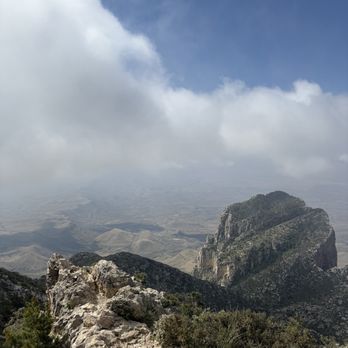


So I spent part of the week here exploring and I really enjoyed my time here. It is the smaller National Park in Texas on about 85,000 acres (compared to Big Bend National Park which is 800,000 acres) but still plenty to explore. This park is more for folks that really like to hike, explore and camp. There are a few entry points into the park but there really is no scenic routes through the park. You are expected to park somewhere and walk to your destination instead which I find very interesting to do (can see alot more too). I've visiting the frijole ranch that had a small museum inside explaining the history of the park. Attach to it there are a few trails you can take off to do. I did the smith springs and it was very pretty to see. Once you manage to get up the hill there were some seats and rails you can hang onto and relax while watching the spring. I also did the Guadalupe Mountain Peak trail, which is the highest peak in Texas. That one takes about 6 to 8 hours to hike (round trip) and it had amazing views. There was also a mark at the to there you can take a picture too which was cool. Definitely need to be prepped to do this or any of the hikes (water, food, first aid, hiking stick and good hiking boots). The Salt Basin Dunes were also really nice to explore but expect to do half a day here. That one you drive over dirt road to get to but very nice views of the mountain. It also had a place you can use the restroom and sit down to eat. The place is exactly what you expect...alot of sand hills you can climb but very soft and cooling (just watch your step). I didn't get to explore all the park since there was a government shut down and closed one of the trails I wanted to do but overall It was definitely worth the trip to visit. I plan to come back next year when it's not too hot (best time for fall colors and cool air for tough hikes). I would absolutely recommend anyone to at least check this park out at least once in your life. Make sure do your research and bring what you need. read more




9 months ago
My husband and I visited in December 2025 and decided to climb Guadalupe Peak. It was amazing. The trail was maintained. A search and rescue ranger was walking the trail to keep a count of the hikers, which made me feel safe. I was so stoked that we were able to summit. We went to the ranger station afterwards to buy souvenirs and share our achievements. The rangers just looked deadpan at us after sharing our news. It left me disheartened. They could have pretended to care about our little victory. Would have liked to hike Devils Hall, but we were beat after the peak. read more




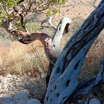


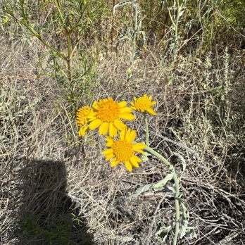
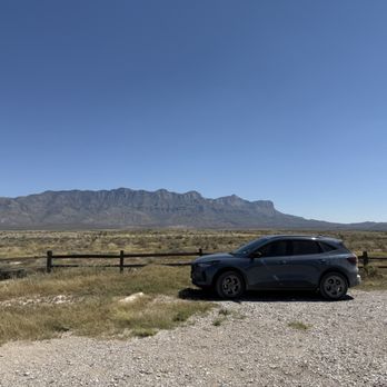
Really no way to check in when you this far out...This entire area is just gorgeous with so much to see...took a hike on the Salt Basin Dunes Trailhead which takes you to very remote spot...Bring Water, hat and glasses...its windy with blowing sand. From there we traveled around the Mountains to see other sites...Highlight was El Capitain View spot. Take your time and look around...So much to see in Texas. read more






7 months ago

This review is for Guadalupe Peak Trail which was a ~8.1 miles round trip that took ~6 hours to complete. Guadalupe Peak Trail was a very strenuous and popular hike in Guadalupe Mountains National Park. It tests your limits physically and mentally! The trail was narrow and extremely rocky. Majority of the trail was an incline towards the top. Easy to slip on the loose rocks during the decline. Highly recommend using hiking poles! Stunning views of the surrounding mountains and desert terrain! There was a Border Patrol Checkpoint on the road to Guadalupe Mountains NP from El Paso direction. They will ask you a few questions before letting you go. Short video of the hike for those interested! https://youtu.be/DW2z1Vnatvw read more
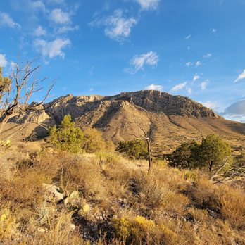


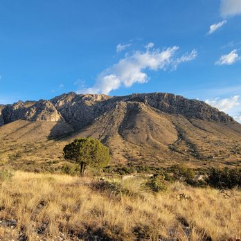
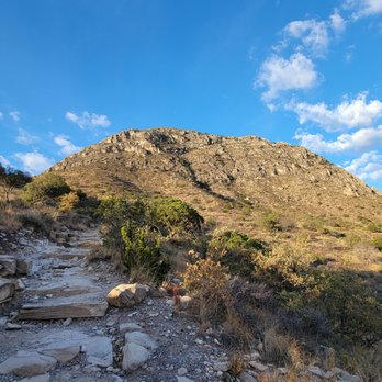


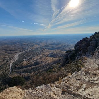

This is a smaller national park, but has some pretty mountain views. We didn't hike the popular Guadalupe Peak trail as it was fairly hot out so we hiked Devil's Hall trail instead. It's only a 4 mile trail, but half of that is walking through a wash and maneuvering rocks so the hike took longer than I expected. read more

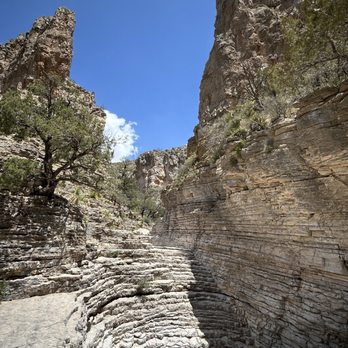


I had been wanting to climb the highest peak in Texas for a long time, so I finally took the opportunity to go during one of the hottest months of the year. Guadalupe Mountains is one of the least visited national parks for a reason. It is remote, and the dusty mountains are not very impressive. However, they have a rugged beauty to them. We camped at Pine Springs Campground (site 18), which has a nice view of the mountains. It is located very close to Pine Springs Visitor Center and the trailhead for Guadalupe Peak. The visitor center is a decent size with an educational exhibit and a gift ship. There are bathrooms with sinks and flush toilets close to the campsite. There appeared to be water fountains at each campsite, but they were not functional. There is also a dishwashing sink and a water bottle refill station (cool water!) by the bathroom. The campsites have picnic tables. We started our Guadalupe Peak hike around 3am to beat the heat. It took us around 7 hours in total to go up and back down, including a nice rest at the top. The ascent took us a total of 2 hours 45 minutes. We had the whole peak to ourselves when we reached it just after sunrise. The peak was surprisingly very windy and chilly. We met quite a few hikers going up as we descended, and they were suffering in the heat. read more


Guadalupe Mountains, the beautiful! This isn't the largest national park and it's also not as popular as nearby Carlsbad Caverns and White Sands National Parks. However, it's still an absolute beauty and you can find quite a bit to do here if you're active. The highest point in Texas can be found right here in this park. You can even hike up to it if you're up for the challenge. It's called Guadalupe Peak and its' range is over 8,700 feet tall. As you can imagine, this is one of the most strenuous hikes in the park. So if you don't want to take that trek, you can still enjoy the beautiful views of the peak along the drive to and from El Paso into the park. There's a neat vista point where you can see the peak and the mountain range right off of the road. There are plenty of other hikes to choose from while you're at the park as well. Be forewarned; the majority of the hikes are difficult. I'd chalk Guadalupe Mountains up to be more a hiker's type of national park. If you're not hiking here, there's not much else to see unless you're planning to camp. And even then, you'd still want to do some kind of hiking to enjoy the beautiful views and to get the most out of what the park has to offer. Also, it's haaaawwwt out here! This is one of those spots where you really need to carry way more water than you think that you'll need because you will most likely end up drinking it. There is little to no shade and a whole lotta sun. There's a cute little visitor center with park maps and souvenirs. It isn't huge but still worth a visit. As I mentioned before, this isn't a super large national park. You'll be able to cover a lot of ground in just one day, and a day hike will do you wonders. Some people like to combine Carlsbad Caverns and Guadalupe Mountains in one day since they're pretty close in driving distance from each other. It's doable but I'd advise dedicating at least a day to each park if you have it. This will allow for a non-rushed experience. The major attraction here of course is the breathtaking mountain range. The views of the Guadalupe Mountains are so scenic. The desert vegetation is pretty damn charming too. I hiked one of the "shorter" trails in the park known as Devil's Hall. I emphasize "shorter" because although it's a shorter hike in length compared to some of the other trails nearby, it ain't easy! The Devil's Hall trail gains 600 feet of elevation within the first 2 miles and requires lots of rock scrambling and a map to stay on track of the trail. There's also some gnarly sections like having to navigate around a natural staircase. But making it to Devil's Hall and being able to take in amazing views on the way up made this difficult hike so worth the trek. I'd recommend it if you're not looking to go hard and tackle the peak. Also, the bugs can be pretty aggressive in spots. Bring but repellant and also sun protection of course. All in all, Guadalupe Mountains National Park has a lot to offer. If you're planning a trip to El Paso or Carlsbad Caverns, make sure to add a visit to this park to your itinerary. read more


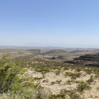


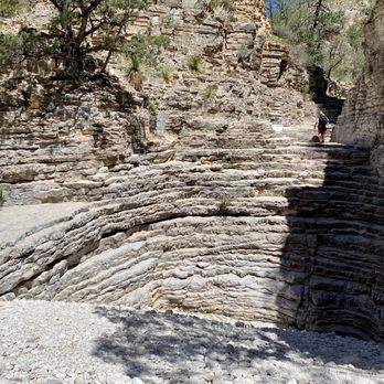


Attitude Adjustment Located in the northern part of the Chihuahuan Desert, this ±86k-acre National Park's (NP) claim-to-fame is its massive mountain range that includes the infamous El Capitan. This mountain range is so large that it even extends 25 miles northerly to include the mountains where Carlsbad Caverns is located. This was a totally impromptu stop as, quite frankly, we didn't even realize this was even a place until we drove thru it. The Good: *Easy on-and-off the freeway *Nice visitors center (VC) with clean restrooms and park info *$10 entrance fee makes this one of the cheaper NPs to visit. *The views of the mountains are pretty spectacular, even just from the VC. *The Headquarters VC Trailhead is about ± 1/2-mile roundtrip and worth the time if you're just stopping thru like we did. The Meh: *Fairly large parking lot that was chock-full and hard to find a spot when we arrived. The Ugly: *Gusts of up-to 60mph winds at the time of our visit, which is why we only did the VC Trail. Evidently, this is fairly common in these here parts, so please hike safely and don't be stupid. TLDR: Spectacular park that we'd love to explore more one day, but until then, I'd still recommend this as a must-stop if you're en route to Carlsbad or El Paso. read more



2 years ago

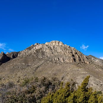
*** 2022 marks 50 years as a national park for GMNP *** Late last fall I drove through Guadalupe Mountains National Park as I have on numerous occasions throughout my near 40 years on Earth. It brought to mind the first time I climbed the highest peak in Texas at 8,751 feet. It was such a fun day trip. I served as a chaperone for a backpacking and camping course through New Mexico Junior College where I was employed for several years. I lived in Colorado for a short while. I'm from New Mexico. The peaks are far superior in those states... go ahead and laugh. I am too. Lol. The hikes are not too strenuous, however, I preface this statement with the fact that I have always been in shape and on the athletic spectrum. As I write, it is March 2022. This is the time of year that I would personally return to hike this area again. Why? It gets unexpectedly hot even early in the morning in the summer time. Late winter will allow you to see the buds growing, birds returning, and perhaps some other wildlife. Use the usual precautions... Bring water, hiking boots, a light jacket, sunscreen, snacks, etc. Pack it in, pack it out. TIPS + Make time to visit Carlsbad Caverns National Park which is not too far away from here. + although you're in Texas when visiting the Guadalupe mountains, you're not on Texas time. You're in the mountain time zone. SOURCE https://www.nps.gov/gumo/ read more

Calling all Peak-Baggers! Wow - what an accomplishment Guadeloupe Mountains NP offers! In this park is the highest speak in Texas at over 8,700 feet. It was a windy journey up to the summit, but it all was worth it to see the peak marker and to sign our names into the peak journal. Additionally, the rangers here are so kind with great advice. They took the time to answer all of my questions in detail and patiently help visitors who are not from the area and are not used to the climate. They seem more in tune with the area than the rangers at the semi-neighboring NP Big Bend. The visitor center is lovely, with an informative museum and separate gender-neutral bathroom. I would absolutely recommend this park to anyone who comes through the area. read more


Amazing mountains, clean fresh air, not alot of tourists. This park is definitely one that is underrated. We were crazy enough to still check out thr park when reports said winds were from 35-65mph. There were moments when there were snow patches on the trail. The waterfall was more like a stream at most. It was a good day. I would love to come back to check out Devil's hall trail and the peak trail next time. read more




4 years ago
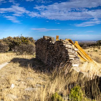
Very close to Carlsbad Caverns NP. We stayed in White's City and visited both parks over 3 days. CCNP is in New Mexico, and GMNP is in Texas, only 30 min apart. There is no road that travels through the park, only Hwy 62 that skirts along the SE border. Therefore, there is no entrance gate. You pay the park fee by stopping at one of the four visitor centers. The Pine Springs visitor center has a nature trail, very small gift shop, exhibits, restrooms, water, picnicking and a covered seating area with information plaques outside. There is a ranger on duty here for questions or first aid. Several of the trails can be reached out the back of the center. We decided to take the trail that led from the visitor center to the Butterfield Stage Station Ruins. This was an easy, paved, and accessible 0.7 mile path with some information along the way. We also traveled to the Frijole Ranch, which includes an 1800s schoolhouse, bunkhouse, barn and springhouse, and from there hiked the 2.3 mile loop Smith Spring Trail. We were told this trail would take us about an hour and be pretty easy. I would not call this trail easy, it is more moderate. We did the trail counter-clockwise and I think it may have been easier clockwise. The biggest problem was that the spring wasn't reached until more than half way through the trail. We didn't realize that, so it seemed like it was taking forever. It's like "where is this spring at?!!" And the map shows that there is another spring at the beginning of the trail called Manzanita Spring, but there is no sign there and it just looks like a small backyard pond. We had no idea that's what it was until later. If you decide to hike the Smith Spring trail, pick up a trail guide at the visitor center first. It includes information for 7 stops along the trail (starting at the Frijole Ranch and ending at the foothills). There is plenty of trail guide information at the visitor center. We not only picked up a nps map and the Smith Springs trail guide, we also received a helpful "Plan your Trip" handout that included specifics about all the trails in the park. It listed trails by how long they took, and then listed each trail with specific information about it. (see my photos) There is a Gypsum Sand Dune inside this park (like white sands np), but it is only accessible by hiking the Butterfield Stage Route or by driving Williams Road from Dell City and hiking from there. read more


The claim to fame is that Guadalupe peak is the highest point in Texas. The hike was decent with the most strenuous climb in the first quarter of the hike. The trail gives you several moments where you think you're almost at the top but then you turn the corner and you're definitely not even close. I'd say this is an average to the peak hike but it paddles in comparison to other national parks. However, definitely worth the quick 8 mile roundup hike in conjunction with Carlsbad caverns. The top has a great view with a cool little post office mailbox. I wonder if anyone ever empties that out as it looks like quite a few of the letters had been there for quite some time. You have a nice 360° view with a cool looking rock in one direction. read more



The website calls this hike "strenuous". Meh. Only if you're not in good shape (I'm fit but not a machine). You'll certainly get a workout but nothing too bad. Seriously. Older people are on this hike all the time and they're fine. You will be too. So, it's a 8 mile (round trip) hike to the top of Guadalupe Peak (there are other trails but I'm talking about hiking to Guadalupe Peak). The first two miles are probably the most difficult as they comprise switchbacks that are fairly steep. Mile three takes you through some nice Aspens and the last mile is the push to the summit. Get past the switchbacks and the rest is a mental game. I'm not a fan of heights and I only had two spots where I was like WTF am I doing. One was along the switchbacks where you have to scramble on some rock (instead of dirt trail) and the dropoff looks bad (prolly just described the entire hike). The second occurred near the summit. While you're going up, you approach a blind turn where you sort of have to peak around the corner to ensure you're on the right path. Other than that, it was a fairly easy hike for me. Toughest was the mental part since I don't like heights. But the trail is well marked and maintained. Easy days. I did it in early June. Perfect weather. Left at 8am & summited by 10. Left the park by 11am. Tips--YMMV so take these as you will: 1) I think a lot of day hikers don't pay the entrance fee (judging on the cohort of randoms I sort of arrived with. I didn't see anyone but me fill out the form). If you get there before the visitors center opens, it's sort of an honor system. You go to where all the RVs are parked. There is a board with maps and park info. Down and to the left is a container filled with envelops that you fill out, seal your $7 entry fee, and tear off the receipt to place in your car window. *Pay your entrance fees.* 2) Leave early to beat the heat. You don't have to wait for the visitor's station to open to start. Just do the self registration and head on up. 3) bring water and light snacks. Someone, somewhere, said two gallons per person? WTF? You do you but I did it with 1.5L bladder and a small handheld with tailwind mix for nutrition. And I had easily half the bladder left. I also didn't have a ton of extra crap: just a Salomon running vest, handheld, hat, running shorts, trail running shoes, and a shirt. That's it. I guess if you're gonna be up there all day, sure. But, seriously, if you go early, you'll beat the heat (plus it's cooler up there but not a lot of shade). You might need a *light* windbreaker for the summit (summer time. No idea what this is like during any other period). Know your body. Bring a few snacks, not meals. I brought 3 honey stinger waffles and an emergency gel that I always carry in my handheld. I ate one waffle at the summit. I did have tailwind tho. I just don't understand why anyone needs to bring a full pack. That's prolly why it takes you 8 hours cuz you're lugging around all that extra (unnecessary) weight. And this is coming from a former Marine. Ditch the weight. 4) if you had ambitions to run up/down. Good luck. The only runable portions (IMO) was between mile 2 to 3, and some random spots here and there. I tried running the switchbacks downhill but my quads were blown. Also TOOOOO MANY STEPS FFS. YMMV. Strava has folks doing the downhill in 30 min. I was way too nervous. I bet I could knock off 30 min on the climb the second time around. 5) if you're headed to San Antonio, DO NOT take 652 to 285 to I-10 (6/5/2019). Soooooo mannnny truckers and oil field rigs on TWO LANE highways with ENDLESS CONSTRUCTION. I was *literally* stuck behind a rig (huge train of vehicles) for 50+ miles going 30-40mph, some points stop and go, coz I couldn't pass. It's just not worth it. I would rather drive further to get to I-10 quicker than suffer through that stuff again. Driving through Pecos was a nightmare because they had road work signs for like 20+ miles on both sides of the city on areas they're not even working on! I don't usually get frustrated in traffic but this was *RIDICULOUS* small town foolishness. Add in the big rigs and I was ready to turn around BUT I COULDNT BECAUSE IT WAS A TWO LANE HIGHWAY. West Texas is not good. read more


Looks like I'm the only hater here, but I was unimpressed with this National Park in comparison to others. The highlight of this park is Guadalupe peak, the highest point in the Lone Star state. We stopped by on our way to Carlsbad Caverns to take a few pics, but didn't do any hiking since it was almost triple digits at the time. read more


This is a really nice national park in Western Texas that isn't too far from Carlsbad Caverns in Carlsbad, NM. This park is really nice to go for several day hikes or for camping. The Devil's Hall trail is a good one but you need to bring water and good hiking boots. The trail is partially marked up to the creek/wash you walk through until you get to a big Hiker's Staircase which you won't miss. It's a big semi wall climb that can be slippery. After that the Devil's Hallway is about a 3 minute walk past it. It's a nice spot to take a break for water and a snack/lunch. The Smith Spring Trail is also a good and not too difficult trail. When you get to the top of the trail there a bunch of places you can rest for a snack. It's well shaded and there's a lot of places you can sit down and listen to the babbling creek. The other half of the trail is back down to the parking lot. read more


Simply amazing.. GPM should be on every outdoor Enthusiast bucket list. Guadalupe Peak being Texas highest point is the Star of the park for sure but there is so many other fascinating hikes out here. Devil's Hall, Hunters peak, El Capitan to name a few. Frijole ranch museum was very cool. Being one of the least visited national parks But to me its one of the most fascinating. It's out in the middle of nowhere of West Texas about about 60 miles North of Van Horn, 70 miles west of Carlsbad, and about 65 miles east of El Paso. Note There is absolutely nothing around out here so Gas up and get your Groceries before arriving here or you're gonna be screwed. The only lodging at the park is at Pine Springs Just up from the visitor center. There is a parking lot that has spaces for RVs and a few spaces for tent camping. It's first come first serve or you can Reserve it through Texas park Wildlife . Mind it is very small and cramped in the tent area. I stayed at an Airbnb in Salt Flat about 20 minutes west of the park (plug).. More Travel Less Talk.. is the name of the place I stayed. Tent. Yurt and RV camping. Anywho This National Park is a must do. I summited the peak, the Frijole ranch and devils hall. I will definitely be back to explore more of this magical and beautiful park. Until then Happy adventuring . read more



5 years ago
Salt Flat, (West) Texas. Timestamp: May 2021. Access/Roads: Accessible roads are paved but a bit rough. Parking: Plenty space near the buildings. Costs: $10 for hikers and backcountry shenanigans. There is a self-registration form along hiking paths. You can just ignore the payments but there is no way to account for your presence if you get lost. Hours: 24/7 Terrain/Weather: West Texas is dry. The lower area is hot, dry and warm. It's disgustingly bad. Please tread carefully. The higher elevation gets a bit cooler depending on the year and snow might persist during winter months. However, just cause it's cooler doesn't mean you can't get bbq'd by the sun. The higher up, the faster the sunburn. Handicap: Poor. This is not a good place for handicap folks. You can rummage on low areas, the paved areas and the visitor's center. That is a safe place to see everything from a distance. The trails itself is not handicap friendly. The pathway is narrow and rough so wheelchairs or electronic scooters are not ideal. And there is little to no shade. Distance: 900 miles from Los Angeles, Calif. North of Site: 50 miles is Carlsbad, New Mexico. The area's largest town for stuff. The Carlsbad Caverns & White City is closer but not an ideal place for food, rest, etc. South of Site: 60 miles is Van Horn, Texas. East of Site: 100 miles is Pecos, Texas. West of Site: 110 miles is El Paso, Texas. El Paso is the largest city in a 300 mile radius that has it all. Nearby Attractions: -Carlsbad Caverns is the main attraction. Covid has things a bit goofy at the site so call/make reservations in advance. -Diablo Wilderness is a bit south. It's the desert area with critters, avians and plants related to desert motifs. -The Pecos oil patches is an interesting site. This isn't an official site but the entire region. Bit rough to navigate and the drive is slow with all the rigs. -Appx 150 miles south is the UT McDonald's Observatory & Fort Davis Frontier Post/Site with some hiking trails. -Appx 200 miles northwest is the White Sands Flats. Guadalupe mountains has several attractions. The Guadalupe Mountain is the highest elevated peak in all of Texas just shy of 9K. There are hiking trails galore for several mountain ranges with Guadalupe being the marquee. Many ranches, some that look like ghost towns, also inhabit the region. Two of popular ones are the Williams and Frijole Ranches. Along the mountains & trails are various caves, and eroded rocks. These are really cool. Generally, the two major things to do is hiking/backpacking & camping. Various large birds are present with the desert animals rummaging around. However, possibly due to heat, wildlife might not be visible til nighttime. The western region or backcountry portions is an ideal place to stargaze. The closer you are to oil patches, the heavier the pollution might be at night so unsure about this one. The visitor center is also a museum. There is no food, gas station or market nearby except for vending machines so prep adequately! 1,000 mile journey starts w/ one step. www.cleeshyun.com @cigarcpa read more


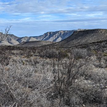
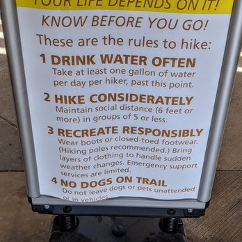


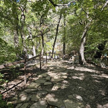
This park was gorgeous. We did the Smith Spring (~2 mile) trail which leads up the canyon to the spring. It was amazing to see the area change from Chihuahuan desert to lush forest as we got near. The spring really was a little oasis in the desert. I wish we could have stayed longer and brought a lunch with us to sit up there; it was peaceful. Unfortunately, the Frijole Ranch and Museum (at the entrance to the Smith Spring trail) were closed when we went. I would have loved to see that too. We camped at the Pine Springs Campground. It was nice. There was potable water, flushing toilets, and pit toilets. The camping pads were tucked back in enough that you had some privacy. I would definitely visit again and do a longer trail next time and camp again. read more


My husband and I decided to visit the El Paso area for a few days to do some hiking at some of the area's beautiful parks! We spent one of our afternoons hiking in Guadalupe Mountains National Park. The park is huge (86,000 acres/134 square miles) and really beautiful! The park includes Guadalupe Peak (the highest point in Texas) and the famous El Capitan. We hiked the McKittrick Canyon Trail (to the Grotto and back - 7 miles). It was a really gray, foggy day, but it was still a beautiful hike! I'd certainly go back for another hike. And you should visit if you're in the area, too! read more
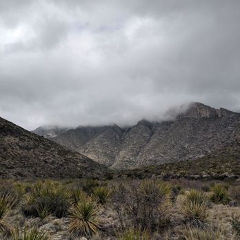
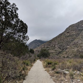


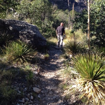
My GI Joe boyfriend hopping rock to rock brought me here for my birthday so I could reattempt the Devil's Hall (because the first time I didn't make it) and now that I can finally say I've completely finished this trail, the views anytime of the year are totally worth it. The one thing I didn't know was you need to go to the visitors center first. It's not optional. You have to pay about $5 per person at the visitor center. Didn't know that. They should put some signs up that tell visitors that. This time around we didn't run into a whole lot of wildlife outside of a couple of squirrels, but it was during the fall months so maybe they were staying in warmer areas. Devil's Hall follows a wash through the middle of the Guadalupe Mountains until you hit these crazy stairs an hour to an hour and a half later. Finally walking up those stairs to the very end made me feel so accomplished. And strangely enough... even though you're in a desert, this trail is very lush so the scenery is amazing! When we finally decided to go to the visitor's center to check it out, we picked up a magnet and some sodas outside at the soda machine (no Powerade machine or any kind of energy drink other than water). All in all, I love this park and I'm hoping that we can make more trips to conquer the other trails. And I won't forget to go to the visitor's center first. read more

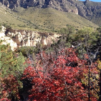


7 years ago
This is a wonderful place to visit. The visitors center has a lot of informational displays as well as a small gift shop. The rangers are very helpful and friendly. There are also areas for tent and RV camping with nice,clean bathrooms, trash,recycle and water. The trails are very good and well maintained for day hikes or backpacking expeditions. We also stopped by the historic ranch house and the historic mail route sites. It was neat to learn about the history of the location of the park and the people who lived and worked there in the past. I recommend stopping at these two areas within the park for sure!!! The only downfall while we were there was the extreme wind. I'm not sure if wind is a usual factor here, but the weather reports while we were at the park said " damaging winds". They were correct. As we left the park we saw a traffic accident with a large RV that had been pushed over by the extreme winds. I hope the passengers were ok!!!!! read more

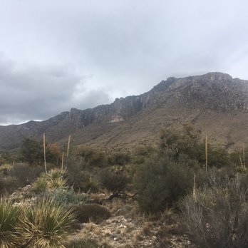


11 years ago

The mountains are close to Carlsbad Caverns. I came here on the last morning of my trip. After looking at the different trails, I decided on the Devil's Hall Trail (3.8 miles round-trip). It leads to a natural rock staircase and a "hallway" formed by steep canyon walls. Unfortunately, I didn't make it to the end. We went the wrong way halfway in, because we missed a sign. By the time we figured it out, we didn't have enough time to walk back and finish the trail. I was super disappointed. I guess I'll have to come back one day... read more


Guadalupe National Park is a smaller National Park when compared to the Yosemite's, Smokies, Yellowstone's or even it's Texas brother Big Bend. There are no scenic drives, there are no touristy towns at the front where you can ride go-karts or eat deep fried bacon pancakes drizzled in chocolate. (is that a thing?...it should be) There is a visitor's center with a small museum of the animals in the park, a tiny gift shop and a station to stamp your NP passports. There are 2 campgrounds at the park both are RV accessible but neither have hook-ups, showers or dump stations. It's basically a asphalt parking lot where as RV's are on top of each other. I didn't see the tent camping area but it seemed to be close by. There were clean bathrooms with potable water. The main reason to come here is to hike IMO. There are 80 miles of trails in the park. I was only there 1 day to do 1 thing: hike the Guadalupe Peak. The Guadalupe trailhead is located in the Pine Springs area campground. You'll come to a sign that points you in the direction of 4 hikes and you just follow the very well marked trail. The trail is 8.5 miles round trip with a little over 3,000 feet in elevation gain. I've done a lot of day hiking before and a few small backpacking trip. That was a few years and 40 pounds ago. This kicked my ass. Luckily I was with a preggo girl and people who haven't hiked a lot in the past. They slowed it down enough for me to make it enjoyable. It took us a little over 7 hours with a lot of breaks on the way up. The pay off is totally worth it as you can see all the way to Houston from up here. (Not really people but you can see a ways). They list the hike as strenuous but if you are in average shape, bring plenty of water and take a few breaks, it's not bad. If I had to do over, I would back pack it, camp up near the top at the campground so I could watch the sunset and sunrise. read more

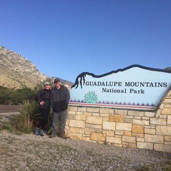


12 years ago
Take this notice to heart, if you are doing the Guadalupe peak trail, bring at LEAST 100oz of water. IF YOU CAN CARRY IT, BRING IT! Even if you can't, BRING IT!!! I have a 64 oz camelback, and I thought it was enough, so I decided not to bring my other container up with me. My camelback only lasted me until I reached the last hill, about 80% done. I was lucky that a volunteer was coming down and offered me a 12 oz bottle of water and that helped me to reach the top. It took me 3:16 hours to hike up. Coming down was another story, it took me 3:12 hours to get down , I have weak ankles and I was afraid to slip on the rocks and twist it, so I was pretty slow coming down. I was out of water, my leg cramped up and I seriously thought I was gonna to die there. For 3 hours, I had no water and I was so dehydrated that I stopped sweating. The most beautiful sight I ever seen was the gallon of water in my truck, I chucked it down like there is no tomorrow. When I got back to the visitor center, I sat in the center for 20 mins and started sweating again, which is good. NEVER again I will be lazy and not bringing enough water with me if I'm doing this trail again. When I was coming down, I see people bringing just a bottle of water, and all I can think about is, yeah, no way. But I was so tired and exhausted that I didn't bother to tell them. Sorry, selfish of me, but trust me, I was dying, I just wanted to reach my car. Now, the view on top is beautiful and stunning, windy and cool, Bring some light snacks to eat and watch the view. One guy brought a beer, a semi-warm beer after a long hike? freaking brilliant! If you are adventures, do this trail, just bring enough water. FYI - the park is in Mountain time zone, so if you are coming from Texas side in the CST zone, it is a hour behind. They open at 8AM, MST. read more
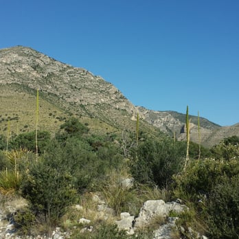


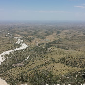

7 years ago

If you like rustic outdoors, hiking, Southwest U.S., with exceptional history, this is the place. It is really out of the way so not many people visit, but this very simple, yet beautiful location is awesome. One of my favorites. Bring some water, food, and good pair of shoes. If you have the time, hike into the canyon. The views are awesome. You will pass over/through some creeks, and deep back into the canyon is a very old and beautiful cabin. Lots of history to discover with how it was built and for whom. Just amazing. read more

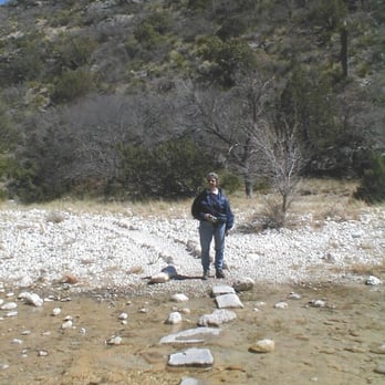


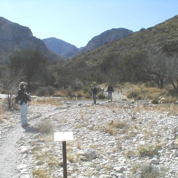

11 years ago
Amazing hikes, incredible trails, vast country, views to die for, and a true sense of accomplishment when you scale the mountain range to the top. It's the highest point in Texas. You feel on top of the world. read more




Page 1 of 2
More info about Guadalupe Mountains National Park
Ask the Community - Guadalupe Mountains National Park
When is the best time to start hiking? I usually prefer starting around sunrise or shortly after, are you able to enter the park this early? I see the website shows it isn't open until 8am but I wasn't sure if that was just for the office. Thank you!
The only portion of the park with time constraints is McKittrick Canyon. The gate at the freeway is open 8-5 MDT. Don't trust your phone though. Guadalupe Mountains is across the street from CST. The park is the same time as El Paso and all of NM.…
Would this be a park for backcountry backpacking? Or more of a car campsite situation? I'm looking for a place to go where me and a buddy can get into a good quiet isolated wilderness area. Would this be a good place to go?
Back country requires a permit purchased at recreation.gov Also a commercially designed human waste bag per person, per night. Read all the rules, watch the weather, plan your…
Review Highlights - Guadalupe Mountains National Park















Why does Yelp recommend reviews?

Guadalupe Mountains National Park - parks - Updated September 2026
Best of Salt Flat
People found Guadalupe Mountains National Park by searching for…
Browse Nearby
BEST of Salt Flat, Texas Things to Do near Guadalupe Mountains National Park
BEST of Salt Flat, Texas Restaurants near Guadalupe Mountains National Park
BEST of Salt Flat, Texas Coffee near Guadalupe Mountains National Park
BEST of Salt Flat, Texas Breakfast near Guadalupe Mountains National Park
BEST of Salt Flat, Texas Campgrounds near Guadalupe Mountains National Park


