Hite Cove Trail Photos



More like Hite Cove Trail
Recommended Reviews - Hite Cove Trail
Start your review...


Reviews With Photos


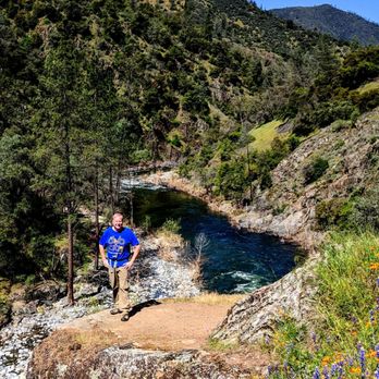
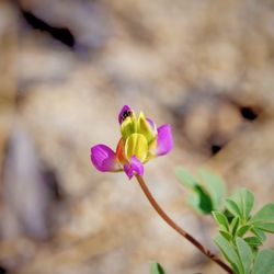
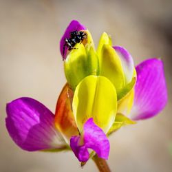
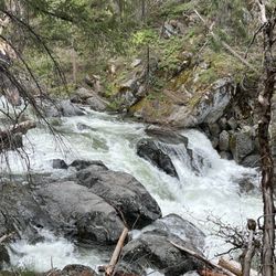
Single track trail , steep drop off in some area. Definitely not recommended for young kids or people who are vertigo. Beautiful trail alongside the Merced River , you can hear the sound of the water almost the entire trail. We were too early for the full bloom but must be amazing during the bloom. We saw a few baby blues and California poppies. There's a large bush of poison oaks right near the first creek , be very cautious if you are allergic ( even if you are not ). Quite a few gnats , bug sprays recommended. I had 3-4 gnats getting into my eyes. Ouch . Beautiful hike nonetheless. Only 100 ft elevation gain, 9 miles round trip. But it is a very narrow trail at the edge of the drop offs. NOT recommended for young children.


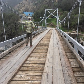
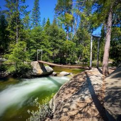
Beautiful trail just outside of Yosemite off of Highway 140 in El Portal. My husband and I hiked about 2.5 miles of the trail mid June. The whole trail is 4.5 miles one way- about 9 miles round trip if you want to go all the way to Hite Cove. We wanted to go all the way to the end, however temperatures in the canyon rise fast during the summer and it was easily 100 degrees by noon. The trail follows up above the Merced River. There were a few times when you can get right down to the river. About 1.5-2 miles in, there is a section with rocks that looks like it is made for jumping in the river. The trail is entirely single track with some areas with steep drop offs. Make sure to pack plenty of water, sunscreen, and bug spray. There is very little shade and the trail is almost completely exposed. To find the trail, just look for the Red Bud Lodge and park right across the street. There is a sign that points just to the trailhead next to the lodge. I would recommend to come as early as possible if you are coming in the summertime. read more


Considering that everything else in El Portal is some pee stained remnant from the Sears catalog, we didn't have high hopes for the 'trail' that came recommended. It's not that encouraging as you drive up either. Seems very average and nondescript. As it was our first night in the greater Yosemite area, we definitely wanted to get out and so we went for it. In retrospect, I would say it was one of the nicer hikes we went on. You walk high above the Merced River on a narrow trail amongst wild flowers and with a beautiful view of the mountains. The power of the river and the beauty of the land impressed all of us. It and easy/intermediate hike. One drawback is that it's not a loop. So you can go as long as you want (to the end even) and come back. We went and hour and turned around. Recommend. read more


7 years ago

Single track trail , steep drop off in some area. Definitely not recommended for young kids or people who are vertigo. Beautiful trail alongside the Merced River , you can hear the sound of the water almost the entire trail. We were too early for the full bloom but must be amazing during the bloom. We saw a few baby blues and California poppies. There's a large bush of poison oaks right near the first creek , be very cautious if you are allergic ( even if you are not ). Quite a few gnats , bug sprays recommended. I had 3-4 gnats getting into my eyes. Ouch . Beautiful hike nonetheless. Only 100 ft elevation gain, 9 miles round trip. But it is a very narrow trail at the edge of the drop offs. NOT recommended for young children. read more



10 years ago
Hite Cove is an amazing hike. It snakes along the Merced River with gorgeous little flowers in the spring months. The trail is 4.5 miles, so 9 miles round trip. It's a fairly easy hike with moderate inclines. There's a small lodge and porta-potties that mark the head of the trail along Hwy 140. read more


More info about Hite Cove Trail
11136 California 140
El Portal, CA 95318
Directions
Hours
Outdoor Amenities













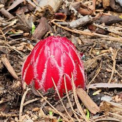
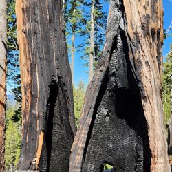


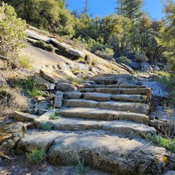
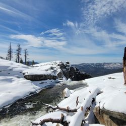
Why does Yelp recommend reviews?
1 review that is not currently recommended
The reviews below are not factored into the business's overall star rating.

10 years ago
Hite Cove Trail - hiking - Updated August 2026
Best of El Portal
People found Hite Cove Trail by searching for…
Hiking Trails With Waterfalls in El Portal, CA
River Swimming in El Portal, CA
Waterfalls and Swimming Holes in El Portal, CA
Flower Fields in El Portal, CA
National Parks in El Portal, CA
Off Road Trails in El Portal, CA
Walking Trails in El Portal, CA
Scenic Overlook in El Portal, CA
Running Track in El Portal, CA
Dog Friendly Trails in El Portal, CA
Water Parks for Kids in El Portal, CA
Trending Searches in El Portal, CA
Barbershop For Men near Hite Cove Trail
Cliff Jumping near Hite Cove Trail
Dog Friendly Beaches near Hite Cove Trail
Ear Piercing near Hite Cove Trail
Eyebrow Threading near Hite Cove Trail
Fishing Spots near Hite Cove Trail
Kids Haircut near Hite Cove Trail
Mini Golf near Hite Cove Trail
Movie Theatre near Hite Cove Trail
Permanent Makeup near Hite Cove Trail
Picnic Areas near Hite Cove Trail
Playgrounds near Hite Cove Trail
Preschools near Hite Cove Trail
Public Golf Courses near Hite Cove Trail
Public Pools near Hite Cove Trail
Scenic Overlook near Hite Cove Trail
Shopping Malls near Hite Cove Trail
Souvenir Shops near Hite Cove Trail
Star Gazing near Hite Cove Trail
Sunrise View near Hite Cove Trail
Swimming Holes near Hite Cove Trail
Things To Do With Kids near Hite Cove Trail
Browse Articles
Browse Nearby
Browse Brands
Related Searches in El Portal, CA
Affordable Kayak Rental Services in El Portal, California
Best Dog Hiking Trails Around El Portal, California
Best Fishing Locations and Guides in El Portal, California
Best Parks for Parties and Events in El Portal, California
Best Places for Horseback Riding in El Portal, California
Best Sightseeing Experiences Available in El Portal, California
Best Water Parks for Kids in El Portal, California
Best Waterfalls and Swimming Holes in El Portal, California
Check Out Great Playgrounds in El Portal, California
Check Out Off Road Trails in El Portal, California
Discover Baseball Fields Around El Portal, California
Discover Dog Friendly Trails to Explore in El Portal, California
Discover Fun Activities to Do in El Portal, California
Discover Kid Friendly Hiking Trails in El Portal, California
Discover Lakes & Ponds to Explore in El Portal, California
Discover Popular Bike Trails in El Portal, California
Discover Scenic Mountain Bike Trails Near El Portal, California
Discover Top Nature Parks to Visit in El Portal, California
Discover a Hiking Trail in El Portal, California
Discover the Best Beaches in El Portal, California
Discover the Best Night Hike Trails in El Portal, California
Dog-Friendly Hikes With Dogs in El Portal, California
Enjoy Camping Adventures Around El Portal, California
Enjoy Exciting Mountain Biking Adventures in El Portal, California
Enjoy Kayaking Adventures in El Portal, California
Enjoy Off Leash Dog Hikes in El Portal, California
Enjoy Tent Camping Spots Around El Portal, California
Enjoy a Beautiful Waterfall Hike in El Portal, California
Enjoy the Best Picnic Spots and Ideas in El Portal, California
Enjoy the Best Walking Trails in El Portal, California
Experience Thrilling White Water Rafting in El Portal, California
Explore Beautiful Parks and Green Spaces in El Portal, California
Explore Easy Hikes Perfect for All in El Portal, California
Explore Family-Friendly Zoos and Wildlife in El Portal, California
Explore Free Picnic Areas Around El Portal, California
Explore Fun Activities to Do in El Portal, California
Explore Parks With Pull Up Bars in El Portal, California
Explore Picnic Parks Near El Portal, California
Explore Popular Campgrounds Near El Portal, California
Explore Popular Picnic Areas Around El Portal, California
Explore Popular RV Parks Around El Portal, California
Explore Popular Recreation Centers Around El Portal, California
Explore Scenic Lakes to Visit in El Portal, California
Explore Top Dog Parks in El Portal, California Near You
Explore Top Trampoline Parks in El Portal, California
Explore Top Water Parks in El Portal, California Today


