Inspiration Point Photos


You might also consider


More like Inspiration Point
Recommended Reviews - Inspiration Point
Start your review...


Reviews With Photos


Although parking at the trail head can be hard to find on the public street, this hike is worth a couple extra steps if parking lower than you planned. Recommend going earlier in day or towards evening as the initial part of the hike is pretty sunny and along a paved road. It is about 3.5 miles round trip and up the whole way. Once there, the views of Santa Barbara make the trip well worth it. Take some water and relax along the way, you won't regret this when you are done!


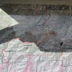
Luckily for us, we know someone who lives just below the start of the trail head so we were fortunate to pass by all the other hikers trudging up the hill to get to the head. I'm not sure I'd commit to the hike if I had to anticipate the parking struggle. The extra trudging can add a good extra 15 minutes uphill. The first 30 minutes of the hike is on pavement with some views of the valley and ocean and one bridge over a creek: not too exciting, but worth it for the greenery and creek beds that come next. The trail splits off into different routes (a map is provided at the forks). Our favorite route goes to what is called 3 pools. It's 30 minutes past the first run in with the creek bed. The beginning gets your lungs breathing heavy but after those 10 minutes it's a fun 20 minute dance along the rocky trail DOWN to the pools. (That's right, DOWN, no more uphill. Hooray!) it's a great spot for a picnic if you plan ahead, unlike us. Our french bulldog easily navigated the Rocky trails and was having a total blast off leash, but be careful at some of the view points because it could be an easy tumble down for your furry friend.


3.4 miles RT from tunnel rd. Moderate level difficulty. 1.45 to 2 hours RT total hiking time. 1,800 ft above Santa Barbara coast and 935 ft gain. Beautiful panoramic view of the Santa Barbara coast and city. Popular location with locals. There is a map at one the main junctions. However, one critique I had was that a junction had no official signage at all which left my friend and me lost for a bit. See picture*. Parts of the trail in the beginning are paved. I didn't see any bathrooms at base as there are few street parking and homes. Few dog walkers here with some that don't pick up after their pet. I wished the city maintained the trail a bit more as some parts of the trail were slippery and had no traction even with my hiking boots. Plan on bringing sufficient amount of water and snacks. Many hikers and locals hike late around 6 PM to catch the sunset. However, it would be unwise to go if you weren't experienced, didn't have headlamps or a flashlight for the trek back. At the peak, you'll stare in awe and amazement for the picturesque views of Santa Barbara. You can also take longer journey/detour to the Jesuita trail.


As of 6/29, this hike is open to the public. We started at the Inspiration Point Trailhead and it's about a 4mile, 2-3 hour hike of moderate intensity. The first half is paved and the second half requires going over some rocks so recommend a good pair of hiking shoes. Like others have said, the trail isn't well marked, but if you keep making lefts at each fork, you'll get to the destination. On a clear day, you'll get great views of Santa Barbara and also be able to see the Channel Islands. Minus-1 Star for the parking situation. There is NO parking lot and very minimal street parking so be prepared to take a "mini-hike" from wherever you find parking to the start of the trailhead.


There seems to be at least 4 different trails that lead to Inspiration Point, one being Jesusita Trail which I took to get here, Stevens Park is another, & the other 2 I forgot but once you make it up to the peak you can see there are two other paths that lead here. This spot has some great views of to the south & west of Santa Barbara County. Despite the ocean being overcast I still got some decent shots of the view, but trust me the picture don't do this spot that much justice. Even though this is just my first hike of a mountain in the Santa Barbara area getting up to this point for the view is totally worth it.


Nice views Hike through the oaks on a well maintained trail. Close to town And from the top you can see the whole beach below Not too crowded even on weekends


Whether you're a Santa Barbara local, new to town or visiting, Inspiration Point is the hike to do! As an SB local myself, Inspiration has always been my favorite. I usually meet a friend at the Mission, then take one car to park on Mission Canyon as spaces can be sparse. Make sure you stay to the left in the beginning to avoid the dead end steep hill! I would say the hike is fairly moderate, with a breathtaking and well deserved view at the top! Bring water!


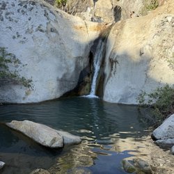
This hike this morning was awesome, it came highly recommended by the workers at the hostel I'm staying at, so I went to give it a try. Upon driving up to the area, be aware that you need to park on the side of the road, so if there are a lot of cars up ahead, just grab the first spot you see and get ready for the uphill climb to the base of the trails . So then you reach the trailhead, and already, you have views. Beautiful scenic shots of the ocean and SB, beautiful. The first part of the trail is paved and comfortable. Easy walk up the path and a fun little waterfall along the way, it was nice. Then, once the path becomes dirt and unpaved, the real hiking begins. And I went towards Inspiration Point up the hills, and I'd say it's a low Medium-Easy hike to get up there. But remember, bring water. There are no fountains. Also, be careful of THE MUD. The mud was pretty thick on the way up, and it almost ate my shoe as I was trudging through it. So be wary. And also, enjoy the dogs on the path. The waterfalls are beautiful, and the scene from the top is breathtaking. This hike is a 5 star hike.


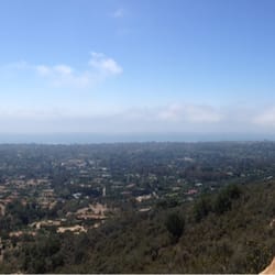
We hiked here late afternoon and got one of the last parking spaces before the road ends at the water tower. You'll hike up a fire road for a while before hitting the trail head. We talked to a few folks who were headed to or coming from the right branch, so we headed left up to inspiration point. The observation point is not very far from the trail head but it's a steep climb. Wonderful tranquility and views all along the trail and at the overlook (at the power line tower). We went in September and the sun was still pretty far north. Had hoped to see it set over Santa Barbara. Would like to come back closer to the solstice to see how much further south the sun sets. Nice view of Santa Barbara. In my photo the mission is in the middle and the harbor to the left. UPDATE: after reading a description of this hike on AllTrails, I'm not sure we were on the right trail. Anyway, we had a steep, but nice hike up to the power lines, and were rewarded with a nice view.


The view is awesome, just be sure to know where you're going before you leave for the point. Enter this in Google Maps to get there: Spyglass Ridge Rd, Santa Barbara, CA 93105 ------------------------------------------------ When you're on Mission Canyon Road, you'll have to park on the side street. There's no public parking, and be sure to be within the curb to not get towed. Once you're up there, go right of the water tower and KEEP HEADING on the FIRST LEFT of every fork in the trail until you're at the top of the mountain. From there, cross the junction and you'll see a wonderful view of Santa Barbara. The hike is easy but not totally flat, so bring 2 bottles of water per person since the hike itself is about 2 hours round trip and on a summer afternoon, it can get pretty hot.


Good quick hike about 3.6 miles. Finished in 2 hours even a slow pace. It was not difficult and dog friendly. It had a few rocks to navigate up so felt like small adventure to a view point at end. Not spectacular ending but it was nice spot to snap a pic. We thought we went early at 7am but most of the parking already taken and we took the last parking spot on side of road. We still had to hike like 0.3 miles to trailhead.


Inspiration Point trail is a easy to moderate hike. The trail can be reached from the Tunnel Road trail (I've done it and this review is based off that) or from the Jesusita Trail (which I have not done). About the hike- Approximately 4.5 miles roundtrip, the trail does not loop. Perfect for morning or late afternoon, although there are few shaded areas you don't want to be hiking in the strong midday sun. The trail is not just uphill but varies between level, uphill, and downhill throughout all while making an elevation gain of about 800ft. How to get there- Take Foothills Road Mission Canyon Road, when the road forks keep left onto Tunnel Road which you will take until the end and park. Walk along the paved road until you reach the trail head. At the top- Once you reach the top the view is, well, inspirational. Spectacular views of Santa Barbara and the ocean. Great picture opportunity. There are reptiles, birds, and other wildlife on the hike. It's a great location with other trails in the area to try as well.


One word: INSPIRATIONAL :D It's a great hike which took my two friends and I going up about 45 minutes with some upward incline, lizard spotting, greeting fellow hikers and watching not to trip and fall lol At the top you can see all of Santa Barbara, Goleta, and UCSB. Pretty cool view with sunny weather to accommodate it :)


10 years ago

11 years ago

10 years ago

10 years ago

12 years ago

12 years ago

11 years ago
12 years ago

11 years ago

15 years ago
11 years ago
11 years ago
10 years ago
More info about Inspiration Point
1498 Tunnel Rd
Santa Barbara, CA 93105
Directions
Hours
Indoor Amenities
Outdoor Amenities
Ask the Community - Inspiration Point
Review Highlights - Inspiration Point
You might also consider
























Why does Yelp recommend reviews?
6 reviews that are not currently recommended
The reviews below are not factored into the business's overall star rating.
10 years ago

2 years ago

15 years ago

15 years ago

13 years ago
12 years ago
Inspiration Point - hiking - Updated September 2026
Best of Santa Barbara
People found Inspiration Point by searching for…
Things to Do in Santa Barbara, CA
Scenic View in Santa Barbara, CA
Hiking Trails in Santa Barbara, CA
Rock Climbing in Santa Barbara, CA
Dog Friendly Beaches in Santa Barbara, CA
Waterfall Hike in Santa Barbara, CA
Sunset View in Santa Barbara, CA
Scenic Drive in Santa Barbara, CA
Running Trails in Santa Barbara, CA
Walking Trails in Santa Barbara, CA
Off Road Trails in Santa Barbara, CA
Stairs Workout in Santa Barbara, CA
Playgrounds in Santa Barbara, CA
Places to Take Pictures in Santa Barbara, CA
Free Parking in Santa Barbara, CA
Easy Hikes in Santa Barbara, CA
Lookout Points in Santa Barbara, CA
Night Hike in Santa Barbara, CA
Night View in Santa Barbara, CA
Trending Searches in Santa Barbara, CA
Apple Orchards near Inspiration Point
Apple Picking near Inspiration Point
Barbershop near Inspiration Point
Bike Shop near Inspiration Point
Blowout near Inspiration Point
Casinos near Inspiration Point
Cliff Jumping near Inspiration Point
Dog Friendly Things To Do near Inspiration Point
Estheticians near Inspiration Point
Eyelash Extensions near Inspiration Point
Furniture Stores near Inspiration Point
Hiking Trails With Waterfalls near Inspiration Point
Kids Birthday Party near Inspiration Point
Lakes & Ponds near Inspiration Point
Makeup Artists near Inspiration Point
Mattresses near Inspiration Point
Off Road Trails near Inspiration Point
Picnic Areas near Inspiration Point
Places To Take Pictures near Inspiration Point
Private Schools near Inspiration Point
Public Shower near Inspiration Point
Rock Quarry near Inspiration Point
Scenic Night View near Inspiration Point
Scenic Overlook near Inspiration Point
Sugaring near Inspiration Point
Sunrise View near Inspiration Point
Browse Articles
Browse Nearby
BEST of Santa Barbara, California Coffee near Inspiration Point
BEST of Santa Barbara, California Things to Do near Inspiration Point
BEST of Santa Barbara, California Parks near Inspiration Point
BEST of Santa Barbara, California Restaurants near Inspiration Point
BEST of Santa Barbara, California Scenic View near Inspiration Point
BEST of Santa Barbara, California Breakfast near Inspiration Point
BEST of Santa Barbara, California Campgrounds near Inspiration Point
Browse Brands
Related Searches in Santa Barbara, CA
Affordable Kayak Rental Services in Santa Barbara, California
Best Fishing Locations and Guides in Santa Barbara, California
Best Nature Trails for Hiking in Santa Barbara, California
Best Places for Horseback Riding in Santa Barbara, California
Best Sightseeing Experiences Available in Santa Barbara, California
Best Water Parks for Kids in Santa Barbara, California
Check Out Off Road Trails in Santa Barbara, California
Discover Dog Friendly Trails to Explore in Santa Barbara, California
Discover Easy Hiking Trails Near Santa Barbara, California
Discover Kid Friendly Hiking Trails in Santa Barbara, California
Discover Popular Bike Trails in Santa Barbara, California
Discover a Hiking Trail in Santa Barbara, California
Discover the Best Fishing Lake in Santa Barbara, California
Discover the Best Night Hike Trails in Santa Barbara, California
Dog-Friendly Hikes With Dogs in Santa Barbara, California
Enjoy Camping Adventures Around Santa Barbara, California
Enjoy Kayaking Adventures in Santa Barbara, California
Enjoy Off Leash Dog Hikes in Santa Barbara, California
Enjoy Tent Camping Spots Around Santa Barbara, California
Enjoy a Beautiful Waterfall Hike in Santa Barbara, California
Enjoy the Best Picnic Spots and Ideas in Santa Barbara, California
Enjoy the Best Walking Path in Santa Barbara, California
Enjoy the Best Walking Trails in Santa Barbara, California
Explore Beautiful Parks and Green Spaces in Santa Barbara, California
Explore Easy Hikes Perfect for All in Santa Barbara, California
Explore Fun Activities to Do in Santa Barbara, California
Explore Popular Campgrounds Near Santa Barbara, California
Explore Top Dog Parks in Santa Barbara, California Near You
Explore the Best Beach Spots in Santa Barbara, California
Family Friendly Hiking With Kids in Santa Barbara, California
Find Popular Ziplining Spots Around Santa Barbara, California
Find Top Dog Friendly Parks to Visit in Santa Barbara, California
Find Top-Rated Waterfalls in Santa Barbara, California Now
Find the Best Parks for Picnics in Santa Barbara, California
Find the Best Playgrounds to Visit in Santa Barbara, California
Hiking Trails With Waterfalls in Santa Barbara, California
Off Leash Dog Hiking Trails in Santa Barbara, California
Popular Outdoor Activities to Try in Santa Barbara, California
Popular Picnic Spots to Visit in Santa Barbara, California
Popular Waterfall Hiking Trails in Santa Barbara, California
Safe River Swimming Areas in Santa Barbara, California
Safe and Fun Parks for Kids in Santa Barbara, California
Top Hiking Trails to Explore in Santa Barbara, California
Top Playgrounds for Kids to Enjoy in Santa Barbara, California
Top Running Trails to Explore in Santa Barbara, California
Top Swimming Lakes to Enjoy in Santa Barbara, California
Top Things to Do With Kids in Santa Barbara, California
Top-Rated Camping Sites in Santa Barbara, California
Walk Dog Friendly Hiking Trails in Santa Barbara, California


