Cancel

    Open app

    Search

    Liberty Bell Mountain

    5.0 (2 reviews)

    Liberty Bell Mountain Photos

    Recommended Reviews - Liberty Bell Mountain

    Your trust is our priority, so businesses can't pay to alter or remove their reviews. Learn more about reviews.
    Yelp app icon
    Browse more easily on the app
    Review Feed Illustration
    Photo of Nami N.
    317
    835
    9465

    1 month ago

    Helpful 0
    Thanks 0
    Love this 0
    Oh no 0
    Photo of Andrew H.
    2616
    3071
    13118

    9 years ago

    Helpful 0
    Thanks 0
    Love this 0
    Oh no 0

    Verify this business for free

    Get access to customer & competitor insights.

    Verify this business

    Glacier Peak

    Glacier Peak

    5.0(2 reviews)
    56.1 km

    This is the lowest and most remote volcano in Washington. I've been up this mountain three times…read moreand love it so I'm reviewing, even though the last time up was 2020. This hike is beautiful, and I suggest taking your time, and staying two nights on the way in, and one night on the way out simply to enjoy the surroundings. Plus, it's nearly a 33 mile round trip. Take the North Fork Sauk Trail to the PCT. First 5 miles are nice and easy, then a couple of miles of seemingly endless switch backs. A short bit on the PCT and a nice camping spot to the right. Second Day is a very nice hike into the mountain and to the high camp. Third morning is the summit approach. The trail is obvious. Depending on the time of the year, you may need to rope up as it can be quite crevassed in the later summer. Definitely recommend ice axe and crampons. We walked out and peered into some deep wide crevasses, anchoring our selves with rope. This is one of my favorite climbs because it's really not hard, just long on the way in. Very beautiful but weather can change very fast and on one summit it turned to a thunder storm. Still, if you like to hike and climb, this one is a must. Bear canisters recommended, though I've never seen a bear here. No permit required, just Northwest Forest Pass for parking. Go do it!

    Glacier Peak is notorious mainly for how remote it is. Many people in Seattle have probably seen…read moreit on a clear day, and either not known it's name or mislabeled it something else. It has one of the longest approaches of any major peak in the NW (along with Mt Olympus). But, man, it's a gorgeous hike in! Terrain is continually changing. In the forest, in alpine meadows, over rock, on glaciers, at the summit! Lots of gorgeous places to put a tent on the way in, I'd be worth going to even if you're not going to summit.

    Photos
    Glacier Peak
    Glacier Peak
    Glacier Peak

    See all

    North Cascades Highway - Diablo Lake.

    North Cascades Highway

    5.0(2 reviews)
    80.2 km

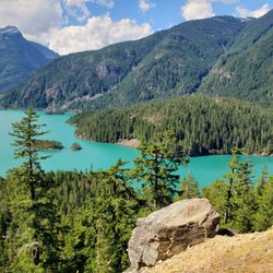
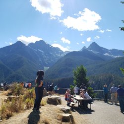
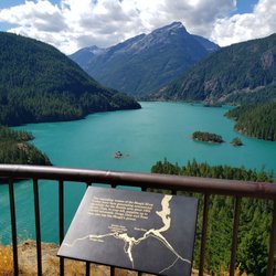
    Every time I drive the North Cascades Highway I ask myself: why don't I do this more often? This…read moredrive is absolutely spectacular, as it winds up from the river lowlands into the mountainous North Cascades National Park, along streams, trails and the gorgeous Diablo Lake. It's a drive to be savored, not rushed, and I like to take as much time as I can to hit the pull-outs and side trails where marvelous vistas can be found. My two favorite spots to stop are the Diablo Lake overlook with it's ahhhhmazing views over the turquoise-colored waters of the lake. This lookout seems to always be windy, so if you go on a cooler day it's wise to have a sweatshirt nearby. My second fave stop is Washington Pass Overlook, which is a little quieter and requires a short, level hike to a phenomenal overlook on top of a cliff (don't worry, there's a railing). If you keep walking past the overlook, there's a bit of climbing on the trail but also more gorgeous vistas. Shortly the trail winds back down to the parking lot, where there are some nice picnic tables to enjoy lunch. The North Cascades Highway is best enjoyed when you have time to camp out for a night or two and take some of the many day hikes in the area. Or, keep going until you get to the quaintly themed "cowboy" town of Winthrop, which sort of marks the unofficial eastern terminus of the NCH. However you do the NCH, just do it - it's got to be one of the most spectacular drives in the USA!

    We rented a supercar in Seattle and wanted to do this whole drive but it's closed this time of…read moreyear. We were able to drive to Diablo Lake though and it was a great drive. We will definitely come back when the whole loop is open and so it in our vehicle. What a beautiful day, drive and trip to Diablo.

    Photos
    North Cascades Highway
    North Cascades Highway
    North Cascades Highway - Diablo Lake.

    See all

    Diablo Lake.

    REO Rafting & Yoga Resort

    REO Rafting & Yoga Resort

    4.3(11 reviews)
    175.8 km

    Best (first) rafting experience ever! You don't get a first ever again, am I right? So why not…read moretreat yourself right to some glamping as well. WHAT IS GLAMPING? I'm embarrassed to say that my parents knew before I did. Glamour + camping, just imagine all the hassle of camping from when you were younger--hauling the tent, eating spam by the fire, potty breaks behind the trees--gone. I know what you are thinking, "WEAK. THAT'S NOT CAMPING!." Well if you are just going to stay at some shoddy hotel 30 minutes away instead, might as well live by the river at this resort in some fancy tents with restrooms + showers and dining hall meals. My parents and I did the rafting + 1 night glamping package. It'll cost you quite a chunk of your wallet at around 300 CAD each. If you aren't the biggest fan of camping, it might not seem worth it at first, but this place definitely did come around to me. You can either do the afternoon rafting option, where you come early afternoon, raft, and then stay the night; or you can come in the late afternoon, stay the night, and raft in the morning. We chose the latter. We checked in around 5pm, got shown to our tent (ours was conveniently, or unfortunately, located right next to the bathrooms), and settled down on the rocking chairs overlooking the river. Dinner was served at 7pm. There's an open dining hall area, and the patrons as well as the staff both eat here. The food is cafeteria style, as in there are huge trays of food brought out and they serve everyone first so that there is enough food to go around. You can then go serve yourself after. The food isn't fancy, but it also isn't bad. Another necessity served at the dining hall area are outlets! Since the tents don't have any outlets, you'll have to bring your phone chargers here. Oh, there is wifi throughout the whole resort too. They know we all can't live without these things. The showers are located farther away from the tents, up a small flight of stairs. The water is nice and hot though, and they keep the shower rooms fairly clean. Towels and bath mats are provided, but shampoo/soap and other toiletries aren't. So make sure you bring those from home! There's also a hot tub area right next to the campfire area, which is right next to the yoga area, which is right next to the dining halls. You get the idea. We didn't chill around the campfire that night, but we saw some people roasting smores. Classic. Lights go out at 10pm, but they do give you a small lantern for light. You can hear the river rushing right outside, drowning out any other noise like one of those "nature soothing sounds" some people put on at night to help them sleep. Knocked me out fairly quick. Breakfast was at 8:30 am. Bright and early. Our rafting guide, Dylan, introduced himself to us then. Spoiler: having a great, experienced guide is important. Rafting was at 9:30. We wetsuited up, lifejackets on, helmets tightened, booties on our feet. They took us on a bus down along the old logging road that runs by the Nahatlatch River. Our group was a bit special because it was just us 3 patrons since I guess another group didn't make it. Usually they bring 6-7 people in each raft. That just meant more room on the raft. Dylan taught us all some important commands like holding on to the rope and crouching down in the raft. We practiced this out in a lake area, and then we were off on some rapids. I was slightly frightened after seeing a trainee fall out of another raft. For better or for worse, I treated every command from then on almost as if my life depended on it. I definitely did not want to fall out along some of these rapids with rocks and branches in the water. The second stretch, Dylan said was a grade 4 (and optional), which meant it was a bit more difficult. We ended up opting out of that, and hopped onto the bus to the stretch after. Dylan said something about a rapid called the Meat Grinder. No thanks. They had snacks waiting for us at that point, which I thought was a nice touch. And after our snack break it was back into the water. The rest of the river all the way back to the resort was about 11km long. After the initial shock was over, and after getting a hang of the commands and trusting Dylan as he guided us between rocks and telling us to hold on before bigger falls, the rest of the river was quite the experience. Drenched and battered by the river, we made it through some real breathtaking views and felt a visceral power of the rushing water. The whole experience was about 3 hours long. The hot tub felt amazing right after. After lunch and an easy checkout, we were on our way back to Vancouver. Without a doubt, Reo is definitely a great place for beginner rafters!
    Got back from a few rounds of rafting. It was an amazing. Wallszy will make sure you get the best…read moretrip you can. The food is great and being a big guy it was nice that they make sure I got enough. Beautiful place to be and enjoy. Been there a few times and really look forward to going back. Thanks reo

    Photos
    REO Rafting & Yoga Resort
    REO Rafting & Yoga Resort
    REO Rafting & Yoga Resort

    See all

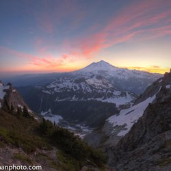
    Mount Shuksan - Mt Baker from the Fisher Chimney route on Shuksan

    Mount Shuksan

    5.0(2 reviews)
    77.8 km

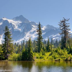
    One of the most iconic, gorgeous, and fun-to-climb mountains in the Cascades…read more It's probably my #1 favorite. "Mt Baker" ski resort is actually located right on this mountain. Shuksan has numerous super-classic routes: Fisher Chimneys (rock, glaciers, snow, a little bit of everything), North Face (high angle goodness), Sulphide Glacier (great beginner ski mountaineering route), and White Salmon glacier (not so classic...actually). If you don't care about climbing, Artist's Point is one of the most iconic places to photograph the peak.

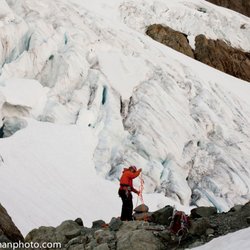
    As I start this review I see a picture of someone doing a climb to the peak in this entry on Yelp…read more I'm not nearly that rugged or adventurous but Mount Shuksan is a beautiful mountain peak to see! You get fantastic views of it at Picture Lake and up at Artist Point. At the top of Artist Point you get a great panoramic view of the area. Mount Shuksan is a non volcanic peak and while Mount Baker which is the other major peak you see at the point is volcanic. Mount Shuksan is also in the North Cascades National Park while Mount Baker is in the Mount Baker National Forest area. So you are very close to a couple of boundaries in this area... and of course farther north is Canada. When we went to the Artist Point area there was some haze from forest fires but that didn't stop us from getting some really great pictures of the scenery. I was most taken with Mount Shuksan and I wound up taking a lot more pictures of that peak than Mount Baker but the whole area is a true sight to behold.
    Photos
    Mount Shuksan
    Mount Shuksan - Mount Shuksan

    Mount Shuksan

    Mount Shuksan

    See all

    Lake Ann - This is Lake Ann. I guess it's okay but I'd suggest attempting Maple Pass Trail for 10x better perspectives of Lake Ann.

    Lake Ann

    5.0(2 reviews)
    84.2 km

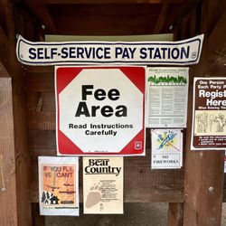
    There is really no such thing as Lake Ann Trail from my POV. There is a pathway that leads to Lake…read moreAnn, but if your sole intention is hiking to Lake Ann, you're doing yourself a disservice. Lake Ann is mediocre. It's an average looking lake with no redeeming qualities. Let me explain what the trail to Lake Ann is really about... It's part of the much bigger MAPLE PASS TRAIL. Yes, Maple Pass is what you want!!! It's a showstopper! All Lake Ann offers is a little side-trek walk to an alpine bowl shoreline. But Maple Pass is an outstanding 7.5 mile loop trail going high above, over and around Lake Ann for stunning panoramic vista point perspectives of the Rainy Lake section of North Cascades National Park. Although there are so many wonderful hiking trails at North Cascades, I highly suggest including Maple Pass as part of your itinerary. Only heading to the "toe" of Lake Ann won't provide a successful journey or wining feeling in any sort of memorable way. Lol, if I haven't reiterated it enough, Maple Pass is the real hero trail! Let me back up just one moment... This Lake Ann - Maple Pass Trail is located in the Rainy Lake Picnic Area of the park. Be aware of this. It's not to be confused with the other side of Highway 20 and the Rainy Lake Trails side. The Picnic Area is what you want! I stopped on by around 1:30pm back over peak summertime visitation season and the Rainy Lake Picnic Area parking lot was completely full. I had to park along the shoulder of Highway 20 and walk 5 minutes to the trailhead. A lot of people were parked on Highway 20 which offers enough spacing between your car and passing traffic to feel safe. Although it's free to visit North Cascades National Park, it's a $5 fee to hike at the Rainy Lake Picnic Area. I'd suggest to be prepared with a $5 bill and or check (with a pen) to pay at the self-service station. I don't believe they accepted credit cards from what I can recall. Btw, if you are curious as to what Rainy Lake actually looks like, if you veer left from the trailhead, it's a casual 0.9 mile walk (each way) along flat ground. But Rainy Lake is nothing special either. Just like Lake Ann, I'd skip Rainy Lake. Start the hike to Maple Pass because it could take half the day, especially if you spend time at the summit admiring the sweeping views. And if you are curious as to what Lake Ann may look like, you'll find the side path for it right before the elevated climb beginning up towards Maple Pass. Overall, I'd rate Maple Pass as strenuous, but if you manage your time well and stop for photos, you'll be handsomely rewarded with dramatic sights looking down upon Lake Ann and even be eye level with the rugged peaks of the North Cascades Mountain Range! Trekking higher on Maple Pass...Heather Pass is about 3/4ths of the way up the mountain. And it's here at Heather Pass where the scenery starts to thrill. Eventually the entire 360 degree landscape opens up with unlimited opportunities to bask in the glow of nature. At this point, Lake Ann will look like a little blip on the radar in the context of how high up the mountainside you are. It's at the height of the hike and coming upon Maple Pass where I felt contentment knowing all the hard work and grinding uphill was worth it. Finally, the descent back down the mountainside starts with an immediate set of switchbacks among a gorgeous cliffside backdrop before reentering below the tree-line horizon again. This back-half section finishing the total loop will add an extra 90 or so minutes making the entire Maple Pass Trail 5 hours long (including briefly stopping at Lake Ann), which is more than manageable for any moderately motivated hiker. Overall, North Cascades is one of the most underappreciated national parks in the USA and there's an abundance of amazing hikes here that barely get any sort of recognition. Although Lake Ann doesn't stand out whatsoever, it's Maple Pass Trail climbing above the bowl that Lake Ann's situated in that's the ultimate prize for the difficult endeavor.

    First, the bad news: this trail is uphill both-ways…read more Sure, you'll feel cool hiking in. "Wow, this is easy", you'll exclaim. It's easy because you're losing 500 ft of gain, right off the bat. You're gonna have to go back up on the way out! Anyway, it's a great trail. It can have lots of downed trees on it early season and it can take a while to melt out so, DO YOUR RESEARCH! Some years there's snow on the trail well into August! The trail ends at Lake Ann. It's a gorgeous area. Only climbers should start to venture out of the Lake Ann area and towards the mountain. #safetyfirst

    Photos
    Lake Ann - Maple Pass Trail is terrific for capturing panoramic moments high above Lake Ann.

    Maple Pass Trail is terrific for capturing panoramic moments high above Lake Ann.

    Lake Ann - Along Maple Pass Trail, stopping to appreciate the views surrounding Lake Ann.

    Along Maple Pass Trail, stopping to appreciate the views surrounding Lake Ann.

    Lake Ann - To access Lake Ann or hike Maple Pass Trail, it's a $5 fee.

    See all

    To access Lake Ann or hike Maple Pass Trail, it's a $5 fee.

    Liberty Bell Mountain - rock_climbing - Updated September 2026

    Loading...
    Loading...
    Loading...