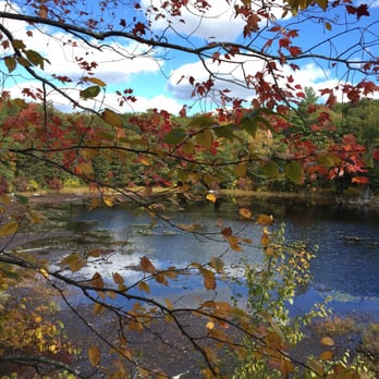
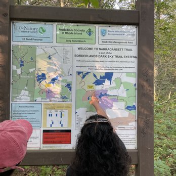
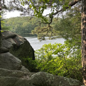
1. Long Pond Nature Area

    1. Long Pond Nature Area

    0

    ,

    Cancel

    Open app

    Search

    Long Pond Nature Area

    4.9 (9 reviews)

    Long Pond Nature Area Photos


    You might also consider

    More like Long Pond Nature Area

    Recommended Reviews - Long Pond Nature Area

    Your trust is our priority, so businesses can't pay to alter or remove their reviews. Learn more about reviews.
    Yelp app icon
    Browse more easily on the app
    Review Feed Illustration
    Photo of Ken C.
    134
    826
    3047

    5 years ago

    Helpful 7
    Thanks 0
    Love this 9
    Oh no 1

    11 years ago

    Helpful 3
    Thanks 0
    Love this 3
    Oh no 0
    Photo of Brian S.
    255
    1992
    28197

    16 years ago

    Helpful 22
    Thanks 0
    Love this 20
    Oh no 0

    15 years ago

    Helpful 2
    Thanks 0
    Love this 1
    Oh no 0

    13 years ago

    Helpful 2
    Thanks 0
    Love this 1
    Oh no 0

    12 years ago

    Helpful 2
    Thanks 0
    Love this 3
    Oh no 0

    8 years ago

    Helpful 1
    Thanks 0
    Love this 1
    Oh no 0

    12 years ago

    Helpful 0
    Thanks 0
    Love this 0
    Oh no 0
    Photo of Aaron M.
    122
    85
    54

    11 years ago

    Helpful 0
    Thanks 0
    Love this 0
    Oh no 0

    Ask the Community - Long Pond Nature Area

    Verify this business for free

    People searched for Hiking 1,012 times last month within 15 miles of this business.

    Verify this business

    Canonchet Brook Preserve - Foster Sawmill Ruins

    Canonchet Brook Preserve

    4.0(1 review)
    2.8 km

    The Canonchet Preserves offer approximately 750 acres of land between the Hopkinton Land Trust and…read morethe Nature Conservancy. Well-maintained and blazed trails provide miles and miles of trekking and historical points of interest to explore. A stone's throw from I-95, this outdoor space is easy to get to and quick to locate. There are many ways to access this land but I started my most recent visit from the parking lot located on Route 3. Much of the area here is a combination of hills and swamplands. Brooks run through the acreage including Canonchet Brook South Fork and the Tomaquag Brook. These water sources are part of the reason there are so many archaeological finds on these lands. According to information about the property, both were significant in pre-Colonial use and offer pre-industrial revolution water powered mill sites. I had the opportunity to check out a mill dam, the Stone Bridge, Foster Sawmill Ruins (circa Revolutionary War era), and the Jonathan G Foster barn foundation. The trails were not too strenuous... I stayed primarily in the Hoxsite-designated area and put in just under 3 miles (Canonchet Trail to Hoxsie Trail loop). So many rock walls intersections and history here; originally farmland owned by the Hoxsie family. How fantastic it is that the public has the opportunity to utilize this land to get a bit a fresh air and immerse oneself in Rhode Island's past. Closed from the 1/2 hour after sunset to the 1/2 hour before sunrise. Open for hiking and "landscape appreciation". Bring orange during season as portions of this land are open for deer hunting. Do not bring a metal detector to go rooting around in the accessible sites as it is prohibited. I visited in early spring which allowed easy views of the landscape without leaves hiding just how far everything is spread out.

    Photos
    Canonchet Brook Preserve - Canonchet Trail marked with Yellow Blazes

    Canonchet Trail marked with Yellow Blazes

    Canonchet Brook Preserve - Miles of walls.

    Miles of walls.

    Canonchet Brook Preserve - Beautiful large tree

    See all

    Beautiful large tree

    Black Farm Wildlife Management Area - Stepping stones across a brook

    Black Farm Wildlife Management Area

    4.0(3 reviews)
    5.0 km

    Note: Black-Farm Management Area is in Hopkinton, not Tiverton! So just be aware that you need to…read morelook for it on the west side of the Bay, not the east side, until Yelp corrects this. That being said, what a wonderful set of trails, woodland, fields, streams, and ponds, this place is! There is a main trail, yellow-blazed, but also many unmarked side trails that are well worth exploring. You'll come across the requisite old stone walls, erratic boulders, towering trees, babbling brooks, tranquil ponds, as well as the "Rail Trail" (aka Narragansett Trail) which follows a section of disused rail line to a large lake-like portion of the Wood River. Quite spectacular! There's also an historic cemetery (RI no. 40) and - somewhere we have been told - the remains of an ice house, no doubt a relic of bygone industry waylaid by modern refrigeration. We'll be back - I want to find that ice house!

    Pines needles kettle ponds…read more and strange buildings At only 250 or so acres Black Farm isn't one of the largest wildlife management areas around and the entire hike can be done in less than an hour unless you decide to linger or get lost on the many side paths. Black Farm was really a working farm at one time but that time is now only a hazy memory. Even though it isn't very large the area has a remarkable amount of interesting things to observe. The most obvious of the geological features is a called Plain Pond. This is really a kettle pond, a shallow depression left over from the retreating glaciers. Kettle ponds don't have any brooks or streams running in or out of them so they are entirely depended on ground water or precipitation, so the water level is frequently changing. The Midwest has some huge kettle ponds but most of the ones around New England are fairly small. Of course a vast diversity of wildlife makes the kettle pond and surrounding marsh their homes. Another interesting feature that' can be found in Black Farm are the strange stone ruins that are scattered about. Most are now covered by trees and brush so you have to look carefully to find them but one in particular is very obvious and quite unusual. It has several large rectangular stones but the whole structure seems to be in the shape of a circle. Various old, rusty metal objects are still hanging around and it's difficult to tell what this thing originally was used for. Lots of small streams intersect the area and they can get surprisingly feisty during periods of rain. A few small bridges were built to assist people getting across the water but they seem to get washed away during just about every storm. People just fix them up with whatever is at hand. An old, long abandoned rail bed marks the end of the management area and even though their are lots of ups and downs, muddy areas and tons of loose stones and roots it definitely isn't a very strenuous hike. The biggest danger is twisting and ankle looking at all the cool things rather than the trail. Of course like every single wooded area in Rhode Island there is a spooky old cemetery lurking deep in the woods. This one has some cool civil war graves in it. Most of the tress are evergreens but a fair share of oaks and maples are also present. The pine needles from the tress make a nice, almost cushioned walkway that absorbs both impact and sound. A very cool feeling while walking. This certainly isn't a place for a vigorous workout or a long hike. Black Farm is a cool place to enjoy some of the local wildlife, geological features, human artifacts and reminders that this whole area was once a lot different than what it is today.

    Photos
    Black Farm Wildlife Management Area - The Wood River (from Rail Trail)

    The Wood River (from Rail Trail)

    Black Farm Wildlife Management Area - The Rail Trail (Narragansett Trail) heading to Wood River

    The Rail Trail (Narragansett Trail) heading to Wood River

    Black Farm Wildlife Management Area - A stately white pine oversees historical cemetery No. 40.

    See all

    A stately white pine oversees historical cemetery No. 40.

    Breakheart Trail - Dead people

    Breakheart Trail

    4.7(3 reviews)
    12.1 km

    A hike that won't…read more break your heart The Breakheart Trial is one of the many trails in the the area that ends up (or starts) at Breakheart Pond. This is one of the main trails and despite it's imposing name really isn't very difficult. Sure some hills, rocks, roots and water but certainly nothing that is going to break your heart or any other part of your anatomy. I heard the name actually stated many decades ago when the oxen had to haul the corn and other farm veggies up a huge, rather steep hill and of course struggled to get up it. The hill may be tough if you're hauling a wagon full of rutabaga but for a hiker it's really not much of a challenge. The old names given to places usually have interesting stories behind them. I have heard that Roast Meat Road in Connecticut received it's name because of a rather unfortunately incident in which a wagon of dry hay being dragged by a couple of oxen was hit by lighting. A rather unpleasant scene developed but I imagine the farmers did eat well that night. The actually Breakheart trail is pleasant with lots of water views including, rivers, steams, swamps and of course Breakheart Pond. In the spring it does get very muddy but there certainly are worse places. Of course because of the water, birds and many small animals make this their home. Lots of turtles, frogs and water snakes can be seen basking on rocks if you thread quietly. Unfortunately a vast number of stinging and biting insects are also present during certainly times of the year. Strong Deet is an absolute necessity if you dare venture here in the late spring, The main trail is poorly marked but easy enough to follow. If you want a challenge you can try some of the very small paths that lead off in all directions but you probably will get lost. Some of the paths just lead into old stone cellar foundations and then stop, Others meander into large open fields or into swamps. A reminder that in days gone by this whole area was once productive farm land. The Breakheart Trail is a well used path that is the most fun in the winter. Easy to follow the tracks of various critters in the snow and of course the horrible bugs are gone. It still is pleasant enough all year long if you don't mine sharing the woods with some insects and lots of mud. An ancient and well traveled path that may break an ankle if you're not careful but it certainly won't break your heart.

    We found this trail via the AllTrails app and glad that we visited. This trail has some pretty…read moreviews (see pictures attached) around the Breakheart Pond. There is adequate parking at a few points around the trail. The paths are wide but there are quite a bit of rocks and roots so you need to be careful with your footing. Other than the rocks and roots the walk is relatively flat (no hills to climb). We took the trail directly around the pond because we weren't sure how long it was (approximately 2 miles). The trails are marked but this could be improved on to indicate the mileage on each trail. Overall we really enjoyed this hike and its views and will be visiting again.

    Photos
    Breakheart Trail - Ankle breaker

    Ankle breaker

    Breakheart Trail - Photos by Anna K.

    Photos by Anna K.

    Breakheart Trail - Remains of old building

    See all

    Remains of old building

    Ben Utter Trail

    Ben Utter Trail

    4.4(16 reviews)
    12.5 km

    Review from September 3, 2025…read more For years I've had this place in mind because a friend recommended it, only to find out I had been once before. There isn't too much parking options (about 3, maybe 4 spots), but I also doubt it gets packed. We had our lunch on the rocks by the waterfalls before taking on the Ben Utter trail. One thing I noticed that's new is that there is a rope to swing on over the water. I tried it and it felt pretty secure. We were initially worried we'd get lost but there's essentially only one way there and back. The path does split a couple times into two different avenues but they eventually meet in the same location (I think it has to do with level of difficulty). Definitely bring good shoes with thick soles because the path is pretty rocky. My favorite part of the hike was seeing a black bear! We heard some rustling to our right and thought it might be another hiker, but then we saw that it was a bear walking around in the woods, about 40 feet from where we were. It did not even look our way, so I just stared in awe. The trail is about 1.5 miles together - there and back. We were tired after but we had done a different trail prior, and it was mostly because of the rocky terrain. It is very peaceful, and between the water and plants, there are good views.

    Two ways to visit Stepstone Falls. One, you can simply park at the falls right off the road. I…read moreprefer the second option which is Ben Utter Trail for a quick up and back to enjoy! A short drive down Plain Road you will find the trail head and small parking options. Please note this is rock/dirt road and there was a gate (not sure of hours open/closed). The path follows the waterway for portions of the way up. Chances to view beaver activity and other wildlife along the way as you traverse up to the falls. While it is an easy short hike (approx 3 miles up and back) there are areas with downed trees and a lot of rock within the trail path to note for those that may have weaker ankles or slower movers. Good way to enjoy a quick afternoon in the woods with small falls to relax!

    Photos
    Ben Utter Trail - Water shot

    Water shot

    Ben Utter Trail - Such a quiet hike.

    Such a quiet hike.

    Ben Utter Trail

    See all

    Westerly Town Forest - Dogs must be on leash.

    Westerly Town Forest

    3.1(7 reviews)
    9.4 km

    Always looking for a new spot to take a stroll. This spot is down a long country road lined with…read moretidy homes. The GPS told me I had arrived, but nothing was there. I tried to re-position the pin on Yelp, and hopefully that will fix that situation. Fingers crossed. The trails here are a mix of widths and surfaces. All paths were maintained, even when some of the signage was hard to spot. I took a photo of the map located at the entrance and that helped us a couple of times to stay on trail. Some areas are wide enough to walk two abreast, while other areas have you brushing up against the undergrowth. It's a lovely, quiet area. Some trails are smooth dirt, others lots have of rocks and or roots and a few spots are muddy/low lying. Just be sure to wear appropriate foot wear, keep a close eye on the trail and you'll be fine. The height difference on this trail is minimal and as long as you are a good walker (not a small child for example) I would recommend this spot for it's quiet beauty. There is a large rock sign at the entrance to the parking area, and the parking lot looks to hold about two dozen vehicles give or take. Pets are welcome as long as they are on a leash and please clean up after them, thank you. Enjoy your walk in the woods.

    A very green…read morehike The Westerly Town Forest is a woody area that contains several miles of hiking trails. All the trails are well marked and there is a accurate map at the start of the hike. Not a large place but if you follow all the different trails you can probably get in five miles of easy hiking. The forest is lovely with lots of old trees, ferns and other plants that are not usually found in this type of heavily forest environment. Everything is so green this time of year with all the different shades merging together to form a beautiful mosaic of color. The hiking is pretty easy and most of the trails wide and easy to follow. A few hills but the terrain is mostly flat and gentle. Lots of huge glacial boulders add some contrast to the ancient forest and stunning greenery. As to be expected the bugs were horrific in the forest. Lots of mosquitoes and other nasty critters out for blood. I suspect this is a much nicer place for a hike in the fall or better yet the winter. Probably a cool place for some cross country skiing after a heavy snow. Definitely not a place for a challenging hike but a lovely woods for older people, children or perhaps individuals that have trouble with lots of steep hills, rocks, ruts, or rugged and slippery footing. A great place for anyone that happens to love the color green.

    Photos
    Westerly Town Forest - Sign pointing the way back to parking lot.

    Sign pointing the way back to parking lot.

    Westerly Town Forest - Single file here.

    Single file here.

    Westerly Town Forest - Another big Mullein.

    See all

    Another big Mullein.

    Barn Island Wildlife Management

    Barn Island Wildlife Management

    4.3(3 reviews)
    18.3 km

    Barn Island offers a 3 mi (5k) loop through a beautiful tidal marsh. I have been coming here since…read more1984 and never miss the chance to enjoy the walk. It is not aggressive or tedious but you should be ready for deer flies and mosquitoes.

    I'm not a hiker but I love a trail that provides a nice scenic walk and Barn Island does just that…read more We walked on the red trail which you pick up from Palmer Neck Rd where there is parking for about 15 cars . Follow signs for the boat launch not your GPS , as that will bring you to another trailhead in a residential area whee there is no parking . The path is wide with some imbedded rocks/ stones and is predominantly flat. It runs through woods and marshes. This was a November day so there wasn't a bug in sight but when I looked into information, many hikers on a popular trail site noted the bugs. Although we didn't experience this, I took off a star knowing I'd never walk this at dusk or early morning and probably never in the summer knowing this ( CT and this area in particular had a EEE scare/ warnings this summer). The views across the marshes to the ocean and Little Narraganset Bay are beautiful. You can see across to Napatree Point and even see Watch Hill Light in the distance. The tidal marshes themselves are picturesque with swaying tall grasses and pools of water. The woods have many large lichen covered rocks along the perimeter and stone walls farther in. The path does have some areas that are muddy. We passed about 20 people some with dogs, a few with cameras and binoculars. Other than a few ducks we saw no wildlife. It was a nice flat picturesque walk over a portion of the 1000 + acre preserve. I'd definitely recommend it especially after a hard frost kills the bugs and we will definitely return!

    Photos
    Barn Island Wildlife Management
    Barn Island Wildlife Management
    Barn Island Wildlife Management - Wild 5yo can be found near the tall grass.

    See all

    Wild 5yo can be found near the tall grass.

    Biscuit City Trail - Cotton mill's foundations

    Biscuit City Trail

    5.0(2 reviews)
    20.7 km

    It's a relatively short set of trail loops but so meticulously maintained and planned that it's a…read moresheer joy to stroll along and admire the foliage, water features, and historical remnants. The trails meander among the environs of a former cotton mill and you'll come across the mill's foundation itself, the overseer's house, the spring house, and what tickled my fancy most, a cold cellar built into a ridge. (Seen from the street side, you'll never know that there was a man-made structure within it!) The springs and pond are simply captivating - a great place to visit in any season. The trailhead is in the midst of a quiet residential neighborhood - I hope they enjoy this gem daily and aren't jaded by it. Charming!

    I was hiking in the area and came upon Biscuit City Preserve. At approximately 3/4 of a mile, I…read moremade a quick detour into its trails and I am so glad I did. The Preserve has a fishing pond, park benches, wood bridges, natural spring, historic ruins, and a variety of plants and animals. So much packed into its 11-acres of land. The pond itself is handicap accessible as it has crushed stone along its borders. Fishing at this site appears to be restricted to children under age 14. Ruins from a historic mill are a stone's throw from the pond. The foundation from the mill has beautifully constructed rock wall faces on a couple sides still. There is a water wheel pit and cellar holes in the area also. The water that powered the mill's activities still flows (first a gristmill, then cotton, then carriage and wagon manufacturing, back to gristmill, and lastly housing before a flood the fire fully destroyed it in the 1880s-1890s). Though there is a natural spring source on the property, it is protected by a spring house which is locked and boarded up. The trails are easy to follow and are well-maintained. A beautiful location acquired by the South Kingstown Land Trust.

    Photos
    Biscuit City Trail - The overseer's house foundations

    The overseer's house foundations

    Biscuit City Trail - The fishing pond

    The fishing pond

    Biscuit City Trail - Rhododendrons over-archiing the trail

    See all

    Rhododendrons over-archiing the trail

    Long Pond Nature Area - hiking - Updated July 2026

    Loading...
    Loading...
    Loading...