Lyons Station Stagecoach Stop Photos

You might also consider
More like Lyons Station Stagecoach Stop
Recommended Reviews - Lyons Station Stagecoach Stop
Start your review...

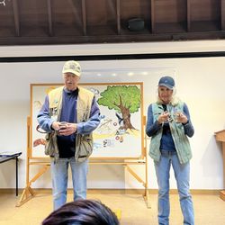
Located at the front of the Eternal Valley Memorial Park. The plaque inscription reads: "This site was the location of a combination store, post office, telegraph office, tavern, and stage depot accommodating travelers during the Kern River gold rush in the early 1850s. A regular stop for Butterfield and other early California stage lines, it was purchased by Sanford and Cyrus Lyons in 1855, and by 1868 at least twenty families lived here. Eternal Valley Memorial Park has called their final resting place "The Garden of the Pioneers." California Registered Historical Landmark No.688 Plaque placed by the California State Park Commission in cooperation with Eternal Valley Memorial Park; The History and Landmarks Association of the San Fernando and Antelope Valley Parlors, Native Sons and Native Daughters of the Golden West, and San Fernando Mission Parlor No.280, Native Daughters of the Golden West, November 22, 1959." Not really worth visiting unless you combine it with a tour other local historical landmarks. Not much to see besides the plaque. read more


17 years ago
More info about Lyons Station Stagecoach Stop


Lyons Station Stagecoach Stop - landmarks - Updated July 2026
Best of Santa Clarita
People found Lyons Station Stagecoach Stop by searching for…
Parks in Santa Clarita, California
Post Offices in Santa Clarita, California
Scenic Drive in Santa Clarita, California
Cemetery in Santa Clarita, California
Scenic Overlook in Santa Clarita, California
Tourist Attractions in Santa Clarita, California
Historical Sites in Santa Clarita, California
Sightseeing in Santa Clarita, California
River in Santa Clarita, California
National Parks in Santa Clarita, California
Free Things to Do in Santa Clarita, California
Urban Exploration in Santa Clarita, California
Usps Locations in Santa Clarita, California
Historical Tours in Santa Clarita, California
Night View in Santa Clarita, California
Photo Spots in Santa Clarita, California
Old Town in Santa Clarita, California
Places to Take Pictures in Santa Clarita, California
Open Early in Santa Clarita, California
Postal Service in Santa Clarita, California
Castle in Santa Clarita, California
Public Services & Government in Santa Clarita, California
Trending Searches in Santa Clarita, CA
4th Of July Fireworks near Lyons Station Stagecoach Stop
Black Owned Nail Salons near Lyons Station Stagecoach Stop
Boardwalk near Lyons Station Stagecoach Stop
Boat Rental near Lyons Station Stagecoach Stop
Caves near Lyons Station Stagecoach Stop
Cliff Jumping near Lyons Station Stagecoach Stop
Day Trips near Lyons Station Stagecoach Stop
Fireworks near Lyons Station Stagecoach Stop
Flower Fields near Lyons Station Stagecoach Stop
Jet Ski Rental near Lyons Station Stagecoach Stop
Kayak Rental near Lyons Station Stagecoach Stop
Landmarks & Historical Buildings near Lyons Station Stagecoach Stop
Picnic Areas near Lyons Station Stagecoach Stop
Places To Visit near Lyons Station Stagecoach Stop
Places To Walk Around near Lyons Station Stagecoach Stop
Public Pools near Lyons Station Stagecoach Stop
River Swimming near Lyons Station Stagecoach Stop
Scenic Restaurants near Lyons Station Stagecoach Stop
Secluded Spots near Lyons Station Stagecoach Stop
Sightseeing near Lyons Station Stagecoach Stop
Soccer Store near Lyons Station Stagecoach Stop
Splash Pad near Lyons Station Stagecoach Stop
Strawberry Picking near Lyons Station Stagecoach Stop
Swimming Holes near Lyons Station Stagecoach Stop
Swimming Lakes near Lyons Station Stagecoach Stop
Things To Do This Weekend near Lyons Station Stagecoach Stop
Things To See near Lyons Station Stagecoach Stop
View Fireworks near Lyons Station Stagecoach Stop
Browse Articles
Browse Nearby
BEST of Santa Clarita, California Coffee near Lyons Station Stagecoach Stop
BEST of Santa Clarita, California Restaurants near Lyons Station Stagecoach Stop
BEST of Santa Clarita, California Things to Do near Lyons Station Stagecoach Stop
BEST of Santa Clarita, California Breakfast near Lyons Station Stagecoach Stop
BEST of Santa Clarita, California Museums near Lyons Station Stagecoach Stop
BEST of Santa Clarita, California Parks near Lyons Station Stagecoach Stop
BEST of Santa Clarita, California Hotels near Lyons Station Stagecoach Stop
BEST of Santa Clarita, California Campgrounds near Lyons Station Stagecoach Stop
BEST of Santa Clarita, California Restroom near Lyons Station Stagecoach Stop
Browse Brands
Related Searches in Santa Clarita, CA
Best Lookout Points to Visit in Santa Clarita, California
Best Nature Trails for Hiking in Santa Clarita, California
Book Engaging Historical Tours in Santa Clarita, California
Discover Charming Historic Homes in Santa Clarita, California
Discover Famous Monuments in Santa Clarita, California
Discover Historic Sites and Places in Santa Clarita, California
Discover Popular Landmarks in Santa Clarita, California
Discover Popular Photo Spots in Santa Clarita, California
Discover Stunning Skyline View Spots in Santa Clarita, California
Discover Top Nature Parks to Visit in Santa Clarita, California
Discover Top Points of Interest in Santa Clarita, California
Discover Top Scenic Spots to Visit in Santa Clarita, California
Discover the Best Interactive Museum in Santa Clarita, California
Discover the Best Military Museum in Santa Clarita, California
Enjoy the Best Walking Trails in Santa Clarita, California
Explore Beautiful Botanical Gardens in Santa Clarita, California
Explore Beautiful Castles and Landmarks in Santa Clarita, California
Explore Beautiful Parks and Green Spaces in Santa Clarita, California
Explore Children's Museums Near Santa Clarita, California
Explore Free Things to Do Around Santa Clarita, California
Explore Popular Scenic Overlook Points in Santa Clarita, California
Explore Popular Scenic Views Near Santa Clarita, California
Explore Popular View Points Around Santa Clarita, California
Explore Top History Museums in Santa Clarita, California
Explore the Top Car Museum in Santa Clarita, California
Explore the Wax Museum Attractions in Santa Clarita, California
Find Beautiful Views in Santa Clarita, California
Find Top Art Museums in Santa Clarita, California
Find Top Libraries to Visit in Santa Clarita, California
Find a Public Library Near You in Santa Clarita, California
Find the Best Bridge Spots in Santa Clarita, California
Find the Best Playgrounds to Visit in Santa Clarita, California
Great Things to See and Do in Santa Clarita, California
Must-See Tourist Attractions Around Santa Clarita, California
Popular Picnic Spots to Visit in Santa Clarita, California
Popular Places to Go in Santa Clarita, California
Popular Places to Take Pictures in Santa Clarita, California
Popular Places to Walk Around in Santa Clarita, California
Popular Things to Do in Santa Clarita, California
Popular Things to See in Santa Clarita, California
Top Hiking Trails to Explore in Santa Clarita, California
Top Historic Restaurants to Try in Santa Clarita, California
Top Museums for Kids to Visit in Santa Clarita, California
Top Places to Visit in Santa Clarita, California for Sightseeing
Tour Famous Lighthouses Located in Santa Clarita, California
Tour Popular Historical Sites in Santa Clarita, California
Visit Beautiful Gardens in Santa Clarita, California
Visit Popular Museums in Santa Clarita, California Now
People who viewed Lyons Station Stagecoach Stop also viewed
Rancho San Francisco
1 review
Mentryville
22 reviews
Lang Southern Pacific Station
1 review
Heritage Junction Historic Park
13 reviews
Canyon Country Park
25 reviews
Los Angeles Aqueduct - Cascades
8 reviews
Sylmar
Veterans Historical Plaza Park
1 review
San Fernando Valley Historical Society
2 reviews
Mission Hills
Griffith Ranch California Historical Landmark No 716
1 review
Pacoima
Hanna Barbera Building
1 review
Hollywood Hills