Madison County Historical Marker Photos


More like Madison County Historical Marker
Recommended Reviews - Madison County Historical Marker
Start your review...

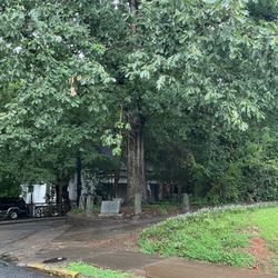
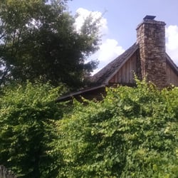
This marker is located a stone's throw from the county courthouse and gives some context as to the origin of the county and how it came to be. It has the same text on both sides. It reads, "This County, created by Act of the Legislature December 5, 1811, is named for James Madison, Virginia Democrat, fourth President of the United States, 1809-'17. The site for Danielsville was given by Gen. Allen Daniel of Revolutionary fame. In this town was born Dr. Crawford W. Long who first used ether in a surgical operation (1842). Among the first County Officers were: Sheriff Nathan Williford, Clerk of Superior Court James Long, Clerk of Inferior Court Samuel Williford, Tax Receiver Britton Sanders Jr., Tax Collector James Ware Jr., Coroner William Hodge and Surveyor Edward Ware Jr." In the early 19th century, the region was deeply influenced by the rise of cotton as a dominant crop. The fertile Piedmont soil and proximity to trade routes made Madison County part of Georgia's expanding cotton belt, with small yeoman farms gradually giving way to larger plantations. This agricultural boom helped shape the county's economy and social structure well into the Civil War era. Though railroads didn't run directly through the county, nearby lines helped connect its farms to broader markets. Danielsville remained a modest civic center, and the county's early schools and churches played key roles in community life, especially in African American neighborhoods during and after Reconstruction. The boll weevil infestation in the early 20th century forced a shift from cotton to poultry, dairy, and timber, leading to more diversified and cooperative farming. Madison County's quiet civic contributions and preservation efforts reflect a legacy of resilience, modesty, and deep-rooted community pride. This is marker number 097-1 and it was erected in 1954 by the Georgia Historical Commission. [Review 1374 of 2025 - 858 in Georgia - 24926 overall] read more


More info about Madison County Historical Marker


Madison County Historical Marker - landmarks - Updated June 2026
Best of Danielsville
People found Madison County Historical Marker by searching for…
Churches in Danielsville, Georgia
Things to Do in Danielsville, Georgia
Courthouses in Danielsville, Georgia
Community Centers in Danielsville, Georgia
Field Trips in Danielsville, Georgia
Places to Take Pictures in Danielsville, Georgia
Trains in Danielsville, Georgia
Urban Exploration in Danielsville, Georgia
Historical Sites in Danielsville, Georgia
Scenic Overlook in Danielsville, Georgia
Military Museum in Danielsville, Georgia
Arts & Entertainment in Danielsville, Georgia
Browse Articles
Browse Nearby
BEST of Danielsville, Georgia Things to Do near Madison County Historical Marker
BEST of Danielsville, Georgia Parks near Madison County Historical Marker
BEST of Danielsville, Georgia Restaurants near Madison County Historical Marker
BEST of Danielsville, Georgia Hiking near Madison County Historical Marker
BEST of Danielsville, Georgia Coffee near Madison County Historical Marker
BEST of Danielsville, Georgia Campgrounds near Madison County Historical Marker
BEST of Danielsville, Georgia Breakfast near Madison County Historical Marker
BEST of Danielsville, Georgia Hotels near Madison County Historical Marker
Browse Brands
Trending Searches in Danielsville, GA
Bait And Tackle Shop near Madison County Historical Marker
Beaches near Madison County Historical Marker
Black Owned Nail Salons near Madison County Historical Marker
Cliff Jumping near Madison County Historical Marker
Day Trips near Madison County Historical Marker
Fishing Spots near Madison County Historical Marker
Hidden Gems near Madison County Historical Marker
Hiking near Madison County Historical Marker
Kayak Rental near Madison County Historical Marker
Landmarks & Historical Buildings near Madison County Historical Marker
Pick Your Own Farms near Madison County Historical Marker
Places To Visit near Madison County Historical Marker
Public Art near Madison County Historical Marker
River Swimming near Madison County Historical Marker
Secluded Spots near Madison County Historical Marker
Soccer Store near Madison County Historical Marker
Splash Pad near Madison County Historical Marker
Strawberry Picking near Madison County Historical Marker
Swimming Holes near Madison County Historical Marker
Swimming Lakes near Madison County Historical Marker
Swimming Pools near Madison County Historical Marker
People who viewed Madison County Historical Marker also viewed
Indian Boundary Historical Marker
1 review
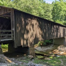
Blind Suzie Covered Bridge
1 review
Athens-Clarke County Court House
1 review
Hart County Courthouse
1 review
Double Barreled Cannon
1 review
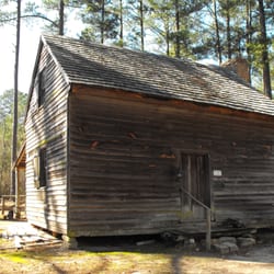
Crawford Long Birthsite Historical Marker
1 review
Howard's Covered Bridge
1 review
Holmes-Hunter Academic Building
1 review
Madison County Courthouse
1 review
Moses Waddel Historical Marker
1 review