Cancel

    Open app

    Search

    Marshall Gulch Trail

    4.6 (5 reviews)

    Marshall Gulch Trail Photos

    You might also consider

    Recommended Reviews - Marshall Gulch Trail

    Your trust is our priority, so businesses can't pay to alter or remove their reviews. Learn more about reviews.
    Yelp app icon
    Browse more easily on the app
    Review Feed Illustration

    1 year ago

    Helpful 1
    Thanks 0
    Love this 1
    Oh no 0

    3 years ago

    Helpful 3
    Thanks 0
    Love this 3
    Oh no 0

    8 years ago

    Helpful 2
    Thanks 1
    Love this 1
    Oh no 0

    10 years ago

    Helpful 2
    Thanks 0
    Love this 1
    Oh no 0

    9 years ago

    Helpful 1
    Thanks 0
    Love this 5
    Oh no 0

    Verify this business for free

    People searched for Hiking 699 times last month within 15 miles of this business.

    Verify this business

    Mount Lemmon - Views

    Mount Lemmon

    4.5(118 reviews)
    2.0 mi

    First Impressions:…read more Very clean, fun, and breathtaking in terms of views! Interactions: We had a few interactions in the shop up there, and they were very friendly and welcoming. Service: Can't speak to this as we didn't buy anything, but again want to emphasize how nice everyone was in the shops up there. Value: This was an amazing experience. I don't think I've ever been up a ski lift before, and I think the total time you get going up and down is roughly anywhere 10-18 mins up and same length back down. It moves very slow and I don't hate that. When you get to the top, you can get off and just walk around up there and get some amazing views. I believe we paid for two $34/35ish bucks. Well worth it! Recommendation: If your looking to do something for fun the weekend and want some amazing views, you should definitely check out the ski valley lift. It's fun and can be pretty relaxing going up and down! Will be back next time!

    Mount Lemmon and the Catalina Highway, AZ. Early Dec, 2025. Mount Lemmon, the highest peak…read more(9,175') in the Santa Catalina Mountains near Tucson, is managed by the U.S. Department of Agriculture, Forest Service as part of the Coronado National Forest. (Fun Fact: Mt. Lemmon is named after Sara Plummer Lemmon, an amateur botanist and the first white woman to climb to the summit in 1881. It is one of the few peaks in the U.S. named after a woman). Our objective was to drive the Catalina Highway Scenic Drive (27 miles) to the Mount Lemmon summit. This is the only paved road that leads to the upper reaches of the Santa Catalina Range, and is one of the most scenic highways in the southwest. Because the road starts in the lower Sonoran vegetative life zone and climbs to high forests, it offers the biological equivalent of driving from the deserts of Mexico to the forests of Canada in only 27 miles. Before proceeding on the drive, we downloaded a free app entitled "Mt. Lemmon Science Tour" by the University of Arizona, which provided excellent commentary on the Sky islands, rocks, life zones, water, forest, and fire, that was well-synced with our drive up the mountain as it evolved. This is a windy, slow drive with the posted speed limit of 35 MPH or less on most sections. Plus, you're sharing the road with bicyclists riding in both directions. The road is paved, and is well-designed with frequent pull-offs and stops that allow for vista views or just to take a rest. A few of our favorite and recommended stops include: *Babad Do'ag for its excellent vistas of the desert environment and saguaros. *Gordon Hirabayashi Campground (and Historical Recreation Area). I've reviewed this separately on Yelp. *The Palisades Visitor Center, with family-friendly exhibits, brochures and general information, and a small gift shop. *Windy Point Vista, for sweeping views. *High-elevation picnic areas at Box Elder, Alder, Loma Linda, or Inspiration Rock. *Mt. Lemmon Ski Valley, where there is a restaurant and ski lift rides ($). We were disappointed that the entrance road to Rose Canyon Lake was closed on the day that we visited. This is a Forest Service fee area. A day-use pass is $8 per vehicle, and can be purchased on-line or at the Palisades Visitors Center on-route. We didn't have time to hike on the day that we visited but there are miles and miles of trails of varying length and difficulty. While there are restrooms with pit toilets at multiple sites, but there is no potable water nor service stations. I've posted a handout about the area that I picked up at the Visitors Center. Only Spanish-language brochures were available.

    Photos
    Mount Lemmon - Peak of Mount Lemmon Ski valley

    Peak of Mount Lemmon Ski valley

    Mount Lemmon - Aspen Draw Trail

    Aspen Draw Trail

    Mount Lemmon - Trailheads upper Hitchcock Hwy

    See all

    Trailheads upper Hitchcock Hwy

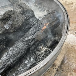
    Rose Canyon Lake - The huge fire pit our fire was in!

    Rose Canyon Lake

    3.5(22 reviews)
    5.5 mi

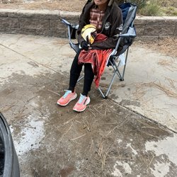
    Get new kind and happy camp hosts! We drove 2 1/2 hours. To be yelled at called stupid and have a 5…read moregl bucket water thrown on our fire which hit a member of group who is not physically well! We checked before we left home and fires were fine. He did it to other campers as well. I come from a fire fighting family! Well aware of the danger. The host at the entrance who took our money was his wife she yelled at us all . Including the other 6 campers who were there to complain, said we were all stupid and that she quit. Mind you not one person was being rude or yelling. I deal with people daily. I would never treat any one so harshly. I feel that we were assaulted!

    Starting off, I'm going to recognize 'Monica E' as an incredible resource for nearly everything as…read morea great breakdown on the intricate details of Rose Canyon Lake, so I won't capitulate on the details she provides; look up her review! There is one error I'll note with her review which is minor but important; you ARE able to reserve locations at Rose Canyon Lake. It's on numerous websites and even by calling, you can. No worries though, small detail but again, her review is amazingly full of all details that I found across three different websites and she put together for you! On a more simpler context I'll say this about Rose Canyon Lake, It's super tiny, very hilly (which I prefer!) and unfortunately the campsites are not 'near' the water. However with 70 some sites, you'll often hear someone near you because the trees deaden so much surrounding noise, you'll hear your neighbor; warning! In fact, our neighbors had to be reported on our visit in May because they were just obnoxious and atrocious with incredibly foul language - throughout the day and well past the quiet hours. Let's be honest, you come to the forest for some peace and quiet. Had we known there was a Ranger on duty throughout the night, we could've communicated that but we learned this the next day. RCL is small, beautiful with surrounding hiking and about 30 degrees cooler than Tucson. Win. Never saw the little 'Lake Store' open during our May visit but no worries nonetheless. Cell phone signal is absent in all the campsites unless you climb the hills around the lake. For at least the four phones with my group, that was the norm. You can use a canoe, ONLY if you pay extra for this. Not sure what good that is but the extra pay keeps you and other out of the water I suppose? There are also a generous amount of restroom spots throughout and some are unisex ones, most, with water spigots. You never have to go to far for a potty break so that made my daughters feel more comfortable. The wildlife surrounding is filled with humorous crows and tons and I mean TONS of squirrels of different species. The pine smell and the beautiful temps in May are a win... One final note, they make it much safer here by implanting 'bear proof' trash and campsite specific lock boxes to store all your food safely out of reach of Bears at night. This no doubt dramatically reduces interfaces thus, making it safer for continuous use as a campsite. The campsite Rangers where attentive and polite and overall, we highly recommend this location albeit secluded, no cell service and a bit on top of your neighbors. No real negatives per se except that the lake is REALLY tiny but is a reprieve nonetheless! It's a nice break from the heat of Tucson and the fresh pine smell is a win!

    Photos
    Rose Canyon Lake - The person who got drenched by the host ! And the fire pit which is on concrete!

    The person who got drenched by the host ! And the fire pit which is on concrete!

    Rose Canyon Lake - Early morning looking westward towards the edge of the dam.

    Early morning looking westward towards the edge of the dam.

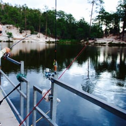
    Rose Canyon Lake - Hooked Up!

    See all

    Hooked Up!

    Hike In Tucson - All around the Old Pueblo of Tucson.

    Hike In Tucson

    5.0(1 review)
    16.8 miJefferson Park

    I love this walk. It's also awesome to stop at the century cactus. I would recommend going in a…read moregroup or with people. I have found deer legs on the trail.

    From the owner: Outdoor great guided hikes on Tucson area trails. Together we trek across the wilderness of the…read moregreat Sonoran Desert exploring the land, its history, flora and fauna. Learning about the desert and the ancient peoples who lived here long ago is not only interesting, it's awe-inspiring. To know we are standing in front of rock carvings called petroglyphs, is breathtaking. Some are thousands of years old. To date, unlike the Egyptian Hieroglyphics, no one knows quite yet what the meanings are of the stories they tell. The unusual iconic giant Saguaro cacti majestically stand to welcome you, literally, with open arms. At times javelina, coyotes, cactus wren, roadrunners will pass us by. To top it all, you'll enjoy a southwestern activity second to none in Tucson, also known as The Old Pueblo. So come, join your trail guide and get as close to nature as you can get. Schedules include sunset, moonlit & themed guided hikes. Book yours today. We also serve the Phoenix area.

    Photos
    Hike In Tucson - Some of the crew take a break from work to say hi.

    Some of the crew take a break from work to say hi.

    Hike In Tucson - Up the Cataline Hwy we go from Tucson to a favorite trail head to begin our hike.

    Up the Cataline Hwy we go from Tucson to a favorite trail head to begin our hike.

    Hike In Tucson - Trali guide, Mark Taylor, is a ready & a waiting to take you onto the trails & show you the wildlife & plant life of the desert.

    See all

    Trali guide, Mark Taylor, is a ready & a waiting to take you onto the trails & show you the wildlife & plant life of the desert.

    Marshall Gulch Trail - hiking - Updated May 2026

    Loading...
    Loading...
    Loading...