Cancel

Open app

Search

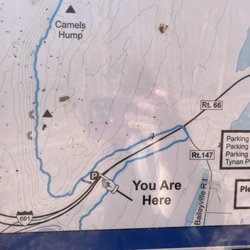
Orchard Glen Trail

4.5 (2 reviews)

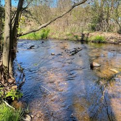
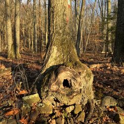
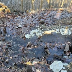
Orchard Glen Trail Photos

Recommended Reviews - Orchard Glen Trail

Your trust is our priority, so businesses can't pay to alter or remove their reviews. Learn more about reviews.
Yelp app icon
Browse more easily on the app
Review Feed Illustration

2 years ago

Helpful 6
Thanks 1
Love this 4
Oh no 0

2 years ago

Helpful 0
Thanks 0
Love this 0
Oh no 0

Verify this business for free

People searched for Hiking 1,106 times last month within 15 miles of this business.

Verify this business

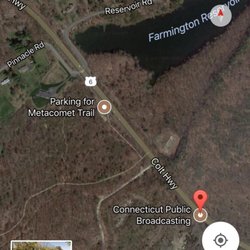
Rattlesnake Mountain - To find the trailhead on the Rt6 side go to 200 Colt Hwy, Farmington, CT 06032 on Google Maps and you'll see it right down the road

Rattlesnake Mountain

4.6(5 reviews)
14.1 mi

Beautiful hiking trail! Muddy in the beginning, so wear hiking boots or shoes with good grip. The…read moreoverlooks are amazing and worth every minute. About 1 hour and 20 minutes to and from The caves. Rugged terrain towards the caves Not for the beginner, so plan accordingly. Snacks, water and maybe a walking stick

Trail has some lovely views, some steep up and down sections but no actual rock scrambling…read morerequired, and if you plan ahead you can find the elaborate rock etchings done over 200 years ago by patients of an 18th century small pox inoculation center! Also, when I went most recently, somebody built a pretty sick rope swing in the woods. Not sure how safe it is, but if it doesn't crap out on you it's a nice little adrenaline rush if you start your swing at the tree branch. Now for some tips to get the most out of your hike: Pro tip #1: if you're doing this as an after work hike, park yourself at Alliance Occupational Health and catch the trailhead across the street. Can't speak as to whether this would be ok during their normal business hours tho. Pro tip#2: go to the local library where they can provide you with a map on how to find hospital rock, just off the trail, with stone carvings made 200 years ago. -side tip- bring flour with you to dust the rocks with so you can make out thyme carvings better for pictures Pro tip #3: Bugspray.

Photos
Rattlesnake Mountain - Just a damn good view from pinnacle rock

Just a damn good view from pinnacle rock

Rattlesnake Mountain - Rattlesnake Cliffs

Rattlesnake Cliffs

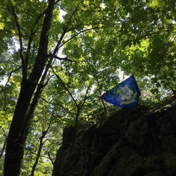
Rattlesnake Mountain - CT flag by Will Warren's Den

See all

CT flag by Will Warren's Den

Wadsworth Falls State Park - Easy on the eyes and ears.

Wadsworth Falls State Park

3.9(73 reviews)
6.4 mi

Crystal-clear water + sunny spring day = perfect hike…read more Spent a beautiful spring sunny day at Wadsworth Falls State Park, and it did not disappoint. I took so many pictures of the clear river. It's seriously that stunning. The swimming water vanished. We hiked the Wadsworth Falls Loop (3.6 miles, easy, great waterfall views) and also checked out part of the Main Trail. Trails were in good shape; just a little mud here and there, but totally manageable. Bonus tips from my visit: · Dogs welcome on leash · Free for CT-registered cars; $10-15 for out-of-state · Restrooms, parking, and picnic tables available · Get there early on a sunny day to beat the crowds If you love clear water, peaceful forest walks, and two distinct waterfalls, don't miss this spot. Already planning to come back with an all-terrain wheelchair for a friend (you can reserve one in advance). Would I go again? 100%.

Gorgeous gorges! Although this park has ample signage against swimming, the Coginchaug River is…read morelovely on the eyes and ears, and being centrally located, Wadsworth Falls is a great local escape. If you have the right footwear in winter, it's a place for a rewarding hike! Boots and grips and the occasional side stepping is good for your winter trip. Mind the tracks, or crews tending the still in-use tracks, then enjoy the lovely views of multiple waterfalls, some frosted over, but water audibly rushing beneath the ice. Starting out, we didn't see the blue trail marked on the yellow and orange junction map, but the trails were well-marked with vertical tree blazes, so if you take the orange, yellow, or blue trails, you should be in good shape. If you don't have the time for a decent hike and just need a restful stop, large falls are just below the parking lot (those no access signs on the trails don't kid!). All year, enjoy! There are zero facilities here, and the only amenities appear to be accessible recreation and a dog waste station beneath the parking lot, but you aren't in the middle of nowhere. Pack in, pack out, and enjoy as much or little woods as you like, and enjoy the peaceful sounds and sights of the many falls.

Photos
Wadsworth Falls State Park - Icy in winter! Wear grips.

Icy in winter! Wear grips.

Wadsworth Falls State Park - Rewarding winter hike.

Rewarding winter hike.

Wadsworth Falls State Park - River

See all

River

West Hartford Reservoir - Spring, please don't trample it.

West Hartford Reservoir

4.6(62 reviews)
18.0 mi

I'm amazed by the beauty of this place!…read more MDC operates the water treatment plants located at this reservoir. This is a privately owned area and not a public park. There was MDC Police that patrolled the area when I was there. Parking was plentiful when we went on a beautiful spring weekday. There were clean porta potties onsite. There were trails in the woods and out in the open; the trails were paved and gravel. It is opened daily from sunrise to sunset and closed on Thanksgiving and Christmas. There were two trails; 3.4-mile loop red trail and 2.0-mile loop yellow trail. We started off with the gravel yellow trail that has a slight incline. Then we got onto part of the red loop which was near the bridge overlooking the water. We saw a couple of deer in the woods, geese, and turtles in the water. This is where we walked on pavement. Some of the trees were marked by type. The trail was busy with walkers and bikers. Overall, I really enjoyed the hike/walk and can't wait to go back.

The WH Reservoir has been my peaceful playground and refuge since the '70's…read more Hard to believe that State Connecticut had a planned to construct ring highway through the hills beside the Reservoir. Following public protest and legal battle(s) the project was shelved indefinitely back in the 70's. This was also about the time, vehicle traffic was barred on many of the back MDC roadways. What was left, beautiful network of paved and foot beaten paths. Everyday day of the week, the public are welcome to walk, jog, saunter, bicycle these mapped trails. Mountain biking has been throttled down significantly due to excessive wear and tear on the wooded areas. Biking still remains popular long designated routes and in a one-way pattern (for everyones safety). Pedestrians: Please mind the painted walking path, eyes on drifting into the bike path - that way ALL will enjoy. Kilkenny rock has been one of my favorite destinations (refer to an MDC map) this is a nice overlook of the Hartford sky scape. Trails also connect from the Farmington Avenue entrance across to Route 44 passing over Avon Mountain. GPS and one of my favorite apps "All Trails" are helpful even to a season chap like me.

Photos
West Hartford Reservoir - Pretty darn groovy sectional view cut.

Pretty darn groovy sectional view cut.

West Hartford Reservoir - Early morning in the woods - great prescription!

Early morning in the woods - great prescription!

West Hartford Reservoir - Nice wooded trail, drizzle fought off by leaves.

See all

Nice wooded trail, drizzle fought off by leaves.

Kaaterskill Falls - March 2026

Kaaterskill Falls

4.6(166 reviews)
78.6 mi

The falls are truly incredible…read more The trail down to the bottom of the falls, is a bit tricky. But so incredibly worth it. I would suggest not to believe the sign saying 189 steps.... it is definitely more! Take drinking water because you'll need that for sure. We went back in August and the heat was definitely there. The parking lot was pretty packed but throughout the trails people were pretty evenly spaced out. Not so much at the base of the falls themselves but there was still plenty of room to move around freely.

One of the tallest waterfall in NY, similar height to Taughannock Falls. Physical requirement is…read moredifferent tho, Kaaterskill Falls has about 500foot of elevation change and a lot of slippery stone steps at the end, if you come here when the weather is still cold. Parking: most people park at the Laurel-House Road parking area, because it is the closest. Or you can park at Mountain Top Historical Society, the old train station, which an extra mile. Starting from the old railroad station is nice, you can still see some old tracks on the ground. Walk to the overlook is fairly easy, once you get to the start point of Lower falls junction, it is where you need to be prepared. I recommend hiking shoe, especially in colder months where the ground is wet and iced. When you reach to the stone steps, they can get slippery. I am surprised no one fell in late March. Half of the steps were cover in ice and people were wearing regular sneakers. Once you reach the base of the two tier falls, the view is tremendous. If water levels are high, you can feel the energy of the water. There is a lot of spray from the falls when you get close. There is short trail to the middle tier pool. It was iced up during winter, spikes will definitely be useful. The end was amazing too. So close to the lead of the waterfall. You can keep going and follow Escarpment trail and follow the edge of the valley. There is monument for fireman Frank Layman who died during firefighting in 1900, at his monument, you can see route 23A bend around mountain. And if you keep going, there are a couple viewpoint to overlook the valley. Nice break points to enjoy the view and rest your legs.

Photos
Kaaterskill Falls - View Of Stream

View Of Stream

Kaaterskill Falls
Kaaterskill Falls

See all

Orchard Glen Trail - hiking - Updated May 2026

Loading...
Loading...
Loading...