1. Parker Ridge

    1. Parker Ridge

    0

    Nordegg, AB

    Cancel

    Open app

    Search

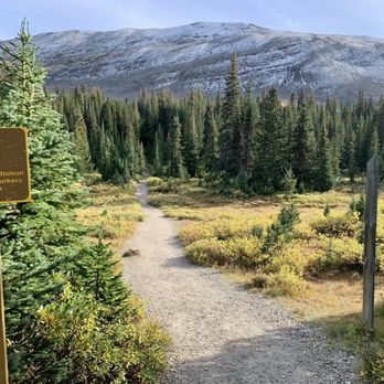
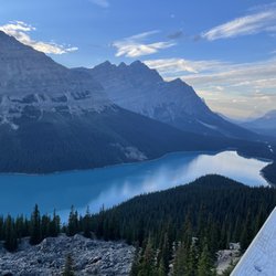
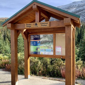
    Parker Ridge

    4.5 (2 reviews)

    Parker Ridge Photos

    Recommended Reviews - Parker Ridge

    Your trust is our priority, so businesses can't pay to alter or remove their reviews. Learn more about reviews.
    Yelp app icon
    Browse more easily on the app
    Review Feed Illustration
    Photo of Seth A.
    46
    1081
    9670

    4 years ago

    Helpful 2
    Thanks 0
    Love this 3
    Oh no 0

    3 years ago

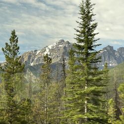
    Amazing hike beautiful views and leisure hike just carry a lot of water and it is highly windy so carry a sweat shirt

    Helpful 0
    Thanks 0
    Love this 0
    Oh no 0

    Verify this business for free

    Get access to customer & competitor insights.

    Verify this business

    Icefields Parkway - Cars stopping to admire animals

    Icefields Parkway

    4.8(26 reviews)
    1.7 km

    The Icefields Parkway is along Alberta Highway Route 93 and is not to be missed if you're on your…read moreway to visit Jasper from either Banff or Canmore. The 288-kilometer route through the Canadian Rockies is one of the most scenic routes in the world when it comes to stunning mountain ranges and lake backdrops. I've witnessed this firsthand and am guilty of doing the same but resist the urge to take photos or videos while driving. Use a GoPro or have someone else capture the footage. The beautiful views are distracting and I've seen people swerve while driving trying to get that Gram worthy photo. It's not worth getting into an accident or even worse, lose your life over it. There is one lane for traffic going in and outbound. I guarantee you will encounter a slow poke during your travels through this stretch of road. Oftentimes it's a slow RV or camper. Just overtake when appropriate and use caution. If you run into wildlife, also proceed with caution. Lastly I'll leave you with a few tips... #1) Make sure you have gas. Fill up your gas tank at Lake Louise before entering through the Icefields Parkway a.k.a. Alberta Route 93. There is a second opportunity if you still have about 150km left in your tank to fill up at the Crossing Gas station near the Saskatchewan River Crossing. This will be your last opportunity to get gas. You will be sorry and stranded if you don't do this. If you're ultra paranoid, carry an extra portable fuel tank and fill that up too. #2) There is no cellphone service for a good portion of this highway. Your phone will go dead for the most part and only Emergency SOS calls are allowed with very limited signal. The reason being is due to Parks Canada restricting infrastructure development. Also the Canadian Rockies are protected wilderness. Google maps will still work and get you to your destination but that's pretty much it. #3) Prepare to make unexpected stops and allow for a few hours on top of your expected commute to make it to your destination. As mentioned earlier, there are several breathtaking points of interest along the way that will lure you out of your car and satisfy your wanderlust. Thankfully there are a bunch of overlook rest stops along the way where you can park your car and enjoy the views.

    Pretty decent mode of travel; sometimes it can be annoying to be stuck in a slow moving group and…read moreunable to pass. If that happens, pull over at an overlook and take a break.

    Photos
    Icefields Parkway
    Icefields Parkway
    Icefields Parkway

    See all

    Jasper National Park - Mature male elk more than 18 points navigating a burned Forest w/18 points in a thicket Jasper on the way to Medicine Lake Jasper

    Jasper National Park

    4.6(51 reviews)
    102.2 km

    Jasper National Park is amazing. They have beautiful lakes and rivers, animals, and shops…read more Admission to the park was easy. You stop at the gate at the entrance of the park. The friendly ranger will ask you questions like how many days you will be staying and then give you a price. Everything was done by credit card. The transaction was easy peasy. They had lakes of all shapes and sizes. There was a roadside lake that I stopped at that was turquoise in color. We visited Maligne Lake with its azure colored waters. Unfortunately, we arrived too late to the lake to get tickets to their boat ride to Spirit Island. Animals weren't seen until my last day there when I spotted bighorn sheep. The town of Jasper was the major hub in the park with lots of shops, restaurant and a nice visitor center. You could buy all the souvenirs that want. There was a recent wildfire that burned part of the town in Jasper and some of the sites. Maligne Canyon was still closed. This is an beautiful place to visit if you like the outdoors.

    Jasper National Park he's just stunning and so vast. Unfortunately, a lot of the Park has been…read moredevastated by last year raging wildfires. The community is working hard to recover and the area needs all the tourism that it can get. You can see the result of the wildfires damage from about 30 miles outside of Jasper town. It's truly heartbreaking to see. We need to support the people & their businesses. They said there are many areas 30 miles outside of Jasper town that are intact & stunning. Go visit... it's amazing

    Photos
    Jasper National Park - Cool sign. I'm a sucker for these. It's located in the downtown train station area of Jasper.

    Cool sign. I'm a sucker for these. It's located in the downtown train station area of Jasper.

    Jasper National Park - Jasper

    Jasper

    Jasper National Park - A pullover area off the main road to Maligne Lake at Jasper NP.

    See all

    A pullover area off the main road to Maligne Lake at Jasper NP.

    Mount Edith Cavell - Excited to be here.

    Mount Edith Cavell

    4.9(15 reviews)
    85.0 km

    Most beautiful hike ever!! Just stunning! Highly recommend- pack layers and be prepared for natural…read morebeauty!

    Stopping again in Jasper National Park a 2nd time during my North American travels, I finally got…read moreto hike and explore Mount Edith Cavell. Initially when I arrived here back in June, 2022, the road to the trailhead was blanketed in snow. Now for late September, I had a terrific opportunity to get a real feel perspective for what makes the surroundings here one of the most popular in all of Jasper. There are 2 pathways to hike... Of course, I couldn't decide which to venture along, so I just chose both! The Path of the Glacier Trail will take you to the foot of Cavell Glacier and the colorful turquoise green lake. It takes maybe 45 minutes to hike it. But, the real star to being at Mount Edith is hiking the Cavell Meadows Trail which you will lead you towards the top of the mountainous landscape for views from high above. This Cavell Meadows Trail goes for 6 - 7 kilometers roundtrip and 3 - 4 hours total. I highly recommend it! Regardless of which hikes and or trails you pick from, just being in such a snow-like winter setting made me feel far away from my realities of the South Florida palm trees. I couldn't have asked for a better day hiking and admiring the crisp and clear conditions. Lastly, Mount Edith Cavell is located right off Icefields Parkway...27 kilometers south of downtown Jasper, AB and is conveniently accessible to complementing the rest of the attractions in the area.

    Photos
    Mount Edith Cavell - Taking a moment to appreciate the setting.

    Taking a moment to appreciate the setting.

    Mount Edith Cavell - Heading towards "The Toe" of Cavell Glacier.

    Heading towards "The Toe" of Cavell Glacier.

    Mount Edith Cavell - So happy to be at Mount Edith Cavell.

    See all

    So happy to be at Mount Edith Cavell.

    Tangle Creek Falls

    Tangle Creek Falls

    4.5(4 reviews)
    16.4 km

    We happened upon these falls after the Glacier Adventure tour nearby and we were stunned at how…read morebeautiful these were! They are right there off the road side, and so close, so beautiful! I was surprised it was not marked on the map it was so pretty! You can kinda take a picture of it from the car gliding by but the best is to stop and take a good picture of it, as it is really good!

    As you're leaving the Columbia Icefields - Athabasca Glacier area heading north towards…read moreJasper...these Tangle Creek Falls are fantastic in terms of being a quick, efficient and beautiful roadside stop! You don't have to walk/hike at all to arrive here...or in fact...even exit your car! For me...this was a rewarding experience without having to work hard to get to. I would be cautious when driving... If you're going north to Jasper...Tangle Creek Falls are situated on the right hand side of the road and can easily be passed if you're not going slow because the road slopes downhill as you're driving, so that's where I'd keep my foot close to the brake. Worst case scenario you pass it and then just turn around. No big deal. Off to the left hand side parallel to the falls...there's a parking lot pullover area for you to leave your car. Then cross the street and you're standing in front of a 3-layer/tier waterfall that I found to be quite photogenic. In fact...among all the waterfalls I confronted throughout my Canadian Rockies adventure (which interestingly weren't too many)...I found these Tangle Creek Falls to probably be the best! I would say this stop is popular because it's so nearby the Columbia Icefield area...within just a couple of kilometers. So, for me, lol...I found it difficult to capture pictures of the falls without being "photobombed". Some strangers were occupying their selfie photos time too much and I did have to stand by the edge of the road and wait for them to finish. Lol, just so you know...you may encounter an issue like this. But me...I'm very, very picky about avoiding strangers in my picture moments. Also here at the falls, people were climbing the rocks and ledges to immerse themselves among the falls in a more optimal manner for photos. I was okay with standing by the edge of the road and snapping pics. I felt satisfied with how my photos appeared. You only need a few minutes hanging out here at this terrific roadside stop. I used 15 minutes before returning to my car. Overall, for what it is (being located right on the side of Icefields Parkway)... I found Tangle Creek Falls to be a memorable experience along my journey north towards the attractions of Jasper.

    Photos
    Tangle Creek Falls
    Tangle Creek Falls
    Tangle Creek Falls

    See all

    Bow Lake - Amazing hiking trail around this beautiful lake

    Bow Lake

    4.5(11 reviews)
    71.9 km

    Bow Lake is one of the MUST-DO stops along famed Icefields Parkway. It's located right off the side…read moreof the road, 37 kilometers (or 23 miles) north of the Lake Louise area. And...it's situated just past Crowfoot Glacier. So...if you do stop at Crowfoot Glacier, be prepared to immediately stop again here at Bow Lake. Interestingly, I found Crowfoot Glacier to be absolutely wonderful, in terms of the incredible snowcapped setting from a quick pullover perspective. Now...here at Bow Lake, you still receive those wondrous snowcapped mountain viewpoints...but I had anticipations that the lake would be colorful and turquoise green/blue...and that was not the case, which disappointed me a little because of my sky high expectations. Yet...looking back at my photos and reflecting...I still have to give Bow Lake 5 stars no matter what! The scenery here would put many other lakes to shame throughout the world! The atmosphere was beautiful. It's just...this whole area in and around Lake Louise, even further south in Banff and just being along Icefields Parkway offered many glorious moments being in nature...I think I got spoiled by it all! Lol. I had this unblemished, postcard image in my head of Bow Lake, especially since there was fresh snow and ice floating in the water. So, when I didn't view any coloring to it (which would have been the pinnacle of it all!), it still remained terrific regardless of a slight letdown I may have had. A little north from Bow Lake is stunningly magnificent Peyto Lake. And...Peyto Lake has a short walk to a viewpoint (less than 1 mile) where you're standing "above it all" and it's there....where you'll discover those incredibly turquoise green waters. Now, lol, I know I'm being critical but, I do want to mention a few factors about maybe why, the waters weren't turquoise at Bow Lake... I visited back in late afternoon time and with the position of the sun in the sky...the surroundings weren't ideal for picture taking. My face was shadowy, which I'm trying to say that I was looking into the sun. I believe now thinking back...I would have been better served coming here in the morning time. This way, the sun could be at my back and help lighten up the backdrop and possibly offer that colorful effect into the waters. Another factor... Coming to Bow Lake, all you have to do is pull into the parking lot and walk a short distance to the edge of the waters. It's simple. But, now being nit picky about my exploring, lol...I think Bow Lake could have been perfect if I viewed it from an overlook perspective, where I'm looking down on the landscape. I find (in my travels) that seeing something at eye level doesn't always do justice. I guess maybe that's why they created gondolas and sky trams? Another element was...since it was already late in the day bordering on early evening, maybe I never gave myself enough exploring time around the lake to find those colorful perspectives. I think, just, when you compare Bow Lake to Peyto Lake, the comparisons much favored Peyto Lake, in my eyes. Ultimately, while writing this...Bow Lake is still fantastic and very, very worthwhile for stopping at while driving Icefields Parkway. Some last extras... - Here at Bow Lake, you can start the trailhead for Bow Glacier Falls - a 9 kilometer roundtrip hike that was recommended by other tourists. Unfortunately, I didn't have the time to hike it. - I used 20 - 25 minutes to casually walk over to Bow Lake's edge and admire the views. There's nothing like taking in sights of snowcapped mountains among nature. - Make sure to stop at Crowfoot Glacier before you arrive here...and stop at Peyto Lake once you leave here. - This section of Icefields Parkway is probably the most scenic you'll find along the journey from downtown Lake Louise north to Jasper...and vice versa. - Remember, if you can...visit here in the morning time. - Lastly, I came to Bow Lake in the middle of June, 2022...and the conditions were perfect outside without rain or wind. Also, there weren't many tourists around for the season yet, so I'm glad I got a head start seeing the popular attractions without all the congestion. Alright, well, this is Bow Lake, located along Icefields Parkway within the Lake Louise area of Banff National Park, Alberta, Canada.

    Beautiful and scenic stop along the Highway of the lake. Amazing blue colour that is so clear and…read morereflective of the mountains and tree. The mountains in the background with snow peaks adds to the majestic view. Definitely a great stop to take photos that's quick and easy.

    Photos
    Bow Lake - Nothing like snowcapped mountains surrounding you.

    Nothing like snowcapped mountains surrounding you.

    Bow Lake - The waters of Bow Lake weren't colorful when I visited in the middle of June, but still so picturesque here.

    The waters of Bow Lake weren't colorful when I visited in the middle of June, but still so picturesque here.

    Bow Lake - Happy to be here.

    See all

    Happy to be here.

    Wilcox Pass - The trailhead for Wilcox Pass.

    Wilcox Pass

    4.5(2 reviews)
    7.6 km

    This is Wilcox Pass Trail located in the Columbia Icefield section of Jasper National Park…read more It's an 8 kilometer (or 5 mile) moderate, roundtrip hike offering rewarding views of Athabasca and Snow Dome Glaciers set in the distance. Basically...if you'd like to capture a landscape/panoramic perspective of this ultra popular, Icefields Parkway area from high above...then you'll appreciate venturing along Wilcox Pass Trail. The hike ends when you have reached Wilcox Ridge, the "pinnacle of it all" where you'll have undisturbed, vista point sceneries. Here at Wilcox Ridge...some hikers were taking selfies as well as sitting and relaxing while having water and snacks. Btw, an added bonus midway through the hike was...passing by a family of bighorn sheep while they were lying and grazing in the grass right along the path towards Wilcox Ridge. Now...I highly recommend you proceed onto Wilcox Pass Trail in the morning to be afforded time with the sun at your back and making for worthwhile picture opportunities. Funny...unfortunately for me, the first time I arrived here, I stopped in the afternoon and the sun was staring me straight in the face. I was barely able to admire the setting because I was blinded by the sun and couldn't see. Welp...with a 2nd chance to make things right, lol, I woke up the following morning (at 6am!) and was the first hiker onto the trail. This made all the difference. With the sun's positioning in the sky exactly where I wanted it, I was now able to have wonderful moments breathing in the fresh Canadian air while enjoying the glacial surroundings. Overall, it made for a fulfilling morning and first half of my day. One extra note...right nearby here (just a few kilometers down the road) is another 1/2-day hike I'd recommend called - Parker Ridge Trail. And, of course, don't forget to spend time at the Columbia Icefield Lodge and taking a tour out onto Athabasca Glacier (which almost every tourist does). Alright, well, this is Wilcox Pass trail situated in the heart of Jasper NP, Alberta, Canada.

    This trail is probably the nicest short trail in Banff-Jasper area, especially when there are no…read moreforest fires or low clouds, so you get perfect views of mountains Athabasca, Andromeda, North Twin, and Columbia icefields. I don't think any other trail in the Rockies is that rewarding in terms of the views from the top. We didn't see any wildlife except for lone elk and some pikas, but people report seeing marmots and mountain goats. Someone told us that there are some fossils right at the top, we tried to find them but couldn't. I recommend starting your hike early in the morning as by 2pm the sun will be right behind the mountains and you would see anything. Also, by noon, the trail will be crowded, we met over 30 people on the way down.

    Photos
    Wilcox Pass - 1.5 kilometers away from Wilcox Ridge.

    1.5 kilometers away from Wilcox Ridge.

    Wilcox Pass - Appreciating the morning sunrise setting with the snowcapped mountain in the background.

    Appreciating the morning sunrise setting with the snowcapped mountain in the background.

    Wilcox Pass - The road sign for Wilcox Pass.

    See all

    The road sign for Wilcox Pass.

    Mistaya Canyon - Great view from the overlook bridge.

    Mistaya Canyon

    4.5(4 reviews)
    36.7 km

    A short excursion from the highway to see some raging waters from a bridge or from rocks, it's a…read morefree attraction. Busy tourist attractions and way too many people trying to get themselves too close to the edge. Besides that, watching the water go is quite interesting.

    Mistaya Canyon is a quick and popular roadside stop around the midpoint area along famed Icefields…read moreParkway. It lies 5 kilometers south of the Saskatchewan River Crossing, which many people consider as the "official" halfway point between Jasper (158 km) and Banff (130 km). From the parking lot, it's a short walk to Mistaya Canyon. You'll first confront a bridge/overlook viewpoint that showcases the raging Mistaya River zigzagging through the rugged rock canyon walls. And best of all from this bridge vista point, you're afforded scenic sights of the forest trees around you with beautiful snowcapped mountain peaks set in the distance. I recommend capturing a photo or two from the bridge. Then...you have the chance to go and explore at your own accord, sort of like choosing your own adventure. Although there is a trail pathway you can follow, most people were climbing on the rocks beside the river and taking their best family photo moments. When I was here for the middle of June, it wasn't too crowded, so you're able to get some decent alone time among the picturesque setting. Since there's so much to see and do along Icefields Parkway and if you're managing your activities throughout the day....I'd just mention that you only really need 30 - 40 minutes while here. But...if you're in no rush, you can sit down and enjoy a picnic lunch and spend 1 or 2 or 3 hours. Point is...to witness Mistaya Canyon, you don't have to work hard to get a real feel glimpse of the surroundings. Overall, this place is another worthwhile attraction within the Canadian Rockies and should be taken advantage of because its conveniently located right off Icefields Parkway.
    Photos
    Mistaya Canyon
    Mistaya Canyon - The road sign for Mistaya Canyon.

    The road sign for Mistaya Canyon.

    Mistaya Canyon - Enjoying the setting.

    See all

    Enjoying the setting.

    Parker Ridge - hiking - Updated July 2026

    Loading...
    Loading...
    Loading...