Cancel

    Open app

    Search

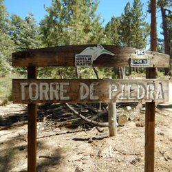
    Parque Nacional Constitucion 1857

    4.0 (1 review)

    Parque Nacional Constitucion 1857 Photos

    Recommended Reviews - Parque Nacional Constitucion 1857

    Your trust is our priority, so businesses can't pay to alter or remove their reviews. Learn more about reviews.
    Yelp app icon
    Browse more easily on the app
    Review Feed Illustration
    Photo of WS U.
    3
    204
    175

    11 years ago

    Helpful 0
    Thanks 0
    Love this 0
    Oh no 0

    Verify this business for free

    Get access to customer & competitor insights.

    Verify this business

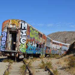
    Goat Canyon Trestle - Hiking frens

    Goat Canyon Trestle

    4.6(34 reviews)
    68.9 km

    Goat Canyon Trestle is near Jacumba California. It is the world's largest all-wooden train trestle…read more It is probably one of the most adrenaline pumping difficult hikes I have ever had the pleasure of experiencing! IMPORTANT: there are two trails to the trestle. The shorter route, Mortero Palms, is a 6 mile hike that includes strenuous rock climbing, steep descents and route finding. Do not take this shorter route as it brings you to a cliff that requires rope rappelling. The longer route about 16 miles is the easier of the two, with abandoned train cars and tunnels. However it is on private property that is trespassing. In summer temperatures can exceed 100 degrees with little to no shade. I recommend bringing 3-4 gallons of water and electrolyte replacement. You also need to be aware of hidden rattlesnakes in the rocks and brush. It is suggested to have an offline gps for navigation. The shorter route requires a high profile vehicle to the trailhead and the longer route you can pay to park at the nearby nudist camp (no joke lol). The nudists charge a nominal fee to park there. It is important to research this trail and be prepared.

    IF YOU ARE NOT PREPARED I DO NOT RECOMMEND HIKING THIS 16 MILE TRAIL. Goat Canyon Trestle is very…read moredeep in the Anza Borrego desert and far from any outside help with a strenuous walk (or bike) trail being bordered by either cliffs, cholla cacti, broken wood and caved in tunnels. No shade on top of a possible TRESPASSING FINE either from parking incorrectly or getting caught walking on the rails, I do not recommend it. This is not an easy hike, but oh man it was BEAUTIFUL AND AN AMAZING EXPERIENCE. Mountain bikes can go through fairly quickly, just don't fall off the cliffs (Especially around tunnel 8). Goat Canyon Trestle is the WORLD'S LARGEST wooden trestle (basically a bridge but held up by toothpicks) and its hike in Carrizo Gorge makes it a seldom visited spot. You'll see abandoned train cars, rattlesnake nests, cholla cactus along the way, and it's a wonderful trip for the brave and adventurous. Apart from 2 bypasses, getting to Goat Canyon is pretty flat. Parking is possible before the sign, or you can enter the gated Jacumba nudist colony office for $5 (they open at 9) You'll want the following to travel to Goat Canyon: -3L of water -Alltrails offline map (you can seriously get lost before the first tunnel) -Sunscreen (apart from the tunnels and cars there's literally no shade the whole way) - pliers to remove the cholla cactus sticking in you -Start early in the day and in the spring/fall as temps aren't too bad -Steel balls and no fear of heights -walk 6/8 hours on fairly flat terrain There are some mini trestles along the way that look like the wood is severely decayed. Tunnels 5 and 8 are blocked, so follow the well worn trail with a lot of man made debris. The hikingguy.com dude probably has the best picture step by step on how to navigate the tunnel bypasses. Overall, the payoff is great. It's more of an endurance test with how long the trail runs.

    Photos
    Goat Canyon Trestle - Go in!!!

    Go in!!!

    Goat Canyon Trestle - We're still not sure why some of the trains were abandoned out on the tracks?Seems like they could have been brought to one end when closed?

    We're still not sure why some of the trains were abandoned out on the tracks?Seems like they could have been brought to one end when closed?

    Goat Canyon Trestle - Abandoned rail cars.

    See all

    Abandoned rail cars.

    Slot Canyon

    Slot Canyon

    4.7(83 reviews)
    129.7 km

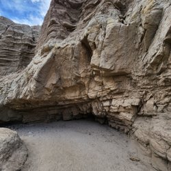
    It's definitely a must do hike when you're visiting Anza borrego, Borrego springs or even Julian. I…read morewent here early May so it was extremely hot, even though I reached the trailhead around 9am. The drive to the parking lot was a little weird because after you get off the freeway, there is a dirt road for about 1.5-2 miles on which there were a lot of signs that said "no vehicles allowed" and "foot traffic only" so I wasn't sure if I should be driving. Once k got there, there were other cars parked too so my assumption is that those signs are applicable only during some seasons. The parking lot looks flat but you can see to trail once you start walking towards the canyon. The hike was really nice, it was definitely more of a walk rather than any uphills. It can get pretty hot so starting early in the summer can be advantageous.

    We decided to visit the Slot Canyon during our Borrego Spring trip. Although it doesn't compare to…read morethe slot canyon views in Arizona or Utah, it was picturesque. The slots were fairly easy to navigate except for a few areas where you had to climb down or squeeze through narrow openings. You can also take the trail above the canyon which gives you panoramic views of the desert. There are 2 bathrooms but no sinks in the parking lot. Most cars can get to the parking lot but it's quite dusty. Come prepared with some water, snack, sunscreen, hats, and sunglasses. It's $10 per day to visit the park. It's an honor system where you fill out the form, drop off the cash in box, and leave the parking pass on your dashboard. The one negative and reason for removing a star is the poor signage on the trail and how to get into the slots. When we went, there were only 2 other families but the signs were not clear which direction to go into the canyon or even back to the parking lot so we ended up taking a much longer and harder route than needed.

    Photos
    Slot Canyon
    Slot Canyon
    Slot Canyon - View point towards the end

    See all

    View point towards the end

    Kofa National Wildlife Refuge - Inside one of the illegal mines..

    Kofa National Wildlife Refuge

    4.5(2 reviews)
    153.4 km

    There is only one negative thing about this area, and let's get it out of the way at the top:…read more You need a high clearance vehicle to really experience this place. There are amazing places to camp, hike, and climb in here but make sure your vehicle has at least 7.5" of clearance (more is always better) or else you're definitely going to get some body-scraping going on. If you're renting a car to come out here, some sort of jeep (or a Tacoma) is probably going to be your best bet. You don't really need 4 wheel drive or all wheel drive, you just need to have your undercarriage up above the ground. Once you get in here though, there's some incredible stuff! I hiked/scrambled to the summits of (you can find my GPS files for your mapping software at the links below): Castle Dome Peak: https://peakbagger.com/peak.aspx?pid=4071 Ten Ewe Mountain: https://peakbagger.com/peak.aspx?pid=35522 Signal Peak: https://peakbagger.com/peak.aspx?pid=4066 There's also some really great stargazing in here, and lots of spots to pull over and have a campout. This is one of the better places for boondocking in the US provided, again, that you have the clearance. And since this is a merely a National "Wildlife Refuge" rather than a National "Park", it's effectively free and not very crowded. I only saw one other person (and his dog) in the mountains.
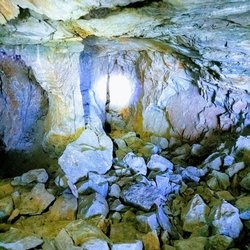
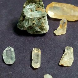
    ~ Crystal Hill Review ~…read more To get to the Kofa National Wildlife Refuge's Crystal Hill just look for the turn-off sign just past the 95 mile marker ( off the State Route 95). You will then have to drive 6 miles down a dirt and rocky road.. It's tough sledding (15 mph), but most cars can made it if they avoid the large rocks and go slow. I even saw a compact car make this. About halfway down the dirt road you'll see the official Kofa Park sign and Trailhead.. You'll then keep going for 2.5 miles until you're next to a small mountain / hill on your left. Hopefully there are RVs camping so you know you're at the right place. Just turn LEFT into the campground toward the bottom of the mountain/hill. There are several pullouts ( campsites) here, so park and walk towards the hill. There are a few trails up, all with white signs telling you that no digging tools are allowed on the hill. Walk up the trail and make your way to the top. Please feel free to go off trail as you please. The best finds are off the main trails so explore everywhere. Crystal Hill is very family friendly and you're going to find quartz ( mostly white) everywhere. The clear crystal points (very tough to find) can be found if you really look hard off-trail. Remember, limit of 10. TIPS - - 10 rock limit or 10 pounds.. whichever comes first.. - Most people collect then leave their spoils in a pile for others to find.. This helps out younger rockhounds find cool specimens. - The top is pure tailing, but the midway point on the North West side has some good locations for the cool stuff. - If you see small holes in the hillside those might be illegal mines. Small, but you or your kids can crawl in and take a look. Bring a flashlight.

    Photos
    Kofa National Wildlife Refuge - It glows under UV light.

    It glows under UV light.

    Kofa National Wildlife Refuge - The top

    The top

    Kofa National Wildlife Refuge - Cool stuff, but you need to have a keen eye.

    See all

    Cool stuff, but you need to have a keen eye.

    Cottonwood Creek - Swimming in the river, before it got very crowded

    Cottonwood Creek

    4.7(7 reviews)
    102.4 km

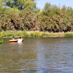
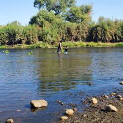
    It's a great river swim with the family…read more However be very careful.. I feel in a whole in Sept 5th,2022 and twisted both ankles. Which I'm still suffering pain from Two month in my injury. My family had lots of fun( I didn't since I was in pain but since it was 2hr drive I suck it up for them). My toddler love it.. we went when LA hit over 100* heat... it very nice in the water!! Many ppl with floating I do suggest to make sure everyone know how to swim as its now drag ppl down the stream..

    I could see this being a 3 or 4 star hike depending on the season and weather conditions you do the…read morehike in. I hiked it on 2/24/19 and found the conditions to be ideal for my enjoyment! Location- it was only about a 30 minute drive for me since I spent the night after attending a party at a family member's house in El Cajon (suburb of San Diego); I jumped on the 8 East and as the elevation reached 3,000 ft I could begin seeing snow on the hills near the fwy and I got even more excited for this hike- took Exit 47 for Sunrise Hwy and the trailhead parking was about 2 miles away from the fwy and there was a large lot on the side of the hwy to park Trail- you access the trail by walking across the road and going to the right of the metal barrier...the snow was the deepest on this portion of the hike for about half a mile and the first part of the hike is where the trail is the narrowest with portions where you have to bend over and get low to continue past low branches; at about 3/4 of a mile you will get down to creek level and make a left to get to the waterfalls...I carefully climbed up to reach about 4 parts of the waterfall and it was flowing really well with all of the recent precipitation of this winter and it was a pleasant surprise to find this so close to the city of San Diego; it is about 2 miles RT and not anything too extreme in the way of incline and I loved having the trail/falls all to myself for the nearly 2 hrs I was there *I used microspikes just to be safe but I could see it being fine with just hiking shoes

    Photos
    Cottonwood Creek - Watching from the bank since I was injured I would walk my ankles were beyond swallowed...

    Watching from the bank since I was injured I would walk my ankles were beyond swallowed...

    Cottonwood Creek - Seeing the lake before getting to the river

    Seeing the lake before getting to the river

    Cottonwood Creek - Cows on our way to the river.. leaving LA behind us

    See all

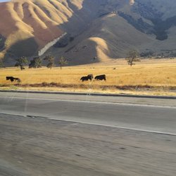
    Cows on our way to the river.. leaving LA behind us

    Pacific Crest Trail At Penny Pines - Beauty that you will see on the Indian Creek trail loop in Mt Laguna

    Pacific Crest Trail At Penny Pines

    4.9(22 reviews)
    108.2 km

    INDIAN CREEK LOOP REVIEW (8.8 miles)…read more Let's begin with 100% of hikes in Mt. Laguna or that includes the PCT will be an ethereal experience. Many say you can create, shape and mold reality. Others will say manifest and it will come. And then there are some that are just bah humbug. I always revel in God's imagination and creativity when he created these mountains. And then gave the gift of ingenuity to humans to work to create pathways and trails for us to enjoy and simply relish in gratitude and awe the entire hike. I'm a real hiker. Real backpacker. Real camper. And real glamping. I hike 2x a week for more than a decade. This is only to give you perspective of this review. This is my first time doing the full loop that included Pacific Crest Trail,Pine Mountain Road,Indian Creek Trail,and Noble Canyon Trail AKA "Indian Creek Loop." And today was wonky. Some parts were hard, some parts were easy, same parts were as if my body never has done hiking before. It was a doozy. I would likely do this hike again within the next couple of weeks. Because in my imagination, I'm an amazing hiker and that did not show today when I was struggling. I love taking photos and there was about an hour where I was trying to manage my breathing and focus and trek poles that I took no photos. Yep, I let the mountain win, smh. On this day, spectacular hike with alternating elevation, endless greenery, and blooming plants. Walking the legendary PCT, passing the "Canada" sign, and glimpsing Anza Borrego's desert floor was unforgettable. From rocky paths to meadows and mountain views, every turn offered something new. No one on the trail until the final half mile where bikers were on trail. I started at Piney Pines. Next time I'll go counterclockwise. GOOD TO KNOW *Att network excellent reception the entire trail *I felt safe as a solo hiker but I still get the quesies. I carry a few safety thins. Shhh. Don't tell *Hike time: 3 hrs, 3 minutes *90% exposed hike. *At the 4 mile marker, shade, benches and toilets. The toilets are unsanitary. I don't want to vomit and make it worse so I do my thing in nature. *When you start there's a point where you just have to finish *You can break this up to build up your mileage over time THIS HIKE IS NOT FOR: *Newbies, there's elevation involved *Whiners, complainers, or scaredy cats *Those who I have only done Cowles Mountain and think this is the next level "Life can be limited and you miss out. But create your own unlimitedness and you must do this hike."

    This review is for the Garnet Peak via Pacific Crest Trail which was a 4 mile round trip that took…read moreabout 2 hours to complete. The trail for the most part was easy to follow and completely exposed to the sun. A good portion of the trail was rocky which could make your foot a bit uncomfortable. There were also a few instances where you could go off trail for a bit to check out the desert views! Short video of the hike for those interested: https://www.youtube.com/watch?v=htU3_t3cDMI

    Photos
    Pacific Crest Trail At Penny Pines - Beauty that you will see on the Indian Creek trail loop in Mt Laguna Garnet Peak

    Beauty that you will see on the Indian Creek trail loop in Mt Laguna Garnet Peak

    Pacific Crest Trail At Penny Pines
    Pacific Crest Trail At Penny Pines

    See all

    Parque Nacional Constitucion 1857 - hiking - Updated August 2026

    Loading...
    Loading...
    Loading...