Portage Pass Trail
Portage Pass Trail Photos


More like Portage Pass Trail
Recommended Reviews - Portage Pass Trail
Start your review...


Reviews With Photos


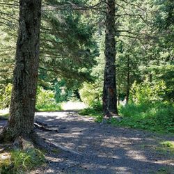
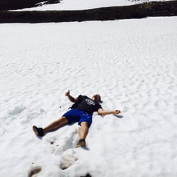
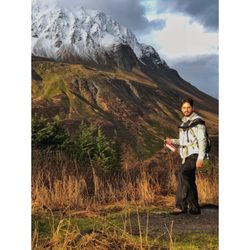
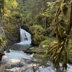
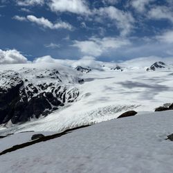
My main tip for doing this hike would be: Watch the weather in Whittier like a HAWK. There is a reason that a certain word starting with "S" and ending in "ittier" is often rhymed with Whittier. This place gets over 200 inches of rain a year. Not sure if that's a lot? Seattle gets about 36 inches. Anyway, watch the weather, and if you catch a sunny day, high-tail down the Seward Hwy, pay the man at the tunnel, exit the tunnel, and hook an immediate right. This brings you to the trailhead, parking is limited. Carpool if you can. The hike is fairly moderate but is the classic "uphill both ways" hike. You go up to a pass, then back down again to Portage Lake. It's about 2 miles with 800 ft of gain, one-way. As far as what it looks like, check my photos. They describe it better than I ever could. You can walk along the lake to scramble right up to the Portage Glacier. I wasn't able to do this since I wanted to make dern-sure that I didn't miss the last (11pm) tunnel crossing. If you want to watch the sunset on the Portage Glacier (worth it) you can even throw down a tent on the shores. I might try to do that next time.


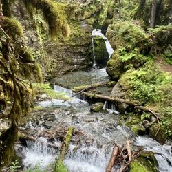
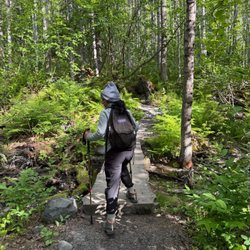
Outstanding trail. It has everything you want to see in Alaska- soaring peaks, colossal glaciers, icy rivers and waterfalls, berries for forgaing, trees and tundra alike, and views of Prince William Sound to die for. And that's all in the first mile. Granted that first mile is entirely uphill... it takes my fat ass well over 90 mins to make the 800 foot elevation gain. But it is Soooo so worth it. The trail is murder on your calves and knees because it's all loose rock at about a 15 degree incline. Going up and down is hairy even with a walking stick. But it's definitely doable, even for the elderly or out of shape if you just pace yourself. The signage isn't great to find it. AS SOON as you come out of the Whittier tunnel on the right start looking for the small sign that points you to the park. Go down the dirt road and make the first right. There's no parking lot it's just a free for all. Get ready for an amazing experience! Enjoy!


This hike is amazing! Medium level of difficulty. Would be good for kids a little older (maybe 7 and up?). First mile is a climb but after that it is easier. Spectacular views of mountains, waterfalls and glaciers. Went on a Sunday afternoon and it was rather busy. To get to the trail head you must go through the Whittier tunnel so take that into account when planning this hike.


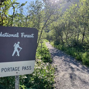
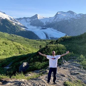
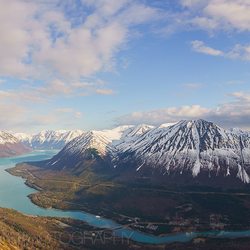
Portage Pass Trail is a fantastic hike in Whittier, Alaska! I didn't even know this trail existed until the Ship Captain on my 26 Glacier Tour Cruise mentioned it was his favorite activity. So...being only about 6pm in the summertime and still looking for more worthwhile areas of Whittier to explore...I thought...why not come over here to Portage Pass to hike for a few hours! From the parking lot where I had left my car for the cruise, the trailhead was only 1-mile away near the tunnel area getting in and out of Whittier. When turning onto the road leading towards the trailhead, be careful of all the potholes along the way. I parked on the side of the road. Portage Pass Trail is a 4-mile roundtrip hike. Well...let me just back up a little... It's a 1-mile hike to Portage Pass which overlooks Portage Lake and Glacier in the background. Then, it is 1 more mile to trek from Portage Pass down to the shores of Portage Lake. Then...obviously, it is a 2-mile hike back to the trailhead. The 1st mile hiking to Portage Pass was virtually all uphill. I gained 800 feet in elevation. This part was moderately strenuous. I believe, since you work hard to make it to Portage Pass, you might as well go all the way to Portage Lake/Glacier. The 2nd half of the hike from Portage Pass was mostly downhill where I winded my way through bushy areas but all on a defined, dirt trail. And it was sort of fun to maneuver on down to the shore. And just to back up one moment, at Portage Pass in late afternoon, the sun was shining brightly onto Portage Glacier and the surrounding landscape offering beautiful views worthy of pausing for photos. Finally, at "The Toe" of Portage Lake and Glacier...the setting was calm and quiet. There weren't many hikers around with me at 7pm. I took some time to admire Portage Glacier but found that my pictures weren't nearly as colorful being at eye-level with a fading sun in comparison to the perspectives looking down on the landscape while hiking lower from Portage Pass. For me being a picky photo person, the dwindling sun started facing me which created shadows rather where I would have preferred the sun positioned at my back. So...to give a suggestion...I believe visiting Portage Lake and Glacier; you'd be better served coming in the morning time. I also noticed that you could hike around the lake to possibly even step on Portage Glacier! That was intriguing to me, but I knew I still had the return hike to complete along with taking the tunnel to depart Whittier. Those factors were on my mind. And...I didn't have any micro spikes or crampons with me so the best I could do was maybe just stand in front of the glacier. But I feel that would maybe lose the photogenic aspect whereas being at the shoreline, I could capture the glacier in its entirety. This just me being particular...lol, that's all. I spent 25 minutes wandering along the shore, even to just breathe in the fresh air. Had I known about Portage Pass Trail ahead of time, I certainly would have afforded myself an extended stay to marvel at how cool untouched glaciers can appear in the distance. The hike back to Portage Pass was uphill, but not nearly as difficult as the initial trek from the trailhead. Then, of course, once back at Portage Pass, it's downhill back to the dirt road where I parked. I'd say the 4 total miles hiked plus time at the lake took me 3.5 hours...just enough time to complete my 26 Glacier Cruise Tour plus this afternoon hiking adventure making for an absolutely wonderful summer day experience here in Whittier, Alaska. read more






6 years ago
Wanting to see a glacier but with our previous honeymoon glacier adventure being canceled due to inclement weather, we had to get creative. My husband and I found the trail head for Portage Pass and decided to give it a shot! The trail head is located down a gravel road, on your right hand side immediately after you exit the Whittier tunnel. There is no parking lot. The trail was extremely easy to follow and as most reviews state, the 1st mile is all incline until you reach the peak. Once you reach the summit, the wind picks up but then it is all downhill until you reach the glacier. During our adventure, the trail was quite slippery and frozen over with ice but we managed to find a few foot holds. Seeing a glacier up close and personal is absolutely breathtaking and a once in a lifetime experience. We had the entire trail to ourselves since it was the off-season and not too many people wanted to brave the whipping windchill. Definitely worth the short drive from Anchorage if you want to see this glacier before it is gone! read more


8 years ago
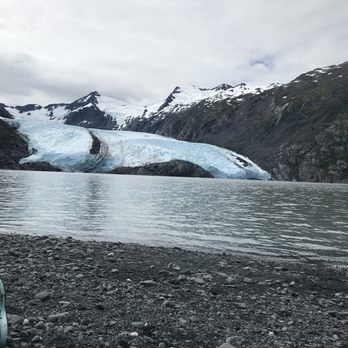
If you're looking for a great hike while in Alaska (in August) I highly suggest portage pass located in Whittier. Keep in mind the weather can change from nice to rainy to slush all too quickly--let's just say it's unpredictable, which is why I also highly suggest waterproof hiking boots, thermal socks, and layers. Arriving you'll see glaciers on the mountain right away, a mesmerizing light blue color. Once you get to the booth there is a $13 entrance fee per vehicle and then you'll drive through a long stretch of tunnel through the mountain (two miles roughly shared with train and auto, once per hour) to get to the other side. Park your car and the adventure begins. The hike is about 2 miles (4 round trip) and very well maintained. The steep incline at the beginning could very well have easily been the toughest part. It took about two hours each way from parking to lake and visa versa. I had plenty of water, a picnic, bear spray (just in case), and my handy dandy camera. There are berries along the trail some edible and some not, I'd leave those for desperate times and desperate measures. It was a bit windy once the summit was reached and great views of glaciers from here. Decided to hike all the way down to the lake; here I was chasing waterfalls or frozen glaciers rather and it just took my breath away. Took a moment to take it all in and enjoy my surroundings. I could tell we weren't in Kansas anymore, lol I mean California. It was time for a picnic, one in which was well deserved. You'll also notice the icebergs breaking off in the glacier water this is called calving, sounds like thunder. The trek back was also amazing and rewarding with views. Keep in mind to the summit (1mile) and continuing to the lake (1mile). I bet in the winter it is even more beautiful. Mosquitos were not an issue here. Fun fact: Once used by Alaska Natives, Russian fur traders, and early settlers. Currently it is used as a migratory route for birds and hiking. +-+-+-+-+-+-+-+-+-+-+-+-+ |m|o|u|n|t|a|i|n|e|e|r|i|n|g| +-+-+-+-+-+-+-+-+-+-+-+-+ Get outside and go pioneering read more


My main tip for doing this hike would be: Watch the weather in Whittier like a HAWK. There is a reason that a certain word starting with "S" and ending in "ittier" is often rhymed with Whittier. This place gets over 200 inches of rain a year. Not sure if that's a lot? Seattle gets about 36 inches. Anyway, watch the weather, and if you catch a sunny day, high-tail down the Seward Hwy, pay the man at the tunnel, exit the tunnel, and hook an immediate right. This brings you to the trailhead, parking is limited. Carpool if you can. The hike is fairly moderate but is the classic "uphill both ways" hike. You go up to a pass, then back down again to Portage Lake. It's about 2 miles with 800 ft of gain, one-way. As far as what it looks like, check my photos. They describe it better than I ever could. You can walk along the lake to scramble right up to the Portage Glacier. I wasn't able to do this since I wanted to make dern-sure that I didn't miss the last (11pm) tunnel crossing. If you want to watch the sunset on the Portage Glacier (worth it) you can even throw down a tent on the shores. I might try to do that next time. read more


Outstanding trail. It has everything you want to see in Alaska- soaring peaks, colossal glaciers, icy rivers and waterfalls, berries for forgaing, trees and tundra alike, and views of Prince William Sound to die for. And that's all in the first mile. Granted that first mile is entirely uphill... it takes my fat ass well over 90 mins to make the 800 foot elevation gain. But it is Soooo so worth it. The trail is murder on your calves and knees because it's all loose rock at about a 15 degree incline. Going up and down is hairy even with a walking stick. But it's definitely doable, even for the elderly or out of shape if you just pace yourself. The signage isn't great to find it. AS SOON as you come out of the Whittier tunnel on the right start looking for the small sign that points you to the park. Go down the dirt road and make the first right. There's no parking lot it's just a free for all. Get ready for an amazing experience! Enjoy! read more


This hike is amazing! Medium level of difficulty. Would be good for kids a little older (maybe 7 and up?). First mile is a climb but after that it is easier. Spectacular views of mountains, waterfalls and glaciers. Went on a Sunday afternoon and it was rather busy. To get to the trail head you must go through the Whittier tunnel so take that into account when planning this hike. read more



11 years ago

9 years ago
Just incredible, words can't describe the beauty of the hike. 4 miles roundtrip, just park your vehicle at the park entrance (just on the side of the road, there is no official parking area) and head up the hill, lakes along the way, came upon a porcupine who wandered out of our way, and then the gorgeous glacier. Bring your camera! This place is off the chart dramatically breathtaking, find a rock at the end and know that you are looking at the perfection of Mother Nature or God, whatever your preference. read more


9 years ago
More info about Portage Pass Trail
Ask the Community - Portage Pass Trail

















Portage Pass Trail - hiking - Updated September 2026
Best of Whittier
People found Portage Pass Trail by searching for…
Places to Take Pictures in Whittier, AK
Things to Do on a Rainy Day in Whittier, AK
Waterfall Hike in Whittier, AK
Natural Hot Springs in Whittier, AK
Restaurants With a View in Whittier, AK
Hiking With Kids in Whittier, AK
Playgrounds for Kids in Whittier, AK
Beautiful Views in Whittier, AK
Places to Swim in Whittier, AK
Trending Searches in Whittier, AK
Browse Articles
Browse Nearby
Browse Brands
Related Searches in Whittier, AK
Affordable Kayak Rental Services in Whittier, Alaska
Best Dog Hiking Trails Around Whittier, Alaska
Best Fishing Locations and Guides in Whittier, Alaska
Best Lookout Points to Visit in Whittier, Alaska
Best Nature Trails for Hiking in Whittier, Alaska
Best Sightseeing Experiences Available in Whittier, Alaska
Best Things to Do on a Rainy Day in Whittier, Alaska
Check Out Off Road Trails in Whittier, Alaska
Discover Popular Bike Trails in Whittier, Alaska
Discover Top Boat Tours in Whittier, Alaska for All Ages
Discover a Hiking Trail in Whittier, Alaska
Discover the Best Night Hike Trails in Whittier, Alaska
Enjoy Kayaking Adventures in Whittier, Alaska
Enjoy Off Leash Dog Hikes in Whittier, Alaska
Enjoy Scenic Night View Experiences in Whittier, Alaska
Enjoy the Best Walking Trails in Whittier, Alaska
Experience Stunning Sunset Views in Whittier, Alaska
Explore Beautiful Parks and Green Spaces in Whittier, Alaska
Explore Bike Rentals Throughout Whittier, Alaska
Explore Easy Hikes Perfect for All in Whittier, Alaska
Explore Free Things to Do Around Whittier, Alaska
Explore Jet Skis for Sale or Rent in Whittier, Alaska
Explore Landmarks & Historical Buildings in Whittier, Alaska
Explore Popular Boat Charters Near Whittier, Alaska
Explore Popular Campgrounds Near Whittier, Alaska
Explore Popular RV Parks Around Whittier, Alaska
Explore Popular Scenic Overlook Points in Whittier, Alaska
Explore Popular Scenic Views Near Whittier, Alaska
Explore Whale Watching Tours in Whittier, Alaska
Explore the Best Boating Spots in Whittier, Alaska
Family Friendly Hiking With Kids in Whittier, Alaska
Find Beautiful Views in Whittier, Alaska
Find Exciting Tours to Take in Whittier, Alaska
Find Fun Kids Activities Outdoor in Whittier, Alaska
Find Top-Rated Waterfalls in Whittier, Alaska Now
Find the Best Scenic View Locations in Whittier, Alaska
Hiking Trails With Waterfalls in Whittier, Alaska
Off Leash Dog Hiking Trails in Whittier, Alaska
Plan a Scenic Drive Route Near Whittier, Alaska
Popular Outdoor Activities to Try in Whittier, Alaska
Popular Places to Take Pictures in Whittier, Alaska
Popular Things to Do in Whittier, Alaska
Relax at Natural Hot Springs Near Whittier, Alaska
Top Fishing Charter Experiences in Whittier, Alaska
Top Hiking Trails to Explore in Whittier, Alaska
Top Running Trails to Explore in Whittier, Alaska
Top Things to Do With Kids in Whittier, Alaska


