Cancel

Open app

Search

Rogue Gorge Viewpoint

4.8 (9 reviews)

Rogue Gorge Viewpoint Photos

Recommended Reviews - Rogue Gorge Viewpoint

Your trust is our priority, so businesses can't pay to alter or remove their reviews. Learn more about reviews.
Yelp app icon
Browse more easily on the app
Review Feed Illustration

Reviews With Photos

Josh B.

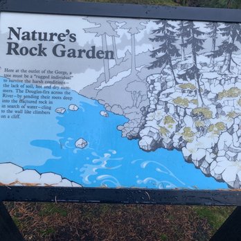
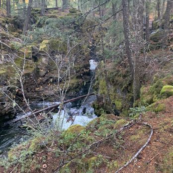
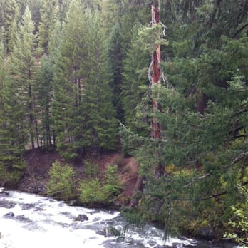
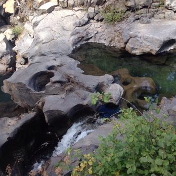
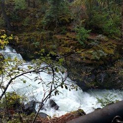
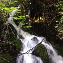
This is one free thing to do while you're all the way out here. It is a wonderful little walk where you can get a view of the tumultuous upper and lower falls. It kind of reminds me of Yellowstone. You can go off the paved trail and walk down where the water kind of smoothes out next to the cabins where the back porch is basically the river. The trail goes for quite a while and changes quite a bit in elevation. There are trail markers and places to grab a map if you don't know where you're going. If you walk around the upper falls area, there are a lot of information signs and stop points where you can read about how the falls came to be and information about the volcano and Crater Lake. I know I've already said it, but the upper falls part really really reminds of some of the falls in Yellowstone National Park. The water is really strong. Strong enough to topple trees into the flow of the river. There are fences up so that you don't just walk right up the water and get swept away. No matter where you stand though, just stand and listen to the force of the water. It's so peaceful yet energizing. I believe the water comes down from Crater Lake through under ground tunnels carved out by the lava flowing through the area many years ago. This is the same with the Natural Bridge campground a short distance down the road. And if the sound of the water is a bit much and leads you to have to have a wee. There are bathrooms on site so you can stop off at the loo before you leave. This is a really wonderful information spot. Be sure and check it out if you're in the area.

See all

8 months ago

Helpful 6
Thanks 4
Love this 8
Oh no 0
Photo of Rob S.
743
2117
49983

7 years ago

Helpful 8
Thanks 0
Love this 7
Oh no 0

6 years ago

Helpful 1
Thanks 0
Love this 1
Oh no 0
Photo of Josh B.
347
1174
9133

12 years ago

Helpful 3
Thanks 0
Love this 1
Oh no 0

3 years ago

Helpful 0
Thanks 0
Love this 0
Oh no 0
Photo of Nora S.
268
2348
399

12 years ago

Helpful 2
Thanks 0
Love this 1
Oh no 0

7 years ago

Helpful 0
Thanks 0
Love this 0
Oh no 0

10 years ago

Helpful 1
Thanks 0
Love this 1
Oh no 0

11 years ago

Amazing! Worth the stop! Free and barely a hike so easy for all to see the gorgeous Oregon scenery.

Helpful 2
Thanks 0
Love this 1
Oh no 0

Ask the Community - Rogue Gorge Viewpoint

Verify this business for free

Get access to customer & competitor insights.

Verify this business

Mill Creek Falls and Avenue of the Boulders - Boulders in the summer.

Mill Creek Falls and Avenue of the Boulders

4.7(13 reviews)
5.3 mi

Hidden about 45 minute outside of Crater Lake National Park in the tiny town of Prospect lies Mill…read moreCreek Falls and the Avenue of the Boulders. The space features a short hike with waterfall views and access to large boulders and parts of the beautiful Rogue River. I stopped here on the way back from Crater Lake National Park. The turnoff from the highway is easy to miss. In fact, I missed it myself and had to turn back around in the middle of the road. There's a small parking lot with a highly degraded trail map and a few portable restrooms near the beginning of the trailhead. The hike is pretty short, I'd say less than 2 miles round trip. You start off on a flat path that will take you to a two-way intersection. If you bear left, the trail will lead you the Rogue River and the Avenue of the Boulders. And if you bear right, the trail continues to two separate viewpoints; Barr Creek Falls and Mill Creek Falls. I decided to hit the falls first. The hike is pretty easy with gentle rolling inclines. It's entirely shaded by big beautiful trees. The first waterfall in view will be Mill Creek Falls. These falls absolutely stunning! They were flourishing in late fall. The second set of falls is just a short walk up a some log steps. This is where you'll find Barr Creek Falls. These falls weren't as robust as Mill Creek Falls, but they were still very charming. You'll also get a glimpse of the beautiful Siskiyou forest in the backdrop. On the way back, I headed down the other way toward the Avenue of the Boulders. I've been to the Avenue of the Giants before in Humboldt County, but the the Avenue of the Boulders are a completely different experience. They're comprised of huge boulders, many of which you can climb to get a better view of the falls and the Rogue River that flows down below. Simply one of the most gorgeous sights that I've ever seen! The Rogue River is so comforting and calming. This a total relaxation spot. A place where you can just sit back, relax, and enjoy the view. Enjoy the sounds and sights of the river flowing beneath your feet. It's truly endearing. Who would have thought that something this beautiful could be hidden away in a small town just outside of Crater Lake? It's so amazing and yet still extremely secluded. If you're coming up to Crater Lake, a visit to Mill Creek Falls and be Avenue of the Boulders should definitely be added to your list.

Gorgeous and easy hike out to some boulders or a set of waterfalls. This seasons rain and snow melt…read moremade the rivers flow violently with water, producing amazing cascades of water for the falls. It's a downward hike and you don't notice it until the hike back out, but it's fairly easy and short so it's a great little stop over for a worthwhile view. The map etched in wood in the parking lot gives a good overlook of the area. Definitely head to the right side and see the falls.

Photos
Mill Creek Falls and Avenue of the Boulders - Rogue River

Rogue River

Mill Creek Falls and Avenue of the Boulders - The climb to the river

The climb to the river

Mill Creek Falls and Avenue of the Boulders

See all

Natural Bridge Trail & Campground - Natural Bridge, Union Creek

Natural Bridge Trail & Campground

4.4(5 reviews)
9.5 mi

Wow!!!! It is BEAUTIFUL! It is about an hour drive from Medford and TOTALLY worth the trip!!!…read more For those less mobile, you can get a great view of the gorge and water rushing through the rocks with a 5 to 10 minute walk to the first bridge depending upon your walking speed. And it is paved until the third overlook. I went hiking. It is a 1/4 mile to the Natural Bridge from the parking, but you can hike further past the three overlooks. I stayed on for another 1.5 miles which is worth the hike. By my standards, it is a "moderate" hike with a few steep grades. Once you cross the second bridge, take a left and walk another 1/4 mile to reach a shaded beach area to lay down and relax or cool off in the water.

This is a cool place to just take a stroll and really breath in the cleanest air possible. Well, it…read moremight not be the cleanest air, but it's darn near close enough in this wilderness area. There is also, a lot of parking here for all sorts of vehicles but it doesn't ever seem like this place gets full. I stopped here as I was staying at a place in Prospect. The road to Crater Lake was super snow covered and I didn't have chains so I opted to just hike here instead and try Crater Lake the following day. It wasn't really challenging but I still got a great hike. I really think it's amazing how the lava and water have carved so much of the landscape in this area and it's free just to roam and take it all in. Most of the trails are well travelled but there are several areas where I had to turn around and head back as they were fenced. Although you can hear the rush of the water nearby, it's oddly quiet. It's just how I like it for hiking so you can get real peace of mind. I kind of wish I saw a little more wildlife but I guess that's why they're called wild-life. They have limited first come, first serve tent sites as well as limited RV sites. There are vault toilets as well. There is no drinking water, so bring your own water. I think I saw signage for $10 for a campsite, but check the resources to make sure. Also with most campgrounds pack it in, pack it out with regards to trash.

Photos
Natural Bridge Trail & Campground - Coming out of cave

Coming out of cave

Natural Bridge Trail & Campground - It is underground

It is underground

Natural Bridge Trail & Campground

See all

Crater Lake National Park

Crater Lake National Park

4.8(478 reviews)
20.2 mi

What a beautiful national park! It is definitely worth the drive from pretty much anywhere. No…read morematter what you are expecting, you will experience so much more. We went today when only a small portion of the rim was open and it was absolutely beautiful. It was a bit 45°F out with strong winds but it was still an amazing experience. We stopped at the Steel Information Center after going through the entrance to the area, then drove up to Rim Village and went to the Rim Visitor Center. There is plenty of parking there and you can follow the path to the rim and get some stunning views of the lake. It was a beautiful day and the water was so clear and blue. I definitely want to come back in July or August when it's a bit warmer and the whole rim is open. If you have a permanent disability you can get a free lifetime national park pass, which is how we got in today. This is a beautiful national park and we need to do everything we can to protect it.

Pro tip: Stay in Bend, OR and pack lots of food and drinks, and drive into the park for a day trip…read more There may still be snow, yes - even in July! We visited the park and stayed at the cabins Jun 19 -20 and they got five inches of snow the night we left. There is not much to do in the park after dark and not really anything to do in the cabins so bring books and cards, because there is no cell service. You can almost drive all the way fully around the whole lake but there are closures happening so you won't be able to go all the way around. Food is very limited and not good, so bring your own! There is NO CELL SERVICE on most of the volcano. However, there is Wifi at the Mazama Store. I was able to sit in my car (once connected inside) and use the wifi for the apps that it would allow over WIFI. It is not a secure network either. You will need to drive to most all of the sites and activities at the park. If the park activities are open for the season, you will probably have about two fulls days worth of activities to do. However, in off season, a day visit is plenty to take in the sites.

Photos
Crater Lake National Park
Crater Lake National Park - We had fun at Crater Lake. Summer 2022.

See all

We had fun at Crater Lake. Summer 2022.

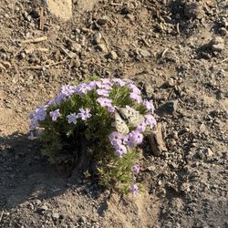
Watchman Peak - Phlox diffusa

Watchman Peak

4.9(8 reviews)
22.9 mi

2 mi, 423 elevation gain, 56 minutes to complete…read more Small snowfield to cross if you start at watchman overlook. If you come from discovery point it would be longer but you would avoid any of the snow crossings. Totally worth the hike- one of the most amazing views in the park especially at sunrise or sunset! Lots of different wildflowers along the way and panoramic views. There is a cute fire lookout that appears to no longer be in use at the top.

I'd like to talk about not just hiking to Watchman Peak, but also the roadside pullover here at…read moreWatchman Overlook. So yes...there are 2 purposes for stopping at this Watchman Area. The Overlook from the rim and hiking the trail to Watchman Peak. This section of Crater Lake is deserving of 5 stars because...when driving around the 33 mile rim encompassing all of Crater Lake (although the views can get quite repetitive and monotonous)...the BEST APPEARANCES OF CRATER LAKE COMES FROM HERE AT WATCHMAN PEAK!!! That's what makes Watchman Overlook so worthwhile. Because the roadside emergence of not just Crater Lake, but the main centerpiece attraction to it all known as Wizard Island is the closest and most prevalent you'll find throughout the park. Watchman Overlook was the best observation viewpoint I can remember from my time spent at Crater Lake. Wizard Island sort of smacked me in the face through my camera lens...I was able to photograph Crater Lake in it's majestic entirety from the viewpoint. Whereas, many of the significantly less roadside Crater Lake stops can just be ordinary especially when you're pulled over far away from Wizard Island. Then the scenery was really a letdown. For instance, when you're on the other side of the lake near Phantom Ship, when I exited my car to look upon Crater Lake, it was like glancing into the abyss of some large sized lake of water, without any focal points (like Wizard Island) and without any meaningful blue coloring to it. I was expecting turquoise blue around the lake and never found it. Even at the main hub of activity in Rim Village featuring Sinnott Overlook, the Crater Lake Lodge, Garfield Peak Trail, and even along Discovery Point Trail....I never received that fulfilling/humbling "wow moment" that completely blew me away in comparison to the sights and scenery I uncovered here at Watchman Overlook and Peak. Regardless...back to what makes Watchman Peak Overlook one of the most worthy of roadside stops at Crater Lake... - I HIGHLY RECOMMEND VISITING HERE IN THE AFTERNOON TIME! Yes this is SO IMPORTANT because from here at Watchman Overlook the sun starts to set from your backside. So...you get the sun reflecting onto Crater Lake and it affords you the most clear and concise perspectives for taking pictures! If you arrive in the morning, the sun will hit you in the opposite (in your face) direction and then you may be stuck with those annoying shadows! - After observing Crater Lake from the rim overlook area....off to the right hand side you'll find the hike to Watchman Lookout Trail. This path will take you to the apex of the rim's edge for uninterrupted views of Crater lake. This Watchman Lookout Trail isn't hard. There'll be a sign/trailhead stating that the Lookout Tower is 0.8 mile to the top. That's 1.6 miles round trip and it's an elevation gain of about 450 feet - I'd say a moderate level of difficulty, but it's overall less than 1 mile. - This Watchman Lookout Trail to the Lookout Tower is certainly recommended because there's not many hikes to even traverse at Crater Lake. I found Crater Lake to be more of just a roadside get out of your car kind of park. So...might as well take advantage of a little hiking opportunity while here...especially since the views around this Watchman Peak area are some of the most scenic in the park! - Along the 0.8 mile...there's not much to view, just switchbacks making your way to the top. From this Watchman Peak Lookout Tower, the appearance of Crater Lake was just as good as the roadside view (there wasn't much difference in my opinion) but still, I'd recommend grabbing a couple of photos from high atop here. - During this summer pandemic of 2020, the Lookout Tower was closed. So, in the end...you just have a small viewpoint to pier down on and admire Crater Lake with of course Wizard Island being so photogenic as well. I truly believe you won't find superior angles/perspectives of Crater Lake and Wizard Island anywhere else in the park other than being here at the rim's Watchman Overlook and at the pinnacle of Watchman Peak Trail Lookout Tower. Capture as many pictures as possible during your time here because the views won't get any better.

Photos
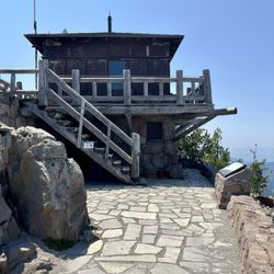
Watchman Peak - Watchman Tower

Watchman Tower

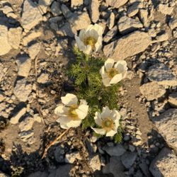
Watchman Peak - Western pasqueflower

Western pasqueflower

Watchman Peak - Inside lookout

See all

Inside lookout

Watson Falls

Watson Falls

5.0(9 reviews)
33.4 mi

Watson Falls is a fantastic looking 293 foot waterfall located in the Umpqua National Forest of…read moreSouthwest Oregon. It sits just 54 miles north of Crater Lake National Park. Watson Falls can be combined together among a trifecta of landmarks all within short distances of each other for a full days worth of basking among the great outdoors. First, start out here at Watson Falls. Next, head 3 miles down the road to Toketee Falls and then finish up 4.5 miles away at Umpqua Hot Springs. But, back to here at Watson Falls and what to expect... To arrive at Watson Falls, it's an easy one mile roundtrip pathway loop gaining 370 feet in elevation. Leave your car in the parking lot, then cross the street and into the forest. You'll pass over a footbridge and continue on the trail which veers towards the left. Finally, approach a Bench Viewpoint of Watson Falls, but that's not nearly a good enough perspective. Climb the rocks and head straight to the base of the falls. Then you'll confront waterfall bliss. What's terrific about standing at the bottom of Watson Falls is that you have the entire waterfall and backdrop to yourself. There's no blemishes or disturbances. In essence, the setting is a waterfall enthusiasts' dream come true. During my visit in early September around 10am, I had unlimited time to admire this stunning natural wonder. Best of all, Watson Falls is one sheer 293 foot drop. There's no cascading down a cliffside or being broken up into different sections or tiers. It truly shines outright. You can continue onward to the Upper Viewpoint which is a short little walk uphill, but the views from high up don't nearly do it justice. The Upper Viewpoint can be skipped altogether but it won't hurt to take in a different glance of Watson Falls if your curiosity gets the best of you. Finally, it's time to return back on the trail to the parking lot. In total, you can take an hour or so to appreciate experiencing Watson Falls. Next up will be Toketee Falls, which is similar to Watson Falls in that it'll take about 1 mile to reach all while hiking through the pristine Umpqua Forest. Overall, Watson Falls is a magical little roadside stop as you make your way through Southwestern Oregon. It may be under the radar, but deserves a place on your To-Do List.

Definitely one the best falls in the area! There's a trail to the bottom of the fall, a loop trail…read moreout, and another trail to overlook higher up! All worth the hike! Best to go when water is flowing heavy in early season.

Photos
Watson Falls - The entrance sign for Watson Falls, a magical waterfall located in Southwestern Oregon.

The entrance sign for Watson Falls, a magical waterfall located in Southwestern Oregon.

Watson Falls
Watson Falls

See all

Rogue Gorge Viewpoint - hiking - Updated May 2026
Loading...
Loading...
Loading...