Cancel

    Open app

    Search

    Ron Coleman Trail

    4.5 (2 reviews)

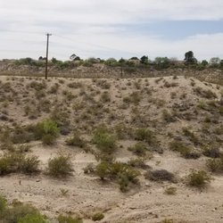
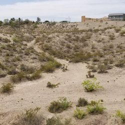
    Ron Coleman Trail Photos

    More like Ron Coleman Trail

    Recommended Reviews - Ron Coleman Trail

    Your trust is our priority, so businesses can't pay to alter or remove their reviews. Learn more about reviews.
    Yelp app icon
    Browse more easily on the app
    Review Feed Illustration
    Photo of Doug A.
    0
    18
    52

    10 years ago

    Helpful 2
    Thanks 0
    Love this 2
    Oh no 0

    7 years ago

    Helpful 0
    Thanks 0
    Love this 0
    Oh no 0

    Verify this business for free

    People searched for Hiking 498 times last month within 15 miles of this business.

    Verify this business

    McKelligon Canyon

    McKelligon Canyon

    4.6(23 reviews)
    3.9 km

    It's a nice spot to go on a walk or jog.There are picnic tables with shade and some nice walls you…read morecan use as balance beams near them.leads to a nice little hole in the mountain with a nice view of the way you walked.The worse thing about Mckelligon is the bath rooms they must be 50+years old with minimal maintenance;you can just pee around a rock or building though.

    I absolutely love McKelligon Canyon! Especially since COVID! So the canyon is technically a city…read morepark. It's a two lane paved road, that leads up to an amphitheater! Normally, the amphitheater has shows, but of course that's all cancelled temporarily. At the top of the road, there are many covered picnic tables that persons like chilling out at. Also, the very top has entrances to Franklin Mountains, which is a state park, and has many hiking trails. This road, due to covid, is closed to all motorized traffic. That is amazing right now, because you can walk up and down and exercise without worrying about vehicle traffic. And honestly, that's what everyone uses it for. From Soldiers hiking up with their rucksacks, to joggers running, families pushing strollers, and dog owners (like me), taking there dogs out for a walk. You can (and we all do), still use this route for exercise even when it is open to vehicle traffic, but of course with it closed, it's much more enjoyable and safer. The road is a dead end of sorts. At the very top, it splits off and loops itself back around. So there is only one way up and one way down. If you walk the top loop twice, the entire trip will be 5.2 miles. If you walk the top loop once, the trip is 4.8 miles. From the start to the top, you climb 800ft in elevation. It's almost exactly 2.5 miles to the top at the loop, so that's 2.5 miles, 800ft elevation increase, dang near going straight up lol. Whether you're walking or jogging, it's definitely a workout. My dogs and I do this trek 1x every single week. It's open from 0630 - 2200 every day. Many Soldiers flood this area and conduct fitness training in the early early mornings during the week. And on the weekends, many fitness seeming persons flood this area as well. It's dog friendly, and they have doggie bags at the entrance. However, there are only about 3 trash cans along the route. Keep that in mind. And please pick up after your dogs

    Photos
    McKelligon Canyon
    McKelligon Canyon - Pavilion

    Pavilion

    McKelligon Canyon - Beautiful Sunrise Views

    See all

    Beautiful Sunrise Views

    Lost Dog Trailhead

    Lost Dog Trailhead

    4.4(14 reviews)
    5.1 km

    As someone who plays Pokémon Go, this is a very popular location to come play! There is a gym to…read morebattle Pokémon or do raids. There is a pokestop to stock up on items or battle Team Rocket. It is also a good spawn point to catch Pokémon! I have also heard from my nephews as a trail, it is a very fun hike to do!

    Lost Dog Trailhead is the start to the Redd Road Trails. For some unknown reason, it does not have…read morean actual address other than to just say it's on the 1600 block of Redd Road. There are tourism signs that will point you in the right direction when you're on Redd Road and a metal sign with a dog on it and the words 'Lost Dog Trail' on it. Quick tip to get there: if you're coming from Mesa get on Redd Road and head towards Transmountain, it'll be on your right as soon as you pass Helen of Troy. From the name you can obviously tell LDT is just the portion that connects all the trails in this area. It's a rather short distance before you hit other trails (.4 miles according to the map). The biggest obstacle is the huge incline at the very beginning that follows the left side of the water tower. DO NOT TAKE A RIGHT AT THE WATER TOWER! That is not part of the trail, it just follows a rain ditch. Once you get over the hill, it's a pretty easy and steady incline the rest of the way. Not speaking about the trails LDT branches off into, but solely LDT...it's a pretty easy trail, so much so the first time I did it, I did it in flip flops (I found the Redd Road Trails when I was driving home, totally unexpected...hence the flip flops). I wouldn't say this is the most scenic of trails, however, you do get a nice view of the west side, Transmountain and all that jazz. Great starter for beginning hikers, walks with the dogs, or cyclists.

    Photos
    Lost Dog Trailhead - Gathering

    Gathering

    Lost Dog Trailhead
    Lost Dog Trailhead

    See all

    Trans Mountain Road - Evening Views

    Trans Mountain Road

    4.5(14 reviews)
    3.7 km

    Beautiful views and a lovely road to cruise. Awesome houses up there with beautiful views. Quite…read morea few park areas to get out and picture take as well as sit and just enjoy the surroundings. There are sitting areas as well as markers proving information about the area.

    Scenic drives are kind of my thing, and the drive up Trans Mountain Road was completely satisfying…read more Not only is the drive an adrenaline rush (albeit a tad bit scary too), the city views are quite astounding at the top. It's also an excellent way to skip the traffic when traveling from New Mexico to El Paso (and probably visa versa but can't confidently confirm that part). I was leaving New Mexico after having a wonderful dinner and saw that there was a ton of traffic getting back to El Paso on my GPS. It suggested an alternate route; Trans Mountain Road. Normally, I'd probably just sit in traffic when I'm in an unfamiliar place. I'm from the Bay Area (California), and I am no stranger to horrible traffic. But who the hell wants to sit in traffic while they're on vacation?! I already deal with that 5 days out of the week, so spare me. It was still daylight so I decided to do it. I've driven on many windy roads, but I'll admit that this one was kind of nerve racking. Mostly because some of you Texans just don't know how to drive (sorry, not sorry). But once I got to the top of the hill and those views started to appear, it became enjoyable. I saw a vista point with a few cars parked in the distance and immediately pulled off to park there. Yep, this was it. I hit the jackpot. The pictures of the vista point doesn't do it justice. The views are outstanding! Panoramic beauty and lots of it. There's even a cute little lookout point and some picnic tables up there. It was windy as hell though, so not sure if I'd sit out there and eat something for fear of being blown over. Maybe in the summer when the weather is warmer and the winds are milder, but still. Fantastic city views of El Paso and some nice views of the New Mexican desert hills. This is definitely a hidden chill spot. I can only imagine how gorgeous the sunrises and sunsets are, but I'm sure it's even gnarlier to drive this road when it's dark. In any event, it's a lovely vista with an adventurous drive and a nice escape from traffic.

    Photos
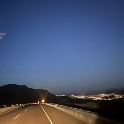
    Trans Mountain Road - Evening Views

    Evening Views

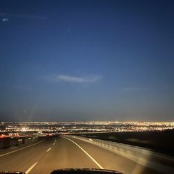
    Trans Mountain Road - Evening Views

    Evening Views

    Trans Mountain Road - Evening views

    See all

    Evening views

    Ron Coleman Trail - hiking - Updated May 2026

    Loading...
    Loading...
    Loading...