Shelton Laurel Massacre Historical Marker Photos

More like Shelton Laurel Massacre Historical Marker
Recommended Reviews - Shelton Laurel Massacre Historical Marker
Start your review...

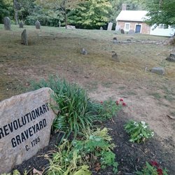
North Carolina seceded from the Union and joined up with the Confederacy as part of the Civil War. And if you were driving through the mountains today, you'd think they were still there. I saw not a small number of homes with Confederate battle flags flying as I drove along US-25. And this marker points out a dark spot of that history. The marker reads, "Thirteen men and boys, suspected of Unionism, were killed by Confederate soldiers in early 1863. Graves 8 miles east." There is more information online. "The deaths of thirteen men and boys at the hands of Confederate soldiers in the Shelton Laurel area of Madison County in January 1863 constitute one of the most tragic events in North Carolina history. Within days of the killings, Governor Zebulon B. Vance wrote that the affair was "shocking and outrageous in the extreme." Writer Wilma Dykeman in 1955 observed that "nowhere is there a microcosm more chill and revealing than this episode of war at its heart and core." Parallels have been drawn with the My Lai incident in Vietnam." "The incident grew out of a series of raids on the town of Marshall by fifty to sixty Unionists claiming that Confederate authorities had denied them salt and other provisions. Brig. Gen. Harry Heth at Knoxville was commander of forces at the scene. With retribution in mind Lieut. Col. James A. Keith and his men went into the Shelton Laurel area and marched three boys, ages thirteen and seventeen, and ten men, twenty to fifty-six, out from their homes and into the woods. They were ordered to kneel. Hesitating on Keith's first command to shoot the thirteen, the troops complied with the second. In addition, "several women were severely whipped and ropes were tied around their necks." Most of what we know of the affair comes from a report prepared for Governor Vance by A. S. Merrimon. No one was ever prosecuted for the killings." The marker is at an intersection, so there is room to stop and contemplate. I did not have time to drive the 8 miles east to the graves. Maybe on a future trip. [Review 20135 overall - 3484 in North Carolina - 1111 of 2023.] read more


More info about Shelton Laurel Massacre Historical Marker


Shelton Laurel Massacre Historical Marker - landmarks - Updated July 2026
Best of Marshall
People found Shelton Laurel Massacre Historical Marker by searching for…
Things to Do in Marshall, North Carolina
Scenic Overlook in Marshall, North Carolina
Photo Spots in Marshall, North Carolina
Places to Take Pictures in Marshall, North Carolina
Public Services & Government in Marshall, North Carolina
Stuff to Do in Marshall, North Carolina
Historical Sites in Marshall, North Carolina
Military Museum in Marshall, North Carolina
To Do in Marshall, North Carolina
View Points in Marshall, North Carolina
Landmarks in Marshall, North Carolina
Observation Deck in Marshall, North Carolina
DMV Offices in Marshall, North Carolina
Scenic Night View in Marshall, North Carolina
Trending Searches in Marshall, NC
Black Owned Nail Salons near Shelton Laurel Massacre Historical Marker
Boat Rental near Shelton Laurel Massacre Historical Marker
Caves near Shelton Laurel Massacre Historical Marker
Cliff Jumping near Shelton Laurel Massacre Historical Marker
Creeks near Shelton Laurel Massacre Historical Marker
Day Trips near Shelton Laurel Massacre Historical Marker
Fishing Spots near Shelton Laurel Massacre Historical Marker
Flower Fields near Shelton Laurel Massacre Historical Marker
Historical Sites near Shelton Laurel Massacre Historical Marker
Jet Ski Rental near Shelton Laurel Massacre Historical Marker
Kayak Rental near Shelton Laurel Massacre Historical Marker
Landmarks & Historical Buildings near Shelton Laurel Massacre Historical Marker
Picnic Areas near Shelton Laurel Massacre Historical Marker
Places To Visit near Shelton Laurel Massacre Historical Marker
Places To Walk Around near Shelton Laurel Massacre Historical Marker
Pool Day Pass near Shelton Laurel Massacre Historical Marker
Public Pools near Shelton Laurel Massacre Historical Marker
River Swimming near Shelton Laurel Massacre Historical Marker
Scenic Restaurants near Shelton Laurel Massacre Historical Marker
Secluded Spots near Shelton Laurel Massacre Historical Marker
Sightseeing near Shelton Laurel Massacre Historical Marker
Soccer Store near Shelton Laurel Massacre Historical Marker
Splash Pad near Shelton Laurel Massacre Historical Marker
Strawberry Picking near Shelton Laurel Massacre Historical Marker
Sunrise View near Shelton Laurel Massacre Historical Marker
Swimming Holes near Shelton Laurel Massacre Historical Marker
Swimming Lakes near Shelton Laurel Massacre Historical Marker
Things To See near Shelton Laurel Massacre Historical Marker
Browse Articles
Browse Nearby
Browse Brands
Related Searches in Marshall, NC
Best Fun Things to Do in Marshall, North Carolina
Best Nature Trails for Hiking in Marshall, North Carolina
Book Engaging Historical Tours in Marshall, North Carolina
Discover Charming Historic Homes in Marshall, North Carolina
Discover Famous Monuments in Marshall, North Carolina
Discover Lakes & Ponds to Explore in Marshall, North Carolina
Discover Popular Landmarks in Marshall, North Carolina
Discover Popular Photo Spots in Marshall, North Carolina
Discover Top Points of Interest in Marshall, North Carolina
Discover Top State Parks to Visit in Marshall, North Carolina
Discover the Best Air Museum Exhibits in Marshall, North Carolina
Discover the Best Interactive Museum in Marshall, North Carolina
Discover the Best Military Museum in Marshall, North Carolina
Enjoy the Best Walking Trails in Marshall, North Carolina
Essential Tips for Every Tourist in Marshall, North Carolina
Explore Beautiful Botanical Gardens in Marshall, North Carolina
Explore Beautiful Castles and Landmarks in Marshall, North Carolina
Explore Beautiful Parks and Green Spaces in Marshall, North Carolina
Explore Fun Activities to Do in Marshall, North Carolina
Explore Fun Field Trips in Marshall, North Carolina
Explore Interactive Science Museums in Marshall, North Carolina
Explore Nature Spots Around Marshall, North Carolina
Explore Popular Scenic Overlook Points in Marshall, North Carolina
Explore Popular Scenic Views Near Marshall, North Carolina
Explore Popular View Points Around Marshall, North Carolina
Explore Venues & Event Spaces in Marshall, North Carolina
Explore the Rich History in Marshall, North Carolina
Explore the Top Car Museum in Marshall, North Carolina
Find Top Art Museums in Marshall, North Carolina
Find the Best Bridge Spots in Marshall, North Carolina
Find the Best Playgrounds to Visit in Marshall, North Carolina
Great Things to See and Do in Marshall, North Carolina
Must-See Tourist Attractions Around Marshall, North Carolina
Plan a Scenic Drive Route Near Marshall, North Carolina
Popular Picnic Spots to Visit in Marshall, North Carolina
Popular Places to Take Pictures in Marshall, North Carolina
Popular Places to Walk Around in Marshall, North Carolina
Popular Things to Do in Marshall, North Carolina
Popular Things to See in Marshall, North Carolina
Top Hiking Trails to Explore in Marshall, North Carolina
Top Places to Visit in Marshall, North Carolina for Sightseeing
Top Things to Do With Kids in Marshall, North Carolina
Top-Rated Plantation Tours Near Marshall, North Carolina
Tour Famous Lighthouses Located in Marshall, North Carolina
Tour Popular Historical Sites in Marshall, North Carolina
Visit Beautiful Gardens in Marshall, North Carolina
Visit Popular Museums in Marshall, North Carolina Now
People who viewed Shelton Laurel Massacre Historical Marker also viewed
Unicoi County-Town of Erwin Historical Marker
1 review
Capitol of State of Franklin
3 reviews
Yancey Collegiate Institute Historical Marker
1 review
Bible Covered Bridge
1 review
Zebulon B Vance Birthplace
7 reviews
Mars Hill College Historical Marker
1 review
Blue Ridge Pottery Historical Marker
1 review
Cocke County Circuit Court Clerk
1 review
Yancey County Courthouse
1 review
Burnsville Town of
2 reviews