Sidney Lanier Bridge Photos


More like Sidney Lanier Bridge
Recommended Reviews - Sidney Lanier Bridge
Start your review...


Reviews With Photos


Beautiful but narrow bridge. Ominous skyline tonight driving into the storm as we cross it. Be careful if you are driving it, looks like some construction is going on they have cones off to the shoulder.


The Sidney Lanier Bridge opened in 2003, and looks very similar to the Dames Point Bridge in Jacksonville. The Lanier Bridge replaced a vertical-lift bridge because the former kept getting struck by ships. Yikes! Well, they arched the Lanier bridge so high, I feel like I'm driving straight up a 90-degree incline whenever I cross it. It's really high up, and when winds are blowing from the nearby sea, it can be terrifying! There is no toll for this bridge. It's normally an interesting view on a clear day. You can see Jekyll Island and St. Simons Island to the East (headed North), and you see the cargo area of Brunswick to the West (headed South). At the northern end of the bridge you enter the city of Brunswick, and just at the foot of the southern end is the causeway entrance for Jekyll Island. The Sidney Lanier Bridge is NOT the entrance to SSI, as the first to review this bridge stated. No portion of the bridge touches SSI. It simply connects the outskirts of Brunswick to the downtown city of Brunswick. St. Simons is accessed by other bridges along its causeway, quite a distance from the Lanier Bridge. If winds are blowing southeast, you will catch the smell of the paper mill in Brunswick, which is unbearable. The Lanier Bridge can be seen, majestically, from Jekyll Island and St. Simons Island, and it's usually in your sunset photos (at least in Feb-April) because sunset is along the horizon with the bridge.


The Sidney Lanier Bridge is a cable-stayed bridge that spans the Brunswick River in Brunswick, Georgia, out of all the types of bridges this particular style was chose for this location for many reasons I'm sure it has something to do with the budget, the span, the height requirements, the winning contractor's expertise, etc. I really like this style of bridge so sleek and strong it's beauty can be admired from miles always. I've always had a fascination with bridges so no matter the type I like them all, they all have their own distinct beauty and function. I could never choose one over the other as my favorite of course but I do prefer some over others but they are all magnificent in my eyes be it a Arch bridge, a Aqueduct, a Bailey bridge, a Bascule bridge, a Beam bridge, a Box girder bridge, a Caisson, a Cantilever bridge, a Cantilever spar cable-stayed bridge, a Clapper bridge, a Covered bridge, a Curling bridge, a Drawbridge, a Extradosed bridge, a Folding bridge, a Footbridge, a Girder bridge, a Inca rope bridge, a Jetway, a Lattice truss bridge, a Log bridge, a Mabey Logistic Support Bridge, a Moon bridge, a Plate girder bridge, a Pontoon bridge, a Retractable bridge, a Self-anchored suspension bridge, a Segmental bridge, a Side-spar cable-stayed bridge, a Simple suspension bridge, a Skew arch bridge, a Step-stone bridge, a Stressed ribbon bridge, a Submersible bridge, a Suspension bridge, a Swing bridge, a Taper Suspension Bridge, a Tied arch bridge, a Tilt bridge, a Through arch bridge, a Toll bridge, a Transporter bridge, a Trestle, a Truss arch bridge, a Truss bridge, a Tubular bridge, a Vertical lift bridge, a Viaduct, a Vierendeel bridge, a Vlotbrug, a Weigh bridge, or a Zig-zag bridge to name a few...


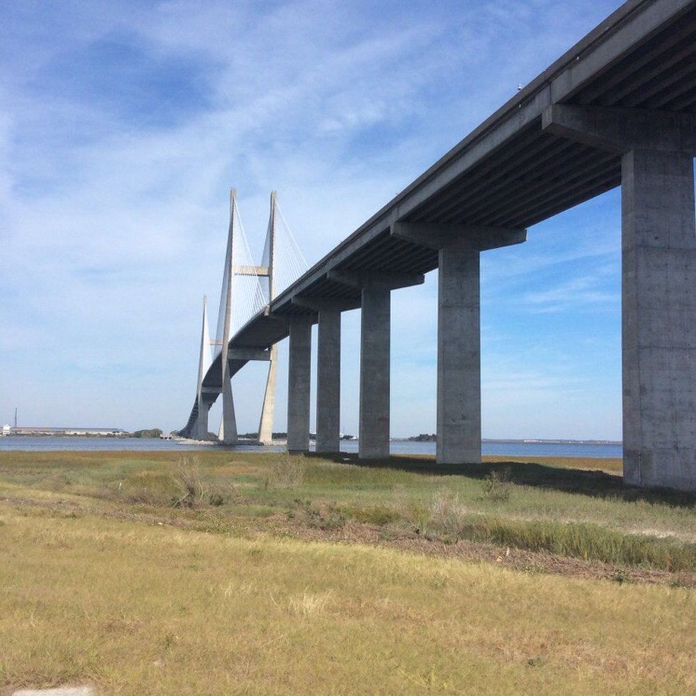
I've seen this bridge dozens of times as I drive I-95 but it isn't the I-95 bridge. The Sidney Lanier Bridge carries four lanes of US-17 over the Brunswick River. It is a cable-stayed bridge that is the longest spanning bridge in Georgia and is 480 feet tall. It is named for poet Sidney Lanier (1842-1881) who was hailed in the South as "the poet of the Confederacy." The bridge was completed in 2003 and features a span of 1250 feet that has 185 feet of clearance over the water. It has four lanes of traffic. The original Sidney Lanier Bridge was opened June 22, 1956, and was built by Sverdrup & Parcel, the same firm that designed the I-35W Mississippi River bridge which collapsed in 2007. On November 7, 1972 the ship African Neptune struck the bridge, causing parts of the bridge to collapse and causing several cars to fall into the water. Ten deaths were caused by the accident. On May 3, 1987 the bridge was again struck by a ship, this time by the Polish freighter Ziemia Bialostocka. If you squint your eyes, you could see this bridge being compared to Charleston's Arthur Ravenel Jr. Bridge https://www.yelp.com/biz/arthur-ravenel-jr-bridge-mount-pleasant-2?hrid=adycp2YtNWJNWD6GJRhgFA though this one has straight pilings where the Charleston bridge is diamond shaped. [Review 15746 overall - 428 in Georgia - 1250 of 2021.] read more
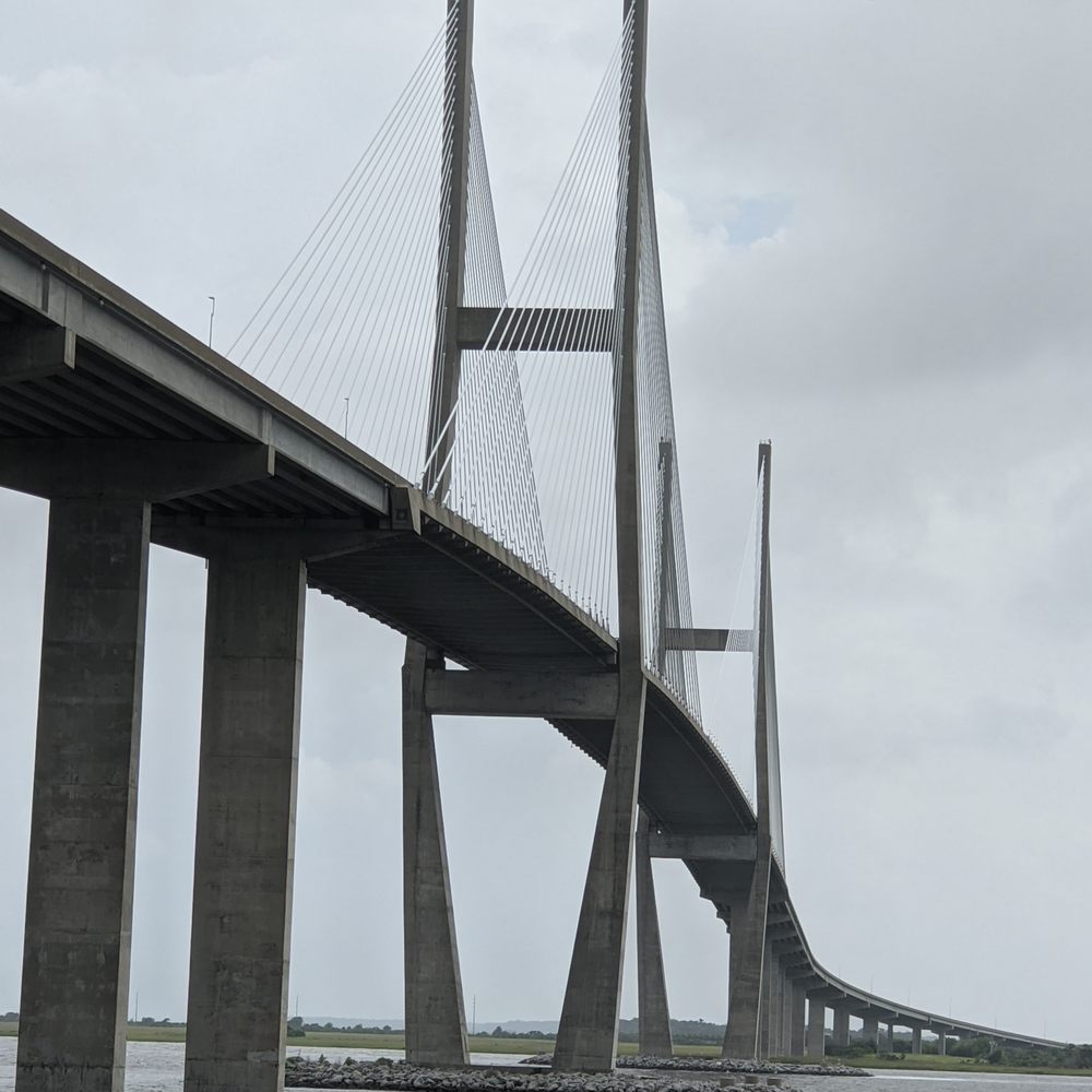
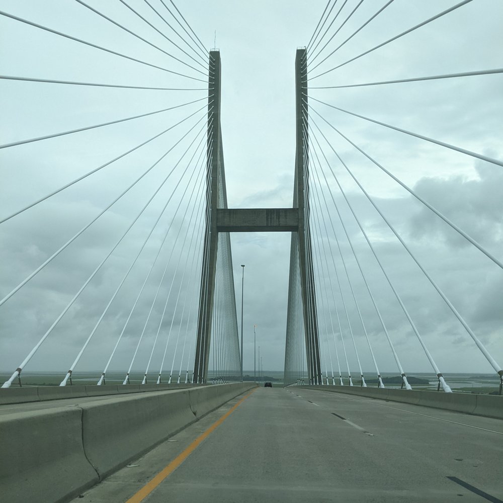


Spectacular views of the coastal Georgia area from the bridge. From his bridge you can see Jekyll and Saint Simons Island and downtown Brunswick Georgia. I won't add to or reiterate what other reviewer's have done here so well. All I'll say here is this: see the photo below. This is what a view from the bridge looks like during a hunters moon. It's a view few will ever see unless they live in the areA. A trip to this bridge is worth it with you stop at Saint Simons, Jekyll, or Brunswick or not. It's about 8 miles off of I 95 read more


5 years ago
The Sidney Lanier Bridge is located at the entrance to the harbor at Brunswick, Georgia. This bridge is Georgia's tallest cable-stayed suspension bridge, which provides easy access to the Golden Isles and allows larger ships to enter the port of Brunswick.. This beautiful structure, which opened in 2003, is 7,780 feet long and 486 feet tall. It contains 95,283 cubic yards of concrete and 14,810,095 pounds of reinforcing steel. The current bridge was built as a replacement to the original lift bridge which was struck by ships twice. It was named for Georgian poet Sidney Lanier who wrote the poem Marshes of Glynn, about the beautiful marshes that surround the area. Georgia Department of Transportation worked with the U.S. Coast Guard and the U.S. Fish and Wildlife Service to install special lighting that wouldn't disorient Federally endangered loggerhead sea turtle hatchlings. (one of my favorite facts about the bridge!) AWARDS Design Award, 2006 Concrete Reinforcing Steel Institute (CRSI) Honor Award, 2005 Consulting Engineers and Land Surveyors of California (CELSOC) Globe Award, 2005 American Road and Transportation Builders Association (ARTBA) Bridge Award of Excellence, 2005 American Segmental Bridge Institute (ASBI) read more


5 years ago
Beautiful but narrow bridge. Ominous skyline tonight driving into the storm as we cross it. Be careful if you are driving it, looks like some construction is going on they have cones off to the shoulder. read more

4 years ago
The Sidney Lanier Bridge opened in 2003, and looks very similar to the Dames Point Bridge in Jacksonville. The Lanier Bridge replaced a vertical-lift bridge because the former kept getting struck by ships. Yikes! Well, they arched the Lanier bridge so high, I feel like I'm driving straight up a 90-degree incline whenever I cross it. It's really high up, and when winds are blowing from the nearby sea, it can be terrifying! There is no toll for this bridge. It's normally an interesting view on a clear day. You can see Jekyll Island and St. Simons Island to the East (headed North), and you see the cargo area of Brunswick to the West (headed South). At the northern end of the bridge you enter the city of Brunswick, and just at the foot of the southern end is the causeway entrance for Jekyll Island. The Sidney Lanier Bridge is NOT the entrance to SSI, as the first to review this bridge stated. No portion of the bridge touches SSI. It simply connects the outskirts of Brunswick to the downtown city of Brunswick. St. Simons is accessed by other bridges along its causeway, quite a distance from the Lanier Bridge. If winds are blowing southeast, you will catch the smell of the paper mill in Brunswick, which is unbearable. The Lanier Bridge can be seen, majestically, from Jekyll Island and St. Simons Island, and it's usually in your sunset photos (at least in Feb-April) because sunset is along the horizon with the bridge. read more


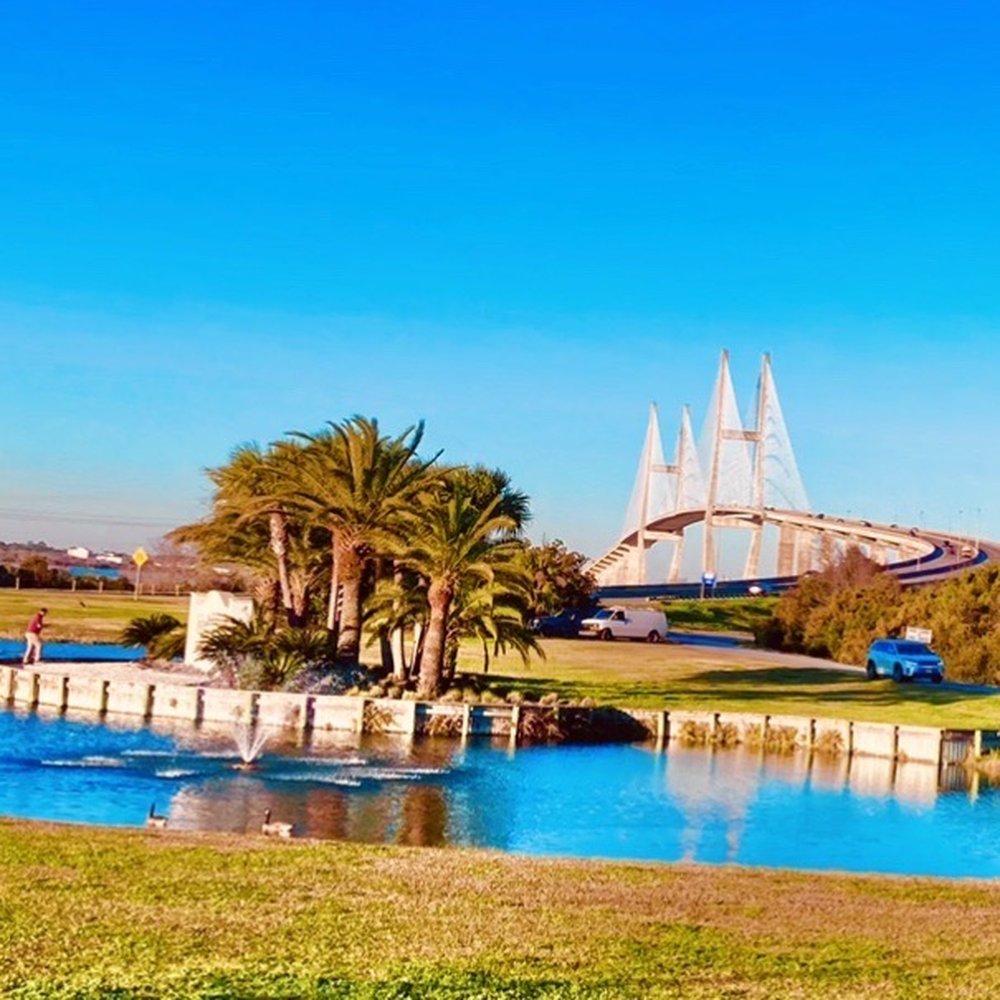
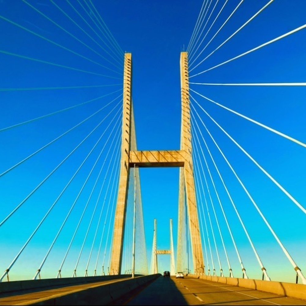


The Sidney Lanier Bridge is a cable-stayed bridge that spans the Brunswick River in Brunswick, Georgia, out of all the types of bridges this particular style was chose for this location for many reasons I'm sure it has something to do with the budget, the span, the height requirements, the winning contractor's expertise, etc. I really like this style of bridge so sleek and strong it's beauty can be admired from miles always. I've always had a fascination with bridges so no matter the type I like them all, they all have their own distinct beauty and function. I could never choose one over the other as my favorite of course but I do prefer some over others but they are all magnificent in my eyes be it a Arch bridge, a Aqueduct, a Bailey bridge, a Bascule bridge, a Beam bridge, a Box girder bridge, a Caisson, a Cantilever bridge, a Cantilever spar cable-stayed bridge, a Clapper bridge, a Covered bridge, a Curling bridge, a Drawbridge, a Extradosed bridge, a Folding bridge, a Footbridge, a Girder bridge, a Inca rope bridge, a Jetway, a Lattice truss bridge, a Log bridge, a Mabey Logistic Support Bridge, a Moon bridge, a Plate girder bridge, a Pontoon bridge, a Retractable bridge, a Self-anchored suspension bridge, a Segmental bridge, a Side-spar cable-stayed bridge, a Simple suspension bridge, a Skew arch bridge, a Step-stone bridge, a Stressed ribbon bridge, a Submersible bridge, a Suspension bridge, a Swing bridge, a Taper Suspension Bridge, a Tied arch bridge, a Tilt bridge, a Through arch bridge, a Toll bridge, a Transporter bridge, a Trestle, a Truss arch bridge, a Truss bridge, a Tubular bridge, a Vertical lift bridge, a Viaduct, a Vierendeel bridge, a Vlotbrug, a Weigh bridge, or a Zig-zag bridge to name a few... read more


13 years ago
This beautiful bridge is the entrance and exit to St. Simon's Island. Sidney Lanier Bridge, a cable-stayed bridge that spans the Brunswick River in Brunswick, Ga. The current bridge was built as a replacement to the original vertical-lift bridge which was twice struck by ships. It is currently the longest-spanning bridge in Georgia and is 480 feet tall. It is also the seventy-sixth largest cable-stayed bridge in the world. It was named for poet Sidney Lanier, Georgia's famous poet, who penned the Marshes of Glynn. This bridge is named after Georgia poet Sidney Lanier. "The Marshes of Glynn" is the final poem in the four-poem set Hymns of the Marshes that American poet Sidney Lanier composed about the coastal marshes of his native state of Georgia. This poem is one of Lanier's most famous works. My time in St. Simon's was enchanting and as I left it behind to return to Nebraska, this is how I felt: Goodbye St. Simon's, I shall return. For you have beauty my eyes have yet to see and history my mind has yet to witness. Sweat tea that has yet to pass my lips and southern delights that have yet to fill my tummy. read more


12 years ago
More info about Sidney Lanier Bridge
Ask the Community - Sidney Lanier Bridge











Why does Yelp recommend reviews?
1 review that is not currently recommended
The reviews below are not factored into the business's overall star rating.

3 years ago
Sidney Lanier Bridge - landmarks - Updated August 2026
Best of Brunswick
People found Sidney Lanier Bridge by searching for…
Trending Searches in Brunswick, GA
Barbershop For Men near Sidney Lanier Bridge
Bike Shop near Sidney Lanier Bridge
Casinos near Sidney Lanier Bridge
Consignment Shops near Sidney Lanier Bridge
Ear Piercing near Sidney Lanier Bridge
Elementary Schools near Sidney Lanier Bridge
Eyebrow Threading near Sidney Lanier Bridge
Hair Braiding near Sidney Lanier Bridge
Hidden Gems near Sidney Lanier Bridge
Historic Restaurants near Sidney Lanier Bridge
Kids Haircut near Sidney Lanier Bridge
Lighthouses near Sidney Lanier Bridge
Pedicure near Sidney Lanier Bridge
Places To Take Pictures near Sidney Lanier Bridge
Public Golf Courses near Sidney Lanier Bridge
Public Pools near Sidney Lanier Bridge
Sunrise View near Sidney Lanier Bridge
Trading Card Shops near Sidney Lanier Bridge
Uniforms near Sidney Lanier Bridge
Browse Articles
Browse Nearby
BEST of Brunswick, Georgia Restaurants near Sidney Lanier Bridge
BEST of Brunswick, Georgia Things to Do near Sidney Lanier Bridge
BEST of Brunswick, Georgia Coffee near Sidney Lanier Bridge
BEST of Brunswick, Georgia Parks near Sidney Lanier Bridge
BEST of Brunswick, Georgia Breakfast near Sidney Lanier Bridge
Browse Brands
Related Searches in Brunswick, GA
Best Fun Things to Do in Brunswick, Georgia
Best Things to Do on a Rainy Day in Brunswick, Georgia
Book Engaging Historical Tours in Brunswick, Georgia
Check Out Off Road Trails in Brunswick, Georgia
Discover Charming Historic Homes in Brunswick, Georgia
Discover Famous Monuments in Brunswick, Georgia
Discover Free Parking Options in Brunswick, Georgia
Discover Historic Sites and Places in Brunswick, Georgia
Discover Popular Landmarks in Brunswick, Georgia
Discover Popular Photo Spots in Brunswick, Georgia
Discover a Library Near You in Brunswick, Georgia
Discover the Best Beaches in Brunswick, Georgia
Enjoy Arts & Entertainment in Brunswick, Georgia
Enjoy Hiking Adventures in Brunswick, Georgia
Enjoy the Best Walking Trails in Brunswick, Georgia
Experience Stunning Sunset Views in Brunswick, Georgia
Explore Beautiful Botanical Gardens in Brunswick, Georgia
Explore Beautiful Castles and Landmarks in Brunswick, Georgia
Explore Beautiful Parks and Green Spaces in Brunswick, Georgia
Explore Children's Museums Near Brunswick, Georgia
Explore Family-Friendly Zoos and Wildlife in Brunswick, Georgia
Explore Free Things to Do Around Brunswick, Georgia
Explore Fun Activities to Do in Brunswick, Georgia
Explore Popular Scenic Views Near Brunswick, Georgia
Explore Secret Spots Worth Visiting in Brunswick, Georgia
Explore Top Art Galleries Located in Brunswick, Georgia
Explore Venues & Event Spaces in Brunswick, Georgia
Explore the Best Swimming Holes Around Brunswick, Georgia
Find Beautiful Views in Brunswick, Georgia
Find Exciting Tours to Take in Brunswick, Georgia
Find Top Art Museums in Brunswick, Georgia
Find Top Libraries to Visit in Brunswick, Georgia
Find the Best Bridge Spots in Brunswick, Georgia
Find the Best Playgrounds to Visit in Brunswick, Georgia
Fun Rainy Day Activities to Try in Brunswick, Georgia
Must-See Tourist Attractions Around Brunswick, Georgia
Perfect Spots to Watch Sunset in Brunswick, Georgia
Plan a Scenic Drive Route Near Brunswick, Georgia
Popular Picnic Spots to Visit in Brunswick, Georgia
Popular Places to Take Pictures in Brunswick, Georgia
Popular Things to Do in Brunswick, Georgia
Top Hiking Trails to Explore in Brunswick, Georgia
Top Places to Visit in Brunswick, Georgia for Sightseeing
Top Things to Do With Kids in Brunswick, Georgia
Top Things to Do With Teenagers in Brunswick, Georgia
Top-Rated Plantation Tours Near Brunswick, Georgia
Tour Famous Lighthouses Located in Brunswick, Georgia


