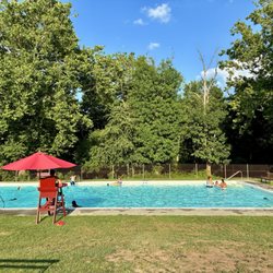
Ticklish Rock Photos


More like Ticklish Rock
Recommended Reviews - Ticklish Rock
Start your review...

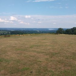
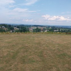
Note the formation is about a quarter of a mile away from the road. The trail is a steep incline highly recommended if you have four-wheel-drive and hiking shoes. There's a pile of walking sticks at the entrance. I'm taking mine. Good luck have fun. Don't go during hunting season. read more
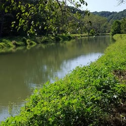
The path was overgrown as we got close to the rock. Be cautious of snakes and bears. The path down to the rock is not easy to find. You need to veer off to the right and step over the two fallen logs to get down to it. Worth the walk! read more
More info about Ticklish Rock
Shrewsbury, PA 17361
Directions
Hours
Outdoor Amenities


Ticklish Rock - parks - Updated July 2026
Best of Shrewsbury
People found Ticklish Rock by searching for…
Things to Do in Shrewsbury, PA
Hiking Trails in Shrewsbury, PA
Places to Take Pictures in Shrewsbury, PA
Off Road Trails in Shrewsbury, PA
Walking Trails in Shrewsbury, PA
Picnic Areas in Shrewsbury, PA
Scenic Views in Shrewsbury, PA
Tourist Attractions in Shrewsbury, PA
Picnic Spots in Shrewsbury, PA
Running Trails in Shrewsbury, PA
Fun Places to Go in Shrewsbury, PA
Things to Do on a Rainy Day in Shrewsbury, PA
Picnic Tables in Shrewsbury, PA
Places to Swim in Shrewsbury, PA
Scenic Overlook in Shrewsbury, PA
Trending Searches in Shrewsbury, PA
Blueberry Picking near Ticklish Rock
Cliff Jumping near Ticklish Rock
Cruising Spots near Ticklish Rock
Dog Friendly Beaches near Ticklish Rock
Dog Friendly Things To Do near Ticklish Rock
Flower Fields near Ticklish Rock
Indoor Dog Park near Ticklish Rock
Jet Ski Rental near Ticklish Rock
Kayak Rental near Ticklish Rock
Kids Activities Indoor near Ticklish Rock
Kids Activities Outdoor near Ticklish Rock
Off Road Trails near Ticklish Rock
Outdoor Activities near Ticklish Rock
Peach Picking near Ticklish Rock
Picnic Spots near Ticklish Rock
Places To Walk Around near Ticklish Rock
Playgrounds near Ticklish Rock
Public Shower near Ticklish Rock
Rainy Day Activities near Ticklish Rock
River Swimming near Ticklish Rock
Rock Quarry near Ticklish Rock
Scenic Night View near Ticklish Rock
Scenic Overlook near Ticklish Rock
State Parks near Ticklish Rock
Swimming Holes near Ticklish Rock
Swimming Lakes near Ticklish Rock
Things To Do On A Rainy Day near Ticklish Rock
Things To Do With Kids near Ticklish Rock
Watch Sunset near Ticklish Rock
Water Parks near Ticklish Rock
Browse Brands
Related Searches in Shrewsbury, PA
Best Fishing Locations and Guides in Shrewsbury, Pennsylvania
Best Off Leash Dog Parks in Shrewsbury, Pennsylvania
Best Places for Horseback Riding in Shrewsbury, Pennsylvania
Best Water Parks for Kids in Shrewsbury, Pennsylvania
Best Waterfalls and Swimming Holes in Shrewsbury, Pennsylvania
Check Out Great Playgrounds in Shrewsbury, Pennsylvania
Check Out Off Road Trails in Shrewsbury, Pennsylvania
Discover Baseball Fields Around Shrewsbury, Pennsylvania
Discover Dog Friendly Trails to Explore in Shrewsbury, Pennsylvania
Discover Fun Toddler Parks in Shrewsbury, Pennsylvania for Your Little One
Discover Lakes & Ponds to Explore in Shrewsbury, Pennsylvania
Discover Popular Photo Spots in Shrewsbury, Pennsylvania
Discover Top State Parks to Visit in Shrewsbury, Pennsylvania
Discover the Best Beaches in Shrewsbury, Pennsylvania
Discover the Best Fishing Lake in Shrewsbury, Pennsylvania
Discover the Best Night Hike Trails in Shrewsbury, Pennsylvania
Dog-Friendly Hikes With Dogs in Shrewsbury, Pennsylvania
Enjoy Camping Adventures Around Shrewsbury, Pennsylvania
Enjoy Exciting Mountain Biking Adventures in Shrewsbury, Pennsylvania
Enjoy Hiking Adventures in Shrewsbury, Pennsylvania
Enjoy Kayaking Adventures in Shrewsbury, Pennsylvania
Enjoy Tent Camping Spots Around Shrewsbury, Pennsylvania
Enjoy the Best Picnic Spots and Ideas in Shrewsbury, Pennsylvania
Enjoy the Best Walking Trails in Shrewsbury, Pennsylvania
Explore Beautiful Parks and Green Spaces in Shrewsbury, Pennsylvania
Explore Easy Hikes Perfect for All in Shrewsbury, Pennsylvania
Explore Family-Friendly Zoos and Wildlife in Shrewsbury, Pennsylvania
Explore Fun Activities to Do in Shrewsbury, Pennsylvania
Explore Parks With Pull Up Bars in Shrewsbury, Pennsylvania
Explore Popular Campgrounds Near Shrewsbury, Pennsylvania
Explore Popular Picnic Areas Around Shrewsbury, Pennsylvania
Explore Popular RV Parks Around Shrewsbury, Pennsylvania
Explore Popular Scenic Views Near Shrewsbury, Pennsylvania
Explore Scenic Lakes to Visit in Shrewsbury, Pennsylvania
Explore Top Dog Parks in Shrewsbury, Pennsylvania Near You
Explore Top Trampoline Parks in Shrewsbury, Pennsylvania
Explore Top Water Parks in Shrewsbury, Pennsylvania Today
Explore the Best Boating Spots in Shrewsbury, Pennsylvania
Explore the Best Swimming Holes Around Shrewsbury, Pennsylvania
Family Friendly Hiking With Kids in Shrewsbury, Pennsylvania
Find Cozy Camping Cabins in Shrewsbury, Pennsylvania
Find Fun Kids Activities Outdoor in Shrewsbury, Pennsylvania
Find Great Places to Feed Ducks in Shrewsbury, Pennsylvania
Find Popular Ziplining Spots Around Shrewsbury, Pennsylvania
Find Top Dog Friendly Parks to Visit in Shrewsbury, Pennsylvania
Find Top Skate Parks in Shrewsbury, Pennsylvania for All Skill Levels
Find Top Skating Rinks in Shrewsbury, Pennsylvania for All Ages


