This was probably one of the worst trails I have ever done thus far because the trail was not easy to follow at all. There were so many times I had to backtrack that it got quite annoying. In addition, I had the trail map downloaded to my Garmin watch but still had trouble especially as you get closer to the rocky terrains.
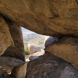
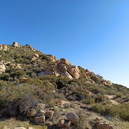
Parking is limited; about 8-10 spaces on the dirt road next to the trail sign. Definitely download the map on AllTrails first because there were no cell service at lower elevations. You will get service once you get to any of the rocks at higher elevations. Trail was mostly dirt, loose sands and boulders. Furthermore, you will need to scramble over boulders in some areas.
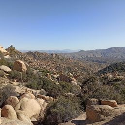
Once you hit the rocky terrains, there seems to be many different paths, false trails where you can climb up to the top... At this time, my GPS / compass was acting a bit wonky and telling me to backtrack so I ended up at one of those hills. Total round trip ended up to be 3.52 miles and 2 hours (should be 4.6 miles if I found the correct peak).
Overall, the view was nice even though the trail was hard to follow. Definitely download the map ahead of time otherwise there's a good chance you will get lost out there. Plenty of rocks to climb on and take photos. Don't be surprised by the gunshots in the area; there's a shooting range nearby. read more