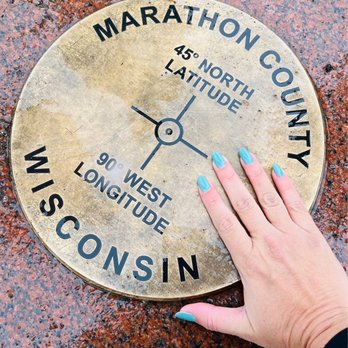
45 x 90 Geographical Marker Photos


More like 45 x 90 Geographical Marker
Recommended Reviews - 45 x 90 Geographical Marker
Start your review...



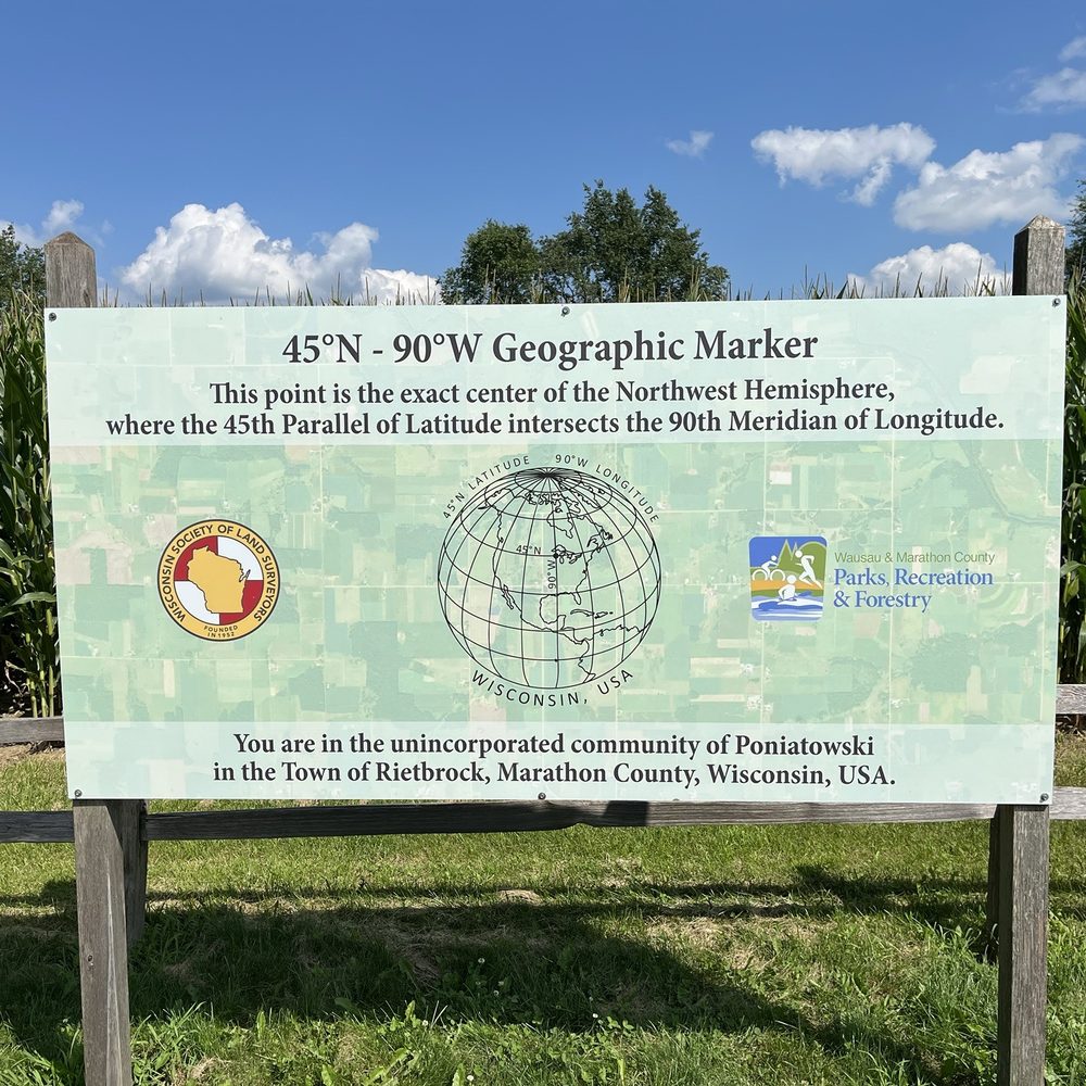
We were on our annual Salmon fishing trip when my friend Carlton said he had a surprise. The question was posed .... How often do you get to stand exactly halfway between the Equator and the North Pole and halfway between the Prime Meridian and the International Date Line? Not every day! The 45x90 Geographical Marker in Wisconsin is one of those quirky, "you've got to stop here" kinds of places. The site is well done, there's a small parking area, a short walk (less than a quarter mile) on a paved path, and a big granite monument marking the spot. It's selfie gold! The nearby visitor center has a fun stamp to certify that you've been to the center of the Northern Hemisphere (bragging rights unlocked). It's not a long stop, but it's a memorable one. Combine it with a scenic drive or lunch in nearby Wausau, and you've got yourself a fun little Midwest adventure. read more





4 years ago
This place doesn't seem like it would be very interesting but we had a feeling that it has good vibes so we went. And, per the pamphlet, it's one of four places in the world at this 45° x 90° spot. However I'm not really sure what the significance of it. But, when in Rome you do as the Roman's do. Which is walk out to the middle of nowhere and marvel at the longitude and latitude lol. However, it was the first snow of the season and it's very pretty so I enjoyed it. The short trail is well maintained and I absorbed the cold energy of that spot! Felt invigorating :) read more
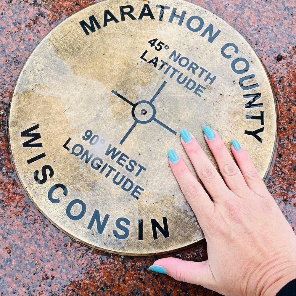

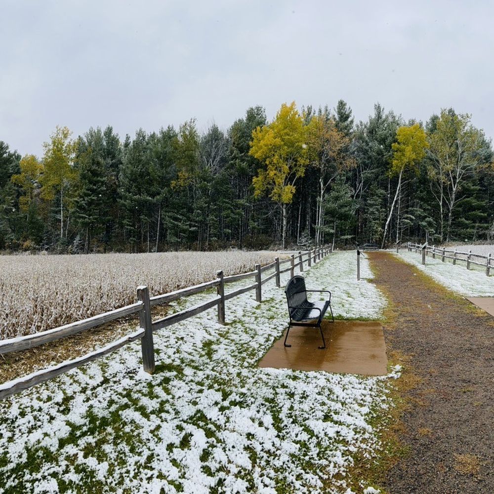

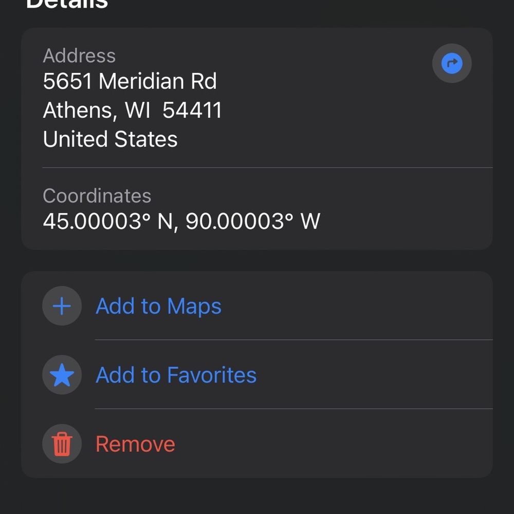
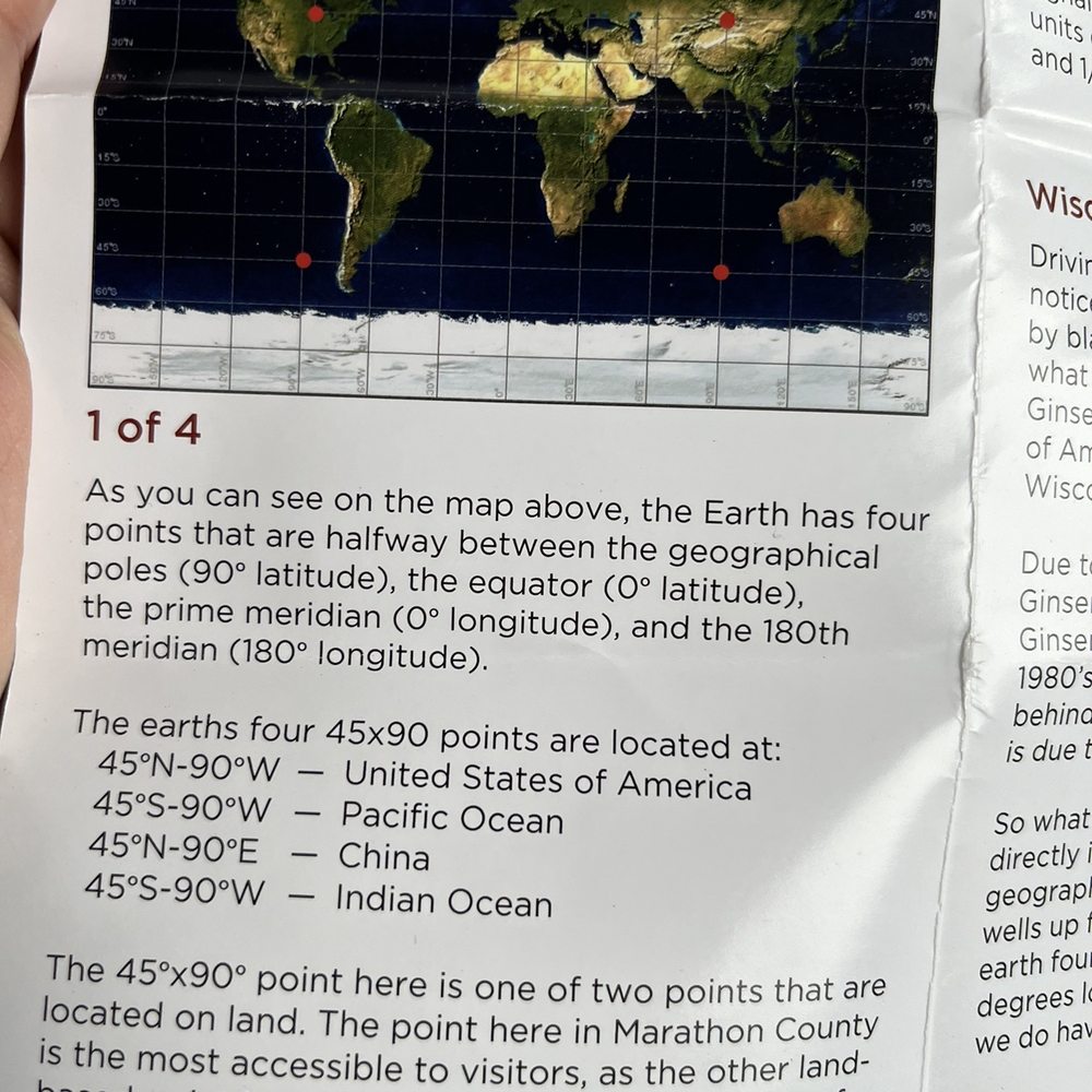


This is only one of four places on earth that are the geographical center of a hemisphere.... and a can now say I'm a member of the "45 x 90 Club". (An actual club that you can sign up for if you make your way to this marker)! So yes, this isn't much, but that's the charm! Plus, the other 3 locations are almost impossible to get to. 2 are in the middle of oceans and the other is high in the mountains of China. So if you find yourself traveling between Green Bay, WI and Minneapolis, MN on Hwy 29 in North-central Wisconsin, make a turn a to the north (a couple of miles) and check this spot out! Road signs help you get to the destination. Once you are there, you will find a small parking lot off the side of the road, along with a well marked gravel trail that leads you into a cornfield to the geographic marker. The trail is maybe a quarter of a mile long and has multiple benches if you need a rest or just want to take in the corn field view! Along the trail there are a number of informational markers that explain and identify some history, facts and trivia. The area is very well maintained and actually a nice stroll along the edge of a small woods and then into the field. This may truly be an "if you build it, they will come" type attraction, but I thought is was kind of fun and relaxing. Maybe it's no "worlds largest thermometer" or "biggest ball of twine".... call me weird, but I like to visit this stuff! read more


3 years ago

5 years ago

5 years ago
More info about 45 x 90 Geographical Marker
Ask the Community - 45 x 90 Geographical Marker


















45 x 90 Geographical Marker - parks - Updated September 2026
Best of Athens
People found 45 x 90 Geographical Marker by searching for…
Trending Searches in Athens, WI
Browse Articles
Browse Brands
Related Searches in Athens, WI
Best Fishing Locations and Guides in Athens, Wisconsin
Best Nature Trails for Hiking in Athens, Wisconsin
Best Places for Stunning Views in Athens, Wisconsin
Best Spots for Star Gazing in Athens, Wisconsin
Best Water Parks for Kids in Athens, Wisconsin
Best Waterfalls and Swimming Holes in Athens, Wisconsin
Check Out Great Playgrounds in Athens, Wisconsin
Check Out Off Road Trails in Athens, Wisconsin
Discover Lakes & Ponds to Explore in Athens, Wisconsin
Discover Popular Bike Trails in Athens, Wisconsin
Discover Top Nature Parks to Visit in Athens, Wisconsin
Discover the Best Fishing Lake in Athens, Wisconsin
Discover the Best Night Hike Trails in Athens, Wisconsin
Enjoy Hiking Adventures in Athens, Wisconsin
Enjoy the Best Picnic Spots and Ideas in Athens, Wisconsin
Enjoy the Best Walking Trails in Athens, Wisconsin
Experience Stunning Sunset Views in Athens, Wisconsin
Explore Easy Hikes Perfect for All in Athens, Wisconsin
Explore Nature Spots Around Athens, Wisconsin
Explore Picnic Parks Near Athens, Wisconsin
Explore Popular Campgrounds Near Athens, Wisconsin
Explore Popular Picnic Areas Around Athens, Wisconsin
Explore Popular Scenic Views Near Athens, Wisconsin
Explore Popular View Points Around Athens, Wisconsin
Explore Top Gyms in Athens, Wisconsin Now
Explore Venues & Event Spaces in Athens, Wisconsin
Explore the Best Swimming Holes Around Athens, Wisconsin
Family Friendly Hiking With Kids in Athens, Wisconsin
Find Beautiful Views in Athens, Wisconsin
Find Fun Kids Activities Outdoor in Athens, Wisconsin
Find Parks and Recreation Activities in Athens, Wisconsin
Find Picnic Tables for Outdoor Fun in Athens, Wisconsin
Find Top-Rated Waterfalls in Athens, Wisconsin Now
Find the Best Parks for Picnics in Athens, Wisconsin
Find the Best Playgrounds to Visit in Athens, Wisconsin
Great Places to Swim in Athens, Wisconsin
Perfect Spots to Watch Sunset in Athens, Wisconsin
Picnic Areas With BBQ Pits Available in Athens, Wisconsin
Popular Fishing Spots to Explore in Athens, Wisconsin
Popular Picnic Spots to Visit in Athens, Wisconsin
Popular Places to Take Pictures in Athens, Wisconsin
Popular Places to Walk Around in Athens, Wisconsin
Popular Things to Do in Athens, Wisconsin
Safe and Fun Parks for Kids in Athens, Wisconsin
Top Dog Friendly Things to Do in Athens, Wisconsin
Top Hiking Trails to Explore in Athens, Wisconsin
Top Playgrounds for Kids to Enjoy in Athens, Wisconsin
Top Running Trails to Explore in Athens, Wisconsin



