Cancel

    Open app

    Search

    Alpine Lakes Wilderness

    5.0 (2 reviews)

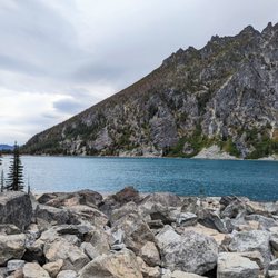
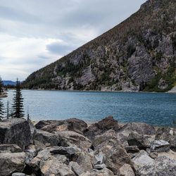
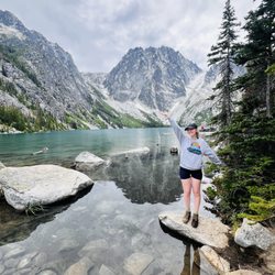
    Alpine Lakes Wilderness Photos
    You might also consider

    More like Alpine Lakes Wilderness

    Recommended Reviews - Alpine Lakes Wilderness

    Your trust is our priority, so businesses can't pay to alter or remove their reviews. Learn more about reviews.
    Yelp app icon
    Browse more easily on the app
    Review Feed Illustration
    Photo of Kaori M.
    269
    1740
    1484

    2 years ago

    Helpful 2
    Thanks 1
    Love this 3
    Oh no 0

    4 years ago

    Helpful 0
    Thanks 0
    Love this 0
    Oh no 0

    You might also consider

    Verify this business for free

    Get access to customer & competitor insights.

    Verify this business

    Deception Falls

    Deception Falls

    4.7(21 reviews)
    0.5 km

    We have passed by this amazing place so many times, and finally stopped to check it out. It is a…read morevery easy hike through the area, suitable for all ages. The scenery is breathtaking! Highly recommend.

    Deception Falls was our first hike on the Western side of the Cascade Mountains. It was barely…read moreover the ridge, but it was easy to see the contrast between the Eastern and Western sides. The Eastern side was noticeably drier, although not dry by normal standards. I would call it normal rather than dry. The Western side had moss on the trees, lichen hanging from the branches and ferns covering the forest floor. Deception Falls was the perfect place to experience it. Even the trail was soft to the touch, decades of rotting wood replenishing the soil under foot. It was a striking experience to walk on the Deception Falls trail. My wife and I both had the feeling that we were walking in a fantasy land. The trees were a new variety and covered in moss, the waters were crystal clear, and the sunlight shown through it all to accentuate the colors. I think we saw the area at the perfect time of year. If it was overcast, cold, or rainy, we would not have had the same experience. Also, the river seemed to be at full strength, forcefully pounding and shaping the rock at each section of the falls. Looking at other pictures of the river from October, the river levels fluctuate dramatically. Our falls experience would've been different if the river was a trickle rather than a torrent. I didn't see any fish in the river when we were there. A nearby sign indicated that the cold, ultra clean waters did not provide favorable conditions or sufficient food for anything other than small fish. I don't know too much about fish in northwest at this time, but it would surprise me if fish could swim up this river. If there were any fish at Deception Falls, they were stuck between the rapids, living in a calendar year that changes from high water to low water. That doesn't seem like ideal conditions for large fish. There was a bridge near the end of the trail that spanned the most forceful section of the rapids. It was a fitting climax, a moment of triumph and emotion, at the end of the trail. Standing in the center of the bridge is adrenaline inducing. Spray from the rapids hits you along with the thunderous noise of water crashing against rock. You know that the bridge will hold you yet there is a lingering thought in the back of your mind praying for the bridge to stay strong. Continuing forward, a short walk under the bridge provides more views of the water crashing down from above and more opportunities to stand in the mist.

    Photos
    Deception Falls - Parking lot closed, but you can park on roadside

    Parking lot closed, but you can park on roadside

    Deception Falls
    Deception Falls

    See all

    The Enchantments

    The Enchantments

    5.0(11 reviews)
    45.2 km

    Indeed very enchanting place. We did backpacking 3 nights 4…read moredays to experience the core zone as much as possible including off-trail scrambles for Little Annapurna and Enchantment Peak. We went Colchuck to Viviane and traced back since not much to see beyond Viviane. Really nice backpacking. My detailed mileage etc is below blog post. https://himebackpacker.blogspot.com/2024/10/the-enchantments-washington.html

    I've done this a couple of times so I'll give you the different perspectives…read more The first time I did it as a one-day hike because I did not have a permit. The second time I did it as a three night hike because it was after October 15th and I still didn't have a permit. Since that time, the permit season has been extended to October 30th. Either way, I suggest that hiking in the fall is the prettiest time due to the larch trees colors. Both times we started at the Stuart Lake trailhead (recommended due to reduced overall elevation gain) and ended at the Snow Lake trailhead. Now at the risk of offending someone I will say that hiking through the Enchantments in one day is like watching a porn movie on fast forward. You miss most of the scenery. My suggestion is to either get a permit, or hike outside of season, preferably in the fall, but stay at least two nights. Given that the hike up Aasgard Pass has an elevation gain of 1900 feet in about a mile, I can attest that it can be quite dangerous when raining. On the East side there will be mud & rock slides and in our case we had to duck out of the way of several large, (18 or so inch diameter) Rocks that came bouncing down the boulders with unpredictable direction at a very high rate of speed. Risks early in the season are snow slides and avalanches, so be very aware of the conditions when you are there. All that said, anyone who does not give this a five and tell you that it's absolutely one of the most beautiful hikes you'll ever take on must know something I don't, and I've hiked the Himalayas. Remember that goats are dangerous. Pee on rocks, not soil because the goats will dig it up for the salt. Try not to let a goat see you peeing or it will run towards you. Try fishing in the lakes; the trout are great for dinner up there. You should also know that when coming down toward the Snow Lake trailhead there are a large number of switchbacks and when you see the cars just down the hill, it will likely be another hour before you get there, and if you did it as a day hike, your feet may not be happy when you finally arrive. If you are a hiker, you must find a way to get this one done before you hang up your boots.

    Photos
    The Enchantments
    The Enchantments - Lo mejor

    Lo mejor

    The Enchantments - Bonking

    See all

    Bonking

    Melakwa Lake - Passing through Denny Creek on the way!

    Melakwa Lake

    4.8(4 reviews)
    39.3 km

    Went tubing here with Chooksty and her mans, James. Just a really good time, despite the…read moresurprisingly overpriced tubing experience at $60(?) per person for tubing rental and shuttle ride to starting point. 2.5 to 3-hour ride bc the paddle for the tube is a literal blue frisbee that is linked to it lolol ...anyway, focusing on just location, the fallen tree hard is a perfect rest stop with guests trying to cross it without falling. Highly recommend water shoes for this. Quite a bit of shore rest stops that people been using as a bio break bc no actual bathroom nearby. Quite a bit of rapid waters sections, so beware because hella rocks in those areas that you may hit. Very nice and cool waters to contrast this sunny weather that only got warmer as the June 2026 day progressed.

    Picked this hike from the Washington Trails book, about 9.5 miles roundtrip with a 2700 elevation…read moregain. This was a tough hike, even though I chose it since the book said "moderate" and even looking up some reviews people had said the hike as relatively simple to enjoy a fantastic lake view. We were both pretty dead at the end due to the length and steep inclines. Knees were pretty banged up because of all the rocks. The trail in the beginning wasn't so bad, definitely got my heart pumping because of the elevation, but as you go higher up there were a lot of switchbacks and seemingly no end in sight. We hustled up the mountain pretty quickly though, which was why we were so tired at the end. The view is definitely worth it in the end; recommend bringing a hammock! There's also plenty of sitting area through slabs of rocks. Coming down we encountered: 1) a girl who was crying we believe because of the toughness of the trail, 2) a couple who stopped us to ask how much longer it was to the top (they unfortunately weren't even halfway) which signifies how tough this hike was. Definitely recommend bringing more than enough water or you will definitely be dehydrated (like we were). Otherwise glad we did this and would recommend (you won't regret it but your body will hate you haha).

    Photos
    Melakwa Lake
    Melakwa Lake - The "water slide", which is impassable during high waters. Popular picnic spot for families!

    The "water slide", which is impassable during high waters. Popular picnic spot for families!

    Melakwa Lake

    See all

    Blanca Lake

    Blanca Lake

    4.6(38 reviews)
    30.0 km

    Came here on a Friday afternoon around 3:30PM, long gravel road to the trailhead, quite a few cars…read moreparked there too. Bathroom and map at the trailhead. Hike is pretty steep, constantly uphill for about 3 miles, all in the trees though. Mosquitoes around, bug spray is good. After 3 miles, trail goes down pretty steeply, lake was really pretty, not very cold water! Sat there for a bit to enjoy the water and view, really calming. Didn't see very many people on the trail, had the lake to ourselves. Bad part of the hike is the need to go back uphill after the lake, but it's not too bad. Took 2 hours to get to the lake, 2 hours back, was a bit dark and got a bit cold towards the end of the hike. Hiking poles definitely helped!

    It is 11.5 miles, you have to park your car 2 miles before the trail starts which adds up total or…read more4 extra miles. It would be good idea to go on sunny day and start hike early. We went around 8:00am got at lake around 11:30am, only few small breaks and took 3 hours to come back. When we reached the lake it was mesmerizing. Thinks to remember: 1.Take a lot of water and snacks with you. It is hard hike so stay hydrated. 2. Bug spray if needed we had it but did not use it because bugs were not too bad. 3. Go early to beat the heat and this hike requires $5 day use fee and Northwest forest pass. 4. Since it's not 7.5 miles be ready to do extra 4 miles. Total of 11.5miles This hike was hardest hike for us so far but the view worth the hike. I would highly recommend to go there at lest once in life time. The view is breathtaking!!! Good luck, you will love it.!!

    Photos
    Blanca Lake
    Blanca Lake
    Blanca Lake

    See all

    Colchuck Lake - Colchuck Lake | Instagram: @telephonesmoothie

    Colchuck Lake

    4.8(19 reviews)
    46.0 km

    This is an amazing lake in the National Forest near Leavenworth Washington. You have to take a 9…read moremile trail out and back, but it's worth the view if you're physically able.

    Colchuck Lake has been on my list for YEARS and one I definitely considered a bucket list trail. I…read morefinally got the chance to do it this past weekend and it was 100% warranted as as bucket list destination. Doing some research before the hike we learned that the parking lot is pretty much full before 7am. We reached there by around 6:45am and it was entirely full and people were parking down the road. We were even as far as at least half a mile away from the actual trailhead when we actually parked, but luckily the walk is pretty flat. The beginning of the trailhead has a bathroom that will have a lengthy line in the morning, and it is gross. Just be prepared! In total, we clocked almost 9 miles round trip and it took us just shy of 7 hours. That said, we did spend about an hour at the top to take in all of the views and the experience as a whole. I knew this trail would be challenging and I'd say it was probably the second hardest I've ever done (maybe the third), with the first being Mailbox Peak. There are some incredibly tough stretches with steep rock stairs and areas where it feels like you're scrambling a ton. There are moderate breaks where the trail flattens, but it's pretty challenging the entire length of the hike. The end point, the actual lake, is entirely worth the pain and "I don't know if I can do this" moments along the way. Absolutely STUNNING. Probably the most unreal colored water I've ever seen with the shade of blue that it was. The mountains encompassing the lake look fake - literally like AI in real life or something. Truly is a great spot to find a nice rock to sit and relax to enjoy lunch and reenergize for the trek down the trail. After hitting the bottom, it was a loooong walk back to the car with us being so wiped. Much to our disappoint we also discovered that ALL of the cars parked along the road received $100 tickets from the Chelan PD, despite there being no signs that said we couldn't park along the road (just on the bridge, which we weren't on). Overall Colchuck Lake was worth the wait and I'm so glad to have seen it finally - I just don't think I'll ever do it again LOL.

    Photos
    Colchuck Lake - Colchuck Lake | Instagram: @telephonesmoothie

    Colchuck Lake | Instagram: @telephonesmoothie

    Colchuck Lake - Totally worth the trek!

    Totally worth the trek!

    Colchuck Lake

    See all

    Wallace Falls State Park - View of the river

    Wallace Falls State Park

    4.6(199 reviews)
    31.4 km

    Wallace Falls definitely deserves enough time to complete all the way through, 3 hours minimum!! Do…read morenot underestimate the time you think you'll take, especially if you love stopping for photos lol. Right from the start of the hike, I appreciated that there were signs showing the latest time you should be back by (8:40 pm closing time), along with phone numbers to call if you ever needed help. I also liked how about every half mile to mile, there were mile markers or detailed maps showing where you were and what else to expect depending on how far you planned to go. And honestly... there were just SO MANY beautiful nature sights with every step. The river flowing alongside most of the trail, the moss-covered trees, the little wildflowers and mushrooms popping up here and there! Everything was just so pretty!! It felt like we couldn't walk more than a few steps without stopping to take photos because we were in constant awe haha. Although we weren't able to make it all the way up to the Upper Falls due to the sun setting, getting to see both the Lower and Middle Falls was still such a gorgeous and accomplishing experience. I especially loved how from the Lower Falls, you can also see the Middle Falls in the distance! And the Middle Falls itself, absolutely awe-striking!! Overall, such a memorable and beautiful hike! I'll definitely have to come back and complete it all the way to the top next time lol

    Very great dog friendly hike. My dog is a big fluff ball and loved wading in the river towards the…read morelast part of the trail. Well maintained. Even though the parking lot was full, there were moments where there was no one else close to us on the trailhead. Personally the middle falls had the best view though a bit obstructed for photos. I completed the upper falls back in 2016 and remembered not being as impressed so I opted out and stopped at the middle falls. My dog was also likely to resist as he was pretty tired by the middle falls. Needs discover pass. The entrance has a small water fountain but definitely bring water. There are no trash areas along the way so make a plan if you have a dog.

    Photos
    Wallace Falls State Park - Lower and middle falls

    Lower and middle falls

    Wallace Falls State Park - During our hike, we picked some huckleberries!

    During our hike, we picked some huckleberries!

    Wallace Falls State Park - Middle falls view with the fence

    See all

    Middle falls view with the fence

    Alpine Lakes Wilderness - parks - Updated July 2026

    Loading...
    Loading...
    Loading...