Barn Bluff Photos



More like Barn Bluff
Recommended Reviews - Barn Bluff
Start your review...


Reviews With Photos


He Mni Can (aka Barn Bluff) is a perfect hike, not too tough and not a straight flat walk with plenty of free ample parking available. There are not many hikes in MN (especially in the greater metro area) that provide you with elevation but He Mni Can does, and even tho the max elevation is mere hundreds of feet, it is definitely better than none. If you don't have little kids, and want a little thrill, I suggest taking the north trail to the top. If you have young ones (less than 10-12 yrs of age) I would suggest sticking to the south trail. Thus far, we have always gone during summer times. Maybe will try it in the winter next time around.


Excellent views and a good workout. Just make sure you have a windbreaker and proper hiking boots as it can get fairly muddy and windy towards the top.
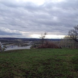

"Know When to Hold 'Em; Know When to Fold 'Em" According to local Dakota legend, hundreds of years ago, back in the days of floppy disks, Clearly Canadian, and when Bob Barker hosted "The Price is Right", a large mountain stood in the place of Barn Bluff. After arguments ensued over who owned this prime spot for watching over enemies, contestants from two Dakota rival villages participated in challenges for immunity and to win sole possession. Tie votes proved problematic, so the Great Spirit and Jeff Probst instead divided the mountain into two parts. One part stayed in Red Wing and was named Barn Bluff, while the other part moved down the Mississippi River to Winona, where it was named Sugarloaf. We'll save the sugar for later. Barn Bluff has several scenic trails that are perfect for quick, yet fairly steep hikes (expect to spend maybe 30 minutes to an hour to cover the roundtrip hike plus exploring/taking photos at the summit), with the reward being stunning views of Red Wing, Wisconsin, and the Mississippi River at the top. Prehistoric people used to build burial mounds on top of the bluff, so take a moment to think back about all the footsteps that came before yours when you get there. Kids and dogs will enjoy the hike, but be always be careful of loose rocks and drop-offs along the trails. Find a bathroom before you go--there are none at the bluff. Now the tricky part...to find the trailhead (GPS will not always bring you to right spot). A. Drive into town. B. Look up at bluff C. Admire or scoff at of the area dedicated to graffiti on the West side of the bluff. There are layers upon layers of paint featuring graduation years, love declarations, and even tributes to Prince! While not technically legal to deface the bluff, the graffiti has been a tradition for over 50 years--the city doesn't usually paint over it unless there are complaints. D. Ask a local for directions. They're usually tame as long as you don't make any sudden movements. *Trail lengths* --South Trail-- To Lime Quarry .32 miles To East Scenic Overlook .83 miles Roundtrip from Main Park Access to West Scenic Overlook 2.27 miles --Prairie Trail-- From West Scenic Overlook to East Scenic Overlook .55 miles --Carlson Lime Kiln Trail-- .3 miles RT (dead end) *The North trail is closed, but the connection path that leads there also goes to the midland trail and quarry trail, both of which are open. The North trail, being the most difficult and dangerous trail was temporarily closed for modifications (there have been 3 fatalities on that trail since 2011). It should be opening back up again this fall. "Barn Bluff" (Parody of "Love Shack" ~B-52's) If you see a little sign at the side of East Fifth that says Drive straight down to the Barn Bluff Barn Bluff yeah I'm driving down over to Barn Bluff's lot Looking for a gooood parking spot Looking for a gooo--oood parking spot I found me a slot underneath a shade tree Don't need money 'cause the parking is free Three-hundred, forty feet, to the best city view So strap on that Fitbit and let it acrue The Barn Bluff is a pretty, old hill where We can hike together Barn Bluff Baby! At Barn Buff, Baby Barn Bluff, hiking, Barn Bluff Barn Bluff, hiking, barn Bluff Barn Bluff, hiking, barn bluff Barn Bluff, hiking barn bluff Sign Says, "Closed", for the north trail "Cause we care, 'bout your hiking fails" Cause that trail goes back to a narrow, slippery path With a bunch of loose rocks and steep vertical drops Hiking up the South Trail Hiking up the Midland.... Hiking to the lime kiln Hiking through the Prairie.... The Love Shack is a pretty, old hill where We can hike together Barn Bluff, baby Barn Bluff, baby Barn Bluff, that's where we hike Barn Bluff, that's where we hike Huffin' and a-puffin', workin' off your muffin Hiking to the summit, keep on path and don't plummet! The big hill's rockin' Yeah the big hill's rockin' The big hill's rockin', when everyone's a wanderin' on up, And on up, and on up, and back down! Everybody's traipsin', everybody's trampin' around Crowds trekkin' up the trail just to trek down Everybody's traipsin', everybody's trampin' around Rockin' that bluff Rockin' out that bluff! Climb to the summit, it's an amazing view Where your crew can rendevoooous, Wear your hiking shoes, make sure that they're grippy, put em' on 'Cause loose rocks can get slippery! The Barn Bluff is a little old hill where We can hike together Barn Bluff, baby Your what? Barn Door's Open! Barn Bluff, baby Barn Bluff! Barn Bluff, baby Barn Bluff! After docking the bluff one "Uffda" for the sometimes ill-maintained paths and signage, I would give this beautiful and historic bluff four hearty (and possibly out of breath) "Uffdas". ~The Nosy Norwegian Sniffing out good deals and dusty trails so that you don't have to.


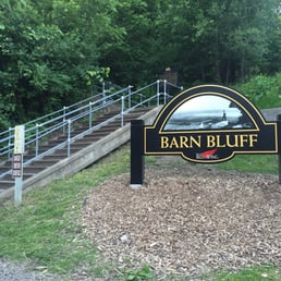
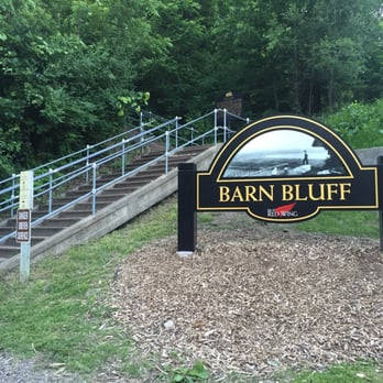
Excellent views of Red Wing, MN! This is a fun day trip coming from the city. Be prepared to walk up a lot of stairs! Not for the weak! It's free and parking is a bit hidden around back and on the street for free. No bathrooms that we found. Wear a mask during COVID because it will get everyone hugging and puffing on those stairs! Nice trails at the top circling the hill with views on all sides!
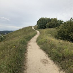

Hiking in Red Wing on a Saturday afternoon was relaxing. The trail seemed moderate. There appeared to be poor signage but we were still able to navigate our way around. There were a few high points on the trail to observe a great view of the Red Wing area. The park itself was easy to find and parking was accessible. The hike itself overall was ok. Be prepared for a few inclines and some stairs during this walk. I'd suggest making plans to have lunch and shop after in the downtown Red Wing area. I can't say that I was over the top impressed with this hike but it was definitely something to do. This was my first visit to Red Wing and this park was suggested as a place to visit. If you like the outdoors and don't mind walking a bit, you'll be satisfied.

6 days ago
My top favorite hiking spot in Minnesota. So many different paths you can take and a partially accessible route for all ages and disabilities. Rock climbing up here is like no other spot in MN and everyone is always incredibly nice on the trails. Lots of places to stop and I love doing photography up here, photoshoots, and timelapses. You will never regret having a hike here. Being water for the break at the top and you are golden. read more
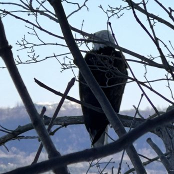


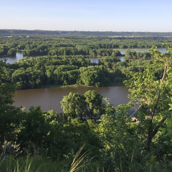
Very nice place for a quick hike of different distances and levels of difficulty. Plentiful parking spots on the streets if need it. We'll pave and well navigate with signs, directions, and directions. We hike the Midland Trail and the South for an easy to moderate hike. We went the west outlook point. Well designed trails and stairs for everyone to come and enjoy. Overall yes, would come by if in the area for a nice breezy hike. The overall view point from the top overlooking downtown red wing is spectacular. Pictures cannot do justice to. read more


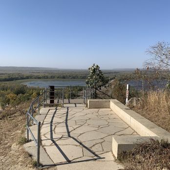


He Mni Can (aka Barn Bluff) is a perfect hike, not too tough and not a straight flat walk with plenty of free ample parking available. There are not many hikes in MN (especially in the greater metro area) that provide you with elevation but He Mni Can does, and even tho the max elevation is mere hundreds of feet, it is definitely better than none. If you don't have little kids, and want a little thrill, I suggest taking the north trail to the top. If you have young ones (less than 10-12 yrs of age) I would suggest sticking to the south trail. Thus far, we have always gone during summer times. Maybe will try it in the winter next time around. read more


2 years ago
Excellent views and a good workout. Just make sure you have a windbreaker and proper hiking boots as it can get fairly muddy and windy towards the top. read more


"Know When to Hold 'Em; Know When to Fold 'Em" According to local Dakota legend, hundreds of years ago, back in the days of floppy disks, Clearly Canadian, and when Bob Barker hosted "The Price is Right", a large mountain stood in the place of Barn Bluff. After arguments ensued over who owned this prime spot for watching over enemies, contestants from two Dakota rival villages participated in challenges for immunity and to win sole possession. Tie votes proved problematic, so the Great Spirit and Jeff Probst instead divided the mountain into two parts. One part stayed in Red Wing and was named Barn Bluff, while the other part moved down the Mississippi River to Winona, where it was named Sugarloaf. We'll save the sugar for later. Barn Bluff has several scenic trails that are perfect for quick, yet fairly steep hikes (expect to spend maybe 30 minutes to an hour to cover the roundtrip hike plus exploring/taking photos at the summit), with the reward being stunning views of Red Wing, Wisconsin, and the Mississippi River at the top. Prehistoric people used to build burial mounds on top of the bluff, so take a moment to think back about all the footsteps that came before yours when you get there. Kids and dogs will enjoy the hike, but be always be careful of loose rocks and drop-offs along the trails. Find a bathroom before you go--there are none at the bluff. Now the tricky part...to find the trailhead (GPS will not always bring you to right spot). A. Drive into town. B. Look up at bluff C. Admire or scoff at of the area dedicated to graffiti on the West side of the bluff. There are layers upon layers of paint featuring graduation years, love declarations, and even tributes to Prince! While not technically legal to deface the bluff, the graffiti has been a tradition for over 50 years--the city doesn't usually paint over it unless there are complaints. D. Ask a local for directions. They're usually tame as long as you don't make any sudden movements. *Trail lengths* --South Trail-- To Lime Quarry .32 miles To East Scenic Overlook .83 miles Roundtrip from Main Park Access to West Scenic Overlook 2.27 miles --Prairie Trail-- From West Scenic Overlook to East Scenic Overlook .55 miles --Carlson Lime Kiln Trail-- .3 miles RT (dead end) *The North trail is closed, but the connection path that leads there also goes to the midland trail and quarry trail, both of which are open. The North trail, being the most difficult and dangerous trail was temporarily closed for modifications (there have been 3 fatalities on that trail since 2011). It should be opening back up again this fall. "Barn Bluff" (Parody of "Love Shack" ~B-52's) If you see a little sign at the side of East Fifth that says Drive straight down to the Barn Bluff Barn Bluff yeah I'm driving down over to Barn Bluff's lot Looking for a gooood parking spot Looking for a gooo--oood parking spot I found me a slot underneath a shade tree Don't need money 'cause the parking is free Three-hundred, forty feet, to the best city view So strap on that Fitbit and let it acrue The Barn Bluff is a pretty, old hill where We can hike together Barn Bluff Baby! At Barn Buff, Baby Barn Bluff, hiking, Barn Bluff Barn Bluff, hiking, barn Bluff Barn Bluff, hiking, barn bluff Barn Bluff, hiking barn bluff Sign Says, "Closed", for the north trail "Cause we care, 'bout your hiking fails" Cause that trail goes back to a narrow, slippery path With a bunch of loose rocks and steep vertical drops Hiking up the South Trail Hiking up the Midland.... Hiking to the lime kiln Hiking through the Prairie.... The Love Shack is a pretty, old hill where We can hike together Barn Bluff, baby Barn Bluff, baby Barn Bluff, that's where we hike Barn Bluff, that's where we hike Huffin' and a-puffin', workin' off your muffin Hiking to the summit, keep on path and don't plummet! The big hill's rockin' Yeah the big hill's rockin' The big hill's rockin', when everyone's a wanderin' on up, And on up, and on up, and back down! Everybody's traipsin', everybody's trampin' around Crowds trekkin' up the trail just to trek down Everybody's traipsin', everybody's trampin' around Rockin' that bluff Rockin' out that bluff! Climb to the summit, it's an amazing view Where your crew can rendevoooous, Wear your hiking shoes, make sure that they're grippy, put em' on 'Cause loose rocks can get slippery! The Barn Bluff is a little old hill where We can hike together Barn Bluff, baby Your what? Barn Door's Open! Barn Bluff, baby Barn Bluff! Barn Bluff, baby Barn Bluff! After docking the bluff one "Uffda" for the sometimes ill-maintained paths and signage, I would give this beautiful and historic bluff four hearty (and possibly out of breath) "Uffdas". ~The Nosy Norwegian Sniffing out good deals and dusty trails so that you don't have to. read more
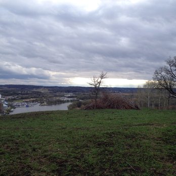
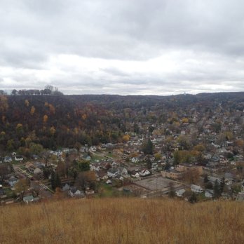


Excellent views of Red Wing, MN! This is a fun day trip coming from the city. Be prepared to walk up a lot of stairs! Not for the weak! It's free and parking is a bit hidden around back and on the street for free. No bathrooms that we found. Wear a mask during COVID because it will get everyone hugging and puffing on those stairs! Nice trails at the top circling the hill with views on all sides! read more


Hiking in Red Wing on a Saturday afternoon was relaxing. The trail seemed moderate. There appeared to be poor signage but we were still able to navigate our way around. There were a few high points on the trail to observe a great view of the Red Wing area. The park itself was easy to find and parking was accessible. The hike itself overall was ok. Be prepared for a few inclines and some stairs during this walk. I'd suggest making plans to have lunch and shop after in the downtown Red Wing area. I can't say that I was over the top impressed with this hike but it was definitely something to do. This was my first visit to Red Wing and this park was suggested as a place to visit. If you like the outdoors and don't mind walking a bit, you'll be satisfied. read more


5 years ago

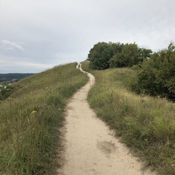
Short little trail, with beautiful views at the different lookouts. The North Trail is closed, so I don't recommend making a long trip to Red Wing just for this. Rather, this is a nice outdoor activity if you are in the area and have the proper attire. I would recommend hiking shoes as there is a steep grade on much of the trail... I wore tennis shoes, and while I could definitely make the walk, I really wished I had my boots. read more




8 years ago


8 years ago
More info about Barn Bluff
636 East 5th St
Red Wing, MN 55066
Directions
Hours
Outdoor Amenities
Ask the Community - Barn Bluff
Review Highlights - Barn Bluff



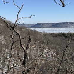





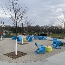
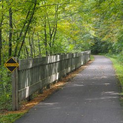
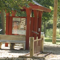





Barn Bluff - hiking - Updated August 2026
Best of Red Wing
People found Barn Bluff by searching for…
Scenic Overlook in Red Wing, MN
Places to Take Pictures in Red Wing, MN
Beautiful Views in Red Wing, MN
Parks for Kids in Red Wing, MN
Walking Trails in Red Wing, MN
Off Road Trails in Red Wing, MN
River Swimming in Red Wing, MN
Lookout Points in Red Wing, MN
Places to Walk Around in Red Wing, MN
Trending Searches in Red Wing, MN
Consignment Shops near Barn Bluff
Dog Friendly Beaches near Barn Bluff
Elementary Schools near Barn Bluff
Fun Things To Do With Kids near Barn Bluff
Lookout Points near Barn Bluff
Public Golf Courses near Barn Bluff
Scenic Overlook near Barn Bluff
Sports Card Shops near Barn Bluff
Swimming Holes near Barn Bluff
Browse Articles
Browse Nearby
BEST of Red Wing, Minnesota Coffee near Barn Bluff
BEST of Red Wing, Minnesota Things to Do near Barn Bluff
BEST of Red Wing, Minnesota Walking Trails near Barn Bluff
BEST of Red Wing, Minnesota Restaurants near Barn Bluff
BEST of Red Wing, Minnesota Parks near Barn Bluff
BEST of Red Wing, Minnesota Breakfast near Barn Bluff
BEST of Red Wing, Minnesota Motel near Barn Bluff
Browse Brands
Related Searches in Red Wing, MN
Affordable Canoe Rental Options in Red Wing, Minnesota
Affordable Kayak Rental Services in Red Wing, Minnesota
Best Dog Hiking Trails Around Red Wing, Minnesota
Best Fishing Locations and Guides in Red Wing, Minnesota
Best Parks for Parties and Events in Red Wing, Minnesota
Best Places for Horseback Riding in Red Wing, Minnesota
Best Water Parks for Kids in Red Wing, Minnesota
Check Out Great Playgrounds in Red Wing, Minnesota
Discover Baseball Fields Around Red Wing, Minnesota
Discover Dog Friendly Trails to Explore in Red Wing, Minnesota
Discover Popular Bike Trails in Red Wing, Minnesota
Discover Popular Photo Spots in Red Wing, Minnesota
Discover Top Boat Tours in Red Wing, Minnesota for All Ages
Discover Top Nature Parks to Visit in Red Wing, Minnesota
Discover a Hiking Trail in Red Wing, Minnesota
Discover the Best Beaches in Red Wing, Minnesota
Discover the Best Night Hike Trails in Red Wing, Minnesota
Dog-Friendly Hikes With Dogs in Red Wing, Minnesota
Enjoy Camping Adventures Around Red Wing, Minnesota
Enjoy Exciting Mountain Biking Adventures in Red Wing, Minnesota
Enjoy Hiking Adventures in Red Wing, Minnesota
Enjoy Off Leash Dog Hikes in Red Wing, Minnesota
Enjoy River Tubing Adventures in Red Wing, Minnesota
Enjoy the Best Walking Trails in Red Wing, Minnesota
Experience Stunning Sunset Views in Red Wing, Minnesota
Explore Beautiful Parks and Green Spaces in Red Wing, Minnesota
Explore Easy Hikes Perfect for All in Red Wing, Minnesota
Explore Family-Friendly Zoos and Wildlife in Red Wing, Minnesota
Explore Free Picnic Areas Around Red Wing, Minnesota
Explore Free Things to Do Around Red Wing, Minnesota
Explore Fun Activities to Do in Red Wing, Minnesota
Explore Parks With Pull Up Bars in Red Wing, Minnesota
Explore Picnic Parks Near Red Wing, Minnesota
Explore Popular Campgrounds Near Red Wing, Minnesota
Explore Popular Picnic Areas Around Red Wing, Minnesota
Explore Popular RV Parks Around Red Wing, Minnesota
Explore Popular Scenic Overlook Points in Red Wing, Minnesota
Explore Popular Scenic Views Near Red Wing, Minnesota
Explore Scenic Lakes to Visit in Red Wing, Minnesota
Explore Secret Spots Worth Visiting in Red Wing, Minnesota
Explore Top Dog Parks in Red Wing, Minnesota Near You
Explore Top Trampoline Parks in Red Wing, Minnesota
Explore Top Water Parks in Red Wing, Minnesota Today
Family Friendly Hiking With Kids in Red Wing, Minnesota
Find Beautiful Views in Red Wing, Minnesota
Find Fun Things to Do With Kids in Red Wing, Minnesota
Find Great Places to Feed Ducks in Red Wing, Minnesota



