1. Beechville Lakeside Timberlea Rails to Trails

    1. Beechville Lakeside Timberlea Rails to Trails

    0

    ,

    Cancel

    Open app

    Search

    Beechville Lakeside Timberlea Rails to Trails

    4.7 (3 reviews)

    Beechville Lakeside Timberlea Rails to Trails Photos

    More like Beechville Lakeside Timberlea Rails to Trails

    Recommended Reviews - Beechville Lakeside Timberlea Rails to Trails

    Your trust is our priority, so businesses can't pay to alter or remove their reviews. Learn more about reviews.
    Yelp app icon
    Browse more easily on the app
    Review Feed Illustration

    15 years ago

    Helpful 2
    Thanks 0
    Love this 3
    Oh no 0

    14 years ago

    Helpful 2
    Thanks 0
    Love this 1
    Oh no 0

    14 years ago

    Helpful 1
    Thanks 0
    Love this 1
    Oh no 0

    Verify this business for free

    People searched for Hiking 138 times last month within 15 miles of this business.

    Verify this business

    Bluff Wilderness Hiking Trail - Me standing on a rock

    Bluff Wilderness Hiking Trail

    5.0(4 reviews)
    6.0 km

    By far the best hike I've ever done. Me and my girlfriend did the first loop out of four I think…read moreand it was fantastic. Took us about 4-5 hours and it was roughly 9 kms but we had a blast. Best way to bond with family or loved ones is to go on this trail, beautiful views from all angles and great trails. Highly recommend being somewhat physically fit to do this trail as there are a lot of steep climbs and rough terrain. The first km of the trail is not so bad if you are just trying to get a feel of the trail. Also would be a great place to camp but it frowned upon because of the dangers it can cause to the wildlife and plants. Also there are bear warnings and moose warnings so come prepared.

    The perfect place to take a hike. This series of trails is…read moregreat for the new hiker to the experienced hiker. The trail is actually set up as four loops, the shortest being around 10km, from the parking lot and back ( with part of it on the Rails to Trails) Then the loops get longer, 17 kms, 23 kms, 30kms for the longest. http://www.wrweo.ca/BluffTrail/webMap.html This link is a topo map of the area. Wonderful views, wonderful trails, some areas boardwalked to keep your feet out of the wet bog. I would recommend sturdy footwear, carry some water, snacks, and extra clothes or a pack to remove clothes to when you warm up. The first loop is very popular and you will run into people almost anytime of day. I'm looking forward to my next hike.......hope to finally push for the long loop.....I'll let you know how that goes.

    Photos
    Bluff Wilderness Hiking Trail - Great spot by the lake

    Great spot by the lake

    Bluff Wilderness Hiking Trail - Trail map at one of the stops

    Trail map at one of the stops

    Bluff Wilderness Hiking Trail - The winding trail

    See all

    The winding trail

    Duncan's Cove Nature Reserve - At dusk

    Duncan's Cove Nature Reserve

    4.4(7 reviews)
    20.1 km

    We rolled out of bed in time to hit the road by eight-ish this morning in hopes of spending a quiet…read moremorning in the wilderness of Duncan's Cove, a coastal hike out past the Herring Cove region. It's only a short drive, it's not even remotely busy, and it's off-the-grid enough to feel the relaxation benefits! I'll get to all the reasons why it's easily one of my new favourite places around the city in a minute, but I do have to point out that it lost some serious points with me before we even got there. Duncan's Cove isn't easy to find without someone who knows where they're headed, there are few (if any) directional signs pointing you in the right direction and even when you're on the right track, there are 'Private Property' signs making you doubt yourself the entire time. Without noticing the path naturally paved with smooth, white rocks for easy passage, we ended up plowing through a trail reminiscent of the raptor fields in Jurassic Park 2 (Anyone? Just me?) with foliage up to our shoulders, rough and dangerous terrain, and plenty of opportunities for injury including ankle-high stone walls, foot-deep sinkholes, and roots ready for the tripping. Nonetheless, we still managed to make it down but much happier with the more user-friendly route on the way back. Even with the safer trail, there are some dangerous spots so pay attention, watch your kids, and give it some serious thought if arriving with a mobility challenge. Once you reach the rocky shore, you can hike for hours without really reaching anything. All the while, you get an unobstructed view of the Atlantic complete with fishing and sailboats, coastguard patrols, schools of herring visible at water level, families of seals on the hunt, incredible diving birds that nab fish right out of the water, and yes - we even saw a school of pilot whales diving off the coast. This was some National Geographic stuff, guys! Dog-friendly for medium to large-size breeds but know that they're going to get messy in the process. Leave the short-legged guys at home, the ground will be a little too dangerous for them. And for any dog brought out, please remember to keep them on-leash to avoid harming any of the wildlife including geese that all too often fall victim to inattentive dog owners.

    We stayed in one of the houses at Duncan's Cove (There are 3 or 4 available on airbnb). There is…read moreparking by the trail head which is kind of hidden. There is a gravel drive across from the parking bay area that leads towards a massive white house in the distance. Follow the drive and disregard the sign that says private no vehicles. You will see a sign pointing the direction of the actual trail on the right of the path. The trail forks immediately. Take a left to head to head the fastest way down to the ocean. You will definitely want proper footwear, as the path is not paved and it will involve some rock climbing. The path exits out of the undergrowth to the rocky shore and follows along it some way where it eventually meets the other fork. If you had taken the straight ahead path at the fork you hike for some distance before coming across an abandoned WWII bunker (we used it for shelter for a storm that hit during our hike). We had the privilege of being the only ones there on our sunny return visit the following day. We sat and watched almost two dozen seals play in the surf. The stormy day was as rewarding, watching the waves crash against the rocks. I encourage any hikers to please take the threat of ticks very seriously. You will be walking on narrow trails between thick undergrowth. Tuck pants into socks, spray repellent, and conduct thorough checks afterwards.

    Photos
    Duncan's Cove Nature Reserve - Some ocean stuff

    Some ocean stuff

    Duncan's Cove Nature Reserve - The November ocean

    The November ocean

    Duncan's Cove Nature Reserve

    See all

    Hemlock Ravine Park - Complete travel guide and video on our website at www.joshthetravelguy.ca and www.youtube.com/joshthetravelguy.

    Hemlock Ravine Park

    4.1(7 reviews)
    6.3 kmBedford

    Perhaps the most popular hike within the park is the ravine trail. The information below is…read morespecifically about this loop. It's 4 kms or 2.5 miles, a loop trail, and has elevation gains of 93m or 315 feet. The trailhead located off the Bedford Highway on Kent Avenue (across from the Rotunda and has parking lot has space for ~20 vehicles In order to get to the ravine trail, you will need to follow this path from the parking lot: Rockingham Loop (Blue), Governors Loop (Red) and the Ravine Trail (Orange). These trails will take you to the bottom of the ravine. It's here the trail ends, but connects with other trails. We recommend making a right at the bottom. It will allow you to follow a beautiful stream - which is perhaps the most beautiful area of the park. Allow yourself about 2 hours to complete this loop. If you want a complete travel guide and video of this location, please visit our website at www.joshthetravelguy.ca and www.youtube.com/joshthetravelguy respectively.

    This is my favorite park in Halifax, for many reasons!…read more Sentimental: I first enjoyed this park when, according to my dad, I was 1 year old. Ever-Changing: Over the years I have returned here and made new memories as I have watched the paths multiply and improve. The landscape evolves with the seasons, bringing new life, transitioning and regenerating. Very popular park, especially on weekend afternoons. Namaste.
    Photos
    Hemlock Ravine Park - The Museum of Natural History took us on a hunt for salamanders now that spring has sprung!

    The Museum of Natural History took us on a hunt for salamanders now that spring has sprung!

    Hemlock Ravine Park - Complete travel guide and video on our website at www.joshthetravelguy.ca and www.youtube.com/joshthetravelguy.

    Complete travel guide and video on our website at www.joshthetravelguy.ca and www.youtube.com/joshthetravelguy.

    Hemlock Ravine Park - New and old growth in the park.

    See all

    New and old growth in the park.

    McNabs Island Provincial Park

    McNabs Island Provincial Park

    5.0(3 reviews)
    13.8 km

    This little provincial park is a beautiful little island just a short water taxi ride away. And oh…read moreboy is it worth having to call the water taxi! The island is stuffed full of history, and it's a beautiful spot to spend a day or a weekend hiking. There are two retired British forts on the island - Fort McNab and Fort Ives. There's also a lighthouse, plenty of beaches and boarded up homes that used to belong to the McNabs family (I think?). But better than the history is how serene it is. The Friends of McNabs Island do tours if you want the official low-down on the history and all that, but it's such a nice spot to escape to for a day. You can camp there as well, though I haven't. It's absolutely beautiful, ad I can't wait to spend some more time there this summer.

    McNabs Island is a gem of a place to visit. It's less than a 5 minute boat trip from Fishermen's…read moreCove and is a great day activity when the weather is nice. You can visit two old British forts - Fort Ives and Fort McNab. There is also Hangman's Beach which the British apparently used to hang deserters. If cemeteries are your thing, there is a cemetery of the McNab family and there is another one of some cholera victims. Mostly though, the island is a quiet place to hike and enjoy the scenery and have a picnic. I wasn't sure what the lighthouse was that I saw from Point Pleasant Park but it's Mauger's Beach Lighthouse. Hurricane Juan split the beach in two so you would have to wade through some water to get to the lighthouse now. There are a few summer houses on the island that are private property but it's mostly open space on the island. There are a few campsites you can reserve through the park website if you are so inclined.

    Photos
    McNabs Island Provincial Park
    McNabs Island Provincial Park - This used to be part of the Victorian garden on the island

    This used to be part of the Victorian garden on the island

    McNabs Island Provincial Park

    See all

    St. Margaret's Bay Rails to Trails - Ocean views

    St. Margaret's Bay Rails to Trails

    4.0(4 reviews)
    16.4 km

    The trail here is amazing, it's perfectly flat, even and wonderfully scenic. You can go for…read morekilometers only passing a few other cyclists or walkers. We got on the trail at the Bike and Bean, obviously a favorite because the parking lot is full of cars with bike racks. Coming from highway 103 you drive right by the Superstore so you can pick-up a picnic lunch and extra water. The trail is on Google maps so you can find other trail heads and entry points. As you ride from Tantallon toward Boutilliers Point there are wonderful ocean views, the trail follows highway 103. It crosses a number of private driveways through Ingramport but it's wonderfully groomed with some very appreciated benches to take a break and enjoy the view. Five stars all the way and worth the trips from the city and I'll try the other end near Bayers Lake soon!

    We connect to this trail from the BLT Trail (Beechville Lakeside Timberlea Rails To Trails) and…read moreride our bikes out to Tantallon and beyond. One time we shared a panini sandwich at the Bike & Bean Cafe on the St. Margaret's Bay Road which was really nice to do, to take a break from riding. We ate it outside where we could watch our bikes. The trail runs right beside the Bike & Bean. There used to be a big beaver lodge at another place along the trail and one day I actually saw the beaver swimming in the water near the lodge. I enjoy riding along this trail very much. Beautiful scenery, lakes, trees and bridges.

    Photos
    St. Margaret's Bay Rails to Trails - Trail map

    Trail map

    St. Margaret's Bay Rails to Trails - Lots of picnic tables and parking at the Bike and Bean!

    Lots of picnic tables and parking at the Bike and Bean!

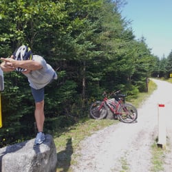
    St. Margaret's Bay Rails to Trails - Don't mind the silly man doing yoga, the trails are smooth and flat like this throughout.

    See all

    Don't mind the silly man doing yoga, the trails are smooth and flat like this throughout.

    Sugar Moon Farm - Maple coffee

    Sugar Moon Farm

    3.9(12 reviews)
    112.1 km
    $$

    Charming cabin restaurant tucked in the woods in Nova Scotia, about an hour outside Halifax, that…read morespecializes in all things maple. It makes for a nice pitstop if you are driving to/from New Brunswick. They make their own maple syrup and specialize in all things maple. If you don't like pancakes, this probably isn't the place for you. Everything on the menu is made with maple. If you have the time, there is a nice mountain trail just out the front door that apparently a lot of folks hike before eating. We couldn't fit it in but I bet it would have made the experience even better. My pancakes with maple roasted pecans were good, not mind blowing, but good. My coffee with maple whipped cream was good but I typically take it black and wasn't a fan of all the sweetness. They do feature some non-pancake items like maple baked Mac n' cheese that was apparently recently on the Food Network. Also, some kind of French toast. But we all went for the pancakes. Service on our visit was not super fast but everyone was very nice and the place was very busy. They have a store with syrup, their own maple porter, and other wares. Overall we enjoyed our visit to this picturesque spot.

    Breakfast was good with delicious biscuits and pancakes. The collection of maple products on the…read moretable are many, such as maple syrup, maple butter, maple pepper and maple drinks. The add-on of blueberry compote could be a bigger scoop and I would happily pay another dollar to get more. If you go hiking on the trails in the area the breakfast is welcome stop before or after. You can buy syrup straight from the farm (or next door) here. The tour is fun for kids and might be more interesting if you go during the spring season.

    Photos
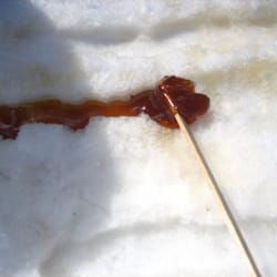
    Sugar Moon Farm - Making maple candy

    Making maple candy

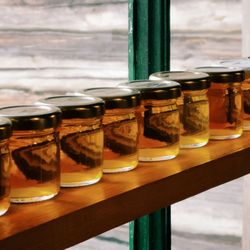
    Sugar Moon Farm - Maple syrup jars, showing differences in harvesting time

    Maple syrup jars, showing differences in harvesting time

    Sugar Moon Farm - Pancakes, sausage, and blueberry compote

    See all

    Pancakes, sausage, and blueberry compote

    Beechville Lakeside Timberlea Rails to Trails - hiking - Updated July 2026

    Loading...
    Loading...
    Loading...