Duncan's Cove Nature Reserve Photos


More like Duncan's Cove Nature Reserve
Recommended Reviews - Duncan's Cove Nature Reserve
Start your review...


Reviews With Photos


I've heard lots of good things about this hiking trail, and creeped lots of photos on the internet over this past summer but never quite made it there. That all ended this past weekend, with a freakishly warm Saturday and google maps. It's actually really easy to get here and lots of parking on the side of the road. It's half trails and half walk along the rocky ocean coast. I use to hate that cold rocky Atlantic cost line, seemed depressing and poor. I say that because I grew up poor as dirt and on the shores of the cold rocky Atlantic. It just is what it is. Now that I've grown up and have lived/worked downtown for a long while, the first thing I want to do on the weekends it get the heck outta Dodge and get out into nature. Now I love that rocky coast. Gimme all that natural Nova Scotia beauty, and there is an over abundance of that here at Duncan's Cove. There are lots of trails to hike, kind of a choose your own adventure. You can bring your dog, I saw a few different size pups running around. I left mine at home due to lots of slippery rocks, huge waves and cliffs I wanted to get close to. Pack a snack, grab your water bottle and head out to this Nature Reserve sometime, you won't be disappointed!


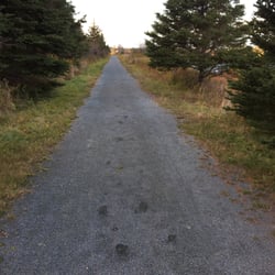
We rolled out of bed in time to hit the road by eight-ish this morning in hopes of spending a quiet morning in the wilderness of Duncan's Cove, a coastal hike out past the Herring Cove region. It's only a short drive, it's not even remotely busy, and it's off-the-grid enough to feel the relaxation benefits! I'll get to all the reasons why it's easily one of my new favourite places around the city in a minute, but I do have to point out that it lost some serious points with me before we even got there. Duncan's Cove isn't easy to find without someone who knows where they're headed, there are few (if any) directional signs pointing you in the right direction and even when you're on the right track, there are 'Private Property' signs making you doubt yourself the entire time. Without noticing the path naturally paved with smooth, white rocks for easy passage, we ended up plowing through a trail reminiscent of the raptor fields in Jurassic Park 2 (Anyone? Just me?) with foliage up to our shoulders, rough and dangerous terrain, and plenty of opportunities for injury including ankle-high stone walls, foot-deep sinkholes, and roots ready for the tripping. Nonetheless, we still managed to make it down but much happier with the more user-friendly route on the way back. Even with the safer trail, there are some dangerous spots so pay attention, watch your kids, and give it some serious thought if arriving with a mobility challenge. Once you reach the rocky shore, you can hike for hours without really reaching anything. All the while, you get an unobstructed view of the Atlantic complete with fishing and sailboats, coastguard patrols, schools of herring visible at water level, families of seals on the hunt, incredible diving birds that nab fish right out of the water, and yes - we even saw a school of pilot whales diving off the coast. This was some National Geographic stuff, guys! Dog-friendly for medium to large-size breeds but know that they're going to get messy in the process. Leave the short-legged guys at home, the ground will be a little too dangerous for them. And for any dog brought out, please remember to keep them on-leash to avoid harming any of the wildlife including geese that all too often fall victim to inattentive dog owners. read more


9 years ago
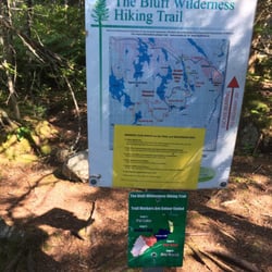
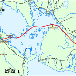
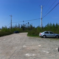
We stayed in one of the houses at Duncan's Cove (There are 3 or 4 available on airbnb). There is parking by the trail head which is kind of hidden. There is a gravel drive across from the parking bay area that leads towards a massive white house in the distance. Follow the drive and disregard the sign that says private no vehicles. You will see a sign pointing the direction of the actual trail on the right of the path. The trail forks immediately. Take a left to head to head the fastest way down to the ocean. You will definitely want proper footwear, as the path is not paved and it will involve some rock climbing. The path exits out of the undergrowth to the rocky shore and follows along it some way where it eventually meets the other fork. If you had taken the straight ahead path at the fork you hike for some distance before coming across an abandoned WWII bunker (we used it for shelter for a storm that hit during our hike). We had the privilege of being the only ones there on our sunny return visit the following day. We sat and watched almost two dozen seals play in the surf. The stormy day was as rewarding, watching the waves crash against the rocks. I encourage any hikers to please take the threat of ticks very seriously. You will be walking on narrow trails between thick undergrowth. Tuck pants into socks, spray repellent, and conduct thorough checks afterwards. read more


7 years ago

16 years ago

I've heard lots of good things about this hiking trail, and creeped lots of photos on the internet over this past summer but never quite made it there. That all ended this past weekend, with a freakishly warm Saturday and google maps. It's actually really easy to get here and lots of parking on the side of the road. It's half trails and half walk along the rocky ocean coast. I use to hate that cold rocky Atlantic cost line, seemed depressing and poor. I say that because I grew up poor as dirt and on the shores of the cold rocky Atlantic. It just is what it is. Now that I've grown up and have lived/worked downtown for a long while, the first thing I want to do on the weekends it get the heck outta Dodge and get out into nature. Now I love that rocky coast. Gimme all that natural Nova Scotia beauty, and there is an over abundance of that here at Duncan's Cove. There are lots of trails to hike, kind of a choose your own adventure. You can bring your dog, I saw a few different size pups running around. I left mine at home due to lots of slippery rocks, huge waves and cliffs I wanted to get close to. Pack a snack, grab your water bottle and head out to this Nature Reserve sometime, you won't be disappointed! read more


an absolutely fun and amazing hike. it was awesome to go through all the various terrain types, but with still being by the water. the views are fantastic and the hike is fun. bring your dog's because they will love all the climbing and exploring. read more


More info about Duncan's Cove Nature Reserve











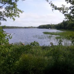
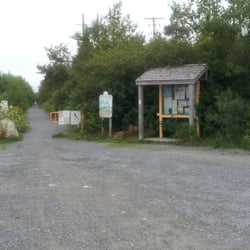
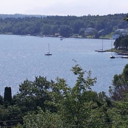


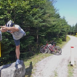
Duncan's Cove Nature Reserve - hiking - Updated August 2026
People found Duncan's Cove Nature Reserve by searching for…
Rock Climbing in Duncans Cove, NS
Hiking Trails in Duncans Cove, NS
Things to Do in Duncans Cove, NS
Walking Trails in Duncans Cove, NS
Tent Camping in Duncans Cove, NS
Make Out Spot in Duncans Cove, NS
Secret Spots in Duncans Cove, NS
Mountain Biking in Duncans Cove, NS
Fishing Spots in Duncans Cove, NS
Places to Swim in Duncans Cove, NS
Off Leash Dog Beaches in Duncans Cove, NS
Dog-Friendly Businesses in Duncans Cove, NS
Natural Hot Springs in Duncans Cove, NS
Cliff Diving in Duncans Cove, NS
Off Leash Dog Hiking Trails in Duncans Cove, NS
Lookout Points in Duncans Cove, NS


