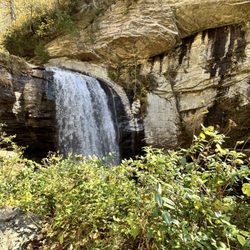
1. Black Balsam Knob

    1. Black Balsam Knob

    0

    NC, NC

    Cancel

    Open app

    Search

    Black Balsam Knob

    4.7 (3 reviews)

    Black Balsam Knob Photos

    You might also consider

    Recommended Reviews - Black Balsam Knob

    Your trust is our priority, so businesses can't pay to alter or remove their reviews. Learn more about reviews.
    Yelp app icon
    Browse more easily on the app
    Review Feed Illustration

    2 months ago

    Helpful 1
    Thanks 0
    Love this 1
    Oh no 0

    4 years ago

    Helpful 3
    Thanks 0
    Love this 4
    Oh no 0

    4 years ago

    Helpful 0
    Thanks 0
    Love this 1
    Oh no 0

    Verify this business for free

    People searched for Hiking 640 times last month within 15 miles of this business.

    Verify this business

    Purchase Knob - Trail signs

    Purchase Knob

    5.0(2 reviews)
    11.8 mi

    This has been our favourite walk forever. Do not let the couple of bad characters hinder you from…read morethis beautiful hike, because getting to the top is its own reward with sheer beauty. This property was donated to the state park and open to all. Very clean and well-kept trails, dog friendly, and a nice place to rest and relax, including restrooms at the science centre.

    I discovered this place through my daughter. She has gone here twice- once through her middle…read moreschool, and once through a local camp. She raved about it, and we finally got a chance to check it out. So happy we did! Purchase Knob was generously donated by the McNeil-Gilmore family to Great Smoky Mountains National Park. It is 535 acres of land that rises ultimately to 5,086 feet at the knob. In the meadow below the knob, at 4,850 feet, there are two buildings housing offices, a lab, a classroom for fifty students, and housing for up to eight scientists. Views are 180 degrees. You can hit the Cataloochee Divide Trail here, too. A refurbished cabin originally from the 1870s is nearby, which I will get to in a bit. When you get to the park, you will be blocked by a gate with a sign to the left identifying the park. It is open once in a while for scheduled visits/field trip students. It is easy to get your vehicle locked within the park. (People cannot get locked in.) Park your car on the sides of the road. Just walk around the gate if it is locked. Bring water, and a jacket in the spring or fall. The 2.5 mile round trip trail is basically a wide, dirt road that will eventually lead up to the main buildings. It is well maintained. When you get a glimpse of the building at the top, you will also see a grass trail leading upwards. I would take that trail. It is a shortcut. If you like to walk, just keep going, and the road will eventually lead to the building as well. On the way up, you will see many types of wildflowers. We heard (up) and spotted a hawk (down). I got a photo of nightshade, all the while with my body centimeters from a hidden cliff edge. Be careful on grassy edges! The open areas and tree-filled areas were of equal beauty. In early September I saw purples, greens, grays, and yellows, all framed by a clear blue sky graced by fluffy clouds. Your soul will take this in, and it will hold on to it. When we got to the top, we relaxed. We did not go to the knob proper. We used the very clean bathrooms, and laid down in the field right in front of the buildings. There is a water fountain. You are allowed on the deck, but not in the buildings unless you are with a scheduled group. There are picnic tables grouped close together, and bear-proof trashcans and recycling bins. You can check out the outside of the weather station that is a bit away. I would not traipse around the adjacent fields. I saw tagged plants and left that area so that we would not screw up any data. If you decide to go to the actual knob, you have to blaze your own trail. As of two days ago, the footbridge leading to Cataloochee was out. There is a sign warning of that; be careful crossing creeks. Anyway, that trail is easy to find; just look for signs. Check out the bulletin board for lists of the types of birds and butterflies that you can see there. I saw (possibly) a Cloudless skipper. It was fluorescent yellow! My first. To get down to the restored Ferguson cabin, just leave via the "grass carpet" trail. Make an obvious right and hitch your horse, or kids. This right will lead you to the cabin. The Fergusons were the first farmers to have an elevated farm. Their apples are still there. Do not pick anything. Do not get in the boar trap. Do not get near bears. Do not bother the cow spirits. Call to make sure horses are indeed still allowed. Bears and boars can hurt you. We leave all snacks in the car. You never know. Call the general number to see if bear activity is intense before going to this park. Middle school and up teachers, call this number to schedule a visit: 828-926-6251. This park welcomes wimpy and tough hikers mid-March through November. Call if you have a desire to hike in the deep winter. Remember to check out the Purchase Knob WebCam online for weather and views. To get to this park, take Exit 20, stay on 276 South for five miles. Get on Hemphill Road and stay on Hemphill Road for four miles. This review is dedicated to my daughter Sophie, a quick, beautiful trailblazer.
    Photos
    Purchase Knob
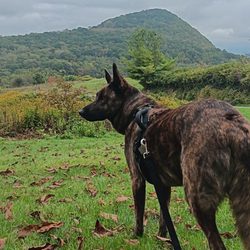
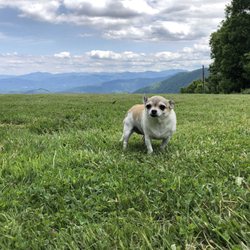
    Purchase Knob - Furbaby friendly

    Furbaby friendly

    Purchase Knob - Coral mushroom. Fall 2017.

    See all

    Coral mushroom. Fall 2017.

    Graveyard Fields

    Graveyard Fields

    4.7(14 reviews)
    2.5 mi

    Of numerous stops available along the parkway, the Graveyard Fields are one of the more…read moreinteresting. An ecologically distinctive valley with trails leading to an impressive waterfall, this offers plenty of places to experience nature. The altitude is sufficient that even on a summer day it is likely to be quite comfortable. There are a lot of stairs to get down into the valley and I do not recommend it for people with mobility limitations. There is a parking area which I have never seen overflow that has restrooms.

    My kind of hike! It wasn't too difficult when it came to physical exertion, but lots of rocks to…read morewalk around. I was thankful for my hiking shoes although I did see many people out there in sandals. Personally I wouldn't have been able to make it in sandals, but kudos to them. The reward was a beautiful waterfall at the end where my husband and I sat around for 30 min or so enjoying both the beautiful view and weather. The trail wasn't marked perfectly, but there are plenty of people to ask on the way where to go so we made it there and back with no issues. We moved at a steady pace and each way took us about 45 min. The parking lot was pretty full when we got there (around 11am on a week day), but people were coming and going so we found a spot. I got off the hike hungry for lunch so we stopped nearby at a store where we were able to grab a snack, but not too much to eat in the area so eat before or bring something with you.

    Photos
    Graveyard Fields
    Graveyard Fields
    Graveyard Fields

    See all

    Craggy Pinnacle Trail

    Craggy Pinnacle Trail

    5.0(8 reviews)
    36.8 mi

    We had planned to hike Graveyard Field our first day in Asheville, but after sleeping in a little…read morelate and also getting over a recent back strain thought starting with Craggy Pinnacle may be better. It took us about 45 minutes to get there from Biltmore Village. I had read that parking could be an issue, but plenty of parking spots available on a late Monday morning in June. Usually when my husband and I are hiking I'm happy our kids aren't with us because I knew they would be complaining. However, this was one hike that I think they would probably enjoy and saw many families with big and little kids enjoying it. It's a pretty short way to the top (maybe 25 min tops) and while it was a nice little workout I didn't find it too difficult. The reward at the is a beautiful view of Asheville and the first thing I heard when we got up top was an adorable 4 year old boy saying "wow this is the most beautiful thing I've ever seen." It was picture perfect so we snapped some pics, enjoyed the view and headed down. Down was a little tricky and I was jealous of those who had walking sticks, but we made it down with no issues In fact, once down we felt like we needed a little more of a workout so added the nearby Craggy Gardens Trail, which was perfect. And after that we were ready for lunch so headed back to Asheville!

    This hike is one of the best hikes to do any time of year. It is a short easy to moderate hike near…read morethe visitors center. The views are breathtaking and you meet great people and dogs along the way. I plan to do this hike again when the seasons change. If you need an uplight in your spirits or a stroll in nature this is your hike. Enjoy!

    Photos
    Craggy Pinnacle Trail - Instagram: @telephonesmoothie

    Instagram: @telephonesmoothie

    Craggy Pinnacle Trail
    Craggy Pinnacle Trail

    See all

    Riley Moore Falls

    Riley Moore Falls

    5.0(4 reviews)
    45.8 mi

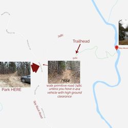
    I just wanted to update my 3/15/20 review below to add I've now done this hike several times, but…read moreTHIS time I had the chance to hike it with a friend who is directly related to the namesake of the waterfall... Riley Moore. Sandie is a church friend of mine and Riley Moore was her Great Great Uncle (I believe that's right). He once upon a time operated a grist mill here at the top of the falls. She's been trying to get here to see the waterfall, but couldn't find it and wanted to join us (along with her family) since I knew the way. Upon further research I discovered there are actually still remnants of the mill including visible drill holes, spikes and bolts. Thought that was pretty cool info to share! [ [ [ PREVIOUS REVIEW ] ] ] Riley Moore Falls is small in height but HUGE in personality. It's located off State Road S37-748, which is a nicely maintained gravel road where cars and trucks alike can comfortably traverse. ~~~ DIRECTIONS From Westminster, SC - DO NOT turn onto Cobb Bridge Road from Long Creek Hwy (Hwy 76) where you will see the brown & white sign pointing you in the direction of Riley Moore Falls. Our GPS had us go this way, then left onto State Road S37-748, but the road was CLOSED during our visit! INSTEAD, turn onto PU-32 also known as Rocky Fork Road. Turn left onto a gravel road near Rocky Fork Baptist Church and follow that until it dead ends @ State Road S37-748 (also known as Spy Rock Road). Turn right and drive approx. 1.4 miles (4 minutes) to 748c (aka Riley Moore Shoals Road). Park at the intersection of State Road S37-748 and 748c. DO NOT ATTEMPT TO DRIVE 748c in a car or minivan. Low clearance vehicles will find the terrain on this road to be VERY difficult to navigate without bottoming out or getting stuck. I'd also recommend 4x4 capability on wet days! There can be several deep-pocketed muddy areas after heavy rains. ~~~ THE TRAIL Once you reach the intersection of Spy Rock Rd (S37-748) and 748c, park roadside on Spy Rock, secure your vehicle and begin your hike approx. 1/2 mile down the "primitive road." IF you have a high ground clearance SUV or truck, you can drive the primitive road another half mile or so to a second parking area near the trailhead. The primitive road is VERY BUMPY  and can be muddy in spots after heavy rains, so a 4x4 is best. After reaching the second parking area, follow the marked trail on the left!!! The trail is a little over a 1/2 mile to the falls from here. The trail is fairly straightforward and easy to follow. ~~~ THE FALLS Once you reach the Chauga River, you will notice a large sandy area with plenty of room for an entire horde of hikers!!! Riley Moore Falls is not very tall (only about 12 feet), but it is very wide and has a deep base pool. PRO TIP - Bring swimwear, towels and a picnic, but be sure to pack it in and pack it out. ~~~ THINGS TO KNOW Hiking Distance: 2 miles (round trip to falls from S37-748) Difficulty of hiking 748c: All downhill to trailhead (moderate return) Difficulty of hiking trail to falls: EASY Creek Crossings: NO Elevation Gain: 357 feet Waterfall Height: Approx 12 feet Access to top of falls: NO - not without getting wet Access to base of falls: YES Pool of water @ base of Falls: YES Sitting areas @ base: YES + sandy beach RESTROOMS: NO PARKING: YES (along road) + secondary parking area closer to trailhead for trucks and high ground clearance vehicles with room for about 6 cars. ~~~ [ FINAL THOUGHTS ] A lovely waterfall in any season, but also a great spot for a summer swim. While we had the waterfall practically to ourselves during our Mid-March expedition, be advised other trail website reviews say it gets trashy & crowded in summer months. What a shame if that is true because it truly is a treasure. ENJOY! 2022 / 74 #UPDATE 178

    This is the best waterfall we got to visit in SC this far. After we left Reedy Branch Falls we…read moredrove here. Well, as close as we could get. I didn't realize that we couldn't drive all the way to the trailhead so we had a long hike in store due to me having to carry my toddler most of the time. I should have re-read the previous reviews before coming. My friend did help me carry her as well and for that I was very thankful. So definitely don't recommend this hike with a little one unless strapped in a carrier. Also, I don't recommend it for the elderly either. It's definitely a wilderness hike deal with roots and elevation change. In fact, it's mostly downhill on the way to the falls, but on the way back it's pretty much all uphill, which was not fun with aforementioned young child. It's about a half mile to the actual trailhead and then another 0.7 mile to the falls. That's about 2.4 miles round trip. The reason of course that my boys absolutely became enamored with this place is the large swimming hole. It is wonderful and has plenty of space. The waterfall itself is beautiful and although it's not as tall as others, its width is quite impressive. I was trying to get as close as I could and even noticed a hidden part of the falls inside of the rock structure. That was so cool!! The sand at the base and shore give it a beachy vibe. We definitely packed it in and out making sure not to leave anything behind as to preserve the area as best as possible. Needless to say we were wiped by the time we made it back to our vehicles, but we're still glad we decided to venture here. Coming back with my hubby and boys in the very near future. Happy yelping!

    Photos
    Riley Moore Falls
    Riley Moore Falls - CREATED FROM GOOGLE MAPS

    CREATED FROM GOOGLE MAPS

    Riley Moore Falls

    See all

    Black Balsam Knob - hiking - Updated July 2026

    Loading...
    Loading...
    Loading...