Cancel

    Open app

    Search

    Blair Park

    4.0 (18 reviews)

    Blair Park Photos

    You might also consider

    Recommended Reviews - Blair Park

    Your trust is our priority, so businesses can't pay to alter or remove their reviews. Learn more about reviews.
    Yelp app icon
    Browse more easily on the app
    Review Feed Illustration

    Reviews With Photos - Blair Park

    Play area
    Tina H.

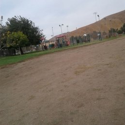
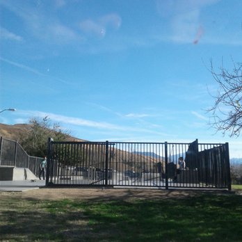
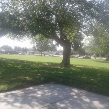
    Nice park with a bunch of space. Huge grass area and hiking trails. Nice place to bring the kids/family to have a nice day @ the park.

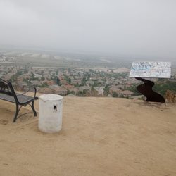
    Summit
    Ramiro O.

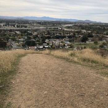
    Easy hike up to the top, if you want to avoid that steep hill, walk down Marshall, make a left at grande vista, and enjoy an easier trail up. My friend did it with flip flops, and you get a nice view up there. The hill on Blair Park can be challenging for kids and elder people, just a thought, since my neighbor didn't know how to get up there and would not hike due to steepness (hes in his 60's), now I see him hike every now and then. Hope this helps others.

    See all

    2 months ago

    Helpful 0
    Thanks 1
    Love this 0
    Oh no 0

    7 years ago

    Helpful 10
    Thanks 0
    Love this 7
    Oh no 0
    Photo of Jocelyn O.
    237
    923
    10192

    4 years ago

    Helpful 3
    Thanks 0
    Love this 3
    Oh no 0

    9 years ago

    Helpful 59
    Thanks 0
    Love this 58
    Oh no 0
    Photo of Ramiro O.
    69
    53
    114

    7 years ago

    Helpful 7
    Thanks 0
    Love this 1
    Oh no 0
    Photo of Ana C.
    108
    17
    34

    7 years ago

    Helpful 3
    Thanks 0
    Love this 1
    Oh no 1

    7 years ago

    Helpful 2
    Thanks 0
    Love this 1
    Oh no 0

    3 years ago

    Helpful 0
    Thanks 0
    Love this 0
    Oh no 1

    5 years ago

    Helpful 2
    Thanks 0
    Love this 3
    Oh no 2
    Photo of Zach H.
    3486
    2253
    10233

    9 years ago

    Helpful 2
    Thanks 0
    Love this 2
    Oh no 0
    Photo of Rene G.
    27
    33
    25

    7 years ago

    Helpful 3
    Thanks 0
    Love this 1
    Oh no 0

    7 years ago

    Helpful 2
    Thanks 0
    Love this 2
    Oh no 0
    Photo of Erik G.
    66
    40
    14

    7 years ago

    Helpful 0
    Thanks 0
    Love this 0
    Oh no 0
    Photo of Ruthie M.
    143
    126
    116

    8 years ago

    Very nice park for the athletic person. I would come here again. Lots of hiking! Basketball courts! And even a baseball field!

    Helpful 0
    Thanks 0
    Love this 0
    Oh no 0

    6 years ago

    Helpful 1
    Thanks 0
    Love this 0
    Oh no 0

    8 years ago

    Helpful 0
    Thanks 0
    Love this 0
    Oh no 0
    Photo of Steven T.
    97
    247
    561

    8 years ago

    Helpful 0
    Thanks 0
    Love this 0
    Oh no 0
    Photo of Chris G.
    110
    5
    10

    10 years ago

    Helpful 4
    Thanks 0
    Love this 3
    Oh no 0

    Ask the Community - Blair Park

    Are there volleyball nets?

    No unfortunately they don't

    Is there handball courts?

    Yes

    How is the parking? Is there enough?

    Yes, there is a lot of parking.

    Do the tennis courts have nets?

    Yes

    This park has a basketball court?

    Yes

    Don’t See Your Question? Ask Away!

    Review Highlights - Blair Park

    They have a nice playground for kids, a tennis court, handball court & even two horseshoe pits!

    Mentioned in 2 reviews

    Read more highlights

    You might also consider

    Verify this business for free

    People searched for Hiking 4,458 times last month within 15 miles of this business.

    Verify this business

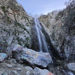
    Bonita Falls

    Bonita Falls

    4.1
    (166 reviews)
    11.6 mi

    We went for a hike yesterday and Bonita Falls was 22 minutes drive. The location was in Lytle Creek…read morein San Bernardino National Forest. The weather was great. We parked in the designated area. It was around 2.8 miles round trip . Make sure bring water, sunscreen, good hiking shoes and hiking stick. The trail was very rocky and steep going to the waterfalls. The running stream was amazing. Water was cold but soothing to listen to the sound of the water. The waterfall was high , great to take pictures and can get to the waterfalls area. There were people doing rock climbing too. Great adventure.

    I'll give this place a strong 3.75 to 4.0 stars. And when compared to all other locations in the…read morearea, this would be easiest location for most people to discover, hike walk or jog and Enjoy. You must arrive early. As people are already taken up slots in the parking lot as early as 630am. Now, super easy to park on the side of the road, as there are many signs against it and many areas that are welcomed. By 8am, the streets were getting filled, as there are many outlets that lead to the river and many places where on can just the views, without the hike. So please get your 5 dollar windows taken for parking- the local 76 station is a place where you are able to. The hike is self explanatory, follow the people, which you will see many many hikers. And contrary to what people say, it is not an easy hike. You will need to be prepared for a 1.5 mile walk up and 1.5 miles back. It is a super rocky trail. Lots of loose rocks , once on the upper trail, boulders get bigger, the small cascades of water can make the area slippery. You will need to extend your limbs to reach up and pull yourself up. Not for small children and not for the elderly. The only thing here that I had a distaste for was the littering and the graffiti. Just the stupidity of humans not picking up their trash or painting moronic signs on rocks. Made it less intriguing... made it comical that people can be such idiots. The downhill trail becomes dangerous, as people can slip or fall and amid some cliffs that surround the area, being careful is at the most important danger. The area is accessible by various routes. The fantastic point here would be the river, which is wide, always tuburlant but not deep. Some area as 1ft ...other areas can reach 3 feet. The picnic area and the small rest stop are great stop points. The water is crystal clear, cold and just majestic. Bring appropriate foot wear, bring water and snacks and make sure you are physically fit. The waterfall is high...over 100ft. Standing under the falls can be refreshing, the cold waters offering an unexpected cold shiver, the light mist and the gaze of the falls can be spectacular. The river extends past the small pits top bonita falls bathroom and parking...next down the road is the picnic area...which is basically one or two tables for a get together, best to just visit the river and enjoy the stream... and finally the large parking lot..from here you can saddle the edge of the river, enjoy it, have a get together and from there, the Rover twist and turns to another southerner point where long lines of cars gather and can be accessed by the public and by foot. Gentle streams and relaxing moments. Over all, a good small hike with options for picnics and stream wading. Please, no graffiti and pick after yourself- let's keep nature clean!

    Photos
    Bonita Falls
    Bonita Falls
    The falls

    See all

    The falls
    Oak Glen Preserve and Southern California Montane Botanic Garden

    Oak Glen Preserve and Southern California Montane Botanic Garden

    4.8
    (63 reviews)
    22.9 mi

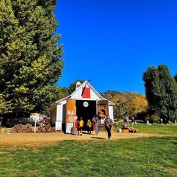
    A beautiful, well maintained preserve with a stream, a few small ponds and waterfalls, and many…read morethemed trails such as: Hummingbird Hill, Falling Waters, Sunflower Lane, Pioneer Loop, Conifers of California, Wetlands Boardwalk, Deciduous Forest, The Artist's Palette, Hidden Hollow, Sacred Springs, and Children's Forest. While there are some dirt walk paths, it be difficult to navigate if in a wheel chair or if you have a stroller. There's a good sized parking lot, though during apple-picking season and when it snows it can be a bit difficult to find a spot. Regardless, if you're in the area, it's a place definitely worth the visit. Love and appreciate that they are dog-friendly to leashed and well mannered dogs and free admission, but donations are much appreciated.

    Absolutely loved getting my steps in and enjoyed the sights, sounds, and smells of all the flora…read moreand fauna in Oak Glen! Highly recommend going earlier in the day to beat the heat. Parking and admission is free. Wonderful information at the entrance of the garden. Just outside the garden past the parking lot (you'll see this upon entry) is a bbq spot and a gift shop. After walking around 2.5 miles, I tapped out and cooled down with an apple cider slushy. Lots of apple orchards in the area. I also took home a jar of apple butter as a souvenir. Had such a lovely time- highly recommend!
    Photos
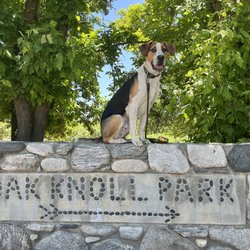
    Oak Glen Preserve's Oak Knoll Park has ample picnic tables for family fun and it's located next to the Children's Forest!
    Oak Glen Preserve's Oak Knoll Park has ample picnic tables for family fun and it's located next to the Children's Forest!
    Oak Glen Preserve and Southern California Montane Botanic Garden
    Oak Glen Preserve and Southern California Montane Botanic Garden

    See all

    San Bernardino National Forest

    San Bernardino National Forest

    4.4
    (14 reviews)
    5.3 mi

    The San Bernardino National Forest is huge!!!…read more This National Forest stretches from San Bernardino Couty to Los Angeles County. I've had the privilege to experience the San Bernadino County side of the San Bernardino National Forest when I lived in Big Bear. It was beautiful and fun for hiking adventures. This time, I was on the Los Angeles County side of The San Bernardino National Forest. I was on the side that feels really desert-like. It's dirt and very dry weather, and then suddenly when you hit the National Forest, it is green and gorgeous. Boy, it is really something when you go from the desert to green trees and pretty views!!! The temperature cooled down too. I love the forestry landscape and lush trees everywhere. I'm thankful that we have National Forests like this that are protected! We must protect them at all costs!

    3/5 loved the location left out a few stars I'll explain the pros and cons:…read more Pros: Beautiful National forest. Camping reservation is available and brown bins to hide food from animals and bears available. One bathroom available and it's cleaned by rangers. Trash is also picked up if you need help cleaning. Beauty of a sky at night. They gave a fire pit area and three large benches to eat and sit. Cons: The drive as soon as you get to the off road areas you lose reception. We got lost so I recommend having a back up plan with maps that help off roading areas. Also we took our Tundra for the first time off road and regretted it immediately. BEWARE: The bushes and trees are not cut down to clear the roads and our truck was completely scratched from both sides. Only bring cars you don't care about and plan to use them through bushes and trees that scratch the paint. We learned the hard way. Also the drive up and down the mountain is very dangerous. If you come early the fog makes it hard to see. We got rain in the afternoon and it's very slippery cars also drive crazy and pressure you to go over the required speed. We had to wait 45 min coming down the mountain Sunday when we left due to a car accident. Again locals drive crazy and ride your car or pass you up. Be really cautious! All in all great camping trip but the truck issue was horrible. We now have to pay to try and wax the truck or have to fully re-paint.

    Photos
    We made it up!
    We made it up!
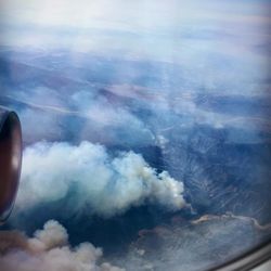
    The Line Fire (almost 28,000 acres burned so far 9/10/24)!
    The Line Fire (almost 28,000 acres burned so far 9/10/24)!
    San Bernardino National Forest

    See all

    North Etiwanda Preserve

    North Etiwanda Preserve

    4.0
    (309 reviews)
    11.8 mi

    Very nice trail, good for beginners, nice workout. Hiked it with my daughters and they liked it…read more The payoff is the waterfall.

    In comparison to all other trails in the area, this would be rated a medium to hard trail. For…read morelength, the trail for the upward Climb is around 2 miles up till you reschedule the waterfall area. After, the trail narrows and continues deeper. During the summer, this hike will test you. The entrance and parking are super easy to navigate, as qr scans are available for info and parking payment- just scan and your ready to go. There are No ebikes allowed just walkers joggers runners hikers and nature. Once at the top, there are other trails that split off and will.offer more northern or western routes ... the loop to the west and then south will. Increase the length of the hike from 4 to 6 miles and others can even stretch further inland. The sceneries will make a huge impact, late evenings adventures should offer spectacular vistas and the trail itself is easy to read and follow. Small tables for picnics dot the bottom rung of the trail. This hike would not be be for newbies...instead for slightly novice and higher. Bring water and snacks, clean after yourself and enjoy the wilderness. The trail is rated at a 4.5 stars - only thing missing are more informational directions on the upper trails

    Photos
    Sunrise hike and the lighting was falling so pretty on the hills!!
    Sunrise hike and the lighting was falling so pretty on the hills!!
    North Etiwanda Preserve
    North Etiwanda Preserve

    See all

    Caroline Park

    Caroline Park

    4.5
    (26 reviews)
    12.7 mi

    This was my first time at this park. You have to drive through the neighborhood of upper Redlands…read moreto get here. Since I decided to have an early morning walk in this park at 5 am, I didn't have difficulty finding a parking spot at the top side of the park. I love hearing all the birds in this park. It's so relaxing and you feel so close to nature. The hiking/walking trail is one mile to walk around the circumference of the park. Be mindful though, the trail is a dirt pathway and if they recently watered the grass, then you'll encounter patches of mud. The trees and bushes are numbered so you can look up what type of plant they are, but they're indigenous to the area. There were only a few people taking their morning walks and others taking their dogs out for a walk as well. I only noticed a few poop droppings from dogs where their owners didn't pick up after them, but other than that, this park makes you feel like you're taking a hike in nature. To the far right, is a grassy meadow where you can have a picnic. There are no picnic benches there though. This is area was completely green from the care and watering. Great place to bring your dog to run freely chasing Frisbees or balls. Also, there are no public restrooms at this park. However, I did notice one water fountain and people must have left bowls there for their dogs to drink out of. Overall, a beautiful park to visit and enjoy nature.

    I had heard of Caroline Park fifteen years ago but never made it there. We had our Grandson so…read morethought we would take him there. You end up walking downhill and there's a large grass area. We saw people sitting having a picnic. You get to this area when you start by sign at the top of park and take path on right side. Our Grandson could run around and explore, fun day .

    Photos
    Dusted Treelines
    Dusted Treelines
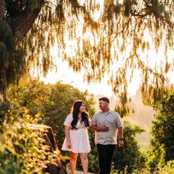
    Love in a shaded place
    Love in a shaded place
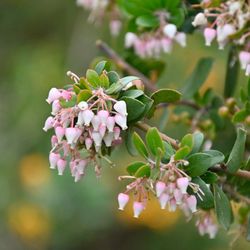
    Lovely manzanita blooms

    See all

    Lovely manzanita blooms
    Big Falls

    Big Falls

    4.5
    (78 reviews)
    25.0 mi

    The drive up to this trail is not bad at all! I sometimes get scared of driving up high into the…read moremountains but this was a pretty easy drive and there weren't any parts that I felt were scary. I was driving from Ontario, CA. You do need a pass to park in the lot. There are restrooms at the parking lot if you need to use them. The hike up is a pretty short one with pretty views! There are tons of shade from the trees and the water/waterfall was beautiful!

    I had a great safe visit. I paid the $5 Forest Adventure pass at Elkhorn General store on Valley of…read morethe Falls Dr, a 1.2 mi from the Big Falls Trailhead and Picnic area. I had a great time hiking with my senior father in law, and my family. The water was refreshing. The parking looks great this spring. This water flows into Hunington Beach, the sea, the Santa Ana River Wash. It was 52 degrees on group our walk through the creek and Cross the wash. Our walk was cut short by other hikers falling in the creek. Big falls trail will lead you along the river bed to cross the creek to a path of a waterfall overlook. The ice cold water was coming from the area of the mountainside has snow melting as we warm up this Spring season. The creek felt refreshing this morning, I dampened my On Running shoes with waterproof silicone in the waters by crossing the creek on a fallen branch. I refreshed my sun beaten hair with the ice melt waters. I like this trailhead. For years Water from San Bernardino mountains has collected in way of steel pipes that flow by gravity on the steep mountainside above a creek pumped in tunnels to Water Companies piped downhill to be bottled and sold as Arowhead Spring Mountain Water.

    Photos
    San Bernardino National Forest Trailhead
    San Bernardino National Forest Trailhead
    Hiking  big falls about a 1 mi out from the waterfall overlook
    Hiking big falls about a 1 mi out from the waterfall overlook
    Big Falls

    See all

    Blair Park - hiking - Updated August 2026

    Loading...
    Loading...
    Loading...