Cancel

Open app

Search

Bumpass Hell in-and-back hike

5.0 (2 reviews)

Bumpass Hell in-and-back hike Photos

You might also consider

More like Bumpass Hell in-and-back hike

Recommended Reviews - Bumpass Hell in-and-back hike

Your trust is our priority, so businesses can't pay to alter or remove their reviews. Learn more about reviews.
Yelp app icon
Browse more easily on the app
Review Feed Illustration

3 years ago

Helpful 4
Thanks 0
Love this 4
Oh no 0
Photo of Dawn F.
187
209
205

10 years ago

Helpful 0
Thanks 0
Love this 0
Oh no 0

Verify this business for free

Get access to customer & competitor insights.

Verify this business

Mill Creek Falls

Mill Creek Falls

5.0(1 review)
2.8 km

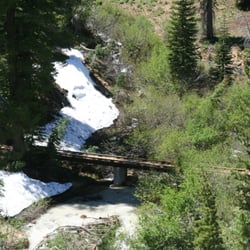
The trail to Mill Creek Falls begins right off to the side of the new Kohm Yah-mah-nee Visitor…read moreCenter in the Southwest parking area. The trail is somewhat easy-moderate, depending how fit you are of course. It has a round trip distance of 4.6 miles with various areas of inclining slopes. The path was not smooth and in many spots there was snow blocking the way (but this was a few weeks ago and it may have melted by now). Hiking poles were very useful here. This trail isn't for those looking for an easy stroll. Keep a close eye on the trail too because it wasn't clearly marked and there are areas were you can get off the main path. With that being said, the hike and the actual falls were beautiful. Along the way there were open areas that offered lovely views of various mountain peaks, as well as areas with towering trees that loomed overhead and offered much leafy shade. There was one part of the trail that brought us to a hillside covered with bushes of yellow wildflowers, which was absolutely beautiful. The Mill Creek Falls itself was stunning. You can walk across a bridge that runs above its cascading waters and also across a second little bridge further up from the first. The bridge gives you a spectacular view of the canyon between the two hills. Be careful though because the wooden bridges do not have railings. It's hard to put into words the beauty and majesty of a natural waterfall. You just have to see it for yourself.

Photos
Mill Creek Falls
Mill Creek Falls
Mill Creek Falls

See all

Caribou Wilderness - One of the Hidden Lakes.

Caribou Wilderness

5.0(3 reviews)
72.9 km

This is one of my favorite spots around lassen county. Great spots to hike and beautiful lakes. You…read morehave to come check it out, it's a beauty you must see for yourself. I went swimming here during summer and the dogs as well. Very cold water, but what do you expect in higher elevations with wind! So worth the drive and hike.

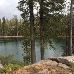
If your idea of a good time is to stroll through the forest past pretty lake after pretty lake and…read moreto see no other people, head up to the Caribou Wilderness on the eastern edge of Lassen Volcanic National Park near Chester. Hubby and I recently spent an October Saturday there, hiking a seven mile loop from the Hay Meadow trailhead. Reaching the trailhead itself is something of an adventure, requiring a twelve mile drive on forest service roads. Fortunately, most of the route is paved and in decent condition; the last couple of miles are gravel, and if it's rained could be a problem. We crawled down the last bumpy downhill stretch in our sedan to see a large gravel lot with nary a car in it. There is a restroom, but it was locked. Hay Meadow on the southern edge of the wilderness, where the trail starts, is large and picturesque; I imagine that it is gorgeous in mid-summer with the wildflowers. We hiked in a counterclockwise direction, taking the Indian Meadow, Hidden Lakes, Posey-Beauty, and Cone-Hay Meadows trails. There's an early climb of some few hundred feet, but after that nothing taxing. Much of the hike is relatively flat, and the range in elevation is from 6500 to 7000 feet. About 1.5 miles in you start to see what you came for: the lakes. The essence of this hike is the pleasure of woods and lakes. And plenty of lakes there are. In our seven miles, we passed at least 15 lakes, and that doesn't count the small ponds. The largest was Long Lake, about mid-way through the hike, and the most beautiful was Evelyn Lake, set among rocky ledges, on the return trip. The Caribou Wilderness is typically open mid-June to mid-October. There is no entrance fee nor backpacking fee. While there are no campgrounds near Hay Meadow, there are two campgrounds at the Caribou Lake entrance on the east side of the wilderness. Mosquitoes can be bad in June and July, but we didn't see any in October.

Photos
Caribou Wilderness - Long Lake.

Long Lake.

Caribou Wilderness - This was on the trail in the middle of nowhere!

This was on the trail in the middle of nowhere!

Caribou Wilderness - Hay Meadow.

See all

Hay Meadow.

Lassen Volcanic National Park - Lassen Peak

Lassen Volcanic National Park

4.7(244 reviews)
7.7 km

As part of our quest to visit all 63 U.S. national parks, we set off on a six week road trip. I…read morehave a personal rule: I only count a national park as "visited" if I actually spend time there, hike or walk through it, and truly experience it. On this trip, we visited 14 national parks, and Lassen Volcanic National Park was one of the biggest surprises. The drive into the park was beautiful, and despite evidence of recent wildfires in parts of the forest, the landscape is recovering and remains absolutely stunning. Nature has an incredible ability to heal, and seeing young trees growing alongside older burned areas was a reminder of how volcanic landscapes are constantly changing. Lassen is one of the few places in the world where you can experience all four types of volcanoes: shield, composite, cinder cone, and plug dome. That alone makes it geologically fascinating, but what really impressed us was how much variety the park offers. One moment we were standing beside steaming fumaroles and bubbling mud pots that reminded us of a smaller, quieter version of Yellowstone. The smell of sulfur, the hissing steam, and the boiling earth beneath your feet make you appreciate that this landscape is still very much alive. The next moment we were hiking around peaceful alpine lakes with spectacular reflections of Lassen Peak mirrored in the crystal clear water. Manzanita Lake was especially beautiful, and seeing the volcano reflected on its calm surface was one of the highlights of our visit. We also loved exploring quieter trails to places like Lily Pond, where we could hike for long stretches while seeing only one or two other people. There is something special about having so much natural beauty almost entirely to yourself. For those who enjoy being on the water, the lakes are perfect for kayaking or simply sitting quietly and taking in the scenery. The combination of volcanic landscapes, mountain forests, meadows, lakes, and wildlife makes every part of the park feel different. We stayed in the nearby town of Chester, which turned out to be a charming little base for exploring the park. It has several good restaurants, friendly people, and everything we needed after long days of hiking. Lassen Volcanic National Park may not receive the attention of some of California's more famous parks, but it absolutely deserves it. It combines dramatic volcanic features with peaceful alpine beauty in a way that feels both exciting and calming at the same time. If you enjoy hiking, geology, photography, or simply discovering places that are a little less crowded, Lassen Volcanic National Park is a hidden gem that should be on every national park lover's list.

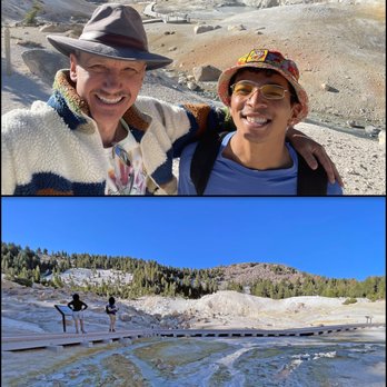
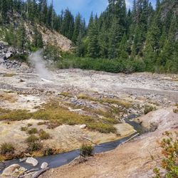
Another gem of a national park. You can see all the volcanic type activity and sulfuric acid that…read moreyou see in Yellowstone Park on a smaller level. Well worth a stop. We downloaded the National parks app and drove through while reading the audible tour. We also took the Bumpass trail to the hot Springs. Also very cool.

Photos
Lassen Volcanic National Park

See all

Heart Lake in-and-back Hike - Downed trees on the trail

Heart Lake in-and-back Hike

4.0(3 reviews)
8.7 km

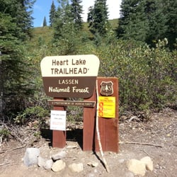
We decided to backpack in to the lake and spend the night as our first attempt at backpacking. We…read morechose this spot because since it is in the National Forest, not the National Park, it is dog friendly, plus it's not often traveled. The road is a good gravel road. No problems for any type of vehicle. You park on the side of the road in a small turnout. No permit needed. The trailhead is well marked. The trail is all uphill, until a few hundred feet from the lake. It's listed as an easy hike, but I think it should be considered a moderate hike. The uphill hike is already on the edge of being moderate, but if you add in the dozens of downed trees, it definitely makes the hike more difficult. In a 25 lb pack, those things are really irritating. Most you can step over, but there are several you have to climb, and as of yesterday 9/14/13, 3 that have to crawled under. Almost at the lake, you cross South Digger Creek. In September this creek is a few inches high and there are lots of rocks to hop over, but I would imagine in the spring this is quite higher from the snow run off. The lake is small, but very scenic. It was heavy on the weeds and quite green though, so we were not going to swim in it. We decided to hike back to the creek so that we could use the creek water (still filtered) for drinking. We found some decent flat spots on the creek to sleep and were very comfortable. The lake, I later found out is quite full of leaches, so do not swim in it. Hang your food, I found a few piles of bear poo around the lake. You cannot make a campfire, only stove use in the summer. Please don't burn our forest down with illegal campfires. Once you see all the downed trees, you will agree this place is a disaster waiting to happen. This was a great place to try backpacking out and I recommend it for being very fun for dogs. See my pictures of the trip attached on the site.

This is a great hike but be prepared. As of our hike (6/3/2012), the trail is in need of…read moremaintenance. There are numerous logs down across the trail and the trail is quite difficult to pick up in places. In one place, close to the lake, the trail leads right into a swamp area. If possible, have a GPS and a map. It's pretty much all up hill on the way in but the views at the lake are well worth the trip.

Photos
Heart Lake in-and-back Hike - Heart Lake

Heart Lake

Heart Lake in-and-back Hike - Trailhead

Trailhead

Heart Lake in-and-back Hike - South Digger Creek

See all

South Digger Creek

Bear Lakes & Long Lake Loop Trail

Bear Lakes & Long Lake Loop Trail

5.0(14 reviews)
110.6 km

Absolutely breathtakingly, beautiful day hike in Graeagle Lakes Basin Area that is not quite 2…read morehours from the Carson City area. Easy directions that has signs that will guide you right to the trailhead with as the other reviewers noted very limited parking but this hike is WELL worth it. With your choice of going to fish at Long Lake or hiking on several different hiking options from the Bear Lakes & Long Lake Loop Trail or take in a more moderate to difficult hike up to Mt. Elwell or Pacific Crest Trail you will not be disappointed by the beautiful nature views plus the four alpine lakes that on this trip in November we weren't brave enough to take a dip in but our Hobey doggy thoroughly enjoyed and we found to be of temperature similar to Lake Tahoe. Big Bear, Little Bear, Cub and Long Lake were exactly what we needed to put us back in touch with the serene vibes of the peacefulness of being outside with nature. Weather, views were stunningly gorgeous, we and our furry companions HIGHLY recommend getting out here to enjoy this easy to moderate hike/loop trail. Enjoy and #moveyourbody !!

I feel like nothing I write will adequately describe the beauty of this place, so I'll let the…read morepictures do the talking for that part. The trailhead is easy to find and off the main road. The road to get to the trailhead is doable in a small car, but take it slow as there are potholes and lots of blind corners. There's a well-maintained bathroom at the start of the trail and good signage. Parking is pretty good, there were plenty of spaces when I went but i could see it getting crowded during the summer months. The trail to long lake is relatively easy, but I wouldn't suggest it for someone with limited mobility. It's also a short hike with almost immediate payoff once you get to long lake, which is BEAUTIFUL. My dog and I elected to keep going past long lake toward the dam, and passed several small pretty lakes and streams on the way there. The trail was a little icy when I went in early December, but nothing too crazy.

Photos
Bear Lakes & Long Lake Loop Trail
Bear Lakes & Long Lake Loop Trail - Trailhead directions

Trailhead directions

Bear Lakes & Long Lake Loop Trail

See all

Bumpass Hell in-and-back hike - hiking - Updated July 2026

Loading...
Loading...
Loading...