
Lassen Peak Trail Photos


You might also consider

More like Lassen Peak Trail
Recommended Reviews - Lassen Peak Trail
Start your review...


Reviews With Photos
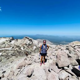

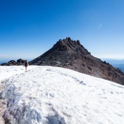
this was the hardest but the most beautiful hike i've ever done. it was rated as 4/4 on the difficulty scale, and i wholeheartedly agree! i was with a group of 4, and from the very start, we were already breathing hard as we scaled upwards towards the peak, and even 1/2 mi from the top, we took many breaks to catch our breath. every time i paused, i took in the view, and noticed how much smaller the cars in the parking lot were getting. there was even snow on the ground that had yet to melt, despite the very warm temps (around 70s when we went). there is the "first peak" which is a bit flatter, great to pause and take pics, have a snack, sip of water, and just rest. then there is the "second peak" what most called the "real peak" which required additional climbing and was not comfortable to sit/rest/pause since all you had were pointy rocks! even so, we definitely sat for a few minutes to rest and have a snack before descending back down. fortunately, it wasn't very crowded when we went (monday, non-holiday) so we never felt rushed or that we were stuck behind another group. it took us 2+ hrs to get to the top, where we rested 20-30 minutes and took pictures, and then about 1.5 hrs to descend down, so roughly 4 hrs total. while the parking lot had restrooms and trash receptacles, there were NO facilities along the trail, no restrooms, no trash receptacles, no water! unfortunately, i had to "go" shortly after reaching the top so i found a semi-private spot and emptied my bladder...sometimes you just gotta do what you gotta do! if you visit lassen nat'l park, this hike is a MUST if you can set aside 3-5 hours. i recommend going earlier in the day when it's cooler, but we were ok going midday b/c the temps dropped the farther up we climbed. the views are absolutely worth the hard work to get to the top. not recommended for those who are unable to be on their feet for 4 hrs straight, very young children, and the elderly.
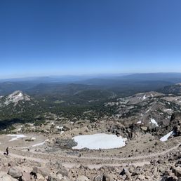

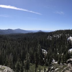
This is quite hard trail. It's like 2.5 miles uphill with an elevation gain of 2000 feet. You might want to carry enough water and something to save you from wind blowing at the top. You also need good hiking shoes as you might encounter snow every now and then. We started hike around 1 pm and were thinking it's quite late to start because of all the sun. But we found it ok. While we were walking downhill, some people were still on their way up. So there is no bad time to start the hike. The views are mesmerizing not only at the top but throughout the hike. You always have a constant Vision of far away lake and hills and nearby lake manzanita. We spent 30-40 mins up top while eating sandwiches and protein bars that we had carried. You can always find a calm spot to sit and meditate (if you like). Once you are back at the base you can head to lake manzanita and relax yourself while swimming in the lake. Manzanita has the warmest water of all the lakes in Lassen forest.


I was a little disappointed with Lassen Peak Trail. I had researched that it's one of the highlight hikes of Lassen Volcanic National Park. Coming from the southwest entrance, the trailhead is located about 10 miles along 30 mile Lassen Parkway that navigates throughout the entire park. The signs can't be missed when driving. Upon arriving here....I knew the trail was a strenuous 5 mile round trip hike climbing 2000 feet or so. Since I only afforded myself 1 day to explore Lassen Park, I concluded that I'd trek a portion of the trail attempting to capture as many photo opportunities in the most time efficient scramble uphill as possible. My biggest issue was the snow on the ground. I guess 2019 had significant snowfall during the winter because when I came to Lassen this past mid July, the trail was quite consumed with melted snow and sludge. Right away, the climb was quick and elevated. I immediately was staring down upon the parking lot and a few of the colored lakes in the surrounding area. My impressions were a little muted. Although climbing just a short ways made for scenic views, the brownish (out of bloom) rugged landscape and terrain didn't make for that quintessential setting I was yearning for. Yeah, the scenery opened up the higher I navigated, but I still couldn't and never did realize that humbling/apex moment where you admire just how hard you hiked - knowing the struggle was all worth it. Continuing on, the elevation and angle at which I was stepping was sincerely difficult.....greatly enhanced by the covering of snow. Roughly, maybe 1 mile into my ascent, I couldn't understand how conquering some of this treacherous trail was possible....especially with the embedded snow covering making the journey quite slippery. Ultimately, I used caution and felt it was best to turn around and head back down. I was slightly discouraged from my experience along Lassen Peak Trail. I believe in the future if I return without all the immense slushy snow covering and with more stable footing, I would much more appreciate discovering what this hike along with the panoramic vistas that accompany it would be all about.


Lassen Peak Trail is a fun and challenging 5-mile round-trip hike, but it comes with a lot of warnings. Time/Distance/Difficulty: As stated on the National Park Service website, this trail will take you approximately 3-5 hours in total with a 2,000 ft elevation gain. I took my time, went slow, and stopped at all the information stations, and it took me about 5 hours round-trip. The trail is very rocky towards the very top and quite tricky to navigate (sturdy hiking shoes highly recommended), but if you're careful with your steps and take your time, you'll be able to safely make it up and back down. I did see a handful of young children climb to the top, but they seemed to be somewhat seasoned hikers with loads of energy and excitement. Weather: I went on the first day of July and I was fine hiking in summer clothes because of the warm weather. Don't be fooled by the mild sun; you're a lot closer to the sun at such a high elevation, so sunglasses and sunscreen is highly recommended. There are snow patches that you will have to hike through (poles are helpful), but it doesn't get that much cooler at the top. You'll be so heated up from the hike that you'll find the breeze refreshing. Wildlife: When I went, I saw a few rodents, but the main attraction were the butterflies. The closer I got to the top, the more and more butterflies there were- to the point where you felt like you were in a cloud of butterflies. The good news is that the butterflies are great at flying and they almost never bump into you. Prepare yourself appropriately for this hike, as it is one of the more strenuous ones at Lassen Volcanic National Park. Bring adequate amounts of water and leave space for snacks. The only restrooms available are at the start of the trail in the parking lot, so plan accordingly.


This trail is never what it seems. Every time we go it is different. Don't be fooled into thinking that this isn't a challenge. Better to be over prepared and suffer less. There can be considerably high wind gusts even when the base (parking lot) is relatively calm. Although this may only be an hour and 30 minute hike, you can suffer eye damage from sun and wind exposure, minor frostbite, hypoxia and much more. I always encounter many people in tennis shoes, light jacket, no hat, no trekking poles. Those are all standard items for a hike like this. Today my son and I were able to lean into the wind at a 45 degree angle. The gusts were also so strong there were several times we almost lost our footing on a ridge.


3 days ago
Go Outside. Five miles, 10,457 feet of beautiful panoramic views! The Facilities: There is a huge parking lot equipped with restrooms right at the trailhead. Keep in mind that there are absolutely no bathrooms along the trail or at the summit, so plan ahead. The Wildlife Warning: Absolutely no dogs are allowed on the trail (on-leash or in a backpack). This is strictly enforced to protect the endangered Sierra Nevada red fox, one of the rarest mammals in North America. High-elevation slopes like this are their last remaining habitat. Wild foxes will pick up a domestic dog's predatory scent, feel threatened, and permanently abandon their vital hunting and denning grounds. Under safe temperature conditions, dogs are permitted to wait inside a vehicle. The Hike & Terrain: The trail is straightforward but physically demanding. It is entirely exposed to the elements with zero shade, offering a mixture of everything--starting with smoother volcanic dirt, transitioning into 43 rocky switchbacks, and ending with stone stairs, loose scree, and patches of ice. Timing & Weather: It took us two hours to power up to the top. I ran back down, navigating the steep gravel and rocky descent in a fast 30 minutes! Even in August, the high altitude makes a massive difference; the top was incredibly cold and windy, so definitely pack layers. read more

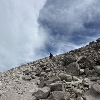

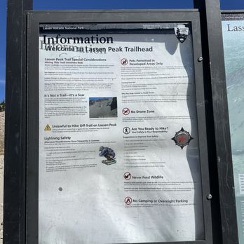

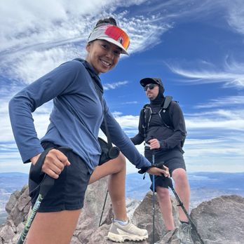


We made a spur of the moment choice to hike up Lassen Peak, which might have been for the best? We had a lot less time to question our choices regarding this strenuous hike, but it was 100% worth it in the end. A five mile roundtrip, strenuous hike, this took us about 5-6 hours to complete - including the time we spent enjoying the view at the peak. And the hike up is definitely steep - about a 2,000ft elevation gain. We just went slow and steady, and it honestly wasn't as bad as I expected it to be. Just enjoy taking in all the surrounding beauty - you get gorgeous views of Lassen National Park from the trail. You'll get to the first summit, and there will be some plaques to read amongst the limited views. BUT, you can keep going a short distance more to reach the true summit. This last bit of trail is definitely unmaintained with more loose gravel, rocks, and a bit of climbing. We even had a bit of snow in this area in July. So definitely be safe if you choose to continue, but we found it so fantastic at the end. We found a place to sit, had a snack, and just took it all in. If you do choose to continue to the true summit, be aware of the rocks and use caution. They are very unstable and should not be used as leverage when climbing up or down. Pack lots of water, bring some food, and don't be afraid to take a lot of breaks. There is no shade, so bring a hat and some sunscreen. Plenty of parking at the trailhead. Probably one of our top 5 difficult hikes, but it was so worth it. Highly recommend. read more


This was the trail we kept on postponing due to mother nature. The trail has always been blocked by snow on previous visits, but finally we did it! It's one of the reasons we keep coming back to Lassen National Park as we needed it to be checked off on the list. The trail was not difficult as it looks. Just remember it's not a race and keep a steady pace. Staring the trail at 7 AM probably made it easier. I honestly think earlier the better. I don't do well with the heat. Trekking poles are recommended as it will save your knees on the way down. The view is spectacular and worth the time. When you reach the top, it doesn't stop there. Make sure you get to the summit. You are close. It's one of those hikes I'm so glad I've completed and would do it again if the opportunity arises. read more


this was the hardest but the most beautiful hike i've ever done. it was rated as 4/4 on the difficulty scale, and i wholeheartedly agree! i was with a group of 4, and from the very start, we were already breathing hard as we scaled upwards towards the peak, and even 1/2 mi from the top, we took many breaks to catch our breath. every time i paused, i took in the view, and noticed how much smaller the cars in the parking lot were getting. there was even snow on the ground that had yet to melt, despite the very warm temps (around 70s when we went). there is the "first peak" which is a bit flatter, great to pause and take pics, have a snack, sip of water, and just rest. then there is the "second peak" what most called the "real peak" which required additional climbing and was not comfortable to sit/rest/pause since all you had were pointy rocks! even so, we definitely sat for a few minutes to rest and have a snack before descending back down. fortunately, it wasn't very crowded when we went (monday, non-holiday) so we never felt rushed or that we were stuck behind another group. it took us 2+ hrs to get to the top, where we rested 20-30 minutes and took pictures, and then about 1.5 hrs to descend down, so roughly 4 hrs total. while the parking lot had restrooms and trash receptacles, there were NO facilities along the trail, no restrooms, no trash receptacles, no water! unfortunately, i had to "go" shortly after reaching the top so i found a semi-private spot and emptied my bladder...sometimes you just gotta do what you gotta do! if you visit lassen nat'l park, this hike is a MUST if you can set aside 3-5 hours. i recommend going earlier in the day when it's cooler, but we were ok going midday b/c the temps dropped the farther up we climbed. the views are absolutely worth the hard work to get to the top. not recommended for those who are unable to be on their feet for 4 hrs straight, very young children, and the elderly. read more


This is quite hard trail. It's like 2.5 miles uphill with an elevation gain of 2000 feet. You might want to carry enough water and something to save you from wind blowing at the top. You also need good hiking shoes as you might encounter snow every now and then. We started hike around 1 pm and were thinking it's quite late to start because of all the sun. But we found it ok. While we were walking downhill, some people were still on their way up. So there is no bad time to start the hike. The views are mesmerizing not only at the top but throughout the hike. You always have a constant Vision of far away lake and hills and nearby lake manzanita. We spent 30-40 mins up top while eating sandwiches and protein bars that we had carried. You can always find a calm spot to sit and meditate (if you like). Once you are back at the base you can head to lake manzanita and relax yourself while swimming in the lake. Manzanita has the warmest water of all the lakes in Lassen forest. read more
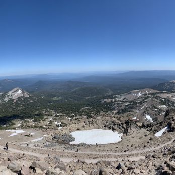


I was a little disappointed with Lassen Peak Trail. I had researched that it's one of the highlight hikes of Lassen Volcanic National Park. Coming from the southwest entrance, the trailhead is located about 10 miles along 30 mile Lassen Parkway that navigates throughout the entire park. The signs can't be missed when driving. Upon arriving here....I knew the trail was a strenuous 5 mile round trip hike climbing 2000 feet or so. Since I only afforded myself 1 day to explore Lassen Park, I concluded that I'd trek a portion of the trail attempting to capture as many photo opportunities in the most time efficient scramble uphill as possible. My biggest issue was the snow on the ground. I guess 2019 had significant snowfall during the winter because when I came to Lassen this past mid July, the trail was quite consumed with melted snow and sludge. Right away, the climb was quick and elevated. I immediately was staring down upon the parking lot and a few of the colored lakes in the surrounding area. My impressions were a little muted. Although climbing just a short ways made for scenic views, the brownish (out of bloom) rugged landscape and terrain didn't make for that quintessential setting I was yearning for. Yeah, the scenery opened up the higher I navigated, but I still couldn't and never did realize that humbling/apex moment where you admire just how hard you hiked - knowing the struggle was all worth it. Continuing on, the elevation and angle at which I was stepping was sincerely difficult.....greatly enhanced by the covering of snow. Roughly, maybe 1 mile into my ascent, I couldn't understand how conquering some of this treacherous trail was possible....especially with the embedded snow covering making the journey quite slippery. Ultimately, I used caution and felt it was best to turn around and head back down. I was slightly discouraged from my experience along Lassen Peak Trail. I believe in the future if I return without all the immense slushy snow covering and with more stable footing, I would much more appreciate discovering what this hike along with the panoramic vistas that accompany it would be all about. read more


Lassen Peak Trail is a fun and challenging 5-mile round-trip hike, but it comes with a lot of warnings. Time/Distance/Difficulty: As stated on the National Park Service website, this trail will take you approximately 3-5 hours in total with a 2,000 ft elevation gain. I took my time, went slow, and stopped at all the information stations, and it took me about 5 hours round-trip. The trail is very rocky towards the very top and quite tricky to navigate (sturdy hiking shoes highly recommended), but if you're careful with your steps and take your time, you'll be able to safely make it up and back down. I did see a handful of young children climb to the top, but they seemed to be somewhat seasoned hikers with loads of energy and excitement. Weather: I went on the first day of July and I was fine hiking in summer clothes because of the warm weather. Don't be fooled by the mild sun; you're a lot closer to the sun at such a high elevation, so sunglasses and sunscreen is highly recommended. There are snow patches that you will have to hike through (poles are helpful), but it doesn't get that much cooler at the top. You'll be so heated up from the hike that you'll find the breeze refreshing. Wildlife: When I went, I saw a few rodents, but the main attraction were the butterflies. The closer I got to the top, the more and more butterflies there were- to the point where you felt like you were in a cloud of butterflies. The good news is that the butterflies are great at flying and they almost never bump into you. Prepare yourself appropriately for this hike, as it is one of the more strenuous ones at Lassen Volcanic National Park. Bring adequate amounts of water and leave space for snacks. The only restrooms available are at the start of the trail in the parking lot, so plan accordingly. read more


9 years ago
This trail is never what it seems. Every time we go it is different. Don't be fooled into thinking that this isn't a challenge. Better to be over prepared and suffer less. There can be considerably high wind gusts even when the base (parking lot) is relatively calm. Although this may only be an hour and 30 minute hike, you can suffer eye damage from sun and wind exposure, minor frostbite, hypoxia and much more. I always encounter many people in tennis shoes, light jacket, no hat, no trekking poles. Those are all standard items for a hike like this. Today my son and I were able to lean into the wind at a 45 degree angle. The gusts were also so strong there were several times we almost lost our footing on a ridge. read more




12 years ago
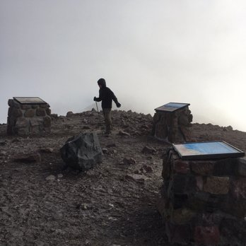
After a lifetime living under this mountain, I finally climbed it. This is a moderately strenous hike from about 8000 feet to 10000 feet over 2.5 miles. It is only up up up to the top. I went in June, so there was some snow to deal with, but conditions change from year to year. It was 45 degrees in the parking lot, maybe 40 at the top, and windy, so plan accordingly. There is very little shade. The trail is nothing but switchbacks, with some sketchy snow patches. A kid as young as maybe 9 would be able to make it up without a ton of complaints, but I saw a 4 year old up there, which isn't very smart. This trail is not inherently dangerous, but conditions change, and you always need to pay attention to what you are doing. read more


More info about Lassen Peak Trail
Mineral, CA 96063
Directions
(530) 595-4480
Call Now
Hours
Outdoor Amenities
Ask the Community - Lassen Peak Trail
Review Highlights - Lassen Peak Trail




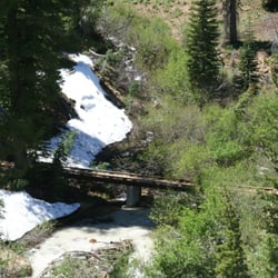


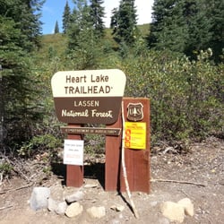


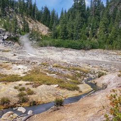


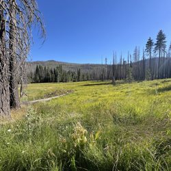







Lassen Peak Trail - hiking - Updated September 2026
Best of Mineral
People found Lassen Peak Trail by searching for…
Trending Searches in Mineral, CA
Browse Articles
Browse Nearby
Browse Brands
Related Searches in Mineral, CA
Affordable Kayak Rental Services in Mineral, California
Affordable Paddle Board Rental in Mineral, California
Best Dog Hiking Trails Around Mineral, California
Best Fishing Locations and Guides in Mineral, California
Best Fun Things to Do in Mineral, California
Best Places for Horseback Riding in Mineral, California
Discover Dog Friendly Trails to Explore in Mineral, California
Discover Scenic Mountain Bike Trails Near Mineral, California
Discover a Hiking Trail in Mineral, California
Discover the Best Beaches in Mineral, California
Discover the Best Night Hike Trails in Mineral, California
Dog-Friendly Hikes With Dogs in Mineral, California
Enjoy Camping Adventures Around Mineral, California
Enjoy Exciting Mountain Biking Adventures in Mineral, California
Enjoy Off Leash Dog Hikes in Mineral, California
Enjoy Tent Camping Spots Around Mineral, California
Enjoy the Best Tubing Experiences in Mineral, California
Experience Stunning Sunset Views in Mineral, California
Explore Beautiful Parks and Green Spaces in Mineral, California
Explore Bike Rentals Throughout Mineral, California
Explore Easy Hikes Perfect for All in Mineral, California
Explore Fun Activities to Do in Mineral, California
Explore Popular Campgrounds Near Mineral, California
Explore Popular RV Parks Around Mineral, California
Explore Scenic Lakes to Visit in Mineral, California
Explore the Best Swimming Holes Around Mineral, California
Family Friendly Hiking With Kids in Mineral, California
Find the Best Playgrounds to Visit in Mineral, California
Find the Best Scenic View Locations in Mineral, California
Find the Best Swimming Pools in Mineral, California Today
Hiking Trails With Waterfalls in Mineral, California
Locate a Public Shower Facility in Mineral, California
Off Leash Dog Hiking Trails in Mineral, California
Popular Fishing Spots to Explore in Mineral, California
Popular Kids Activities in Mineral, California
Popular Places to Take Pictures in Mineral, California
Popular Things to Do in Mineral, California
Relax at Natural Hot Springs Near Mineral, California
Safe River Swimming Areas in Mineral, California
Top Hiking Trails to Explore in Mineral, California
Top RV Campgrounds to Visit in Mineral, California
Top Swimming Lakes to Enjoy in Mineral, California
Top Things to Do With Kids in Mineral, California
Top-Rated Boat Rental Services in Mineral, California
Top-Rated Camping Sites in Mineral, California




