
Butano State Park Photos


You might also consider
More like Butano State Park
Recommended Reviews - Butano State Park
Start your review...

Reviews With Photos

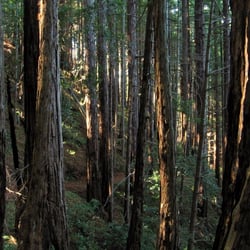
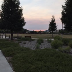
I had never been to this remote state park before the 2020 CZU wildfires which forced the closure of all the campsites and the more extended trails. However, that really shouldn't stop you from coming here because what survived is still quite bucolic and I have to admit I liked the atmospheric Sleepy Hollow vibe of the charred stumps and fallen trees. It lent a mystical feeling to my three-plus-mile hike. It was quite a drive to get here as it's about five miles south of Pescadero off Cloverdale Road. There's a turn-off onto a narrow road that leads to the booth where I dropped off my $10 admission fee in a lockbox. From there, I kept driving further into the woods until I saw there was a space on the shoulder near the barrier. Surrounded by redwoods, it didn't take long to feel like I was in the wilderness. I followed the fire road that climbed up the hillside and followed the Goat Hill and Ano Nuevo Trails which circumvented the largest abandoned campsite. Given the proximity of the Pacific coast and the deep shade of the redwood groves, the hike felt quite cool. I ran into only one couple on the trail and a couple of rangers on the fire road. If you're looking for a peaceful setting with some striking natural images, this be the place. RELATED - Up for a hike? Here's a collection of trails I've walked and reviewed: http://bit.ly/2OrC8nU

With regret, I need to downgrade the rating of Butano, one of my favorite state parks. We stopped by in late September 2022 for lunch and a quick hike, hoping to take the Little Butano Creek Trail, always a lovely walk. I had no idea Butano had had such heavy damage from the 2020 CZU fire - 90% of the trails are closed. See the photo of the park map with the closed trails in red; it was on the entrance station wall. We took a short hike off the picnic area and saw fire damaged trees down to the ground level (I had naïvely thought the fire damage was only in the Hills). The vegetation remains lush and beautiful, so reopened trails are still worthwhile. The campground has been closed since the fire; misleadingly the sign on the gate blocking the campground road says "Closed For The Season". The campground is now only used by reconstruction workers. Butano remains a beautiful quiet oasis, and talking to a ranger, work to reopen trails is steady and ongoing. The entrance fee remains $10 which probably helps pay for reconstruction. But in the meantime the Butano Experience is a shell of its former self.

Visited Butano back in late September. Not a lot to see/hike since many trails remain closed due to fire damage. I talked with the ranger who told me some trails will reopen within months; some will remain closed for 10 years due to the damage. I'm sure Butano was a beautiful place prior to the CZU fire. A lot of forest healing needs to happen...and it takes time.

Great state park which offers camping sites along with tons of hiking acreage, on an edge of the Santa Cruz Mountains near the California Coast. Spent a 3 day trip here and was able to pair good hiking (14 miles in 3 separate hikes) to go with very relaxing camping. I like camping here versus neighboring Memorial Park mostly because it is smaller and offers less sites. When Memorial gets going, it is like a miniature city. Butano simply has less people staying so the serenity factor is more enhanced. The town of Pescadero is also only a 10 minute drive away, so supplies and options are within easy reach. And within another couple of minutes outside of Pescadero, is the California Coastline. So you can go from a heavily forested area to beach and surf within 15 minutes. The hiking here is well organized. The park list the names of the trails along with the mileage and a degree of difficulty. The trails are also well marked so along with a trail map, it is pretty easy to navigate, even in the heavily wooded areas. Goat Hill Trail was one of my favorites to hike as the trail weaved around in an erratic manner on a steep hillside so it was like a roller coaster through redwoods and alder trees. Little Butano Creek Trail hovered above and around the babbling creek which is completely shaded and quite muddy. I saw tons of these orange/brown newts on the trails, so you really have to watch your steps as they are very camouflaged and don't really move out of the way. Lots of cut and fallen trees here also impede the trail, which lead to some sketchy detours. This may have been an easy trail at one point, but the condition that it is in now proved much more difficult. There are some climbing over huge logs only to land on a slippery steep hillside. Not really a relaxing stroll. But all the other hikes I did here were satisfying. So to be able to have all this access to so many varied trails, without having to get into a vehicle, and to always be able to get back to your campsite on foot, was just an experience that I can't let just happen once.

CAMPGROUND We stayed at sites 18 and 19, which were across from each other. There was plenty of room and we were able to fit four tents per site comfortably. Theres a picnic table, bear box, and fire pit at each of the sites. You can fit three or four cars in each area as well. BATHROOMS There were three stalls in the bathroom near our campground and the toilets were fairly clean. The sink, not so much. Soap and paper towels are not provided, so bring your own. TRAILS If you have a dog, you can only bring them on the fire trail. We checked out the fire trail that was closest to the campground, about a five minute walk. Be warned that the fire trail is a very steep hike, bring lots of water! It's pretty nice though, you are surrounded by tall redwood trees looming over you. I also hiked the Little Butano Creek Trail, which is an amazing trail by the way. You should definitely do this one if you get the chance. You can stop and dip your toes in the creek or just admire from the side. WILDLIFE There are lots of mosquitos here and I got bit about ten times. Don't forget the bug spray at home! Besides the mosquitos, there are giant, bright yellow banana slugs all over. Overall, a very nice park and also very close to the beach as well.

Great little state park close to Pescadero! Came for some hiking and ended up being proposed to on a bench under the redwoods on the Jackson Flats trail :) Five stars just for that tbh but besides the sentimental value, it's a bit off the beaten path and most folks head to Big Basin if they are down this way so we had the trails mostly to ourselves when we went on a Friday morning. No rangers on duty so we did the self pay/registration and grabbed a map. Did Jackson Flats Trail Loop but couldn't quite find the Loop and turned around and doubled back. Quiet and some parts of the trail are narrow but well maintained. Lovely redwoods along the way!

You will get lost! the map is not very useful. That is the reason why I am only giving 3 stars. I got the map actually from a couple of hikers as my friend and I were so lost we stopped them to ask if we were on the correct trail. $10 for parking deserves a better map, as you get in other state parks. This was the worst indicated so far, also lack of indications where the trails start and confusing signage all the time. We did not conclude any trail as we were scared of getting lost and being around 4 pm and with so much shade from those huge trees we wanted to play it safe. The bathrooms were not in great shape. Also the worst I have seen in all the state parks nearby so far. Other than that, Butano Park is magical, those trees, shades, shadows, ferns, paths...you will enter a really magical forest! It is the perfect escape for the South Bay people that want to escape those scorching hot summer days. Perfect scenario for romantic pictures or for those true huggers like me who cannot resist to 'enter' inside the huge redwoods!

This was our second camping trip of 2018 and it was another fun one! We slept, ate and hiked under majestic redwoods for a whole weekend in June. Even though it was mid-June and it was cold and it drizzled (not surprising as we were only a couple of miles away from the Pacific Ocean), I loved camping at Butano. The small town of Pescadero was only a few minutes drive away, but being sheltered by redwoods made it feel like a true getaway. I would totally camp here again! My friend Keith booked our campsite 6 months prior, and we were able to squeeze in 7 people and about 5 tents in Site #8. My friend Gary had a huge tent (a 10 x 10 just for himself and his cot!!!), so it was a little tight with additional 2 4-person tents, one 2 person and 1 backpacking tent. We were also able to park 3 cars easily at our site. Our site was directly across the restrooms, so that was convenient. We did a moderate five mile hike (Little Butano Creek and Goat Hill). The entire hike was shaded, so we didn't get too much sun. Make sure to dress in layers. You'll see several redwood groves along this route and lots of ferns. The creek was very low by mid-June but that didn't detract from beauty of the park. It's amazing that we only saw three groups during our entire hike. Such a difference from our last camping trip in Yosemite, when the whole world seemed to be hiking the Mist Trail! You can buy your firewood from the Camp Host at 5 pm. You must store your food in lockers to keep your site "crumb clean" or you will have aggressive Blue Jays visiting your campsite. There are power outlets in the restrooms. My friend Tom was given permission by park rangers to plug in his electric car to the outlet, so he'll have enough charge to get back home. Except for crying children at 6:30 am both Sat and Sun mornings :/, it's a pretty quiet campground. Everyone observed the 10 pm quiet curfew. My friend Tom entertained us (and our immediate neighbors) with his guitar and songs as we sat around the campfire, and thankfully, our neighbors enjoyed it too. They even clapped a couple of times. Oh and before you get settled in the park, you must stop by downtown Pescadero, and get loaves of their warm Artichoke Garlic Herb Bread. You're welcome!

Another hidden gem of the California State Park system! While it's bigger cousin Big Basin Redwoods SP gets a lot of the attention, Butano is less crowded, thus feels more secluded. After getting sustenance in downtown Pescadero, headed over for a hike at Butano. There is a day-use fee of $10 per vehicle, and the fee covers any state park or state beach for the whole day (until sunset when the parks and beaches close). There isn't a whole lot of parking at Butano - there are a handful right next to the kiosk where you pay which is where the visitors center is, and there a few more up the road next to the restrooms and picnic tables. After that there is unpaved parking on the side of the roads where you can find it. There is an unpaved area by the Mill Ox trailhead that can fit a couple of cars. Make sure you get a map of Butano - it'll help a lot when you're hiking on the trails. There are lots of redwoods that provide a lot of shade, which i I love. It's so lush and green here! And there are hardly any people, so it feels like your own private personal forest (for a while anyway, until you run into the occasional hiker). There are lots of banana slugs, so watch where you step! Once you get a little higher in elevation in some of the trails, there's less tree coverage and the trail turns more like sandy gravel and then there are little lizards sunbathing. When you're done hiking and still have some time before the sun sets, make use of the $10 fee you paid and head over to nearby Pescadero State Beach! You can massage your feet in the sand after all that hiking!

One of the best pre birthday gift to me this year was a hike planned by a friend to this park. She and I go to great lengths to seek difficult trails to conquer. Every Friday we hike and it became a ritual. We have exhausted Black Mountain Trail. Even the little side trails were inspected and hiked to death. I was super excited for the day to arrive so I can finally explore Butano. The drive from the South Bay is not bad at all. An hour and a half later of beautiful and scenic drive we arrived. I'm an early bird. By the clock and very happy to report that if you go early the parking lot is empty. As in around 8:30 or 9. Butano boasts of 4,738 acres or 7.388 square miles. It was established in 1957 to protect California's Coast Redwoods. The day pass fee for a private vehicle is $10. Bring cash as you self register at the kiosk by the entrance if you're early. Pen is provided. Dig deep in the box. I wanted a robust start that's uphill. So we started at the Ano Nuevo Trail. The trail head is near the kiosk to the right of it. It is to me the prettiest trail and the most interesting as it continues to climb up. Along the trail you will encounter banana slugs every few steps. Please be careful. They're slow and careless and will be easily stepped on if you're not paying attention. I have yet to see a Newt at this park. Ano Nuevo is a moss covered trail. Lush and just about everywhere moss hangs from the trees. Tree roots adorn the grounds and presses you to keep an open eye and a balanced footing every switchbacks. The first bench midway is a fine place to stop if you feel you need a break. Otherwise proceed to a much better view coming up. If you keep going up you will eventually hit Indian Trail. You will be amazed at this area. Moss hanging from the trees. A trail that looks like it belongs on the beach because it's all white. From here you will continue on to a fire road and can choose to either make a bigger loop or head down the road back to the parking lot. It's not a butt kicking trail as some would think. It's not flat either. Remember though if you don't hike regularly or have been hiking in flat areas the Ano Nuevo Trail will kick your butt. So know your strength and choose your trail head wisely. The map offered at the kiosk does not have the trail mileage. In the end we did a 14 mile hike give or take based on my Fit Bit.

Great weekend getaway place for bay area residents. We really enjoyed the experience at Ben Ries Campground. It is quite and peaceful. We arrived at Friday afternoon around 5pm, set up the tent, and had dinner at the Pescadero town. Then came back to enjoy the campfire. The restroom has flush water toilet, but no shower. It's ok since we only stay one night. The next morning we hiked up along Little Butano Creek Trail and fire road back loop, a little bit over 3 miles. Nice and easy.

Beautiful park! We went camping here for 2 nights, the 2 sites we reserved were very spacious and close to the restrooms. My only issue was the restroom stalls were always wet, it did not stink (surprisingly) so the floor looked muddy all the time. The morning when we were packing to head home, the woman's restroom ran out of tp. Other than this we had a great time hiking through the woods, admiring the redwoods, singing by the fire and making s'mores. I would love to return.

A group of 10 of us went to Butano SP on Sat 8/23/14. From Hayward it's about 1hr something to the park entrance, 50 miles each way. Parking I think is $10, but we had parking pass. Someone at the booth around 9:45am, if nobody is in there they have a box where you need exact amount. We did a 9 mile lollipop hike. From the Parking lot we a trail to Caldelabra Trail and found the slightly famous Candelabra Tree not marked on the park map, at a split in the trail take the Right fork, it's not too far from it. Then we continued on the Gazos Tr - to Doe Ridge Tr - lunch at a Viewpoint with a bench - then do the Little Butano Creek Trail. There's mosquitoes there but didn't get any bites this time. Back to cars. Pit toilets in the other parking lot - stinky, there was toilet paper good thing. We hiked for about 5hrs with lots of stops & pretty slow. There's campgrounds there, didn't check it out. Was full is what I heard. Lots of banana slugs there even in a drought yr, that was nice to see. Be careful not to step on them. From Tom Steinstra, SFGate on Candelabra Tree: http://www.sfgate.com/bayarea/article/Candelabra-Tree-is-hiding-in-plain-sight-3297105.php#photo-2444288

2 years ago
Planned out a day trip including a stop at Pescadero first followed by a hike at Butano State Park. The park itself is quite small and cozy and it's easy to see why it's often referred to as one of the least known California State Parks, because you really do have to make an effort to come here. That being said, the road to the park is quite well paved and there should be no trouble accessing it. We unfortunately visited the park during one of the controlled burns. I would not recommend visiting at those times because the smell of smoke lingers for quite some time even though we visited over a week after the burn ended. There was even one area of the park that was still smoking. It's also sad to see the extensive damage from the CZU fire that ripped through this area back in 2020. But overall there are still tons of beautiful redwoods and the trails are well maintained. Also not many people visit this park so you'll have plenty of peace and quiet on the trails! read more


2 years ago
Butano, as it once was, prior to the summer of 2020, CZU fire, is no more. It's prior lushness is marked by charred redwoods and lack of undergrowth. But that doesn't mean it's not worth a visit. As of December 2024, all trails in the park are open. I commend the crews that restored the trails-they did an amazing job restoring safe access to the park. While camping remains closed, there are limited facilities (no drinking water and only pit toilets that are in sad shape.) However, if you come with an open mind and an appreciation for how forests regenerate after fires, it's quite an interesting park. I'd hiked an out and back last summer on Jackson flats and then, on NYD 2025, hiked the recently reopened loop of Little Butano Creek, Goat Hill Trail and Olemo Fire road. The creek was still low but there were too many banana slugs and mushrooms to count. Yes, lots of charred trees but also lots of green coming back. The lower trails aren't particularly steep or challenging and it's never crowded. Very peaceful park. It will be interesting to come back, over time, to see how the park regenerates and changes. read more


I had never been to this remote state park before the 2020 CZU wildfires which forced the closure of all the campsites and the more extended trails. However, that really shouldn't stop you from coming here because what survived is still quite bucolic and I have to admit I liked the atmospheric Sleepy Hollow vibe of the charred stumps and fallen trees. It lent a mystical feeling to my three-plus-mile hike. It was quite a drive to get here as it's about five miles south of Pescadero off Cloverdale Road. There's a turn-off onto a narrow road that leads to the booth where I dropped off my $10 admission fee in a lockbox. From there, I kept driving further into the woods until I saw there was a space on the shoulder near the barrier. Surrounded by redwoods, it didn't take long to feel like I was in the wilderness. I followed the fire road that climbed up the hillside and followed the Goat Hill and Ano Nuevo Trails which circumvented the largest abandoned campsite. Given the proximity of the Pacific coast and the deep shade of the redwood groves, the hike felt quite cool. I ran into only one couple on the trail and a couple of rangers on the fire road. If you're looking for a peaceful setting with some striking natural images, this be the place. RELATED - Up for a hike? Here's a collection of trails I've walked and reviewed: http://bit.ly/2OrC8nU read more


With regret, I need to downgrade the rating of Butano, one of my favorite state parks. We stopped by in late September 2022 for lunch and a quick hike, hoping to take the Little Butano Creek Trail, always a lovely walk. I had no idea Butano had had such heavy damage from the 2020 CZU fire - 90% of the trails are closed. See the photo of the park map with the closed trails in red; it was on the entrance station wall. We took a short hike off the picnic area and saw fire damaged trees down to the ground level (I had naïvely thought the fire damage was only in the Hills). The vegetation remains lush and beautiful, so reopened trails are still worthwhile. The campground has been closed since the fire; misleadingly the sign on the gate blocking the campground road says "Closed For The Season". The campground is now only used by reconstruction workers. Butano remains a beautiful quiet oasis, and talking to a ranger, work to reopen trails is steady and ongoing. The entrance fee remains $10 which probably helps pay for reconstruction. But in the meantime the Butano Experience is a shell of its former self. read more


Visited Butano back in late September. Not a lot to see/hike since many trails remain closed due to fire damage. I talked with the ranger who told me some trails will reopen within months; some will remain closed for 10 years due to the damage. I'm sure Butano was a beautiful place prior to the CZU fire. A lot of forest healing needs to happen...and it takes time. read more

2 years ago
2 years ago
7 years ago
Great state park which offers camping sites along with tons of hiking acreage, on an edge of the Santa Cruz Mountains near the California Coast. Spent a 3 day trip here and was able to pair good hiking (14 miles in 3 separate hikes) to go with very relaxing camping. I like camping here versus neighboring Memorial Park mostly because it is smaller and offers less sites. When Memorial gets going, it is like a miniature city. Butano simply has less people staying so the serenity factor is more enhanced. The town of Pescadero is also only a 10 minute drive away, so supplies and options are within easy reach. And within another couple of minutes outside of Pescadero, is the California Coastline. So you can go from a heavily forested area to beach and surf within 15 minutes. The hiking here is well organized. The park list the names of the trails along with the mileage and a degree of difficulty. The trails are also well marked so along with a trail map, it is pretty easy to navigate, even in the heavily wooded areas. Goat Hill Trail was one of my favorites to hike as the trail weaved around in an erratic manner on a steep hillside so it was like a roller coaster through redwoods and alder trees. Little Butano Creek Trail hovered above and around the babbling creek which is completely shaded and quite muddy. I saw tons of these orange/brown newts on the trails, so you really have to watch your steps as they are very camouflaged and don't really move out of the way. Lots of cut and fallen trees here also impede the trail, which lead to some sketchy detours. This may have been an easy trail at one point, but the condition that it is in now proved much more difficult. There are some climbing over huge logs only to land on a slippery steep hillside. Not really a relaxing stroll. But all the other hikes I did here were satisfying. So to be able to have all this access to so many varied trails, without having to get into a vehicle, and to always be able to get back to your campsite on foot, was just an experience that I can't let just happen once. read more


CAMPGROUND We stayed at sites 18 and 19, which were across from each other. There was plenty of room and we were able to fit four tents per site comfortably. Theres a picnic table, bear box, and fire pit at each of the sites. You can fit three or four cars in each area as well. BATHROOMS There were three stalls in the bathroom near our campground and the toilets were fairly clean. The sink, not so much. Soap and paper towels are not provided, so bring your own. TRAILS If you have a dog, you can only bring them on the fire trail. We checked out the fire trail that was closest to the campground, about a five minute walk. Be warned that the fire trail is a very steep hike, bring lots of water! It's pretty nice though, you are surrounded by tall redwood trees looming over you. I also hiked the Little Butano Creek Trail, which is an amazing trail by the way. You should definitely do this one if you get the chance. You can stop and dip your toes in the creek or just admire from the side. WILDLIFE There are lots of mosquitos here and I got bit about ten times. Don't forget the bug spray at home! Besides the mosquitos, there are giant, bright yellow banana slugs all over. Overall, a very nice park and also very close to the beach as well. read more


7 years ago
Great little state park close to Pescadero! Came for some hiking and ended up being proposed to on a bench under the redwoods on the Jackson Flats trail :) Five stars just for that tbh but besides the sentimental value, it's a bit off the beaten path and most folks head to Big Basin if they are down this way so we had the trails mostly to ourselves when we went on a Friday morning. No rangers on duty so we did the self pay/registration and grabbed a map. Did Jackson Flats Trail Loop but couldn't quite find the Loop and turned around and doubled back. Quiet and some parts of the trail are narrow but well maintained. Lovely redwoods along the way! read more


 - Parks Near Me - Pescadero, California")
You will get lost! the map is not very useful. That is the reason why I am only giving 3 stars. I got the map actually from a couple of hikers as my friend and I were so lost we stopped them to ask if we were on the correct trail. $10 for parking deserves a better map, as you get in other state parks. This was the worst indicated so far, also lack of indications where the trails start and confusing signage all the time. We did not conclude any trail as we were scared of getting lost and being around 4 pm and with so much shade from those huge trees we wanted to play it safe. The bathrooms were not in great shape. Also the worst I have seen in all the state parks nearby so far. Other than that, Butano Park is magical, those trees, shades, shadows, ferns, paths...you will enter a really magical forest! It is the perfect escape for the South Bay people that want to escape those scorching hot summer days. Perfect scenario for romantic pictures or for those true huggers like me who cannot resist to 'enter' inside the huge redwoods! read more


This was our second camping trip of 2018 and it was another fun one! We slept, ate and hiked under majestic redwoods for a whole weekend in June. Even though it was mid-June and it was cold and it drizzled (not surprising as we were only a couple of miles away from the Pacific Ocean), I loved camping at Butano. The small town of Pescadero was only a few minutes drive away, but being sheltered by redwoods made it feel like a true getaway. I would totally camp here again! My friend Keith booked our campsite 6 months prior, and we were able to squeeze in 7 people and about 5 tents in Site #8. My friend Gary had a huge tent (a 10 x 10 just for himself and his cot!!!), so it was a little tight with additional 2 4-person tents, one 2 person and 1 backpacking tent. We were also able to park 3 cars easily at our site. Our site was directly across the restrooms, so that was convenient. We did a moderate five mile hike (Little Butano Creek and Goat Hill). The entire hike was shaded, so we didn't get too much sun. Make sure to dress in layers. You'll see several redwood groves along this route and lots of ferns. The creek was very low by mid-June but that didn't detract from beauty of the park. It's amazing that we only saw three groups during our entire hike. Such a difference from our last camping trip in Yosemite, when the whole world seemed to be hiking the Mist Trail! You can buy your firewood from the Camp Host at 5 pm. You must store your food in lockers to keep your site "crumb clean" or you will have aggressive Blue Jays visiting your campsite. There are power outlets in the restrooms. My friend Tom was given permission by park rangers to plug in his electric car to the outlet, so he'll have enough charge to get back home. Except for crying children at 6:30 am both Sat and Sun mornings :/, it's a pretty quiet campground. Everyone observed the 10 pm quiet curfew. My friend Tom entertained us (and our immediate neighbors) with his guitar and songs as we sat around the campfire, and thankfully, our neighbors enjoyed it too. They even clapped a couple of times. Oh and before you get settled in the park, you must stop by downtown Pescadero, and get loaves of their warm Artichoke Garlic Herb Bread. You're welcome! read more


 - Parks Near Me - Pescadero, California")


Another hidden gem of the California State Park system! While it's bigger cousin Big Basin Redwoods SP gets a lot of the attention, Butano is less crowded, thus feels more secluded. After getting sustenance in downtown Pescadero, headed over for a hike at Butano. There is a day-use fee of $10 per vehicle, and the fee covers any state park or state beach for the whole day (until sunset when the parks and beaches close). There isn't a whole lot of parking at Butano - there are a handful right next to the kiosk where you pay which is where the visitors center is, and there a few more up the road next to the restrooms and picnic tables. After that there is unpaved parking on the side of the roads where you can find it. There is an unpaved area by the Mill Ox trailhead that can fit a couple of cars. Make sure you get a map of Butano - it'll help a lot when you're hiking on the trails. There are lots of redwoods that provide a lot of shade, which i I love. It's so lush and green here! And there are hardly any people, so it feels like your own private personal forest (for a while anyway, until you run into the occasional hiker). There are lots of banana slugs, so watch where you step! Once you get a little higher in elevation in some of the trails, there's less tree coverage and the trail turns more like sandy gravel and then there are little lizards sunbathing. When you're done hiking and still have some time before the sun sets, make use of the $10 fee you paid and head over to nearby Pescadero State Beach! You can massage your feet in the sand after all that hiking! read more


One of the best pre birthday gift to me this year was a hike planned by a friend to this park. She and I go to great lengths to seek difficult trails to conquer. Every Friday we hike and it became a ritual. We have exhausted Black Mountain Trail. Even the little side trails were inspected and hiked to death. I was super excited for the day to arrive so I can finally explore Butano. The drive from the South Bay is not bad at all. An hour and a half later of beautiful and scenic drive we arrived. I'm an early bird. By the clock and very happy to report that if you go early the parking lot is empty. As in around 8:30 or 9. Butano boasts of 4,738 acres or 7.388 square miles. It was established in 1957 to protect California's Coast Redwoods. The day pass fee for a private vehicle is $10. Bring cash as you self register at the kiosk by the entrance if you're early. Pen is provided. Dig deep in the box. I wanted a robust start that's uphill. So we started at the Ano Nuevo Trail. The trail head is near the kiosk to the right of it. It is to me the prettiest trail and the most interesting as it continues to climb up. Along the trail you will encounter banana slugs every few steps. Please be careful. They're slow and careless and will be easily stepped on if you're not paying attention. I have yet to see a Newt at this park. Ano Nuevo is a moss covered trail. Lush and just about everywhere moss hangs from the trees. Tree roots adorn the grounds and presses you to keep an open eye and a balanced footing every switchbacks. The first bench midway is a fine place to stop if you feel you need a break. Otherwise proceed to a much better view coming up. If you keep going up you will eventually hit Indian Trail. You will be amazed at this area. Moss hanging from the trees. A trail that looks like it belongs on the beach because it's all white. From here you will continue on to a fire road and can choose to either make a bigger loop or head down the road back to the parking lot. It's not a butt kicking trail as some would think. It's not flat either. Remember though if you don't hike regularly or have been hiking in flat areas the Ano Nuevo Trail will kick your butt. So know your strength and choose your trail head wisely. The map offered at the kiosk does not have the trail mileage. In the end we did a 14 mile hike give or take based on my Fit Bit. read more


7 years ago
Great weekend getaway place for bay area residents. We really enjoyed the experience at Ben Ries Campground. It is quite and peaceful. We arrived at Friday afternoon around 5pm, set up the tent, and had dinner at the Pescadero town. Then came back to enjoy the campfire. The restroom has flush water toilet, but no shower. It's ok since we only stay one night. The next morning we hiked up along Little Butano Creek Trail and fire road back loop, a little bit over 3 miles. Nice and easy. read more


Beautiful park! We went camping here for 2 nights, the 2 sites we reserved were very spacious and close to the restrooms. My only issue was the restroom stalls were always wet, it did not stink (surprisingly) so the floor looked muddy all the time. The morning when we were packing to head home, the woman's restroom ran out of tp. Other than this we had a great time hiking through the woods, admiring the redwoods, singing by the fire and making s'mores. I would love to return. read more


A group of 10 of us went to Butano SP on Sat 8/23/14. From Hayward it's about 1hr something to the park entrance, 50 miles each way. Parking I think is $10, but we had parking pass. Someone at the booth around 9:45am, if nobody is in there they have a box where you need exact amount. We did a 9 mile lollipop hike. From the Parking lot we a trail to Caldelabra Trail and found the slightly famous Candelabra Tree not marked on the park map, at a split in the trail take the Right fork, it's not too far from it. Then we continued on the Gazos Tr - to Doe Ridge Tr - lunch at a Viewpoint with a bench - then do the Little Butano Creek Trail. There's mosquitoes there but didn't get any bites this time. Back to cars. Pit toilets in the other parking lot - stinky, there was toilet paper good thing. We hiked for about 5hrs with lots of stops & pretty slow. There's campgrounds there, didn't check it out. Was full is what I heard. Lots of banana slugs there even in a drought yr, that was nice to see. Be careful not to step on them. From Tom Steinstra, SFGate on Candelabra Tree: http://www.sfgate.com/bayarea/article/Candelabra-Tree-is-hiding-in-plain-sight-3297105.php#photo-2444288 read more


4 years ago
We went to Butano State Park last Sunday to escape the hellishly hot (over 100 degree) weather in Milpitas and also get a good workout in the meanwhile. We got to the park around 1:30pm, paid the $10 day use parking fee and parked near the Mix Ox Tail before the Ben Reis Campground. We then hiked the Little Butano Creek Trail which looped past the Ben Reis Campground. We did around 4miles per my FitBit since we got lost a bit along the way. The hike itself was about 95% shaded and was fairly easy. Nor too much climbing had to be done however I did make the mistake of wearing running shoes instead of hiking shoes so I did fear for my life here and there when I lost my balance. In terms of views, there is not much to see on this trail in particular. Mostly just tall towering redwoods which are a beauty in and of themselves, a baby creek, some banana slugs, as well Ben Reis Campground. If you are a newb looking for a relatively easy shaded hike here's one for ya. :) read more


My first thoughts as we cruised down Gazos Creek drive toward Butano State Park was..."This is gonna be great!" I was so right. (as usual) Upon entering the park, we confronted several Signs that prominently displayed -SLOW - NEWT CROSSING-. At first I thought it must be a joke, but sure enough, there were indeed newts all over the place. And banana slugs. Seriously. A slug-fest if I ever saw one. (see photos) The park itself is a surprisingly lush canopy of redwoods, fir trees, and coastal mountain chapparal (again, see photos). There is an extensive network of trails, and they take you through all of the varied terrain that the park offers...you can even backpack in to a remote site about 5 miles in if you're feeling adventurous! Our ranger, Michael Graham, was like a woodsy Jekyll and Hyde. On the one hand, he was really accommodating as I called repeatedly as our group size fluctuated. He kindly showed us our options when we arrived, changed our schedule, and hey, he even stopped in the middle of the road to get out of his truck and remove a newt from the drive. Now that's what I call good ranger-ing! But lo'! Dr. Jekyll side could only show for so long. Soon after our campmates arrived, the nasty came out. He must have thought we were all rowdy college kids bent on making trouble and keeping the entire campground up til the wee hours of the night. As Erica S. mentioned, he came back and quasi-chastised us numerous times making sure we understood for the umpteenth time that quiet hours began at 10. I guess they must have some serious problems with party-ers at Butano, but I assure you we didn't break the rules. INSIDER TIP(s): Drive-in campsites are right on top of each other. It can get kind of crowded and claustrophobic. Except for site 16. Grab that if you can. The walk-in campsites are MUCH nicer...with more space, and seclusion from other campers. The walk is really just a 200 ft descent down a light slope to the sites. So don't worry about having to lug your stuff far. It's totally worth it. read more


Butano is one of the tougher parks to get to from the bay area cities, with the main entrance on the western side, just a few miles in from the coast Hwy (Rte 1). So the best way to visit here for day hiking is to make the most of the short road trip, with stops along the way; whether it be grabbing some garlic-artichoke bread and coffee in the nearby town of Pescadero; or getting a burger and a beer in Half Moon Bay (or Santa Cruz). Or you could camp here for a night or two (April-Nov). I have yet to do so, but I've heard great things about it. The campground typically fills up in the summer, but there is also a set of backpacking campsites for the more adventurous. The park itself can be summed up as follows: a shaded, cool canyon floor filled with medium-sized redwoods, with upland slopes mixed in pine, manzanita and chaparral. A fire road encircles the entire park at the canyon ridgeline, offering views for miles; most of that trail is quite exposed. A few small sections of old growth forest are scattered through the park. It's a great place for seclusion, especially in the winter months. Our group of hikers traveled 14 miles over the course of about 5 hours, and we saw only four other people the entire time. I was amazed at the emptiness. Here's a loop trail that will take you to almost every corner of the park: From the visitor center, take the Jackson flats Trail uphill to the Butano Fire Rd.; this trail then follows the ridgeline all the way to the back of the park, through some sections of old growth forest, where it intersects with the Olmo Fire Rd. Take this road down to the Doe Ridge Trail (perhaps the prettiest trail in the park), then turn right on Goathill trail, turn right again on the dirt road, where it will lead you to the Little Butano Creek trail. This trail will lead you back through the shaded valley bottom to the main road and eventually your vehicle. A very satisfying 12 miles. Remember that Big Basin State Park, one of the most popular hiking & camping spots in Northern CA, starts at the next ridgeline south of here. So enjoy the comparative peace and quiet that Butano has to offer. Hiking Spot Checklist: -- Parking: One small paved lot at entrance; one large one 100 yds further in -- Bathrooms: 2 pit toilets at the large parking lot -- Potable water: No -- Maps provided: Yes, at entrance -- Highlights: Solitude; some old growth redwood sections; shaded streamside walks My Peninsula Hike Collection is here: (https://www.yelp.com/collection/qBI6U6Lz9LJQjnGjFW6ubg) read more


14 years ago
Butano State Park is one of those spots that flies completely under the radar. It is northern California camping in a lush redwood grove with year round streams. It is in the small town of Pescadero, just south of Half Moon Bay and just north of Santa Cruz. We spent three days here and found it to be even better than we hoped for. Showing up to Butano during a heat wave, we were unsure what to expect. Upon arrival we were greeted by a ranger at the kiosk. She gave us the rundown and answered all of our questions. We were given a map, and she told us that the rangers will always have firewood for sale if needed. This was very convenient and the price is reasonable. Remember that I mentioned a heat wave? Well, the high temperature was a non issue here. You literally drive a mile into the shaded redwood canopy to get to your campsite. Miraculously, you are about 20 degrees cooler inside than it is outside of the trees protection. It turns a crappy hot, sweaty day into a day that you can actually enjoy and do some redwood exploring. Our campsite was bare bones, but still adequate. We got a camping space that was generous in size. We saw tents from our neighbors in the distance, but they are not all up on you. You get a nice wooden picnic table that seats 8 or so. A large bear box for food storage that could house two or three small children if needed. You also get a nice industrial sized fire ring with a grill on it as well. You will be a stones throw away from your car, in case you gotta go into town or need some supplies. Oh yeah, the communal toilet is an outhouse like the one from "Slumdog Millionaire." Nothing fancy here, but it's enough. There is no store for supplies in BSP, so you should stop prior to your arrival for water, snacks, food, and bug spray. If you are too lazy to bring or cook your own food, just eat all your meals at Duarte's or the Taqueria de Amigos, both are great options and less than 10 minutes from Butano SP. Another option is to drive into Santa Cruz for food. The vibe here is cool. We saw a good mix of young families, hard core hikers, and even some seniors were getting their nature on. We explored the park every day. There are trails all over the place. We liked the "Little Butano" trail and found streams, banana slugs, wild mushrooms, newts, ferns, and everything covered in green moss. The trails smell good here. Can't explain it, but a combo of all the plants and streams make it smell earthy. Cell phone service is not available here, unless you peak one of their mountains and get higher than the redwoods. The best thing to do is to let people know you are going into the forest and will be inaccessible. So when you arrive, turn your phone off, and focus on the things that really matter. Butano State Park is the best place I can think of to camp with your family. We can't wait to get back. read more


12 years ago
10 years ago
This park is beautiful. I have camped here twice. The park rangers have never bothered us even after seeing our dogs off leash the whole time. The best camping sites I would say are 1, 5, 9, 14, 15 and 16. They are the most private and farthest from the road. I stsyed at site 10 and it's right across from the bathrooms and super close to the road so it kinda sucked. Although it's pretty tough to get a reservation for any of these sites for the weekend, especially during summer months. There are plenty of beautiful hiking trails. Dogs are only allowed on fire roads which I found were still great. Bean Hallow Beach is a dog friendly beach about 15 minutes away. Make your way out to Pescadero Road and take a left. You will come to the beach rather quickly. The beach has tide pools. And the most important thing is to bring enough alcohol so you don't run out! lol. There are a couple stores in Pescadero about 10 minutes away but they only sell beer and wine. I need my Jack! read more


12 years ago
Came here camping for the weekend.. First off the place is gorgeous, clean, and dog friendly! A nice place to camp if your wanting to relax, I'd say definitely not a party place more family oriented.. Word of advice bring your own wood they charge like $9 a bundle which is a rip off! read more


11 years ago
Butano State Park is not only my favorite in the immediate Bay Area but also the closest to my home, making an overnight camping trip doable and spontaneous! I spent the first few times camping in the walk-in area until I tried car camping in the other loop. Both are wonderful, quiet, clean, and I've luckily picked spots with few (or any) neighbors. Plus, they are dog-friendly in the campground and on fire trails with the beautiful Bean Hollow beach (also dog-friendly) just down the road. I've yet to enjoy their longer loop trails but their shorter trails along the creek are excellent and perfect for kids! Birds, bunnies, banana slugs - Butano State Park is great for a Bay Area weekend camping trip. read more

Wow, based on previous experience, I wasn't expecting to see so many useful Yelp reviews on a relatively unknown little park. Maybe it's the fact that this is a full-blown State Park with camping spots. At any rate, I just came here for a day hike. I did the same 5.5 mile loop that Margot B describes, and while the Ano Nuevo trail offers some fleeting views of the coastal hills, the highlight is surely the Little Butano Creek trail which runs through redwoods along the canyon floor (very reminiscent, IMO, to Fall Creek State Park over by Felton). Based on the barren, windswept scenery on the drive in, I really wasn't expecting to find such an impressive redwood forest tucked in here. So if you're a fan of Henry Cowell, Big Basin, and Portola Redwoods, make sure to add Butano to your list. And I agree that the proximity to the beach and the little town of Pescadero (home of Duarte's) are a definite plus if you're thinking about camping here. read more


8 years ago
Absolutely love this place. We camped here for the first time in early August. The park is like a fairy forest, complete with a trickling creek, magical ferns, bright yellow banana slugs and towering redwoods. There are only about 40 campsites, so even though it was full the entire time we were there, we never felt crowded. The sites are pretty large, and even when they're not large there's a bit of space between them so you feel as if you have a buffer. We stayed at the walk-in sites, which was nice because there was no traffic at all. It's a bit of a walk to get things back and forth from the car, but it was worth it. There is a bathroom with flush toilets in the middle of the campground, and there was a pit toilet nearest us. We knew in advance this would be the case so we weren't surprised or disappointed. Yes, the pit toilet was really stinky and there are no showers. The bathroom with flush toilets was fine. Nothing fancy but clean enough. It's camping, not glamping. We stayed in #31, which was large enough for our two tents although not totally flat. We had neighbors to left and right, and the toilet was close, but not so close that we could smell it. I would stay away from #29 and #30, as they're behind the toilet and I really noticed the smell back there. Aside from that, I don't think you can go wrong with the walk-in sites. Pay attention to the size of the lot, as I noticed some were significantly smaller than others. Campsite #1 looks like the supreme drive-in spot. We might try that one next time. The trees are so dense that it always feels like dusk under the canopy. I was craving cool weather so I thought I'd be fine with that, but I have to admit I was looking forward to the sun after 4 days. The quaint village of Pescadero is a nice diversion. The little market is always bustling and we had a nice meal at the tavern. We didn't make it to the nearby goat cheese farm, but we did pick some cheese up at the market and it was fabulous. We did a couple of hikes in the park that were lovely--very few people, and utterly picturesque. Overall, an awesome stay. If you're interested in truly disconnecting from civilization, I highly recommend this park. read more

I'm probably not going to say anything different than other Yelpers, but I have to add this campground is gorgeous! All the sites, including ours (#19), were very spacious and surrounded by towering redwoods. I fully expected to be swarmed by mosquitoes but there hardly any! The only animals we saw during our 4 day stay were banana slugs and noisy jays/ravens. There are no showers, but thankfully the toilets are flush, not vault. If you forget anything, the tiny town of Pescadero is less than 15 minutes away. And the beaches are just a bit further than that. If you're looking for a good hike, Goat Hill to Ano Nuevo to Six Bridges will give you a workout. Ano Nuevo has a steep down section, but its not too bad for seasoned hikers. read more

9 years ago
7 years ago
7 years ago
7 years ago
Page 1 of 3
More info about Butano State Park
1500 Cloverdale Rd
Pescadero, CA 94060
Directions
(650) 879-2040
Call Now
Visit Website
http://www.parks.ca.gov/?page_id=536
Hours
Indoor Amenities
Outdoor Amenities
From the Business
Ask the Community - Butano State Park
Is this park for RV's as well as tents?
Some sites are suitable for small RVs and one I know would accommodate a longer RV (across from site 11 at the bend in the road). No hook-ups that I'm aware of.
Review Highlights - Butano State Park
You might also consider


Why does Yelp recommend reviews?
Butano State Park - parks - Updated July 2026
Best of Pescadero
People found Butano State Park by searching for…
Waterfall Hike in Pescadero, CA
Scenic Drives in Pescadero, CA
Redwood Trees in Pescadero, CA
Dog Friendly Hiking Trails in Pescadero, CA
National Parks in Pescadero, CA
Abandoned Places in Pescadero, CA
Dog Friendly Beaches in Pescadero, CA
Hiking Trails in Pescadero, CA
Park With BBQ Pits in Pescadero, CA
Secluded Beaches in Pescadero, CA
Camping Sites in Pescadero, CA
Places to Walk Around in Pescadero, CA
Park & Forests in Pescadero, CA
Public Plazas in Pescadero, CA
Free Things to Do With Kids in Pescadero, CA
Trending Searches in Pescadero, CA
Blueberry Picking near Butano State Park
Boardwalk near Butano State Park
Boat Tours near Butano State Park
Cliff Jumping near Butano State Park
Cruising Spots near Butano State Park
Day Trips near Butano State Park
Dog Friendly Beaches near Butano State Park
Dog Friendly Trails near Butano State Park
Jet Ski Rental near Butano State Park
Kayak Rental near Butano State Park
Kids Activities Indoor near Butano State Park
Kids Activities Outdoor near Butano State Park
Off Road Trails near Butano State Park
Outdoor Activities near Butano State Park
Outdoor Basketball Courts near Butano State Park
Peach Picking near Butano State Park
Picnic Spots near Butano State Park
Places To Walk Around near Butano State Park
Public Beaches near Butano State Park
Public Shower near Butano State Park
Rainy Day Activities near Butano State Park
River Swimming near Butano State Park
Rock Quarry near Butano State Park
Scenic Night View near Butano State Park
Scenic Overlook near Butano State Park
Soccer Store near Butano State Park
Splash Pad near Butano State Park
Sunrise View near Butano State Park
Swimming Holes near Butano State Park
Swimming Lakes near Butano State Park
Things To Do With Kids near Butano State Park
U Pick Farms near Butano State Park
Watch Sunset near Butano State Park
Water Parks near Butano State Park
Browse Nearby
BEST of Pescadero, California Restaurants near Butano State Park
BEST of Pescadero, California Coffee near Butano State Park
BEST of Pescadero, California Things to Do near Butano State Park
BEST of Pescadero, California Lunch near Butano State Park
BEST of Pescadero, California Beaches near Butano State Park
BEST of Pescadero, California Campgrounds near Butano State Park
BEST of Pescadero, California Wineries near Butano State Park
Browse Brands
Related Searches in Pescadero, CA
Affordable Kayak Rental Services in Pescadero, California
Best Dog Hiking Trails Around Pescadero, California
Best Fishing Locations and Guides in Pescadero, California
Best Nature Trails for Hiking in Pescadero, California
Best Off Leash Dog Parks in Pescadero, California
Best Parks for Parties and Events in Pescadero, California
Best Places for Horseback Riding in Pescadero, California
Best Sightseeing Experiences Available in Pescadero, California
Best Water Parks for Kids in Pescadero, California
Check Out Great Playgrounds in Pescadero, California
Check Out Off Road Trails in Pescadero, California
Discover Baseball Fields Around Pescadero, California
Discover Dog Friendly Trails to Explore in Pescadero, California
Discover Easy Hiking Trails Near Pescadero, California
Discover Fun Toddler Parks in Pescadero, California for Your Little One
Discover Kid Friendly Hiking Trails in Pescadero, California
Discover Lakes & Ponds to Explore in Pescadero, California
Discover Popular Bike Trails in Pescadero, California
Discover Soccer Fields in Pescadero, California Near You
Discover Top Nature Parks to Visit in Pescadero, California
Discover Top State Parks to Visit in Pescadero, California
Discover Walking Parks in Pescadero, California Near You
Discover a Hiking Trail in Pescadero, California
Discover the Best Beaches in Pescadero, California
Discover the Best Kids Park Spots in Pescadero, California
Discover the Best Night Hike Trails in Pescadero, California
Dog-Friendly Hikes With Dogs in Pescadero, California
Enjoy Camping Adventures Around Pescadero, California
Enjoy Kayaking Adventures in Pescadero, California
Enjoy Off Leash Dog Hikes in Pescadero, California
Enjoy Scenic Places to Walk in Pescadero, California
Enjoy Tent Camping Spots Around Pescadero, California
Enjoy a Beautiful Waterfall Hike in Pescadero, California
Enjoy the Best Picnic Spots and Ideas in Pescadero, California
Enjoy the Best Walking Path in Pescadero, California
Enjoy the Best Walking Trails in Pescadero, California
Explore Easy Hikes Perfect for All in Pescadero, California
Explore Free Picnic Areas Around Pescadero, California
Explore Fun Activities to Do in Pescadero, California
Explore Parks With Pull Up Bars in Pescadero, California
Explore Picnic Parks Near Pescadero, California
Explore Popular Campgrounds Near Pescadero, California
Explore Popular Dog Walking Trails in Pescadero, California
Explore Popular Kids Parks Throughout Pescadero, California
Explore Popular Picnic Areas Around Pescadero, California
Explore Popular RV Parks Around Pescadero, California
Explore Popular State Park Destinations in Pescadero, California
Explore Scenic Lakes to Visit in Pescadero, California
Browse Articles
People who viewed Butano State Park also viewed
El Corte de Madera Creek Preserve
78 reviews
Big Basin Redwoods State Park
667 reviews
Rancho Cañada del Oro Open Space Preserve
20 reviews
Phleger Estate
5 reviews
Cowell-Purisima Coastal Trail
26 reviews
Sam McDonald Park
25 reviews
Coal Mine Ridge Nature Preserve
15 reviews
Thornewood Preserve
30 reviews
Henry Cowell Redwoods State Park
647 reviews
Berry Creek Falls
8 reviews