Rancho Cañada del Oro Open Space Preserve Photos


You might also consider


More like Rancho Cañada del Oro Open Space Preserve
Recommended Reviews - Rancho Cañada del Oro Open Space Preserve
Start your review...


Reviews With Photos


We did Mayfair Ranch Trail today, a 3.1 mile (one way )up down trails . There were no super blooms but we saw some wildflowers here and there. The hills were super green after the rain. Saw about 20 hikers , 2 riding horses on trail. We didn't do the loop continuing to Longwall Canyon Trail due to creek crossings. We didn't want to take our hiking boots off and walk in the swift water. The main parking was full so we parked in the overflow parking. A restroom at the main parking lot. A few areas of the trail was muddy.


Fantastic views, a nice wide trail, a mix of sun and shade, and good traffic management make this park a great getaway on a weekday morning during shelter-in-place. The trail systems have been divided into one-way and two-way trails, which greatly minimizes the chances of running into people when the park is not busy. Throughout the morning earlier this week, the main lot did not completely fill up. Over the course of an 8 mile hike, we ran into only about 10 people in total, a mix of hikers and bikers. There is also a shorter loop available, which is about half the length. There are great views in all directions from the ridges on this trail, including both the mountains to the west and the hills to the east, as well as a reservoir. At this time of year, in late May, the hills have all turned golden but there are still wildflowers here and there along the trail.
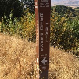

A hiking trail in the middle of nowhere - but the Rancho Canada del Oro trails connect to Calero County Park. But since it's in the middle of nowhere it's less crowded/not many people know of it. Characteristic of most south Bay hiking trails, the trails here are hot and dry. Bonus of cow paddies lining the trail and some cows grazing on the dry grass. I've run on the Bald Peaks trail (moderate - lots of inclines) but one could make a giant loop around Rancho Canada, through Calero and come back around if you wanted a long, challenging hike. Overall, a quiet, untouched gem tucked away in the back roads of Morgan Hill/south Bay.
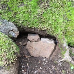

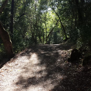
We came back on Thanksgiving Sunday for long 4.1m hikes (750 feet climb). We started from Serpentine Loop trail near the parking lot) which is rather flat and wide in the first 0.5 miles. Continue towards Longwall Canyon Trail which does get slight incline and not very steep. The initial 1.5 miles is great for kids and plenty of deers, wild turkey and California newts when it rain. The trail will eventually meet to a junction and keep left to continue to Mayfair Ranch Trail. The initial part of Mayfair Ranch Trail is very steep and slippery when wet. There are limited network coverage doing the trail anti-clockwise but less strenuous. When you reached the top, there will be a picnic bench for a good rest and fuel up with snacks. Animal you might see: - Deer - Wild turkeys - Birds (lots of them) - California newts (when it rain) After the rest at the picnic bench, it is mostly downhill back to the car park. My favorite route is the anti-clockwise since you start flat and then slow climb but it is long climb so you need to have good endurance. The downhill is fast and quick 30 minutes. Make sure you stop to enjoy the scenery and appreciate nature especially the Manzanita trees. Rancho Cañada Del Oro Open Space Preserve is 5 stars because parking is free and not crowded even on weekend. The trail is well maintain and lots of things to see and explore. There are cellphone coverage on Mayfair trail when you are the top of the hill and plenty of caches for geo-caching. We will be back in early Spring to see the flowers. Thansk Open Space Preserve.
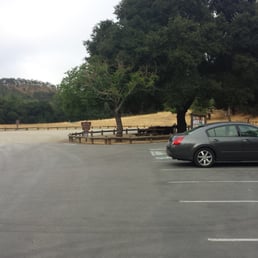

There are two main trail paths starting from the parking lot: The shorter trail loop (4.3m): Mayfair Ranch Trail (3.1m) loop to part of Longwall Canyon Trail (1.2m) The longer trail loop (9.5m): Mayfair Ranch Trail (3.1m) loop part of Longwall Canyon Trail (2 m), loop to Bald Peaks Trail (1m), loop to Catamount Trail (1.7m), back to the other part of Longwall Canyon Trail (0.7m) I was going to do the longer loop, but my feet was hurting really bad about 2.5 mils in, so I end out taking the shorter route back. The parking was empty when I arrived in the morning, but it was half full 2 hour later. There is a bathroom in the parking lot, no water on the trail. No dogs in the park. Very beautiful open space preserve, trails are well maintained and paved, views are wonderful.


Ranch Out Opened in 2004, this ±5.7k-acre Preserve sits in the oak-covered foothills nestled at the base of the Santa Cruz Mountains. It's a short ±30-minute drive from Silicon Valley, but you'll feel like you're miles away from civilization, which is a really good thing these days. The Good: * Free to visit * Multiple parking lots with horse trailer parking available * Restroom in the main lot * Twelve miles of trails throughout the preserve (5.5 miles of which are designated as part of The Bay Area Ridge Trail) * If you're looking for a nice loop, there's a semi-moderate 4.5-mile loop available: Mayfair Ranch Trail to Longwall Canyon Trail to Baldy Ryan Creek Trail. * Horseback riding on certain trails (see map) * Biking allowed on certain trails (see map) The Meh: * No dogs allowed * Trails for the most part were in pretty decent shape, but there were a few areas where they need some TLC. The Ugly: * Much like the EBRPD, they use cows to try and control the non-native grasses, but there were no cows during our visit. :( Conclusion: Great place to escape from civilization and commune with Mother Earth. read more


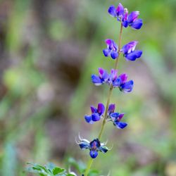
Sat 4/17/21 hiked at Rancho Cañada del Oro OSP after already doing 4mi at Coyote Ridge OSP. Parking at the first lot was full, so had to park in the Overflow Lot that's further away. Went over the fence to get to the paved Llagas Creek Loop 0.6 miles, lots of lupines! Then did the Mayfield Ranch to Longwall Canyon, lots of climbing that's moderate. I felt really tired near the end because it got temperate Hot and I hate hiking in hot weather! There was a bunch of wildflowers and saw turkeys and 1 snake! Overall, good day for a Spring hike. read more

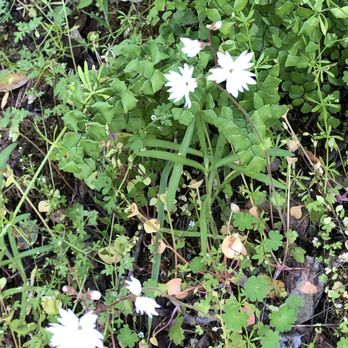

Such a nice hike with plenty of wild flowers, social distancing, and beautiful views. Made for a great hike somewhere outside the city. We arrived to an employee who gave us directions and recommended trails. Overall, such a great escape. Also beware there is some trump compound on the drive in (about 3 min before you arrive). 10 points to whoever sets that guys trump flag on fire and pisses on the ashes. read more


We did Mayfair Ranch Trail today, a 3.1 mile (one way )up down trails . There were no super blooms but we saw some wildflowers here and there. The hills were super green after the rain. Saw about 20 hikers , 2 riding horses on trail. We didn't do the loop continuing to Longwall Canyon Trail due to creek crossings. We didn't want to take our hiking boots off and walk in the swift water. The main parking was full so we parked in the overflow parking. A restroom at the main parking lot. A few areas of the trail was muddy. read more


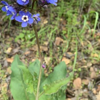


Fantastic views, a nice wide trail, a mix of sun and shade, and good traffic management make this park a great getaway on a weekday morning during shelter-in-place. The trail systems have been divided into one-way and two-way trails, which greatly minimizes the chances of running into people when the park is not busy. Throughout the morning earlier this week, the main lot did not completely fill up. Over the course of an 8 mile hike, we ran into only about 10 people in total, a mix of hikers and bikers. There is also a shorter loop available, which is about half the length. There are great views in all directions from the ridges on this trail, including both the mountains to the west and the hills to the east, as well as a reservoir. At this time of year, in late May, the hills have all turned golden but there are still wildflowers here and there along the trail. read more


9 years ago
A hiking trail in the middle of nowhere - but the Rancho Canada del Oro trails connect to Calero County Park. But since it's in the middle of nowhere it's less crowded/not many people know of it. Characteristic of most south Bay hiking trails, the trails here are hot and dry. Bonus of cow paddies lining the trail and some cows grazing on the dry grass. I've run on the Bald Peaks trail (moderate - lots of inclines) but one could make a giant loop around Rancho Canada, through Calero and come back around if you wanted a long, challenging hike. Overall, a quiet, untouched gem tucked away in the back roads of Morgan Hill/south Bay. read more
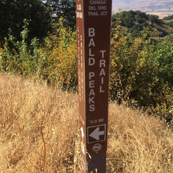
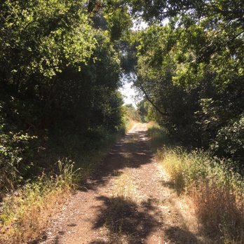


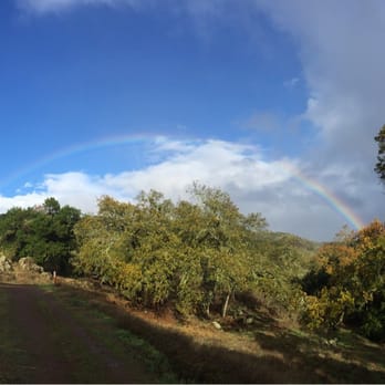
We came back on Thanksgiving Sunday for long 4.1m hikes (750 feet climb). We started from Serpentine Loop trail near the parking lot) which is rather flat and wide in the first 0.5 miles. Continue towards Longwall Canyon Trail which does get slight incline and not very steep. The initial 1.5 miles is great for kids and plenty of deers, wild turkey and California newts when it rain. The trail will eventually meet to a junction and keep left to continue to Mayfair Ranch Trail. The initial part of Mayfair Ranch Trail is very steep and slippery when wet. There are limited network coverage doing the trail anti-clockwise but less strenuous. When you reached the top, there will be a picnic bench for a good rest and fuel up with snacks. Animal you might see: - Deer - Wild turkeys - Birds (lots of them) - California newts (when it rain) After the rest at the picnic bench, it is mostly downhill back to the car park. My favorite route is the anti-clockwise since you start flat and then slow climb but it is long climb so you need to have good endurance. The downhill is fast and quick 30 minutes. Make sure you stop to enjoy the scenery and appreciate nature especially the Manzanita trees. Rancho Cañada Del Oro Open Space Preserve is 5 stars because parking is free and not crowded even on weekend. The trail is well maintain and lots of things to see and explore. There are cellphone coverage on Mayfair trail when you are the top of the hill and plenty of caches for geo-caching. We will be back in early Spring to see the flowers. Thansk Open Space Preserve. read more





10 years ago
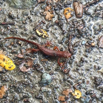
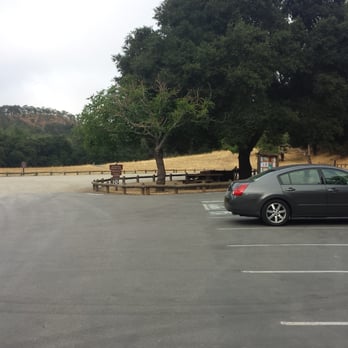
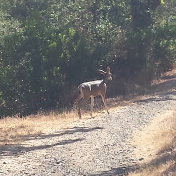
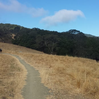
There are two main trail paths starting from the parking lot: The shorter trail loop (4.3m): Mayfair Ranch Trail (3.1m) loop to part of Longwall Canyon Trail (1.2m) The longer trail loop (9.5m): Mayfair Ranch Trail (3.1m) loop part of Longwall Canyon Trail (2 m), loop to Bald Peaks Trail (1m), loop to Catamount Trail (1.7m), back to the other part of Longwall Canyon Trail (0.7m) I was going to do the longer loop, but my feet was hurting really bad about 2.5 mils in, so I end out taking the shorter route back. The parking was empty when I arrived in the morning, but it was half full 2 hour later. There is a bathroom in the parking lot, no water on the trail. No dogs in the park. Very beautiful open space preserve, trails are well maintained and paved, views are wonderful. read more





11 years ago
This is not a park to go to if you don't like to climb hills, but the trails are well groomed and critters abound. I've seen bobcat, deer, foxes and coyote, eagles, owls and plenty of scavengers like crows and turkey vultures too. At this time of year it is bursting with wildflowers and it's not too hot either. Usually I am riding horseback and there are few mountain bikes and some hikers. On one of the main trails you climb up the ridge and can see sweeping vistas all around. Then you pass through a couple of cattle gates and you're in the canyon. This is a lovely, lovely place. If hills aren't your thing there are some lower trails where you will see plenty of wildlife too, just not the views like at the top of Baldy Peak. Oh, and did I mention this park is FREE? Yep, and they do night sky observations some evenings. Very cool. read more


18 years ago


9 years ago

15 years ago

10 years ago
13 years ago
17 years ago
More info about Rancho Cañada del Oro Open Space Preserve
4289 Casa Loma Rd
Morgan Hill, CA 95037
Directions
(408) 224-7476
Call Now
Visit Website
https://www.openspaceauthority.org/visitors/preserves/rancho.html
Hours
Indoor Amenities
Outdoor Amenities
Other Amenities
From the Business
Rancho Cañada del Oro Open Space Preserve Reviews in Other Languages
Ask the Community - Rancho Cañada del Oro Open Space Preserve
Review Highlights - Rancho Cañada del Oro Open Space Preserve
You might also consider




















Why does Yelp recommend reviews?


Rancho Cañada del Oro Open Space Preserve - parks - Updated August 2026
Best of Morgan Hill
People found Rancho Cañada del Oro Open Space Preserve by searching for…
Waterfall Hike in Morgan Hill, CA
Star Gazing in Morgan Hill, CA
Scenic Night View in Morgan Hill, CA
Meteor Shower in Morgan Hill, CA
Dinosaur Park in Morgan Hill, CA
Beautiful Views in Morgan Hill, CA
Hiking Trails in Morgan Hill, CA
Places to Take Pictures in Morgan Hill, CA
Scenic Overlook in Morgan Hill, CA
Walking Trails in Morgan Hill, CA
Picnic Areas in Morgan Hill, CA
Water Parks in Morgan Hill, CA
Scenic Drive in Morgan Hill, CA
Off Road Trails in Morgan Hill, CA
Photo Spots in Morgan Hill, CA
Wildflowers in Morgan Hill, CA
Fishing Spots in Morgan Hill, CA
Free Parking in Morgan Hill, CA
Playgrounds in Morgan Hill, CA
Scenic Places to Walk in Morgan Hill, CA
Trending Searches in Morgan Hill, CA
Baseball Card Shop near Rancho Cañada del Oro Open Space Preserve
Blueberry Picking near Rancho Cañada del Oro Open Space Preserve
Cinema near Rancho Cañada del Oro Open Space Preserve
Cliff Jumping near Rancho Cañada del Oro Open Space Preserve
Dog Friendly Beaches near Rancho Cañada del Oro Open Space Preserve
Fishing Spots near Rancho Cañada del Oro Open Space Preserve
Flower Fields near Rancho Cañada del Oro Open Space Preserve
Fun Things To Do With Kids near Rancho Cañada del Oro Open Space Preserve
Indoor Dog Park near Rancho Cañada del Oro Open Space Preserve
Kids Haircut near Rancho Cañada del Oro Open Space Preserve
Lakes near Rancho Cañada del Oro Open Space Preserve
Movie Theatre near Rancho Cañada del Oro Open Space Preserve
Peach Picking near Rancho Cañada del Oro Open Space Preserve
Picnic Areas near Rancho Cañada del Oro Open Space Preserve
Playgrounds near Rancho Cañada del Oro Open Space Preserve
Public Beaches near Rancho Cañada del Oro Open Space Preserve
Public Running Track near Rancho Cañada del Oro Open Space Preserve
Scenic Drive near Rancho Cañada del Oro Open Space Preserve
Shopping Malls near Rancho Cañada del Oro Open Space Preserve
Souvenir Shops near Rancho Cañada del Oro Open Space Preserve
Sports Card Shops near Rancho Cañada del Oro Open Space Preserve
Sunrise View near Rancho Cañada del Oro Open Space Preserve
Swimming Holes near Rancho Cañada del Oro Open Space Preserve
Things To Do On A Rainy Day near Rancho Cañada del Oro Open Space Preserve
Trading Card Shops near Rancho Cañada del Oro Open Space Preserve
Uniforms near Rancho Cañada del Oro Open Space Preserve
Used Book Stores near Rancho Cañada del Oro Open Space Preserve
Browse Articles
Browse Nearby
BEST of Morgan Hill, California Restaurants near Rancho Cañada del Oro Open Space Preserve
BEST of Morgan Hill, California Coffee near Rancho Cañada del Oro Open Space Preserve
BEST of Morgan Hill, California Breakfast near Rancho Cañada del Oro Open Space Preserve
BEST of Morgan Hill, California Wineries near Rancho Cañada del Oro Open Space Preserve
Browse Brands
Related Searches in Morgan Hill, CA
Best Off Leash Dog Parks in Morgan Hill, California
Best Parks for Parties and Events in Morgan Hill, California
Best Water Parks for Kids in Morgan Hill, California
Check Out Great Playgrounds in Morgan Hill, California
Discover Baseball Fields Around Morgan Hill, California
Discover Fun Toddler Parks in Morgan Hill, California for Your Little One
Discover Popular Bike Trails in Morgan Hill, California
Discover Popular Photo Spots in Morgan Hill, California
Discover Soccer Fields in Morgan Hill, California Near You
Discover Top Nature Parks to Visit in Morgan Hill, California
Discover Top State Parks to Visit in Morgan Hill, California
Discover Walking Parks in Morgan Hill, California Near You
Discover the Best Beaches in Morgan Hill, California
Discover the Best Kids Park Spots in Morgan Hill, California
Enjoy Scenic Places to Walk in Morgan Hill, California
Enjoy the Best Picnic Spots and Ideas in Morgan Hill, California
Enjoy the Best Walking Trails in Morgan Hill, California
Explore Free Picnic Areas Around Morgan Hill, California
Explore Fun Activities to Do in Morgan Hill, California
Explore Parks With Pull Up Bars in Morgan Hill, California
Explore Picnic Parks Near Morgan Hill, California
Explore Popular Campgrounds Near Morgan Hill, California
Explore Popular Kids Parks Throughout Morgan Hill, California
Explore Popular Picnic Areas Around Morgan Hill, California
Explore Popular RV Parks Around Morgan Hill, California
Explore Scenic Lakes to Visit in Morgan Hill, California
Explore Top Dog Parks in Morgan Hill, California Near You
Explore Top Water Parks in Morgan Hill, California Today
Find Great Places to Feed Ducks in Morgan Hill, California
Find Parks and Recreation Activities in Morgan Hill, California
Find Top Dog Friendly Parks to Visit in Morgan Hill, California
Find Top Skate Parks in Morgan Hill, California for All Skill Levels
Find a Kids Birthday Party Park in Morgan Hill, California
Find a Park With BBQ Pits in Morgan Hill, California
Find the Best Parks BBQ Grills in Morgan Hill, California
Find the Best Parks for Picnics in Morgan Hill, California
Find the Best Playgrounds to Visit in Morgan Hill, California
Have Fun at a Splash Pad in Morgan Hill, California
Locate Tennis Courts Around Morgan Hill, California
Picnic Areas With BBQ Pits Available in Morgan Hill, California
Play at a Splash Pad Park in Morgan Hill, California
Popular Picnic Spots to Visit in Morgan Hill, California
Relax in Parks With Shade Areas in Morgan Hill, California
Safe and Fun Parks for Kids in Morgan Hill, California
Top Hiking Trails to Explore in Morgan Hill, California
Top Playgrounds for Kids to Enjoy in Morgan Hill, California
Top Running Trails to Explore in Morgan Hill, California
Top-Rated Camping Sites in Morgan Hill, California


