Cancel

    Open app

    Search

    Cabezon Peak

    5.0 (1 review)

    Cabezon Peak Photos

    You might also consider

    Recommended Reviews - Cabezon Peak

    Your trust is our priority, so businesses can't pay to alter or remove their reviews. Learn more about reviews.
    Yelp app icon
    Browse more easily on the app
    Review Feed Illustration

    16 years ago

    Helpful 0
    Thanks 0
    Love this 0
    Oh no 0

    Verify this business for free

    Get access to customer & competitor insights.

    Verify this business

    San Antonio Hot Springs

    San Antonio Hot Springs

    4.6(16 reviews)
    34.5 mi

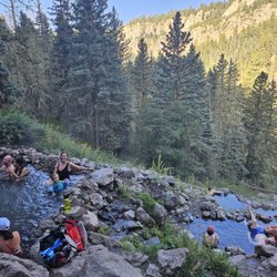
    Read below before going!…read more 1. Make sure your car can travel through the terrain. We took our minivan (thankfully it was a dry week) and made it through. It was a bit rocky. 2. Load the trail on your phone on All Trails (download it) because the service is rough. 3. Bring your towel and water shoes, the rocks can be rocky when going from pool to pool. 4. The earlier the better in the summer. And apparently it can get busy. (It did for us) 5. Everyone is friendly, make sure you're friendly too! Seriously one of the coolest things in nature. My kids loved it, we could have spent hours here. If I didn't have a train to catch (literally) we would have been here longer.

    Relaxing 5 mile hike, although with a 4 x 4 vehicle that has decent clearance, you can drive about…read more4ish miles and hike the rest. Even in November the water was perfect, like a nice hot bath *not scorching* and with plenty of steam to compliment the light chill in the air. We went on an "off peak time", a monday morning which meant little traffic and that was exactly what we were hoping for. Beeeeautiful scenery, relaxing pools, tall trees and a mountain breeze....que mas queres?? This was an exceptional day, my batteries are officially recharged. Is it possible that you might come across some old naked dudes smokin a doob and sippin a brew in the hot springs? I suppose it's possible. But we didn't come across any. I bet if you went on a weekend you'd run across a lot more hikers and have less of a private experience.

    Photos
    San Antonio Hot Springs
    San Antonio Hot Springs
    San Antonio Hot Springs

    See all

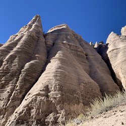
    Kasha-Katuwe Tent Rocks National Monument - Pretty slot canyon

    Kasha-Katuwe Tent Rocks National Monument

    4.7(179 reviews)
    42.5 mi

    Visiting is a little more complicated than some other parks/monuments, but if you just read the…read morewebsite you'll get it figured out! The key is that reservations are required, both from the NPS and from the Cochiti Pueblo. Get the NPS reservation first, and only then get the Cochiti Pueblo one (link to that is on the NPS site!). Don't drive to the trailhead, drive to the Cochiti Pueblo visitor center first, check in there, then follow the guide car (runs pretty much continuously all day) to the NPS entrance. The trailhead has multiple pit toilets, all of which were well maintained. The hike through the slot canyon and up onto the ridge is absolutely stunning. There really aren't words to do justice, nor do the pictures really convey things either. The hike into and through the slot canyon isn't steep, although there are some pretty big steps required to clamber over some rocks here and there, and it can be narrow and is often sandy. There's not a lot of elevation change though until you get through the slot canyon, then you just switchback straight up a couple hundred feet onto the ridge. That section isn't terribly long though, and the views from the top are well worth it. The first third of the hike and the last third are pretty exposed to the sun, so make sure you apply that sunscreen and bring plenty of water!

    Incredible. Reservation was easy. Gov Rec Ticket and Cochiti Tribal Pass, so two tickets. Worth…read moreevery penny. We got our tickets about 5 days out from visit. Check in at Visitor Center on arrival to check off your name on the list. Visitor centre has good restrooms, snacks and a few gifts and some very pleasant staff. Next Line up behind the white pilot vehicle and he will guide you in for a few miles where they will check your pass. After that its another few miles to a small carpark with restrooms and then off your go. We did slot canyon. Half a mile walk through amazing scenery/narrow passages through the stone and some climbing over rocks. I found it quite easy but do go before the sun comes out. We started at 9.30 am. After this section, which took us about 40 minutes due to lots of photo ops you will see another sign saying 1 mile to overlook. We almost gave up as the first climb looked hard - its not, just go on. We are in our 60's with dicky knees and it was not issue, just use your bottom when you have to. A light pair of garden gloves would be handy for when your hands scrape the boulders. All practical stuff here, the views speak for themselves. it's stunning and because of the limited access you meet few people along the way. As always with State Parks, check the website for any passes required or closures.

    Photos
    Kasha-Katuwe Tent Rocks National Monument - Kind of a tight squeeze at times along the trail

    Kind of a tight squeeze at times along the trail

    Kasha-Katuwe Tent Rocks National Monument - The first .5 mile

    The first .5 mile

    Kasha-Katuwe Tent Rocks National Monument

    See all

    TWA Plane Crash Hiking Trail - One of the two places where you will probably lose the trail.  This is looking down the trail, but coming up stay left.

    TWA Plane Crash Hiking Trail

    4.8(5 reviews)
    47.1 mi•Eastside

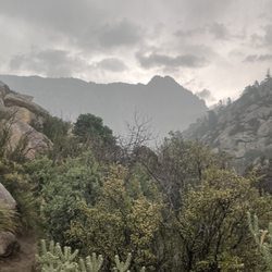
    Water, water, water! Bring at least 3 litters of water. You will not have any left over. It is a…read moretrue kickass hike! The last time I did it I was scrambling up a steep rock face, and there was a gentleman waiting for me at the top of the rock face who encouraged me by saying, "you are almost at the crash site!" When I told him that I knew because I had been there before, he responded in amazement and asked, "why the heck did you come back?!" Yep, for many, it is that kind of hike! I believe it is rated at 4.8 out of 5 in difficulty, and by the time you finish the last half mile or so you will probably agree. Download a topographic trail (i.e. AllTrails) map on your phone, and you might need to bring an extra power source, because your phone may drain down searching for a cell signal while you lay down electronic breadcrumbs on the digital map. However, there are two places where it is almost guaranteed that you will miss a turn, and add some "bonus" miles. You definitely don't need "bonus " miles on this hike. You pass through at least 2-3 biomes as you ascend and descend. It's an interesting hike, but be prepared to give yourself a pep talk or two along the way Up. Also, expect your legs to be shaky by the bottom. Decending is a lot of eccentric contractions, which only fire about half the muscle fibers as concentric contractions. You can fact check that yourself. This is a hike to build up to. Remember - the best rescue is a self rescue! Have fun, be smart, and be safe.

    First off the address is not correct. The trail is Trail #230 Domingo Baco. This is a hard trail…read more We made it past the crash site but then lost the trail we made it to the top but I do not think we were on the trail at that point. A storm was brewing so we opted to turn around. We ended up with just under 6 miles one way and roughly 3k feet of elevation. The storm popped over the mountain quickly so we were glad we were on our way down when the bottom fell out and the hail started. I was shocked that so much of the plane was still there. It was a very eerie site to see especially for someone who flys often. Great trail, very physical but not impossible as I am 56 and made it. Beautiful trail with a lot of variety. The size of the trees up there shocked me. Oh yes and beware of the briars at the top. Didn't pay attention as I was struggling to climb up a decent rock face and at the top break over point I grabbed and they grab back. Again I think at this point I was off the trail.

    Photos
    TWA Plane Crash Hiking Trail - Almost there

    Almost there

    TWA Plane Crash Hiking Trail
    TWA Plane Crash Hiking Trail - A small sample of the debris

    See all

    A small sample of the debris

    Paseo del Bosque Trail - Cottonwood trees

    Paseo del Bosque Trail

    4.6(30 reviews)
    44.4 mi•Barelas/South Valley

    I pulled into the Alameda Open Space parking area. I pulled my bike out, got geared up, started my…read moreapps and began the ride. I rode about 11 miles out, then I turned around and came back. The trail had a dotted center line and a reminder of the courtesies to use while on the trail. The path I took was not shaded. I would say about a 1/4 of the path had rough bumps, and many of them were painted to highlight them. It was a decent path, but I didn't feel like there was much in the way of sight seeing.

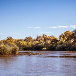
    I took my wife and our dog for a walk along the Paseo del Bosque Trail, and it was exactly the…read morereset we needed. We went in late November, when the cottonwoods are still glowing gold, and the whole riverside felt like it was an autumn paradise. The trail is flat and easy, with long stretches that let you really settle into the scenery-Rio Grande on one side, trees and little side ponds on the other. Our dog loved it. There's plenty of room to keep a dog on leash without feeling crowded, and enough side paths and textures (sand, dirt, leaves) to keep him interested. We saw ducks and geese cruising on the water, along with a woodpecker working a cottonwood trunk. It also turned into a really sweet date. There are quiet spots to stop, sit by the water, and just watch the birds and the current go by. It never felt unsafe or overly busy, just a steady trickle of walkers, cyclists, and other people out enjoying the trail. If you're visiting Albuquerque-or you just moved here and want to fall in love with the area a little bit-Paseo del Bosque is an easy yes.

    Photos
    Paseo del Bosque Trail - Pond

    Pond

    Paseo del Bosque Trail - Rio Grande

    Rio Grande

    Paseo del Bosque Trail - Pond

    See all

    Pond

    Atalaya Trail

    Atalaya Trail

    4.7(15 reviews)
    70.9 mi

    Atalaya Trail is a very serviceable and enjoyable trail.  It's just the right length for an…read moreafternoon (or morning) hike, and it offers just enough elevation gain that you won't be bored by the level of endeavor required.  That said, apart from the views you'll be rewarded with when you're here, there's not a whole lot else of interest to see during your visit. Tip: This is a popular destination for both hikers and cyclists; both of the aforementioned need to keep their eyes peeled for their opposite numbers; hikers especially need to exercise caution to avoid being hit by oblivious cyclists. I've been here several times recently, and very much enjoy myself each time.  I've found that the views (especially from the top) are very rewarding.  Because it's very easily accessible from all over the area, the trail can sometimes get very crowded; it's best to visit either in the early morning or at off-peak hours to optimize avoid the crowds. The trail winds through the Cruz Blanca neighborhood before rapidly ascending up the side of Atalaya Mountain; it eventually reaches a height of just over nine thousand feet.  While the final stretch is quite gravelly and steep, the views from the top are totally worth it!

    Part of the Dale Ball trail system, that include the Dorothy Stewart and Wilderness Trailheads. The…read moreparking lot near after entry for St John's college is the largest and furthest away. Drive up Camino Cruz Blanca and save yourself the 1.5 walk along the road past $1MM homes to these other trailheads. As with everything Dale Ball creates, this is a superbly marked trail system that allows the hiker to plan and tailor their experience. I made a bee-line to the summit of Mt. Picacho. Beautiful vista, but I'll need to return for a sunset and very carefully make my way down the steeper parts of a darkening trail.

    Photos
    Atalaya Trail
    Atalaya Trail
    Atalaya Trail

    See all

    Cabezon Peak - hiking - Updated September 2026

    Loading...
    Loading...
    Loading...