Cancel

    Open app

    Search

    Las Conchas Trailhead

    5.0 (1 review)

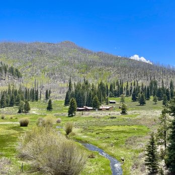
    Las Conchas Trailhead Photos

    You might also consider

    Recommended Reviews - Las Conchas Trailhead

    Your trust is our priority, so businesses can't pay to alter or remove their reviews. Learn more about reviews.
    Yelp app icon
    Browse more easily on the app
    Review Feed Illustration
    Photo of Tanja N.
    12
    391
    4016

    3 years ago

    Helpful 0
    Thanks 0
    Love this 0
    Oh no 0

    Verify this business for free

    Get access to customer & competitor insights.

    Verify this business

    San Antonio Hot Springs

    San Antonio Hot Springs

    4.6(16 reviews)
    10.6 mi

    Read below before going!…read more 1. Make sure your car can travel through the terrain. We took our minivan (thankfully it was a dry week) and made it through. It was a bit rocky. 2. Load the trail on your phone on All Trails (download it) because the service is rough. 3. Bring your towel and water shoes, the rocks can be rocky when going from pool to pool. 4. The earlier the better in the summer. And apparently it can get busy. (It did for us) 5. Everyone is friendly, make sure you're friendly too! Seriously one of the coolest things in nature. My kids loved it, we could have spent hours here. If I didn't have a train to catch (literally) we would have been here longer.

    Relaxing 5 mile hike, although with a 4 x 4 vehicle that has decent clearance, you can drive about…read more4ish miles and hike the rest. Even in November the water was perfect, like a nice hot bath *not scorching* and with plenty of steam to compliment the light chill in the air. We went on an "off peak time", a monday morning which meant little traffic and that was exactly what we were hoping for. Beeeeautiful scenery, relaxing pools, tall trees and a mountain breeze....que mas queres?? This was an exceptional day, my batteries are officially recharged. Is it possible that you might come across some old naked dudes smokin a doob and sippin a brew in the hot springs? I suppose it's possible. But we didn't come across any. I bet if you went on a weekend you'd run across a lot more hikers and have less of a private experience.

    Photos
    San Antonio Hot Springs
    San Antonio Hot Springs
    San Antonio Hot Springs

    See all

    Frijoles Creek

    Frijoles Creek

    5.0(1 review)
    14.2 mi

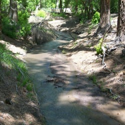
    Frijoles Creek flows right through the Bandalier National Monument. It is a gentle waterway here as…read moreit passes under foot bridges and along creeks dotted with river rock. But that was not always the case as the gigantic 2011 Las Conchas wildfire burned through the monument's watershed. According to a story in the Albuquerque Journal newspaper, " the fire left thousands of acres charred and denuded, and cleared the way for huge floods through Frijoles Canyon in 2011 and again in 2013 that threatened key features of the (Bandalier) monument and the visitors center." Yes, little Frijoles Creek (El Rito de los Frijoles, Spanish for "the little river of beans,") turned into a mighty raging river of water.The floods here washed out Frijoles Rim Trail and the bottom part of the Falls Trail down to the Rio Grande. The Bandelier website says the "Frijoles Canyon Trail between Alcove House and the Upper Crossing "is basically a streambed hike at this point - passable but challenging in places due to erosion, rockfalls, fallen trees, log jams, flood debris, dense vegetation and numerous stream crossings," said the Journal newspaper at the time. Frijoles Creek generally flows at 10 cubic feet per second or less. But in September 2013, it was rushing along at 9,000 cfs, park rangers say. That's a lot of water moving around. Frijoles Creek was so powerfully flooded that 300-year old trees came toppling down along it's banks. But this Creek is so important because it is one of the few places in the plateau region where water flows year-round This reliable source of water must have been very important to the Native Peoples who utilized the H20 for drinking and cooking. Animals and wildlife would have been attracted to the area to drink at the stream. A wide range of plant life would have flourished along the stream. The Creek I saw at Bandalier in May 2015 was a peaceful stream of cold river water. The water is so cold because it flows down from the melted snow up in the mountains above the plateau. The Creek has waterfalls. Both Upper Frijoles Falls and Lower Frijoles Falls feed the Creek stream. But these waterfalls are not really the main attraction, as not much water flows over them. However, the hike up to see the Falls and the beautiful rocks around them are fantastic. I have to give Frijoles Creek 5 YELP STARS for it's unusual name and the fact that this hardy watershed has recently survived both a raging wildfire and torrential flooding. It's consistent flow of water enabled the Ancestral Pueblo people to survive and flourish in this sometimes arid and harsh climate.

    Photos
    Frijoles Creek - Wooden footbridge over Frijoles Creek.

    Wooden footbridge over Frijoles Creek.

    Frijoles Creek
    Frijoles Creek - Many pebbles in the stream.

    See all

    Many pebbles in the stream.

    Bandelier National Monument - Bandelier National Monument

    Bandelier National Monument

    4.8(223 reviews)
    15.0 mi

    This is a very well taken care of trail that is very easy for people to see quite up close. You…read morecould possibly have a stroller or wheelchair here and still see a lot. There are seats all throughout the routes. The first third of the trail isn't as shaded but the entire last portion is quite shaded. There's also a bathroom available about 2/3rds of the way to alcove house. The history is amazing. Glad we are preserving this place and sharing it with the public.

    One of my favorite national parks that I have ever been to and hiked! STUNNING. I love that you can…read morehike up the ladders on one of the hikes here. That hike definitely is not for the faint of heart and pushed my limits at the top (you are high and it seems scary) but it is one of my most memorable hikes all around for the scenery and unique experience. A must visit! For those who don't to do the ladder hike, you can still walk to the bottom of it and look up and get a good view. So there is something for all levels here. The scenery is gorgeous. It does get windy here sometimes (we had a lot of wind blasting us as we were climbing the ladders) so be careful and be prepared for that. The nature all around is beautiful. Additionally, there are some tables so you could bring a picnic. Staff in the visitor center is very friendly and has lots of great recommendations of what to do here or nearby. A must do! This was the highlight of my trip to this area and I can't recommend it enough :)

    Photos
    Bandelier National Monument - Bandelier National Monument

    Bandelier National Monument

    Bandelier National Monument - Bandelier National Monument

    Bandelier National Monument

    Bandelier National Monument - Bandelier National Monument

    See all

    Bandelier National Monument

    Las Conchas Trailhead - hiking - Updated September 2026

    Loading...
    Loading...
    Loading...