Cassidy Arch Photos


You might also consider

More like Cassidy Arch
Recommended Reviews - Cassidy Arch
Start your review...


Reviews With Photos
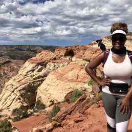

Unbelievable views with an unbelievably satisfying hike to match. The hike to and from Cassidy Arch is roughly a "short" 4 miles long, but don't let the length of this hike fool you. You will definitely get ALL of the feels in that bawdy of yours. An excellent workout indeed. I would rate it as a moderate to moderately difficult hike. To reach the parking lot, you'll have to drive passed the Visitor's Center along the scenic drive road. The park charges a toll to drive down this road, but it's paid by the honor system (putting cash into an envelope, sealing it, and placing it on your dashboard). If you have a park pass, you can display this on your dashboard instead. The drive to the Cassidy Arch turnoff isn't too long, and it passes by many campgrounds, recreational areas, and other hiking trails. Once you turn onto the Cassidy Arch turnoff, be ready to drive slowly down a rocky, unpaved road. The road is maybe 2 miles long, but narrow and rough which it'll make it feel a lot longer. You'll dead end into a parking lot. If the lot is full, you can park on the side of the unpaved road. There are restrooms near the entrance of this trail. I actually started this hike a lot later than I wanted to (around 10:15 am). The lot was already full at this time and it was already warming up. I would without a doubt recommend that you start as early as possible or later on in the day because the afternoon heat is no joke at ALL. Luckily there was some overcast during my hike, but this hike is basically completely exposed. The trail starts off on a flat path that meanders through beautiful rock formations. You'll see a sign for the Cassidy Arch Trail on your left, and this is where the elevation will start to hit you. You'll gain about 400 feet of elevation in about a half mile. Basically tons of rocky inclines and switchbacks right out of the gate. But with each incline comes an insanely beautiful view. Once you reach the end of the switchbacks, you'll have an open view of the canyon and you'll also get to see a glimpse of Cassidy Arch from a distance. At this point, it's mainly gradual up and downs until you reach the Arch. What makes this hike more difficult is the sun that'll be beaming on you and the higher elevation. Definitely make sure that you bring more water than you think that you'll need, and don't be afraid to take breaks. There's virtually no shade at all, but the picturesque views more than make up for that in my opinion. You'll know that you're getting closer to the Arch when the path starts to smooth out and you're basically scaling up and down rocks. There are several cairns in place to make sure that you won't lose your way. I honestly might have ended up somewhere else if I hadn't followed those cairns. They are super helpful. Also, there are a few gnarly sections on the trail that may have you questioning if you should continue. Well, there were for me at least. When the surface changes from dirt to smooth rock, it's also really close to the edge with sections of steep drop-offs. Scary if you're looking down while you're crossing, but nothing too hard. Probably not the best for someone who has a fear of heights though. You should also possess some kind of upper body strength because you'll have to climb up and down a few large boulders. One you make it to the Arch, it'll look and feel surreal. The views are seriously breathtaking. You can actually stand right on top of the Arch. Again, it's kind of scary getting there but totally doable. Have one of your friends or someone else who's there take your picture from the other side. Just don't get too close to the edge of course. You can really get some killer photo action on that Arch. People tend to chill out there for a moment and take a break. I'd suggest bringing a lunch and eating it there if you can. There weren't too many people there since it was so hot. However, the people that were there were friendly and kept their distance. It took me about an hour and 15 minutes to reach the Arch. I actually ended up chilling there for an hour (turned into the social little butterfly that I am). Can't recall exactly how long it took me to get back, but I'd say no more than an hour (much easier going down versus up for me). Honestly, this was one of the most enjoyable National Park hikes that I've done despite the heat. The views of Cassidy Arch and the surrounding canyon really made it all worth while. Capital Reef is such a gorgeous and highly underrated National Park. I'd come back just to do this hike again. Would definitely recommend this hike for the scenery and workout.
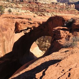

Cassidy Arch (Capitol Reef National Park, Utah) There are two ways to view Cassidy Arch. One way is .4-mile walk from Grand Wash Road. From there, you can see the arch from a distance. The other way is to hike to it. We assumed that we would get a better view of the arch by hiking to it and hike we did. He started at the parking lot, hiked about .2 miles on the Grand Wash Trail, and another 1.5 miles to the arch. The map has this hike listed as strenuous. I consider this hike moderate, but dangerous. Sections of the trail is on the edge of a canyon. Just be prepared, have enough hydration, a good pair of sturdy shoes (prefer hike boots with good grip), and keep in mind that the elevation gain is about 1,000 feet with no shade on the trail. Most of the trail is easy to follow until the last 1/4 mile or so. There are no signs or markings. We relied on cairns and eventually arrived at the arch. The Cassidy Arch is an amazing natural arch and currently sturdy enough to walk on top of it (I do not recommend it). Although, we were literally as close as you can get to the Cassidy Arch, I didn't feel like the view of the arch itself was that great. Based on photos, the view may be better from the Grand Wash Road. Or, maybe it's the fact that didn't want to slip, trip, or fall while trying to get a close look of the arch. Believe me, It's a long way down. The hike was still rewarding and offered great views of the canyons around. Getting to the trailhead... Getting to the trailhead is straight-forward but not. From the visitor's center, drive down Scenic Drive and take a left on Grand Wash Road. Continue on the dirt road until you reach the parking lot. I recommend that you get here early because the parking lot fills quickly. You can also park on the dirt road. Just keep in mind that you will be adding more steps to your hike. Fun!


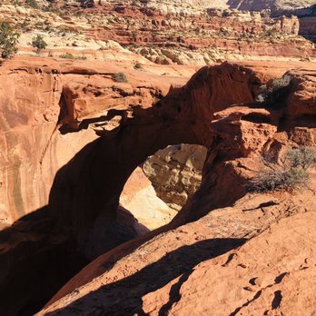
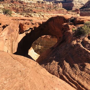
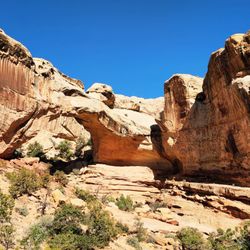
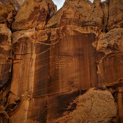
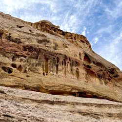
What a wonderful little trail in Capitol Reef. And what a payoff. The arch itself made my eyes bug out with weird depth perception stuff, as it's an arch view that you don't typically get to see. Start by taking the scenic drive from the Fruita campground, and you'll hang a left at Grand Wash Road. Take that road to the end where there's a parking lot, and then you'll see the sign for the trailhead. It's marked at 1.5 miles, which means it's a nice leg stretcher (3 miles round trip) and you make 950 feet of elevation between the parking lot and that arch. The arch sits at 6350ft and the trailhead is at 5400ft. You actually walk away from the arch and through the wash before doubling back and hugging the canyon wall. I love the view all along as you gently climb up the rock. This area has some of the best and most accessible examples of desert varnish I can recall. Desert varnish is like a stain that covers rocks, and here, it's displayed in that multicolored "streaking" down canyon walls of browns, tans, creams, oranges, and other colors that makes it look like someone above spilled pain and it ran down the sides. Do an image search, and some of the first examples that come up are from Capitol Reef. After about a third of a mile, of the wash and first gentle climb, you'll start to make elevation, clinging to the canyon wall and trail. It's not too steep, but there are a few areas that are less like hills and more like steps. The first real climb comes at a third of a mile in, and lasts about a quarter of a mile. From there, the next half mile or so isn't too bad at all. At the one mile mark, you'll have the option to continue on the Frying Pan trail which takes you back to camp (4 miles) or continue to the arch, another .5 mile. At this point you will have already come around a corner and seen the arch, but what I wasn't prepared for was the fact that you actually will take this last half mile or so, and climb up, scramble (the trail isn't so much marked) and end up looking DOWN through the arch. Most arches, you hike to the base and look up at it. This one, you wrap up around the back side of it, and when you come around the corner you aren't really prepared for how dizzying it is. It's steep, and looking down the throat you realize that it's one false step for you to tumble to your demise. If you're scared of heights, this is a good time to keep a distance. And definitely don't go out and stand/sit on top of it. You've done the hike out, on the hike in, so complete this out and back hike in style, back downhill, and wrap up at the car. Obligatory warnings that summer is hot hot hot, so pack water, good sturdy shoes, sunblock, and watch small ones. I saw a family here on my hike, and while they seemed great, it's perhaps not the absolute best hike for kids you'd be worried about falling and losing over the edge of a cliff. Take plenty of pics!


Awesome hike that I found more moderate than difficult. The path is well marked with cairns. You can walk on the bridge and check out rock climbers.


This hike sucks if you're NOT a fan of amazing landscapes, gigantic arches, and mild elevation gain...I would do this hike everytime I visit Capitol Reef, seriously I would... Because it's freaking awesome. My one regret is that I didn't know that there was a canyoneering hike with a rappel down the side of Cassidy Arch...so I didn't bring my gear. I was told there were six more rappels in the hike so it sounds super fun. I'll plan on making a trip out if it next time. The first half mile is where the 400 feet of elevation gain comes into play... But after that it's very casual but at the same time you're overlooking gorgeous views of the national park and there are moments that you just have to stop... Not because you're tired, but because you just want to enjoy the view. I loved it, you'll love it...unless that is of course you hate going on amazing hikes in national parks ;)


2 months ago
Cassidy arch is one of the most popular hikes in CRNP and for good reason! It's a very memorable hike. Kind of nebulous at one point in the first 1/3 of it when you reach this kinda rocky/brushy clearing (I lost a good 30 min wandering around in that area trying to find the actual trail) but once you figure that out it's easy to follow the rest of the trail. The views along the way are lovely and of course the vista at the end is stunning!! I had no issues with parking, there was plenty at the trail head on a week day in April. Just come prepared for finicky weather; I got lucky that it was just cloudy and only misted for like 10 min before stopping but it definitely could rain/get cold quickly. read more


This review is for Cassidy Arch Trail which was a ~3.1 miles round trip that took ~2 hours to complete. Steady inclines mostly near the beginning. Follow the rock cairns for the last stretch to the arch. Amazing views throughout the hike! Required to drive ~1 mile on dirt road to reach the trailhead. Short video of the hike for those interested! https://youtu.be/4rdkNmKmd5M read more
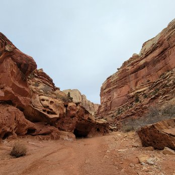


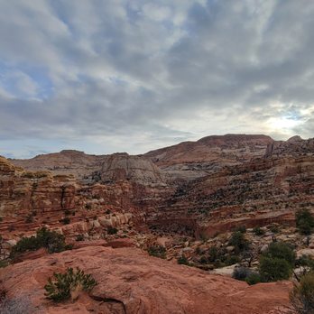


This is a very popular hike in Capitol Reel National park. It is understandable why it is popular. The Cassidy Arch is really nice. The way to the trailhead on dirt road is already really scenic. Then trailhead to the arch is all great view. Every step is wonderful. This hike goes to the top of the arch, but on the way the entire arch is visible. Not difficult and long. Half a day's nice hike. read more
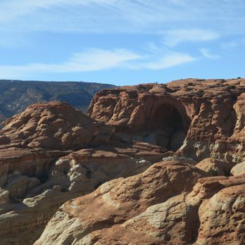


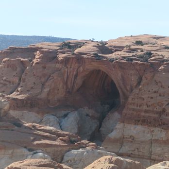

Unbelievable views with an unbelievably satisfying hike to match. The hike to and from Cassidy Arch is roughly a "short" 4 miles long, but don't let the length of this hike fool you. You will definitely get ALL of the feels in that bawdy of yours. An excellent workout indeed. I would rate it as a moderate to moderately difficult hike. To reach the parking lot, you'll have to drive passed the Visitor's Center along the scenic drive road. The park charges a toll to drive down this road, but it's paid by the honor system (putting cash into an envelope, sealing it, and placing it on your dashboard). If you have a park pass, you can display this on your dashboard instead. The drive to the Cassidy Arch turnoff isn't too long, and it passes by many campgrounds, recreational areas, and other hiking trails. Once you turn onto the Cassidy Arch turnoff, be ready to drive slowly down a rocky, unpaved road. The road is maybe 2 miles long, but narrow and rough which it'll make it feel a lot longer. You'll dead end into a parking lot. If the lot is full, you can park on the side of the unpaved road. There are restrooms near the entrance of this trail. I actually started this hike a lot later than I wanted to (around 10:15 am). The lot was already full at this time and it was already warming up. I would without a doubt recommend that you start as early as possible or later on in the day because the afternoon heat is no joke at ALL. Luckily there was some overcast during my hike, but this hike is basically completely exposed. The trail starts off on a flat path that meanders through beautiful rock formations. You'll see a sign for the Cassidy Arch Trail on your left, and this is where the elevation will start to hit you. You'll gain about 400 feet of elevation in about a half mile. Basically tons of rocky inclines and switchbacks right out of the gate. But with each incline comes an insanely beautiful view. Once you reach the end of the switchbacks, you'll have an open view of the canyon and you'll also get to see a glimpse of Cassidy Arch from a distance. At this point, it's mainly gradual up and downs until you reach the Arch. What makes this hike more difficult is the sun that'll be beaming on you and the higher elevation. Definitely make sure that you bring more water than you think that you'll need, and don't be afraid to take breaks. There's virtually no shade at all, but the picturesque views more than make up for that in my opinion. You'll know that you're getting closer to the Arch when the path starts to smooth out and you're basically scaling up and down rocks. There are several cairns in place to make sure that you won't lose your way. I honestly might have ended up somewhere else if I hadn't followed those cairns. They are super helpful. Also, there are a few gnarly sections on the trail that may have you questioning if you should continue. Well, there were for me at least. When the surface changes from dirt to smooth rock, it's also really close to the edge with sections of steep drop-offs. Scary if you're looking down while you're crossing, but nothing too hard. Probably not the best for someone who has a fear of heights though. You should also possess some kind of upper body strength because you'll have to climb up and down a few large boulders. One you make it to the Arch, it'll look and feel surreal. The views are seriously breathtaking. You can actually stand right on top of the Arch. Again, it's kind of scary getting there but totally doable. Have one of your friends or someone else who's there take your picture from the other side. Just don't get too close to the edge of course. You can really get some killer photo action on that Arch. People tend to chill out there for a moment and take a break. I'd suggest bringing a lunch and eating it there if you can. There weren't too many people there since it was so hot. However, the people that were there were friendly and kept their distance. It took me about an hour and 15 minutes to reach the Arch. I actually ended up chilling there for an hour (turned into the social little butterfly that I am). Can't recall exactly how long it took me to get back, but I'd say no more than an hour (much easier going down versus up for me). Honestly, this was one of the most enjoyable National Park hikes that I've done despite the heat. The views of Cassidy Arch and the surrounding canyon really made it all worth while. Capital Reef is such a gorgeous and highly underrated National Park. I'd come back just to do this hike again. Would definitely recommend this hike for the scenery and workout. read more
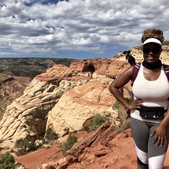


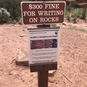

Cassidy Arch (Capitol Reef National Park, Utah) There are two ways to view Cassidy Arch. One way is .4-mile walk from Grand Wash Road. From there, you can see the arch from a distance. The other way is to hike to it. We assumed that we would get a better view of the arch by hiking to it and hike we did. He started at the parking lot, hiked about .2 miles on the Grand Wash Trail, and another 1.5 miles to the arch. The map has this hike listed as strenuous. I consider this hike moderate, but dangerous. Sections of the trail is on the edge of a canyon. Just be prepared, have enough hydration, a good pair of sturdy shoes (prefer hike boots with good grip), and keep in mind that the elevation gain is about 1,000 feet with no shade on the trail. Most of the trail is easy to follow until the last 1/4 mile or so. There are no signs or markings. We relied on cairns and eventually arrived at the arch. The Cassidy Arch is an amazing natural arch and currently sturdy enough to walk on top of it (I do not recommend it). Although, we were literally as close as you can get to the Cassidy Arch, I didn't feel like the view of the arch itself was that great. Based on photos, the view may be better from the Grand Wash Road. Or, maybe it's the fact that didn't want to slip, trip, or fall while trying to get a close look of the arch. Believe me, It's a long way down. The hike was still rewarding and offered great views of the canyons around. Getting to the trailhead... Getting to the trailhead is straight-forward but not. From the visitor's center, drive down Scenic Drive and take a left on Grand Wash Road. Continue on the dirt road until you reach the parking lot. I recommend that you get here early because the parking lot fills quickly. You can also park on the dirt road. Just keep in mind that you will be adding more steps to your hike. Fun! read more


11 years ago
What a wonderful little trail in Capitol Reef. And what a payoff. The arch itself made my eyes bug out with weird depth perception stuff, as it's an arch view that you don't typically get to see. Start by taking the scenic drive from the Fruita campground, and you'll hang a left at Grand Wash Road. Take that road to the end where there's a parking lot, and then you'll see the sign for the trailhead. It's marked at 1.5 miles, which means it's a nice leg stretcher (3 miles round trip) and you make 950 feet of elevation between the parking lot and that arch. The arch sits at 6350ft and the trailhead is at 5400ft. You actually walk away from the arch and through the wash before doubling back and hugging the canyon wall. I love the view all along as you gently climb up the rock. This area has some of the best and most accessible examples of desert varnish I can recall. Desert varnish is like a stain that covers rocks, and here, it's displayed in that multicolored "streaking" down canyon walls of browns, tans, creams, oranges, and other colors that makes it look like someone above spilled pain and it ran down the sides. Do an image search, and some of the first examples that come up are from Capitol Reef. After about a third of a mile, of the wash and first gentle climb, you'll start to make elevation, clinging to the canyon wall and trail. It's not too steep, but there are a few areas that are less like hills and more like steps. The first real climb comes at a third of a mile in, and lasts about a quarter of a mile. From there, the next half mile or so isn't too bad at all. At the one mile mark, you'll have the option to continue on the Frying Pan trail which takes you back to camp (4 miles) or continue to the arch, another .5 mile. At this point you will have already come around a corner and seen the arch, but what I wasn't prepared for was the fact that you actually will take this last half mile or so, and climb up, scramble (the trail isn't so much marked) and end up looking DOWN through the arch. Most arches, you hike to the base and look up at it. This one, you wrap up around the back side of it, and when you come around the corner you aren't really prepared for how dizzying it is. It's steep, and looking down the throat you realize that it's one false step for you to tumble to your demise. If you're scared of heights, this is a good time to keep a distance. And definitely don't go out and stand/sit on top of it. You've done the hike out, on the hike in, so complete this out and back hike in style, back downhill, and wrap up at the car. Obligatory warnings that summer is hot hot hot, so pack water, good sturdy shoes, sunblock, and watch small ones. I saw a family here on my hike, and while they seemed great, it's perhaps not the absolute best hike for kids you'd be worried about falling and losing over the edge of a cliff. Take plenty of pics! read more


6 years ago
Awesome hike that I found more moderate than difficult. The path is well marked with cairns. You can walk on the bridge and check out rock climbers. read more


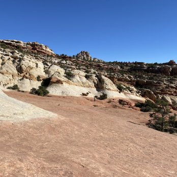


This hike sucks if you're NOT a fan of amazing landscapes, gigantic arches, and mild elevation gain...I would do this hike everytime I visit Capitol Reef, seriously I would... Because it's freaking awesome. My one regret is that I didn't know that there was a canyoneering hike with a rappel down the side of Cassidy Arch...so I didn't bring my gear. I was told there were six more rappels in the hike so it sounds super fun. I'll plan on making a trip out if it next time. The first half mile is where the 400 feet of elevation gain comes into play... But after that it's very casual but at the same time you're overlooking gorgeous views of the national park and there are moments that you just have to stop... Not because you're tired, but because you just want to enjoy the view. I loved it, you'll love it...unless that is of course you hate going on amazing hikes in national parks ;) read more


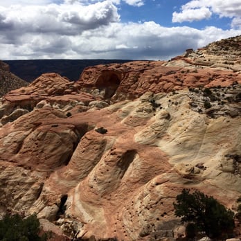

This is one of the most delightful, rewarding hikes I've yet to go on. The depth perception on a few things is definitely a trip, but don't let that stop you. There's a pretty steady incline for almost the whole hike up to the arch, but it's a perfect hike to pack a lunch and eat at the top. Watch for the cairns (stacked rocks) as the trail can get a little wonky at times. Be sure to bring a camera for the views at the top and lots and lots of water. I wouldn't go during rainy season either as the road in has a couple washes that are build to withstand the flash floods. The drive in should never be taken during that season. The arch is a little deceptive from a far, but can 100% be walked over and I highly recommend it! Wear layers, too. As in spring, it's chilly at the base, warm on the hike as you move, then windy and cold again at the summit. If you only do one hike while here, do this one! read more


10 years ago
More info about Cassidy Arch
Ask the Community - Cassidy Arch
Review Highlights - Cassidy Arch















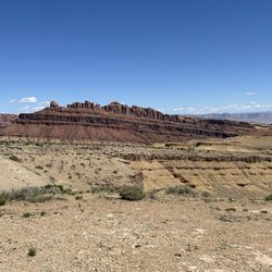
Cassidy Arch - hiking - Updated August 2026
Best of Torrey
People found Cassidy Arch by searching for…
Trending Searches in Torrey, UT
Browse Articles
Browse Nearby
Browse Brands
Related Searches in Torrey, UT
Best Dog Hiking Trails Around Torrey, Utah
Best Fishing Locations and Guides in Torrey, Utah
Best Nature Trails for Hiking in Torrey, Utah
Best Places for Horseback Riding in Torrey, Utah
Best Sightseeing Experiences Available in Torrey, Utah
Best Spots for Star Gazing in Torrey, Utah
Best Waterfalls and Swimming Holes in Torrey, Utah
Check Out Off Road Trails in Torrey, Utah
Discover Dog Friendly Trails to Explore in Torrey, Utah
Discover Popular Bike Trails in Torrey, Utah
Discover Popular Photo Spots in Torrey, Utah
Discover Scenic Mountain Bike Trails Near Torrey, Utah
Discover Top Nature Parks to Visit in Torrey, Utah
Discover a Hiking Trail in Torrey, Utah
Discover the Best Fishing Lake in Torrey, Utah
Discover the Best Night Hike Trails in Torrey, Utah
Dog-Friendly Hikes With Dogs in Torrey, Utah
Enjoy Exciting Mountain Biking Adventures in Torrey, Utah
Enjoy Hiking Adventures in Torrey, Utah
Enjoy Off Leash Dog Hikes in Torrey, Utah
Enjoy Scenic Night View Experiences in Torrey, Utah
Enjoy Tent Camping Spots Around Torrey, Utah
Enjoy the Best Night View Spots in Torrey, Utah
Enjoy the Best Picnic Spots and Ideas in Torrey, Utah
Enjoy the Best Walking Trails in Torrey, Utah
Experience Stunning Sunset Views in Torrey, Utah
Explore Beautiful Parks and Green Spaces in Torrey, Utah
Explore Bike Rentals Throughout Torrey, Utah
Explore Easy Hikes Perfect for All in Torrey, Utah
Explore Free Picnic Areas Around Torrey, Utah
Explore Fun Activities to Do in Torrey, Utah
Explore Landmarks & Historical Buildings in Torrey, Utah
Explore Popular Campgrounds Near Torrey, Utah
Explore Popular RV Parks Around Torrey, Utah
Explore Popular Scenic Overlook Points in Torrey, Utah
Explore Popular Scenic Views Near Torrey, Utah
Explore Popular View Points Around Torrey, Utah
Explore Scenic Lakes to Visit in Torrey, Utah
Explore Secret Spots Worth Visiting in Torrey, Utah
Explore the Best Swimming Holes Around Torrey, Utah
Family Friendly Hiking With Kids in Torrey, Utah
Find Beautiful Views in Torrey, Utah
Find Cozy Camping Cabins in Torrey, Utah
Find Exciting Tours to Take in Torrey, Utah
Find Fun Kids Activities Outdoor in Torrey, Utah
Find Top-Rated Waterfalls in Torrey, Utah Now


