Cancel

Open app

Search

Rim Overlook Trail

4.5 (2 reviews)

Rim Overlook Trail Photos

You might also consider

Recommended Reviews - Rim Overlook Trail

Your trust is our priority, so businesses can't pay to alter or remove their reviews. Learn more about reviews.
Yelp app icon
Browse more easily on the app
Review Feed Illustration

13 days ago

Helpful 1
Thanks 0
Love this 0
Oh no 0
Photo of Seth A.
46
1082
9679

5 years ago

Helpful 2
Thanks 0
Love this 2
Oh no 0

Verify this business for free

Get access to customer & competitor insights.

Verify this business

Capitol Reef National Park - Hickman's Bridge

Capitol Reef National Park

4.8(166 reviews)
1.0 mi

As part of our quest to visit all 63 U.S. national parks, we set off on a six week road trip. I…read morehave a personal rule: I only count a national park as "visited" if I actually spend time there, hike or walk through it, and truly experience it. On this trip, we visited 14 national parks, and Capitol Reef National Park became one of the most beautiful surprises of the entire journey. The drive from Death Valley to Capitol Reef was already an adventure, with constantly changing landscapes along the way. But nothing prepared us for the moment we arrived. Suddenly, the desert opened up into an incredible world of red rock formations, towering cliffs, and colors that seemed almost impossible. It was breathtaking. Capitol Reef is a smaller national park compared to some of the giants we visited, but it has a beauty and personality all its own. In fact, it became my husband's favorite park of the entire trip. There is something about the combination of landscapes, colors, history, and peacefulness that makes this park truly special. The scenery changes dramatically throughout the park. One area is filled with the famous red rock formations, cliffs, and sandstone walls that look like they were painted by nature. Then, as you explore other areas, the landscape changes into lighter limestone formations, with shades of yellow, cream, and gray. Everywhere you look there is a different view, a different texture, and a different color. One of the unique things about Capitol Reef is the historic Fruita area, where early settlers planted orchards along the Fremont River. Today, visitors can still see these beautiful fruit groves, which feel almost magical surrounded by the desert landscape. There is also a historic building in the Fruita area where they sell homemade fruit pies, and it is incredibly popular for a reason. The pies are absolutely delicious. We could not resist and enjoyed having pie and ice cream one morning for breakfast. When you are traveling, sometimes breakfast rules become a little more flexible! The park also has fascinating history, including ancient petroglyphs left by the Fremont people. Seeing these markings carved into the rock walls was a powerful reminder that people have been connected to this landscape for thousands of years. The hiking was another highlight. I especially enjoyed hiking through the Narrows, where I was able to explore on my own and experience the beauty and quiet of the canyon. Walking through the towering walls, surrounded by the colors and textures of the desert, was unforgettable. Capitol Reef feels like nature's own painting. The reds, oranges, yellows, blues, turquoise, and greens all come together to create a landscape that is constantly changing depending on the light. It is a park that invites you to slow down, look around, and appreciate the incredible creativity of the natural world. Capitol Reef may not always get the same attention as Utah's more famous parks, but it deserves it. It is beautiful, peaceful, full of history, and absolutely worth the visit.

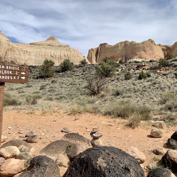
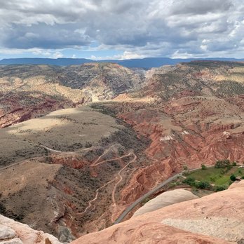
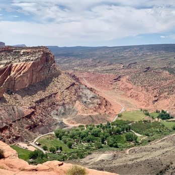
This is an amazing national park. One thing I noted about the park is that it offers things for…read morepeople to do regardless of their activity level. If you're super fit and want to do hikes, good for you as there's plenty of strenuous hikes! If you aren't as active or use a mobility assistive device, you can travel on the very, very scenic drive and also learn about the ghost town of Fruita (although the NPS employees live there). If you time your visit right, you can even pick fruits from the orchards. I combined the Rim Overlook trail with the trail to Hickman Bridge to get amazing views, as well as hiked the Cassidy Arch trail. The trails weren't too crowded, so it was a great place to listen to nature and focus on hiking. You're rewarded with amazing views. Definitely hit up Gifford Homestead for fruit pies. They often sell out in the afternoon.

Photos
Capitol Reef National Park - Some of the amazing petroglyphs!

Some of the amazing petroglyphs!

Capitol Reef National Park - Some of the amazing petroglyphs!

Some of the amazing petroglyphs!

Capitol Reef National Park - Gifford Homestead Pie

See all

Gifford Homestead Pie

Chimney Rock Trail - Chimney Rock  09-23-2025

Chimney Rock Trail

5.0(3 reviews)
4.5 mi

Definitely a strenuous hike on the way up, but totally do-able and worth it for the views. We were…read moreon a time crunch, so we didn't do the full hike - we just hiked up to chimney rock and back down instead of doing the full loop. So I imagine if you did the full loop the views would have been even more beautiful, but even the modified hike we did was amazing. Whenever I looked up hikes for Capitol Reef, this one was often overlooked, but after experiencing it, I feel it's one that should be included much more often. We did read in a couple places that this was good for sunset - we didn't get that chance, but I imagine it would be beautiful. Trail was not crowded at all, but there is little shade cover so be prepared with plenty of water and a hat.

I am very excited to talk about Chimney Rock Trail!!! Alright, I have been on hikes throughout the…read moreUnited States within all sorts of national parks, etc...but, I need to urge everyone who visit Capitol Reef...it is imperative for you to hike this Chimney Rock Trail! I am serious. Although I don't have an official ranking system, I'd place this hike at least within my Top 10 - 15 BEST HIKES OF ALL TIME! Everything about being here was simply epic. If you want to immerse yourself and understand the true power of what makes the state of Utah so famous for its colorful landscape terrains, then hiking Chimney Rock Trail will give you everything you could possibly ask for! Besides Angels Landing at Zion or the Queens Garden/Navajo Loop at Bryce...I'd then put Chimney Rock just behind them. It's a MUST SEE AND DO while here at Capitol Reef! Alright, enough gushing let me just go into details and what makes Chimney Rock special... Chimney Rock Trail is a very accessible and convenient 3.5 mile loop gaining almost 600 feet in elevation. I believe 3.5 miles is ideal in distance...not too long and not too short. Then, the maybe 580 feet in elevation is also perfect. It's not really difficult whatsoever but at the same making it to the plateau area along Chimney Rock instantly provides you with stunning views of the Capitol Reef landscape. Basically, you don't have to work hard along the hike. You're not huffing and puffing. It's extremely manageable. While reading the park pamphlet and hiking guide about Capitol Reef...it mentioned that coming here to Chimney Rock was worthwhile for hiking in late afternoon and during sunset time. I couldn't agree more with that! When I arrived, the sun was at my back which allowed for very clear photo taking opportunities of the grand setting from high above. Plus, when I was here back in late July of this year, 2021, the daytime temperatures were brutal ranging in the mid to upper 90's. Having the chance to hike here when things cooled down made a huge difference. Btw, I'd also like to point out the trailhead. Finding the start to Chimney Rock was very simple. It's located right off Highway 24 (the main road that cuts through the heart of Capitol Reef) as you're heading west from Torrey, UT going east. When I arrived in late afternoon the parking lot was empty and quiet. I was surprised by this because it specifically stated Chimney Rock was appropriate for hiking during sunsets. Good thing, better off in my opinion not having other tourists around. And, that was also another terrific aspect about exploring Chimney Rock. I was virtually the only hiker here! I had the entire trail to myself. I was grateful for this as it just allowed me to collect my thoughts and feel totally separated from reality. Before I give my interpretation of what Chimney Rock is all about...I'll just take a little highlighted piece from a page I found at americansouthwest.net/utah/capitol_reef/chimney-rock-trail.html... "Chimney Rock Trail is perhaps the best short path in the national park, as it is relatively short, not too steep, provides the shortest hike to a high elevation viewpoint, and passes varied surroundings; besides Chimney Rock itself, an eroded pillar of red sandstone, the trail encounters colorful badlands, tall cliffs, and the mouth of a narrow canyon." I really liked this introduction/description. Along the 3.5 miles...I couldn't stop taking pictures. Each curve I passed, each winding turn I crossed, each climb or descent I made...was another humbling chance for picture moments. I couldn't stop, like an addicted kid at a candy store, lol. Over the course of the hike it covered every nook and cranny within Capitol Reef Park you could ask for. Granted, I did the 8 mile Scenic Drive, I hiked other trails, I ventured all around... But coming here and along Chimney Rock I felt like I had found my calling, like I discovered true fulfilment and better understood why Capitol Reef is part of Utah's "Mighty 5". I'll admit, I had moments where I felt tears of joy because here I was standing high above the ground looking down upon glorious Capitol Reef, feeling like I'm a small piece in the big scheme of history. Having infinite time made me feel like I had paused all my worries and troubles and was living in a "dreamland of sandstone cliffs, badlands, multicolored boulders and vertical walls!" And eventually the pathway leads back down to the flat base section but you're still afforded more stunning mounds of colored shades of purple, red and brown. Every step along the way felt like a new adventure. I can't say enough good things about here along Chimney Rock Trail. And because I was so infatuated with the hike, I used every last bit of fading sun to enjoy my time. I probably stayed along the trail for at least 3+ hours until it was pitch dark out before returning back to the parking lot. Lastly, that's it. Can't say anymore. Chimney Rock Trail, memories that will live with me forever.

Photos
Chimney Rock Trail - Information Sign  09-23-2025

Information Sign 09-23-2025

Chimney Rock Trail - Information  09-23-2025

Information 09-23-2025

Chimney Rock Trail

See all

Hickman Bridge - Hickman Bridge

Hickman Bridge

4.9(15 reviews)
0.0 mi

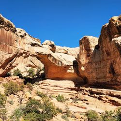
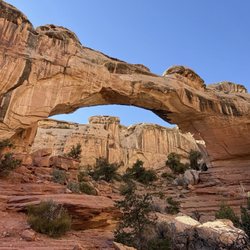
I combined the Rim Overlook trail with the trail to Hickman Bridge to get the most out of my hike…read more Unfortunately, the sky was threatining rain so I didn't want to risk it hiking to Navajo Knobs. The Hickman Natural Bridge is a 125-foot-tall natural bridge in Capitol Reef National Park. It's an 1.8 mile out-and-back trail, with some switchbacks, but it's an easy trail if you don't have any trouble climbing a few flights of stairs as baseline daily activity. The first part of the trail is the steepest with some stairs, but it gets more level afterwards as it follows a dry riverbed. You are hiking from the canyon floor to the rim! On the way up, you get to see the rock formation that reminded travelers of the Capitol dome that inspired part of the national park's name. It's a much better name than "Wayne Wonderland" which was what the region was called before it became a national park. The natural bridge is absolutely amazing. Climbing on it is prohibited, but you get to go up close and personal with the bridge to satisfy your photo-taking cravings. Vault toilets are at the trailhead, otherwise you're on your own.

This is a lovely hike. It's not too steep, not very hard, and the bridge is pretty massive and…read morebeautiful when you reach it! It was recommended to me by friends and the volunteer at the visitor center because it's easy to do in a short time/on a short trip. There was plenty of trailhead parking as well. Would definitely recommend if you're passing through Capitol reef NP!

Photos
Hickman Bridge - More interesting rock formations - these depressions in the canyon walls are formed by weather ("cavernous weathering")

More interesting rock formations - these depressions in the canyon walls are formed by weather ("cavernous weathering")

Hickman Bridge - Fun on the trail!! Some wide open sky along the way!

Fun on the trail!! Some wide open sky along the way!

Hickman Bridge - Fremont River rushes along the first part of the trail

See all

Fremont River rushes along the first part of the trail

Goosenecks Overlook - Information panel

Goosenecks Overlook

5.0(4 reviews)
3.8 mi

Definitely cool overlook that lets you take in the unique landscape of a very squiggly Sulphur…read moreCreek that is slowly and surely carving out the canyon it meanders over. It's such an amazing view, as the canyons have bands of yellow, red, and browns. They denote (from descending order) the Moenkopi formation, Kaibab limestone, and the White Rim sandstone. It's such a dramatic vista. It was also snowing a little bit when I visited, so everything was capped with a thin layer of white snow too. Such a beautiful view. It's an easy hike with a roundtrip distance of 0.6 mi and minimal elevation gain. The hardest part was the unpaved road to get to the trailhead! I did it in a 2WD sedan, but there were some pits in the road I had to navigate around. Not too hard though, just go slow.

Such a dope vista point! The Goosenecks Overlook is located just a couple miles before you reach…read morethe Capitol Reef National Park Visitor's Center. Goosenecks Canyon is filled with limestone and sandstone dating back to over 270 million years old! You will have a clear view of the millions of years of erosion right from this viewpoint. The canyon is about 800 feet deep and Sulphur Creek runs along the bottom. It's almost like a mini Grand Canyon. In fact, some of the oldest rock layers of this canyon are the same rock layers that you'll find within the Grand Canyon (Kaibab Limestone). You'll have to drive a short distance up a rough and unpaved road to get here, but it's absolutely worth it for the views. From the parking lot, it's a short little hike up to the actual vista point. There's lot of room to roam around and explore the areas beyond the vista point. You'll be presented with stunning views with each and every turn. 360 degrees of pure bliss right before your eyes. If you're planning a trip to Capitol Reef National Park, this is an excellent place to stop on your way into and out of the park.

Photos
Goosenecks Overlook - Landscape

Landscape

Goosenecks Overlook - View of the river

View of the river

Goosenecks Overlook - Landscape

See all

Landscape

Capitol Gorge - Pioneer Register

Capitol Gorge

4.8(4 reviews)
6.3 mi

Found at the end of the Scenic Drive, Capitol Gorge begins with a dirt road that weaves through the…read morebeautiful rocks and mountains of Capitol Reef. While the scenic drive in and of itself was wonderful, this dirt road to the Capitol Gorge trailheads had that beat. We drove this in a compact car without any issue, just make sure to take it slow as there are some tight, blind turns on this two-way road. If it's busy, parking can be a bit difficult at the end of the road to hike the trails. We came to hike to The Tanks, and the trail to the beginning of the The Tanks portion is super easy. You'll get to see some petroglyphs as well as the Pioneer Register - which is a cool section of rocks with signatures dating back 100+ years. There's plenty of shade in this area as you're walking between two mountain walls, and it can get pretty windy. I'd recommend bringing a jacket for this area if you're going on cooler days. The actual The Tanks hike we had planned to do was super disappointing. This 0.2 miles add-on is probably considered a moderate hike. While it had nice views, there was nothing special about the views, and you would be better off spending your time at another one of the better hikes in Capitol Reef. The other part of the Capitol Gorge Trail I previously discussed is worth it, just not the additional hike to The Tanks.

This is the wondrous Capitol Gorge area of Capitol Reef National Park at the end of the paved road…read moreportion of the Scenic Drive. This Capitol Gorge is fantastic for grasping the true essence of what makes Capitol Reef NP so special. The red rocks and canyon cliffs are simply stunning! I was visiting here in late July 2021 and unfortunately the overcast skies did darken the scenic setting somewhat, but I was still able to capture some beautiful examples of vintage Utah scenery. I'd put the Scenic Drive to arrive at this Capitol Gorge along with hiking Chimney Rock Trail as 2 of the best activities I did while exploring the park. The Scenic Drive starts right beside the Visitor Center and runs for 10 miles each way into the heart of the Capitol Reef landscape. Along the drive there'll be plenty of opportunities to pull your car off to the side, get out and snap amazing picture moments including standing at Capitol Gorge. Also of note...the Scenic Drive runs on paved road for about the first 7 - 8 miles and the last 2 - 3 miles are set on dirt/gravel road. Unfortunately, I had a compact car with me and didn't want to chance driving on the rough road in this remote part of the country. So...after stopping here at Capitol Gorge, I turned around and headed back the 7 - 8 miles towards the Visitor Center. It is a $20 fee to drive the Scenic Road, otherwise to enter and do anything within Capitol Reef it's absolutely free! You pay an attendant during normal business hours that they're open but when the Visitor Center closes, they use the "honor system" and ask you to drop the $20 into a box as proof of payment. Btw, the Visitor Center is great for buying souvenirs and picking up a park pamphlet and map of all the trails. I highly recommend stopping at the VC for any questions you may have and general advice about exploring around. Lastly, while in this Capitol Gorge area...I'd suggest hiking the Grand Wash Trail as well as the Rim Overlook Trail for 2 different, yet unique perspectives for appreciating Capitol Reef from high above and also down below in between the rugged canyon walls. Alright well, this is the Capitol Gorge section of Capitol Reef National Park!
Photos
Capitol Gorge - Enjoying the Capitol Gorge setting.

Enjoying the Capitol Gorge setting.

Capitol Gorge - GMonkey do: Tanks Trail Oct 2020

GMonkey do: Tanks Trail Oct 2020

Capitol Gorge - The cliff-faced walls hover all around you here at Capitol Gorge.

See all

The cliff-faced walls hover all around you here at Capitol Gorge.

Fremont River Trail - The view from the top, looking back at campground river valley

Fremont River Trail

5.0(1 review)
1.3 mi

This is one of those hiking trails that sorta becomes what you make of it. Want an easy little…read morestroll along the river? Go for it. This trail leaves directly from the campground and heads downriver along the Fremont, wandering past the orchards, the group campground, and eventually enters a small canyon with walls. If you've got little ones, you could easily stop here and it will have been a nice, flat stroll. But waiting for you downstream, and atop those walls, is a nice panoramic view of the Fremont River valley, orchards, and main hub of Capitol Reef National Park. Once you reach the narrowed canyon walls, you start an ascent that rises above the river and gives you some great looks at the downstream vista. You can stop at the first overlook and no one would judge you for it, and you'll get great views. But press on to the full mile and after departing that overlook, you'll again rise on a less rocky trail before summiting out on a point that overlooks the campground valley in one direction, and the canyons in all others. From there, you go back out a mile on the same trail you came in on, and you're back at camp. The park lists this one as "moderate" in its scale of difficulty. That feels like a bit much until you do that climb to the overlook. But it does wind around some rugged rocks and you will pant a bit, so take that seriously, especially if it's warm out. There's no cover once you pass the riparian corridor and head into the rocks, so it will be hot. Sunblock and water are highly recommended. It's not the most written-about or awe-inspiring hike in the park, but it will probably take you less than an hour (and that includes the time you will walk from your campsite) so if you've got the time, grab a camera and go for a little hike along the river.

Photos
Fremont River Trail - View from partway through the hike

View from partway through the hike

Fremont River Trail - View only from partway up, looking back at campground

View only from partway up, looking back at campground

Fremont River Trail - Closer view of canyon walls (opposite of trail)

See all

Closer view of canyon walls (opposite of trail)

Sunset Point Trail - Instagram: @telephonesmoothie

Sunset Point Trail

4.7(3 reviews)
3.8 mi

They don't make it easy to find, but it's not really hidden…read more I don't remember if the signage on the road indicates that this is the Sunset Point Trail, but if you're coming down the highway you will see signs for the Goosenecks overlook, and that's your indication. Once you exit the highway, you'll want to go left past the first parking area that's ahead, and down a dirt road that's a half mile or so. You'll go down that road, and then come to a parking area. You'll be tempted to go up to the right a bit to the overlook, and that's a good idea, you should do it, but that's not the Sunset Point Trail. The trail you seek is on the left (west) side of the parking area. We made our way here a bit prematurely before sunset, but I'm glad we did. We rolled in on a holiday weekend and still found parking in the small lot that probably holds no more than 20 cars. By the time we left, it was packed and there were cars parked all along the dirt road. The hike is pleasant, with only mild elevation gain and it goes for just about 1/3 of a mile each way. The views are stellar, though not as dramatic as that Goosenecks Overlook, they are still sweeping and majestic. You can see the red fingery cliffs to the north, the white-capped peaks to the west (is that Fern's Nipple?) and the canyon to the south. Funky rock formations and spires greet you at the terminus of the trail and you can sit along the way and there at the end on a couple of benches. Sunset is the right time to visit; it's aptly named. Red and orange cliffs were just aglow with amber light in the late, late afternoon. The red cliffs become their own new colors and it's really special.

Very easy & perfect for a sunset trail. We were lucky not many people came to this hike…read more HOW TO GET THERE & PARKING: if you're driving in from town to the park, the road that leads you to the parking lot is right before the visitor center so be sure to keep your eyes peeled on your right hand side. Once you got it, there's a lot of gravel & you think you're going the wrong way, but soon, you will reach the parking lot. There's plenty of parking so don't worry about that. Considering this is also a very short hike, people come in & out of there pretty often. HIKE: very easy. Pretty much 0.5 miles RT without any strain/incline challenge so any level hiker can do this. The path is pretty smooth & the end result is gorgeous view of the park. There are a lot of tall rocks that you can easy climb on to see a higher view of the park. There's a couple of benches at the end of the trail so very nice to just sit, relax & enjoy the color changes of the rocks & mountains as the sun sets. Very beautiful. And at such an easy hike, the reward is pretty big! I'd suggest bringing your dinner, hike the short hike & enjoy nature's beauty.

Photos
Sunset Point Trail - Instagram: @telephonesmoothie

Instagram: @telephonesmoothie

Sunset Point Trail - A lot of stacked rocks around to show you the path

A lot of stacked rocks around to show you the path

Sunset Point Trail - Instagram: @telephonesmoothie

See all

Instagram: @telephonesmoothie

Rim Overlook Trail - hiking - Updated July 2026
Loading...
Loading...
Loading...