Castleridge Trailhead Photos


You might also consider


More like Castleridge Trailhead
Recommended Reviews - Castleridge Trailhead
Start your review...


Reviews With Photos


This was a trail close to where I was staying so we spent about an hour walking this path. There's free parking along the side of the road near the trailhead or a parking lot nearby. The initial parts of the trail is a steady incline. There's no shade until you get to the trees further up. Be aware of bicyclists going up and down the trail.


It's supposed to be easier the second time right? Well...it's not. Going up that initial hill is still soooo hard! Even though I'm a pretty active person, I still felt like I was out of shape. This trail starts off on the very, very steep hill. I felt like 25% of my energy got sucked away just from climbing this hill. But it does get better as you keep going! Beautiful views (I took photos this time!) and plenty of shade on the trail. Took me about 45 minutes to get all the way to the top! Just be careful when there's muddy areas; take your time walking around it. I almost slipped a couple of times and got my shoes all muddy. The entire hike took an hour and 40 minutes for me and I felt so accomplished afterwards! Legs are not too sore this time since I stretched. Bring water and make sure you put on sunscreen!


This is a Beautiful Hike in a Beautiful Neighborhood!! It's. steep one FYI, I think I missed that memo and tried to do it with a toddler and a pregnant me but it's definitely beautiful and worth. few miles up if you can. Most people park on the street near the entrance and that's what we did but realized later there is a parking straight up so keep driving ahead if you don't find parking spots next to the Gate!! Small streams, some sheep, some birds, bugs, wildflowers, it's beautiful.


Love this Pleasanton gem of a trail, especially when it's green and lush. Dog-friendly, great views, and a little butt-burner with the steep climb up. Go early to grab one of the street parking spots. A mix of sun and shade. Hiking through the ferns makes me so happy! Being up on the ridge is not my fav on a hot summer day, imho. Other than that, I highly recommend!


Out-of-State visited here and I definitely recommend this trail. I did not come to CA prepared to hike but no worries because you don't need much for this one. Workout gear and some simple tennis shoes and I was ready. Starting off is a little steep so I was feeling it in my legs within 5 minutes. From there it's more hills but tends to flatten out on a few areas. More hills then flat areas. Beginning is missy but gets better. Awesome views. Plenty of photo ops along the way. Quiet and serene. 10 out of 10 for the modest hiker looking for a little exercise.


Decided to take advantage of a sunny day after so much rain and cloudy days. Got here around 3ish on a weekday afternoon and there were lots of empty parking spots. I have also visited during the weekend afternoon with plenty of parking. You can either park in the lot (Castle Ridge Trail Parking Lot) or along the street (Old Foothill Rd but note it's only one way street). Both are free. There is a water fountain in the Lot and bathrooms at the start of the trailhead. One of my favorite trails close to the east bay-not too crowded, lots of greenery, plenty of shade, and a great view of the city! There is plenty of shade which makes it a great hike in the summer whereas in the winter, it'll probably be best to come earlier in the day (if you want a warmer/sunnier hike) as the sun disappears over the hill pretty early. This is an out and back trail and takes about an hour to reach the top.


It's all about the Green Ya know what I mean? Go get off your arses & take part of the scene! _________________________________________________ Yet another portion of the glorious Pleasanton Ridgeline trails with lush forests of green cascading across the mountainside with several connecting trails. Beautiful terrain with sunny areas as well as plenty of forestry greenery as you make your ascent. Moderate to challenging trail, my tracker on my app showed I killed a 1,037ft. elevation gain. BURN , BABY... BURN!! Oh, don't mind me, just cheering on my glutes. Butterflies and wildflowers were abundant as well as lizards bun bathing alsong the trail with the peaceful sound of songbirds happily going about their bird business. Wonderful location to bring the binoculars for bird watching as well as a professional camera as many colorful species were present. As with this area, one should definitely be alert as it is notorious for rattlers, mountain lions as well as coyotes & I'm not talking about the ones who smuggle folks across the borders. Stick to the middle of the trail & spare yourself a potential surprise with one of those guys & you also might wanna skip out on an unpleasant case of itchy witchy poison oak! I managed to make it without seeing any of these aforementioned critters, but loads of lizard wizards, birds, a couple small gopher snakes, dragonflies & even a very expressive herd of fluffy, grazing sheep! Pro-Hiking Tip - I ended up hitting the trailhead at 11:30am and took my sweet time pausing for the many photo opps and just taking a moment to absorb all the beauty - I didn't get bit not once by a mosquito, so hit it early and avoid anything remotely near dusk if you have that "sweet blood" like I do. There. Just saved your life. You're welcome!! What I especially enjoyed was - shhhh - *whispering* There weren't many - peoooople. That's right folks, a frolic in nature with all her beauty sans a too-peopley kinda scene. I'm fucking IN!! Honestly, the few folks I encountered here were actually very welcoming & friendly. A few paused to wish me a happy sunday or commented on the abundance of butterflies that were to be seen. You can always spot the "regulars" of the trails with those infamous muscled hiking calves, walking sticks or poles, backpacks, a sunburned glow and a cheesy ear to ear grin - just cuz, well... cuz they flippin' feel energized & are truly GRATEFUL to be a part of such a tranquil scene. I'm definitely one of those. I think the world needs more folks who believe some of the best adventures in life can be found along a trail of dirt. Gorgeous scenery! Highly recommend! Get in touch with your inner hippie peace-mc'lovin badass exploring self today!


This was my first time doing this particular trail. I chose it today because it does have shade options along the walk. It is pretty steep when you first get there. It does level out a couple spots, but just continues to have a gradual incline. So be prepared. It was busy and well traveled as I saw quite a few people going up and coming down. I did see one snake, but it was non-venomous in the shadow of the trees on the trail. Bring lots of water because it does get hot. I don't think I would do this hike again, but I'm glad I did it. read more


Ok this is the "first time" that I write a review on a hiking trail. I just couldn't resist doing so.. why? It's one of the, if not THE best trail I have ever hiked. My hiking criterias are simple :). They have to give me a good intense workout & with lots of shades, in the woods if possible. It's hard to find a trail with such combination and I found it here. It's also so blissfully quiet, fresh air with smells of the oak trees. First time on this trail and boy was I in for a good surprise! It's a "really" steep, challenging, inclined uphill hike all the way (starting from base to the top) with significant elevation gain every step of the way. Also unpaved with lots of pebbles/rocks along the way. So be sure to have a good sturdy pair of hiking boots/shoes with you. It's a good 4mile roundtrip (two mile each way which takes roughly 1hour to get to the top and another 1hour coming down). The maximum elevation was 1450feet. It's fairly narrow trail and you will find many folks doing mountain biking here .. on the same trail.,So you need to keep an eye out as you hike up and down. I was truly impressed with the cyclists who did the whole roundtrip up the hill as I found myself starting to pant just a 1/4 mile into the hike.. and this is me, someone who does high intensity workout 6days a week with most days double dipped (cardio+strength). Love that it has lots of shades as we walked through the woods with huge fallen trees and eroded land. On our way down we even saw sheeps and stopped to feed them some grasses & hear the bleat, meh and baa sound from their baby sheeps. This is now my top of the list favorite place to hike. Initially I was planning to hit the gym in the evening to do my usual strength and cycling classes.. but I ended up skipping it after that long strenuous hike. read more


1 year ago
I've hiked this trailhead a few times in the past and forgot how hard the initial section is. It will wake up your glutes! It's a two mile hike (four miles round trip) all up hill to the top of the Pleasanton Ridge. The trailhead is a shared trail so be prepared and cautious of people on e-mountain bikes. The scenery is beautiful especially when you make it to the top. Parking can be difficult because there is no parking lot. Only street parking. Bathrooms are available at the entrance. read more

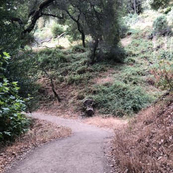


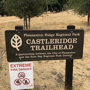


This was a trail close to where I was staying so we spent about an hour walking this path. There's free parking along the side of the road near the trailhead or a parking lot nearby. The initial parts of the trail is a steady incline. There's no shade until you get to the trees further up. Be aware of bicyclists going up and down the trail. read more


3 years ago
It's supposed to be easier the second time right? Well...it's not. Going up that initial hill is still soooo hard! Even though I'm a pretty active person, I still felt like I was out of shape. This trail starts off on the very, very steep hill. I felt like 25% of my energy got sucked away just from climbing this hill. But it does get better as you keep going! Beautiful views (I took photos this time!) and plenty of shade on the trail. Took me about 45 minutes to get all the way to the top! Just be careful when there's muddy areas; take your time walking around it. I almost slipped a couple of times and got my shoes all muddy. The entire hike took an hour and 40 minutes for me and I felt so accomplished afterwards! Legs are not too sore this time since I stretched. Bring water and make sure you put on sunscreen! read more


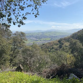
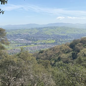


3 years ago
This is a Beautiful Hike in a Beautiful Neighborhood!! It's. steep one FYI, I think I missed that memo and tried to do it with a toddler and a pregnant me but it's definitely beautiful and worth. few miles up if you can. Most people park on the street near the entrance and that's what we did but realized later there is a parking straight up so keep driving ahead if you don't find parking spots next to the Gate!! Small streams, some sheep, some birds, bugs, wildflowers, it's beautiful. read more


Love this Pleasanton gem of a trail, especially when it's green and lush. Dog-friendly, great views, and a little butt-burner with the steep climb up. Go early to grab one of the street parking spots. A mix of sun and shade. Hiking through the ferns makes me so happy! Being up on the ridge is not my fav on a hot summer day, imho. Other than that, I highly recommend! read more


3 years ago

4 years ago
Out-of-State visited here and I definitely recommend this trail. I did not come to CA prepared to hike but no worries because you don't need much for this one. Workout gear and some simple tennis shoes and I was ready. Starting off is a little steep so I was feeling it in my legs within 5 minutes. From there it's more hills but tends to flatten out on a few areas. More hills then flat areas. Beginning is missy but gets better. Awesome views. Plenty of photo ops along the way. Quiet and serene. 10 out of 10 for the modest hiker looking for a little exercise. read more




3 years ago
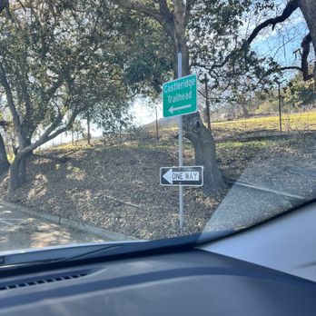
Decided to take advantage of a sunny day after so much rain and cloudy days. Got here around 3ish on a weekday afternoon and there were lots of empty parking spots. I have also visited during the weekend afternoon with plenty of parking. You can either park in the lot (Castle Ridge Trail Parking Lot) or along the street (Old Foothill Rd but note it's only one way street). Both are free. There is a water fountain in the Lot and bathrooms at the start of the trailhead. One of my favorite trails close to the east bay-not too crowded, lots of greenery, plenty of shade, and a great view of the city! There is plenty of shade which makes it a great hike in the summer whereas in the winter, it'll probably be best to come earlier in the day (if you want a warmer/sunnier hike) as the sun disappears over the hill pretty early. This is an out and back trail and takes about an hour to reach the top. read more


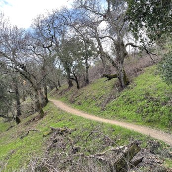
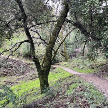


It's all about the Green Ya know what I mean? Go get off your arses & take part of the scene! _________________________________________________ Yet another portion of the glorious Pleasanton Ridgeline trails with lush forests of green cascading across the mountainside with several connecting trails. Beautiful terrain with sunny areas as well as plenty of forestry greenery as you make your ascent. Moderate to challenging trail, my tracker on my app showed I killed a 1,037ft. elevation gain. BURN , BABY... BURN!! Oh, don't mind me, just cheering on my glutes. Butterflies and wildflowers were abundant as well as lizards bun bathing alsong the trail with the peaceful sound of songbirds happily going about their bird business. Wonderful location to bring the binoculars for bird watching as well as a professional camera as many colorful species were present. As with this area, one should definitely be alert as it is notorious for rattlers, mountain lions as well as coyotes & I'm not talking about the ones who smuggle folks across the borders. Stick to the middle of the trail & spare yourself a potential surprise with one of those guys & you also might wanna skip out on an unpleasant case of itchy witchy poison oak! I managed to make it without seeing any of these aforementioned critters, but loads of lizard wizards, birds, a couple small gopher snakes, dragonflies & even a very expressive herd of fluffy, grazing sheep! Pro-Hiking Tip - I ended up hitting the trailhead at 11:30am and took my sweet time pausing for the many photo opps and just taking a moment to absorb all the beauty - I didn't get bit not once by a mosquito, so hit it early and avoid anything remotely near dusk if you have that "sweet blood" like I do. There. Just saved your life. You're welcome!! What I especially enjoyed was - shhhh - *whispering* There weren't many - peoooople. That's right folks, a frolic in nature with all her beauty sans a too-peopley kinda scene. I'm fucking IN!! Honestly, the few folks I encountered here were actually very welcoming & friendly. A few paused to wish me a happy sunday or commented on the abundance of butterflies that were to be seen. You can always spot the "regulars" of the trails with those infamous muscled hiking calves, walking sticks or poles, backpacks, a sunburned glow and a cheesy ear to ear grin - just cuz, well... cuz they flippin' feel energized & are truly GRATEFUL to be a part of such a tranquil scene. I'm definitely one of those. I think the world needs more folks who believe some of the best adventures in life can be found along a trail of dirt. Gorgeous scenery! Highly recommend! Get in touch with your inner hippie peace-mc'lovin badass exploring self today! read more


6 years ago
Beautiful and shady hike and perfect for my ten month old beagle puppies! We come from Tracy it was a short drive, no fees for parking (we parked on the side of the road and went on Courdet Trail) and the trail was so clean, I was telling my boyfriend at the top of the trail that I didn't see even one piece of trash! The fellow hikers we saw along the way were so friendly and dog loving and most people were wearing a mask which made us feel very comfortable, especially in the narrower parts of the trails. We didn't wear or mask when we didn't see anyone but put the masks back on when we saw we were getting within 6 feet of folks which others were doing as well. We went in the morning and the air was crisp and dewy, it was a perfect day hike for our little family, highly recommend for people of all ages and doggos too! read more


5 years ago


8 years ago
More info about Castleridge Trailhead
3864 Old Foothill Rd
Pleasanton, CA 94588
Directions
Visit Website
https://www.ebparks.org/parks/pleasanton/default.htm
Hours
Indoor Amenities
Outdoor Amenities
Ask the Community - Castleridge Trailhead
Review Highlights - Castleridge Trailhead
You might also consider
























Castleridge Trailhead - hiking - Updated September 2026
Best of Pleasanton
People found Castleridge Trailhead by searching for…
Hiking Trails in Pleasanton, CA
Walking Trails in Pleasanton, CA
Free Parking in Pleasanton, CA
Places to Visit in Pleasanton, CA
Beautiful Views in Pleasanton, CA
Dog Friendly Hiking Trails in Pleasanton, CA
Fall Foliage in Pleasanton, CA
Fishing Spots in Pleasanton, CA
Waterfall Hike in Pleasanton, CA
Secluded Spots in Pleasanton, CA
Public Running Track in Pleasanton, CA
Swimming Lakes in Pleasanton, CA
Off Road Trails in Pleasanton, CA
Bird Watching in Pleasanton, CA
Trending Searches in Pleasanton, CA
Archery near Castleridge Trailhead
Barbershop For Men near Castleridge Trailhead
Bike Shop near Castleridge Trailhead
Bird Sanctuary near Castleridge Trailhead
Boardwalk near Castleridge Trailhead
Casinos near Castleridge Trailhead
Cliff Jumping near Castleridge Trailhead
Consignment Shops near Castleridge Trailhead
Cruising Spots near Castleridge Trailhead
Dog Friendly Beaches near Castleridge Trailhead
Dog Friendly Things To Do near Castleridge Trailhead
Ear Piercing near Castleridge Trailhead
Eyebrow Threading near Castleridge Trailhead
Fishing Spots near Castleridge Trailhead
Flower Fields near Castleridge Trailhead
Hair Braiding near Castleridge Trailhead
Kids Haircut near Castleridge Trailhead
Lakes near Castleridge Trailhead
Lookout Points near Castleridge Trailhead
Parks near Castleridge Trailhead
Picnic Areas near Castleridge Trailhead
Playgrounds near Castleridge Trailhead
Preschools near Castleridge Trailhead
Private Schools near Castleridge Trailhead
Public Golf Courses near Castleridge Trailhead
Public Running Track near Castleridge Trailhead
Public Tennis Courts near Castleridge Trailhead
Rock Quarry near Castleridge Trailhead
Scenic Night View near Castleridge Trailhead
Scenic Overlook near Castleridge Trailhead
Sunrise View near Castleridge Trailhead
Swimming Holes near Castleridge Trailhead
Things To Do Alone near Castleridge Trailhead
Trading Card Shops near Castleridge Trailhead
Uniforms near Castleridge Trailhead
Used Furniture Stores near Castleridge Trailhead
Browse Nearby
BEST of Pleasanton, California Coffee near Castleridge Trailhead
BEST of Pleasanton, California Restaurants near Castleridge Trailhead
BEST of Pleasanton, California Things to Do near Castleridge Trailhead
BEST of Pleasanton, California Parks near Castleridge Trailhead
BEST of Pleasanton, California Breakfast near Castleridge Trailhead
BEST of Pleasanton, California Horseback Riding near Castleridge Trailhead
Browse Brands
Related Searches in Pleasanton, CA
Best Dog Hiking Trails Around Pleasanton, California
Best Fishing Locations and Guides in Pleasanton, California
Best Nature Trails for Hiking in Pleasanton, California
Best Off Leash Dog Parks in Pleasanton, California
Best Parks for Parties and Events in Pleasanton, California
Best Places for Horseback Riding in Pleasanton, California
Best Sightseeing Experiences Available in Pleasanton, California
Best Water Parks for Kids in Pleasanton, California
Check Out Great Playgrounds in Pleasanton, California
Check Out Off Road Trails in Pleasanton, California
Discover Baseball Fields Around Pleasanton, California
Discover Dog Friendly Trails to Explore in Pleasanton, California
Discover Easy Hiking Trails Near Pleasanton, California
Discover Fun Toddler Parks in Pleasanton, California for Your Little One
Discover Kid Friendly Hiking Trails in Pleasanton, California
Discover Lakes & Ponds to Explore in Pleasanton, California
Discover Popular Bike Trails in Pleasanton, California
Discover Popular Photo Spots in Pleasanton, California
Discover Scenic Mountain Bike Trails Near Pleasanton, California
Discover Soccer Fields in Pleasanton, California Near You
Discover Top Nature Parks to Visit in Pleasanton, California
Discover Top State Parks to Visit in Pleasanton, California
Discover Walking Parks in Pleasanton, California Near You
Discover a Hiking Trail in Pleasanton, California
Discover the Best Beaches in Pleasanton, California
Discover the Best Kids Park Spots in Pleasanton, California
Discover the Best Night Hike Trails in Pleasanton, California
Dog-Friendly Hikes With Dogs in Pleasanton, California
Enjoy Camping Adventures Around Pleasanton, California
Enjoy Kayaking Adventures in Pleasanton, California
Enjoy Off Leash Dog Hikes in Pleasanton, California
Enjoy Scenic Places to Walk in Pleasanton, California
Enjoy a Beautiful Waterfall Hike in Pleasanton, California
Enjoy the Best Picnic Spots and Ideas in Pleasanton, California
Enjoy the Best Walking Path in Pleasanton, California
Enjoy the Best Walking Trails in Pleasanton, California
Explore Beautiful Parks and Green Spaces in Pleasanton, California
Explore Easy Hikes Perfect for All in Pleasanton, California
Explore Free Picnic Areas Around Pleasanton, California
Explore Fun Activities to Do in Pleasanton, California
Explore Parks With Pull Up Bars in Pleasanton, California
Explore Picnic Parks Near Pleasanton, California
Explore Popular Campgrounds Near Pleasanton, California
Explore Popular Dog Walking Trails in Pleasanton, California
Explore Popular Kids Parks Throughout Pleasanton, California
Explore Popular Picnic Areas Around Pleasanton, California
Explore Popular RV Parks Around Pleasanton, California


