Brushy Peak Regional Preserve Photos



You might also consider


More like Brushy Peak Regional Preserve
Recommended Reviews - Brushy Peak Regional Preserve
Start your review...


Reviews With Photos


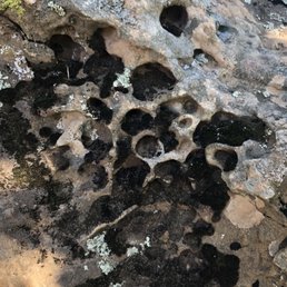
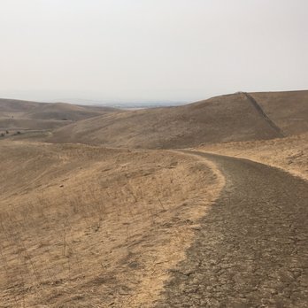
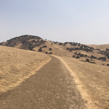
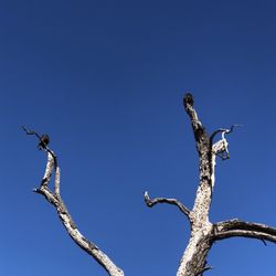
Just a shot of the sru, dead scenery. Can't wait until. It's green again. Hiked 3 miles, is normally done 6 but I wasn't hiking alone this day. Try all the trails if you go, then go back and do them in reverse.


Quiet, serene and perfect place to hike and take landscape photos. The turbines up the hill is magnificent! I can't get enough pictures of this place!


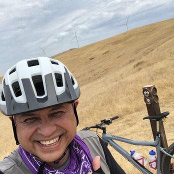
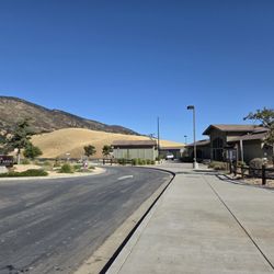
Brushy Peak is a hidden gem in the East Bay. Located just north of Vasco road nestled beneath the windmills on the Altamont Pass. I'm blessed to be able to ride my bicycle from my office at lunchtime to the regional park which is 12.25 miles one-way. The trails are challenging and will strengthen your endurance. The parking lot has restrooms and maps of the park are available for free. No drinking water, so BYOW. Sunscreen and a visor recommended.
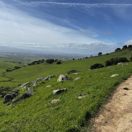

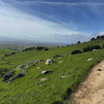
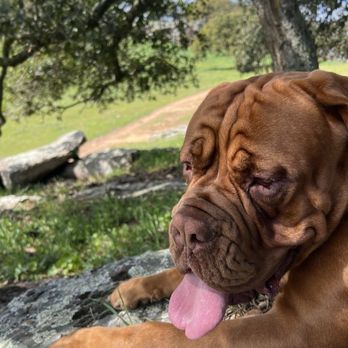
Very nice trail... great views and the park was very well maintained. I'd recommend if you have dogs and familes :)


A great place to hike in the Livermore area! There are multiple trails that you can take which is nice since you're able to choose whatever you're most comfortable with. As other reviews mentioned, I'd agree that it's better to come here in the winter or on a colder day since there's little to no shade in the area at all and it does tend to get on the hotter end. I visited on a Saturday morning and it wasn't too crowded at all. There's a small parking lot right at the entrance that does seem to fill up quickly. It is dog-friendly here, however, take care of your pooch and keep a good lookout since there's a good amount of coyotes that enjoy roaming the area. Overall, perfect for families and beginners!


We found a coyote head at Brushy Peak! Austin Ca$h on YouTube for our Hiking adventures and secret trails at Brushy Peak!


There are two trails one is about 2 miles long and that's the one we tried with our small dog. The trail was very muddy because of all the rain we got recently so wear your hiking boots. There is no shaded spot for the short trail so I won't recommend it if the weather is really hot. Parking was easy and there is a public bathroom by the parking lot.


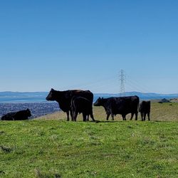
Took the homeschoolers (twin boys age 10) on a field trip today. It was just what we needed. I'd heard the parks and trails were crowded at times and were one way but not here.. the trails were like 6 feet wide and only passed 3 other people/families on our trail. Thought I'd heard bikes weren't allowed on the trails yet but saw 2 bikers as we entered the parking lot and one we passed on the trail was on his bike... we may try that next time as my boys are just finally getting the gears figured out on their mountain bikes. Great place to give it a try! The views at the top of the peaks are great.. we did the Laughlin trail which was shorter and probably not as scenic as others, but it was our first time. I can see how it could be torturing HOT on days over 85 degree as there is no shade on the trails. Today was perfect around 78 degrees. There is a shaded picnic table near the parking lot we saw families at on the way up and again on the way back. Parking was easy and people were respectful of social distancing. Nobody in masks, though asked to wear one if many are around (maybe the weekend).. Today we saw many little gophers, lizards, some bunnies, lots of cows and even had a couple follow us on the trail which freaked my boys out for a minute til I told them they were following the one ahead that left the herd while they were taking photos the other direction . I could have hiked longer as we stopped a lot to look at lots of little creatures on the way but was time well spent with my kids, outdoors and felt like something we had to drive a long ways a way far away from everything else, but only 10 min from home. So, weather cooperated and was super close for us.. best part, all FREE (even parking).. so 5 stars from us!


Being a Livermore local, Brushy Peak is a great preserve to go hiking or trail running at! I've experienced all seasons and the best time to go is spring. The hills are lush with green and the weather is just perfect with chill temperatures and lots of sun. Unfortunately, the green came and went by May and it's back to the yellow tall grasses, not saying that yellow isn't amazing, but the green surrounding the preserve and Livermore with the windmills in the background is just a beautiful sight. As for the trailhead, there are two ways to enter. There's one near the parking lot entrance that you can embark on the steep incline or you can enter through the less steep side near the restroom. The trails are pretty well paved and there are a couple hills to go up and down, but the 4.5 mile loop is great to get your mind off things or to catch up with friends. There's also many wildlife around. There are the herds of cows that may sometime crowd on a trail, don't worry you can just shoo them away. I've seen snakes, rabbits, and groundhogs so it's a very active wildlife area.
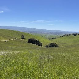

It is a very good place to hike in the tri-valley especially during the spring time. They preserve has a bathroom, it has multiple hikes. The scenery was beautiful. I would rate it as a moderate hike with decent elevation. It took us 2-2.5 hrs to complete the brushy peak trail.


What a beautiful hike! A friend of mine recommended Brushy Peak as an easier hike for children. While there are a few hills, nothing that a 4 or 5 year old cannot handle. We did the hike during prime fire season, which meant CA's golden hills were seen instead of green ones, but it was still a beautiful hike. To those familiar with Livermore's windmills, you definitely get a close up of them. Bring some water, bring your dog if you have one as they allow dogs on leash & enjoy the stroll. Apparently it's even more beautiful around the March/April time frame! And a major bonus, parking is free.


Found this on Yelp. We used to live nearby and didn't know this hiking area exist. Thanks to Yelpers. It's peaceful here. Long and Open trails. It can get very hot or very cold depending on the weather. Today was freezing and we expected mini hiking trails. We ended hiking for 4 hours during lunch time, but luckily we had enough water and snacks to accommodate us.......and there's no such thing as mini hiking here. It's all uphill once you start.......gradual at first but it gets steeper. I would say, it's about 3-4 miles uphill. For people who have knee problems, this is not advisable. Must take Advil, hiking stick and knee support. Yes! For people like me, who also sprained my right ankle while hiking yesterday at Lake Chabot. As we walk on the trail and tell stories, we just keep hiking up not realizing we made it to the top. My hands and ears were frozen cause we didn't come prepared. At least now we will know what to expect if we decided to come back. There are many trails but I think we took the strenuous trail. So, depending on your hiking level, everyone can enjoy their hikes and chosen trails. Recommendation: probably better to start hiking early in the day. Dress accordingly. Bring water, and snacks. Do not text while on the trail...... Pay attention, there's a lot of Cow poop. Lol There's a nice view from the top, bring a camera.
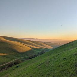

The "mission peak" hike of livermore. A very peaceful hike, somewhat strenuous at certain stretched.

10 months ago
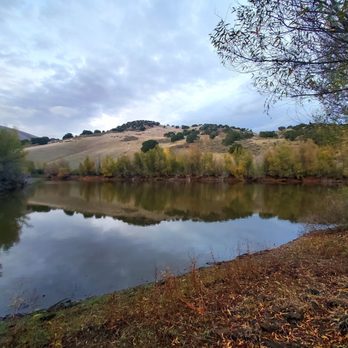
It was a bit muddy from the rain, but still a lovely site to go for a run this past Sunday, along the West Loop Trail, the flatter route among several trails here. The entrance can be found near Laughlin Road. I enjoyed the scenery at sunset, the clouds lit in a beautiful pinkish hue, and being surrounded by nature, tranquil ponds, and views of the windmills on the hills. As soon as I entered the dirt path, I was greeted by a rabbit who soon hopped away, but not before I snapped a couple pics. There were also gnats and mosquitos in the air, the sounds of crickets chirping, and of course grazing cows. When I made it back, I found that same cottontail had returned to the exact spot I initially found the cute and cuddly creature. It was like deja vu. Other things to note... there were a couple picnic tables near the parking lot (Laughlin Ranch Staging Area), a restroom, and surprisingly good cell phone service on site. read more



6 months ago


1 year ago


3 years ago
Quiet, serene and perfect place to hike and take landscape photos. The turbines up the hill is magnificent! I can't get enough pictures of this place! read more

2 years ago
Brushy Peak is a hidden gem in the East Bay. Located just north of Vasco road nestled beneath the windmills on the Altamont Pass. I'm blessed to be able to ride my bicycle from my office at lunchtime to the regional park which is 12.25 miles one-way. The trails are challenging and will strengthen your endurance. The parking lot has restrooms and maps of the park are available for free. No drinking water, so BYOW. Sunscreen and a visor recommended. read more


2 years ago
Very nice trail... great views and the park was very well maintained. I'd recommend if you have dogs and familes :) read more



7 months ago

A great place to hike in the Livermore area! There are multiple trails that you can take which is nice since you're able to choose whatever you're most comfortable with. As other reviews mentioned, I'd agree that it's better to come here in the winter or on a colder day since there's little to no shade in the area at all and it does tend to get on the hotter end. I visited on a Saturday morning and it wasn't too crowded at all. There's a small parking lot right at the entrance that does seem to fill up quickly. It is dog-friendly here, however, take care of your pooch and keep a good lookout since there's a good amount of coyotes that enjoy roaming the area. Overall, perfect for families and beginners! read more


2 years ago
We found a coyote head at Brushy Peak! Austin Ca$h on YouTube for our Hiking adventures and secret trails at Brushy Peak! read more


There are two trails one is about 2 miles long and that's the one we tried with our small dog. The trail was very muddy because of all the rain we got recently so wear your hiking boots. There is no shaded spot for the short trail so I won't recommend it if the weather is really hot. Parking was easy and there is a public bathroom by the parking lot. read more


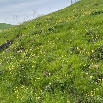


Took the homeschoolers (twin boys age 10) on a field trip today. It was just what we needed. I'd heard the parks and trails were crowded at times and were one way but not here.. the trails were like 6 feet wide and only passed 3 other people/families on our trail. Thought I'd heard bikes weren't allowed on the trails yet but saw 2 bikers as we entered the parking lot and one we passed on the trail was on his bike... we may try that next time as my boys are just finally getting the gears figured out on their mountain bikes. Great place to give it a try! The views at the top of the peaks are great.. we did the Laughlin trail which was shorter and probably not as scenic as others, but it was our first time. I can see how it could be torturing HOT on days over 85 degree as there is no shade on the trails. Today was perfect around 78 degrees. There is a shaded picnic table near the parking lot we saw families at on the way up and again on the way back. Parking was easy and people were respectful of social distancing. Nobody in masks, though asked to wear one if many are around (maybe the weekend).. Today we saw many little gophers, lizards, some bunnies, lots of cows and even had a couple follow us on the trail which freaked my boys out for a minute til I told them they were following the one ahead that left the herd while they were taking photos the other direction . I could have hiked longer as we stopped a lot to look at lots of little creatures on the way but was time well spent with my kids, outdoors and felt like something we had to drive a long ways a way far away from everything else, but only 10 min from home. So, weather cooperated and was super close for us.. best part, all FREE (even parking).. so 5 stars from us! read more


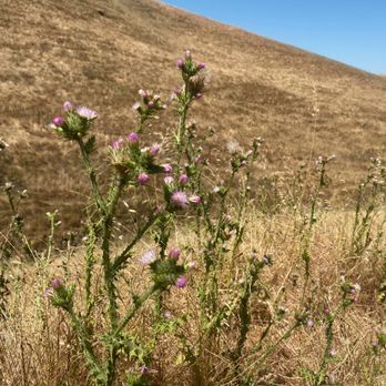
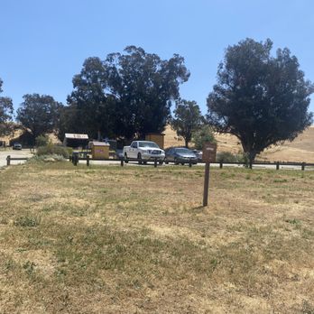

Being a Livermore local, Brushy Peak is a great preserve to go hiking or trail running at! I've experienced all seasons and the best time to go is spring. The hills are lush with green and the weather is just perfect with chill temperatures and lots of sun. Unfortunately, the green came and went by May and it's back to the yellow tall grasses, not saying that yellow isn't amazing, but the green surrounding the preserve and Livermore with the windmills in the background is just a beautiful sight. As for the trailhead, there are two ways to enter. There's one near the parking lot entrance that you can embark on the steep incline or you can enter through the less steep side near the restroom. The trails are pretty well paved and there are a couple hills to go up and down, but the 4.5 mile loop is great to get your mind off things or to catch up with friends. There's also many wildlife around. There are the herds of cows that may sometime crowd on a trail, don't worry you can just shoo them away. I've seen snakes, rabbits, and groundhogs so it's a very active wildlife area. read more


3 years ago
It is a very good place to hike in the tri-valley especially during the spring time. They preserve has a bathroom, it has multiple hikes. The scenery was beautiful. I would rate it as a moderate hike with decent elevation. It took us 2-2.5 hrs to complete the brushy peak trail. read more
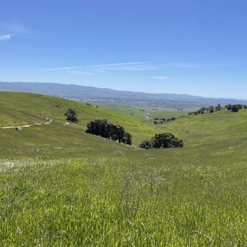


What a beautiful hike! A friend of mine recommended Brushy Peak as an easier hike for children. While there are a few hills, nothing that a 4 or 5 year old cannot handle. We did the hike during prime fire season, which meant CA's golden hills were seen instead of green ones, but it was still a beautiful hike. To those familiar with Livermore's windmills, you definitely get a close up of them. Bring some water, bring your dog if you have one as they allow dogs on leash & enjoy the stroll. Apparently it's even more beautiful around the March/April time frame! And a major bonus, parking is free. read more


Found this on Yelp. We used to live nearby and didn't know this hiking area exist. Thanks to Yelpers. It's peaceful here. Long and Open trails. It can get very hot or very cold depending on the weather. Today was freezing and we expected mini hiking trails. We ended hiking for 4 hours during lunch time, but luckily we had enough water and snacks to accommodate us.......and there's no such thing as mini hiking here. It's all uphill once you start.......gradual at first but it gets steeper. I would say, it's about 3-4 miles uphill. For people who have knee problems, this is not advisable. Must take Advil, hiking stick and knee support. Yes! For people like me, who also sprained my right ankle while hiking yesterday at Lake Chabot. As we walk on the trail and tell stories, we just keep hiking up not realizing we made it to the top. My hands and ears were frozen cause we didn't come prepared. At least now we will know what to expect if we decided to come back. There are many trails but I think we took the strenuous trail. So, depending on your hiking level, everyone can enjoy their hikes and chosen trails. Recommendation: probably better to start hiking early in the day. Dress accordingly. Bring water, and snacks. Do not text while on the trail...... Pay attention, there's a lot of Cow poop. Lol There's a nice view from the top, bring a camera. read more


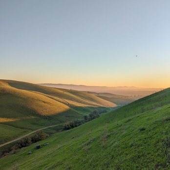


5 years ago
My favorite hike during winter time! Today was no exception. Very peaceful hike and parking is always non-chaotic. I'd take the West Loop Trail as a starting point due to lesser incline vs starting from the Brushy Peak Loop Trail side. The views start to become very scenic halfway through the hike. read more
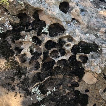


2 years ago

12 years ago
2 things I love.. Running and being outdoors. And for both of these Brushy Peak is a great place to come. There are two trails you can take - one directly to the top of the 1,700-foot peak or one slightly longer that goes around it which is a lot less steep. I enjoy my incline Run's so my favorite is to go directly to the top but on those day's where I have a less enthusiastic Husband in tow I'm happy to take either. Both are great for Running or Hiking depending on your fitness level and are not too long. If you take the route all the way around it's 4.4miles with the option to add roughly another 2. The views are quite impressive, you can see a lot of Livermore. The trail is also Dog friendly but they MUST be kept on a leash. Please don't be that person that let's your Dog run free scaring people and pooping all over the place. Not cool. *TIP* There is almost no shade so remember to wear Sunscreen and keep hydrated . read more

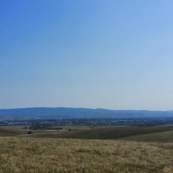


Okay, okay, it was on my bucket list, I wanted to go to the top some time. So, one day off in October, with my daughter in school and the hunny taking a nap, I took the long drive to the other side of Livermore and went to the top of Brushy Peak. Unfortunately for my wife, I came back down and went home. This walk in the park is not easy. But it's not very hard, either. Parts of it are a little steep, most is not. It's much easier than Fremont's Mission Peak. But the views are not drop-dead gorgeous, or even slightly impressive like on Mission Peak. The only real shade is on the long stretch at the top. And this country can get very hot. Thankfully, there is water available at the parking lot, so load up the water bottle; you and Fido will need it. The actual peak is in a Resource Protection Area. EBRPD gives the definition on the sign: "KEEP OUT". The trail to the top is a small footpath not on the map but easy to find once you're there. It's the steepest part of the trip, probably 500 feet to the barb wire fence with the KEEP OUT sign. If you squeeze through to reach the top, then leave only footprints, take only photos, and don't disturb the deer or trees. Brushy Peak is good for: A strong cardiovascular workout. A look at what the Bay Area was like before all the suburban development after World War II. A picnic with your date when you get to the oak forest at the top (hint to Denise L). An undeveloped wonderland to let your dog run and you hang onto the leash. It's a convenient jaunt close to 580, and if you don't get there, Mission Peak is better anyway. read more


This is a very beautiful, serene trail to hike. A moderate hike with stunning views of the hills and just overall nature. We came here a day after it rained so it was pretty muddy but still a fun and beautiful hike. There's a small stream at the top of the hill. You will also come across quite a few cows but they are harmless as long as you are good to them. We will definitely come back here again. read more


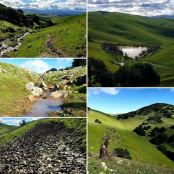


Came here on a Sunday morning the day after it had rained. If you're not in the mood to get covered in mud, I would probably hold off on hiking here. We hiked about a quarter of a mile before having to turn back. We were sinking in mud and my dogs were up to their chests in mud (given they are pretty low to the ground). It was a beautiful hike (the little we did see), very green and clean. There's lots of parking and a single clean bathroom at the start of the trails. There's maps as well and the trail heads were pretty obvious and direct. We definitely will come back once the rains let up for a bit, and the trails dry up a tad. read more


5 years ago
I love this hike, this is a better workout than sitting on my couch A little harder depending on the weather conditions, but worth every inch of it. read more



8 years ago

7 years ago
Very nice and beautiful hike! Definitely not for the newcomers or people like myself who say "I go to the gym everyday I can hike" Wow my legs and butt are on fire at points of this If you want a leg workout this is the place Very steep in some areas, up and down, so definitely recommend a good pair of shoes read more


8 years ago
A great loop trail with a nice view of the Livermore, Dublin, Pleasanton Tri Valley Link to my You Tube Review: https://youtu.be/Lk1Zi3ddTmE A part of the fantastic East Bay Park System #Eastbayparks read more


8 years ago
My husband and I really enjoyed this hike. We took the Brushy Peak trail and we weren't exactly sure when we hit "Brushy Peak", but we assumed it was once we were near the top in a brushy area. We went in April, which was great because everything was nice and green, and it was still cool, but also warm enough that you weren't freezing. We saw 2 snakes while we were out. One just slithered across the path and the other didn't budge when we jumped/hopped/ran around it. I would definitely do it again! read more


7 years ago
After reading the reviews, I made this hiking adventure a priority! I took our three girls, seven years old, nine years old, and 13 years old. They all did great! Even with the steep incline when you first start the hike! I was out of breath, but it was great exercise for the body! It was absolutely beautiful and perfect weather for the beginning of October. There is absolutely no shade, so I would not hike this any hotter than high 70s. Hiking shoes are a must for when you start making the decline around the hill because the dirt is soft and a bit slippery. I like that they have bathrooms before starting the hike and that there is no fee for parking. I will definitely hike this again, but try a different trail next time to add variety. read more




3 years ago

10 years ago
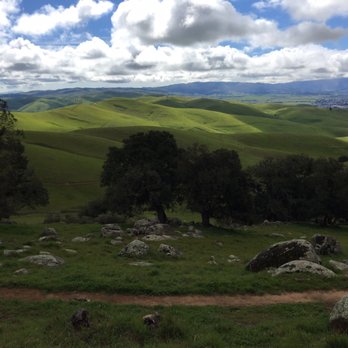
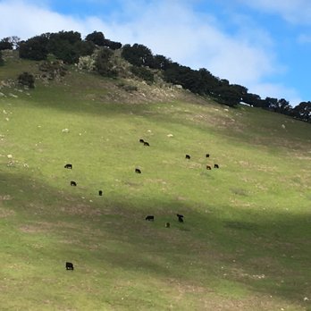
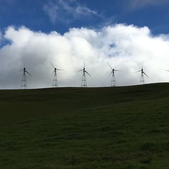
What a fun surprise, courtesy of (once again) the East Bay Regional Park District's 2017 Trails Challenge: http://www.ebparks.org/TrailsChallenge. I'd have never known Brushy Peak existed, let alone been inspired to visit. The park is located off the Vasco Road exit on 580 with a few turns to get you down the narrow road to the park. Free and plentiful parking with a good amount of foot & bike traffic on the trails, even very early in the morning. Gates open at 8 and when I arrived 8:30 on a Saturday morning, the lot was about 1/3 or more full. By 11:30 it was nearly 100% full. There are not a ton of trails so the park is pretty easy to navigate. Thanks to the guidebook for the 2017 trails challenge, the featured hike takes you through most of the trails. A six mile loop took my friend and I on the Laughlin Ranch Loop Trail to the Tamcan Trail, up the Brushy Peak Trail and then back down via the West Side Loop Trail. The elevation gain wasn't too steep, but over several inclines scattered throughout the hike, our guidebook said we gained a total of 2103 feet. Our hike was moderate-challenging, made more so by muddy trails and storm damaged paths that we needed to skirt around. I can see it being easier once the ground dries up a bit more BUT the time to go is in winter or early spring where the green hills and blue skies are particularly dramatic & striking. Along the route, we encountered cattle grazing but they seemed pretty docile and didn't pay us any mind. The peak itself is absolutely gorgeous-hands down the best part of the hike! Heading up to the top was pretty moderate and the rewards paid off in spades. Interesting rocky (and brushy-hence the name!) terrain with sweeping views, cool rock formations and a few wildflowers spattered along the peak. With quite a few photo stops, slow going as we crossed muddy areas and a quick snack break at the peak, the whole loop took us 3 hours. We felt very safe all along due to the number of other trail goers, but it wasn't overly crowded. I can see if I lived in Livermore this being my go-to weekend or after work hiking spot. Thank you once again to EPRD for their wonderful work on maintaining these trails and organizing the annual trails challenge! 2017 East Bay Regional Parks District Trails Challenge Hike #2 Miles hike on featured hike: 6 Total Miles Hiked on Challenge: 10.08 read more






9 years ago
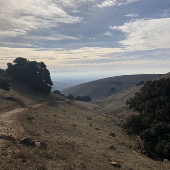
First time up here last weekend, it's a popular spot. Brushy Peak loop is a good 3 miles I would estimate with some decent inclines. The view from the highly elevated spots is great. Good place to bring the dog on a long hike. I will definitely be back several Times especially since it's so close to where I live. read more


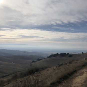


6 years ago
Short fun bike trail. Hike up is hard but the view from the top is nice. Rolling down the trail is fun, three trails and we're done. read more

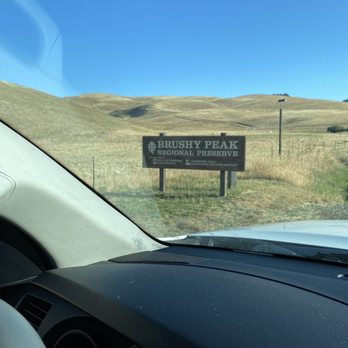


I'm not a hiker. Yet I had a fabulous time (hiking!) at Brushy Peak the other day. There are two sides to this 1,700-foot-tall peak: the public-access side operated by the East Bay Regional Park District (more the south side) and the other side owned by the Livermore Area Recreation and Park District. I have not been to the EBParks side, but went on a guided ranger tour of the LARPD side. This side of Brushy Peak is accessible only by guided tour. But it's so worth it to sign up for a hike and go out of your way to do it. Perhaps I never liked hiking before because I went with friends who only care about going fast and not taking time to look around. Seriously, what's the point then? Going with two rangers was a totally different story. They know all about the history of the park as well as the natural rock formations, identifying wildflowers, etc. It was really cool. And once again, let me say I had some trepidation before going ... being that it was uphill and I'm out of shape. You do get tired along the way, but it was a fairly gradual uphill, you don't make a straight line for the top. Some of the coolest stuff was much further down the hill anyway. It's kind of neat because it's in the Altamont, so you can hear the motors (are there motors?) in the windmills. I went on a perfect spring day. Don't try to find your own way out here, though, at least to the LARPD side because it is closed except for guided tours because of the sensitive nature of the site. If you'd rather check it out on your own, head for the EB Parks side. This may have just changed my mind about hiking. Maybe. read more

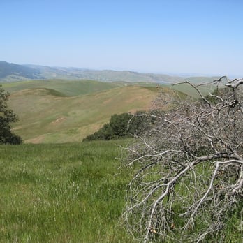


A good quick little hike. If you don't want to make the trek to Mission Peak and Dell Valle is getting old, this is a fun hike to get your nature/excercise fix. Shade is very scarce so wear sunscreen and bring a hat. The trail doesn't exactly go to the top of Brushy peak, but instead circumnavigates the peak, and you walk all the way around it. Clean trail, easy footing, probably about 60-70 mintes round trip depending on your fitness level. read more


8 years ago
Page 1 of 2
More info about Brushy Peak Regional Preserve
Livermore, CA 94550
Directions
(925) 373-5700
Call Now
Hours
Outdoor Amenities
Ask the Community - Brushy Peak Regional Preserve
Review Highlights - Brushy Peak Regional Preserve
You might also consider
















Why does Yelp recommend reviews?
1 review that is not currently recommended
The reviews below are not factored into the business's overall star rating.

9 years ago
Brushy Peak Regional Preserve - hiking - Updated September 2026
Best of Livermore
People found Brushy Peak Regional Preserve by searching for…
Hiking Trails in Livermore, CA
Places to Take Pictures in Livermore, CA
Beautiful Views in Livermore, CA
Walking Trails in Livermore, CA
Dog Friendly Hiking Trails in Livermore, CA
Lakes & Ponds in Livermore, CA
Off Road Trails in Livermore, CA
Secluded Spots in Livermore, CA
Flower Fields in Livermore, CA
Running Trails in Livermore, CA
Trending Searches in Livermore, CA
Apple Orchards near Brushy Peak Regional Preserve
Apple Picking near Brushy Peak Regional Preserve
Archery near Brushy Peak Regional Preserve
Barbershop near Brushy Peak Regional Preserve
Blow Dry Bar near Brushy Peak Regional Preserve
Caves near Brushy Peak Regional Preserve
Cliff Jumping near Brushy Peak Regional Preserve
Consignment Shops near Brushy Peak Regional Preserve
Corn Maze near Brushy Peak Regional Preserve
Dog Friendly Things To Do near Brushy Peak Regional Preserve
Dog Swimming near Brushy Peak Regional Preserve
Eyebrow Threading near Brushy Peak Regional Preserve
Eyelash Extensions near Brushy Peak Regional Preserve
Hiking near Brushy Peak Regional Preserve
Kids Birthday Party near Brushy Peak Regional Preserve
Makeup Artists near Brushy Peak Regional Preserve
Mens Suits near Brushy Peak Regional Preserve
Off Road Trails near Brushy Peak Regional Preserve
Parks near Brushy Peak Regional Preserve
Photo Spots near Brushy Peak Regional Preserve
Picnic Areas near Brushy Peak Regional Preserve
Places To Take Pictures near Brushy Peak Regional Preserve
Private Schools near Brushy Peak Regional Preserve
Public Shower near Brushy Peak Regional Preserve
Rock Quarry near Brushy Peak Regional Preserve
Scenic Night View near Brushy Peak Regional Preserve
Scenic Overlook near Brushy Peak Regional Preserve
Browse Articles
Browse Nearby
BEST of Livermore, California Coffee near Brushy Peak Regional Preserve
BEST of Livermore, California Things to Do near Brushy Peak Regional Preserve
BEST of Livermore, California Restaurants near Brushy Peak Regional Preserve
BEST of Livermore, California Parks near Brushy Peak Regional Preserve
BEST of Livermore, California Walking Trails near Brushy Peak Regional Preserve
BEST of Livermore, California Breakfast near Brushy Peak Regional Preserve
BEST of Livermore, California Campgrounds near Brushy Peak Regional Preserve
Browse Brands
Related Searches in Livermore, CA
Affordable Kayak Rental Services in Livermore, California
Best Dog Hiking Trails Around Livermore, California
Best Fishing Locations and Guides in Livermore, California
Best Nature Trails for Hiking in Livermore, California
Best Places for Horseback Riding in Livermore, California
Check Out Off Road Trails in Livermore, California
Discover Dog Friendly Trails to Explore in Livermore, California
Discover Easy Hiking Trails Near Livermore, California
Discover Kid Friendly Hiking Trails in Livermore, California
Discover Popular Bike Trails in Livermore, California
Discover Scenic Mountain Bike Trails Near Livermore, California
Discover Walking Parks in Livermore, California Near You
Discover a Hiking Trail in Livermore, California
Discover the Best Night Hike Trails in Livermore, California
Dog-Friendly Hikes With Dogs in Livermore, California
Enjoy Camping Adventures Around Livermore, California
Enjoy Kayaking Adventures in Livermore, California
Enjoy Off Leash Dog Hikes in Livermore, California
Enjoy Scenic Places to Walk in Livermore, California
Enjoy a Beautiful Waterfall Hike in Livermore, California
Enjoy the Best Walking Path in Livermore, California
Enjoy the Best Walking Trails in Livermore, California
Explore Beautiful Parks and Green Spaces in Livermore, California
Explore Easy Hikes Perfect for All in Livermore, California
Explore Fun Activities to Do in Livermore, California
Explore Popular Campgrounds Near Livermore, California
Explore Popular Dog Walking Trails in Livermore, California
Explore Top Dog Parks in Livermore, California Near You
Explore the Best Beach Spots in Livermore, California
Family Friendly Hiking With Kids in Livermore, California
Find Parks and Recreation Activities in Livermore, California
Find Top Dog Friendly Parks to Visit in Livermore, California
Find Top-Rated Waterfalls in Livermore, California Now
Find the Best Parks for Picnics in Livermore, California
Hiking Trails With Waterfalls in Livermore, California
Off Leash Dog Hiking Trails in Livermore, California
Popular Outdoor Activities to Try in Livermore, California
Popular Picnic Spots to Visit in Livermore, California
Popular Waterfall Hiking Trails in Livermore, California
Safe River Swimming Areas in Livermore, California
Safe and Fun Parks for Kids in Livermore, California
Top Hiking Trails to Explore in Livermore, California
Top Playgrounds for Kids to Enjoy in Livermore, California
Top Running Trails to Explore in Livermore, California
Top Swimming Lakes to Enjoy in Livermore, California
Top Swimming Spots and Pools in Livermore, California
Top-Rated Camping Sites in Livermore, California


