Cathance River Nature Reserve Trails Photos


You might also consider

More like Cathance River Nature Reserve Trails
Recommended Reviews - Cathance River Nature Reserve Trails
Start your review...



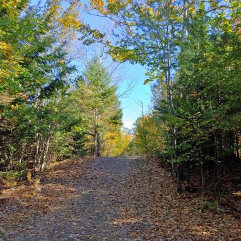
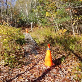
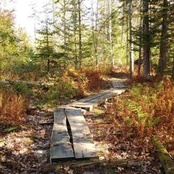
Walking along the Cathance River reminded me a lot of Swift River in the Kancamagus - a stunning hike through the forest alongside a rushing body of water (stretches of which include Class IV rapids). So much of it felt so organic too - rocks and tree roots making paths and stairs through the gently winding quiet woods. It's well marked, the directional signs are in the perfect places, and the trails are all extremely well maintained. What a fantastic way to spend an autumnal morning - had a picnic on some of the rocks that were jutting out into the river with the sun pouring down around me. For sure the way to go for maximum water views, with the most privacy, is: park at the Ecology Center, walk down to it and hook a left on Highland Trail (blue), which connects to Cathance River Trail (white), take Cathance River Trail to Rapids Trail (yellow), Rapids Trail back to Highland Trail and the Ecology Center. I say this because... You should know that this hiking area is basically within a housing development on a golf course and is currently undergoing a lot of construction on the eastern side of the trail system (anything around and beyond the actual Hiker Parking area - didn't see the wooden bridge near Old Quarry Road or the Clay Brook bridge to Head of Tide Park because I wasn't allowed to access them when I came). Also, you can hear the traffic from 295 pretty clearly throughout most of the trail system. I didn't know either of these things, so both were a bit off-putting. As an aside, I was yelled at twice: once by a golfer and once by some lady in her backyard who could see me through the trees. Both wanted to know what I was doing, why I was doing it, and where my destination was (not even kidding). It seems to me there needs to be bit more communication with these folks about the trail system here - that people actually come to hike them. Until that happens, my advice is to avoid anything and everything to do with the heath (all trails to it and around it since this is where golfing and people's backyards seem to be). I'm looking forward to coming back when construction is done and the area is a less confusing and awkward place to navigate as a hiker. But I will stick to the trails near the water! read more






9 years ago

This really is as good as it gets. The trails are well maintained and range from small foot paths that are either packed gravel, dirt, roots, or rocks that are good for a good day hike. There are trails for the staff members to get carts through for their Ecology center, and then there are also dirt roads that meander through for both CREA and the golf course that hugs the border. These trails are also very good for any runners out there that want to feel like they are in nature, but not twist their ankle on an unseen rock, root, or stump. The Ecology center does a wonderful job educating both child and adult on all the wonderful creatures and plants in this habitat. I personally have never been in the center, but many of the grades at my school attend field trips at the center and have been for years. Below is taken from their website at www.creamaine.org Mission Statement The mission of the Cathance River Education Alliance is to use the natural resources of the Cathance River Preserve to promote ecological awareness and nature-based learning among students, educators, and the public; to foster the wise use of the Preserve; and to prepare future stewards of the Cathance River. Teaching Goals & Actions Encourage and assist area schools, teachers, students, and administrators to develop environmental education curricula, workshops, and in-classroom activities. Use organized student visits to the Cathance River Preserve and the Cathance River Ecology Center as hands-on teaching resources to emphasize the value of understanding our natural environment. Encourage and support future stewards of the Preserve and the Cathance River. Foster wise use of the Cathance River Preserve and the Cathance Corridor. Oversee the trails and the Ecology Center. Develop programs that educate the general public about ecology, environmental preservation, and sustainable living. Foster an appreciation for local natural resources and meaningful cross-generational interaction. Maintain and enhance constructive relationships with the Preserve owner, Highland Green, and the holder of the conservation easement, Brunswick-Topsham Land Trust. Establish working relationships with other environmental organizations to generate awareness and support for the Alliance, for the preservation of the Cathance River Corridor, and for the broader educational mission of the Cathance River Education Alliance. read more


More info about Cathance River Nature Reserve Trails
219 Evergreen Cir
Topsham, ME 04086
Directions
Visit Website
http://www.creamaine.org
Hours
Outdoor Amenities




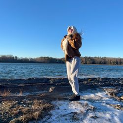





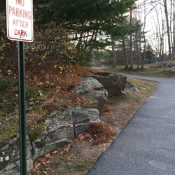

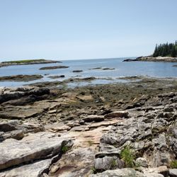




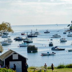

Cathance River Nature Reserve Trails - hiking - Updated September 2026
Best of Topsham
People found Cathance River Nature Reserve Trails by searching for…
Trending Searches in Topsham, ME
Apple Orchards near Cathance River Nature Reserve Trails
Apple Picking near Cathance River Nature Reserve Trails
Barbershop near Cathance River Nature Reserve Trails
Bike Shop near Cathance River Nature Reserve Trails
Casinos near Cathance River Nature Reserve Trails
Cliff Jumping near Cathance River Nature Reserve Trails
Consignment Shops near Cathance River Nature Reserve Trails
Cruising Spots near Cathance River Nature Reserve Trails
Dog Friendly Things To Do near Cathance River Nature Reserve Trails
Estheticians near Cathance River Nature Reserve Trails
Eyebrow Threading near Cathance River Nature Reserve Trails
Eyelash Extensions near Cathance River Nature Reserve Trails
Furniture Stores near Cathance River Nature Reserve Trails
Hiking Trails With Waterfalls near Cathance River Nature Reserve Trails
Kids Birthday Party near Cathance River Nature Reserve Trails
Kids Haircut near Cathance River Nature Reserve Trails
Makeup Artists near Cathance River Nature Reserve Trails
Mattresses near Cathance River Nature Reserve Trails
Outdoor Activities near Cathance River Nature Reserve Trails
Parks near Cathance River Nature Reserve Trails
Picnic Areas near Cathance River Nature Reserve Trails
Places To Take Pictures near Cathance River Nature Reserve Trails
Public Shower near Cathance River Nature Reserve Trails
Rock Quarry near Cathance River Nature Reserve Trails
Scenic Night View near Cathance River Nature Reserve Trails
Scenic Overlook near Cathance River Nature Reserve Trails
Star Gazing near Cathance River Nature Reserve Trails
Sunrise View near Cathance River Nature Reserve Trails
Swimming Holes near Cathance River Nature Reserve Trails
Trading Card Shops near Cathance River Nature Reserve Trails
Browse Nearby
Browse Brands
Related Searches in Topsham, ME
Affordable Canoe Rental Options in Topsham, Maine
Affordable Kayak Rental Services in Topsham, Maine
Best Dog Hiking Trails Around Topsham, Maine
Best Fishing Locations and Guides in Topsham, Maine
Best Places for Horseback Riding in Topsham, Maine
Best Sightseeing Experiences Available in Topsham, Maine
Check Out Off Road Trails in Topsham, Maine
Discover Dog Friendly Trails to Explore in Topsham, Maine
Discover Popular Bike Trails in Topsham, Maine
Discover a Hiking Trail in Topsham, Maine
Discover the Best Beaches in Topsham, Maine
Discover the Best Night Hike Trails in Topsham, Maine
Dog-Friendly Hikes With Dogs in Topsham, Maine
Enjoy Camping Adventures Around Topsham, Maine
Enjoy Kayaking Adventures in Topsham, Maine
Enjoy Off Leash Dog Hikes in Topsham, Maine
Enjoy Tent Camping Spots Around Topsham, Maine
Enjoy a Beautiful Waterfall Hike in Topsham, Maine
Enjoy the Best Walking Trails in Topsham, Maine
Explore Beautiful Parks and Green Spaces in Topsham, Maine
Explore Easy Hikes Perfect for All in Topsham, Maine
Explore Fun Activities to Do in Topsham, Maine
Explore Popular Campgrounds Near Topsham, Maine
Explore Popular Scenic Views Near Topsham, Maine
Explore Popular State Park Destinations in Topsham, Maine
Explore Top Dog Parks in Topsham, Maine Near You
Explore the Best Beach Spots in Topsham, Maine
Family Friendly Hiking With Kids in Topsham, Maine
Find Beautiful Views in Topsham, Maine
Find Top Dog Friendly Parks to Visit in Topsham, Maine
Find Top-Rated Waterfalls in Topsham, Maine Now
Find the Best Parks for Picnics in Topsham, Maine
Find the Best Playgrounds to Visit in Topsham, Maine
Find the Best Scenic View Locations in Topsham, Maine
Hiking Trails With Waterfalls in Topsham, Maine
Off Leash Dog Hiking Trails in Topsham, Maine
Perfect Spots to Watch Sunset in Topsham, Maine
Plan a Scenic Drive Route Near Topsham, Maine
Popular Outdoor Activities to Try in Topsham, Maine
Popular Picnic Spots to Visit in Topsham, Maine
Safe and Fun Parks for Kids in Topsham, Maine
Top Hiking Trails to Explore in Topsham, Maine
Top Playgrounds for Kids to Enjoy in Topsham, Maine
Top Running Trails to Explore in Topsham, Maine
Top Swimming Lakes to Enjoy in Topsham, Maine
Top Swimming Spots and Pools in Topsham, Maine
Top Things to Do With Kids in Topsham, Maine
Top-Rated Camping Sites in Topsham, Maine





