Cecret Lake Photos


You might also consider


More like Cecret Lake
Recommended Reviews - Cecret Lake
Start your review...


Reviews With Photos
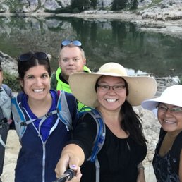

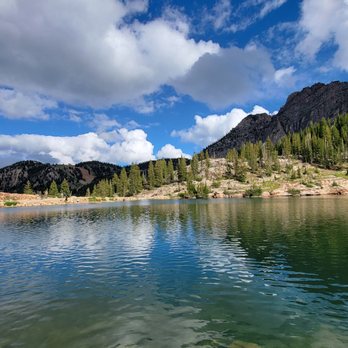
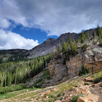
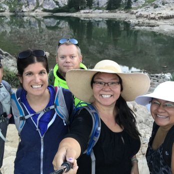
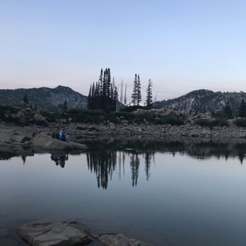
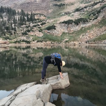
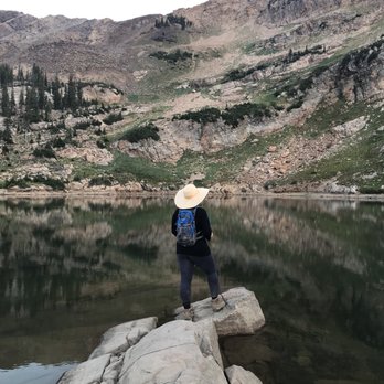
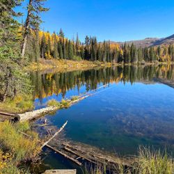
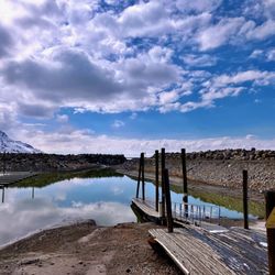
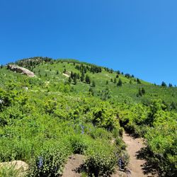
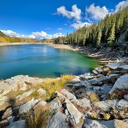
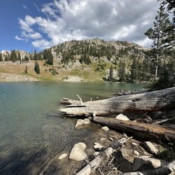
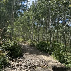
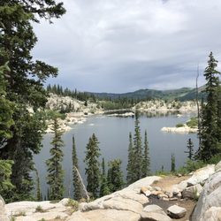
There are several ways to get here, but the outdoors hiking group I went with started from the bottom and hiked our way up: 6 miles round trip. We started our trail behind Albion Grill and slowly worked our way up. Along the trail, you'll see wildflowers, deer, a hidden restaurant, tons of hikers, stunning green foliage, and be greeted at the end with a lake. I didn't see any moose on the trail, but others have seen them in the past. If you're not up for hiking 6 miles, you can pay $6.00 to park closer going 2 or 4 miles round trip instead. Pictures doesn't do any justice for Cecret Lake. You actually have to be there and experience the views yourself. Hopefully my pictures show how peaceful this place can be with tons of hikers around! Just gotta find that sweet spot that no one will be around to photobomb your lake!


Great hike! Arrive early or when it gets full you have to wait for someone to leave at the gate. I went thru around 10, and had to wait 40 min. The very end is steep and rocky, my kids whined a lot, but they made it. No dogs allowed.

This was such an amazing hike. It isn't the easiest but not the hardest, we enjoyed!! Breath taking!


Cecret Lake is beautiful and worth the hike to the top. You'll be at over 9,000 feet but the views are worth it. In mid June there was still plenty of snow to hike through. Wearing good hiking shoes is important - we encountered snow, streams too wide to jump over and deep enough to get your feet wet, and lots of mud! We took the trails up and walked the road back down. I'm a beginner but it took us a total of 2.5 hrs to complete. It wasn't too overcrowded when we went on a Sunday around 1pm. As you get closer to the lake the terrain can be sketchy navigating through the rock and tight areas. I fell and cut my hand a bit. Worth it though!!!


So much beauty packed into a short hike. Wildflowers, pikas, and plenty of landscape. In addition to the lake, you'll see water in many other forms... streams, rivers, icechunks and snow... even in July! Its popular for a reason, and on a summer weekend its really busy where you'll see lots of other families enjoying the same sights. However its well kept, and people are respectful of nature, and I didn't see any trash on the trail. The most annoying part is definitely waiting for the shuttles when its busy, but its free and friendly so can't complain. The second most annoying thing is the flying bugs near the lake... mating season maybe? Either way you just need to hike a bit away and enjoy the view from afar. Perfect for beginners, families, and even visiting friends (like me who aren't as adjusted to high altitude hiking).


I've been hiking trails in both Big and Little Cottonwood Canyons all my life, and I'm just now getting to this one for the first time. And now I kind of know why. It's an okay hike, but not the best. I did enjoy hiking the same hills I ski in the winter, so that part was cool, and the scenery is beautiful. Not the best trail around, and Cecret Lake itself is more of a pond, and a bit dirty looking and buggy on top of that, so not the best end of hike payoff, but it's still worth hiking at least once. By the way, it is pronounced like "Secret Lake", though it's not so secret. A lot of people were out hiking it, so apparently people like it maybe a little more than I did.
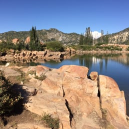

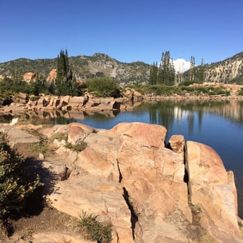
One of the best easy hikes in the area. The lake is lovely but the 10,000 altitude can tire inexperienced hikers quickly. It did me. We watched a good sized bull moose eat willows for a half hour and the lake has plenty of shady spots to sit and gaze at the tranquil beauty.


We went on a Saturday around 9:45 and snatched up one of the last spots in the Catherine pass parking lot- the cecret lot was already full. The 1 mile (one way) isn't too bad at all if you're relatively active (not sure with kids although many on the trail).. the view is amazing and well worth it. We hiked amphitheater lake in the grand Tetons and hikes 10 miles RT for this same lake view (except surrounding mountains were Tetons)... This is so solid for 2 miles RT!!


This review is for Cecret Lake from Albion Base which was a ~4.5 miles round trip that took ~2.5 hours to complete. Trail starts from a ski resort which means it would be difficult or inaccessible during the winter! Extremely diverse terrain; stunning views from beginning to end. The last stretch up to the lake was steep and rocky! AllTrails map recommended. Short video of the hike for those interested! https://youtu.be/zkHFyRgwxMQ read more
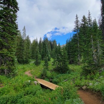
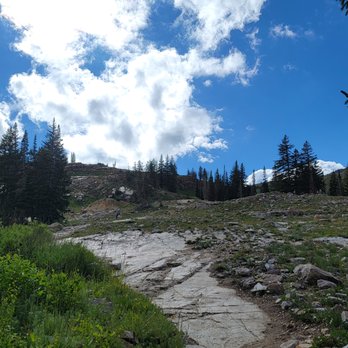

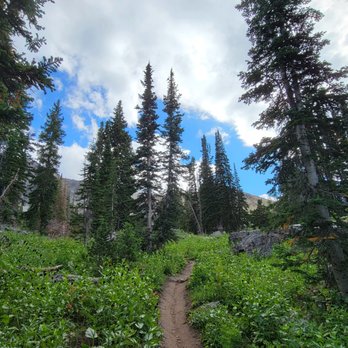


There are several ways to get here, but the outdoors hiking group I went with started from the bottom and hiked our way up: 6 miles round trip. We started our trail behind Albion Grill and slowly worked our way up. Along the trail, you'll see wildflowers, deer, a hidden restaurant, tons of hikers, stunning green foliage, and be greeted at the end with a lake. I didn't see any moose on the trail, but others have seen them in the past. If you're not up for hiking 6 miles, you can pay $6.00 to park closer going 2 or 4 miles round trip instead. Pictures doesn't do any justice for Cecret Lake. You actually have to be there and experience the views yourself. Hopefully my pictures show how peaceful this place can be with tons of hikers around! Just gotta find that sweet spot that no one will be around to photobomb your lake! read more


4 years ago
Great hike! Arrive early or when it gets full you have to wait for someone to leave at the gate. I went thru around 10, and had to wait 40 min. The very end is steep and rocky, my kids whined a lot, but they made it. No dogs allowed. read more


4 years ago
This was such an amazing hike. It isn't the easiest but not the hardest, we enjoyed!! Breath taking! read more


4 years ago

13 years ago


Cecret Lake is beautiful and worth the hike to the top. You'll be at over 9,000 feet but the views are worth it. In mid June there was still plenty of snow to hike through. Wearing good hiking shoes is important - we encountered snow, streams too wide to jump over and deep enough to get your feet wet, and lots of mud! We took the trails up and walked the road back down. I'm a beginner but it took us a total of 2.5 hrs to complete. It wasn't too overcrowded when we went on a Sunday around 1pm. As you get closer to the lake the terrain can be sketchy navigating through the rock and tight areas. I fell and cut my hand a bit. Worth it though!!! read more


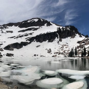


So much beauty packed into a short hike. Wildflowers, pikas, and plenty of landscape. In addition to the lake, you'll see water in many other forms... streams, rivers, icechunks and snow... even in July! Its popular for a reason, and on a summer weekend its really busy where you'll see lots of other families enjoying the same sights. However its well kept, and people are respectful of nature, and I didn't see any trash on the trail. The most annoying part is definitely waiting for the shuttles when its busy, but its free and friendly so can't complain. The second most annoying thing is the flying bugs near the lake... mating season maybe? Either way you just need to hike a bit away and enjoy the view from afar. Perfect for beginners, families, and even visiting friends (like me who aren't as adjusted to high altitude hiking). read more


I've been hiking trails in both Big and Little Cottonwood Canyons all my life, and I'm just now getting to this one for the first time. And now I kind of know why. It's an okay hike, but not the best. I did enjoy hiking the same hills I ski in the winter, so that part was cool, and the scenery is beautiful. Not the best trail around, and Cecret Lake itself is more of a pond, and a bit dirty looking and buggy on top of that, so not the best end of hike payoff, but it's still worth hiking at least once. By the way, it is pronounced like "Secret Lake", though it's not so secret. A lot of people were out hiking it, so apparently people like it maybe a little more than I did. read more


12 years ago

One of the best easy hikes in the area. The lake is lovely but the 10,000 altitude can tire inexperienced hikers quickly. It did me. We watched a good sized bull moose eat willows for a half hour and the lake has plenty of shady spots to sit and gaze at the tranquil beauty. read more


5 years ago
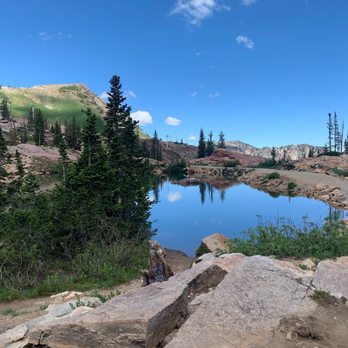
Beautiful and easy hike. We did it with kids, the youngest 5 years old. Go early before it gets too hot and crowded in the day. read more


6 years ago

10 years ago

11 years ago

We went on a Saturday around 9:45 and snatched up one of the last spots in the Catherine pass parking lot- the cecret lot was already full. The 1 mile (one way) isn't too bad at all if you're relatively active (not sure with kids although many on the trail).. the view is amazing and well worth it. We hiked amphitheater lake in the grand Tetons and hikes 10 miles RT for this same lake view (except surrounding mountains were Tetons)... This is so solid for 2 miles RT!! read more


10 years ago
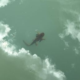
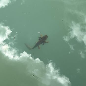
Beautiful hike, Albion Basin is such a gem. Cecret Lake is beautiful as well! A whole bunch of kids were catching salamanders which was fun. Relatively short hike, however we were told this was an easy hike for kids. For older kids, definitely doable. My 2 year old definitely struggled with the last half of the hike, as it's all uphill. Ended up having to carry him uphill about half a mile so it just about killed me being pregnant and from California (ah that altitude at 10000 ft is killer), but I'd definitely do this hike again without young kids. read more

11 years ago

More info about Cecret Lake
8595 Albion Basin Rd
Salt Lake City, UT 84121
Directions
Hours
Indoor Amenities
Outdoor Amenities
Ask the Community - Cecret Lake
Are the dogs allowed here?
The entire canyon is a watershed area. Dogs are not allowed.
I plan on visiting in early March. I would like to plan for a private or group guided hike one afternoon. Can anyone advise me on a best in class hiking guide company? Thank you in advance!!
In early March, Cecret Lake and the entire canyon will still be under several feet of snow and the lake frozen over. It usually isn't hikeable until June, or July in years of heavy snow. The trail actually crosses under a ski lift of Alta Ski Resort…
Review Highlights - Cecret Lake
You might also consider




























Why does Yelp recommend reviews?
1 review that is not currently recommended
The reviews below are not factored into the business's overall star rating.
6 years ago
Cecret Lake - lakes - Updated August 2026
Best of Salt Lake City
People found Cecret Lake by searching for…
Things to Do in Salt Lake City, UT
Picnic Areas in Salt Lake City, UT
Scenic View in Salt Lake City, UT
Fishing Spots in Salt Lake City, UT
Photo Spots in Salt Lake City, UT
Easy Hikes in Salt Lake City, UT
Beautiful Views in Salt Lake City, UT
Off Road Trails in Salt Lake City, UT
Make Out Spot in Salt Lake City, UT
Scenic Drive in Salt Lake City, UT
Swimming Lakes in Salt Lake City, UT
Swimming Holes in Salt Lake City, UT
Dog Swimming in Salt Lake City, UT
Secret Spots in Salt Lake City, UT
Lakes & Ponds in Salt Lake City, UT
River Swimming in Salt Lake City, UT
Dog Friendly Lakes in Salt Lake City, UT
Swimming in Salt Lake City, UT
Fishing With Kids in Salt Lake City, UT
Fishing Lake in Salt Lake City, UT
Trending Searches in Salt Lake City, UT
Barbershop For Men near Cecret Lake
Cliff Jumping near Cecret Lake
Consignment Shops near Cecret Lake
Eyebrow Threading near Cecret Lake
Fishing Spots near Cecret Lake
Outdoor Basketball Courts near Cecret Lake
Parks With Shade near Cecret Lake
Permanent Makeup near Cecret Lake
Playgrounds For Kids near Cecret Lake
Public Golf Courses near Cecret Lake
Running Trails near Cecret Lake
Scenic Night View near Cecret Lake
Scenic Overlook near Cecret Lake
Shopping Malls near Cecret Lake
Swimming Holes near Cecret Lake
Trading Card Shops near Cecret Lake
Used Furniture Stores near Cecret Lake
Browse Articles
Browse Nearby
BEST of Salt Lake City, Utah Things to Do near Cecret Lake
BEST of Salt Lake City, Utah Restaurants near Cecret Lake
BEST of Salt Lake City, Utah Coffee near Cecret Lake
BEST of Salt Lake City, Utah Picnic Areas near Cecret Lake
BEST of Salt Lake City, Utah Parks near Cecret Lake
BEST of Salt Lake City, Utah Natural Hot Springs near Cecret Lake
BEST of Salt Lake City, Utah Sledding near Cecret Lake
Browse Brands
Related Searches in Salt Lake City, UT
Affordable Kayak Rental Services in Salt Lake City, Utah
Best Fishing Locations and Guides in Salt Lake City, Utah
Best Parks for Parties and Events in Salt Lake City, Utah
Best Pontoon Boat Rentals Near Salt Lake City, Utah
Discover Lakes & Ponds to Explore in Salt Lake City, Utah
Discover Popular Bike Trails in Salt Lake City, Utah
Discover the Best Beaches in Salt Lake City, Utah
Enjoy Water Activities and Fun in Salt Lake City, Utah
Enjoy the Best Walking Trails in Salt Lake City, Utah
Experienced Fishing Guides Available in Salt Lake City, Utah
Explore Beautiful Parks and Green Spaces in Salt Lake City, Utah
Explore Boat Rentals for Every Need in Salt Lake City, Utah
Explore Easy Hikes Perfect for All in Salt Lake City, Utah
Explore Fun Activities to Do in Salt Lake City, Utah
Explore Parks With Lakes to Visit in Salt Lake City, Utah
Explore Popular Campgrounds Near Salt Lake City, Utah
Explore Popular Picnic Areas Around Salt Lake City, Utah
Explore Popular RV Parks Around Salt Lake City, Utah
Explore Secret Spots Worth Visiting in Salt Lake City, Utah
Explore Top Marinas Near Salt Lake City, Utah
Explore Top Water Parks in Salt Lake City, Utah Today
Explore the Best Swimming Holes Around Salt Lake City, Utah
Explore the Scenic River in Salt Lake City, Utah
Find Beautiful Views in Salt Lake City, Utah
Find Cozy Camping Cabins in Salt Lake City, Utah
Find Parks and Recreation Activities in Salt Lake City, Utah
Find Top Dog Friendly Parks to Visit in Salt Lake City, Utah
Find Top-Rated Waterfalls in Salt Lake City, Utah Now
Find the Best Parks BBQ Grills in Salt Lake City, Utah
Find the Best Parks for Picnics in Salt Lake City, Utah
Find the Best Playgrounds to Visit in Salt Lake City, Utah
Find the Best Swimming Pools in Salt Lake City, Utah Today
Great Places to Swim in Salt Lake City, Utah
Have Fun at a Splash Pad in Salt Lake City, Utah
Hiking Trails With Waterfalls in Salt Lake City, Utah
Picnic Areas With BBQ Pits Available in Salt Lake City, Utah
Popular Fishing Spots to Explore in Salt Lake City, Utah
Popular Picnic Spots to Visit in Salt Lake City, Utah
Relax at Natural Hot Springs Near Salt Lake City, Utah
Safe Lakes for Swimming Near Salt Lake City, Utah
Safe River Swimming Areas in Salt Lake City, Utah
Safe and Fun Parks for Kids in Salt Lake City, Utah
Top Fishing Ponds to Visit in Salt Lake City, Utah
Top Hiking Trails to Explore in Salt Lake City, Utah
Top Playgrounds for Kids to Enjoy in Salt Lake City, Utah
Top Swimming Lakes to Enjoy in Salt Lake City, Utah
Top Swimming Spots and Pools in Salt Lake City, Utah


