Ensign Peak Park Photos


You might also consider


More like Ensign Peak Park
Recommended Reviews - Ensign Peak Park
Start your review...


Reviews With Photos


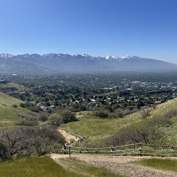
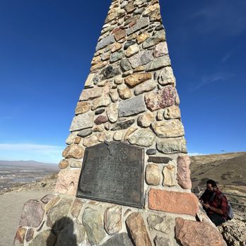
Trivia: On July 26th, 1847, this person and seven others used Ensign Peak to survey the land below. Technically (and I guess this means I like to be to be credit for all my miles) this hike started at my hotel so the whole adventure was about 6 or 7 miles. All uphill to Ensign and then all downhill. I'm guessing that the trail itself was under 1.5 miles, bottom to top back to bottom. It basically curls up and brings you to the peak from the backside. Delightful bunches of mountain sage can be picked and enjoyed near the top. One of my favorite smells. The trail itself IS uphill. But it's relatively short. If you're from out of town and live closer to sea level, remember that SLC sits above 4000 feet. So plan some extra time as your lungs will thank you. It's a busy trail. And while decently spacious at the top, it's not going to likely be a place of solitude.


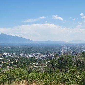
Ensign Peak Nature Park is an easy and enjoyable hike, even if you're not in the best shape. The trail is nice and not too long, and the payoff at the top is amazing, you get a beautiful, panoramic view of the entire Salt Lake City valley. Totally worth the effort for the scenery and the experience!
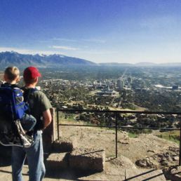

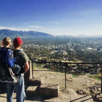
Not too difficult to find. I hiked this trail to Ensign Peak in autumn. Carried my oldest son on my back. Let him run and play on the trail at times. He was very young. I wanted him to experience hiking in the west. The trail wasn't crowded in October. The trail isn't long, but it is kind of steep. At the top, you can see all across the Salt Lake Valley on clear days when the skies are clear. You can look west and see Antelope Island and the Great Salt Lake. You can look south and see the city below the viewpoint. Looking east, you can see the Wasatch Mountains and the University of Utah on the foothills.


The hike was difficult for me because I struggle with elevation, but it was so worth it once I got to the top.


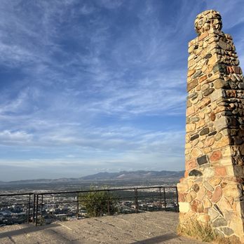
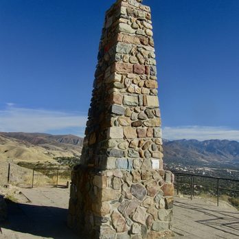
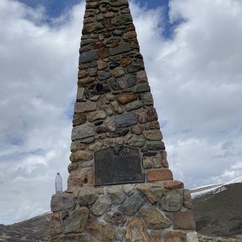
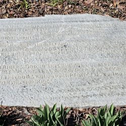
Ensign Peak is a public park just north of Salt Lake City. It was here the Brigham Young laid out the rough plan for the new city, since the spot has a commanding view of the land between the mountains and the lake. You park along the residential street adjacent to the park. I guess you could park a bit further away (near the capitol building, for instance) and walk further up too. Once you enter the park, there is a small level plaza with some plaques. You can ascend a few stairs and an incline (maybe you gain 25 - 30 feet in altitude) to the lower overlook. It is pretty close. Some of our party opted to wait there. If you choose the hike to the top, it is around a mile and a quarter, I think (about 2 km). The trail is not paved, but is well worn. I don't know the exact altitude gain, but it is probably on the order of at least 250 feet, maybe somewhat more. At the top there is a larger monument. You can see further to the south (than at the lower points) and you can even see the plaza and the street where you likely parked. I think it took us around 40 minutes up and back. It is easier if you have hiking boots (just to avoid slips on the descent) but I did it in sneakers. If you want a moderate but short hike with great views, this is a good spot to check out.
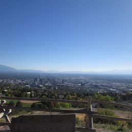

The hike up to the top is not bad. It might take 40 minutes depending on your pace. I rested a few times so it took a bit longer. It's worth the sweat and workout to the top. The view is really nice! Parking available on the street!


Ensign Peak Park was recommended to be checked out by the Mormon sisters of LDS. Earlier, we went on a tour. [Taken from the web] "Ensign Peak is a prominent hill on the northern edge of the Salt Lake Valley. On July 26, 1847, two days after arriving in the Salt Lake Valley, Brigham Young and seven other pioneer leaders climbed the hill to survey the valley. From its summit, they laid out in their minds the city they intended to build." You can park in the residential area of the neighborhood of some very nice homes! The trailhead is easily accessed from the street. The views overseeing Salt Lake City are breaktaking. We went on the Vista Mound trail - fairly easy but with an slight incline.


I wanted to experience an awesome nature view, and Ensign Peak kept coming up in my searches! I'm not a hiker and I read it was a fairly easy hike to the top. I personally struggled with the uphill trek, but I think most of it was due to elevation I'm not used to (I'm from Texas, we are not 4600 ft above sea level!) I huffed and puffed and got to the top and it was a STUNNING view. I stayed there quite some time just taking it all in. It was nice and windy, and relaxing. I'd say it's a must see for people visiting SLC. If you're leaving after sunset, use some sort of flashlight and be careful! Going back down was hard on my knees, but much easier than going up :)


Super easy and accessible overlook for views of the city and the mountains at the same time.


Fun hike near downtown Salt Lake City, about a 10 minute drive that takes you up past the capital building. Pretty easy hike if you're in shape, doable even if you aren't. Takes about 25 minutes to climb up and 15 to get back down. Definitely worth doing if you are staying downtown!


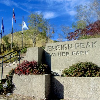
This is an excellent spot for a mini hike that will reward you with some epic city views! If you know me, you know that I'm addicted to sunsets. Ensign Peak Park is the perfect place to catch an incredible sunset in SLC. Of course, you gotta time it right. But once you experience it, it'll have you craving for more. This is a super quickish out and back hike that's less than a mile long, but don't let the short length fool you. It's a short little heart pumper with some steepish inclines. At most, I'd say to wear some kind of walking or running shoes. I did see a few people in flip flops but I think they were regretting that decision once they made it to the top. There's actually two vista point areas. The first one isn't a hike at all, just a short walk to one of the peaks. This part of the trail is paved and has a nice view of the city and a few places to pose for pictures. If you're not interested in hiking to the main vista point, then stopping at this vista may be best for you. The main vista point is straight up the hill along the Ensign Peak Trail. Once you make it to the top of the hill, you'll bare a left and go up one more small hill until you've made it to the peak. You'll know that you've made it because BAM.... all kinds of gorgeous views of the city will surround you. I can't say that it'll be super peaceful up there because this is a popular viewpoint spot, but the views are super enchanting. There's a good amount of space up there too. I think most people go up to take their pictures and then bounce. I had to linger a bit longer to really enjoy the entire sunset experience. It was truly lovely. This park also connects to another larger park called Mueller Park that has several other different hiking trails. If you want to make a day out of it or extend your hike, you can do so by connecting from this park. Since Ensign Peak Park is located within the a small residential neighborhood, parking is street only. There's a long road up the hill that heads up to the park, and this is where most people tend to park their cars. You'll see the entrance sign of the park right in front and it's hard to miss it. This was one of my favorite activities to partake in while visiting SLC. If you're looking for a beautiful vista point in SLC, Ensign Peak Park is a great place to explore.


I planned a birthday weekend getaway for my fiancé to Utah specifically for hiking! Locals advised us to visit Ensign Peak trail as its perfect for beginners. If I'm not mistaken, it was 10-12 miles round trip. The end point was definitely worth it! The views are amazing especially at sunset. Beautiful views and very proud we made it to the top. I would recommend planning accordingly because I don't recommend staying on the trail when it's dark. It's completely pitch black and very hard to see much of anything really. I definitely recommend this hike for anyone!


Quick drive from downtown SLC, street parking, and quick hike to beautiful views. It's a pretty steep drive and walk up, but I still made it okay in my dress shoes (I didn't want to waste time going back to the hotel to change and miss the sunset) after work.


I had a couple of hours free before my work day started and ChatGPT recommended this hike. It was an excellent recommendation. Good distance, mostly shaded during the early morning and amazing views. I could not have been happier to squeeze this hike in. Very popular in the morning. I parked by the adjacent park. Please come and create your own adventure. read more






Trivia: On July 26th, 1847, this person and seven others used Ensign Peak to survey the land below. Technically (and I guess this means I like to be to be credit for all my miles) this hike started at my hotel so the whole adventure was about 6 or 7 miles. All uphill to Ensign and then all downhill. I'm guessing that the trail itself was under 1.5 miles, bottom to top back to bottom. It basically curls up and brings you to the peak from the backside. Delightful bunches of mountain sage can be picked and enjoyed near the top. One of my favorite smells. The trail itself IS uphill. But it's relatively short. If you're from out of town and live closer to sea level, remember that SLC sits above 4000 feet. So plan some extra time as your lungs will thank you. It's a busy trail. And while decently spacious at the top, it's not going to likely be a place of solitude. read more


Ensign Peak Nature Park is an easy and enjoyable hike, even if you're not in the best shape. The trail is nice and not too long, and the payoff at the top is amazing, you get a beautiful, panoramic view of the entire Salt Lake City valley. Totally worth the effort for the scenery and the experience! read more



1 year ago
Not too difficult to find. I hiked this trail to Ensign Peak in autumn. Carried my oldest son on my back. Let him run and play on the trail at times. He was very young. I wanted him to experience hiking in the west. The trail wasn't crowded in October. The trail isn't long, but it is kind of steep. At the top, you can see all across the Salt Lake Valley on clear days when the skies are clear. You can look west and see Antelope Island and the Great Salt Lake. You can look south and see the city below the viewpoint. Looking east, you can see the Wasatch Mountains and the University of Utah on the foothills. read more



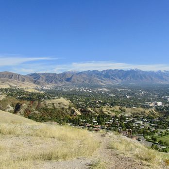


Ensign Peak is a public park just north of Salt Lake City. It was here the Brigham Young laid out the rough plan for the new city, since the spot has a commanding view of the land between the mountains and the lake. You park along the residential street adjacent to the park. I guess you could park a bit further away (near the capitol building, for instance) and walk further up too. Once you enter the park, there is a small level plaza with some plaques. You can ascend a few stairs and an incline (maybe you gain 25 - 30 feet in altitude) to the lower overlook. It is pretty close. Some of our party opted to wait there. If you choose the hike to the top, it is around a mile and a quarter, I think (about 2 km). The trail is not paved, but is well worn. I don't know the exact altitude gain, but it is probably on the order of at least 250 feet, maybe somewhat more. At the top there is a larger monument. You can see further to the south (than at the lower points) and you can even see the plaza and the street where you likely parked. I think it took us around 40 minutes up and back. It is easier if you have hiking boots (just to avoid slips on the descent) but I did it in sneakers. If you want a moderate but short hike with great views, this is a good spot to check out. read more


The hike up to the top is not bad. It might take 40 minutes depending on your pace. I rested a few times so it took a bit longer. It's worth the sweat and workout to the top. The view is really nice! Parking available on the street! read more
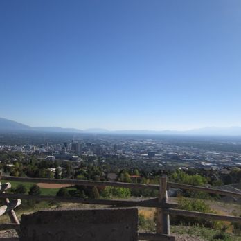
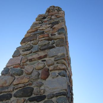

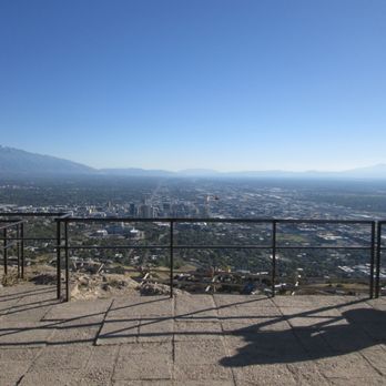
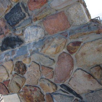

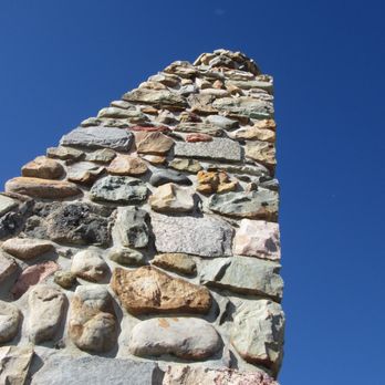
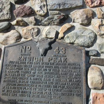


3 months ago

Ensign Peak Park was recommended to be checked out by the Mormon sisters of LDS. Earlier, we went on a tour. [Taken from the web] "Ensign Peak is a prominent hill on the northern edge of the Salt Lake Valley. On July 26, 1847, two days after arriving in the Salt Lake Valley, Brigham Young and seven other pioneer leaders climbed the hill to survey the valley. From its summit, they laid out in their minds the city they intended to build." You can park in the residential area of the neighborhood of some very nice homes! The trailhead is easily accessed from the street. The views overseeing Salt Lake City are breaktaking. We went on the Vista Mound trail - fairly easy but with an slight incline. read more


3 years ago
I wanted to experience an awesome nature view, and Ensign Peak kept coming up in my searches! I'm not a hiker and I read it was a fairly easy hike to the top. I personally struggled with the uphill trek, but I think most of it was due to elevation I'm not used to (I'm from Texas, we are not 4600 ft above sea level!) I huffed and puffed and got to the top and it was a STUNNING view. I stayed there quite some time just taking it all in. It was nice and windy, and relaxing. I'd say it's a must see for people visiting SLC. If you're leaving after sunset, use some sort of flashlight and be careful! Going back down was hard on my knees, but much easier than going up :) read more


4 months ago

1 year ago
Super easy and accessible overlook for views of the city and the mountains at the same time. read more


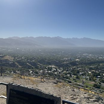
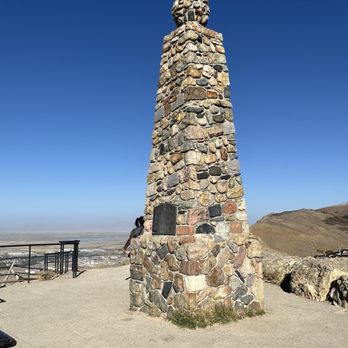
Fun hike near downtown Salt Lake City, about a 10 minute drive that takes you up past the capital building. Pretty easy hike if you're in shape, doable even if you aren't. Takes about 25 minutes to climb up and 15 to get back down. Definitely worth doing if you are staying downtown! read more




2 years ago

This is an excellent spot for a mini hike that will reward you with some epic city views! If you know me, you know that I'm addicted to sunsets. Ensign Peak Park is the perfect place to catch an incredible sunset in SLC. Of course, you gotta time it right. But once you experience it, it'll have you craving for more. This is a super quickish out and back hike that's less than a mile long, but don't let the short length fool you. It's a short little heart pumper with some steepish inclines. At most, I'd say to wear some kind of walking or running shoes. I did see a few people in flip flops but I think they were regretting that decision once they made it to the top. There's actually two vista point areas. The first one isn't a hike at all, just a short walk to one of the peaks. This part of the trail is paved and has a nice view of the city and a few places to pose for pictures. If you're not interested in hiking to the main vista point, then stopping at this vista may be best for you. The main vista point is straight up the hill along the Ensign Peak Trail. Once you make it to the top of the hill, you'll bare a left and go up one more small hill until you've made it to the peak. You'll know that you've made it because BAM.... all kinds of gorgeous views of the city will surround you. I can't say that it'll be super peaceful up there because this is a popular viewpoint spot, but the views are super enchanting. There's a good amount of space up there too. I think most people go up to take their pictures and then bounce. I had to linger a bit longer to really enjoy the entire sunset experience. It was truly lovely. This park also connects to another larger park called Mueller Park that has several other different hiking trails. If you want to make a day out of it or extend your hike, you can do so by connecting from this park. Since Ensign Peak Park is located within the a small residential neighborhood, parking is street only. There's a long road up the hill that heads up to the park, and this is where most people tend to park their cars. You'll see the entrance sign of the park right in front and it's hard to miss it. This was one of my favorite activities to partake in while visiting SLC. If you're looking for a beautiful vista point in SLC, Ensign Peak Park is a great place to explore. read more


I planned a birthday weekend getaway for my fiancé to Utah specifically for hiking! Locals advised us to visit Ensign Peak trail as its perfect for beginners. If I'm not mistaken, it was 10-12 miles round trip. The end point was definitely worth it! The views are amazing especially at sunset. Beautiful views and very proud we made it to the top. I would recommend planning accordingly because I don't recommend staying on the trail when it's dark. It's completely pitch black and very hard to see much of anything really. I definitely recommend this hike for anyone! read more


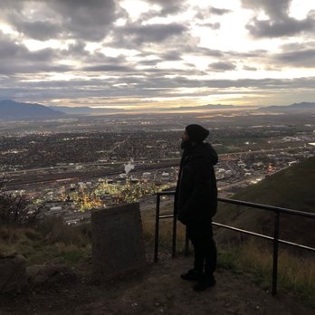


Quick drive from downtown SLC, street parking, and quick hike to beautiful views. It's a pretty steep drive and walk up, but I still made it okay in my dress shoes (I didn't want to waste time going back to the hotel to change and miss the sunset) after work. read more


If you're short on time and in the downtown Salt Lake City area when the craving to get into nature hits you, Ensign Peak may be just what you need. It's a rather short (albeit steep) hike that takes you from a lovely park to the top of a mountain with breathtaking views of the city. Don't assume that the sub-one mile length means that you don't have to take it seriously. Bring water, wear decent shoes (hiking shoes are great, sneakers are fine-but watch for mud on wet days.) There is limited shade, so lather up the sunscreen. Once you get to the top, there are beautiful views of the city in all directions. There are not trash receptacles or places to sit along the way, so prepare for that. I was sad to see a few water bottles or drink cups along the route. Come on guys, take your trash with you. That goes for dog poop too-leashed dogs are welcome on the trail, but clean up after them. There are two potential trails you can take to get you to the top-Ensign Peak or Hell Canyon. We took Hell Canyon up, which has lots of switchbacks, then we took Ensign Peak down-that one was a more straight shot, but may have been a bit steeper. Both were enjoyable. I look forward to returning and doing this hike again a little earlier in the day. Watching the sun rise from the top would be a great way to start a day. read more


This is a well-known short hike looking over the Salt Lake Valley. Rich in history. If want to take some awesome sunset pictures, I would be here at dusk. Especially the sunset over the lake. **Several poop bags left on the trail. There is a garbage can right at the start of the trail that you have to pass by please be a responsible dog owner and throw your poop bags in provided garbage cans. ***No bathrooms available read more


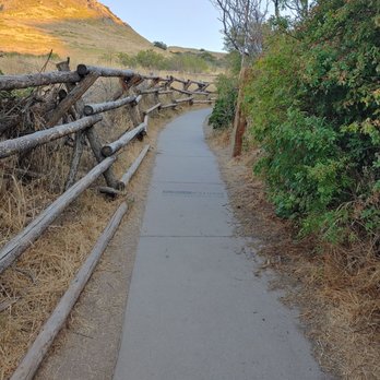

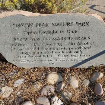
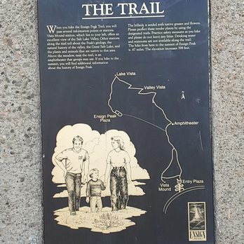

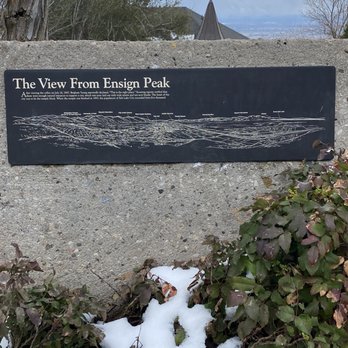
Interesting landmark, this was the first place I checked out when I got to Utah. The trail wasn't that bad, a decent hike for a rookie and a nice view of the surrounding area as well. There were also rest spots in between each level, and at the top there was a placard that gave information on the landmark and the history of Utah. Being able to learn about different states is nice, and this landmark tells the story of the founding of the state and how its inhabitants paved the way for the different parts of the city. read more


4 years ago
Bring your water jug and wear sunscreen. The hike up to the top was a little hard since Im from Texas and not used to the elevation. At one point I wondered if I was wheezing. It is a main attraction. It has 2 wonderful spots to take pictures which is at the bottom and one at the very top. I highly suggest wearing hiking shoes due to the amount of rocks around. Once I got up to the top after a very much needed water break, the view of the city and the mountains was absolutely beautiful. If you are wanting to hike you can definitely try this spot, but if you are looking for a challenge then you can go all the way to the top. The view from the top is amazing. You can see the view of the city and the beautiful buildings. Definitely recommend this spot if you are visiting! read more


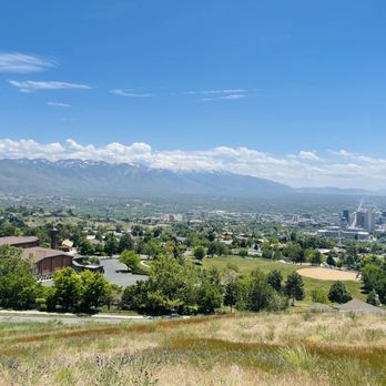

This is a great lookout! I've been here in the summertime and wintertime! I always just trek up the tiny hill and stop at the first lookout. It's very a very short hike up, then I stop at the first lookout. You can see the rest of the hill from there, a view of the city, and mountains! It's a great spot to just hang out, chill, and enjoy the view. read more
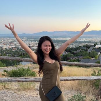


After touring Utah State Capitol, I was planning to head to Temple Square and come back later for the sunset. However, since it's so close to the State Capitol (about 1 miles), I decide to check it out despite its still like 95 degrees at 630pm. It's located in a residential area, the Yelp map pointer is pretty accurate. If you are driving coming downhill, The park is on the right hand side. I wasn't sure at the beginning either and it's early so doesn't seem like anyone was there. Plenty street parking along the park. Once you walk pass the small park, the well marked trail is ahead. It's unpaved but not too rocky or slippery, so shoes with traction isn't that necessary. In the fact, I wasn't expecting it to be a hike. For most peak I had been to like Twin Peak in SF or the one in El Paso... just very short walk from the parking lot. But this one is a trail! And it's hot AF...I took as many stops as possible and also I wasn't carrying any water!! Some review said it takes about 15 mins to the peak, there's a monument on the top of the trail so you can't miss it. It took me good 30 mins slowly made it to the peak. Once 3/4 close to the top, I can start feeling the cooler breeze and the sun wasn't as bad as before. Coming down is easy and probably less than 10 mins. I did see some people jog all the way to the top, I also spotted the same girl met on the trail later when I drove pass Capitol...street parking wasn't packed, most people walk from nearby. The view is amazing and rewarding. I would do it again (on the cooler weather:P) read more


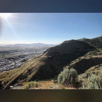

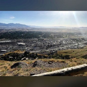

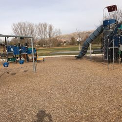
Super close proximity to dtown SLC, free/easy parking, short/relatively easy hike, fantastic views. Definitely a must see if you're looking for a quick, highly effective way to make the most of your time/visit. There's also a playground near the base of the trail -- great for kids. read more


4 years ago
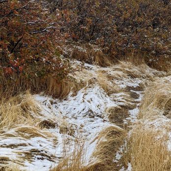
I was so sad when we arrived to terrible weather in Utah on Saturday October 22nd because our first plan was to walk this area because we heard the views were stunning I was heartbroken we couldn't go. The next morning we woke up to clear skies and snow on the ground so we knew we had to get up there and walk. The view does not disappoint as somebody that just recently got out of a cast it's very easy to walk anyone can do it. Do not miss this breathtaking view! read more


7 years ago
Great introduction to the city- the route to get to the trailhead takes you straight through town past the temple and the capitol building, then up into the foliage in this gorgeous neighborhood. Then you get your hike on and are rewarded with an incredible view of the entire city laid out before you! IMO the best time of day to go would be sunrise or sunset, save this for another day if the forecast is cloudy. Okay, so it's not quite as easy as it sounds. The route is steep, like nature's stair master, but it's a fairly short route and you can certainly stop along the way if the altitude is rough on you. Wear appropriate shoes- sneakers were fine for my visit but there was a lot of dried-up mud that a day or two earlier would have been problematic without hiking boots. read more


5 years ago
Ensign peak is a must if you're in Salt Lake City. It's only a 10 min drive from down town's main attractions and it's a fast/easy way to experience Utah's scenery. Whenever our friends come in from out of town we always take them to see this view. There's 2 hikes to this view and you can decide from the beginning which best fits you. The Left road (easy walk like 5 mins) is beautiful and has a 10 min trail that takes you around the mountain so you can see all of Utah. The right road (also easy maybe 20-30 minute hike) takes you to the very top of the mountain where you have a 360 view of the whole city & it's mountains so worth it. I recommend both of these hikes at sunset! 10/10 read more


This place is amazing! The hike is not that bad. The view is so nice, mountain, color of the cloud, I'm awe.... I can stay here and smell the fresh air. I will not get tired of this place. I was with my family and they love this place we are "wowed" This place seems very safe and you will not get lost. By the way you can park on the street. read more


5 years ago
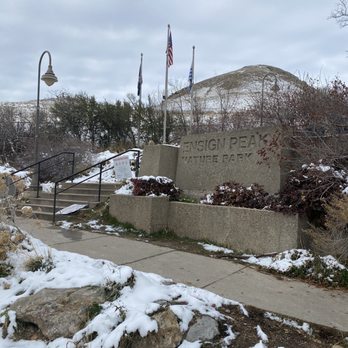
I thought this would be the best hike to do with the snow since it's fairly short. The floor was really icy. We made it halfway but noticed it was too much of a danger risk so we slowly made our way back down. I would say with the proper shoes one can go up in this weather. Definitely worth a visit after the winter. We did catch some great views still! read more



4 years ago
Such a beautiful spot! I had a 4-day trip in Salt Lake City with a group of friends for an event, so we had a tight schedule but after hearing some recommendations we decided to visit Ensign Peak Park on our free day-- definitely well spent! The hike was fun and doable for a group with little to no hiking experience. The view from the top was AMAZING with a far and wide view of the city, and we waited until after sunset to see the city lights which I really loved. On the hike down, we used flashlights to follow along the path and we were a bit more cautious since some dirt paths felt steep and slippery. I don't recommend waiting until dark without having some sort of phone flashlight because it gets pretty dark. Including the hike up and down, taking a bunch of pics throughout and at the top of the peak, my friends and I spent almost 2 hours total here! read more


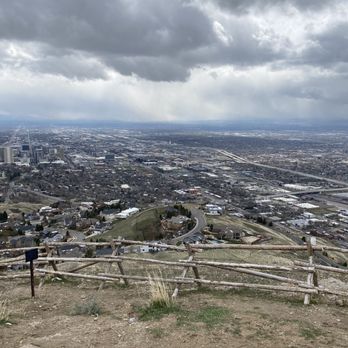
What a fun trail! My uncle cane to visit and I had to rake him on an adventure. He didn't have hiking boots, but tennis shoes worked for him. We went when it was pretty muddy so he almost his shoes a few times. It's an uphill battle almost the entire way. Some say it's easy, but I thought it was a little difficult. The muddy terrain didn't help, but that's probably why. It's dog friendly so I brought my fur baby with me. It's a nice view at the top and you can see SLC like you've never seen it before. There's also other trails along this path that you can take. Just stay in the trail so you won't get lost! read more


2 years ago
Place was a nice get away for my wife and i. Definitly bring water when hiking up the switch backs read more



3 years ago

4 years ago
A great hike with a great view! Definitely would recommend taking a water bottle and not expecting a leisurely stroll, but at the same time not a terribly difficult hike. read more


Simple hike on dirt gravel with a gorgeous city view when you get to the top of the mountain. There are different ways to get to this trail, we didn't know that when we first started to explore this trail so we walked through the residential way and got to see some lavish homes along the way to get to the start of this trail. It's a pretty easy one but there is incline but not too much if your in decent shape. Downside- there are no public bathrooms so make sure you account for this when you start your journey and there's no much of a hangout area when you get to the peak. So make sure you know there's no comfy place to sit on top. This is a straightforward hike and simple. It's a great trail to practice your hiking steps or if you want a light incline walk. I would recommend this trail! read more




4 years ago
Page 1 of 3
More info about Ensign Peak Park
Ask the Community - Ensign Peak Park
I plan on visiting in early March. I would like to plan for a private or group guided hike one afternoon. Can anyone advise me on a best in class hiking guide company? Thank you in advance!!
Review Highlights - Ensign Peak Park
You might also consider

















Why does Yelp recommend reviews?
3 reviews that are not currently recommended
The reviews below are not factored into the business's overall star rating.

12 years ago
7 years ago

6 years ago


