Chamisa Trailhead Photos


More like Chamisa Trailhead
Recommended Reviews - Chamisa Trailhead
Start your review...




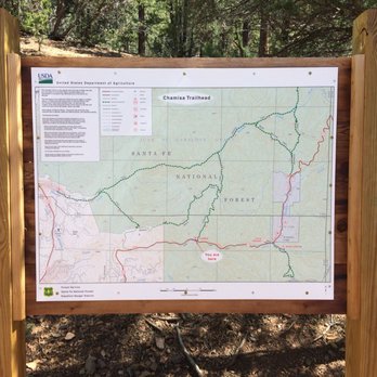
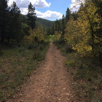
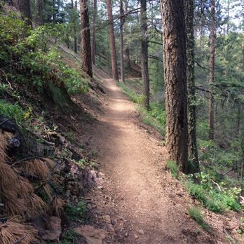
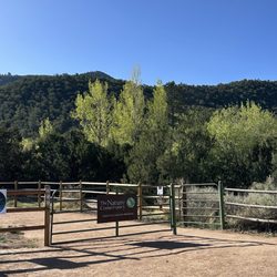
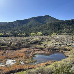
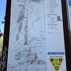
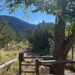
We need to have a talk, my Santa Fean Yelp brethren. You undervalue the James Beard-awarded fine dining destination pumping lifeblood into your celebrated art district*. You ignore the historic (and haunted) cemetery where many of your most prominent ancestors rest (or *don't* rest, if my investigation is any indication)**. Worst of all, you apparently have no knowledge of the scenic trail just a few miles northeast of town. Fortunately for you, the dapper, mysterious Ryan M. from San Antonio is here not only to berate but to educate. My father and I were so taken with the Chamisa Trail that I added it to Yelp Santa Fe's business listings. The Chamisa Trailhead is located somewhere between mile markers seven and eight on Hyde Park Rd. Signage is minimal, which might explain the trail's relative obscurity to tourists and locals. When you arrive, you'll notice two paths, neither of which is labeled. The path on the right is apparently the more difficult of the two, a fact my father and I learned the hard way. It was a challenge at times but nothing too strenuous. If you're a girly man (or a LaVeyan Satanist who takes things too literally), then the "left-hand path" would probably be the better option. Both paths begin and end at the parking area, though, so don't worry about getting lost. The word "chamisa" refers to the rubber rabbitbrush that grows wild throughout Santa Fe and parts of the western United States. I could pretend to be a well-traveled authority on ericameria nauseosa, but that would be mendacious of me. No, I learned much about the rabbitbrush from a chatty server at Café Pasqual's, the best place for breakfast in Santa Fe. He informed me that many folks suffer a violent allergic reaction to chamisa, which might explain the Latin prefix "nauseo" in "nauseosa." Thankfully, my father and I suffered no ill effects throughout our three-mile hike. Ironically, I recall seeing very little (if any) chamisa brush on the trail. As I attempt to describe the unmolested beauty of this semi-secluded trail, I find myself resorting to adjectives such as "gorgeous," "scenic," "spectacular," and "peaceful." The Chamisa Trail is indeed all of these and more. Every turn reveals something new: a millennia-old rock formation, an aspen with trembling yellow leaves, a ground squirrel foraging for food. Not once did my father and I hear the sound of a car engine, an airplane, or any semblance of modern life. We had the trail practically to ourselves the entire time, which emphasized the sense of isolation. As I mentioned earlier, the path on the right is definitely the more difficult of the two. If you choose this path, expect a steep, mostly uphill hike with many switchbacks and drop-offs. The most challenging moment of the hike, however, occurred towards the end when we were declining. The section in question was steep and rocky. Had we attempted to navigate it on foot, we probably would have fallen and broken our necks. After some deliberation, we decided to sit and slide down until we reached the bottom. Our exfoliated butt cheeks paid the price, but at least we lived to tell the tale. The mystic charm of Santa Fe is apparent in its art, architecture, cuisine, and the untouched beauty of Hyde State Park, the home of Chamisa Trailhead. Whether you're a local (in which case, shame on you again for neglecting your Yelper duties) or a visitor, then please consider spending an afternoon hiking the Chamisa Trail. You'll appreciate its many gifts and work up an appetite for a world-class meal at either Geronimo or The Compound. *See my review of The Compound: https://www.yelp.com/biz/the-compound-santa-fe?hrid=CL8YFxAUxslYbtKsF28oKw&utm_campaign=www_review_share_popup&utm_medium=copy_link&utm_source=(direct) **See my review of Fairview Cemetery: https://www.yelp.com/biz/fairview-cemetery-santa-fe?hrid=1kYzceD5CpAKFiqUDxapbw&utm_campaign=www_review_share_popup&utm_medium=copy_link&utm_source=(direct) read more


4 years ago
More info about Chamisa Trailhead
Santa Fe, NM 87505
Directions
Hours
Outdoor Amenities




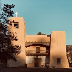

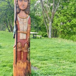

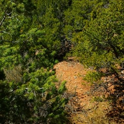


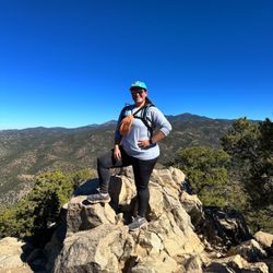






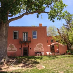
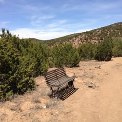


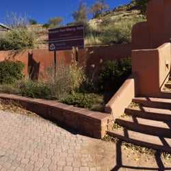

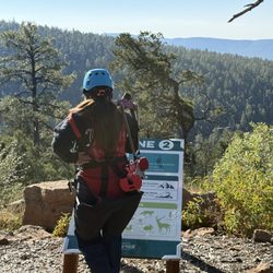


Chamisa Trailhead - hiking - Updated August 2026
Best of Santa Fe
People found Chamisa Trailhead by searching for…
Walking Trails in Santa Fe, NM
Things to Do at Night in Santa Fe, NM
Off Road Trails in Santa Fe, NM
Beautiful Views in Santa Fe, NM
Free Things to Do in Santa Fe, NM
Playgrounds for Kids in Santa Fe, NM
Running Trails in Santa Fe, NM
Places to Take Pictures in Santa Fe, NM
Sunday Fun Things to Do in Santa Fe, NM
National Parks in Santa Fe, NM
Fun Things to Do on a Friday Night in Santa Fe, NM
Trending Searches in Santa Fe, NM
Barbershop For Men near Chamisa Trailhead
Bike Shop near Chamisa Trailhead
Consignment Shops near Chamisa Trailhead
Dog Friendly Things To Do near Chamisa Trailhead
Ear Piercing near Chamisa Trailhead
Elementary Schools near Chamisa Trailhead
Eyebrow Threading near Chamisa Trailhead
Hair Braiding near Chamisa Trailhead
Kids Haircut near Chamisa Trailhead
Pedicure near Chamisa Trailhead
Picnic Areas near Chamisa Trailhead
Preschools near Chamisa Trailhead
Public Golf Courses near Chamisa Trailhead
Public Pools near Chamisa Trailhead
Running Trails near Chamisa Trailhead
Scenic Night View near Chamisa Trailhead
Scenic Overlook near Chamisa Trailhead
Sunrise View near Chamisa Trailhead
Swimming Holes near Chamisa Trailhead
Trading Card Shops near Chamisa Trailhead
Browse Articles
Browse Nearby
BEST of Santa Fe, New Mexico Coffee near Chamisa Trailhead
BEST of Santa Fe, New Mexico Restaurants near Chamisa Trailhead
BEST of Santa Fe, New Mexico Things to Do near Chamisa Trailhead
BEST of Santa Fe, New Mexico Breakfast near Chamisa Trailhead
BEST of Santa Fe, New Mexico Parks near Chamisa Trailhead
BEST of Santa Fe, New Mexico Walking Trails near Chamisa Trailhead
BEST of Santa Fe, New Mexico Campgrounds near Chamisa Trailhead
BEST of Santa Fe, New Mexico Caves near Chamisa Trailhead
BEST of Santa Fe, New Mexico Sightseeing near Chamisa Trailhead
Browse Brands
Related Searches in Santa Fe, NM
Affordable Kayak Rental Services in Santa Fe, New Mexico
Best Dog Hiking Trails Around Santa Fe, New Mexico
Best Fishing Locations and Guides in Santa Fe, New Mexico
Best Places for Horseback Riding in Santa Fe, New Mexico
Best Places for Stunning Views in Santa Fe, New Mexico
Best Sightseeing Experiences Available in Santa Fe, New Mexico
Check Out Off Road Trails in Santa Fe, New Mexico
Discover Dog Friendly Trails to Explore in Santa Fe, New Mexico
Discover a Hiking Trail in Santa Fe, New Mexico
Discover the Best Night Hike Trails in Santa Fe, New Mexico
Dog-Friendly Hikes With Dogs in Santa Fe, New Mexico
Enjoy Camping Adventures Around Santa Fe, New Mexico
Enjoy Kayaking Adventures in Santa Fe, New Mexico
Enjoy Off Leash Dog Hikes in Santa Fe, New Mexico
Enjoy Tent Camping Spots Around Santa Fe, New Mexico
Enjoy the Best Picnic Spots and Ideas in Santa Fe, New Mexico
Enjoy the Best Walking Trails in Santa Fe, New Mexico
Experience Stunning Sunset Views in Santa Fe, New Mexico
Experience Thrilling White Water Rafting in Santa Fe, New Mexico
Explore Beautiful Parks and Green Spaces in Santa Fe, New Mexico
Explore Easy Hikes Perfect for All in Santa Fe, New Mexico
Explore Fun Activities to Do in Santa Fe, New Mexico
Explore Popular Campgrounds Near Santa Fe, New Mexico
Explore Top Dog Parks in Santa Fe, New Mexico Near You
Explore the Best Swimming Holes Around Santa Fe, New Mexico
Family Friendly Hiking With Kids in Santa Fe, New Mexico
Find Beautiful Views in Santa Fe, New Mexico
Find Top Dog Friendly Parks to Visit in Santa Fe, New Mexico
Find Top-Rated Waterfalls in Santa Fe, New Mexico Now
Find the Best Parks BBQ Grills in Santa Fe, New Mexico
Find the Best Parks for Picnics in Santa Fe, New Mexico
Find the Best Scenic View Locations in Santa Fe, New Mexico
Hiking Trails With Waterfalls in Santa Fe, New Mexico
Off Leash Dog Hiking Trails in Santa Fe, New Mexico
Perfect Spots to Watch Sunset in Santa Fe, New Mexico
Plan a Scenic Drive Route Near Santa Fe, New Mexico
Popular Dog Walking Areas in Santa Fe, New Mexico
Popular Fishing Spots to Explore in Santa Fe, New Mexico
Popular Outdoor Activities to Try in Santa Fe, New Mexico
Popular Picnic Spots to Visit in Santa Fe, New Mexico
Safe River Swimming Areas in Santa Fe, New Mexico
Safe and Fun Parks for Kids in Santa Fe, New Mexico
Top Hiking Trails to Explore in Santa Fe, New Mexico
Top Playgrounds for Kids to Enjoy in Santa Fe, New Mexico
Top Running Trails to Explore in Santa Fe, New Mexico
Top Swimming Lakes to Enjoy in Santa Fe, New Mexico
Top Swimming Spots and Pools in Santa Fe, New Mexico
Top Things to Do With Kids in Santa Fe, New Mexico


