Chickies Rock County Park Photos


You might also consider


More like Chickies Rock County Park
Recommended Reviews - Chickies Rock County Park
Start your review...


Reviews With Photos


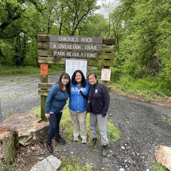
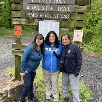
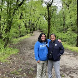
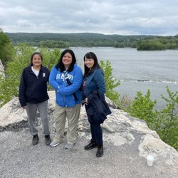
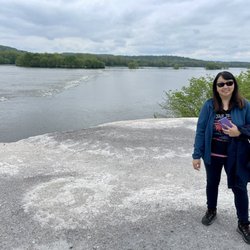
This a beautiful view of the Susquehanna River! It has such a rewarding view for such a short hike. There are two routes that both lead to the same two view points. One trail veers to the left the other high & to the right. There's no elevation gain on the left trail, which half of us took & the other half decided they wanted to slightly challenge themselves & took the trail to the right. The trails were muddy & slippery from the rain. Just keep that in mind should you decide to check out these trails for the view, if it's previously rained. If hiking to the higher view point, it requires descending some jagged rocks. There's a slight scramble (the same rocks you descended)once you leave the higher view point. Take this into consideration if you have ankle issues or just not very coordinated or mobile. You will see huge signs that look like you shouldn't enter but once you walk closer, it actually indicates to stay away from the cliff & to not throw objects below as people are down below. If you want to avoid descending rocks & scrambling, you may want to go to the first viewpoint which requires no scramble . There is a gravel parking lot located near a bend, which can be dicey enter & leaving the lot as the bend creates a blind spot. These trails are located close to the Turkey Hill Experience , so if you're looking for additional things to do nearby, this overlook is a great option for an easy short hike.


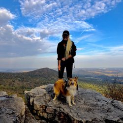
The perfect beginner's hiking trail for anyone of almost any age. With one of the most beautiful overlooks at the end of the trail. Very dog friendly with mostly a flat walking path for their paws. Plenty of shade for those hot days and the overlook is completely in the shade so it's a perfect spot to take a rest and take in the breathtaking view. The parking area isn't very big so you might be out of luck if it's a busy day.


Very nice clean walk! Only complaint is no trash cans at the parking lot. Very quiet ! Kid friendly


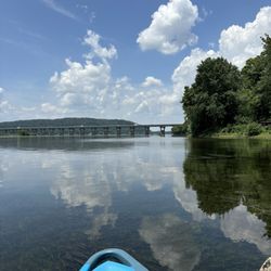
Breathtaking views of the Susquehanna River! It was an easy trek to and from the parking lot along the interstate. We took in the views from different vantage points and could see parts of the railroad and homes across the way, along the river. Worth the stop!! Highly recommend it!!
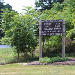

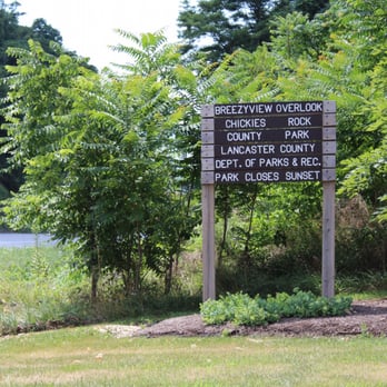
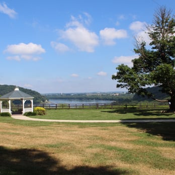
Chickies Rock County Park (CRCP) is located in Lancaster County, and the county's second largest regional park. Because of that, and because it has several different entrances, it took me a while to explore the whole thing (well, most of it anyway). CRCP has 422-acres, includes two creeks and a river, a massive outcropping of quartzite rock (220 foot vertical wall which makes for a rock climber's paradise), breathtaking views and is part of the Northwest Lancaster County River Trail. Here's what you need to know: *CRCP got its name derived from the American Indian word Chiquesalunga, which means "place of the crayfish." The area where CRCP is located used to be one of the largest Indian villages discovered in Lancaster County. *There are 3 different parking areas for CRCP: Breezeview Overlook, Chickies Rock Overlook and Furnace Road Day-Use Area. *Breezeview Overlook has a gazeebo, picnic tables and beautiful vistas. There is also the Heritage Trail that will take you down to Northwest River Trail. It's only .3-mile but it is quite steep. I've also read that the Heritage Trail will take you to Chickies Rock. I haven't figured it out yet but if you have, let me know! *Chickies Rock Overlook has two parking lots on both sides of the road. One side of the road will take you to the overlook at the Rock. It has lovely views and some small trails. The other side has a wonderful, steep hiking trail and connects with some horse trails. *Chickies Rock has the largest exposed Anticline on the east coast. Anticline "is a type of fold that is an arch-like shape and has its oldest beds at its core" (wikipedia.org). *The parking lot at Furnace Road Day-Use Area has portable toilets--and that's about it! You park here and then bike or walk to the trail. I believe there is a boat launch just up the road, but I haven't checked it out since I no longer have a kayak. *Park on Furnace Road, and then take a left out of the lot, you will connect to Northwest River Trail. That part of the trail has some picnic tables, trashcans at the trailhead, a bridge over Donegal Creek and almost all of it is in shade. I believe the parking lot to the bottom of Heritage Trail (which will take you up to Breezeview Overlook) is about 1.5-miles. If you continue another 1.2-miles, it will take you to Columbia. It's a wonderful walk for my dogs and popular for bikers. Honestly, I'm still completely confused about this park. It has so many pieces and I find the map very difficult to follow. But, it's growing on me, and it's becoming my favorite park in the area. As I become more familiar with the area, I will update my review.


This is a straightforward hiking path - pretty much straight and up to be rewarded with a beautiful view of the Susquehanna River. If you are lucky, like we were, you will see a low flying plane from the nearby military base. We stopped during the week, but I could imagine the parking at this area could get filled and you may have to wait for a spot. I'm seeing from other reviews that there are other parking spots and entrances, but the one we were at seemed fairly direct to the overlook. It was a beautiful quick hike to see some impressive views. read more
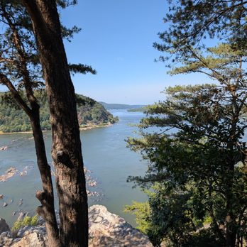
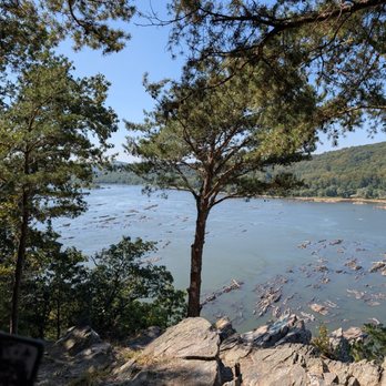

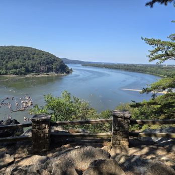
This was stop #2 on a beautiful late-September Sunday adventure. I'd done my homework ahead of time and planned to tackle the Chickie's Rock Overlook Trail first, then swing by the nearby Breezyview Overlook (just a 4-minute drive away). Chickie's Rock Overlook Trail: Parking was plentiful, and I appreciated the history sign at the trailhead--it turns out this path was once a trolley line leading to an amusement park near Chickie's Rock. So you're not just walking, you're walking through history. The trail itself is wide, relatively flat, and about a 20-minute walk to the overlook if you're taking your time (we were chatting the whole way--it was Sunday morning, not a cardio day). Pro Tip: Not far from the parking lot, the trail forks. Go LEFT for the easy stroll. Go RIGHT if you want a steeper climb and some cardio. Either way, the two trails meet up again before the overlook. When you arrive, the payoff is worth it: a panoramic view of the Susquehanna River and classic Central PA scenery--rolling hills, farmland, distant ridges, train tracks running at the base, and acorns plinking down around you. Pure magic. Just note: the overlook itself requires scrambling over some big rocks to get to the railing. Sneakers or boots are a must, and it's not super friendly for little kids or anyone with mobility challenges. Bonus history fact: Chickie's Rock was actually used as a Union lookout post during the Civil War in 1863, when Confederate troops invaded PA. That blew my mind. Breezyview Overlook: From Chickie's Rock, it's a quick 4-minute drive to Breezyview Overlook. This one's a lot easier--park, take a few steps on grass, and you're there. You even get the fun perspective of looking back at Chickie's Rock and seeing where you'd just been. Parking was easy, and they had a port-a-john if needed. The view is nice, but not nearly as epic as Chickie's Rock. Then again, the best things usually require a little extra effort. Overall, this was the perfect low-impact Sunday adventure. Bring water, pack out your trash, and don't forget to smile and say hi to fellow hikers along the way. If you're looking for an accessible trail with a stunning payoff, Chickie's Rock is a must. read more


2 years ago
Ok so I missed the turn to this place twice! But when I parked it was a beautiful hike to the best view of the Susquehanna! Not a long walk but a must see! It definitely took be to another time. I could visualize, centuries ago, natives up on that ledge seeing other tribes coming down the river or sending smoke signals to other tribesmen across the river. It really transports you! read more


This a beautiful view of the Susquehanna River! It has such a rewarding view for such a short hike. There are two routes that both lead to the same two view points. One trail veers to the left the other high & to the right. There's no elevation gain on the left trail, which half of us took & the other half decided they wanted to slightly challenge themselves & took the trail to the right. The trails were muddy & slippery from the rain. Just keep that in mind should you decide to check out these trails for the view, if it's previously rained. If hiking to the higher view point, it requires descending some jagged rocks. There's a slight scramble (the same rocks you descended)once you leave the higher view point. Take this into consideration if you have ankle issues or just not very coordinated or mobile. You will see huge signs that look like you shouldn't enter but once you walk closer, it actually indicates to stay away from the cliff & to not throw objects below as people are down below. If you want to avoid descending rocks & scrambling, you may want to go to the first viewpoint which requires no scramble . There is a gravel parking lot located near a bend, which can be dicey enter & leaving the lot as the bend creates a blind spot. These trails are located close to the Turkey Hill Experience , so if you're looking for additional things to do nearby, this overlook is a great option for an easy short hike. read more


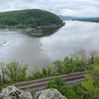


The perfect beginner's hiking trail for anyone of almost any age. With one of the most beautiful overlooks at the end of the trail. Very dog friendly with mostly a flat walking path for their paws. Plenty of shade for those hot days and the overlook is completely in the shade so it's a perfect spot to take a rest and take in the breathtaking view. The parking area isn't very big so you might be out of luck if it's a busy day. read more
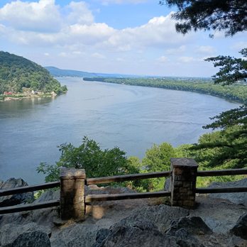

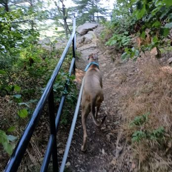


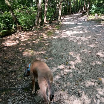


5 years ago

Breathtaking views of the Susquehanna River! It was an easy trek to and from the parking lot along the interstate. We took in the views from different vantage points and could see parts of the railroad and homes across the way, along the river. Worth the stop!! Highly recommend it!! read more



10 years ago
Chickies Rock County Park (CRCP) is located in Lancaster County, and the county's second largest regional park. Because of that, and because it has several different entrances, it took me a while to explore the whole thing (well, most of it anyway). CRCP has 422-acres, includes two creeks and a river, a massive outcropping of quartzite rock (220 foot vertical wall which makes for a rock climber's paradise), breathtaking views and is part of the Northwest Lancaster County River Trail. Here's what you need to know: *CRCP got its name derived from the American Indian word Chiquesalunga, which means "place of the crayfish." The area where CRCP is located used to be one of the largest Indian villages discovered in Lancaster County. *There are 3 different parking areas for CRCP: Breezeview Overlook, Chickies Rock Overlook and Furnace Road Day-Use Area. *Breezeview Overlook has a gazeebo, picnic tables and beautiful vistas. There is also the Heritage Trail that will take you down to Northwest River Trail. It's only .3-mile but it is quite steep. I've also read that the Heritage Trail will take you to Chickies Rock. I haven't figured it out yet but if you have, let me know! *Chickies Rock Overlook has two parking lots on both sides of the road. One side of the road will take you to the overlook at the Rock. It has lovely views and some small trails. The other side has a wonderful, steep hiking trail and connects with some horse trails. *Chickies Rock has the largest exposed Anticline on the east coast. Anticline "is a type of fold that is an arch-like shape and has its oldest beds at its core" (wikipedia.org). *The parking lot at Furnace Road Day-Use Area has portable toilets--and that's about it! You park here and then bike or walk to the trail. I believe there is a boat launch just up the road, but I haven't checked it out since I no longer have a kayak. *Park on Furnace Road, and then take a left out of the lot, you will connect to Northwest River Trail. That part of the trail has some picnic tables, trashcans at the trailhead, a bridge over Donegal Creek and almost all of it is in shade. I believe the parking lot to the bottom of Heritage Trail (which will take you up to Breezeview Overlook) is about 1.5-miles. If you continue another 1.2-miles, it will take you to Columbia. It's a wonderful walk for my dogs and popular for bikers. Honestly, I'm still completely confused about this park. It has so many pieces and I find the map very difficult to follow. But, it's growing on me, and it's becoming my favorite park in the area. As I become more familiar with the area, I will update my review. read more


6 years ago
This is a short hike to a nice overlook over the Susquehanna river. Located in Columbia, PA, just off the bridge, it is easy to navigate there. Parking is not small but this tends to get crowded quickly during the weekends and on nice days so plan ahead. There are other trails within the park that you can choose if you prefer more shaded paths rather than the big straight path towards the overlook. Be careful and make sure you wear good shoes since the path has lots of tiny rocks, making it's easy to slip and fall. Some areas can be pretty buggy so bring bug spray if you need to. Overall, it's a pretty easy trail that's suitable for everyone and your furry friends. If you're looking for a short hike with a nice view, check this place out! read more


8 years ago

10 years ago
More info about Chickies Rock County Park
881 Chickies Hill Rd
Columbia, PA 17512
Directions
Hours
Outdoor Amenities
Ask the Community - Chickies Rock County Park
Review Highlights - Chickies Rock County Park















Why does Yelp recommend reviews?
2 reviews that are not currently recommended
The reviews below are not factored into the business's overall star rating.

9 years ago

6 years ago


